220 entries match your criteria. Entries 101 through 200 are listed.⊲ Previous 100 — The final 20 ⊳
Alabama Tourism Department Historical Markers
The Alabama Tourism Department has “exclusive power and authority to plan and conduct all state programs of information and publicity designed to attract tourists to the state of Alabama." One way it promotes travel to and through Alabama is by working with partners to place hundreds of historical markers throughout the state, which have the multi-color Great Seal of Alabama medallion at the top of each marker.
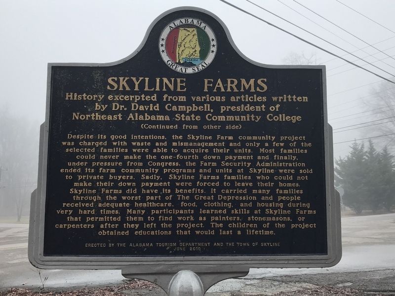
History excerpted from various articles written
by Dr. David Campbell, president of
Northeast Alabama State Community College
Skyline Farms was an effort to build a “new world” in rural America where tenant farmers, hit hard by . . . — — Map (db m167093) HM
Bright Star
In 1907, Greek immigrant Tom Bonduris invested his savings and opened a small cafe with only a horseshoe shaped bar at First Avenue and 21st Street in Bessemer, Alabama. Outgrowing three locations, the Bright Star moved to this . . . — — Map (db m83797) HM
Built by Birmingham industrialist A. H. “Rick” Woodward, Rickwood Field served as home to the Birmingham Barons and Birmingham Black Barons for most of the 20th century. Recognized as “America’s Oldest Baseball Park,” . . . — — Map (db m83837) HM
Rev. Martin Luther King Jr.’s ‘Letter From Birmingham Jail’
The Rev. Martin Luther King Jr.'s "Letter From Birmingham Jail" is the most important written document of the Civil Rights Era. His eloquent justification of the movement and . . . — — Map (db m173404) HM
(side A)
Brookside's Unique Heritage
Originally settled by the Samuel and Mary “Polly” Fields family in the 1820s, Brookside enjoyed a quiet life as an agricultural community until industrialists discovered rich coal . . . — — Map (db m43223) HM
The town of Cardiff, Alabama has a long, rich history. Situated
along the winding picturesque banks of Five Mile Creek, the area
of present-day Cardiff was originally settled in the 1830s by the
Crocker family. According to historian Martha . . . — — Map (db m153234) HM
In 1700s, Native Americans occupied the Springs property. Robert Reed's family arrived in the area from North Carolina in 1816. They obtained a land grant; soon others moved to the area. In 1871, Dave Franklin built a log cabin in the area which was . . . — — Map (db m37230) HM
The clay soil of the area, first cultivated by Creek Indians, gave this agricultural community it name in 1878 when a post office was established. Clay’s historical roots date to the early 1800s through two small communities, Ayres and Self’s Beat, . . . — — Map (db m83863) HM
Miles College Leaders. Students Active During Civil Rights Era
The Colored Methodist Episcopal Church founded Miles College in
Fairfield in 1898. During the 1960s, President Lucius Pitts
encouraged students, faculty and staff to become . . . — — Map (db m153232) HM
Black Creek Park, part of the Five Mile Creek Greenway Partnership, encompasses the Fultondale Coke Oven Park development. The Fultondale Coke Oven Park preserves the environment and history of the old mining communities of north Birmingham, . . . — — Map (db m50823) HM
Side A When Andrew Jackson defeated the Creek Nation at the Battle of Horseshoe Bend in 1814, the subsequent Treaty of Fort Jackson and other treaties that followed ceded Indian land that made up most
of what is now Alabama. Abraham Stout . . . — — Map (db m39111) HM
(side A)
In the latter 1800s and early 1900s, the city of Graysville was called Gin Town. Because Graysville had the only cotton gin for miles around, the town and community grew. As the community grew, the need for businesses and houses of . . . — — Map (db m43221) HM
Side A Located in Jefferson County in Shades Valley, Homewood came into existence with the combination of Edgewood, Rosedale, and Oak Grove. Hollywood, a fourth community, joined Homewood later. The City of Homewood was incorporated in 1926, . . . — — Map (db m37712) HM
During the early 1800s, members of the Huey family took pioneering steps toward establishing the community that would eventually become the City of Hueytown. On May 6, 1960. Hueytown
was officially incorporated under a Mayor/Council form of . . . — — Map (db m212934) HM
The War of 1812, geography, geology, and three cultures shaped the history of Leeds. Lying at the crossroads of ancient Indian paths in the center of Alabama, Leeds drew Europeans, Cherokee, and African-American settlers to a land of fertile . . . — — Map (db m49351) HM
S.W. Lipscomb, with his two brothers L.Y. and H.P., all from Epps, Alabama, settled here in 1885. L.Y. Lipscomb ran a general store on the old South Bessemer car line, which opened the 15 miles between Birmingham and Bessemer in 1890. This stop . . . — — Map (db m215906) HM
Pinson, one of Alabama’s oldest communities, was settled by General Andrew Jackson’s soldiers in the early 1800s, after victory at Horseshoe Bend during the War of 1812. The community was originally known as Hagood’s Crossroads for settler . . . — — Map (db m88406) HM
The first official meeting of the Town of Sylvan Springs, Incorporated on May 22, 1957, was held on July 13, 1957. The Town Hall was temporarily located in Harmon's Service Station. The following were classified Alderman:
Oscar Hogan, Alderman 1 . . . — — Map (db m217152) HM
Front:
A pipe foundry was established in 1912 by the following founders, A. H. Ford, F. M. Jackson, E. E. Linthicum, Charles Green and Charles Day. Originally the main office was located approximately 100 yards west of this building. The . . . — — Map (db m83928) HM
Trussville was settled between 1816 and 1819 by a few settlers from the Carolinas prior to Alabama becoming the 22nd state in December 1819. The First Baptist Church, Cahaba, was organized in 1821. Trussville’s first postmaster in 1833 was Arthur . . . — — Map (db m34338) HM
Side A Sibyl Temple was moved to this site from its original location in 1975. George Ward built it on the brow of his 20-acre mountaintop “Vestavia” estate in 1929. It marked the entrance to the lower 10 acres where he planned a . . . — — Map (db m37708) HM
In April 1886, railroad prospectors were traveling up the Butahatchie Valley in Lamar County, Alabama, Moscow beat, and securing right of way for a railroad to be built that would connect Birmingham, Alabama and Memphis, Tennessee. In November . . . — — Map (db m96472) HM
The Forks of Cypress plantation was established in 1818 by James and Sarah Jackson. Its home, believed the design of William Nichols, was one of Alabama's great houses, featuring perhaps the earliest peristyle colonnades in America. Built by skilled . . . — — Map (db m83975) HM
The Forks of Cypress plantation was established in 1818 by James and Sarah Jackson. This home, believed the design of William Nichols, was one of Alabama's great houses, featuring perhaps the earliest peristyle colonnades in America. Built by . . . — — Map (db m156982) HM
The Rolling Stones in the Shoals in 1969.
The Rolling Stones stayed at the Florence Holiday Inn on this site for several nights while recording at the Muscle Shoals Sound Studio in Sheffield.
When a hired engineer failed to arrive, . . . — — Map (db m165908) HM
[Side 1:] The area known as Killen in Lauderdale County, was settled in the early 1800s. In 1826, Joseph Mason was appointed the first postmaster of the new community called Masonville, later to become Killen. The post office existed . . . — — Map (db m35169) HM
Side A
The settlement of what is now eastern Lauderdale County (known as "Over Elk)" by non-Native Americans commenced by 1807.
Federal land sales were held in Huntsville during the spring of 1818.
Although much of the land was described . . . — — Map (db m281246) HM
Side 1
Auburn
1865~Present
Only one house was built in the village in the decade after the Civil War, and though the state took over the bankrupt college in 1872, the institution received no state appropriation until 1883. . . . — — Map (db m79947) HM
Opelika A Railroad Town. Opelika's original name was Opelikan when the town was founded in the 1830s. In 1850, the name was respelled as Opelika. In 1851, the Montgomery & West Point Railroad Company extended its Montgomery to Opelika rail . . . — — Map (db m184077) HM
Athens was incorporated in 1818, one year prior to the admission of Alabama as the 22nd state. It is the seat of Limestone County, created by an act of the Alabama Territorial Legislature. Athens has a legacy of providing quality education for . . . — — Map (db m159697) HM
(Side 1)
Mooresville, Alabama
Incorporated November 16, 1818
Mooresville Post Office, c.1840, is the oldest operational post office in the state of Alabama. It has served the community form the same building since its . . . — — Map (db m89028) HM
In the 1820s, Hayneville was known as "Big Swamp." In 1830, after being chosen as the county seat of Lowndes County, it was named Hayneville for Robert Y. Hayne, governor of South Carolina and a U.S. senator. The incorporation of Hayneville as a . . . — — Map (db m305560) HM
Lowndesboro, Alabama
Lowndesboro developed from a small community of early settlers to a thriving township in the 1830’s. The settlers’ plantation interests were maintained in the lowlands along the Alabama River, while they built their . . . — — Map (db m70934) HM
Franklin School, originally constructed on this lot, was in operation as early as the 1890s teaching grades 1-11. By the mid 1930s, it was downsized to grades 1-6. There were northern and southern classrooms adjoined by a common auditorium. The . . . — — Map (db m68028) HM
Shiloh-Rosenwald School
The Shiloh-Rosenwald School, located in Notasulga, was a collaboration between educator Booker T. Washington and Julius Rosenwald, CEO of Sears. Rosenwald schools are landmarks in the history of African-American . . . — — Map (db m95109) HM
Shorter was originally called Cross Keys for the birthplace in South Carolina of an early settler, J.H. Howard. It was later named Shorter for former Alabama Governor John Gill Shorter. The town embodies the memories of the proud Creek Indian . . . — — Map (db m85463) HM
Tuskegee consists of 80 square miles and is the county seat of Macon County, Alabama. Tuskegee rests in the heart of the rural Alabama Black Belt and is 40 miles east of Montgomery. Tuskegee was founded by General Thomas S. Woodward in 1833 after he . . . — — Map (db m99679) HM
Side 1
Born in 1930 in Montgomery, Gray was among the foremost civil rights attorneys of the 20th century. Forced by segregation to leave Alabama to attend law school, he vowed to return and "destroy everything segregated I could find." . . . — — Map (db m101898) HM
There has been a settlement at and around the area presently known as Gurley since before the 1800s. Located in Madison County in in the rich agricultural, mineral and timber belt of northern Alabama, Gurley lies 16 miles east of Huntsville and 80 . . . — — Map (db m275318) HM
On September 8, 1960, President Dwight Eisenhower formally dedicated the George C. Marshall Space Flight Center in Huntsville, Alabama, as a new field installation of the National Aeronautic and Space Administration (NASA) organization that had . . . — — Map (db m50147) HM
Pension Row is representative of many small town African American neighborhoods. Once a thriving community with its own schools, churches, businesses, lodges, and recreation areas, it has been a part of Madison since Madison was incorporated in . . . — — Map (db m99420) HM
New Hope Cemetery By 1813-14, white settlers were coming in 1arge numbers following Andrew Jackson's Fort Deposit Road. Most were squatters on the Cherokee Indian Reservation. When the land began to be sold by the government in 1830, Robert . . . — — Map (db m191686) HM
The Demopolis Historic Business District, listed on the National
Register of Historic Places, has long served as a commercial center
for West Alabama. The district contains 57 structures built between
1843 and 1926. Downtown Demopolis developed . . . — — Map (db m285172) HM
The Alabama Territorial Legislature established Marengo County in 1818. The “Town of Marengo” was then surveyed near the center of the county to serve as county seat. In 1824 lots were sold, and early French immigrants named the town Hohenlinden . . . — — Map (db m72971) HM
(side 1)
About 1830, settlers from the Carolinas and Virginia came to this area in search of fertile land. They staked their claims to adjoining plantations adjacent to what became Thomaston. In 1890, Dr. Charles Brooks Thomas bought the . . . — — Map (db m72967) HM
In the early days, Glen Allen was known as Stewart's Gap. Glen
Allen got its name from the last names of two engineers who
worked with the railroad company. In early 1889 lots were laid
out along the rail tracks using the railroad to serve as . . . — — Map (db m168048) HM
City of Guin, Alabama: The Early Years
In 1889, Dr. Jeremiah Guin gave land to the Kansas City, Missouri & Birmingham Railroad to allow completion of its Memphis to Birmingham railway. The rails connected at Dr. Guin's farm, about ¼ . . . — — Map (db m96796) HM
Hamilton was established on November 17, 1882 and was named in honor of Capt. Albert James Hamilton. Hamilton was first known as "Toll Gate," named for a toll gate on the Jackson Military Road. The original county seat of Marion County was . . . — — Map (db m96479) HM
Earliest visitors to the region now known as Winfield were bands of Chickasaw Indians who frequented this area as a hunting ground. The abundant wildlife of the Appalachian foothills made this area attractive to early hunters. After the Chickasaw . . . — — Map (db m85847) HM
Albertville, located in Marshall County in northeast Alabama, was named for Thomas A. Albert, one of the first area residents. It lies on Sand Mountain, a plateau approximately 25 miles wide and 75 miles long. Albertville was hunting ground for . . . — — Map (db m225622) HM
First Arab High School
In the early 1900s, students from Arab enrolled at Albertville High School because Arab didn’t have a high school. One group, called the “Brindlee Mountain Boys”, would travel to Guntersville by buggy and then by . . . — — Map (db m261862) HM
Side A Informally called Sparkstown for a period of time, the city of Boaz was officially named after the husband of Ruth, a Biblical character in the Old Testament. Incorporated in March 1897, Boaz quickly began to "set a pace for her . . . — — Map (db m39156) HM
Grant, Alabama is located atop Gunter Mountain at 1310 feet of elevation. It is surrounded by the foothills of the Appalachian Mountains and overlooks Historic Kennamer Cove. The post office was established here on May 18, 1887 and the town was . . . — — Map (db m85854) HM
(Side A) This area's proximity to the Tennessee River and Indian trails made it a crossroads for early habitation, settlement, and trade. Archaeological studies reveal it was first inhabited about 12,000 years ago by Paleo-Indians. They . . . — — Map (db m33305) HM
The stream near the site, known as Bayou la Batre, was known during the period of French occupation as "Riviere d'Erbane," then as "Rivere la batterie" because of the French artillery battery located on its banks. The town's name consists of bayou, . . . — — Map (db m117255) HM
The name Chickasaw originated from Native Americans living in the area prior to the arrival of the French settlement at Twenty-Seven Mile Bluff in 1702. Native Americans from the Apalachee and Choctaw Tribes referred to the creek running through . . . — — Map (db m111286) HM
This park and bird refuge dates from the Mississippian Period (AD 1100 to 1550). Native Americans, who roasted oysters and fished in adjacent Dauphin Island Bay, visited the shell mounds for centuries. From excavations carried out in 1990, . . . — — Map (db m122350) HM
In 1811, the Mount Vernon Cantonment, located on a hill about three miles west of the Mobile River, was laid out by Col. Thomas H. Cushing. The cantonment was on the site of a spring called Mount Vernon Springs. In 1814, the garrison at Mt. Vernon . . . — — Map (db m85911) HM
Originally a part of the Mississippi Territory purchased from Spain in 1795, this area was inhabited and controlled by Indian Nations until 1814. Now safe from Indian uprisings, settlers migrated down the Old Federal Road as far as Burnt Corn and . . . — — Map (db m86000) HM
The first settlers came to this area in 1815. Major Walker built a grist mill and a log structure was built which served as a school and a religious meeting place for three different denominations. Settlers came to clear land and build log . . . — — Map (db m86001) HM
(Obverse)
The Jonesville Community on Old Pike Road in Mathews, named for wealthy landowner George Mathews from Olgethorp County Ga.
was designated by the Montgomery County Commission on October
16th, 2007 to honor the life and legacy . . . — — Map (db m68716) HM
Greek immigrant Christopher Anastasios Katechis opened Chris’ Hot Dogs on May 1, 1917, at 138 Dexter Avenue. Until the 1960’s, Chris offered curb service for its hot dogs, leading to long lines of cars cued for service. The hot dogs featured Chris’ . . . — — Map (db m312089) HM
Born in 1930 in Montgomery, Gray was among the foremost civil rights attorneys of the 20th century. Forced by segregation to leave Alabama to attend law school, he vowed to return and "destroy everything segregated I could find." Over a . . . — — Map (db m80842) HM
Rosa Parks Returns to St. Paul AME
Rosa Louise McCauley Parks, the Mother of the Civil Rights Movement, passed away in Detroit on Oct. 24, 2005 at the age of 92. Six days later, dressed in the uniform of an AME deaconess, her body arrived . . . — — Map (db m127280) HM
1936 Olympic Silver Medalist
Morgan County native David Donald Albritton competed at the XI Olympics in Berlin, Germany and became the first Alabama native to win an Olympic track and field medal. During Olympic Trials on July 11, 1936 at . . . — — Map (db m160716) HM
Original Falkville Town Hall Building
According to a bronze plaque located on the east side of the building, the original Town Hall was built from 1936-1937 by the Works Progress Administration (WPA). The two-story brick structure was one of . . . — — Map (db m160713) HM
City of HartselleHartselle, named after early pioneer George Hartsell (with no "e") rose from modest beginnings to an important position in the growing economy of Morgan County. Founded in 1870, the town owes its existence to the construction . . . — — Map (db m37205) HM
The Great Hartselle Bank Robbery In the early morning hours of Monday, March 15, 1926, bandits pulled off one of the most brazen bank robberies in the history of Alabama. In a well-planned operation, a band of five to ten men took around . . . — — Map (db m217091) HM
Somerville was incorporated in 1819, the same year in which Alabama became the 22nd state in the Union. It was the county seat of Morgan County from 1819 until 1891. Somerville was named after Lt. Robert Summerville (the spelling was later . . . — — Map (db m130416) HM
Eight U.S. Army Air Corps officers and enlisted men were killed one-fourth mile east of here near the Roundtop Community on Sunday, April 9, 1944, at 2:20 p.m. when their B-26C Martin Marauder bomber, nicknamed the “Katy-Did”, crashed nose-down, . . . — — Map (db m80562) HM
The site that became Marion was settled by Michael McElroy, traditionally known by his alias, Michael Muckle, around 1817. McElroy sold his property, which had become known as Muckle’s Ridge, to Anderson West in 1818. West and his wife moved into . . . — — Map (db m70089) HM
In 1928-29 the Aliceville Chamber of Commerce and Alabama Power Company persuaded Alabama Mills. Inc. to locate one of
their ten proposed cotton mills in Aliceville. A precondition to the location was that local citizens be required to purchase . . . — — Map (db m284620) HM
This area's first settlers arrived in the 1830s and established the Crossroads community at the intersection of the Columbus-Tuscaloosa and Vienna-Fayette stagecoach roads, one mile northeast of Gordo's present location on Highway 82. The name . . . — — Map (db m152577) HM
In 1817, two years before Alabama became a state, a white man named Josiah Tilley came in the Tombigbee area which was inhabited by Indians. In 1820, the Town of Pickensville was established and named for Civil War General Andrew Pickens of South . . . — — Map (db m178599) HM
City of Brundidge and the Bass House. Brundidge was founded in 1851 and incorporated in 1890. Brundidge City Hall has been located in the former Bass House on South Main Street in downtown Brundidge since November 1992. The entire house was . . . — — Map (db m315779) HM
Pike County's John Lewis: National Civil Rights Icon
John Lewis was born in rural Pike County on February 21, 1940 to sharecroppers during the era that African Americans in the South were subjected to segregation in education and public . . . — — Map (db m168098) HM
Side A Chiseled in the cornerstone are the words, Franklin MacVeagh, Secretary of the Treasury, James Knox Taylor, Supervising Architect, MCMX.
This Classical Revival-style Post Office remained in service until 1980. The building . . . — — Map (db m38944) HM
Wadley is located on the west bank of the Tallapoosa River in southwest Randolph County. It was born circa 1901 with the advent of the new Atlanta-Birmingham and Atlantic Railroad and named for George Dole Wadley who was vice president and general . . . — — Map (db m206681) HM
(Front):
Alabaster was named for its quality of lime rock and the lime industry. In 1925, Joseph E. Walker opened the first retail business. The Alabaster lime rock plant was established in 1929 by George L. Scott Sr. The railroad . . . — — Map (db m59721) HM
Side A
Creek Indians once owned and hunted the land where the City of Chelsea now stands. In 1813, Andrew Jackson and his army won millions of acres of Creek land from the Indians at the Battle of Horseshoe Bend, including the area where . . . — — Map (db m38488) HM
Side 1
Columbiana, originally called Columbia, was selected as the county seat of Shelby County in 1826 over rivals Calera and Montevallo. After the selection as the county seat, Columbiana celebrated by drilling holes in a large pine . . . — — Map (db m76251) HM
Harpersville is one of Shelby County’s oldest communities. Its existence precedes that of Shelby County and the State of Alabama. Big Springs, as Harpersville was originally called, was settled around 1815 by the Harper and Kidd families. Prime . . . — — Map (db m61886) HM
At a crossroads, one mile south of Helena, a post office called Cove was established in 1849 and renamed Hillsboro in 1857. During the Civil War the South & North Railroad (the Louisville & Nashville Railroad) was constructed to just north of . . . — — Map (db m76243) HM
Home of the University of Montevallo, American Village and the Alabama Veterans Cemetery, Montevallo is located in the geographical center of Alabama at 33° 6’ 18” N 86° 51’ 46” W. In 1814, Jesse Wilson laid claim to “Wilson’s . . . — — Map (db m37178) HM
Side 1
Pelham, Alabama
Pelham, located in Shelby County, Alabama, acquired its name in approximately 1867. It was named for “Gallant Pelham” who fought in the Confederate Army and was killed in action at Kelly’s Ford, . . . — — Map (db m76260) HM
The Town of Vincent is located on land that was granted to the Kidd family by the Governor of Alabama in the 1800's. In 1859, the land was willed to three Kidd daughters, one daughter's name was Anna Bella Vincent after whom the town was named. The . . . — — Map (db m61623) HM
Located in Shelby County, the Town of Westover was established in 1901. Originally called Weldon or Cobb, Westover received its name from the AB&A Railroad. Westover was a passenger and mail stop. The Old Rock School served the children of the area . . . — — Map (db m62545) HM
Wilsonville, nestled near Lay Lake in Shelby County, was named for Adam Wilson. The town was incorporated in 1897. Wilsonville was of great importance in the late 1800s because of the Southern Railway and it was also a major stop on the old stage . . . — — Map (db m61622) HM
Side 1
Wilton, a once prominent railroad town now sits nestled quietly in the southwest corner of Shelby County. Founding members were as follows: L. McMillen, L.W. Irwin, O. H. Bice, John Westley Little, Sam Vest, L. Cochran, and O. L. . . . — — Map (db m76246) HM
Margaret traces its roots to the Alabama Fuel & Iron Company, which organized in the early 1900s and developed Margaret coal mines under the leadership of its president Henry F. DeBardeleben. Named after DeBardeleben’s wife Margaret, the town was . . . — — Map (db m50759) HM
The town charter for Pell City was granted in 1887. The town was named for George Hamilton Pell, a prominent New York industrialist and president of the East and West Railroad. In 1901, the town was almost deserted when a young man named Sumter . . . — — Map (db m49656) HM
This community honors Emelle Dial, whose father Joseph Dial gave land to the Alabama, Tennessee and Northern Railroad with the provision that the station be named for his daughter. The daughter is said to have been named for her two aunts, Emma and . . . — — Map (db m92660) HM
The Town of Gainesville, a designated Tree City USA, was founded in 1832. The land on which the town is located was originally owned by John Coleman, husband to a Choctaw Indian of the area. He sold the land to Colonel Moses Lewis, who had the . . . — — Map (db m69709) HM
Side 1
Livingston, Alabama
Prior to the signing of the Treaty of Dancing Rabbit Creek on September 27, 1830, this site belonged to the Choctaw Nation. Early settlers to the area came from the Carolinas, Georgia, Tennessee, and . . . — — Map (db m92665) HM
History of York
Legend has it that York began at a blacksmith shop called Old Anvil, located at a crossroads a few miles northwest of the present city. Circa 1833, early settlers of a site located east of modern-day York on the old . . . — — Map (db m89719) HM
Childersburg traces its heritage to the Coosa Indian village located in the area. DeSoto, accompanied by 600 men, began his march across North America in June 1539. Traveling from Tampa Bay, Florida, northward through what became the Southeastern . . . — — Map (db m45137) HM
Historical records indicate that DeSoto and his men, as they traveled the South in search of gold, were the first white men to see the Lincoln area. With the ceding of the Creek Indian Territory in 1837, the population of the area increased. The . . . — — Map (db m33282) HM
Stars Fell On Alabama
November 30, 1954. It was a cold, clear early afternoon when Dr. Moody Jacobs left his office for lunch. In the sky, he saw a trail of dark smoke and heard an explosion before white smoke shot out in several directions. . . . — — Map (db m44229) HM
The City of Talladega was incorporated in 1835. Not long after the founding of Talladega, the Square became the town center. The Talladega Courthouse was built in 1836 and is the oldest courthouse in continuous use in Alabama. The courthouse . . . — — Map (db m37229) HM
Front Youngsville, Alabama was incorporated in 1872. The name was changed to Alexander City in March 1873. In 1892, when cotton was king, farmers and planters in the Alexander City area were producing an estimated 18,000 bales of cotton a . . . — — Map (db m45739) HM