Chief Cochise was a great leader of his people. He was accused falsely of a kidnapping and members of his tribe were killed by soldiers. He became a bitter enemy of the White man. Sculptor: Betty Butts — — Map (db m182527) HM
Brave Wiinnebago hero whose courage and self-sacrifice reflects the traditional spirit of bravery inherited from Great Indian Warriors. He gave his life for his country. Saved his comrades in battle and was awarded the Congressional Medal of Honor. . . . — — Map (db m182108) HM
S.M. Singer was the owner and manager of Singer's clothing store from 1913 to 1947.
George's Department Store is Anadarko's oldest clothing and shoe store. It was opened in 1948 by George Salamy. For over 65 years, George made a tremendous . . . — — Map (db m181822) HM
Vigilant, stubborn, fierce and relentless war leader who became a legendary fighting hero.
He led his followers in revolt against cruelties and injustices that changed the brave Apache's way of life. Sculptor: Leonard McMurry Donor: Mrs. . . . — — Map (db m182545) HM
Mohawk Indian Chief who lived during the late 1500's. Social reformer, interested in ending war and promoting universal peace. Co-founder of the Iroquois Confederacy, an influence on the U.S. Constitution. Sculptor: Kenneth F. Campbell
Donor: . . . — — Map (db m182558) HM
U.S. Post Office (1947). The historic Anadarko post office building was previously the site of the Kiowa Indian Agency until 1947. The former name is still on the east side of the building.
The post office is listed on the National Historic . . . — — Map (db m166736) HM
Hosteen Klah was a noted medicine man and an unsurpassed weaver. His sand paintings were seen by President F.D. Roosevelt in 1934. He was a singer and a chanter of the many Navajo ceremonial chants. Sculptor: Allan Houser — — Map (db m182529) HM
The location of the Youngheim Clothing Co. for the better part of a century. In 1901, Herman Youngheim arrived at Ellis Island from Bad Wildengen, Germany.
Shortly after arriving in New York City, his family put him on a train to meet his . . . — — Map (db m181806) HM
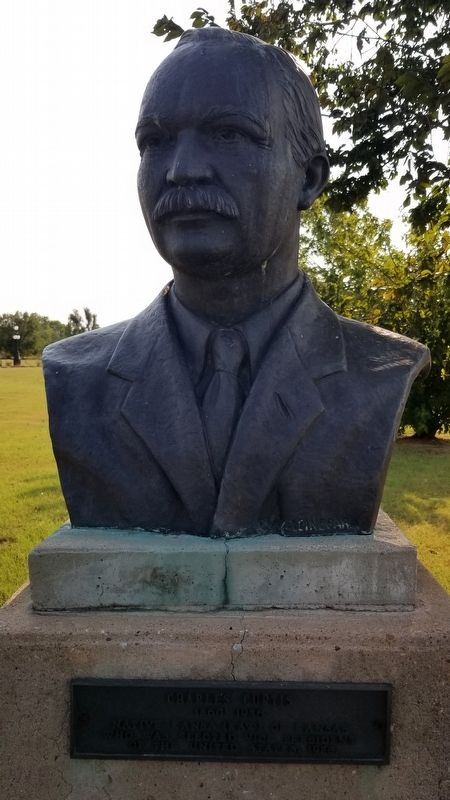
Most notable chief of the Cherokees. Served as leader and statesman for a half century during the most dynamic period of Cherokee history. His love and attachment to the sacred home lands matched that of the full blood Cherokees, whom he led when . . . — — Map (db m182084) HM
José Maria Was Principal Chief of All Caddo Tribes and Led Them From the Brazos River, Texas in 1859, to the Site Now Called Anadarko, Oklahoma
Sculptor: Leonard McMurry
Donors: the Caddo Tribe and Citizens of Anadarko . . . — — Map (db m182078) HM
A Hopi tribal antelope, he received a silver medal in the 1912 Stockholm Olympics. He lived most of his life on Second Mesa, Hopi Reservation, Arizona. He won more than 25 track records during his school years. In 1967 he was inducted into the . . . — — Map (db m182526) HM
Chief of the Southern Arapaho, Brave in War, a tribal religious leader who always stood for peace with the with the United States. — — Map (db m182519) HM
Martinez 1911 is embossed atop the store front. Andres Martinez, known as Andele, was an Apache captive. One day he and his nephew were taken by a band of Mescalaro Apache Indians. Andele's nephew, Pedro, didn't survive. Andele remained a slave for . . . — — Map (db m181819) HM
Wright was a teacher and researcher. She worked for the Oklahoma Historical Society researching and writing the history and language of the Cherokee, Choctaw, Chickasaw, Creek and Seminole. She wrote "A Guide to Oklahoma Indians" in 1951 and many . . . — — Map (db m182127) HM
Powhatan --- 1595 to 1617
Noted as the Angel of Mercy who saved
the starving colonists of Jamestown, Virginia
Sculptor: Kenneth F. Campbell
Donor: National Society of the Colonial Dames XVII Century — — Map (db m7619) HM
Wise, and eloquent leader, educator and warrior of great distinction. Friend of President Andrew Jackson and leader of Choctaw warriors in the War of 1812.
Sculptor: Leonard McMurry
Donated by: Frances Billingsley — — Map (db m182109) HM
Redskin Theatre at 221 West Broadway. The Redskin Theater's formal opening was held on Wednesday February 12, 1947. It was designed by architect Jack Corgan of Dallas, Texas, and constructed by Cowan Construction of Shawnee, Oklahoma.
Arrows . . . — — Map (db m181831) HM
This school opened at the Indian agency on Sugar Creek with 8 pupils. A new building was erected as a boarding school in 1872, for Wichita and Caddo children. Fire in 1878 destroyed the school. It soon reopened in a new building here on the Washita . . . — — Map (db m166713) HM
"Orator of the Plains" One of the most illustrious and colorful Indian leaders of the southwest region. Signer of the Medicine Lodge treaties which benefit the Nation's Indian tribes today.
Satanta's (Set-Tainte) Children . . . — — Map (db m182604) HM
Beloved Southern Cherokee Chief
who served during Civil War as
brave Brigadier General. Last
Confederate leader to surrender.
Donors Frances Billingsley
Plains Indian Arts and Crafts — — Map (db m7719) HM
Kiowa Chief 1832 - 1903
Stumbling Bear became a chieftain for his leadership in battle at the age of 22. He led war parties against the Navajos in 1856-57. Against the Utes in 1859-59 and Kit Carson at Adobe Walls, Texas in 1865. He was a . . . — — Map (db m182514) HM
Born and raised in southwest Oklahoma, Cannon permanently resided in Santa Fe, N.M. at the time of his death. Following his studies at the Institute of American Indian Arts in Santa Fe, Cannon quickly became internationally recognized as a leading . . . — — Map (db m182531) HM
A noted warrior / statesman who conceived a confederation of Indian Tribes to stem the flow of white emigration, revitalize tribal culture and preserve tribal lands along the Mississippi Valley. Killed in the Battle of Thames River, 1813 — — Map (db m275412) HM
The Anadarko Heritage Museum is housed in the old Rock Island Depot (1912). The museum was established in 1936 by the Philomathic clubwomen, and was previously located at the old City Hall then the Fire station and Police Department.
Through . . . — — Map (db m181858) HM
The building that houses the Soda Fountain Eatery was built in 1901. This building has only housed pharmacies until it was converted into a restaurant in 2012, and had only three owners over the past century or more.
The current establishment . . . — — Map (db m181814) HM
Noted as the "War Chief" of the Chickasaws, advisor and leader in the Treaty of Pontotoc (1832) and final removal of the tribe to the west. — — Map (db m182128) HM
"Old Man Wagon" Kiowa Principal Chief From 1833-1866
A courageous warrior, peacemaker, skilled diplomat and a member of Koitsenko "Real dogs", the elite Kiowa military society consisting of the 10 bravest men in the Kiowa tribe.
He . . . — — Map (db m182501) HM
This building has been the location of a number of businesses over the years. It was WN Lankford Grocery before 1935 when it became Hagemeier Grocery, then a year later it was Toma's Grocery.
Bill's Club was here in 1938, followed by Broadway . . . — — Map (db m181824) HM
(Warm Springs Apache-Band of Chil-ehn-deh) ca 1809 - 1879
Victorio was known for his skills in warfare tactics. He lived up to his name, "The Triumphant One". Despite the hardships and abuses imposed on his people, he tried to keep peace. He . . . — — Map (db m182469) HM
Honor Roll of All Cement Area Men Who Died While Our Country. 2nd LT. William A. Simms • 2nd LT. V. Leslie Dixon • Clyde Walker, S. SGT. • Samuel Lawrence Estes, PVT. • Sidney Ezzell, PVT. • Lester Logston, SA • Loftin McGinnis, CPL. • John David . . . — — Map (db m192435) WM
Established Oct. 1. 1859 by 1st Cavalry, U.S.A. under Major Wm. H. Emory. Post evacuated by Federal troops, May 1861, and occupied by Confederate garrison 1862. Hq. for Gen. W.B. Hazen, special Indian Agent, 1868. Gen. Phil H. Sheridan based here . . . — — Map (db m181533) HM
This bridge spans the South Canadian River, which at this point is the boundary between Canadian and Caddo Counties Oklahoma. It is 3,944.33 feet in length and was built jointly by the state and federal governments. Contract for its construction was . . . — — Map (db m171053) HM
Established in 1911 and known as Science Hill. The school house was located one half mile east of this memorial. Later the name was changed to Britton School in honor of the pioneer family. The church located at the same site served as a Grade . . . — — Map (db m142497) HM
This rural Rt. 66 filling station with an over the drive design was built by Carl Ditmore in 1929.
W.O. Waldrop bought the business/home in 1934 and renamed the place, the Provine Station. A small tourist court was added for overnight stays. . . . — — Map (db m174530) HM
An encomium of honor to
Senator Don Baldwin
Born Feb. 2, 1912 Anadarko
Caddo County Oklahoma
Member House of
Representatives 1944-1948
Majority Floor Leader
State Senate 1955
President Pro Tempore
State Senate . . . — — Map (db m171056) HM
The original Lucille's station was built in 1927. Lucille and Carl Hamons purchased the station and motor courts on Route 66 near Hydro, Oklahoma in 1941. The station was truly a family business. The living quarters and
the business were in the . . . — — Map (db m267045) HM
This duplex, erected in 1876, served as the home of married officers and their families until Fort Reno was decommissioned in 1948. There were 3 bedrooms and a maid's room upstairs, and a parlor, front room, kitchen, and front porch on the ground . . . — — Map (db m171132) HM
This Adjutant Office you see before you today is not actually the originally which was built of wood and served as Post Headquarters & Officer Quarters for 51 years. This structure, constructed of low fired brick and faced with concrete. In 1939, . . . — — Map (db m171129) HM
In honor of those citizens of Canadian County who served their country during the World War 1914-1918
They served without thought of self. That the principles of liberty, justice and equality might prevail for all mankind.
On the three . . . — — Map (db m267922) WM
During World War II, an eastern portion of the Fort Reno lands served as an internment work camp for German & Italian Prisoners of War. Mostly from Gen. Rommel's Afrikakorp, captured in North Africa, over 1,300 Germans were brought to Fort Reno by . . . — — Map (db m171128) HM
The Commander's Quarters was constructed in 1876. This building underwent major renovations during the WPA period in the late 1930's. Last remodeled in 2014, the building is home to BlueSTEM AgriLearning Center. This STEM (science, technology, . . . — — Map (db m171131) HM
Cheyenne-Arapaho Agency established there 1870, by Brinton Darlington, Quaker Indian agent appointed by President Grant. Important stop on Chisholm Trail, site of Arapaho School, John H. Seger, Supt. Post Office established in 1873, and first . . . — — Map (db m284688) HM
U.S. troops encamped near Cheyenne Agency in Indian uprising 1874. Site s.w. of agency selected by Agt. J.D. Miles and Capt T. Wint, established as permanent post in July, 1875, and named for Gen. Jesse L. Reno who died in action in Battle of . . . — — Map (db m39808) HM
In 1868, after several years of chasing the Plains Indians in the summertime, with no success, General Sherman developed the idea of a winter campaign. Severe winter weather made all Tribes less mobile. Sherman selected General Sheridan and Col. . . . — — Map (db m171122) HM
The Fort Reno Commissary is a 234-foot-long, 16,300 square foot building. It was constructed in three parts. The center section was built in 1885. The north and south sections were added in 1886. Supply trains and freight wagons brought food and . . . — — Map (db m171125) HM
The Guard House, also known as a jail, was constructed in 1888 of native stone from a quarry located about 6 miles west of here. Many windows still have the bolts imbedded where iron bars were held in place. An annex was added to the west side of . . . — — Map (db m171127) HM
Originally built in the late 1930's to serve as officer's barracks, then turned into a hospital in the mid 1940's, this building now serves as the Administration Building for USDA ARS Grazinglands Research Laboratory (GRL). GRL develops and delivers . . . — — Map (db m171124) HM
Mennonites settled in this area soon after Oklahoma territory opened by run April 22, 1889. Their first mission activity was among Indians. This colony was southernmost for Mennonites along Chisholm Trail. Farmers of Swiss (from Berne, Ind.), . . . — — Map (db m186333) HM
El Reno namesake born in Wheeling, West Virginia. Reno was a 1846 graduate of West Point Military and thrice decorated hero of 1846 war with Mexico. He was promoted to Brigadier General at the start of the Civil War. Reno is credited with saving the . . . — — Map (db m56899) HM
Introduced in the 1920s,
shredded onions fused with
limited amounts of ground
beef made these burgers an
affordable local specialty. — — Map (db m274223) HM
Ben Clark, more than any other man in the history of Western Oklahoma, can be identified with the history of Fort Reno. He was one of the interpreters at the signing of the treaty at Medicine Lodge, KS in 1867. He was with Cavalry Commander . . . — — Map (db m171123) HM
The western branch of the Chisholm Trail passed less than one mile east of this location on its way to the Darlington Indian Agency located about a mile to the northeast. Fort Reno thus became an important resupply location for the drovers and herds . . . — — Map (db m171121) HM
The home was built in 1900-1901, by William and Magdalen Goff. Mr. Goff came to El Reno, in 1892, to work for Anheuser and Busch. He soon became an agent for the firm, later he started Goff Bottling Works and organized the Goff Cadet Band.
The . . . — — Map (db m171134) HM
This Victorian style house was built in 1891 and used as Officer Quarters. It has three stories plus a basement. The foundation is stone with load-bearing brick on the lower floor. The second and third floors are a wood frame constructed with . . . — — Map (db m171130) HM
Established in 1899 by early Czech settlers who were members of Sokol Karel Havliček Lodge and Western Fraternal Life Association Lodge Jan Žižka No. 67. Original structure replaced in 1925. Focal point of Czech, social and musical functions in . . . — — Map (db m56898) HM
A.N. Spencer, founder of Yukon, drove his cattle up the Chisholm Trail from Texas several times. Spencer bought land from Mrs. Taylor, Luther Morrison, and Joseph Carson to start Yukon. He persuaded the Choctaw, Oklahoma, and Gulf railroad to change . . . — — Map (db m297295) HM
This building, originally built in 1930 by
architect J.B. White, was called the
Gilbert Building. It was renamed the
Ardmoreite Building in 1966 when it
became the home of The Daily
Ardmoreite. Between 1930 and 1966
many businesses . . . — — Map (db m142416) HM
Carter County was created in 1907 from part of the old Chickasaw Nation. Pickens County was renamed Carter County in honor of Ben Carter, prominent Native American of the Chickasaw Nation. Members of the Constitutional Convention chose Ardmore as . . . — — Map (db m286796) HM
This park was created between 1933 and 1940 by members of Civilian Conservation Corps Companies 1813 and 849, two of many organized by the federal government during the Great Depression. To provide useful employment for thousands of young men . . . — — Map (db m212797) HM
Daubes’ Department Store was a long time landmark on Main Street of Ardmore.
The original Daube Store was opened in Bowie, Texas, in 1883, and was owned by Sam Daube.
In about 1888, when the Ardmore area was in Pickens County, Indian . . . — — Map (db m142482) HM
The construction of this courthouse was
financed in 1898 by two private
entrepreneurs, Joe F. Robinson and
A. V. Doak. The building was leased to the Federal
Government and the court was presided over by
Judge Hosea Townsend. This fourth . . . — — Map (db m142411) HM
Before statehood in 1907 Lewis Robert Marston began laying sidewalks in Ardmore, I.T. Before 1907 Mr. Marston poured the first sidewalk around what would become the Carter County Courthouse in 1910. This piece of concrete is from the original . . . — — Map (db m286798) HM
A Methodist college once stood here. Begun by the City of Ardmore it was given to the Indian Mission Conference of the Methodist Church. Named in honor of Bishop Robt. K. Hargrove. In 1907 the school burned but was rebuilt north of the city. It . . . — — Map (db m141620) HM
The Hotel Wisnor, named in honor of Benjamin Wisnor Carter, prominent Chickasaw citizen, was built on this site in 1884 and was the first and finest establishment of its kind in Indian Territory. The three-story building of brick and stone had 50 . . . — — Map (db m142485) HM
In 1893, E.B. Luke came to Ardmore, Chickasaw Nation, from Detroit, Michigan. At the time, his brother, Jack Luke, operated a music and school book store in Oklahoma City, and urged E.B. to open this same type of store in Ardmore. So in 1895, E.B. . . . — — Map (db m142420) HM
On April 19, 1895 a fire broke out in Harper’s Caddo Street Livery Stable. It quickly spread and consumed six blocks of East Main Street from the Santa Fe Railroad tracks to Washington (then known as Springer Street). Eighty-six businesses were . . . — — Map (db m142489) HM
The Noble Brothers, Sam and Ed, arrived in Ardmore, Chickasaw Nation, in 1893, from Oakland Prairie, Pickens County, after a brief sojourn in Pottsboro, Texas, where they were partners in a general merchandise business and operated a ferry crossing . . . — — Map (db m142481) HM
Before 1899, J.W. Banks built, at this site, a mercantile establishment combined with lodging quarters. In 1903, W.F. (Dixie) Gilmer arrived from North Carolina and leased the hotel which was a three story structure with rooms on the second and . . . — — Map (db m142422) HM
Built in 1918, the Simpson Building was Ardmore's first attempt at building a skyscraper office building. B. A. Simpson, P. C. Dings, and Roy M. Johnson, all of Ardmore, financed the building's construction. The building's first floor facade was . . . — — Map (db m287097) HM
On November 9, 1905 Mattie Dobbins purchased this lot from the Chickasaw and Choctaw Nations for the sum of $252.60. Ms. Dobbins entered into a 10 year lease contract with the Banker's Trust Co. on July 31, 1906 for a $50.00 per month rental on the . . . — — Map (db m286797) HM
Two years after the City of Ardmore was founded, the First National Bank & Trust Company of Ardmore began as a private bank in 1889 by J. F. Anderson and his son, Charles. Within a year, a national charter was granted, giving the bank the honor of . . . — — Map (db m282382) HM
The original Whittington Hotel was opened on the corner of Caddo and Main Street in 1891. It was rebuilt with brick and sandstone following Ardmore’s Great Fire of 1895. It had the town’s first metal-cage Otis elevator. The hotel was closed in 1965 . . . — — Map (db m286898) HM
Rosella Hightower
The world renowned ballerina was born 1/20/1920 on Wolf Creek 2 miles south and ½ mile east (C SW SE SE Sect. 34, 3E 4S). She became the prima ballerina of the Ballet Russe de Monte Carlo, the original Ballet Russe, the . . . — — Map (db m147485) HM
March 14, 1943 Aeronca L-3C Grasshopper
Emil M. Horkavi Gary, Indiana • Frank M. Dimond Wilmington, California
November 4, 1943 B-17 Flying Fortress
Derald C. Holland, Santa Ana, California •
Lee R. Woodall Jr. El Dorado, Arkansas • . . . — — Map (db m209383) WM
Production of crude oil from the newly-discovered Healdton field surrounding this marker site flooded the marker with an oversupply of petroleum protesting that pipeline purchases were inadequate. Producers claimed they were being deprived of . . . — — Map (db m180600) HM
WW II CO Co K 152nd Inf 38th Inf Div
Wounded in Philippine Islands May 16, 1945
Korea CO Tank Co 179 Inf Reg 45 Inf Div wounded May 6, 1952
Distinguished Service Cross
Distinguished Service Cross by direction of the President under the . . . — — Map (db m180534) HM WM
The All-Black towns of Oklahoma represent a unique chapter in American history. No where else, neither the Deep South nor the Far West, did so many African American men and women come together to live in and govern their own communities. By 1920, . . . — — Map (db m284940) HM
Center of Cherokee culture was one mile east on Park Hill Creek; Home of Chief John Ross, Samuel Austin Worcester, Elias Boudinot, other pioneers and The Mission Press which printed millions of pages for the benefit of the Cherokee people . . . — — Map (db m52751) HM
Established July, 1837, Rev. S.A. Worcester, Supt. Over 25 million pages were printed in Indian languages and in English by 1861. Printers and translators were John F. Wheeler, John W. Candy, Edwin Archer, Stephen Foreman. Near site are graves of . . . — — Map (db m52755) HM
First Annual Indian Mission Conference of the Methodist Church was held in Oklahoma at Riley's Chapel, Oct. 23, 1844, Bishop Thomas A. Morris presiding. Conference area was west to the Rocky Mts., east to Ark.-Mo. line. Rev. Thomas Bertholf, . . . — — Map (db m52757) HM
(front)
The United States Government, unable to conclude an agreement with the duly authorized leaders of the Cherokee Nation, signed a treaty with a minority faction willing to cede the last remaining portion of the original Cherokee . . . — — Map (db m77932) HM
As a tribute to Oklahoma’s First Legal Newspaper The Cherokee Advocate established Sept. 26, 1844 in a building approximately 100 feet north of this location. This marker is dedicated Sept 6. 1957 by the Oklahoma Press Association and the . . . — — Map (db m259291) HM
has been designated a Registered National Historic Landmark under the provisions of the Historic Sites Act of August 21, 1935 This site possesses exceptional value in commemorating and illustrating the history of the United States . . . — — Map (db m259277) HM
2059 entries matched your criteria. Entries 101 through 200 are listed above. ⊲ Previous 100 — Next 100 ⊳