By Duane and Tracy Marsteller, December 1, 2025
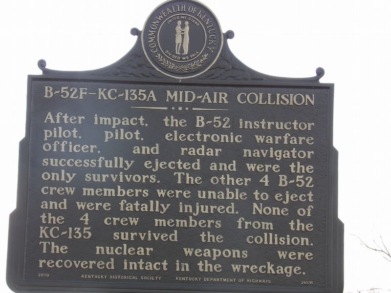
B-52F–KC-135A Mid-Air Collision Marker, Side Two
| On Blacklick Church Lane west of Rockvale Road (Kentucky Route 629), on the right when traveling west. |
| On U.S. 60 at Kentucky Road 144, on the right when traveling west on U.S. 60. |
| On State Road 144, on the right when traveling south. |
| On South Main Street (State Road 261) 0.1 miles south of FFA Camp Road, on the left when traveling south. |
| On North Main Street (State Road 259), on the right when traveling north. |
| On U.S. 60 0.5 miles east of Low Dowell Road, on the left when traveling east. |
| On Preston Highway (Kentucky Route 61) at Beech Grove Road (County Route 1494), on the left when traveling north on Preston Highway. |
| Near Clermont Road (Kentucky Route 245) 0.1 miles west of Lotus Road ( Route 1604), on the left when traveling west. |
| On Pioneer Drive 1 mile south of East Pioneer Drive, on the left when traveling south. |
| On South Buckman Street (Kentucky Route 61), on the right when traveling north. |
| On South Buckman Street (Kentucky Route 61) at East 4th Street ( Route 44), on the right when traveling north on South Buckman Street. |
| On East 4th Street (Kentucky Route 44) 0.1 miles County Road 1124, on the right when traveling east. |
| On West Hebron Lane 0.1 miles south of John Harper Highway ( Route 1526), on the left when traveling south. |
| On South Buckman Street (Kentucky Route 61), on the right when traveling north. |
| On Preston Highway (Kentucky Route 61) at Old Preston Highway South ( Route 480c), on the left when traveling north on Preston Highway. |
| On Preston Hwy (State Highway 61) at Old Preston Highway South (County Route 2237), on the right when traveling south on Preston Hwy. |
| On Little Muddy Church Road at Bowling Green Road (U.S. 231), on the left when traveling east on Little Muddy Church Road. |
| Near North Main Street at East Ohio Street, on the right when traveling north. |
| On Logansport Road (Kentucky Route 403), on the right. |
| On E G L Smith Street east of North Main Street, on the left when traveling east. |
| Near North Main Street at East Ohio Street, on the right when traveling north. |
| On North Main Street north of W G L Smith Street, on the left when traveling north. |
| On E G L Smith Street east of North Main Street, on the left when traveling east. |
| On Huntsville-Quality Road (Kentucky Route 106) at County Route 1482, on the right when traveling south on Huntsville-Quality Road. |
| On Ferry Street (Kentucky Route 369) at Creamery Street, on the right when traveling north on Ferry Street. |
| On Reedyville Road (State Road 185) 0.3 miles south of Lock 5 Road, on the left when traveling south. |
| On Lock 4 Road 0.1 miles east of Barren River Road ( Highway 403), on the left when traveling east. |
| On Woodbury Loop (Kentucky Route 403) east of Hines Street, on the left when traveling east. |
| On Cassidy Avenue at Shelby Street, on the right when traveling south on Cassidy Avenue. |
| On Dorroh Street at W Wyatt Street, on the right when traveling north on Dorroh Street. |
| On North Harrison Street at West Main Street, on the left when traveling south on North Harrison Street. |
| On East Washington Street west of Edwards Avenue, on the left when traveling east. Reported missing. |
| On East Court Square at U.S. 62, on the left when traveling north on East Court Square. |
| On East Market Street (U.S. 62) at North Harrison Street ( Route 293), on the left when traveling west on East Market Street. |
| On U.S. 62 at West Main Street, on the right when traveling west on U.S. 62. |
| On North Plum Street at West Main Street, on the right when traveling south on North Plum Street. |
| On West Main Street (U.S. 62) east of South Cave Street, on the right when traveling east. |
| On South Jefferson Street (Kentucky Route 293) at Dogwood Lane, on the right on South Jefferson Street. |
| On West Main Street (U.S. 62) at North Cave Street, on the left when traveling east on West Main Street. |
| On Hopkinsville Road (State Road 91) at Friendship Road, on the right when traveling south on Hopkinsville Road. |
| On East Washington Street west of Edwards Avenue, on the left when traveling east. |
| On East Main Street at North Franklin Street, on the right when traveling east on East Main Street. |
| On North Donnivan Street at Calvert Street, on the right when traveling north on North Donnivan Street. |
| On Hopkinsville Road (State Road 91) at Friendship Road, on the right when traveling south on Hopkinsville Road. |
| On Kentucky Route 672 north of Cobb Spur Road, on the right when traveling north. |
| On Hopkinsville Street (State Road 91) at University Drive, on the right when traveling south on Hopkinsville Street. |
| On North Franklin Street at East Market Street, on the right when traveling north on North Franklin Street. |
| On Radio Road (Kentucky Route 1824) at Roosevelt Road ( Route 1346), on the right when traveling south on Radio Road. |
| On Kirksey Road (Kentucky Route 299) 0.2 miles south of Backusburg Road ( Route 464), on the right when traveling south. |
| On North 16th Street 0.1 miles north of Miller Avenue, on the right when traveling north. |
| On South 4th Street (Business U.S. 641) just north of Maple Street, on the left when traveling north. |
| Near North 15th Street at Olive Boulevard, on the left when traveling north. |
| Near Gil Hopson Drive (County Route 1084) 0.3 miles north of Arcadia Circle, on the left when traveling north. |
| On North 16th Street at University Drive, on the right when traveling north on North 16th Street. |
| On South 4th Street (Business U.S. 41) south of Maple Street, on the left when traveling south. |
| On Gil Hopson Drive (County Road 1084) 0.3 miles north of Arcadia Circle, on the right when traveling north. |
| On State Highway 121 at Cypress Trail, on the right when traveling north on State Highway 121. |
| On State Highway 121 at Cypress Trail, on the right when traveling north on State Highway 121. |
| On Alexandria Pike (U.S. 27) at Kenton Station Road ( Route 1936), on the right when traveling south on Alexandria Pike. |
| On East Main Street (Kentucky Route 10), on the right when traveling east. |
| On Alexandria Pike (U.S. 27) at Kenton Station Road ( Route 1936), on the right when traveling south on Alexandria Pike. |
| On Fairfield Avenue (Kentucky Route 8) near Patchen Avenue, on the right when traveling east. |
| On South Fort Thomas Avenue at Douglas Drive, on the right when traveling north on South Fort Thomas Avenue. |
| On Memorial Parkway (Kentucky Route 1120) at North Fort Thomas Avenue, on the right when traveling south on Memorial Parkway. |
| On North Fort Thomas Avenue 0.1 miles south of Stanbery Ridge, on the left when traveling south. Reported unreadable. |
| On Alexandria Pike (U.S. 27) at Woodfill Avenue on Alexandria Pike. |
| On East Third Street near Monmouth Street. |
| On Carothers Road (Kentucky Route 1892) at Monmouth Street (U.S. 27), on the right when traveling south on Carothers Road. |
| On Court Place at York Street (U.S. 27), on the right when traveling east on Court Place. |
| On East Third Street at Overton Street, on the right when traveling west on East Third Street. |
| On West 5th Street (Kentucky Route 8), in the median. |
| On West 4th Street at York Street (U.S. 27), on the right when traveling west on West 4th Street. |
| On Louie B Nunn Drive west of University Drive, on the right when traveling west. |
| On East Southgate Street east of Saratoga Street, on the left when traveling east. |
| On Court Place at York Street (U.S. 27), on the left when traveling east on Court Place. |
| On Mary Ingles Highway (Kentucky Route 8) west of 4 Mile Road ( Route 547), on the left when traveling east. |
| On Alexandria Pike at Beverly Hills Drive, on the right when traveling east on Alexandria Pike. |
| On Alexandria Pike (U.S. 27), on the right when traveling south. |
| On Alexandria Pike (U.S. 27) at the Evergreen Cemetery entrance, on the right when traveling south on Alexandria Pike. |
| On AA Highway (Kentucky Route 9) at Pooles Creek Road ( Route 1998), on the right when traveling east on AA Highway. Reported permanently removed. |
| Near Paducah Road (U.S. 62) 0.9 miles east of Elm Street (U.S. 51), on the right when traveling east. |
| On Elm Street (U.S. 51/62), on the right when traveling south. |
| On Highland Avenue (U.S. 42) east of Martin Road (Route 2350), on the right when traveling west. |
| On U.S. 42 east of Ware Avenue, on the right when traveling west. |
| Near General Butler Park Road east of 11th Street (Road 320). |
| On Highland Avenue (U.S. 42) at 2nd Street, on the right when traveling west on Highland Avenue. |
| On Fifth Street north of U.S. 42, on the left when traveling north. |
| On Highland Avenue (U.S. 42) at 2nd Street, on the right when traveling west on Highland Avenue. |
| On Main Street, on the right when traveling west. |
| On U.S. 42 east of Carraco Road, on the left when traveling east. |
| On Main Street (U.S. 42) south of Main Cross Street ( Route 47), on the left when traveling south. |
| On Main Street (U.S. 42) at Ann Street, on the right when traveling south on Main Street. |
| On Ghent-Eagle Station Road south of Dividing Ridge Road ( Route 2984), on the left when traveling south. |
| On Kentucky Route 467 at Pike Street (Route 36), on the right when traveling east on Kentucky Route 467. |
| On U.S. 60 at Grahn Rd ( Route 182), on the left when traveling south on U.S. 60. |
| On Kentucky Route 7 at Route 1496, on the left when traveling south on Kentucky Route 7. |
| On East Main Street (U.S. 60) west of Prichard School Drive. Reported missing. |
| On Landsdown Avenue at College Street on Landsdown Avenue. |
| On Carol Malone Boulevard (Kentucky Route 7) just north of East 2nd Street, on the right when traveling north. |
1869 entries matched your criteria. Entries 201 through 300 are listed above.
⊲ Previous 100 —
Next 100 ⊳
