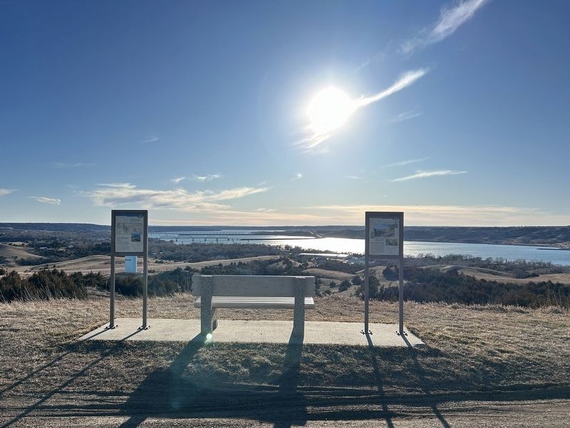
Near State Highway 50 south of Thunder Road, on the right when traveling south.
This spot offers a spectacular view of the Missouri River, but the river is much different today from when Lewis and Clark traveled up it. Several huge dams now control its flow.
When the expedition came through, the river could go from a mere . . . — — Map (db m242480) HM
Near State Highway 50 south of Thunder Road, on the right when traveling south.
Most of the native plants you see here are direct descendants of those found by Lewis and Clark when they arrived in the fall of 1804. As they traveled, the captains always noted stands of timber because they needed wood for kindling and because . . . — — Map (db m242479) HM
On Cemetery Road 0.2 miles west of Main Street, on the left when traveling west.
The church was built in 1893 by Bohemian pioneers. Relocated to Kimball and restored in 1982. Contains Bohemian artwork and artifacts of more than 100-year vintage. Intricate altars make a striking setting for weddings and is enjoyed by tour groups. . . . — — Map (db m271836) HM
On Main Street at 6th Street, on the right when traveling south on Main Street.
In honor and memory of those who served in the Armed Forces of the United States of America.
They made the supreme sacrifice
They died for liberty
They died for us
They are at rest
We the Kimball veterans wish to honor our . . . — — Map (db m271840) WM
On 351st Avenue (State Highway 50) north of 266th Street, on the right when traveling south.
This 840 acre tract was donated by Everald H. Hoover to the people of the Bijou Hills area. It honors his pioneer relatives who homesteaded or bought land here. The tract is in the care of the South Dakota Game, Fish and Parks Commission.
John . . . — — Map (db m271131) HM
On State Highway 47 just north of Lower Road, on the left when traveling north.
In memory of the Dakota whose lives were taken at Fort Thompson in 1863, these were the innocent exiled from Minnesota, who suffered hardship and sickness at this camp.
The stone that stands here, reminds us of the land from which you came. . . . — — Map (db m185463) HM WM
On State Highway 47 north of Lower Road, on the right when traveling south.
A Crow Creek Sioux dancer at a powwow.
Courtesy of South Dakota Public Broadcasting
The Crow Creek Reservation began in a tragic story of hardship. The Uprising, or the U.S. – Dakota War, started in 1862 when starving Dakota . . . — — Map (db m242476) HM
On State Highway 47 north of Lower Road, on the right when traveling south.
Dancers at a Lower Brule Sioux powwow.
Courtesy of Central Dakota Times, Debi Ruiz
For thousands of years, ancestors of the Kul Wicasa Oyate, members of the Lakota band known as the Sicangu (burnt or scorched thigh), . . . — — Map (db m242478) HM
On State Highway 47 north of Lower Road, on the right when traveling south.
Indigenous peoples throughout the West have used medicine wheels of many forms. For thousands of years, Native peoples have used this wheel pattern for health and healing.
The Spirit of the Circle Monument honors and remembers . . . — — Map (db m242477) HM
The statistical center of population for South Dakota in 2000,
according to the Census Bureau and the National Geodetic Survey,
lies at the point 3.2 miles northwesterly from this monument.
The center is at Latitude 44 degrees 02 . . . — — Map (db m125779) HM
Near 5th Avenue (CanAm Highway) (U.S. 85) just north of Faulk Street, on the right when traveling north.
[marker on south side of cabin] This cabin, built in 1876 of logs split & transported by Spaulding from the Black Hills, was the first home on the Redwater & what became Butte County. An experienced scout, familiar with the . . . — — Map (db m234772) HM
On State Street (Business U.S. 212) just east of 8th Avenue, on the left when traveling east.
From this location you are able to view the “Beautiful Forks” of the Redwater River as it runs into the Belle Fourche River as named by French explorers as they passed through the area over 200 years ago. Of course, “Belle Fourche” (pronounced . . . — — Map (db m234799) HM
Near 5th Avenue (U.S. 85) north of Faulk Street, on the right when traveling north.
This cabin, the first in this vicinity was built by John T. Spaulding and his brother-in-law, Thomas J.Davis, in 1876-77 as a home for himself and Mr. and Mrs. Lucinda Davis and family. It was located on Lower Redwater 22 miles S.E. of here from . . . — — Map (db m280265) HM
Near 6th Avenue just north of Indian Street, on the left when traveling north.
A.G. Challis built the 1st plank jail in 1896 (for under $400) where City Hall now stands. Unfortunately, an exuberant “one-legged” celebrant arrested at the Black Hills Soldiers & Sailors Reunion, built a fire on the unusually cool night & burned . . . — — Map (db m234740) HM
Near 5th Avenue (U.S. 85/212) just north of Faulk Street, on the right when traveling north.
[west side]Dedicated to those who answered our Nations call in the pursuit of freedom. ”The Forgotten War” 25 June 1950 – 27 July 1953 [east side]Korea 1950 — 1953 Casualties Dead 54,246 . . . — — Map (db m234857) WM
Near Theodore Roosevelt Expressway (U.S. 85), on the right when traveling north.
Sheepherder's Monuments or stone Johnnies survive the day of the open range. These stone columns were probably built to indicate distance and direction to waterholes and provided the sheepherder with a pastime while tending his flock. — — Map (db m4564) HM
Near 5th Avenue (U.S. 85/212) just north of Faulk Street, on the right when traveling north.
The Great Western Cattle Trail embodied the spirit, determination, and grit of the early cowboys and remains one of the most romantic and interesting times of our past. The entire trail extended from Matamoros, Mexico to Saskatchewan, Canada (Texas . . . — — Map (db m234800) HM
On 5th Ave (U.S. 85) near Edmunds Street, on the right when traveling north.
In 1959 following the admission of Alaska and Hawaii to the Union, the U.S. Coast and Geodetic survey officially designated a point 20 miles north of Belle Fourche, South Dakota as the Geographic Center of the Nation.
Entry of Alaska and Hawaii . . . — — Map (db m4867) HM
On 112th Street (State Highway 10) at 320th Ave, on the right when traveling west on 112th Street.
Hoffnungstal
EV. Lutheran Church
Eureka, South Dakota
Organized 1888
Disbanded December 31, 1968
Record Depository Zion Am. Lutheran Church
Eureka, South Dakota
Original Church Corner Stone
Ev. Luth. . . . — — Map (db m112049) HM
On U.S. 83 at 102nd St. SE, on the right when traveling south on U.S. 83.
You are about to enter South Dakota Created with its twin, North Dakota, 2 November 1889, its 77,047 square miles ranks 15th in size. Those square miles include: exceptional corn land in the SE, grass land in the W, wheat land in the N. and . . . — — Map (db m44710) HM
On 306th Avenue (U.S. 83) 0.3 miles north of 3rd Street, on the left when traveling north.
The Town of Mound City was started by Edward C. McIntosh, and his father, E.H. McIntosh on June 10, 1884. It was named “Mound City” because of the small hills just north of town, which they called “bachelor mounds.” The . . . — — Map (db m154474) HM
On 296th Ave at State Highway 10, on the right when traveling north on 296th Ave.
Side A The Flint store and post office was built on this site in 1895. It was named after Moses E. Flint, and early homesteader. Mr. Flint served as a teamster with General Custer on the 1876 campaign against the Sioux which ended with the . . . — — Map (db m112082) HM
On State Highway 10 at A Ave, on the left when traveling west on State Highway 10.
Lewis and Clark
The Lewis and Clark Expedition, officially the Corps of Discovery, was in what is now South Dakota from August 21 to October 14, 1804 and from August 21 to September 4, 1806.
While here they would make numerous . . . — — Map (db m187079) HM
On State Highway 1804 at 294th Ave, on the right when traveling west on State Highway 1804.
Lewis and Clark and the Legend of Stone Idol Creek
On their epic exploratory expedition Meriwether Lewis and William Clark stopped near here and noted two stones resembling human figures, and third like a dog. Capt. Clark writes on Oct. . . . — — Map (db m112085) HM
On State Highway 1804 at 294th Ave, on the right when traveling west on State Highway 1804.
Old Pollock
In 1901 Pollock was founded as the end point of the Soo Line rail service from Wishek, ND. Soo Line officials requested the town be named Pollock in honor of R.Y. Pollock, a pioneer lay minister and respected citizen of the . . . — — Map (db m112084) HM
On B Avenue (State Highway 1804) at Park Street, on the right when traveling north on B Avenue.
Pollock, South Dakota Settlers
The first settlers came to this area about 1880. LaGrace, 9 miles southwest, was the first town and the County seat until 1888, when it gradually disappeared. The town of Pollock was founded in 1901 at the end . . . — — Map (db m112086) HM
On 401st Avenue north of 295th Street, on the right when traveling north.
I, the Lord, was there at the beginning, and I, the Lord God, will be there at the end. Isaiah 41:4
Bohemian Protestant homesteaders organized in 1895 with services in member homes
Incorportated in 1902 as Bohemian-Moravian . . . — — Map (db m313509) HM
On Main Avenue north of 4th Street, on the right when traveling north.
Dedicated To Those Who Served Our Country
Alphonse Jaeger US Army WWII India/Burma ·
Donald L. Jaeger US Army Ft Bragg NC ·
Frank C. Dufek JR US Army WWII ·
John E. Jaeger US . . . — — Map (db m313455) WM
On 381st Avenue 0.4 miles south of 285th Street (County Highway 34), on the right when traveling north.
Henry Kasulka (1839-1918) with wife Caroline (1844-1934), German immigrants from Pomerania, set aside land at this site for a German Methodist Church and Cemetery originally organized in 1897. The congregation erected the church in 1906 with John . . . — — Map (db m313443) HM
On 382nd Avenue 0.2 miles south of State Highway 50, on the right when traveling south.
Camp BF-1 (DSE-204): located in edge of town of Lake Andes
Companies: Nebraskans?--July-October 1933; 2759V -- 7/31/34-11/1/34; 2743 (Nebraskans) -- 5/25/35-Fall 1935
The Civilian Conservation Corps was a federal relief program during . . . — — Map (db m187634) HM
On 303rd Street east of 388th Avenue, on the right when traveling east.
Martin Marty
1834-1896
First Abbot of St. Meinrad Archabbey, First Bishop of the Dakota Territory, began to visit the Indians in this territory in 1877. He established the first Indian Mission called St. Ann’s Mission of Wheeler, . . . — — Map (db m177442) HM
On 390th Avenue 0.2 miles north of County Road 2, on the right when traveling north.
This monument commemorates the Yankton Sioux Treaty of 1858.
As increasing numbers of settlers came upriver, the Yankton Sioux had to decide whether to join other Sioux tribes in armed resistance or to co-exist with the immigrants. They . . . — — Map (db m217461) HM
On 390th Avenue 0.2 miles north of County Road 2, on the right when traveling north.
In memory of the Yankton Chiefs, who made the Treaty of 1858.
Struck by the Ree ·
Black Bear ·
Medicine Cow ·
White Swan ·
Pretty Boy ·
Feather in the Ear ·
Crazy Bull ·
Frank Deloria
Sioux
Delegates who signed the . . . — — Map (db m217464) HM
On U.S. 18 0.5 miles west of Missouri Drive, on the right when traveling west.
Making a hide tipi cover was a community project. The women would get together to make a cover, which was made by piecing together the hides of multiple animals, usually buffalo.
It required 18 tanned buffalo hides to make the average tipi. . . . — — Map (db m187547) HM
On U.S. 18 0.5 miles west of Missouri Drive, on the right when traveling west.
"You have noticed that everything an Indian does is in a circle, and that is because the power of the world always works in circles, and everything tries to be round. . . . The sky is round, and I have heard that the earth is round . . . — — Map (db m187544) HM
On U.S. 18 0.7 miles west of Lewis Avenue, on the right when traveling west.
Fort Randall Dam
Construction Period: 1946-1956
Length: 10,700 ft
Width at Base: 4,300 ft
Max. Height: 165 ft
Type: Rolled Earth Fill
Earth Fill: 50 million cu yds
Concrete: 961,000 cu yds.
Record Discharge: 169,800 cfs (July . . . — — Map (db m187549) HM
On U.S. 18 0.5 miles west of Missouri Drive, on the right when traveling west.
To the Native American tribes of the Great Plains, the buffalo was sacred. They depended on the buffalo for their survival and used nearly every part of the animal. They felt a strong sense of kinship with the animal that kept them warm, . . . — — Map (db m187548) HM
On Lewis Avenue at U.S. 18, on the right when traveling south on Lewis Avenue.
Pickstown
Lewis and Clark passed this site on September 8, 1804. The next day they had their first encounter with prairie dogs, which they called barking squirrels. They killed one and caught one alive by pouring a great quantity of water . . . — — Map (db m187535) HM
On Lewis Avenue north of Abnor Drive, on the left when traveling north.
Dedicated to all who served
in the defense of our country
South Dakota centennial year
1889 — 1989
Pickstown, S. D.
Unincorporated 1947–1986
Incorporated Aug. 10, 1986 — — Map (db m237280) WM
On U.S. 18 0.5 miles west of Missouri Drive, on the right when traveling west.
Living under a vast blanket of stars above the Great Plains, Native Americans had an interest in the stars. Stars are believed to be Woniya of Wakan Tanka, "the holy breath of the Great Spirit." Constellations in the night sky . . . — — Map (db m187545) HM
On U.S. 18 0.5 miles west of Missouri Drive, on the right when traveling west.
Few dwellings stir the imagination like the tipi. Used by nearly all Native American tribes of the Great Plains, this practical, moveable, one-room home was ideal for seminomadic tribes that followed buffalo herds across the prairie.
Inside . . . — — Map (db m187543) HM
On U.S. 18 0.5 miles west of Missouri Drive, on the right when traveling west.
Tipis were the exclusive responsibility of women among Great Plains tribes. They worked together to set them up and take them down, make hide covers, cut poles, and pack and transport the tipis and their contents.
After the arrival of the . . . — — Map (db m187546) HM
Our National Symbol
In 1782, over 200 years ago, the United States adopted the bald eagle as our national symbol. This majestic, white-headed bird, soaring freely throughout our continent, was a common sight to our ancestors.
Today, the . . . — — Map (db m234977) HM
The Omaha and Ponca
The Omaha and Ponca tribes were once a single people closely related to the Osage, Kansa and Quapaw tribes of the lower Missouri and Mississippi River valleys. The ancestoral Omaha-Ponca people migrated from that region . . . — — Map (db m234981) HM
has been designated a
Registered Natural Landmark
Under the provisions of the
Historic Sites Act of August 21, 1935
this site possesses exceptional value
in illustrating the natural
history of the United States
U.S. . . . — — Map (db m234940) HM
Basin
Many thousands of years ago a great continental ice sheet advancing from the northeast onto the northern plains blocked or reversed the flow of all rivers it came into contact with. The result of this titanic natural force was the . . . — — Map (db m234980) HM
On 271st Street at 355th Avenue, on the right when traveling east on 271st Street.
To the memory of Dr. Lewis E. and Ella Woodman Camfield
Founders of Ward Academy at this site in 1893
Dedicated their lives to the building of Christian character through church and school
Lewis Emerson Camfield
1860 — . . . — — Map (db m273595) HM
On Elm Avenue (County Road 21) 0.1 miles south of 293rd Avenue (U.S. 18), on the left when traveling south.
Gone but not Forgotten
The Golden Years
Home of the Bears
This memorial to Ravinia Consolidated School is a tribute to all who attended and graduated from the humble institution, including dedicated educators and board members who . . . — — Map (db m187638) HM
On 293rd Street (U.S. 18) 0.1 miles west of Elm Avenue (County Road 21), on the right when traveling east.
This marker commemorates and gives directions to the Ravinia Consolidated School site and memorial ¼ mile south on County Highway 21 in Ravinia.
The school operated from 1917-1967 when reorganization dissolved the district. During this period . . . — — Map (db m187637) HM
On Front Avenue Southeast at 1st Street Southeast, on the right when traveling south on Front Avenue Southeast.
Army Navy Air Force Marine Corps Coast Guard Merchant Marine
Duty · Honor · Country · Freedom
In honor of the brave men and women of the Armed Forces of the United States of America who served for our great country so each . . . — — Map (db m217530) WM
On 297th Street (State Highway 46) 0.2 miles east of Front Avenue Southeast, on the right when traveling west.
of the men and women of Company A
153rd En Bn who served in support of
Operation Iraqi Freedom II.
07 December 2003 to 01 March 2005
A Company Roster
Commander - CPT Gregory R. Darlow
First Sergeant - 1SG John L. Noyes . . . — — Map (db m217633) WM
On Wagner Lake Road 0.2 miles north of 297th Street (South Dakota Highway 46), on the right when traveling north.
Lewis and Clark
The Lewis and Clark Expedition, officially the Corps of Discovery, was in what is now South Dakota from August 21 to October 14, 1804 and from August 21 to September 4, 1806.
While here they would make numerous . . . — — Map (db m313461) HM
On 1st Ave. W at Commercial St., on the right when traveling east on 1st Ave. W.
This Memorial dedicated to all veterans of Clark County and to those who will come after us for their service to God and Country. They gave the supreme sacrifice
Sponsored by American Legion and Veterans of Foreign Wars Posts and . . . — — Map (db m183482) WM
On 1st Avenue East at South Commercial Street, on the left when traveling west on 1st Avenue East.
Samuel H. Elrod was born near Coatesville, Indiana, May 1, 1856. Having worked his way through Asbury College, now Depauw University, graduating in 1882, he passed the Indiana Bar Examinations and headed for Dakota Territory. Arriving in Watertown . . . — — Map (db m183480) HM
On U.S. 212 0.2 miles west of 433rd Avenue, on the right when traveling east.
In 1931 an economic depression spread across South Dakota and the nation. A drouth ravished crops and unemployment was widespread.
In an effort to raise the morale of the people and to give amateur baseball players an opportunity to compete, . . . — — Map (db m183478) HM
On Lincoln Street south of State Highway 28, on the right when traveling south.
CW2 Scott Saboe
CW2 Scott Saboe was assigned to Alpha Company, 4th Battalion, 101st Aviation Regiment, "The Comancheros." CW2 Saboe took great pride in being an Army aviator and an Assault Helicopter Pilot. His dedication and technical . . . — — Map (db m206436) HM WM
On Lincoln Street south of State Highway 28, on the right when traveling south.
All Gave Some
Some Gave All
Clark County Veterans Who Gave The Ultimate Sacrifice For Our Freedom
World War I
Lyman F Baker ·
Antone Barrie ·
Henry G Chatfield ·
Emery D Cloud ·
Ernest L Cloud ·
Otto H Disrud · . . . — — Map (db m206441) WM
On University Road 3 miles east of State Highway 19, on the right when traveling north.
The Southeast South Dakota Experiment Farm was organized on April 5th 1956, for the purpose of conducting a research demonstration farm in Southeast South Dakota. It was through the efforts of the Norgren family, farmers, and other interested people . . . — — Map (db m182240) HM
On White Street (469th Avenue) north of Madison Street, on the left when traveling north.
The town that became Burbank began its life in Union County under the name Liberty. In 1873, the town was moved to a new plat on its present location and renamed for territorial governor John A. Burbank. Non-Indians had resided in the Burbank area . . . — — Map (db m221306) HM
On State Highway 50 east of 469th Avenue, on the right when traveling west.
On November 25, 1935, 17 farmers from Clay and Union counties held an historic meeting at the Manning/O'Connor store in Burbank, three miles south of this spot. Their purpose was to form a consumer-owned corporation which would allow the rural . . . — — Map (db m221237) HM
On University Road 0.5 miles south of 304th Street, on the right when traveling south.
Dalesburg School
The Dalesburg School was located one-half mile south of the village site on land donated by Andrew and Lina Berg in 1872. Classes were held in the Berg home until the schoolhouse was built in 1874. A second building was . . . — — Map (db m221138) HM
On Main Street (State Highway 46) east of Dakota Avenue, on the right when traveling east.
far left:
WWI
McFarland, Carl H. ·
Olsen, Oscar ·
Morman, Henry C.
WWII
Hansen, Duane A. ·
Logan, Leo ·
Oien, Orvin C.
Korean War
Jensen, Roger R. ·
Larsen, Ronald R. ·
Eide, Mervin
Vietnam War
Gerry, . . . — — Map (db m222204) WM
On Main Street south of State Route 50, on the right when traveling east.
Meckling, like so many small American towns, was built by progress, and it was progress that slowly took the town away. The town was named for railroad grading contractor Jonas S. Meckling, who helped to build the Dakota Southern Railway through the . . . — — Map (db m179346) HM
On Main Street south of State Route 50, on the left when traveling east.
Named for a grading contractor on the Dakota Southern Railway, built in 1872. George W. Gilbert became the first postmaster on 29 April 1873. Prior to that Lincoln Post Office, Charles M. Taylor, Postmaster, 27 July 1864 was nearby to the south. In . . . — — Map (db m179347) HM
On West Main Street 0.2 miles west of Stanford Street, on the left when traveling west.
Overlooking the Missouri River floodplain, Bliss Hill is believed to have been occupied by the Oneonta, ancient Great Plains Indians dating back to AD 900. The Oneonta were hunters, fishers, and gatherers who later developed agriculture based on . . . — — Map (db m292665) HM
On South Dakota Route 50 3 miles west of Interstate 29, on the right when traveling west.
August Bruyer, his wife, Josephine (Simon) and their sons, John and Julius, were born in France, coming to America about the middle of the nineteenth century. By 1858, they had settled in Fairview Township, 4 miles east of what was to be Vermillion. . . . — — Map (db m179897) HM
Near East Cherry Street east of North Dakota Street, on the right when traveling east.
(USD '40)
World War II
Olson, of the U.S. Army Infantry, exhibited extraordinary and repeated personal heroism in the 1943 Italian campaign. After leading his troops in multiple engagements with German forces, he was fatally wounded and . . . — — Map (db m221359) HM WM
Near East Cherry Street east of North Dakota Street, on the right when traveling east.
(USD '39)
World War II
Foss was a U.S. Marine pilot in the Pacific who shot down 23 enemy aircraft and returned home to be elected governor of South Dakota. He was the first commissioner of the American Football League, was president of . . . — — Map (db m221360) HM WM
On West Main Street at High Street, on the right when traveling west on West Main Street.
Dedicated in memory of all who have served and to those who gave their lives in the service of our country in World Wars I & II
Clay County
South Dakota
Rededicated July 4, 1976 our nation's 200th birthday in honor of the Clay County . . . — — Map (db m221604) WM
Near East Cherry Street east of North Dakota Street, on the right when traveling east.
(USD '49) Vietnam War, Korean War, WWII
A U.S. Air Force pilot captured by enemy forces in 1967, Day was recaptured after escaping and was finally repatriated at the end of the war after years of torture and deprivation in prison. Day is one . . . — — Map (db m221357) HM WM
Near South Dakota Street 1.5 miles south of U.S. 50, on the right when traveling south.
The Missouri River flowed beneath the bluff when Meriwether Lewis and William Clark led the Corps of Discovery on their epic journey. The mouth of the White Stone River was then near this site at Cotton Park. Now known as the Vermillion River, its . . . — — Map (db m179205) HM
On East Main Street west of Church Street, on the right when traveling west.
Vermillion's downtown district moved from below the bluff after the 1881 flood destroyed the original town, forcing development on higher ground. The new business district was located on the north side of Vine (Main) Street. Some of the pre-flood . . . — — Map (db m221597) HM
On State Highway 50 west of 469th Avenue, on the right when traveling east.
On November 25, 1935, 17 farmers from Clay and Union counties held an historic meeting at the Manning/O'Connor store in Burbank, three miles south of this spot. Their purpose was to form a consumer-owned corporation which would allow the rural . . . — — Map (db m179899) HM
On State Highway 19 0.1 miles north of 312th Street, on the left when traveling north.
Change came slowly to Spirit Mound after 1804. For 55 years the area remained the land of the Yankton Sioux, with fur traders conducting business from posts on the Missouri. The tallgrass prairie continued to thrive as it had for thousands of years . . . — — Map (db m194632) HM
Near State Highway 19 near South Dakota Street 320th Street, on the left when traveling north.
The Missouri River
South of Vermillion, SD is a wild scenic segment of the Missouri River. In this area, the Missouri River has been designated a National Recreational River and is representative of the pre-dam river. The reaches of . . . — — Map (db m316161) HM
On West Main Street west of South Market Street, on the right when traveling east.
Andrew E. Lee was born near Bergen, Norway, on March 18, 1847. When Lee was four, he and his family moved to Wisconsin. After receiving a general school education, Lee arrived in Vermillion, Dakota Territory, in 1867.
Lee and Charles E. . . . — — Map (db m221599) HM
On South Dakota Street at West Chestnut Street, on the right when traveling south on South Dakota Street.
This stone marks the place where, on the twenty first day of July A.D. 1875, A.L. 5875, the Most Worshipful Grand Lodge, Ancient Free and Accepted Masons of Dakota, was constituted and the officers installed.
Grand Officers
Thos. H. . . . — — Map (db m179206) HM
On 306th Street at University Road, on the right when traveling west on 306th Street.
On Midsummer Day, June 24, 1925, William Inberg and Arvid Johnson opened the newly built gas station and repair-business Hub City Garage. The name Hub City was suggested on opening day because the site is equidistant from the surrounding towns. . . . — — Map (db m221219) HM
Near South Dakota Street 1.5 miles south of State Route 50, on the right when traveling south.
Lewis and Clark
The Lewis and Clark Expedition, officially the Corps of Discovery, was in what is now South Dakota from August 21 to October 14, 1804 and from August 21 to September 4, 1806.
While here they would make numerous . . . — — Map (db m187536) HM
On State Highway 19 0.1 miles north of 312th Street, on the left when traveling north.
On the hot day of August 25, 1804, captains Lewis and Clark and several of their men walked from the river to explore Spirit Mound. They had heard that little people with deadly arrows inhabited the mound. Although they did not find little people, . . . — — Map (db m194633) HM
On State Highway 19 0.1 miles north of 312th Street, on the left when traveling north.
The Missouri National Recreational River preserves two splendid segments of the free-flowing, once unpredictable "Big Muddy." These natural-appearing reaches are reminiscent of the river as reported in the journal pages of captains Lewis and Clark . . . — — Map (db m194634) HM
On West Main Street 1 mile south of State Route 50, on the right when traveling east.
The confluence of the Missouri and Vermillion rivers provided an ideal location for camping, farming, and settling for generations. Yankton Sioux camped below the bluffs in the winter for protection from the harsh winds and moved to the bluffs in . . . — — Map (db m179288) HM
On Canby Street 1.3 miles south of State Route 50, on the left when traveling west.
Early Vermillion settlers built their homes and businesses below the bluff. The town was susceptible to flooding from the Missouri River, which at that time ran next to the bluff.
The winter of 1880 started early and did not subside until an . . . — — Map (db m179289) HM
On North Plum Street at East Main Street, on the right when traveling north on North Plum Street.
Vermillion's third city park was created in 1923 when Charles E. Prentis donated ten acres of land for that purpose in memory of his late wife. The land was originally part of the A. A. Carpenter homestead, including an apple orchard and nursery, . . . — — Map (db m179293) HM
On State Highway 19 0.1 miles north of 312th Street, on the left when traveling north.
This trail leads to the summit of Spirit Mound, a sacred site for several Plains Indian tribes. Some tribal members make pilgrimages to Spirit Mound, say prayers on top, and leave offerings. As you approach and walk to the top, please do so . . . — — Map (db m39700) HM
The First Baptist Church
Was built in 1889 and 1925.
The Congregation, organized in
1868, is one of the oldest in
South Dakota. The Church
houses a historic Tracker
Pipe Organ.
Has been placed on the
NATIONAL REGISTER . . . — — Map (db m135986) HM
Near East Clark Street north of North Yale Street, on the right when traveling west.
The University of South Dakota (USD) was Dakota Territory's first university. Proposed during the 1862 legislative assembly, it was originally called the University of Dakota.
Governor Jayne signed the bill in April 1862, but details were not . . . — — Map (db m221453) HM
On South Dakota Street 1.5 miles south of State Highway 50, on the right when traveling south.
After heavy precipitation in the spring of 1984 averaged between 250 to 300 percent of normal, river levels were higher than normal and the ground was heavily saturated. Record (at the time) rainfall in June caused widespread flooding on the James, . . . — — Map (db m177315) HM
On West Cherry Street 0.5 miles south of State Route 50, on the left when traveling west.
Vermillion
August 24, 1804, Lewis & Clark camped near the White Stone (Vermillion) River and next day visited Spirit Mound 8 miles north. The military road, Sioux City - Ft. Randall after 1855 provided access, as did steamboats. A. C. Van Meter . . . — — Map (db m179392) HM
2154 entries matched your criteria. Entries 201 through 300 are listed above. ⊲ Previous 100 — Next 100 ⊳