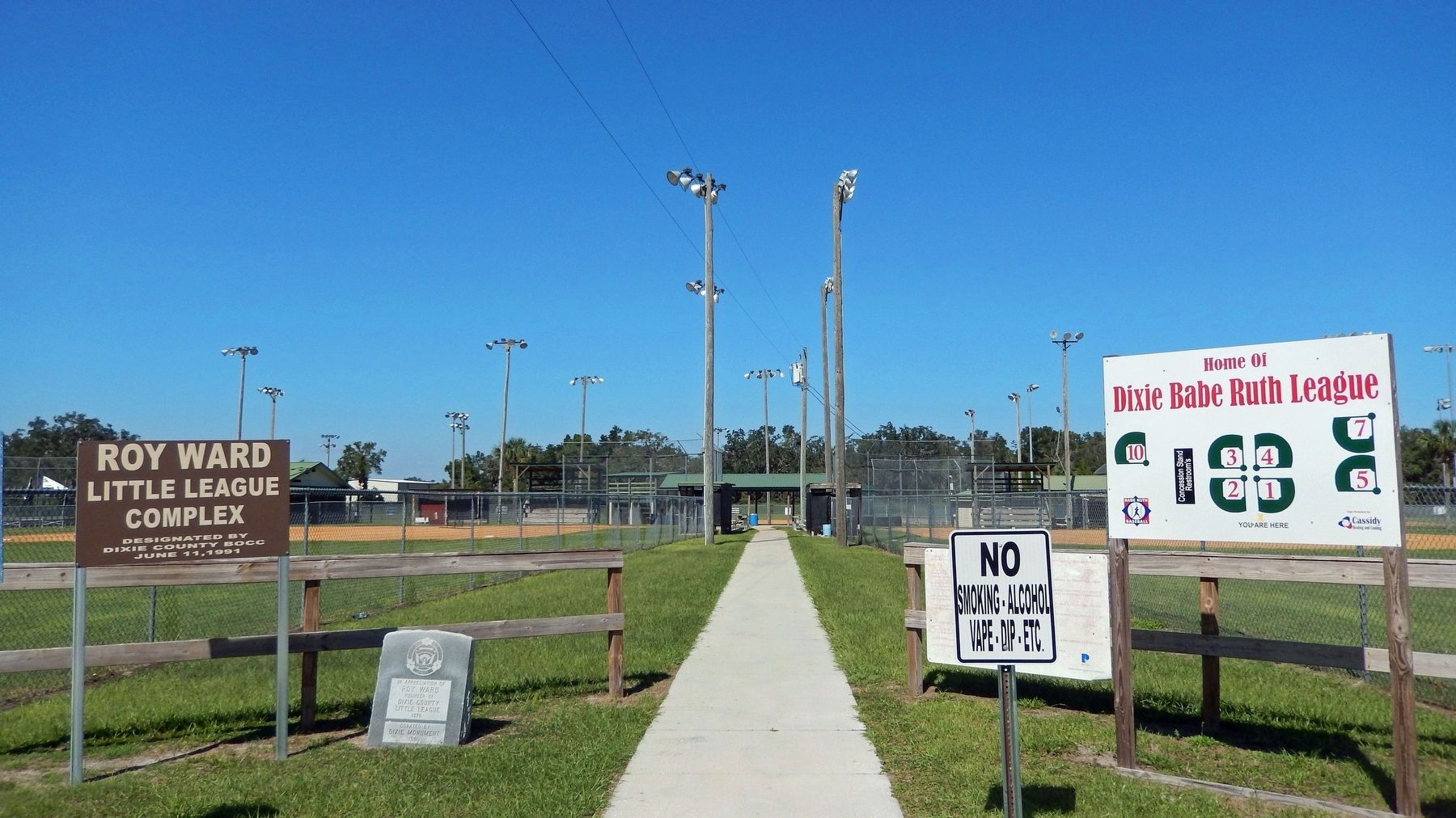
On U.S. 19 0.1 miles west of Northeast 223rd Avenue (County Road 351A), on the right when traveling north.
Putnam Lodge, built in 1927-28 by the Putnam Lumber Company, is part of a bygone era in Florida's forestry history. Here, beside the old Dixie Highway, Putnam Lodge, part of the "company town" of Shamrock, accommodated tourists, transients and . . . — — Map (db m77791) HM
On Northeast 106th Street at Northeast 216th Avenue, on the right when traveling north on Northeast 106th Street.
This church, built in 1929, was originally a wood-framed structure and the first church erected in the African-American community of Cross City. The architectural character was retained when it was remodeled and enlarged in 1942. The hand-made . . . — — Map (db m67597) HM WM
On County Road 351 2.4 miles north of 1st St, Horseshoe Beach, on the left when traveling south.
On December 26, 1817, U.S. Secretary of War John C. Calhoun directed General Andrew Jackson to protect citizens trying to settle in Florida. Jackson arrived in Florida with the largest army ever to invade the state to date -- 2,000 Creek Warriors . . . — — Map (db m61566) HM
On State Road 349 0.6 miles north of Pine Crest Drive, on the left when traveling north.
The Fletcher Community was established when Dixie County was part of Lafayette County and both were part of their parent county, Madison. In the early 1850s Fletcher families and other families emigrated south from the Carolinas through Georgia, . . . — — Map (db m67595) HM
On County Route 55A at County Route 349, on the right when traveling east on County Route 55A.
On April 1, 1899, Orren Y. Felton and his wife, Lille F. Felton, gave deed to the Board of Public Instruction for Old Town School. On May 23, 1911, Ruby E. Chaires and her husband McQueen Chaires gave additional deed to the Board of Public . . . — — Map (db m165868) HM
On U.S. 19 at State Road 349, on the right when traveling west on U.S. 19.
Inhabited by the Upper Creeks, Oldtown, often called Suwanee Oldtown, was one of the largest Indian villages in northern Florida. In Andrew Jackson's punitive expedition into Florida in April, 1818, Oldtown was captured. Most of the renegade Indians . . . — — Map (db m17712) HM
Near County Route 349 just east of Canal Street(Southeast 199th Street).
Captain Francis Langhorne Dade, U.S. Army and his 120-man Companies A,B,D,H and N, built Fort Duval in November 1826 at the mouth of the Suwannee River. The structure was 140 by 130 feet and six feet high with portholes for firing. The fort was . . . — — Map (db m167492) HM
About 3 miles up river from here the sunken remains of the "City of Hawkinsville" lie on the bottom of the Suwannee River at Old Town landing. The "City of Hawkinsville" was brought to the Suwannee River in 1900 as a vessel employed in the timber . . . — — Map (db m245245) HM
Near U.S. 19 at Kentucky Avenue, on the right when traveling west.
Fort Fanning was built in 1838 during the Second Seminole War.
The fort was originally called "Palmetto", but was renamed in honor of Colonel Alexander Campbell Wilder Fannin (1788-1846).
Made of real wood, and situated in warm humid . . . — — Map (db m67884) HM
On North Main Street (U.S. 129) south of Northwest 5th Avenue, on the right when traveling south.
The Coca Cola bottling plant is located next to the Crystal Ice House and the old railway depot in the heart of historic downtown Trenton. It was originally built by Mr. J. F. Haigler in 1925. In 1956 the Florida Coca-Cola Company of Daytona Beach . . . — — Map (db m126397) HM
On Southeast 1st Avenue just east of South Main Street (U.S. 129), on the left when traveling west.
[south side] This monument is dedicated to the memory of those Confederate Veterans from the western part of Alachua County that became Gilchrist County in 1925 [east side] This monument is dedicated to . . . — — Map (db m298992) WM
On South Main Street (U.S. 129) just south of Southeast 1st Avenue, on the right when traveling north.
On behalf of the Gilchrist County Board Of County Commissioners and the Citizens Of Gilchrist County, this building is dedicated in the memory of John Franklin Beach, Sr. for his lifelong commitment to his church and his community, through the . . . — — Map (db m153203) HM
On Northwest 4th Avenue east of Northwest 1st Street, on the left when traveling east.
Originally the old Crystal Ice and Cold Storage Building was built by Clyde Townsend's father in 1925, before being bought by “J.F.” Haigler, owner of the Coca Cola franchise in Trenton. During many a day, Mr. Haigler would sit in a . . . — — Map (db m126400) HM
On North Main Street (U.S. 129) south of Northwest 5th Avenue, on the right when traveling south.
The Mariner's Compass pattern is one of the earliest quilt patterns. “Trenton's Compass Rose” is a variation that was designed by Stephanie Metts to highlight the City of Trenton's leadership in creating Florida's first quilt trail. The . . . — — Map (db m126489) HM
On Central Avenue SE at 5th Street SE, on the right when traveling north on Central Avenue SE.
First Methodist Church
of Jasper
Built 1878
Placed on National Register of
Historical Places September 29, 1978
Presented by Hamilton County Historical Society — — Map (db m123253) HM
On Hatley Street (U.S. 41/129) at Central Avenue Northwest, on the left when traveling east on Hatley Street.
After the Civil War began in 1861, it became critical for the Confederacy to have north and south running railroads to connect existing Florida and Georgia lines to bypass Union blockades at Florida ports. The Confederate government ordered . . . — — Map (db m96933) HM
On U.S. 41/129 just south of Chan Bridge Drive (15th Avenue Northwest), on the left when traveling south.
Warren Alford — US Army • Jack A. Buckles — US Army • Booker T. Bryant Jr. — US Army • Willie F. Cato — US Army • Arlester Cole — US Army • James A. Eatmon — US Navy • Joseph W. Goodbread — US Army • Obie R. Harris — US Navy • Dwight M. Hewitt — US . . . — — Map (db m234507) HM WM
On U.S. 41 1.1 miles north of Oak Street (Northwest 9th Street), on the left when traveling north.
Dedicated to the memory of Michael McKenzie Smith Member State Road Department of Florida 1915-1919, Chairman 1919-1920 Born Dec. 20, 1863 Tattnall County Georgia Died July 6, 1929 Winter Park, Florida ————— He visioned and created a . . . — — Map (db m234449) HM
Near Lillian Saunders Drive at Foster Barnes Drive, on the right when traveling south.
In the Upper Suwannee River Valley folks continue to make items for decorative and daily use. As local quilter Nancy Morgan says, "There's an art to everything you do." From christening dresses to gourd birdhouses, handmade items reflect the values, . . . — — Map (db m230356) HM
Near Lillian Saunders Drive at Foster Barnes Drive, on the left when traveling south.
Stephen Collins Foster (July 4, 1826-January 13, 1864), supposedly never laid eyes on the dark, tannic waters of the Suwanee River that he immortalized in his 1851 composition "Old Folks at Home", but when he took his pen and shortened the three . . . — — Map (db m230258) HM
On Spring Street (U.S. 41) east of Bridge Street, on the left when traveling east.
Native Americans grew crops for their own consumption for
generations before white settlers immigrated here in the 1830s
seeking farmland, fortunes, and homesteads.
Farmers found the soil rich and the climate favorable for
growing the famous . . . — — Map (db m146344) HM
Near Lillian Saunders Drive just south of Stephen Foster Drive, on the left when traveling south.
Commemorating the Organization of the Second Girl Scout Troop in America by Juliette Gordon Low in White Springs, Florida March 1912. — — Map (db m298999) HM
On River Street east of Bridge Street (State Road 136), on the right when traveling east.
From the Native Americans who first sought the healing sulphur waters of the spring, to the present-day travelers who enjoy the wide variety of recreational opportunities along the Suwannee River and the historical significance of the Town of White . . . — — Map (db m44591) HM
Near Lillian Saunders Drive at Foster Barnes Drive, on the right when traveling south.
Folklife is the traditional cultural expression of a community or group—foods prepared for a church potluck, games played with a neighbor, songs sung in a community, crafts passed down in a family. While many older traditions persist in the Upper . . . — — Map (db m230326) HM
Near Lillian Saunders Drive at Foster Barnes Drive, on the right when traveling south.
From homemade jellies to boiled peanuts, the heritage of the Suwannee River Valley is experienced through local foodways. For example, Chicken Pilau - a chicken and rice dish cooked over an open fire - has been a culinary tradition in Florida for . . . — — Map (db m230333) HM
Near Northwest Morrell Drive 0.5 miles north of Northwest Mansfield Drive.
The Bishops had a great love for Florida and its beautiful rivers. Senator Bishop was a conservationist and farmer. While in the Florida senate he was a key figure in the establishment of the Ichetucknee Springs State Park. Virginia Bishop was a . . . — — Map (db m210075) HM
Near Southeast 94th Street 1 mile east of County Route 135.
Late in the 19th century the Godwin Bridge was built to span the river for both residential and commercial transportation (such as logging, cotton, and turpentine industries) to connect Hamilton and Columbia Counties. Floods swept the bridge away . . . — — Map (db m239390) HM
On Camp Street just west of Roberts Street (Florida Route 100) (U.S. 41), on the right when traveling west.
Human inhabitants of this area found bountiful resources with which to build themselves shelters. Palmettos made roofs, trees were fashioned into log walls, native limestone formed sturdy foundations, and the semi-tropical climate precluded the need . . . — — Map (db m172316) HM
On Bridge Street (State Road 136) north of River Street, on the right when traveling north.
Florida's native Timucuan Indians lived for hundreds of generations in what is now north Florida and southeast Georgia. Beginning in the 1580s, they were organized into mission villages by Spanish Franciscan priests. While exploitation and . . . — — Map (db m44609) HM
Near Lillian Saunders Drive at Foster Barnes Drive, on the right when traveling south.
Each person is an archive of memories, knowledge and skills. As traditions pass from one generation to another, they transform and take on new meaning. Some old ways of life fall out of practice, while others are made new again. From building quail . . . — — Map (db m230341) HM
On Spring Street (U.S. 41) east of Wesson Street, on the right when traveling east.
Although residents living here have always been somewhat insulated, outside influences such as war and conflict have historically influenced the Town of White Springs. The Spanish, French, British, and Americans all fought wars to own the peninsula . . . — — Map (db m44512) HM
On Bridge Street south of Spring Street (U.S. 41), on the right when traveling south.
Sulphur deposits in the
limestone layers of the
aquifer system in the
northern stretches of the
Suwannee River cause
Florida's historic White Springs to
discharge mineral water" containing
hydrogen sulfide gas and sulfate. As a
result, . . . — — Map (db m146348) HM
On U.S. 41 (Local Road 25) just east of Wesson Street, on the right when traveling east.
These sulphur springs were thought to have medicinal properties and were considered sacred by the Indians. Warriors wounded in battle reputedly were not attacked when they came here to recuperate. Settlers moved into the vicinity in 1826 and the . . . — — Map (db m13675) HM
On Spring Street (U.S. 41) west of Bridge Street (State Road 136), on the left when traveling west.
White Sulphur Springs was once a popular health resort, attracting large numbers of people to drink the water and bathe in the spring. This structure encircles a natural spring that was thought to possess great healing qualities. An early . . . — — Map (db m44610) HM
On South Jefferson Street (U.S. 19) 0.5 miles north of Apalachee Parkway (U.S. 27), on the right when traveling north.
This excellent example of a "Carpenter Classic" style farmhouse was probably built c. 1836 for Burwell McBride shortly after he moved to Jefferson County from South Carolina. He was the grandfather of Margaret McBride who married Asa May, a wealthy . . . — — Map (db m126389) HM
On Ashville Highway (County Route 146) at Livingston Road, on the left when traveling east on Ashville Highway.
Livingston Place, a former Antebellum cotton plantation, is located in the heart of the Red Hills, a distinct American landscape of large wild quail hunting preserves rich in natural and cultural resources. From 1926 to 1994, this land was the . . . — — Map (db m264338) HM
On West Capps Highway (U.S. 27) north of County Road 257, on the right when traveling south.
Lamont began existence in 1848 when a U.S. post office was established at Beasley's Store which also served as a horse changing station on the stagecoach line between Tallahassee and St. Augustine. After the Civil War, the small settlement that had . . . — — Map (db m127036) HM
Near West Washington Street (Florida Route 10) at North Hickory Street.
In honor of the Confederate
Soldiers of Jefferson County
and the south land who
who served the South and the
Confederate States of
America from 1861-1865.
Donated by the Sons of the
Confederate Veterans, Major . . . — — Map (db m239653) WM
On West Washington Street west of Mahan Drive, on the right when traveling west.
It’s October 3, 1539…
Hernando de Soto’s army has crossed a large swamp to the east of here and is attacked by Apalachee warriors –
Our cavalry proved useless against this attack, as the trails are too narrow. We were forced to . . . — — Map (db m126590) HM
Near Sunray Road 0.6 miles south of Mahan Drive (U.S. 90), on the right when traveling south.
Archaeologists have many types of tools for unearthing the story of human cultures. Between 2002 and 2005, archaeologists conducted several digs at Letchworth-Love Mounds Archaeological State Park. They used a variety of methods to learn about the . . . — — Map (db m153300) HM
On Groover Road (County Road 6) at Rains Road, on the right when traveling north on Groover Road. Reported missing.
The Elizabeth School, a three-room, vernacular shingle-clad building, was a school for Black students on Groover Road in 1938 and was funded by parents and the Works Progress Administration (WPA). Miles Edward Groover (1887-1966) and his wife, Daisy . . . — — Map (db m67601) HM
On West Washington Street (U.S. 90) 0.1 miles west of Mahan Drive, on the right when traveling west.
In recognition of Platoon Sergeant Ernest I. Thomas U.S.M.C.R. who, on February 23, 1945, led his platoon to raise the first flag on Iwo Jima, the first Japanese territory taken in World War II. On March 3rd, eight days after the first flag . . . — — Map (db m62109) WM
Near Interstate 10 9 miles east of Route 257, on the right when traveling east.
The light of freedom still burns brightly in our world today because
of the service and sacrifice of America’s men and women in uniform.
Our Nation’s servicemen and women have fought the forces of tyranny and
won victories for liberty, . . . — — Map (db m154514) WM
Near Interstate 10 9 miles west of Route 150, on the right when traveling west.
The light of freedom still burns brightly in our world today because
of the service and sacrifice of America’s men and women in uniform.
Our Nation’s servicemen and women have fought the forces of tyranny and won victories for liberty, . . . — — Map (db m154516) WM
On 2nd Street at Park Avenue, on the right when traveling east on 2nd Street.
This historic marker recognizes Howard Academy Elementary/Junior High School, which eventually became Howard Academy High School. In 1957, the first phase of Howard Academy Elementary and Junior High School was constructed on Second Street. The . . . — — Map (db m67639) HM
On Mamie Scott Drive north of Cypress Street, on the left when traveling north.
Howard Academy High School's Building 1 opened on Chestnut Street in 1936 with one structure containing several classrooms. In 1940, a similar, second building was constructed and financed by the county, parents and The Julius Rosenwald Fund. . . . — — Map (db m67656) HM
On Jefferson Street (Courthouse Circle) (U.S. 19) at Washington Street (U.S. 90), on the left when traveling north on Jefferson Street (Courthouse Circle).
(front/north side)
Erected 1899 by the Ladies’ Memorial
Association of Jefferson County Fla.
Our Fallen Heros
(west side)
Let this testimonial of Woman’s deathless fidelity to Man’s imperishable valor speak to the sons . . . — — Map (db m126495) WM
On West Washington Street (Florida Route 10) at South Water Street, on the left when traveling west on West Washington Street.
Jefferson County High School
Erected 1852
Charter Granted in 1852 by Legislative Council
First brick school building constructed in state
Bricks made on George Taylor Plantation
Building constructed by Samuel Carroll with slave . . . — — Map (db m239585) HM
On Jefferson Street (Courthouse Circle) (U.S. 19) at Washington Street (U.S. 90), on the left when traveling north on Jefferson Street (Courthouse Circle).
When Florida’s Territorial Legislative Council established Jefferson County in January, 1827, settlers from the seaboard states already had begun to develop cotton plantations in this area. In December, 1827, the county seat received the name . . . — — Map (db m126297) HM
Near Sunray Road 0.6 miles south of Mahan Drive (U.S. 90), on the right when traveling south.
If you were able to travel back in time over 1,100 years to the peak period of the Weeden Island civilization, you would witness the construction of one of the greatest feats of American Indian architecture in the region now known as Florida. You . . . — — Map (db m153298) HM
Near Sunray Road 0.6 miles south of Mahan Drive (U.S. 90), on the right when traveling south.
Cultures throughout history left their mark through art. Come and explore the art of architecture from an earlier time and culture here at Letchworth-Love Mounds Archaeological State Park. Constructed between 1,800 and 1,100 years ago by the Weeden . . . — — Map (db m153296) HM
On Interstate 10, on the right when traveling west.
Named for President Thomas Jefferson, Jefferson County is home to the Monticello courthouse and opera house. Monticello's 1909 courthouse remains Florida's last historic courthouse square model still in active use. Surrounded by antebellum homes, . . . — — Map (db m293070) HM
On Walnut Street at North Olive street, on the left when traveling east on Walnut Street.
This church was on the Leon Circuit, Tallahassee District, South Carolina Conference of the Methodist Episcopal Church in 1828.
Adam Wirick, a minister on the Leon Circuit, from 1828 to 1832, “located” in Monticello and his name heads the . . . — — Map (db m239560) HM
On Boston Highway (County Road 149) 1.2 miles north of Fulford Road, on the left when traveling north.
The Olive Baptist Church was begun in 1831, and at that time the property was in the state of Georgia. In 1872 the U.S. Congress designated this land to be a part of Florida. On Tuesday, November 22, 1853, in the Eleventh Annual Session of the . . . — — Map (db m110980) HM
On West Washington Street (U.S. 90) at Jefferson Street (Courthouse Circle) (U.S. 19), on the right when traveling east on West Washington Street.
A Landmark of American Music
Perkins Opera House
Erected in 1890 by John H. Perkins, a Monticello merchant and patron of the theatre. Touring theatrical, musical and community performances were presented until 1928. The upstairs auditorium . . . — — Map (db m126298) HM
On East Washington Street (U.S. 90) 0.1 miles east of North Marvin Street, on the right when traveling west.
Built in 1890, John Howard Girardeau and his wife, Agnes, constructed this Folk Victorian style house for their large family on 11 children. It faces north toward Dogwood Street. Girardeau planted 46 oaks along the street, which provided a grand . . . — — Map (db m200398) HM
Near Sunray Road 0.6 miles south of Mahan Drive (U.S. 90), on the right when traveling south.
Believe it or not, the discovery of the Great Mound was like finding a needle in a haystack. Although archaeologists began searching for the mound as early as the 1930s, and some even found the site, it was not officially recorded until 1975. The . . . — — Map (db m153299) HM
Near Sunray Road 0.6 miles south of Mahan Drive (U.S. 90), on the right when traveling south.
Imagine standing in this spot over 1,100 years ago. Surrounding you would be a large architectural complex, complete with ten small mounds, two cleared plazas and the Great Mound, with its platforms, earthen ramp and pyramid-like peak. While form . . . — — Map (db m153297) HM
On North Jefferson Street (U.S. 19) south of West Pearl Street, on the right when traveling south.
Jefferson County became Territorial Florida's 13th county in January, 1827. In December of that year, the town of Monticello, named in honor of Thomas Jefferson's famous Virginia home, was laid out and lots began to be sold. During the 1830s and . . . — — Map (db m126300) HM
On Methodist Church Road 0.1 miles east of Waukeenah Highway (County Road 259), on the right when traveling east.
175th Anniversary of the Waukeenah
United Methodist Church
In the year 1837, the Waukeenah United Methodist Church was
established. It began as the Waukeenah Methodist Episcopal
Church. The story of the Waukeenah United Methodist Church . . . — — Map (db m136051) HM
On West Main Street (U.S. 27) at Monroe Street, on the right when traveling west on West Main Street.
Lafayette County was created December 23, 1856, from Madison County. The county was named in honor of the Marquis de Lafayette, the French citizen who rendered invaluable assistance to the Colonies during the Revolutionary War. The famed Suwannee . . . — — Map (db m17725) HM
On West Main Street (U.S. 27) west of North Fletcher Avenue (State Road 51), on the right when traveling west.
Established in 1874 by John B. Whitfield, Mayo was named in honor of James M. Mayo, a colonel in the Confederate Army and father of Nathan Mayo, who served as State Commissioner of Agriculture from 1923 to 1960. Mayo became the county seat of . . . — — Map (db m132099) HM
On Blountstown Highway (State Road 20) 0.1 miles Five By Five Drive, on the right when traveling east.
Fort Braden was established in 1839 as a military outpost during the Second Seminole War (1835-1842). At the end of the war the fort was abandoned, but the small farming community that had developed nearby continued. A school in the Fort Braden area . . . — — Map (db m79475) HM
On Veterans Memorial Drive (Florida Route 59) 0.1 miles south of Moccasin Gap Road ( Route 142), on the left when traveling south.
Miccosukee United Methodist Church has been placed on the National Register of Historic Places by the United States Department of the Interior Est. 1828 — Built 1876 — — Map (db m172646) HM
On Veterans Memorial Road (County Route 59) at Cromartie Road (County Route 151), on the right when traveling north on Veterans Memorial Road.
In 1778 the British mapped this once thriving community, originally called Mikasuki, with sixty houses, a square, 28 families and 70 gunmen. The village was first settled by Native Americans of Creek descent who were often in armed conflict with . . . — — Map (db m167466) HM
On South Monroe Street 0.1 miles south of East Paul Russell Road, on the right when traveling north.
Throughout the 1950s-1970s, large-scale, nonviolent demonstrations by audacious students attending Florida Agricultural and Mechanical University (FAMU), Florida State University, and the University of Florida, as well as local high school . . . — — Map (db m135553) HM
Near Stadium Drive (Florida Route 366) just south of West Pensacola Street, on the right when traveling north.
The Moore Family Trust presents this plaque to the Florida State University to honor the achievements of the 1993 National Championship Football Team FSU 42 — Kansas 0 FSU 45 — Duke 7 FSU 57 — Clemson 0 FSU 33 — N. Carolina 7 FSU 51 — Georgia Tech 0 . . . — — Map (db m269997) HM
Near Stadium Drive (Florida Route 366) just south of West Pensacola Street, on the right when traveling north.
The Moore Family Trust presents this plaque to the Florida State University to honor the achievements of the 1999 National Championship Football Team FSU 41 — Louisiana Tech 7 FSU 41 — Georgia Tech 35 FSU 42 — NC State 11 FSU 42 — N. Carolina 10 FSU . . . — — Map (db m269998) HM
Near Stadium Drive (Florida Route 366) just south of West Pensacola Street, on the right when traveling north.
The Coyle Moore Family Trust honors the Florida State University and the achievements of the 2013 Atlantic Coast Conference Championship and National Championship Football Team FSU 41 — Pittsburgh 13 FSU 62 — Nevada 7 FSU 54 — Bethune-Cookman 6 FSU . . . — — Map (db m269999) HM
On Easterwood Drive 0.2 miles east of Weems Road, on the left when traveling east.
2977 Total Victims
19 Hijackers
2753 Killed In And Around WTC
183 Killed in Action At The Pentagon
40 Killed IN Pennsylvania
343 Firefighters Killed
71 Law Enforcement Killed
8 Emergency Medical Services Killed
55 Military . . . — — Map (db m310952) HM
Near West Tennessee Street at Ocala Road, on the right when traveling west.
Daily life for Spaniards at San Luis was not unlike that in other Hispanic communities. Shoemakers and tailors plied their trades. Off-duty soldiers drank wine, played at cards or dice, and stringed guitars or similar stringed instruments known as . . . — — Map (db m239318) HM
The Apalachee ball game was an integral part of native life. The game was dedicated to the native gods of rain and thunder and was played to ensure rain for crops.
The game involved 50 or more players and was quite violent, sometimes . . . — — Map (db m239526) HM
Near South Gadsden Street at East Gaines Street, on the left when traveling south.
Defeating segregation took years of sustained struggle. A federal court ordered the integration of Leon County's public schools in 1967 more than 10 years after the local civil rights movement began. The legacy of those who fought for justice . . . — — Map (db m230698) HM
In 1656, the Spaniards chose this hilltop because of its clear view of the countryside. A powerful Apalachee chief offered to build a blockhouse for the Spanish military garrison and moved his village to San Luis. The blockhouse added a formal . . . — — Map (db m239259) HM
Julian Edwin "Cannonball" Adderley (1928-1975)
Nathaniel Carlyle "Nat" Adderley (1931-2000)
Brothers Cannonball Adderley (alto saxophone) and Nat Adderley (cornet) were two of the most important jazz musicians in history. Born . . . — — Map (db m230644) HM
Near West Tennessee Street at Ocala Road, on the right when traveling south.
The Apalachee were a matrilineal society. Inheritance and authority were passed down through the mother's family. Related groups were also combined into clans with each member belonging to the mother's clan. After marriage, the husband relocated to . . . — — Map (db m239379) HM
Near West Tennessee Street at Ocala Road, on the right when traveling south.
The dwelling frame to your right represents the shape and size of a typical Apalachee home. Although the Apalachee were skilled carpenters, their own dwellings were relatively simple. Most activities were conducted outside, with homes reserved for . . . — — Map (db m239388) HM
Near West Tennessee Street at Ocala Road, on the right when traveling west.
Living on the hilltop where the plaza and public buildings were located was an honor most likely reserved for the village's leaders. They attended daily meetings in a council house where community affairs were discussed and planned.
By . . . — — Map (db m239272) HM
Near West Tennessee Street at Ocala Road, on the right when traveling south.
Apalachee militias provided the bulk of the province's military power. Apalachee received training in the use of firearms from Spaniards. They served as sentries, some held military titles, and they always outnumbered Spanish soldiers on raids. . . . — — Map (db m239355) HM
On Natural Bridge Road, on the right when traveling west.
Site of decisive repulse of Federal forces by Confederate Militia in joint U.S. Army and Navy Operation to take St. Marks. The Army landing at lighthouse was prevented from getting to rear of St. Marks by Confederate opposition at Newport and . . . — — Map (db m13721) HM
On Woodville Highway (Florida Route 363) at McNeil Boulevard, on the left when traveling north on Woodville Highway.
In the early 1800s, wealthy Tallahasseans traveled to the mountains of
Tennessee, the Carolinas, and Georgia during the summer. When the Panic
of 1837 caused a national economic depression that resulted in the decline
of Tallahassee's Union . . . — — Map (db m270488) HM
Near Stadium Drive (Florida Route 366) south of West Pensacola Street, on the left when traveling south.
Bernard F. Sliger President 1977-1991 Bernard F. “Bernie” Sliger served as FSU president from 1977 to 1991. In 1993 he returned to the helm as interim president and served in that capacity until 1994. During Sliger’s tenure, student . . . — — Map (db m187599) HM
Near Lake Ella Drive east of Legion Street, on the right when traveling east.
In 1947, an American "Friendship Train" traveled around the United States collecting large amounts of food and supplies from donors for transport to the people of France and Italy. These countries were hit the hardest during WWII and in desperate . . . — — Map (db m211149) HM WM
Near South Martin Luther King Jr Boulevard just south of Gamble Street.
Built in 1908 with funds donated by industrialist and philanthropist Andrew Carnegie, this was the first Carnegie Library built on a Black Land-Grant college campus. Nathan Young, President of the State Normal College for Colored Students, with . . . — — Map (db m207495) HM
Near South Gadsden Street at East Bloxham Street, on the left when traveling south.
This waterfall celebrates the location of the Florida State Capital in October 1823 by Dr. William H. Simmons of St. Augustine and John Lee Williams of Pensacola. These men were commissioned by Governor William P. Duval to find a compromise location . . . — — Map (db m230632) HM
On South Adams Street at West Van Buren Street, on the right when traveling north on South Adams Street.
In 1915, construction began on the Dixie Highway system that linked Florida with the Midwest via highways running from Michigan through Tallahassee along Old St. Augustine Road toward Miami. In the 1920s, the number of auto tourists visiting Florida . . . — — Map (db m100888) HM
The introduction of Catholicism to the Apalachee at San Luis brought fundamental changes. From marriage to funeral practices, holidays to education, the church influenced nearly every aspect of daily life.
Throughout the day, the church bells . . . — — Map (db m239520) HM
Near Natural Bridge Road 6 miles east of Woodville Highway (State Highway 363), on the left when traveling east.
“Colonel Scott proceeded to place the troops in line… In the early dawn the enemy advanced in force across the pass, firing rapidly, but after a short contest were driven back by a mingled fire of musketry and canister.” ”During . . . — — Map (db m157202) HM
On Natural Bridge Road 6 miles east of Woodville Highway (State Highway 363), on the left when traveling east.
(south)In Loving Memory 1861-1865 Defenders of Natural Bridge Lest We Forget (east) This monument erected under authority of an act of the legislature of Florida of 1921 as a just tribute of the people of Florida to commemorate the . . . — — Map (db m157200) HM WM
Near West Pensacola Street (State Road 366) near Appleyard Drive, on the right when traveling west.
In October 1940, hundreds of laborers began clearing swampland for temporary quarters for Dale Mabry Army Air Base, named in honor of a young Tallahassee dirigible pilot who died in 1922 after serving in World War I. In 1941, America entered World . . . — — Map (db m79561) HM
On West Call Street just east of Murphree Street, on the left when traveling east.
Dale W. Lick served as president of Florida State University from 1991 to 1994. He led the implementation of the first Capital Campaign at FSU; construction of the University Center, National High Magnetic Field Laboratory and FSU London Study . . . — — Map (db m173933) HM
Near Learning Way 0.2 miles east of Varsity Drive.
Dr. J. Stanley Marshall came to Florida State University in 1958 from the State University of New York at Cortland, where he held a professorship in physics. His first assignment was to establish a department of science education and to design . . . — — Map (db m173868) HM
Near West Call Street east of Stadium Drive, on the right when traveling east.
Dr. John Gorrie designed a refrigeration machine to treat malaria and yellow fever patients in Apalachicola. He received the first U.S. patent for mechanical refrigeration in 1851. Artist: Steven Weitzman Year: Completed 2006 Medium: Terrazzo . . . — — Map (db m173776) HM
On Martin Luther King Jr Boulevard south of West Georgia Street, on the right when traveling south.
“If you can’t fly then run, then walk, if you can’t walk then crawl, but whatever you do you have to keep moving forward.” —Dr. Martin Luther King, Jr.
In 1952, Reverend Charles Kenzie "C.K." Steele moved with his family . . . — — Map (db m230426) HM
On South Martin Luther King Jr Boulevard at FAMU Way, on the right when traveling south on South Martin Luther King Jr Boulevard.
"Freedom is never voluntarily given by the oppressor; it must be demanded by the oppressed." -Dr. Martin Luther King, Jr.
Dr. Martin Luther King, Jr. (1929 - 1968) was an African American Baptist minister, activist, . . . — — Map (db m230574) HM
On East Seventh Avenue at Martin Luther King,Jr. Boulevard, on the right when traveling west on East Seventh Avenue.
"The function of education is to teach one to think intensively and to think critically. Intelligence plus character - that is the goal of true education." - Dr. Martin Luther King, Jr.
Where We Are
The Levy Park neighborhood was built . . . — — Map (db m245734) HM
Near West Call Street east of Stadium Drive, on the right when traveling east.
In 1849, Elizabeth Blackwell became the first woman to graduate from medical school in the U.S. She faced adversity throughout her career, leading the way to diversity in medical practice today. Artist: Steven Weitzman Year: Completed 2006 Medium: . . . — — Map (db m173775) HM
769 entries matched your criteria. Entries 301 through 400 are listed above. ⊲ Previous 100 — Next 100 ⊳