By Duane and Tracy Marsteller, February 25, 2023
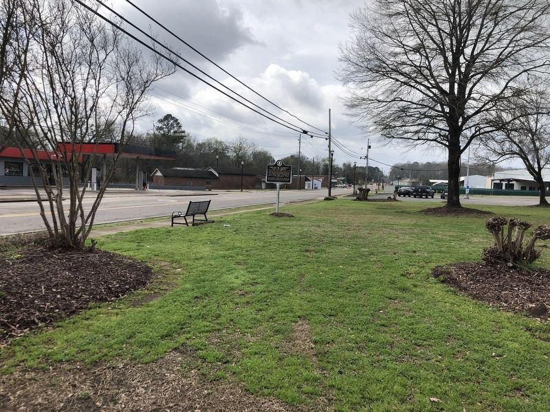
Proven by Tempest: City of Brent Marker
| On Main Street (Alabama Route 25) at 1st Street, on the right when traveling south on Main Street. |
| On Montevallo Road (State Highway 25) at County Road 62, on the left when traveling west on Montevallo Road. |
| On Furnace Road (County Road 62) south of Montevallo Road (State Route 25). |
| On Montevallo Road (State Highway 25) at County Road 62, on the left when traveling west on Montevallo Road. |
| Near State Park Road south of Furnace Road (County Route 62), on the right when traveling south. |
| On Alabama Route 139 0.2 miles north of Cornelia Road, on the right when traveling south. |
| On Alabama 25 at Abbey Lane, on the right when traveling north on Alabama 25. |
| On State Park Road south of Furnace Road (County Road 62), on the left when traveling south. |
| Near Mill Street 0.2 miles south of Walnut Street (State Route 25), on the right when traveling south. |
| On Chestnut Street 0.1 miles east of SW Davidson Drive, on the right when traveling east. |
| On Sixmile School Road south of Montevallo Road (State Highway 25), on the right when traveling south. |
| On Montevallo Road (State Highway 25) at Six Mile School Road, on the left when traveling west on Montevallo Road. |
| On Cahaba River Drive (County Road 24), on the right when traveling north. |
| On Blocton Bypass (County Road 24) 0.1 miles east of Primitive Ridge Road, on the left when traveling east. |
| On Cahaba River Drive (County Road 24) at Piper Road, on the right when traveling south on Cahaba River Drive. |
| Near Blocton Bypass (County Road 24) west of Griffin Town Road, on the right when traveling west. |
| Near Blocton Bypass (County Road 24) west of Griffin Town Road, on the right when traveling west. |
| On Main Street at Walter Owens Drive, on the left when traveling east on Main Street. |
| Near Blocton Bypass (County Road 24) west of Griffin Town Road, on the right when traveling west. |
| On Alabama Route 5, on the right. |
| On U.S. 31 at County Road 7, on the right when traveling north on U.S. 31. |
| On Local Road 26 at Dunn Lane, on the right when traveling east on Local Road 26. |
| On Main Street (U.S. 231) at Lee Street West, on the left when traveling north on Main Street. |
| On Lee Street (County Road 26), on the right when traveling west. |
| On College Street at Church Street, on the right when traveling north on College Street. |
| On Local Road 26 at Dunn Lane, on the right when traveling east on Local Road 26. |
| On Main Street (U.S. 231) 0.1 miles east of Bailey Street, on the right when traveling south. |
| On Main Street (U.S. 231) north of Bailey Street, on the right when traveling south. Reported permanently removed. |
| Near Main Street South (U.S. 231) at Lee Street, on the right when traveling south. |
| On Dallas Loop Road 0.1 miles north of Highway 79, on the left when traveling north. |
| On County Route 27 at Fred Young Road, on the right when traveling south on County Route 27. |
| On State Highway 79 at Hornet Drive, on the right when traveling south on State Highway 79. |
| On Town Hall Road, on the left when traveling east. |
| On Alabama Route 160 at Nectar Bridge Road, on the right when traveling north on Alabama Route 160. |
| On County Route 20, on the left when traveling north. |
| On County Road 36 0.1 miles north of New Home Church Road, on the right when traveling north. |
| On Second Avenue East (US Highway 231) at 4th Street North, on the right when traveling west on Second Avenue East (US Highway 231). |
| On 6th Street South (U.S. 231) at Champion Road, on the right on 6th Street South. |
| On 2nd Street South 0.2 miles south of Highway 75, on the right when traveling south. |
| On Sand Valley Road 0.3 miles north of U.S. 231, on the left when traveling north. |
| On Ingram Avenue East at 2nd Street South, on the right when traveling east on Ingram Avenue East. |
| On Alabama Route 75, on the left when traveling north. |
| On U.S. 29 just north of Twin Trail, on the right when traveling south. |
| On Alabama Route 239 0.4 miles south of U.S. 29, on the right when traveling south. |
| On County Route 19, on the right when traveling south. |
| On U.S. 29 at County Road 19, on the right when traveling south on U.S. 29. |
| On Fitzpatrick Road 0.5 miles north of Route 110, on the right when traveling north. |
| On Old Broadway Street (U.S. 82) at Main Street, on the right when traveling west on Old Broadway Street. |
| On Old Troy Road, on the left when traveling west. |
| On Old Broadway Street (U.S. 82) at State Route 51, on the right when traveling south on Old Broadway Street. |
| On Main Street, on the right when traveling south. |
| On Enon Road just north of County Road 89, on the left when traveling north. |
| On Old Troy Road, on the left when traveling west. |
| On Railroad Street, on the right when traveling west. |
| On Railroad Street at Depot Street, on the right when traveling west on Railroad Street. |
| On U.S. 15/29 at County Road 8, on the right when traveling north on U.S. 15/29. |
| On U.S. 29, on the right when traveling south. |
| On U.S. 82 at County Road 35, on the right when traveling west on U.S. 82. |
| On North Prairie Street, on the right when traveling south. |
| On Peachburg Road (County Road 40) east of County Road 30, on the right when traveling east. |
| On Conecuh Avenue at North Prairie Street, on the right when traveling west on Conecuh Avenue. |
| On Conecuh Avenue East just east of North Prairie Street, on the right when traveling west. |
| On West Hardaway Ave at North Prairie Street, on the right when traveling west on West Hardaway Ave. |
| On County Road 14 0.1 miles east of County Road 154, on the right when traveling west. |
| On U.S. 29, on the right when traveling north. |
| On U.S. 82 near Greenwood Avenue, on the right when traveling west. Reported damaged. |
| On U.S. 82 west of Prairie Street, on the right when traveling east. |
| On County Road 14 1.3 miles west of County Road 15, on the left when traveling west. |
| On State Highway 223 at County Road 22, on the left when traveling south on State Highway 223. |
| On Blackmon Street (U.S. 82) at Prairie Street, on the right when traveling west on Blackmon Street. |
| On North Prairie Street, on the right when traveling north. |
| On Mobile Road (U.S. 31) 1.4 miles south of Solomon Hill Road (County Road 28), on the right when traveling south. |
| On Pineapple Highway (Alabama Route 10) 0.8 miles west of Bibb Road (County Road 5), on the right when traveling west. |
| On Nickquenum Road 2 miles south of Kirkville Road (County Road 75), on the left when traveling south. |
| On East Railroad Avenue at Jones Street, on the right when traveling north on East Railroad Avenue. |
| On Rose Street at West Railroad Avenue, on the right when traveling east on Rose Street. |
| On Sherling Lake Road (County Road 44) 1 mile west of Braggs Road (State Route 263), on the right when traveling west. |
| On Parmer Street at Oglesby Street, on the right when traveling east on Parmer Street. |
| On East Commerce Street (Alabama Route 10) at South Conecuh Street (County Route 45), on the left when traveling east on East Commerce Street. |
| On East Commerce Street (Alabama Route 10) at North Conecuh Street, on the left when traveling west on East Commerce Street. |
| On East Commerce Street (Alabama Route 10) at South Conecuh Street (County Route 45), on the left when traveling east on East Commerce Street. |
| Near Depot Square at Bolling Street. |
| On Ridge Road (County Road 54) at Crenshaw Road, on the right when traveling north on Ridge Road. |
| On Crenshaw Road when traveling east. |
| On South Street east of South Perry Street, on the right when traveling east. |
| On East Commerce Street (Alabama Route 10) at South Park Street, on the left when traveling west on East Commerce Street. |
| On South Park Street south of Walnut Street, on the right when traveling north. |
| On Sherling Lake Road (Road 44) 0.4 miles north of Ridge Road (County Road 54), on the right when traveling north. |
| On East Commerce Street (Alabama Route 10) at North Conecuh Street (County Route 45), on the left when traveling west on East Commerce Street. |
| On Adams Street west of South Park Street, on the right when traveling west. |
| On South Park Street at Deming Street, on the left when traveling south on South Park Street. |
| On Halso Mill Road (County Route 59) 0.1 miles south of Mt. Zion Road (County Road 65), on the left when traveling south. |
| Near Braggs Road (Alabama Route 263) 0.4 miles north of Sherling Lake Road (County Road 44), on the left when traveling north. |
| Near South Park Street north of Dunklin Street. |
| On East Commerce Street (Alabama Route 10) at Posey Street, on the right when traveling west on East Commerce Street. |
| On East Commerce Street (Alabama Route 10) west of Flowers Street, on the left when traveling west. |
| On Fort Dale Road (Alabama Route 185) 0.3 miles north of Sherling Lake Road, on the right when traveling south. |
| On East Commerce Street (Alabama Route 10), on the right when traveling east. |
| On West Commerce Street (Alabama Route 10) at Bolling Street, on the left when traveling west on West Commerce Street. |
4630 entries matched your criteria. Entries 301 through 400 are listed above.
⊲ Previous 100 —
Next 100 ⊳
