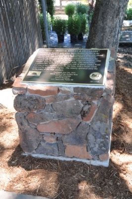
Founded by Scottish gold miner James Skinner in 1861 in the community that became known as Skinners. Strategically placed on the Pony Express Trail, the J. Skinner Native Wine and Brandy Co. was one of the first commercial vineyards in the country, . . . — — Map (db m66603) HM
This town, settled in 1848, derived its name from its crystal clear springs. Among the richest in this vicinity its diggings produced a 25 pound nugget, one of the largest in El Dorado County. Its most thriving period was in 1851. Later it became a . . . — — Map (db m10936) HM
The oldest fraternal edifice in continuous use on the West Coast. Built on this hillside, not on the main street as in the usual practice for the era. It avoided the ravages of fire which razed the town of Diamond Springs on several occasions. . . . — — Map (db m19263) HM
Erected in 1852 by
Diamond Springs Lodge No.9
I.O.O.F.
Oldest building in constant use
By the Odd Fellows in California
Dedicated to the memory of the
Pioneer Odd Fellows
Of El Dorado County by
Marguerite Parlor No.12
Native . . . — — Map (db m19264) HM
El Dorado, meaning “The Gilded One”, was first known as Mud Springs from the boggy quagmire the cattle and horses made of a nearby watering place.
Originally a important camp along the old Carson Emigrant Trail. By 1849 – 50 it . . . — — Map (db m13148) HM
Trading post, emigrant stop, and mining camp of the 1850’s. This became one of the remount stations of the Central Overland Pony Express. Here at the Nevada House on April 13, 1860, pony rider William (Sam) Hamilton changed horses while carrying . . . — — Map (db m11571) HM
Hiram Lodge No.43: Free and Accepted Masons, was chartered in the town of Mud Springs, as it was then called, May 16, 1854. The Lodge met in rented buildings until the completion of this brick edifice in 1862.
On September 17, 1923 a fire . . . — — Map (db m12396) HM
1. Mormon Island Relocation Cemetery
In the late 1940s, plans to create the Folsom Dam at the confluence of the North and South Forks of the American River meant many acres of land would be flooded, including several historic cemeteries, . . . — — Map (db m128767) HM
These historic mining towns, and other mining camps of the Gold Rush Era, now inundated by Folsom Lake, are commemorated by the Mormon Island Memorial Cemetery nearby. Here were reburied the pioneers whose graves were flooded when the lake was . . . — — Map (db m210974) HM
At this site on the old Clarksville-White Rock Emigrant Road was Mormon Tavern. Constructed in 1849, this popular stage stop was enlarged and operated by Franklin Winchell in 1851. It became a remount station of the Central Overland Pony Express and . . . — — Map (db m12056) HM
The birth of Prairie City, Sacramento County, was announced in the pages of The Sacramento Daily Union newspaper in June of 1853. Located 21 miles from the City of Sacramento, it was approximately 2 miles south of Negro Bar, now known as . . . — — Map (db m10500) HM
The Central Overland Pony Express passed this site many times. Green Valley Road was the gateway to the gold region, and was the center of activities in the 1850’s & 60’s, where many early California Inns were located. In the late 1800’s a . . . — — Map (db m11311) HM
"Camping place called [Fresh] Pond at foot of Junction Hill, very long and steep." John McTurk Gibson, Sep 7, 1859
"We got some whisky [sic] for the cattle and drank it ourselves. It is the first I have had" - John W. Powell, Sep 7, 1859 — — Map (db m212408) HM
[Three small markers are mounted on the front of the building:]
Marker 1:
Balsar House
A hotel built in 1850 by
Madam Balsar
Remodeled for an opera house in 1870. Restored by the Independent Order Odd Fellows and used as a . . . — — Map (db m54812) HM
This monument is presented in appreciation for the commitment, loyalty, leadership, service, and vision provided to the people of the Georgetown Divide by
Chief
Jack Anderson
The following are a few of his notable accomplishments prior to . . . — — Map (db m11379) HM
Founded August 7, 1849 by George Phipps and party. Nicknamed Growlersburg from the heavy nuggets that “growled” in the miners’ pans. Georgetown was the hub of an immensely rich gold area. After the disastrous fire of 1852 the old town . . . — — Map (db m57962) HM
Georgetown
Pride of the Sierras
Georgetown was founded in 1849 by George Phipps, a member of a party of sailors prospecting for gold, who first pitched his tent near the head of what is now known as Empire Canyon. George's town quickly . . . — — Map (db m54773) HM
A Military Company Was Organized
At Georgetown In August 1859, Called
The Georgetown Blues
This Is In Honor Of Them, And
Dedicated To All United States
Veterans Who Have So Honorably
Answered Their Nation’s Call To Duty
America . . . — — Map (db m55078) HM
During the 1850’s the Methodists were the first to serve in the mining towns of El Dorado County. Some ministers traveled on horseback from one mining town to another with a Bible and a Colt Revolver. Known as Georgetown Methodist Episcopal Church, . . . — — Map (db m55075) HM
This firehouse, completed in 1965, was built to replace one on the opposite side of Main Street which was inadequate to house modern equipment. Headquarters of the Georgetown Fire District, now in this building, were formerly on Church Street. — — Map (db m54929) HM
Education for children on the Georgetown Divide began with home schools for a few gold miner families in the early 1850s. The first permanent school was established in 1854, on School Street. It was replaced in 1890 by a two-story school house on . . . — — Map (db m93981) HM
This monument is dedicated to the Georgetown Volunteer Firemen past and present who have served this community for 125 years.
This bell had served as the fire alarm for many years until retired in 1965 when the new station was built. Material . . . — — Map (db m11376) HM
One and a half miles north of Georgetown sailors from Georgia established claims in 1849. General store and mining camp in 1850 which later produced by seam diggins hydraulic and flood sluicing methods. The famous Blue Rock, Pacific Beattie and . . . — — Map (db m54943) HM
John Greenwood, a trapper and guide who came to California in 1844, established a here a trading post in 1849. The mining town of Greenwood, which developed during the Gold Rush, boasted a theater, 4 hotels, 14 stores, a brewery, and 4 saloons. . . . — — Map (db m10447) HM
Built circa 1850, originally two separate buildings, it housed many businesses during the Gold Rush era including hardware and furniture stores. It survived five, 19th century fires, including an 1897 conflagration that destroyed all but the brick . . . — — Map (db m219772) HM
On December 19, 1854 just North of Georgetown above Cherokee Bar on Ruck-a-Chuky a gunfight occurred that makes the OK Corral look weak.
The Sydney Ducky Gang consisting of 5 Australians, 4 Mexicans,2 Britons,
2 Americans and a Frenchman had . . . — — Map (db m146755) HM
In May 1980 with the help of Msgr. Patrick Nolan this church was saved from being torn down and was then moved from Main Street to Buffalo Hill by the Jeepers Jamboree Committee for Preservation as a historical building of early Georgetown. . . . — — Map (db m54928) HM
On Labor Day Weekend 2004, The Dysfunctional Organization held the first "Cantina for the Con." With the sale of that first "Dysfunctional" taco, "Cantina for the Con" became an annual Labor Day event. To date, "Cantina for the Con" has raised over . . . — — Map (db m106333) HM
Historically speaking, to cross the Rubicon River meant that you had passed the point of no return. This trail was originally used by Native Americans as a trade route. In the 1800s it became the main byway from Georgetown to Lake Tahoe. The route . . . — — Map (db m105984) HM
Site of the only tea and silk farm established in California. First agricultural settlement of pioneer Japanese immigrants who arrived at Gold Hill on June 8, 1869. Despite the initial success, it failed to prosper. It marked the beginning of . . . — — Map (db m76181) HM
The first school house in Greenwood was located yards from this location. It burned down in 1855. In 1858 the Greenwood School District was established and this one room school house was built by the community. It remained open from 1859 to 1954. . . . — — Map (db m105978) HM
The youngest town acquisition of El Dorado County owes its origin to the Placerville and Sacramento Valley Railroad. They established a station for neighboring Amador County at this crossing of the roads. The town started on the completion of the . . . — — Map (db m19317) HM
Latrobe was founded in 1864, when James Miller gave the right-of-way through his property to the Placerville and Sacramento Valley Railroad. Latrobe school originated as a one room classroom, however in 1915 a fire raged through Latrobe and the . . . — — Map (db m19322) HM
The last remaining building
of the Gold Rush era Chinese community
in Old Hangtown
Stone House is famous
for its historical significance
as an old Chinese brothel
Restored by
John R. Berry – Attorney at Law
Architectural . . . — — Map (db m36815) HM
This building was used as a
post office from 1854 through
1858. Famous Norwegian skier and
mailman Snowshoe Thompson
picked up his first mail here in
1856. His courage and
perseverance conquered the
impassable winter Sierra Nevada
mountains . . . — — Map (db m193324) HM
One of the oldest preserved homes of Placerville (Old Hangtown) originally built in 1853 by Col. Fred A. Bee, pioneer merchant, and enlarged in 1889 by Judge Marcus P. Bennett, early jurist, retaining redwood ornate paneling woodwork and fireplace . . . — — Map (db m42260) HM
This fieldstone building was built by Giovanni N. Lombardo in 1872 from stones cleared to plant vineyards on the property. The lower cellar was used to produce wine for the local community. The grapes were crushed in the upper story living room and . . . — — Map (db m101534) HM
Branch Saloon Bingham’s Jewelry Seligman Building Ewing Building Collins Auto Parts Placerville Clothing
A log building owned by C.C. Williams once stood on the western portion of this lot. In 1853 thirsty miners stopped here for a drink . . . — — Map (db m69356) HM
"This is called 'Dry Diggins'...More gold has been raised (here) than in any other part of California. Here we made a final stop and unloaded our wagons & felt of a truth that we had at last reached the gold mines." - P. C. Tiffany, Aug 25, 1849 — — Map (db m212359) HM
"We decided to head for Placerville and cast out lot digging gold, and we expect to pass into this place to night....We passed...a good many cradling out gold, and we are all very enthusiastic to get started" - Albert G. Paschal, Aug 18, 1859 — — Map (db m211225) HM
"Entered Pleasant Valley in which are established several trading posts....We moved on and...descended into a valley in which is situated a few log huts & 1 tavern. This place is named Ring(g)old." James G. Shields, Aug 13, 1850 — — Map (db m211169) HM
These headstones, removed from their gravesites as a result of vandalism, were found throughout the county on roadsides and in backyards. The headstones have been given a temporary resting site, here, until their rightful places can be located. — — Map (db m13613) HM
Erected in 1860, this part of City Hall housed the Confidence Engine Company which was originally formed as The Mountaineer Engine Company. When flames engulfed most of the town in 1856, concerned citizens of Placerville realized that even the best . . . — — Map (db m35540) HM
This building was erected in the Fall of 1860 for Confidence Engine Company No.1, organized in June 1857. City government located here since 1902. — — Map (db m35546) HM
Board of Supervisors
John M. Caswell – District 1, William V.D. Johnson – District 2, Thomas M. Goodloe, Jr. – District 3, Raymond E. Lawyer, Chairman – District 4, Gerald E. Martin – District 5.
Robert Mason, . . . — — Map (db m12755) HM
Fisher’s Oasis Coffee House and Wadsworth’s Chicago Dining Saloon occupied this site from 1851- 1855. In 1853 F.A. Bee, founder of the Placerville Herald, printed his short-lived newspaper here. Early pioneer doctors, Harvey and Sholer and . . . — — Map (db m65253) HM
The antique bricks that were used on the façade of this building were originally used to build the “Dougalss – Hines” Building.
The “Douglass – Hines” Building stood where the Fountain Plaza now stands at 312 . . . — — Map (db m13144) HM
[Marker located on right planter stand on walkway of entrance to Monument:]
El Dorado County
Veterans Monument
Dedicated on Veterans Day
November 11, 2006
By
The Friends of the Monument
And
The Grateful Citizens
Of . . . — — Map (db m21750) WM
The Gold Bug is like the thousands of small mines that once dotted the Sierra foothills. Surprisingly enough, most of the digging in this mine occurred in the 1920’s and 30’s, and not during the Gold Rush. Mines like this were worked by small . . . — — Map (db m69863) HM
This city in the days of ’49
was called
“Hangtown”
This was the site of Elstner’s Hay Yard on which stood the ‘Hangman’s Tree’ where vigilantes executed many men for various crimes. The stump of the tree is under this . . . — — Map (db m10504) HM
Did you know that Gold Bug Park has nearly 100 years of gold mining history?
The 61 acres of the park include six mining claims that were once a part of the Poverty Ridge Mining District. Some of the richest deposits of the Mother Lode were . . . — — Map (db m69861) HM
The Masonic Building was built by S.G. Beach and Company in the fall of 1893 for the Placerville Masonic Hall Association, using 85,000 first quality bricks shipped from Sacramento. It housed some of the finest legal talent in the county, attorneys . . . — — Map (db m35590) HM
On Thursday, June 30, 1864 at about 10 PM two west-bound stage coaches of the Pioneer Stage Company were held up and the passengers robbed at gun-point at a location approximately 15 miles east of Placerville.
The bandits demanded and obtained . . . — — Map (db m13150) HM
Boarders and guests of the Cedar Ravine House that once stood two doors up the street purchased groceries and provisions here from 1853 to 1856. Proprietor N.C. Fassett sold a variety of goods from beans to brandy, candy to coffee, lard to lead, . . . — — Map (db m65252) HM
Whose deep concern for the conservation and improvement of our forests led him to establish the Eddy Tree Breeding Station on this site in 1925. His own effort and funds created this oldest forest genetics research institution in the Western . . . — — Map (db m105854) HM
This statue commemorates the life
and career of Norwegian American pioneer
and skier, John A. Snowshoe Thompson, who
by his courage and perseverance conquered
the impassable winter Sierra Nevada
mountains to carry mail, medicine and
supplies . . . — — Map (db m193400) HM
"We have come four miles and come to a flourishing little town in the mountains. The original name of this town is Placerville.... Men are diging [sic] here in the middle of the streets in search of gold." - William H. Kilgore. Aug 5, 1850 — — Map (db m212362) HM
Re-Dedicated July 1, 1986
To The Memory of
Joseph M. Staples
El Dorado County Deputy Sheriff
Who Was Killed In The Line
Of Duty July 1, 1864 — — Map (db m13970) HM
F.A. Gerbode began construction of this building for W.A. (Will) Fairchild in 1903. Family legend says that when excavation began, enough gold was found to finance the project which totaled $16,000. The building’s two stories, much like today, . . . — — Map (db m35579) HM
Erected in 1851, Oldest church building in El Dorado County. It originally stood on the corner of Cedar Ravine and Main Street. The Ponderosa Pine beams are hand hewn. First church bell was purchased from the sailing ship . . . — — Map (db m143485) HM
Morning Star Lodge #20 was instituted February 9, 1854. The Lodge met for several years on the second floor of a 48 x 24 foot hillside building near here. In 1859, the members erected a building on this site. On May 15th, 1910, a fire started in the . . . — — Map (db m35518) HM
[Marker facing Bee Street]
Placerville
Known as Hangtown
In the days of “49”
to
Sutter’s Fort
Sacramento
50 Miles
[Marker facing Coloma Street-State Hwy . . . — — Map (db m16024) HM
Established on banks of “Hangtown” Creek as rich mining camp in spring of 1848. Millions in gold were taken from its ravines and hills. Supply center for surrounding mining camps and transportation terminus for famous Comstock Lode. John M. . . . — — Map (db m12732) HM
Gold Rush town and Western Terminus of the Placerville – Carson Road to the Comstock. Placerville was a relay station of the Central Overland Pony Express, April 4, 1860 – June 30, 1861. Here on April 4, 1860 the first east-bound pony . . . — — Map (db m57973) HM
Dedicated to the memory of all those veterans,
down through the years, who fought so valiantly
for their country.. Those who returned..
and those that did not.
From one who did not return from “Desert Storm”
Sgt. J. Scott . . . — — Map (db m35524) WM
Site of original
Raley’s Grocery Store
opened on February 16, 1935
by
Thomas P. Raley, Founder of
“Raley’s Super Markets
&
Drug Centers” — — Map (db m35508) HM
Owned and operated by the
Ray Gier Family
From 1946 to 1955
Owned and operated by the Bing Peterson
and Thomas C. Smith Families
From 1955 to 1967 — — Map (db m35510) HM
A Viking Son of Norway who fulfilled California’s motto:
“Bring Me Men To Match My Mountains”
For twenty winters from 1858 to 1878 he was the lifeline between Utah Territory across the Sierras, and the new state of California. . . . — — Map (db m12750) HM
Born Nebraska 1887. Educated Biltmore Forest School, North Carolina. Began career 1908 in California with U.S.F.S.
Major U.S. Army A.E.F. 1917 – 1919
General Manager
Michigan California Lumber Co. 1925 – 1949
California State . . . — — Map (db m57974) HM
The Druids of California
Erected
This Memorial
to
Frederick Sieg
Who Instituted
the Order
in this State
A. D. 1859
Presented to the City of Placerville
Sept. 5, 1926 — — Map (db m16460) HM
Saloons and gambling halls provided the main form of entertainment for miners during the gold rush. One of Old Hangtown’s largest gaming halls, The United States Trio, once stood on this site. Owner and entrepreneur, Benjamin Nickerson, first . . . — — Map (db m65251) HM
On this site stood the Luse Ditch Flume carrying water from Placerville to the ranching and mining operations in the eastern Gold Hill area. The ditch and flume system was managed by George and John Luse from 1920 to 1924. This structure is believed . . . — — Map (db m437) HM
In 1852 Phillip L. Platt preempted a ½ quarter section here. He erected a log building for the lodging of miners. He named his hotel The Kossuth House. Dr. Platt died in 1853. His widow sold the property to Anna W. Clark for $200 in 1856. She . . . — — Map (db m13165) HM
A hotel originally built in 1853 with substantial additions including a blacksmith shop in 1863. In the cellar is the famous opening to the Blue Lead Mine. Known early as "3 Mile House" the building has served as a stage coach stop, general . . . — — Map (db m52512) HM
Local residents remember that the thunderous crashing staccato of the ore stamp mill could be heard for miles in the narrow canyon. The song of the stamps had been a familiar sound in this area for since George Cozens erected the first mill here in . . . — — Map (db m69864) HM
“Somewhere here lie the remains of the three unfortunates hanged in late 1849 from the oak tree in the feed corral after fair trial by the vigilantes. This incident changed the name of Dry Diggins to Hangtown.
Let us not judge them too harshly . . . — — Map (db m227884) HM
First operated by Elias Parker, only Gold Rush hotel still standing in Placerville. Used as the Placerville Academy School from 1871 – 1894. Dedicated May 6, 1962, by Marguerite Parlor No.12, Native Daughters of the Golden West on their 75th . . . — — Map (db m12760) HM
"After descending from this ridge by a long hill...at twilight entered on as beautiful a valley as ever I laid eyes on called Pleasant Valley." - Peter Decker, Aug 7, 1849 — — Map (db m211152) HM
"We reached what in our guide book was called 'Pleasant Valley Gold Mines'; where we found two or three tents, and a few men with their gold-washing pans." - Sarah Royce. Oct 24, 1849 — — Map (db m210982) HM
"Came on the forks of the road - the left hand leading to Sutters Fort & the right hand to...Coloma...We here took the right hand fork and went...through Wevervill (and) came on...farther to Hang Town" - James A. Pritchard, Aug 11, 1849 — — Map (db m211151) HM
Scene of the robbery of two coaches of the Pioneer Stage Line running between Virginia City, Nevada, and Sacramento, California, on the night of June 30, 1864, at about ten o’clock. Perpetrated by a gang of fourteen men, eight sacks of bullion and . . . — — Map (db m13922) HM
California’s only Home Station where riders changed on the Pony Express trail. Here, at 8:01 A.M. on April 4, 1860, Sam Hamilton, first eastbound rider, was relieved by Warren Upson who carried the initial mail over the then storm swept Sierras.
. . . — — Map (db m613) HM
On June 30, 1864, two Pioneer Line coaches were stopped at gunpoint on the Pony Express Trail at a sharp bend on the trail forever to be known as Bullion Bend in Pollock Pines. Both coaches were robbed by a band of Confederate irregulars, all . . . — — Map (db m94633) HM
"We moved on...to where the roads forked...the left hand road leads to Weberville & the right leads to Hangtown or Placerville. We concluded to take the left hand road, now we commence a gradual descent." - James G. Shields, Aug 12, 1850 — — Map (db m212434) HM
Carson Trail - To Pleasant Valley
"Continued down the ridge upon which we traveled day before yesterday, occasionally descending deep valleys.... We reached what the Mormons call 'Pleasant Valley Gold Diggins.'" - P. C. Tiffany, Aug 24, 1849 — — Map (db m211067) HM
Cutoff to Johnson Ranch and Placerville
"Came...up to the forks of the road, one goes to Placerville and one to Weaver Town (Weberville), took our right hand road to Placerville or Hang Town, and came to what is called Johnson's ranch" . . . — — Map (db m212436) HM
922 entries matched your criteria. The first 100 are listed above. Next 100 ⊳