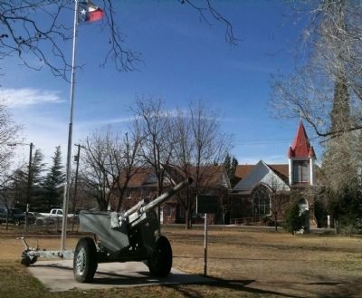
This 105 Howitzer served in Sept. 1943 with 132nd Field Arty. Bn., U.S. Army, in support of 142nd Inf. 36th Div., in Battle of the Rapido River, Salerno, Italy — One of the bloodiest actions in World War II. In the fighting, this cannon was . . . — — Map (db m61046) HM
The mountains toward the east are limestone reef beds deposited in the Cretaceous and Permian seas about 135 million years ago and 250 million years ago; respectively. The limestone reefs overlie deformed rocks in the Ouachita Fold Belt, which is . . . — — Map (db m26361) HM
The northern, or "highland",
region of Brewster County has
the highest average elevations
in the County, ranging from
3,700 up to 6,000 feet above
sea level. Lower temperatures
and slightly increased rainfall
contribute to open . . . — — Map (db m163876) HM
Formed from Presidio County
Created February 2, 1887.
Organized February 14, 1887.
In 1897 the territory of Buchel
and Foley counties was
added to Brewster. Named for
Henry Percy Brewster, 1816-1884
soldier and statesman, a hero . . . — — Map (db m60923) HM
Called San Lorenzo by Juan Domínguez de Mendoza, 1684. Later Charco de Alzate in honor of an Apache chieftain. After Civil War given name of Burgess' water hole honoring John W. Burgess, pioneer freighter, who here outwitted the Apaches. The . . . — — Map (db m26390) HM
Erected in 1893. Oldest public school building standing in Alpine. Abandoned as school in 1910. Later served as a hospital, college dormitory, Border Patrol station and U.S. Agricultural and Soil Conservation Service.
Recorded Texas . . . — — Map (db m139127) HM
Side A:
County Named for Texas Confederate Colonel Henry P. Brewster 1816-1884South Carolinian came to Texas, 1836 - Attorney General, State of Texas, 1847-49. When South seceded he was instrumental in recruiting post office . . . — — Map (db m44612) HM
Building erected in 1887 when Brewster County was created. Served Buchel and Foley Counties until these areas where added to Brewster County. Courthouse Square still is community center for various events.
Recorded Texas Historic Landmark . . . — — Map (db m61016) HM
On this fateful date, the Marfa Border Patrol Sector was conducting a ground breaking ceremony for the new Alpine station facility you see standing in the background. The ceremony was halted when the report was received and all personnel were put on . . . — — Map (db m47215) WM
Early Human History in the Big Bend Region
Historic Period - AD 1535 - The first Spaniards entered the Big Bend beginning with Cabeza de Vaca in AD 1535. Spanish entradas in the late 1500s and 1600s led to the establishment . . . — — Map (db m220415) HM
1475 CE* 1492 - Columbus lands on San Salvador Island in the Caribbean West Indies 1497 - John Cabot, first known English party to land in North America, northeast Canada 1521 - Hernán Cortés conquers the Aztec Empire 1528 - Panfilo de Narváez . . . — — Map (db m160836) HM
When the railroad came through this area in 1882, the settlement of Osborne was established here near natural springs. The community's name changed to Murphysville in 1883, and at that time, as the population began to grow, missionaries arrived from . . . — — Map (db m61014) HM
Built in 1890 by Trinidad Garcia, ranch hand. Original four rooms had adobe walls 27 to 33 inches thick. Was a social center for many years. Since 1926, home of Thomas Valadez, a leading local merchant, and family. House now has eight rooms. . . . — — Map (db m61072) HM
This Spanish Colonial Revival hotel was built in 1912 for John R. Holland (d.1922), a successful area cattleman. Completed during the mercury mining boom days of Alpine, it served as the civic, social, and business center for the growing city. After . . . — — Map (db m61069) HM
This tablet is dedicated
to the men & women
of
Brewster County
in grateful recognition
of their patriotic
service to our country
in times of war
Erected AD 1948
by
American Legion Auxiliary
Big Bend Unit No. 79
Alpine, . . . — — Map (db m61354) WM
Julius Canselor Bird (1863-1925) was born in Round Mountain (Blanco Co.), and came to West Texas at age 18 as a Texas Ranger, protecting crews during construction of the transcontinental railroad. J.C. then homesteaded and ranched on ten sections of . . . — — Map (db m139126) HM
Built 1884 by an early settler, J.C. Carr. Adobe brick double walls were laid at night, slowly drying to super-strength, in time-honored southwestern manner.
Five adobe rooms were added after 1903 sale to Judge R.B. Slight (1869-1953), English . . . — — Map (db m61015) HM
Born in Wharton County, John Riley Holland as a young man moved to Brady (McCulloch Co.) to become a rancher. He married Mary L. Fuller in 1881; the couple had two children, Crystal and Clay. By 1884, the Hollands moved to Presidio County near . . . — — Map (db m61070) HM
Iowa born family came to Texas 1839. Gained experience with Indians in central Texas while father was Indian agent. Led reservation Indians in campaigns against Comanches. As Ranger company captain in 1855 he killed the noted Comanche Chief Peta . . . — — Map (db m50296) HM
Built 1890 by F.H. Nolte, early settler, on land in Murphyville (now Alpine). The 20-inch walls are made of adobe bricks molded at the building site. Home was sold 1893 to John Rooney, second county Sheriff. The exterior looks as it did in 1890. . . . — — Map (db m60924) HM
Site of the first Roman Catholic Church in Alpine. Deeded to the Diocese of San Antonio in 1896 by father and son Daniel and Thomas O. Murphy. The original adobe church building was dedicated November 19, 1902, by the Rev. A.J. Forest, Bishop of San . . . — — Map (db m61090) HM
[Bottom plaque]
This building is the original Brewster County Jail. Completed in 1888, the old jail was subsequently modified on numerous occasions to meet various requirements of the State of Texas. In 1995, upon completion of a new . . . — — Map (db m195517) HM
Parish Hall, site of the oldest church building in Alpine, originally called Our Lady of Guadalupe Church, completed in 1892 and in continuous use as a church until 1942, and as a parish hall until 1964.
Recorded Texas Historic Landmark - . . . — — Map (db m61093) HM
The present church building was dedicated on January 6, 1943, by Rev. Sidney M. Metzger, Bishop of El Paso. Construction began in 1941 under Father Francis Juaniz with members of the parish donating over $10,000. Contributions by the Catholic . . . — — Map (db m61091) HM
This marble slab and tablet carries our message of grateful remembrance for their interest in and courage to seek a home site in this rugged, yet beautiful range of mountains and valleys. Most of our pioneers came in the eighties and it can be said . . . — — Map (db m61048) HM
Transportation
In the thirty years following the Civil War, massive trail drives brought more than 10
million cattle to markets in the Midwest. Driving herds
across country was time-consuming and expensive in staff, supplies and wear on . . . — — Map (db m163874) HM
Frame and adobe. Built facing old cattle loading pens on the Southern Pacific Railway.
Lodgings and saloon for cowhands and ranchers in town to ship cattle from widely scattered ranches of the Big Bend country. — — Map (db m61071) HM
This mural commemorates Alpine's original Art Colony that produced two of the top WPA Mural Project's artists during the 1940's.
The Art Department at what was then Sul Ross State Teachers College (1923-1949) began as the Department of Drawing . . . — — Map (db m290097) HM
1680 CE*
1683 – Juan Domínguez de Mendoza leads first expedition to La Junta de los Rios in 95 years
1693 – Juan Fernández de Retana leads expedition to protect native Jumano Indians from Apache Indian raids at La Junta . . . — — Map (db m160837) HM
This enduring monument of marble with attached bronze plaque is a symbol of honor and a tribute of praise for the valiant service rendered by the men and women from Brewster County who answered the call of duty in the Armed Forces of the nation, not . . . — — Map (db m61049) HM
Built in 1908 by local architect and building contractor William Daugherty for William Wallace Townsend (1833-1915), this house is a good example of a turn-of-the-century residence. Allen H. Palmer purchased the home in 1920 and lived here until his . . . — — Map (db m61142) HM
An Advocate for Nature The rugged peak in front of you honors George Meléndez Wright, a significant figure in the early history of the National Park Service (NPS) and the establishment of Big Bend National Park.
Born in 1904 to American . . . — — Map (db m218781) HM
Tiny horses and hippopotamus-like animals once roamed a more humid Big Bend. For a glimpse into the parks tropical past, take a short trail to the fossil bone display and the overlook beyond. — — Map (db m95632) HM
By decision of the Bureau of the International Coordinating Council of the Program on Man and the Biosphere, duly authorized to that effect by the Council, Big Bend National Park is recognized as part of the International Network of Biosphere . . . — — Map (db m293792) HM
The massive cliffs of the Sierra del Carmen appear unyielding, yet the Rio Grande has carved a gorge 1,500 feet deep directly through the escarpment. Boquillas Canyon is so narrow that the entrance is almost invisible at this distance.
From the . . . — — Map (db m54555) HM
Despite a tendency to spiny plants, barren ground, and a variety of reptiles, each desert is distinctive. To recognize the Chihuahuan, shift focus from the broad horizon to the “indicator plants” that characterize this particular . . . — — Map (db m95631)
You are now traveling the Comanche Trail blazed by Comanche Indians, en route from
the western plains to Mexico, and traveled later by emigrants and soldiers. It
extended south from the Horse Head Crossing of the Pecos by Comanche Springs . . . — — Map (db m53931) HM
Imagine living in this remote region a century ago. In 1927, J. O. Langford built this store and post office to provide services to a ranching and mining community that spanned many miles and two countries.
In 1939, Maggie Smith ran the store . . . — — Map (db m218847) HM
People have long sought relief from the desert heat in the Chisos Mountains and Mexico's Maderas del Carmen. Forests, steep slopes, shade, and cooler temperatures allow wholly different plants and animals to live in the Big Bend.
In the 1930s . . . — — Map (db m218835) HM
These are the remnants of a stone farmhouse owned by James and Melissa Belle Sublett, settlers who first came to Castolon in 1913.
Sublett is recognized for introducing mechanized farming into the Big Bend. In 1914 the Subletts moved into the . . . — — Map (db m219105) HM
Heated by geothermal processes and emerging at 105° F (41° C), the water in the hot springs carries dissolved mineral salts reputed to have rejuvenating powers. Langford claimed his health was restored after 21 days of soaking in the springs. . . . — — Map (db m218871) HM
The buildings below look like an active ranch, though this line camp was abandoned in 1945. Take the short trail down into the canyon for a closer view. The foreman's house makes eloquent use of native materials: reed ceiling from the river, timbers . . . — — Map (db m219285) HM
Homesteader J.O. Langford built the structures ahead. He arrived from Mississippi in 1909, stricken with recurring malaria, spending his last pennies seeking health and fortune.
Long before the establishment of Big Bend National Park, Langford . . . — — Map (db m218839) HM
With better transportation and extensive advertising, health seekers and vacationers sought out this remote, riverside retreat. Langford's resort flourished from the 1920s to the 1940s. Rooms were $1 per day or $6 per week; hot spring baths were 25¢ . . . — — Map (db m218854) HM
On its long journey to the Gulf of Mexico, the Rio Grande passes through some of the most dramatic and storied landscapes in the West. Here, it has carved through solid limestone to form Santa Elena, one of Big Bend's most beautiful river canyons. . . . — — Map (db m218938) HM
Here at the edge of Alamo Creek, Gilberto Luna raised a large family in this small house called a jacal (hah-KAHL). Built from rock, earth, and plant fiber, the dwelling was well adapted to desert conditions: notice a dramatic temperature difference . . . — — Map (db m53935) HM
The confluence of a creek, a river, and the hot springs drew people to this area thousands of years before Langford arrived. Living in the shadow of the cliffs, ancient people left rock art, midden areas, and bedrock mortars. These serve as . . . — — Map (db m218865) HM
Hot springs along the river made this an appealing tourist destination in the early 20th century. The Langford Hot Springs are still well-known and accessible.
In 1914, J.O. and Bessie Langford moved here from Mississippi and started a health . . . — — Map (db m218834) HM
When J.O. Langford homesteaded this section in 1909, he was moving into an area that had long been inhabited by native Americans. Walk this trail to view pictograph and petroglyphs created by prehistoric people hundreds or even thousands of years . . . — — Map (db m53936) HM
He laid the foundation of the National Park Service. Defining and establishing the policies under which its areas shall be developed and conserved unimpaired for future generations. There will never come an end to the good that he has done. — — Map (db m60610) HM
This deserted farming village supplied produce for miners and ranchers of the area from 1900 until the 1930's. You are welcome to walk across Terlingua Creek into the heart of the rock and adobe ruins. It is hard to believe that the banks of . . . — — Map (db m53958) HM
I never saw a place so definitely marked for a military post....
Lieutenant D. Green, commander, US-Mexican Boundary Survey Commission, 1851.
Not until 1916 - during the Mexican Revolution - did the U.S. Army . . . — — Map (db m219262) HM
Before the 1920s no one along this part of the Rio Grande had ever planted cotton. In 1922 businessman Wayne Cartledge began to sow that high-dollar commercial crop in these river-bottom fields. Cartledge also introduced steam- and gasoline-powered . . . — — Map (db m219109) HM
The Drive from Castolon to Santa Elena Canyon
Between Castolon and Santa Elena Canyon, the road passes along the broad floodplain of the Rio Grande. From the late 1880s until 1961, Mexican and American families lived, farmed, and ranched . . . — — Map (db m219279) HM
This adobe house was built in 1925 as the residence of Fred Garlick, farm manager for Wayne Cartledge's La Harmonia Company. During the 1930s, it also served as a schoolhouse for the children who lived in this remote area. The Garlick House is among . . . — — Map (db m219259) HM
During the Mexican Revolution, life on the border was often chaotic. This adobe structure stood as a symbol of harmony in that perilous time.
In 1918 Howard Perry, owner of the Chisos Mining Company in Terlingua, and his bookkeeper, Wayne . . . — — Map (db m219107) HM
Magdalena Silvas lived in this house in the 1950s. As a widowed mother, she raised her five children while cooking for La Harmonia Company here in Castolon for about 30 years. The family kept animals in the yard.
The Magdalena House is a window . . . — — Map (db m219110) HM
Lajitas, the Spanish word for flagstone, comes from the Boquillas Geologic Formation. Located near the Lajitas Crossing/San Carlos ford on the Rio Grande, the Lajitas cemetery has been in use since at least the early 1900s. For millennia, the ford . . . — — Map (db m170662) HM
In 1883, completion occurred of the extension of tracks by the Galveston, Harrisburg and San Antonio Railway (G.H. & S.A. Ry.) Line located between El Paso and San Antonio. Retired sea captain Albion E. Shepard arrived in the region as a railroad . . . — — Map (db m111473) HM
Black Gap, a natural cleft in the basalt ridge northeast of the Sierra del Carmen, frames the headquarters site of the Black Gap Wildlife Management Area.
Established in 1948, the "Gap" contains approximately 100,000 acres representative of . . . — — Map (db m234635) HM
Chambers Hotel. Original adobe building constructed in 1891. First owner, Mrs. Mary Collins. Purchased in 1905 by "Gran" Chambers. Enlarged and a wooden frame built over the thick walls. Operated as Chambers Hotel until 1930. — — Map (db m26362) HM
Typical of those who served the South and then moved into new counties of Western Texas. Surveyor, Indian agent, soldier, legislator, Justice of the Peace. Born in Tennessee. Moved to Texas 1838. Fought in Mexican War. Though 43 when Civil War . . . — — Map (db m201874) HM
In highway cuts toward the east are excellent exposures of almost vertical rock layers - part of the Ouachita Fold Belt, a northeasterly trending, folded and faulted mountainous range which was uplifted about 275 to 290 million years ago. The . . . — — Map (db m26417) HM
A natural watering place in prehistoric time, as evidenced by artifacts found here. Used later by Indians and Spaniards on roads from northern Mexico. As Maravillas Creek developed from a draw into water channel, old water hole vanished. About . . . — — Map (db m53933) HM
Established in 1880 as a means of preventing Indian raids into Mexico. Raided by Apaches in 1881. Abandoned in 1893 after Western Texas had been permanently cleared of Indians. — — Map (db m73723) HM
Highly deformed rocks in the Ouachita Fold Belt, a northeasterly trending range, uplifted about 275 to 290 million years ago. The intricate folding is shown by whitish rock bands—called caballos (the Spanish word for horses)—exposed on . . . — — Map (db m60920) HM
Fort Peña Colorado, the last active fort in this area, on the old Comanche Trail, about 4 miles to the southwest was established in 1879.
Marathon was founded in 1881. Named by an old sea captain, A.E. Shepard, for the Plain of Marathon, in . . . — — Map (db m26436) HM
This brick hotel building, designed by the El Paso firm of Trost and Trost, was constructed in 1926-27 for Vermont native Alfred S. Gage. A cattleman, Gage founded the largest ranching operation in the Trans-Pecos, consisting of over 600 sections of . . . — — Map (db m26167) HM
Camels in the Big Bend
Camel ancestors first appeared in North America approximately 40 million years ago. Modern camels migrated to Asia over a land bridge that submerged when sea level rose at the end of the last Ice Age. Camels became . . . — — Map (db m111499) HM
The southern region of Brewster County is characterized by rough terrain and low elevations with higher temperatures and less rainfall than in other parts of the County. As a result, only the hardiest of cattle can thrive here.
Border . . . — — Map (db m218777) HM
Everett Ewing Townsend, called the "father of the Big Bend National Park," was instrumental in initiating, promoting and finally bringing into reality the idea of a public park along the Big Bend of Texas' Rio Grande.
Townsend was born on . . . — — Map (db m218918) HM
Transportation
In the thirty years following the Civil War, massive trail drives brought more than 10 million cattle to markets in the Midwest. Driving herds across country was time-consuming and expensive in staff, supplies and wear on the . . . — — Map (db m218636) HM
To a Modern Observer, living conditions in early 20th century Terlingua may seem primitive, even brutal. For immigrant miners, Terlingua and the Chisos Mine offered a distinct improvement over their native Mexico, which was torn by political . . . — — Map (db m220385) HM
Villalba family tradition traces their lineage to Algiers where several generations were members of the Order of Santiago in 1764, Federico's great-grandfather, Juan Villalba, traveled to New Spain (Mexico). He founded Rancho Villalba in 1773 near . . . — — Map (db m218941) HM
Mercury, or Quicksilver, is derived from a red-colored ore known as cinnabar.
Cinnabar (sample at left) was used by Native-Americans as a durable pigment, and there are many places in Big Bend where traces of ancient drawings . . . — — Map (db m111500) HM
With the Mother-Ore Cinnabar strike in 1890, Terlingua became the world's quicksilver capital, yielding 40 percent of nation's need by 1922.
Its name from Terlingua (three tongues) creek nearby, was coined by Mexican herders. Comanche, Shawnees . . . — — Map (db m60861) HM
This cemetery dates from the early 1900's when Terlingua became a flourishing mercury mining town. It served the district as the final resting place for residents and mine workers that succumbed to dangerous working conditions, gunfights, and the . . . — — Map (db m220372) HM
Butterfield Overland Mail
First Overland Mail Route from St. Louis, Missouri to San Francisco, California.
As a forerunner of the Pony Express and Transcontinental Railroad, the Butterfield Overland Mail was the first successful . . . — — Map (db m61507) HM
We are not recognizing development. We are recognizing another important link in bringing others to know and love this land, its plants and animals, and its human history. When completed, this new visitor center will greet many who will, for the . . . — — Map (db m30337) HM
Guadalupe Peak, Texas' highest mountain at 8,751 feet, dominates one of the most scenic and least-known hinterlands of the old frontier. It lies behind and to the right of 8,078-foot El Capitan, the sheer cliff that rises more than 3,000 feet above . . . — — Map (db m4759) HM
Guadalupe Peak, Texas' highest mountain at 8,749 feet above see level, dominates one of the most scenic and least-known areas of the state. It lies behind and to the right of El Capitan (8,078 feet), the sheer wall that rises more than 3,000 feet . . . — — Map (db m61490) HM
Built in 1858 as a station on the Butterfield overland mail route St. Louis to San Francisco · Abandoned in 1859, when the line was shifted to the Davis Mountain route. — — Map (db m116734) HM
He laid the foundation of the National Park Service. Defining and establishing the policies under which its areas shall be developed and conserved unimpaired for future generations. There will never come an end to the good that he has done. — — Map (db m60611) HM
The U.S. Highway 180 Association salutes the inspiring leadership and dedication of the "Committee of Five" for their untiring efforts in the development and promotion of the Guadalupe Mountains National Park. Dedicated to
Glenn Biggs of Abilene, . . . — — Map (db m30348) HM
Dedicated to the Airmen who, like the stage drivers before them, challenged the elements through this pass with the pioneer spirit and courage which resulted in a vast system of airline transport known as "American Airlines". . . . — — Map (db m30349) HM
First permanent structure in Van Horn. Earliest portion (built 1901) housed original city post office. Main portion was built in 1905-06 by John Cox of concrete blocks handmade by crew on site.
In 1911-12, when Culberson was newly organized, . . . — — Map (db m60763) HM
This is a two-sided marker
(Front): Native Georgian. Came to Texas 1856. Although opposed to secession he aided in raising 18th Texas Infantry as Lt. Colonel, C.S.A. Made commanding Colonel of 18th in 1862. After service in Vicksburg area . . . — — Map (db m44613) HM
Formed from El Paso County; Created March 10, 1911; Organized April 18, 1911; Named for David B. Culberson 1830-1903 famous constitutional lawyer, a Confederate officer, member of the Texas legislature, member of the United States congress; Van . . . — — Map (db m43479) HM
The nearby cemetery (250 yards S) was first used in 1910 for the burial of an infant son of J.H. Feely. The owner of a grocery in the railroad settlement of Plateau (2 miles north), he later served as the first sheriff of Culberson County when it . . . — — Map (db m120691) HM
The lands which now lie within the boundaries of the Figure 2 Ranch were occupied in the 19th century by nomadic Native American tribes. One of the last battles between Texas Rangers and Apache Indians occurred in the mountains west of this site in . . . — — Map (db m52722) HM
In order to provide local law enforcement in the wake of Mexican bandit attacks, Culberson County was organized in 1911. The following year the county commissioners accepted plans for construction of this red brick jail. Although prisoners at times . . . — — Map (db m60765) HM
U.S. 1902. First church building erected in Van Horn. This was used by all faiths until other churches were built.
Recorded Texas Historic Landmark - 1964 — — Map (db m60764) HM
One of Texas' first cross-country wagon trails. The San Antonio-El Paso section of this route was surveyed in 1848 by a party under the intrepid Indian fighter Jack Hays. Used first by emigrants and gold-seekers, it became part of the San . . . — — Map (db m73317) HM
"To those who have shown a willingness to give their lives for the United States of America. Words cannot express the gratitude owed to you for the freedoms we enjoy.
Please accept our interminable appreciation for your service to our country and . . . — — Map (db m164545) WM
Only dependable water supply in miles of arid terrain. Used by Indians for centuries. Named for either Maj. Jefferson Van Horne (who passed here en route to establish fort at El Paso, in 1849), or for Lt. J.J. Van Horn (stationed here to fight . . . — — Map (db m73296) HM
359 entries matched your criteria. The first 100 are listed above. Next 100 ⊳