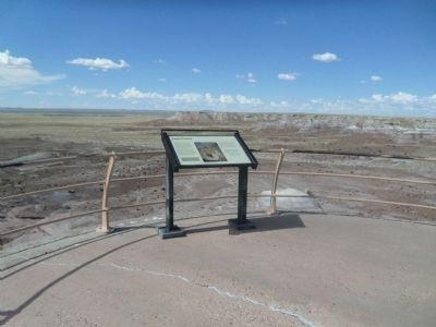
The petrified wood strewn in the valley below was once encased in the bluffs around you. When erosional forces removed the softer rocks, the petrified wood tumbled and accumulated on the valley floor. Once filled with fallen logs, Jasper Forest . . . — — Map (db m269587) HM
Just like visiting a grocery store, park paleontologists have a “wish list” of fossils that they would like to find. Petrified Forest's wish list included a bonebed of metoposaurid amphibians, the large, flat-headed amphibians that were one of . . . — — Map (db m286551) HM
In the summer of 1921, heiress and explorer
Annie Montague Alexander and her research partner
Louise Kellogg set off into the badlands in front of
you. Intrigued by fossils discovered by John Muir
fifteen years earlier, Annie and Louise . . . — — Map (db m286363) HM
In this vast, nearly treeless landscape, it may sound strange to call the Civilian Conservation Corps (CCC) Roosevelt's Tree Army, but it has meaning here. President Franklin D. Roosevelt created the CCC in 1933 as part of his New Deal program for . . . — — Map (db m286291) HM
Across the Puerco River, the tracks of the Burlington Northern Santa Fe Railroad stretch for miles to the east and to the west. With no landforms or forests to block your view, you can see very long trains from beginning to end. More than 60 . . . — — Map (db m119934) HM
Most people have never heard of a caecilian, but they are one of the most fascinating groups of animals alive today. They are one of the living groups of amphibians along with frogs, toads, salamanders, and newts. Caecilians spend nearly all their . . . — — Map (db m286544) HM
Nowhere else has so large and beautiful and in every way wonderful [a] section of the ancient…forests been discovered, and, after it is cared for by the Nation and made easily accessible, it will, I am sure, become one of the most . . . — — Map (db m269682) HM
Geologists call eroded landscapes such as the Painted Desert "badlands." Summer thunderstorms and winter snowmelt carve the shale and sandstone into mazes of sharp ridges, steep hillsides, and deep V-shaped gullies. Practically waterless, badlands . . . — — Map (db m72923) HM
The colorful mesas, buttes, and badlands before you compose a natural work of art--the Painted Desert.
Wind and running water cut these features from the Chinle Formation deposited over 200 million years ago when this area was a vast inland . . . — — Map (db m72925) HM
Discovery of two well-preserved mummies led members of an 1880 archeological expedition to call this site Mummy Cave. The traditional Navajo name for this impressive setting is Tséyaa Kini — House Under Rock. Anasazi lived here for nearly a . . . — — Map (db m170537) HM
The Navajo know this prehistoric Anasazi village site as Kináázhoozhí, which means Sliding House. It is an apt description. The dwellings were constructed upon a steeply sloping ledge, and even the ingenious Anasazi builders were unable to keep many . . . — — Map (db m285791) HM
Spanish soldiers may have fired from this very site during the infamous “massacre” of 1805. Their Navajo targets were huddled in the alcove below and to the left. Spanish accounts describe a day-long battle against Indians “…entrenched in an . . . — — Map (db m285844) HM
Once owned & often visited by film legend John Wayne, the ranch with the prominent white show barn came to fame in the 1940s as the Milky Way Hereford Ranch, owned by the Mars Candy Family. — — Map (db m36611) HM
This stone chimney is all that remains of a one room country school house that served pioneer Amity pop. 119 from the early 1880's until closing in April 1930. The Amity Cemetery & Amity Ditch are the only other remains of this early Mormon . . . — — Map (db m36614) HM
An early 1900s adobe home built by the son of Eagar's first Mormon Bishop. Crosby, a major sheep & cattle rancher, was a railroad contractor who in 1917 laid the track for the Santa Fe Railroad north of here. — — Map (db m36626) HM
Below among the large cottonwood trees are the historic hdqtrs of Fred T. Colter's Cross Bar Ranch. Originally homesteaded in 1881 by Texan Micajah Phelps, Colter built the ranch into one of the largest cattle operations in Northeastern AZ. — — Map (db m36609) HM
After the original frame school house burned in 1930, this building served Eagar's children for 53 years. Mothers prepared hot lunch across the street creating Eagar's own depression era "soup lines" at 5 cents a cup for the children. — — Map (db m36628) HM
Completed in 1912 by J.P. LeSueur manager of the Eagar ACMI, this frame house with a skin of pressed metal wall sheathing is best known as home to one of the Colter Bros. important Round Valley Ranchers. — — Map (db m36643) HM
Built in the early 1900s by one of Eagar's prominent civic, religious & business leaders, this barn was constructed with wooden pegs & retains remarkable architectural integrity. The 2-story brick farmhouse no longer stands. — — Map (db m36640) HM
Built c.1892, this adobe structure once housed the Eagar School & later a bootlegger's still. Jepson purchased & enlarged the home in 1925 & moved his family from Alpine so his daughters could attend Round Valley High School. — — Map (db m36627) HM
On July 24, 1900, the Peter P. Rencher family arrived from Texas in four wagons & set about building their place in Eagar. Completed in 1913, this 5 bedroom, red brick Colonial Revival home was the crown jewel of their labors. — — Map (db m36618) HM
In 1878, this notorious outlaw gang clashed over dividing their loot. A heated gunfight occurred in the saddle of this hill and it is said that at least seven died. Here lie their last known remains. — — Map (db m36607) HM
This handsome example of Colonial Revival architecture was home to the manager of Round Valley's ACMIs. His wife, the area's first registered nurse, boarded expectant mothers & teachers from the high school. — — Map (db m36645) HM
Welcome Hubbell Trading Post, established in 1878, is the oldest continually operated trading post on the Navajo reservation. J.L. Hubbell, whose family operated the trading post for nearly 90 years, was known among the Navajo as trustworthy and . . . — — Map (db m250806) HM
U.S. Route 66 (US 66 or Route 66), also known as the Will Rogers Highway, the Main Street of America or the Mother Road, was one of the original highways within the U.S. Highway System. US 66 was established on Nov. 11, 1926, with road signs erected . . . — — Map (db m184319) HM
Take a quick scan of Arizona's history since statehood and you'll find many economic shifts, some in response to local booms and busts, others the result of national and global changes. In the 1920s, Arizona's five economic bedrocks were given the . . . — — Map (db m272265) HM
In November of 1776 a party of Spanish explorers and Indian guides passed through this area on their way to the Zuni Mission in what is now New Mexico. Franciscan Fathers, Francisco Atanasio Dominquez and Silvestre Velez De Escalante, had embarked . . . — — Map (db m36577) HM
December 29, 1863 Arizona's Territorial officials took the oath of office during a snowstorm. Governor John N. Goodwin and other officials arriving from the east by wagon train, took their oaths of office and raised the U.S. flag "to establish a . . . — — Map (db m36334) HM
As you look out over the Painted Desert, you are only seeing a small portion of it. The Painted Desert extends over 7,500 square miles (19,425 km²) across northeastern Arizona. Because Petrified Forest National Park lies at its heart, the entire . . . — — Map (db m163185) HM
Native Americans' familiarity with local plants, minerals, rocks, and animals has helped sustain their cultures and make their homes in this beautiful-and challenging-landscape for more than 13,000 years.
Stones & Petrified Wood
The . . . — — Map (db m255956) HM
Strong lines, flat roofs, smooth, unadorned wall surfaces, and asymmetrical facades are the main characteristics of the International Style of architectural design. In the United States, Richard Neutra was a top architect on this style. In a daring . . . — — Map (db m255934) HM
Like the geologic layers of the Painted Desert, the lives of its residents layer upon each other in the form of rock art, structures, and artifacts. Ongoing research uncovers such dramatic evidence, constructing a timeline of continuous occupation . . . — — Map (db m255984) HM
What does silence sound like? Where do you go if there are no footsteps to follow? How does it feel to be in a place where day and night are the only times that matter? How does it feel to be totally immersed in nature?
The answers to . . . — — Map (db m255959) HM
Petrified Forest is the only National Park in the country with a portion of Historic Route 66 within its boundaries. You are currently standing where the Mother Road used to be, with the line of telephone poles paralleling its alignment through the . . . — — Map (db m163277) HM
More than 650 images adorn the boulders below – one of the largest concentrations of petroglyphs in the park.
People who farmed the Puerco River Valley 650 to 2,000 years ago pecked these petroglyphs onto the rocks, leaving a legacy etched in . . . — — Map (db m269591) HM
Below you lies a black basalt which forms the rim of the plateau on which you stand. This hard basalt, called the Bidahochi Formation, was deposited by local volcanoes between 16 and five million years ago, and forms a protective cap over the soft, . . . — — Map (db m163270) HM
As a traveler to this spot, you are in good company. The Painted Desert offers a rich story of travelers, traders, and migrants passing near this location through the centuries. This natural travel corridor skirts the Rocky Mountains and other . . . — — Map (db m255985) HM
You are standing near old Route 66. The line of the roadbed and the telephone poles in front of you mark the path of the famous "Main Street of America" as it passed through Petrified Forest National Park. From Chicago to Los Angeles, this heavily . . . — — Map (db m68904) HM
Enjoy the tranquility of the grassland as the trail leads you to scenic Tawa Point. The Tawa rail is a perfect place to stretch your legs after a long road trip
In Hopi ideology, Tawa refers to the Sun Spirit, the creator of the World. The . . . — — Map (db m255941) HM
Enjoy the tranquility of the grassland as the trail leads you to scenic Tawa Point. The Tawa rail is a perfect place to stretch your legs after a long road trip
In Hopi ideology, Tawa refers to the Sun Spirit, the creator of the World. The . . . — — Map (db m255948) HM
Iowa Congressman John Fletcher Lacey strongly advocated the protection of public lands and the resources within them. Lacey is most prominently known by his namesake of the Lacey Act of 1900, which protected both plants and wildlife. However, he . . . — — Map (db m255987) HM
From its perch on the Painted Desert rim, this building has seen many changes. First built by Herbert Lore in the early 1920s, it was made with the resource most abundant in the area: petrified wood! Look above the double doors and you will see a . . . — — Map (db m255958) HM
You have made a good decision to exit the interstate and visit Petrified Forest National Park. Beyond lies a 28 mile (45 km) road through the heart of the park, showcasing the Painted Desert, the world's largest and most colorful concentration of . . . — — Map (db m255927) HM
Think of a word to describe the semi-arid grassland in front of you. Is it lush, green, or forested? No, but those would be accurate descriptions for this land during the Triassic Period. At that time, this area resided on the supercontinent Pangea . . . — — Map (db m269588)
Step up to the railing ahead and you will see one of the park’s largest concentrations of petroglyphs. It is called Newspaper Rock for the more than 650 images pecked, carved, or incised in the boulders below. This unique site is part of a larger . . . — — Map (db m269681) HM
Built of adobe in 1901 with a cast iron front shipped from St. Louis, the ACMI was a branch of the Mormon Cooperative Store system for 17 yrs. It later served the community as a saloon, variety store & furniture emporium. — — Map (db m36652) HM
Gregorio Baca bought this house from G. Becker in 1907 for his bride, Chona Ortega. It's walls are 16" thick adobe. The wealthy Bacas & Ortegas ran large herds of cattle & sheep on vast tracts of land in Concho, St. Johns & The R.V. area. — — Map (db m36383) HM
Part of the Spanish migration from northern New Mexico to Round Valley, Faustin Baldonado & his son Pedro bought this adobe home w/1 foot thick walls in the 1890's. Originally a cantina, Pedro added rooms when he married in 1900. — — Map (db m36382) HM
The oldest continuously operated Ford dealership west of the Mississippi began in the west building in 1910. A pathfinding auto trip blazed the first "ocean to ocean highway" through here. — — Map (db m36379) HM
In 1899, 14 year old Bertha Wahl was murdered here by a shepherd. Just south of here was the original Becker Store. Beyond lie the graves of the Becker family. Due west stood Henry Springer's Mercantile. — — Map (db m36647) HM
H.T. Brawley, teacher and principal of R.V.H.S. began construction on this house in approximately 1925. The unfinished shell sold to the M.J. Wiltbank Family in 1935. M.J. & son Clive completed the home. Through the years teachers, newlyweds & . . . — — Map (db m36595) HM
Built c.1915 & originally called the Apache Theatre, this adobe movie house once showed silent flickers with a hand-cranked projector. Renamed the El Rio in 1937, Round Valley's first theatre is still operating with its original popcorn machine. — — Map (db m36381) HM
Due south rises the 3rd tallest peak in AZ, revered by conservationist, Aldo Leopold Escudilla was home to Ike Clanton of OK Corral fame & Arizona's last grizzly bear. In fall, the north slope is golden with Aspen covering the 23,000 acre fire of . . . — — Map (db m36592) HM
On Dec. 25, 1886, James Hale was gunned down here in front of the Brighton Saloon. His accused was never brought to trial. In 1894 this site, then called Hunter's Hall, held the first Presbyterian services in the Round Valley. — — Map (db m36651) HM
This 10 foot high, 5 ton statue cast by St. Louis sculptor August Leimbach is one of 12 identical monuments to the bold spirit of the pioneers erected in 1928-29 along the National Old Trails Road from Maryland to California. — — Map (db m36380) HM
Just west on the river, W.R Milligan built the first grist mill & sawmill in Round Valley, later a brick kiln was added. Subsequent owners included the Udall Bros. & J.P. Rothlisberger who built the barn just ahead. — — Map (db m158475) HM
These log structures built by Thompson, a Danish convert to Mormonism, are Round Valley's oldest surviving buildings (1879). The cabin hosted the first Mormon services in Springerville. — — Map (db m36385) HM
Begun as missions in the late 1800s, Community Presbyterian Church here, and St. Peter's, a block east, moved into these permanent homes built respectively of brick (1918) & adobe (1928). — — Map (db m36384) HM
Second cousin to famed "Texas John Slaughter", Peter Slaughter & his rough trailhands brought the first Texas cattle to the White Mountains c. 1881 and built his P Lazy S Ranch on the Black River. Pete is buried here with 3 sons & extended family. — — Map (db m228567) HM
This bronze school bell summoned children until 1950. This 2 room adobe with high pitched roof & bell tower was added onto with brick, altering the entry & roof in 1927 & again in 1950. The school served the community 99 years. — — Map (db m36653) HM
1914 Honor roll 1918
Died
in the service of
their country
Richard W. Judd
born Dec 17, 1895 died April 12, 1918
Sidney Severens
born March 24, 1891 died June 7 1918
John H. Slaughter
born April 2, 1889 died October 27, 1918 . . . — — Map (db m195841) WM
This park contains buildings restored by the White Mtn. Historical Society. They preserve early settler, Hispanic, & Native American cultures, along with farming, forestry and ranching heritage. — — Map (db m36594) HM
Built during the great depression using native stone & W.P.A. labor, this twenty-bed facility finally opened in 1939 when a doctor agreed to come to Round Valley to finish, lease & run the hospital for 10 years. — — Map (db m36649) HM
The original dam at this site was destroyed in the spring floods of April, 1915. With the loss of eight lives and severe damage to farmlands. It was rebuilt with loans from the state of Arizona. — — Map (db m136234) HM
The old "Bowery" was the first place of worship used by the members of the Latter Day Saints Church who came to St. Johns in 1879-1880. The Assembly Hall, located on the northwest corner of the public square was erected in 1882. It was built of logs . . . — — Map (db m36586) HM
The line separating the territories of New Mexico and Arizona was established as 32 degrees of longitude west of the Washington Meridian by Congressional Act of February 24, 1863, signed by President Abraham Lincoln.
The Washington Meridian . . . — — Map (db m36625) HM
About the Navajo Code Talkers
During World War II the Japanese possessed the ability to break almost any American military code. Over 400 Navajos, with 29 being the original Navajo Code Talkers, stepped forward and developed the most . . . — — Map (db m51537) HM
In Remembrance of Our Warriors
Who Made the Ultimate Sacrifice and/or
Missing in Action,
They will never be forgotten
and to us they will always be young in our thoughts.
Nelson Lewis • Walter Nelson • Willie A. Notah • Edie . . . — — Map (db m27911) HM
Eight hundred years ago, a savannah-like grassland covered much of this high desert with abundant grasses. The residents would have collected and burned much of the nearby fuel, necessitating long walks to adjacent areas to gather wood. Sparse . . . — — Map (db m60105) HM
Named for one of Arizona's first U.S. Senators. A pioneer in development of trails and copper mines in Grand Canyon. Near here was the site of Tanner's Crossing of the Little Colorado River on the Mormon Trail from Utah via Lee Ferry to settlements . . . — — Map (db m80764) HM
Jesse Jefferson "Bear" Howard was one of the first settlers in Oak Creek in the 1880s, arriving there from California. Well known in the territory for hunting bears, Howard primarily sold the meat to merchants in Flagstaff and Williams. He hollowed . . . — — Map (db m263145) HM
Section crews were the laborers who built the railroads in the beginning and have continued throughout the years to maintain them. These crews were most efficient in moving heavy sections of rails when they all worked in unison. To accomplish . . . — — Map (db m178072) HM
On June 30, 1956, a TWA Constellation and a United Airlines DC-7 collided over the Grand Canyon. The 123 passengers and crew members aboard both aircraft perished.
This site is a common burial and memorial to 66 of the 70 TWA passengers and . . . — — Map (db m154949) HM
This 11-ton telescope, built by the Alvan Clark & Sons Telescope Manufacturing Company of Cambridgeport, Massachusetts, was installed at Lowell Observatory in 1909. It came with four secondary mirror combinations so that it could be operated at . . . — — Map (db m149451) HM
]Panel 1:]
Between 1100 and 1200, more people lived in this area than ever before, or since. Located along routes linking large populations to the northeast and south, villages here were well situated for trade. As people, goods, and ideas . . . — — Map (db m60079) HM
Box Canyon and Lomaki ruins are a short 15-minute walk from here, along the edges of ancient earthcracks. The 1/4-mile trail will take you back in time over 800 years to the remnants of this once-thriving community. You will see the few native . . . — — Map (db m60114) HM
A Village
You are entering the “Citadel,” a ruin from the late 1100s. Research has not been completed so it is important that we leave things as they are. Will there be extra storage spaces found, possible evidence for the . . . — — Map (db m60089) HM
Under the forebearer of this American Elm George Washington assumed command of the Continental Army at Cambridge, Massachusetts, on July 3, 1775.
This sprig of the "Washington Elm" was donated to the Arizona State Teachers College at . . . — — Map (db m263603) HM
The idea of a non-motorized trail
traversing Arizona from Mexico to Utah
was conceived by Dale Shewalter, a Flagstaff
public school teacher, after numerous
long-distance hikes throughout the state. In
1985 Dale walked from Nogales to . . . — — Map (db m121444) HM
Aubineau Building: The earliest buildings on this site were wood frame saloons, which burned in 1886 and 1888 and 1892. In 1892, ownership passed to Julius Aubineau, who later became Mayor of Flagstaff and is credited with installing the . . . — — Map (db m33267) HM
Because of its prime location, this corner, containing two lots, was one of the earliest in Flagstaff to be developed. Pioneer merchant J. R. Kilpatrick built New Town's sixth building here in December 1883. This wooden store building burned in the . . . — — Map (db m119945) HM
In 1888, David Babbitt, who had been running a lumber yard on this site, decided to construct a general store. Starting in late summer, he built a 35 X 70 foot structure on this corner, with the long side of the building running west along Aspen . . . — — Map (db m59504) HM
In 1857 Congress authorized Navy Lieutenant Edward F. Beale to survey a wagon road along the 35th parallel from Fort Defiance, New Mexico Territory, to the Colorado River. A secondary mission was to test the feasibility of using camels in the . . . — — Map (db m33348) HM
From 1857-60, Lt. Edward F. Beale and a crew of 100 men completed the first federal highway in the southwest from Fort Smith, Ark. to Los Angeles, Calif. at a cost of $200,000. The wagon road was used extensively by immigrants en route to . . . — — Map (db m33346) HM
The rich diversity of plants and animals of the Flagstaff area was first recognized in the summer of 1889 when Dr. C. Hart Merriam led a biological survey to the San Francisco Peaks. Merriam's "Life Zone Theory" detailed that temperature and . . . — — Map (db m201772) HM
The Box Canyon ruins are typical of many pueblos found in this region. Early inhabitants constructed walls of nearby sandstone and limestone, and used local soils to cement the stones together. The flat roofs were built of timbers laid side-by-side, . . . — — Map (db m60094) HM
The City of Flagstaff purchased this land in 1959 from the United States Forest Service.
In 1964, James Potter, Sr., long-time resident, entrepreneur and Flagstaff Chamber of Commerce President, led the effort to form a non-profit organization, . . . — — Map (db m33347) HM
Bushmaster Park is named in memory of Flagstaff's Company I-158th Infantry Regiment, Arizona National Guard, and their sacrifices for freedom made in New Guinea, the Phillipine Islands and Japan from 1941 to 1945.
"No greater fighting team ever . . . — — Map (db m60932) HM
In 1888, at the insistence of a group of Catholic
Laymen, The First Catholic Church in Flagstaff was built of brick on the south side of town. It was moved in 1911 to a temporary site just west of and across the street from the present permanent . . . — — Map (db m33336) HM
Understanding and predicting local weather patterns helps astronomers plan successful observing runs. Because of this, observatories such as Lowell typically maintain weather stations to monitor the conditions. One such station was set up at the . . . — — Map (db m149452) HM
The Hoxworth family was the first to develop this lot, when H. H. Hoxworth built a hardware and furniture store here in January 1884. The property was owned by his father, George Hoxworth, a wounded Union veteran of the Battle of Shiloh.
Like . . . — — Map (db m33268) HM
This area seems quiet and lonely today - but not 800 years ago. This valley was used for farming and hunting by the people living in Citadel, Nalakihu, and other nearby pueblos, all inhabited at about the same time. (You can see the ruins of at . . . — — Map (db m41716) HM
Plaza
An open area in the pueblo near the rim of the earthcrack is known as the plaza. In pueblos, the plaza was the center for many daily activities including grinding corn, making pottery, working obsidian into arrowheads, processing other . . . — — Map (db m60110) HM
This building for many years was the home of J. J. "Sandy" Donahue's famous Senate Saloon. After earlier frame buildings on the site had been destroyed by fire, Donahue built the present brick structure in 1888.
An important figure in . . . — — Map (db m33266) HM
The K.J. Nackard family came to Flagstaff in 1912 and opened a small general store at 106 E. Railroad Avenue. The store was successful. In 1921, Nackard built a home on this property, just a stone's throw from the store.
Soon afterwards, . . . — — Map (db m119932) HM
Volcanic activity to the south produced giant fissures or earthcracks throughout the Wupatki area in the Kaibab Limestone. This formation covers most of the western half of Wupatki National Monument. The Sinagua and Anasazi Indians who inhabited . . . — — Map (db m60098) HM
The Emerson School bell and concrete nameplate once graced Flagstaff's first permanent education institution, built by the city with a bond generated in an 1893 election. The following year, the Territorial Legislature encouraged school districts . . . — — Map (db m263147) HM
The City of Flagstaff City Council & Historic Sites Commission recognize this property for its Historic & Architectural Significance cited 1988 — — Map (db m157599) HM
3650 entries matched your criteria. The first 100 are listed above. Next 100 ⊳