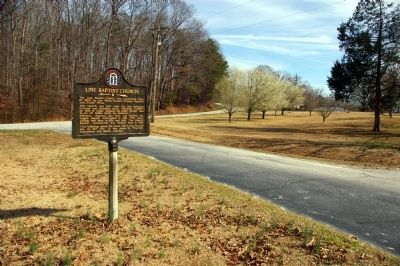
The Line Baptist Church was constituted Sept. 13, 1802, by Rev. Moses Sanders, Thomas Maxwell and Daniel White.
This church was just over the line between Georgia and Cherokee lands. Meetings couldn’t be held at night, because all white people . . . — — Map (db m40651) HM
This line, sometimes called “The Four Mile Purchase Line” was the boundary between Georgia and the Cherokee Nation from 1804 to 1818. It was established when Georgia bought a four mile strip from the Indians so as to take in Wofford’s . . . — — Map (db m40642) HM
This battle was fought Oct. 12, 1864 between Confederate troops and Union cavalry in the nearby mountain pass.
A Confederate victory saved Habersham county from pillaging by Union troops and camp followers and also saved grain fields for . . . — — Map (db m40640) HM
Leatherwood Baptist Church was established in 1801 at Eastanollee in Franklin County. Many members moved near here, organized this church and named it Leatherwood. Members remaining in Eastanollee reorganized and named their church Eastanollee. Land . . . — — Map (db m40703) HM
This marker is a memorial to the Middle River Volunteers, March 4, 1862, who drilled on this road for service before entering Civil War.
Donated by descendants of these soldiers.
Dedicated 1980
Company Roster
Orig Capt Wm P Brown + . . . — — Map (db m41943) HM WM
Banks County was created by Act of Dec. 11, 1858 from Franklin and Habersham Counties. It was named for Dr. Richard Banks (1784-1850), whose reputation as physician and surgeon extended over north Ga. and S.C. Especially noted for treating Indians . . . — — Map (db m40684) HM
This eternal flame is a memorial to those American soldiers from Banks County, Georgia who gave their lives in heroic sacrifice for their country while serving on foreign soil in the wars of this century.
Henry T. Gillespie WWI •
James M. . . . — — Map (db m252494) WM
The boundary between the State of Georgia and the Cherokee Nation established by the Treaty of Augusta, May 31, 1783, ran along here. The line ran “from the top of Currahee mountain to the head, or source, of the most southern branch of the Oconee . . . — — Map (db m40659) HM
In 1780 a group of people, Garrisons and Wilmonts, met on the top of the hill behind the church, built a platform between two trees, and held a religious meeting. This small gathering, and the statement that it was pleasant to worship on the . . . — — Map (db m16995) HM
Nails Creek Baptist Church, the first Baptist Church in Banks County, was established February 11, 1787. It was the Mother Church of Middle River, Grove Level and Indian Creek. Many descendants of its charter members are active in the work of the . . . — — Map (db m14473) HM
On this site in 1882, the original Hurricane Shoals Covered Bridge was completed, spanning some 127 feet at the cost of a mere $1,433. Vandals burned the old bridge in 1972, spoiling a community landmark and transportation corridor that had been in . . . — — Map (db m109855) HM
Adairsville had its beginning in Oothcaloga Valley, two miles north of the present site. It was named for Cherokee Indian Chief John Adair, the son of a Scottish trader and a Cherokee Princess.
Adairsville moved in 1848 to Adair Station . . . — — Map (db m227027) HM
A unique, ante-bellum plantation, established by Godfrey Barnsley in the 1850’s.
Maj. Gen. J. B. McPherson’s H’dq’rs. [US], May 18, 1864.
K. Garrard’s cav. [US], via Hermitage, arrived at noon. A detachment (Minty’s brigade) sent S. . . . — — Map (db m40812) HM
May 18, 1864, The 4th, 14th & 20th Corps (Army of the Cumberland) [US] together with the 15th &16th corps (Army of the Tennessee) [US] reached Adairsville from Resaca, at noon. Sherman convinced that all of Johnston's forces had gone to Kingston & . . . — — Map (db m13235) HM
About 2 miles N. is the plantation home of Augustus Crawford Trimble, pioneer settler, member of the Home Guard, and businessman of Adairsville. A son, serving in the 1st Georgia Cavalry under Gen. Joe Wheeler, engaged the enemy on the plantation. . . . — — Map (db m12419) HM
[Top] City mayor-council many years. Founded city public
schools. Founded city water works. Co-founder & V.P.,
Georgia Brick Company. President, Bank of Adairsville.
Owner-editor Adairsville Banner. Owner, Bowdoin Drug . . . — — Map (db m228042) HM
May 18, 1864. The three corps of the Confederate Army, on reaching Adairsville from Resaca, moved by two roads to Cassville. Hood's & Polk's corps marched S. on old U.S.41 Highway: Hardee's corps took direct road to Kingston W. & parallel to the . . . — — Map (db m13233) HM
A Revolutionary soldier volunteer under Capt.
Marks of Charlottesville, Va. Part of the time he belonged to the regiment that was detailed as a body guard to General LaFayette. He was in all the principle battles fought in New Jersey, Penn. and . . . — — Map (db m87052) HM WM
May 18th, 1864. Logan’s 15th A.C. of the Army of the Tennessee [US] left Adairsville in afternoon, following the 4th & 14th A.C. [US] as far as this point, where it turned S.W. to Barnsley Gardens, where it joined K. Garrard’s Cavalry [US]. . . . — — Map (db m40466) HM
Five miles NE on State Highway 140 - a notable plantation and manufacturing center of the 1860's. The Federal 23rd Corps, left wing of Sherman's forces [US] marching southward from Resaca, having crossed at Field's Mill, Coosawattee River, enroute . . . — — Map (db m13231) HM
May 17, 1864, Johnston’s forces (CSA) retreated S. From Resaca and paused here on an E. - W. line, the intention being to make a stand against the Federals in close pursuit. Finding the position untenable due to width of Oothcaloga Valley, Johnston . . . — — Map (db m87049) HM
April 12, 1862: James J. Andrews led Union spies in an espionage scheme to destroy the Western & Atlantic Railroad and thus disrupt a vital supply line for the Confederacy. Andrews' Raiders stole a train, The General, 50 miles south of . . . — — Map (db m87053) HM
On this site stood a wood frame "dog-trot" style house that served as the regimental headquarters for the 4th Minnesota Regiment, the permanent Federal garrison at Allatoona under the command of Lieutenant Colonel John E. Tourtellotte.
Here . . . — — Map (db m87376) HM
On the morning of October 5, 1864, following a two hour bombardment from Major John D. Myrick's Confederate artillery on Moore's Hill located 1,200 yards to the south, Confederate Major General Samuel G. French sent his adjutant, Major David W. . . . — — Map (db m193681) HM
Allatoona was in pioneer days a travel hub, because ridges from east and south met here where it was fairly easy to cross the Allatoona Mountain range by winding over a low ridge, or pass.
The Sandtown or Tennessee Road from the south, and the . . . — — Map (db m13843) HM
The Western & Atlantic Railroad, running from
Chattanooga to Atlanta, “winds Southeasterly among
the hills, and...penetrates a minor ridge and emerges
from a cut” recalled a Federal officer. The ruggedness of
Allatoona Pass . . . — — Map (db m142914) HM
By 11:00 a.m., after overrunning Rowett's Redoubt, the Confederate attack swept up this hill from the west and the north, forcing the Federals to retreat inside the Star Fort. As the last of the fleeing Federals entered the fort, a three-inch . . . — — Map (db m87383) HM
After artillery firing and repeated assaults by French's troops, [CS] the Federals made a final stand in the star fort W. of rock cut. Failing to dislodge
the defenders, French retreated to New Hope Church in Paulding County. French's division . . . — — Map (db m13936) HM
"A shout of triumph rolled over those fields … Men grasped hands and shouted … and embraced each other. The wounded joined in the delirium of rejoicing. The dying looked to the Flag, still proudly floating above these hills…" History of . . . — — Map (db m87386) HM
During the night of October 4, Federal troops anxiously awaited in their defenses for the attack they knew would come.
Harvey M. Trimble at the 93rd Illinois Regiment recalled:
"That night the command slept under arms. All knew that . . . — — Map (db m87379) HM
Local families once recalled that a few days after the battle, a wooden box addressed "Allatoona, Georgia" arrived at the station with no information as to its origin. Six local women found a deceased Confederate soldier in the box and buried . . . — — Map (db m87382) HM
They Died so that our Nation Might Live 39th Iowa Volunteer Infantry Brigadier General John Corse of Iowa commanded victorious Federal forces at Allatoona Pass October 5, 1864 Reverse: 39th Iowa Volunteer Infantry Fallen soldiers at . . . — — Map (db m240086) HM WM
The Federal defenses at Allatoona included a military service road that crossed the Tennessee Wagon Road at this point. The military road connected the fortified positions at the Eastern Redoubt on the right side with positions closer to the . . . — — Map (db m87373) HM
The Federal defense at Allatoona included a military
service road that crossed the Tennessee Wagon
Road-noted by a star on the map. The Military Service
Road connected the fortified positions of the Eastern
Redoubt to the headquarters of the 4th . . . — — Map (db m142956) HM
Small contingents of the 35th and 39th Mississippi took refuge in the deep gully to the right where they could neither advance up the slope nor retreat for fear of being shot in the back. There they remained until the battle ended; they surrendered . . . — — Map (db m252894) HM
The Tennessee Wagon Road was a heavily traveled route that
passed through the Allatoona Mountain Range. It traversed
north to Chattanooga and south to Sandtown, which was
located on the Chattahoochee River just west of Atlanta. As it
ran south . . . — — Map (db m143025) HM
The Allatoona Mountain range is the southernmost spur of the Appalachian Mountains. Years before the war, Lieutenant William T. Sherman spent time surveying this area for the U.S. Army; therefore, he understood the formidable military defense . . . — — Map (db m87374) HM
Allatoona Pass is the site of a significant and bloody Civil War battle that took place after the fall of Atlanta in September 1864. With no city to defend, the Confederate Army retreated from Atlanta and began a new tactic of attacking Federal . . . — — Map (db m87341) HM
At this approximate location stood the Crow's Nest, a sixty-foot tall Georgia Pine surmounted by a signal platform. Before and after the battle, information to General Sherman was sent by signal flag communication from this platform to signal . . . — — Map (db m87378) HM
The immediate level, directly below the top, is a berm or shoulder excavated to prevent earth from falling into the cut and blocking the tracks and corresponds to the top of the rock strata. Beyond this berm, the Western and Atlantic Railroad . . . — — Map (db m87372) HM
The eastern redoubt was constructed with six-foot tall earth parapets and a six-foot deep ditch surrounding the fort on all sides. Gun embrasures allowed cannon to be fired at the enemy from this defensive position. Under the command of . . . — — Map (db m87377) HM
At this point, a crude wooden bridge spanned the cut about 90 feet above the railroad tracks. It was constructed by felling two pine trees across the cut, planking over them and adding a handrail. During the battle, Private Edwin R. Fullington . . . — — Map (db m87380) HM
This battlefield, along with its memorial ground, is dedicated to the Union and Confederate forces that fought here on October 5, 1864. During the battle, units representing five Union states and six Confederate states were present. Most of the . . . — — Map (db m276672) HM
Chartered by the State of Georgia in 1837, workmen completed the Western & Atlantic Railroad in 1850 over a winding 137-mile route from Atlanta, Georgia, to Chattanooga, Tennessee. At Allatoona, massive quantities of earth and stone were removed . . . — — Map (db m87344) HM
In 1866, George N. Barnard photographed Allatoona looking north from approximately the same location as this marker. The Western & Atlantic Railroad from Atlanta to Chattanooga penetrated the Allatoona Mountain range at this point through a 175 . . . — — Map (db m276671) HM
The Georgia State Parks and Historic Sites, Redtop Mountain State Park, the U.S. Army Corps of Engineers, the Friends of Georgia State Parks and Historic Sites, and the Etowah Valley Historical Society welcome you to Allatoona Pass Battlefield. . . . — — Map (db m87340) HM
Johnston’s forces [CS] retreated southward from Cassville along this road, to Allatoona Mountains, south of the Etowah, May 20, 1864. They were immediately followed by Schofield’s 23d Corps, [US] which encamped in this vicinity. While here, troops . . . — — Map (db m21679) HM
There is no place you or I can go, to think about or not think about, to summon the presences of, or recollect the absences of slaves; nothing that reminds us of the ones who made the journey and of those who did not make it. There is . . . — — Map (db m273603) HM
Etowah’s village increased and decreased in size and population throughout its 600 years of occupation. Village residents supplied the labor that supported the society’s elite. They raised crops, hunted and fished, built mounds and palisades, . . . — — Map (db m250027) HM
Native Grasses Planted at Etowah
Etowah's current grassy landscape was far different in appearance in the days when Indians inhabited this area. Early settlers introduced European livestock forage grasses which soon seeded the entire . . . — — Map (db m250167) HM
Alabama
“For the noble dead the army mourns. A nation mourns for the living. Honor and respect will await them wherever they shall be known as faithful soldiers who have for their dearest rights so often gone through the fires of battle and . . . — — Map (db m277721) HM WM
Lawyer, U.S. Attorney for District of Georgia, 1869-70; U.S. Attorney General, 1870-71. Born Portsmouth, N.H., February 23, 1821; died in Cartersville, Georgia, December 21, 1880; buried Oak Hill Cemetery. Served as Confederate soldier in Georgia . . . — — Map (db m60385) HM
Lawyer, U.S. Attorney for District of Georgia, 1869-70; U.S. Attorney General, 1870-71. Born Portsmouth, N.H., February 23, 1821; died in Cartersville, Georgia, December 21, 1880; buried Oak Hill Cemetery.
Served as Confederate soldier in Georgia . . . — — Map (db m190656) HM
Amos Tappan Akerman, born in Portsmouth, New Hampshire, graduated from Dartmouth College and moved south. While tutoring the children of US Senator and former US Attorney General John Macpherson Berrien in Savannah, Akerman studied law and became an . . . — — Map (db m171181) HM
Art in Bartow: This painting represents the four areas of the arts taught in schools under the National Standard for The Arts drama, dance, visual arts and music. Four local artists incorporated Bartow County images into iconic paintings by . . . — — Map (db m273580) HM
Asa G. Candler, founder of the Coca-Cola Company, moved from Carroll County, Georgia to Cartersville and served as an apprentice to learn the apothecary profession. He studied under Dr. John Best and Dr. William Kirkpatrick between 1870 and 1873 on . . . — — Map (db m190704) HM
Originally Cass, Bartow County was created by Act of Dec. 3, 1832 from Cherokee County. The name was changed Dec. 6, 1861 to honor Gen. Francis S. Bartow (1816-1861), Confederate political leader and soldier, who fell mortally wounded at the First . . . — — Map (db m40585) HM
(Southeast side)
Our Soldiers
(Southwest side)
CSA
Erected by the Daughters of the Confederacy
In honor of the men, of Bartow County who served in the army of the Confederate States of . . . — — Map (db m273859) WM
World War I
Carl Boyd • Burton Paul Bradley • Robert A. Burns • James Wesley Butler • Wm. Ed Champion • Cecil R. Cline • Tip Cox • Willie Cox • Lonnie C. Crow • Ralph Raiford Davis • Homer Easley • Thomas E. Everett • Samuel G. Harmon • . . . — — Map (db m273643) WM
After the fall of Atlanta, hoping Sherman would follow, Hood moved his Confederate army north, sending French’s Division to fill the railroad cut at Allatoona, and burn the railroad bridge over the Etowah River, to hamper Sherman’s movement. . . . — — Map (db m21843) HM
Folksong: Been Working on the Railroad
By 1840, the Western & Atlantic Railroad started building rail operations locally. The train depot was completed in 1854. Historians document that hundreds of enslaved persons were both owned and . . . — — Map (db m283306) HM
This small locomotive is known as a "dinky." It has three speeds forward and three speeds backward, and it could either pull or push open cars called gondolas. The dinky was used to transport barite ore from the mine at New Riverside Ochre to the . . . — — Map (db m269445) HM
This 10-ton Euclid dump truck could haul 6½ cubic yards of material. It worked at New Riverside Ochre, a local barite mine, and was used to haul ore to a railroad dumping ramp. The ore was then transferred into open-top rail cars called gondolas. . . . — — Map (db m269451) HM
This large dump truck was used in the gold mines of Nevada. It is classed as a 100-ton truck. Large trucks such as these are essential to the mining industry, the largest of which can haul 327 tons.
A truck this big cannot travel on the . . . — — Map (db m269456) HM
Lawyer, journalist, humorist. Born Lawrenceville, Georgia, June 15, 1826; died Cartersville, Georgia, [August] 24, 1903.
Major in Confederate Army, former Mayor of Rome, Georgia. Writing career started in 1861 under pen name “Bill Arp". A . . . — — Map (db m190672) HM
Lawyer; Justice, Georgia Court of Appeals; Chief Justice, Supreme Court of Georgia.
Born September 25, 1946. First African American Lawyer to practice law in Cartersville, Bartow County: and to serve as President of Bartow County Bar Association. . . . — — Map (db m190660) HM
Author. Born Elbert County, Georgia, May 17, 1869; died Atlanta, Georgia, February 7, 1935; buried at "In the Valley", Bartow County, Georgia.
Wrote 28 novels, including "Circuit Rider's Wife," upon which the move "I'd Climb the Highest Mountain" . . . — — Map (db m190666) HM
Four miles east, in the gorge of the Etowah River, are the picturesque ruins of the once flourishing town of Etowah, developed by Mark Cooper around his iron furnace and rolling mill. The furnace was built in 1844, following one built in 1837 on . . . — — Map (db m56315) HM
For over 100 years Etowah Indian Mounds were the Tumlin Mounds. In 1832 Col. Lewis Tumlin came to Cass County (Bartow) and drew the land lot that contained the mounds. Col. Tumlin served as county sheriff from 1834 to 1840. As young soldiers, Gen. . . . — — Map (db m13471) HM
The Confederacy sought iron and munitions eagerly, which quickly brought prosperity to Etowah. Patriotic key workers, though exempt from army duty, enlisted, and loss of their skill hampered production.
Mark Cooper sold the works in 1862. In the . . . — — Map (db m56318) HM
Etowah Mounds
has been designated a
Registered National Historic Landmark
under the provisions of the
Historic Sites Act of August 21, 1935
This site possesses exceptional value
in commemorating and illustrating
the history of the . . . — — Map (db m277869) HM
On this site from 1844-1879 stood the plantation of Maj. John Sharpe Rowland and Frances Lewis Rowland. The plantation comprised some 2,500 acres. Rowland’s Ferry was located just northeast of here at the mouth of Pettit’s Creek. The Rowlands also . . . — — Map (db m68747) HM
Based on archaeological findings, early written descriptions, and their imagination, many artists have sketched their view of Etowah. This view from the top of Mound A illustrates a tribal chief greeting his villagers, gathered on the plaza below at . . . — — Map (db m250250) HM
Early explorers to the Southeast described vast stands of Arundinaria or river cane. Called canebrakes, these stands were especially common in river lowlands and often covered thousands of hectares (2.471 acres per hectare). Canebreaks provided . . . — — Map (db m250038) HM
Beginning in April of 2008, American Indians, Etowah staff, and volunteers constructed this wattle and daub house. Reminiscent of those that once covered this site between 1250 and 1325 AD, it was constructed using upright posts with woven green . . . — — Map (db m249970) HM
Planter, land speculator, entrepreneur. Born South Carolina, November 24, 1780; died Milledgeville, Georgia, July 2, 1861.
Never lived in Cartersville, Georgia, but it is named in his honor. He has been cited as the richest landowner and . . . — — Map (db m190661) HM
Atop the hill to the east was a fort that protected the river bridge, part of the rail line which enabled Sherman to supply his army during the Atlanta Campaign. The rail line has been moved downstream, but piers in the river mark the site of the . . . — — Map (db m10894) HM
Dr. William H. Felton and his wife, Rebecca Latimer, lived from 1853 until 1905 in the house east of this marker.
A physician, minister and noted orator, Dr. Felton was the leader of the Independent Revolt from the State Democratic Party in . . . — — Map (db m13483) HM
The first painted wall sign to advertise Coca-Cola was placed on this wall for the Coca-Cola Company in 1894. The sign was restored in 1989.
Coca-Cola is a trademark of the Coca-Cola Company. — — Map (db m273594) HM
Presented by the American Legion in
commemoration of its 50th anniversary
and dedicated to all those who served
the cause of freedom in the Armed
Forces of the United States.
March 15th, 1969 — — Map (db m273730) WM
Lawyer, legislator, soldier. Born Savannah, Georgia, September 6, 1816; died Manassas Battlefield, Virginia, July 21, 1861; buried Laurel Grove Cemetery, Savannah, Georgia.
Served two terms in State Legislature and one term in State Senate, from . . . — — Map (db m190659) HM
This site was donated by Arnold Milner, owner of a farm on the Etowah River, to be used for a church and cemetery for his family and friends. Friendship Presbyterian Church held its first services here on February 26, 1843. The church met here until . . . — — Map (db m56367) HM
The nearby marble shaft has the unique distinction of having been erected by a debtor in honor of his creditors. Losses during the panic of 1857 forced Mark A. Cooper, proprietor of the Etowah Iron Works, to offer this property for sale to satisfy a . . . — — Map (db m11627) HM
Lawyer, politician, soldier, planter, humanitarian. Born Habersham County, Georgia, June 28, 1824; died Cass Station, Georgia, May 22, 1884. Captain in Mexican War. Georgia Legislator, 1849. Delegate to Georgia Secession Convention, 1861. Voted not . . . — — Map (db m190698) HM
(Top side)
At this location in 1937 a group of fifty farmers from surrounding counties
met to establish what is now known as the Georgia Farm Bureau Federation and began to shape the future of Georgia's number one . . . — — Map (db m273727) HM
In Memory & In Honor
of Those Who Serve And Protect Our Great Country
This memorial given by Frank Perkins, Cartersville Monument Co & Steve Owen, Owen Funeral Home
9-11-2003 — — Map (db m65822) WM
Legislator, Georgia Governor.
Born February 16, 1936, Atco, Bartow County, Georgia. Elected member of Georgia House of Representatives from several counties, including Bartow County for 18 years, serving as Chairman of the Appropriations . . . — — Map (db m190667) HM
Harris II-meter antennas are used worldwide for a variety of applications, including telephone networks, television uplinks, and private networks for corporations and newspapers.
This antenna was originally installed in LaGrange, Georgia, in . . . — — Map (db m272397) HM
Sam P. Jones was born October 16, 1847, in Oak Bowery, Alabama; he moved to Cartersville with his parents in 1856. After his admission to the Georgia Bar in 1868 he married Laura McElwain. In 1872 he was licensed as a Methodist Minister. His . . . — — Map (db m21695) HM
Thoroughbred Horse Racing Hall of Fame Trainer. Two Kentucky Derby Winners. Born February 27, 1901, Argentina, died December 16, 1991, buried Oak Hill Cemetery. Inducted into Hall of Fame, November 9, 1980, by Thoroughbred Club of America at . . . — — Map (db m190670) HM
(front)
Here loyal men fell defending the United States and Freedom
October 5, 1864
The price of victory was 86 killed, 243 wounded, 48 missing
Illinois Volunteer Infantry Regiments 7th 9th 12th 50th 57th 93rd . . . — — Map (db m277716) HM WM
PFC Gentry was a crew member of an M113 Armored Personnel Carrier assigned to B Troop, 1st Squadron, 1st Cavalry, of the Americal Division in the Republic of Vietnam. While engaged in an assault west of the city of Que Son, his APC was disabled . . . — — Map (db m273631) HM WM
The "Star Fort" was constructed of 6-foot high earthworks or parapets, with a 6-foot deep trench completely surrounding the fort. The earthen walls were topped with interlacing railroad ties forming a multi-pointed star, giving the fort its . . . — — Map (db m77959) HM
Initiated in Cartersville Lodge No. 63 on June 2, 1891, passed on June 30, & raised on
Aug. 4, 1891. Was W.M. 1893, 1894, 1899 & 1901. Jr. Grand Warden of the Grand Lodge of GA in 1897 & 1898. Judge of Cartersville City Court, President of City . . . — — Map (db m53015) HM
Teacher, Missionary to China. Born December 12, 1840, Abermarle County, Virginia. Died December 24, 1912 en route from China at Kobe, Japan, buried Crewe, Virginia. Moved here in 1871 to open Cartersville Female Seminary, which she and Anna C. . . . — — Map (db m190671) HM
(front)
Pointe Coupee
Co. A
Louisiana Battery
Allatoona Pass
Oct. 5th 1864
(back)
This monument is dedicated to the brave soldiers of Louisiana. They manned the guns and fought mightily at Allatoona Pass on October . . . — — Map (db m277722) HM WM
Soldier, politician. Born Spartanburg, South Carolina, November 15, 1836; died New York City, July 6, 1896; buried Oak Hill Cemetery. Resigned from West Point, Class of 1861 to join Confederate Army, roommate of General George Armstrong Custer. Was . . . — — Map (db m190703) HM
2048 entries matched your criteria. The first 100 are listed above. Next 100 ⊳