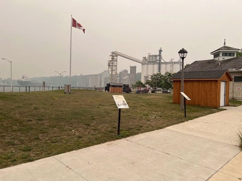
In the early 1930s, Bert MacDonald, a ship builder at the Mariton shipyard, leased the former CPR freight shed for the building of small boats and fishing vessels. As the demand for boat building decreased, Bert created a bathing house by converting . . . — — Map (db m306661) HM
Approximately 200 metres off the Rotary Beach Arch is the 'boneyard' for the historic Port of Goderich. Shipbuilders in years gone by used this area as a dumping ground for the remains of vessels that had foundered or were derelict.
Another method . . . — — Map (db m307120) HM
With the outbreak of hostilities in 1939, one of Canada’s major responsibilities was to provide air training facilities removed from the theatre of war. On December 17, 1939, the Plan was inaugurated. The first schools were opened the following . . . — — Map (db m307346) HM
With the beginning of settlement in 1827 these Canada Company lots became the local public burial ground. The pioneers of Goderich and the neighbouring townships were laid to rest here, until the Maitland Cemetery property was acquired on the Huron . . . — — Map (db m282698) HM
The Park House, once known as the Harbour Park Inn, was built as the residence of Thomas Mercer Jones, Commissioner of the Canada Company from 1839 until 1859. In this period, Jones was effectively the lord and master of the Huron Tract. He first . . . — — Map (db m307075) HM
North of this spot and south of the piers currently in use, lie the remains of one of the two Canada Company piers constructed in 1839. These created a stable opening for the first harbour. This location originally formed the mouth of the Maitland . . . — — Map (db m282741) HM
On this site, west of the original location of the station, was the roundhouse for the engines of the Canadian Pacific Railroad. It was constructed in time for the opening of this railway in 1907 along with a turntable positioned directly in front . . . — — Map (db m282738) HM
Officially opened by dignitaries of
the Guelph & Goderich Railway and the Town of Goderich
on
September 12, 1907
We dedicate this plaque to commemorate
the 100th anniversary of the building
on
September 15, 2007
The Town of . . . — — Map (db m198314) HM
Adjacent to the waterfront, as part of the Ocean House hotel complex operated by Captain William Babb, was a bathing house very close to the shoreline. It was placed there for the convenience of swimmers and sunbathers who could change attire . . . — — Map (db m282742) HM
Along the top of the bluff, from the area overlooking the CPR station to the southern end of Essex (formerly Norfolk) Street, were located numerous frame construction summer cottages. Only a few remain. One example can be found on the south side of . . . — — Map (db m306324) HM
The former building on this site, later to be known as the Bathing House, was originally built in 1907 by the CPR to be used as a freight shed for a marine terminal that was to complement the opening of the new CPR rail service to Goderich. The . . . — — Map (db m306652) HM
Christopher Crabb (1814-1893) arrived in Goderich in 1833 from London England.
He quickly established himself at the harbour, having acquired a 40-ton schooner, the Mary-Anne, and later the Annexation after the Mary-Anne . . . — — Map (db m306563) HM
Robert Graham Dunlop
1790-1841
Robert was the second son of Alexander Dunlop of Keppoch and Janet Graham, born on Oct. 1, 1790. He was familiarly known as Robin. Robert went to sea at 13 years of age as a cabin-boy and served in the Royal . . . — — Map (db m282677) HM
Until the 1970s, the south pier was lined with buildings used by commercial fisheries. Fishing shanties used by John Graham, Norman MacKay, John Baker, Ab and Florence Leonard, Reddy MacDonald, Mac and Norman MacDonald, Ed Siddall and others, were . . . — — Map (db m306990) HM
This unique structure was built to service passenger and freight needs for the new Goderich-Guelph railway line, operated under lease to the CPR commencing in 1907. Its original location was at the base of the embankment behind, with the building . . . — — Map (db m263177) HM
The Founding of Goderich
In 1826 the Canada Company, a newly chartered colonization
firm, acquired a large block of land known as the Huron Tract.
The following year William “Tiger” Dunlop, appointed Warden of
the Forests by . . . — — Map (db m307304) HM
You are standing on the last remnant of Gairbraid, the 845 acres acquired in 1833 by Robert and William Dunlop. The estate name came from their mother Janet Graham's childhood home in Dumbartonshire, Scotland.
The dream was for a sister town . . . — — Map (db m282678) HM
Goderich
Founded 1827 • Dedicated • Incorporated 1850
May 1, 2010
The Goderich Dominion Post Office and Customs Office was built in 1889-1890. The imposing grey stone Romanesque Revival building was designed by Thomas Fuller, Chief . . . — — Map (db m192987) HM
In 1859, the Canada Company deeded land to the Buffalo and Lake Huron Railway for transportation and grain storage. By 1866, the first 60,000-bushel elevator was opened. In 1897, then owned by the Grand Trunk Railway, it burned to the ground. The . . . — — Map (db m306489) HM
The Goderich Harbour was established by the Canada Company in 1826 to promote the settlement and commercial development of the Huron Tract.
The Port of Goderich became the gateway of the Huron Tract. By the 1830's, the Canada Company had built the . . . — — Map (db m306943) HM
In its early days, the harbour flats became a bustling centre of economy. There were shipyards, rail lines from the 1860s, three hotels, fish shanties, warehouses, freight sheds, ship chandlers, piles of coal and lumber, numerous homes and . . . — — Map (db m307024) HM
The beacon at the top of the bluff is actually the second Goderich lighthouse, said to be built in 1847. The land was acquired by the Crown in March 1849, from Thomas Mercer Jones who kept a small house here. The first mention of the 'new' . . . — — Map (db m193012) HM
“No man becomes rich unless he enriches others.” — Andrew Carnegie
The Goderich Library was opened in 1905 with a grant from Andrew Carnegie who believed a free library was the best gift that could be given to a . . . — — Map (db m198316) HM
The industrial buildings that you see on the north side of the pier, are the visible portion of the Goderich salt mine which opened in 1959. This mine is the largest underground salt mine in the world.
Although salt was discovered in the area . . . — — Map (db m306663) HM
In a storm that struck Lake Huron on November 9, 1913,
ten lake freighters were lost. Seven of them vanished,
ranging from the 30-year-old, 270-foot "Wexford” to the
550-foot "James Carruthers", launched six months earlier at
Collingwood. The . . . — — Map (db m192995) HM
In this building
on the
5th of May, 1945
Lt Gen Charles Foulkes CB CBE DSO
General officer commanding
1st Canadian Corps
accepted
the unconditional surrender
of the 25th German Army from
Col Gen Johannes Blaskowitz
The . . . — — Map (db m290008) HM
Erected between 1839 and 1841, this remarkably preserved
building follows Jeremy Bentham's Panopticon design for
prison construction, often found in mid-19th-century Britain
and America. It features an octagonal central block, . . . — — Map (db m263758) HM
This site was the location of a number of large, circular, steel storage tanks painted silver, owned by Imperial Oil and bearing the 'ESSO' logo.
They provided temporary liquid storage for up to two million gallons of fuel and heating oil. . . . — — Map (db m306422) HM
This propeller blade came from the last Canadian coal-fired lake freighter.
Launched in 1924, the vessel held several names before becoming P&H
Shipping's Spruceglen in 1982. It was scrapped in 1985.
Donated in memory of Ralph (Chief . . . — — Map (db m306420) HM
“The frontiersmen are soon overrun by the generations for whom they pave the way, but they
never entirely vanish. Something of them remains in stories, and in the habits and feelings of those who follow, and sometimes the bones, if not the . . . — — Map (db m282685) HM
In the early days, the harbour flats, first nicknamed Goosey Green, formed a bustling community complete with shops, taverns, factories and hotels. Sailors and other visitors arriving in the busy waterfront area had little need to ascend the hill . . . — — Map (db m306562) HM
"In 1886, four artesian wells were sunk on the harbour flats to a depth of 240 feet with the water being found, on analysis, 'clear, colourless' soft, of great organic purity and excellent quality,'..." (Toronto Daily Mail Nov. 5, 1892). . . . — — Map (db m306648) HM
As a mariner, Captain William Babb, realizing the need for good accommodation for passengers arriving by water and waiting to catch the stagecoach for points east, decided to build a grand, two-storey hotel near the sulphurous Mineral Springs. It . . . — — Map (db m306643) HM
This railway was planned, funds raised, properties purchased for completion from Goderich to Kincardine, Ontario for its initial operation for freight and passengers. Construction process began in 1907 after Canadian Pacific Railway was . . . — — Map (db m307349) HM
In this immediate area was located the first lighthouse to be built as a navigational aid for the Port of Goderich. It was likely the inner light tower for a range light to show direction for the harbour entrance. It was thought to be a log . . . — — Map (db m282714) HM
Goderich was the location of the first lighthouse erected on the Canadian side of Lake Huron.
1847 This tower was built by Scottish stonemason, Adam MacVicar. • It stands 10.1 metres high (about 33 feet) and 42.7 metres above the lake (about . . . — — Map (db m193008) HM
After a life of vigorous action and colourful scenes, it remained for Dunlop to close with a memorable exit, and this he did with a final flourish, dying far afield and enjoying a heroic posthumous homecoming.
He died at Lachine near Montreal . . . — — Map (db m282598) HM
It is difficult to estimate the total number of salt wells and brine evaporation plants that existed in Goderich from the first discovery of salt in 1866 to today. In the early days, they seemed to spring up almost everywhere, even as far inland as . . . — — Map (db m306419) HM
'Ship Island' was located in the northeast corner of the present harbour. Originally some four acres in size, it served for over a century as a base for various shipyards. Over 100 ships were built there beginning in 1831. John Thornton and George . . . — — Map (db m307020) HM
Built in 1868 by the early pioneers, originally as a Presbyterian Church, if later became the St. Andrew’s United Church in 1925 until its' closure in 1969.
This cairn and plaque is to honour
Henry Lednor and his wife Jean Dunbar,
and . . . — — Map (db m307364) HM
12 Elementary Flying Taining School RCAF
North of this marker was the above base of the BCATP of World War II inaugurated December 17th, 1939. From 360 schools on 281 Canadian
sites such as this graduated 131,553 aircrew, over 200,000 . . . — — Map (db m307337) HM
A large three storey 80-bedroom summer hotel once sat on the north side of Britannia Road at the corner of Essex Street, occupying most of the west end of the block. It was built of yellow brick veneer construction, had a staff complement of 32, a . . . — — Map (db m306323) HM
A powerful Canada Company land magnate, Jones was born in England and acquired business training there.
By virtue of his London connections he obtained an appointment as a Company Commissioner and moved to York (Toronto) in 1829. He administered a . . . — — Map (db m307073) HM
In the nearby tomb is buried Dr. William Dunlop, physician, author, woodsman, soldier, politician and raconteur. Born in Scotland, he served in Canada as an army surgeon during the War of 1812. His writings, including articles based on his residence . . . — — Map (db m282580) HM
Following the founding of Guelph in April, 1827, William "Tiger” Dunlop travelled through the forests to the site of Goderich at the mouth of the Maitland River and returned the following year with the company of road cutters who opened the Huron . . . — — Map (db m307305) HM
”We visited yesterday the grave of my late uncle, Captain Dunlop - poor fellow! He rests in a sweet spot, with trees near it, a sloping wooded bank on one side and flowers growing all round. The grave is covered with a handsome granite slab, and . . . — — Map (db m282600) HM
At 4 PM on August 21, 2011, an F3 category tornado struck Goderich at approximately this location. It swept up from the lake at the Sifto Salt mine. and crossed through the centre of the town, attaining speeds of 320 km/hr. The loss to Goderich and . . . — — Map (db m307334) HM
At 7 a.m., Sunday, July 17, 1988, 27 Year old Vicki Keith departed from Harbor Beach Michigan on an epic swim across Lake Huron. Vicki swam on bravely through July 17, July 18 and onward into the early hours of Tuesday, July 19th. She arrived on the . . . — — Map (db m306945) HM
The Electric Light and Water Plant, formerly located on this site, was the town's first steam-powered electric generation, water pumping station. By 1889, electricity was being supplied to some parts of the town from a large red brick building with . . . — — Map (db m306444) HM
The old green bathing house adjacent to the pier, built as a freight shed for the CPR, was the site for summer time student jobs. Here is an account by one of those students:
"The Bathing House had stalls to change your clothes and boxes that . . . — — Map (db m306948) HM