854 entries match your criteria. The first 100 are listed. ⊳
Historical Markers and War Memorials in Maine
By Devry Becker Jones (CC0), November 11, 2021
Amitgonpontook Marker
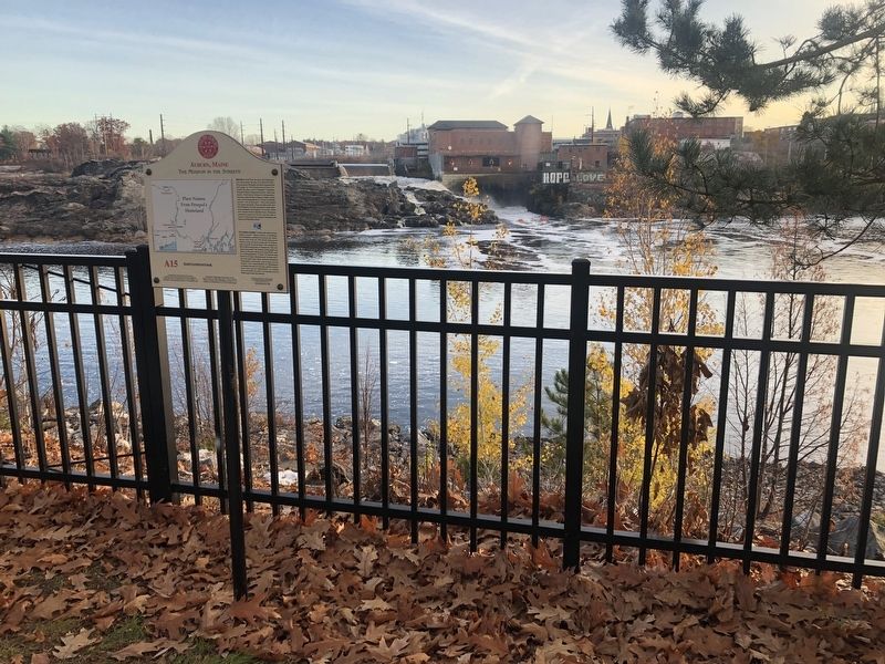
| 1 ► Maine, Androscoggin County, Auburn — A15 — Amitgonpontook — Auburn, Maine — The Museum in the Streets — |
| On Auburn Riverwalk, 0.1 miles north of Court Street (U.S. 202), on the right when traveling north. | |||
| 2 ► Maine, Androscoggin County, Auburn — A1 — Androscoggin Log Drives / Les Draves Sur L'Androscoggin — Auburn, Maine — The Museum in the Streets® — |
| On Auburn Riverwalk, 0.1 miles north of Great Falls Plaza, on the left when traveling east. | |||
| 3 ► Maine, Androscoggin County, Auburn — A5 — Auburn L.L. Bean Store / Le Magasin L.L. Bean À Auburn — Auburn, Maine — The Museum in the Streets® — |
| On Main Street (Maine Route 136) at Court Street (U.S. 202), on the right when traveling north on Main Street. | |||
| 4 ► Maine, Androscoggin County, Auburn — Map — Auburn, Maine — The Museum in the Streets — |
| On Main Street (Maine Route 136) 0.1 miles south of Court Street (U.S. 202), on the right when traveling north. | |||
| 5 ► Maine, Androscoggin County, Auburn — Map — Auburn, Maine — The Museum in the Streets — |
| On Auburn Riverwalk, 0.2 miles north of Court Street (U.S. 202), on the right when traveling north. | |||
| 6 ► Maine, Androscoggin County, Auburn — 9 of 16 — Auburn's Agriculture, Forestry and Resource Protection Zone — Auburn, Maine Agriculture Committee — |
| On Auburn Riverwalk, 0.1 miles south of Court Street (U.S. 202), on the right when traveling south. | |||
| 7 ► Maine, Androscoggin County, Auburn — Bonney Park — |
| Near Main Street (Maine Route 136). | |||
| 8 ► Maine, Androscoggin County, Auburn — Bonney Park — |
| On Auburn Riverwalk just east of Main Street (Maine Route 136), in the median. | |||
| 9 ► Maine, Androscoggin County, Auburn — Cities of the Androscoggin — Lewiston-Auburn — |
| Near Main Street (Maine Route 136). | |||
| 10 ► Maine, Androscoggin County, Auburn — Civil War Memorial — |
| On Turner Street at Court Street (Maine Route 100) on Turner Street. | |||
| 11 ► Maine, Androscoggin County, Auburn — A12 — Development of New Auburn / Le Nouvel Auburn — Auburn, Maine — The Museum in the Streets® — |
| On Auburn Riverwalk, 0.1 miles north of Main Street (Maine Route 136), on the right when traveling north. | |||
| 12 ► Maine, Androscoggin County, Auburn — A14 — Ecology of the Riverbanks / La Biodiversité des Berges — Auburn, Maine — The Museum in the Streets® — |
| On Auburn Riverwalk, 0.2 miles south of Court Street (U.S. 202), on the left when traveling north. | |||
| 13 ► Maine, Androscoggin County, Auburn — A7 — Edward Little House 1827 / La Maison d'Edward Little 1827 — Auburn, Maine — The Museum in the Streets® — |
| On Main Street (Maine Route 136) just south of Vine Street, on the left when traveling north. | |||
| 14 ► Maine, Androscoggin County, Auburn — Festival Plaza — |
| On Main Street (Maine Route 136) 0.1 miles south of Court Street (U.S. 202), on the right when traveling north. | |||
| 15 ► Maine, Androscoggin County, Auburn — A8 — Foss Mansion / Le Manoir Foss — Auburn, Maine — The Museum in the Streets® — |
| On Elm Street just west of Main Street (Maine Route 136), on the right when traveling west. | |||
| 16 ► Maine, Androscoggin County, Auburn — A4 — Great Falls Geology / La Géologie des Grandes Chutes — Auburn, Maine — The Museum in the Streets® — |
| On Auburn Riverwalk, 0.2 miles Court Street (U.S. 202), on the right when traveling north. | |||
| 17 ► Maine, Androscoggin County, Auburn — A13 — Great New Auburn Fire / Le Grand Incendie du Nouvel-Auburn — Auburn, Maine — The Museum in the Streets® — |
| On Auburn Riverwalk, 0.2 miles north of Main Street (Maine Route 136) when traveling north. | |||
| 18 ► Maine, Androscoggin County, Auburn — A3 — Hydroelectric Power / L'Énergie Hydraulique — Auburn, Maine — The Museum in the Streets® — |
| On Auburn Riverwalk just north of Great Falls Plaza, on the right when traveling north. | |||
| 19 ► Maine, Androscoggin County, Auburn — A2 — Knight House / La Maison Knight — Auburn, Maine — The Museum in the Streets® — |
| On Auburn Riverwalk, 0.1 miles Great Falls Plaza, on the left when traveling north. | |||
| 20 ► Maine, Androscoggin County, Auburn — A9 — Lewiston Falls Academy / L'Académie de Lewiston Falls — Auburn, Maine — The Museum in the Streets® — |
| On Main Street (Maine Route 136) just south of Academy Street, on the right when traveling south. | |||
| 21 ► Maine, Androscoggin County, Auburn — 6 of 16 — Maine's Loss of Farmland & Rise of Small Farms — Auburn, Maine Agriculture Committee — |
| On Auburn Riverwalk, 0.1 miles north of Court Street (U.S. 202), on the left when traveling north. | |||
| 22 ► Maine, Androscoggin County, Auburn — A11 — River Pollution and Restoration / Pollution et Restoration de la Rivière — Auburn, Maine — The Museum in the Streets® — |
| Near Auburn Riverwalk, 0.1 miles north of Main Street (Maine Route 136), on the right when traveling north. | |||
| 23 ► Maine, Androscoggin County, Auburn — A6 — Roak Block — Auburn, Maine — The Museum in the Streets® — |
| On Main Street (Maine Route 136) just north of Mechanics Row, on the left when traveling north. | |||
| 24 ► Maine, Androscoggin County, Auburn — The Knight House — 1796 — |
| On Auburn Riverwalk, 0.1 miles north of Great Falls Plaza, on the left when traveling north. | |||
| 25 ► Maine, Androscoggin County, Auburn — A10 — Wabanaki History / Les Wabanaquis — Auburn, Maine — The Museum in the Streets® — |
| On Auburn Riverwalk just east of Main Street (Maine Route 136), in the median. | |||
| 26 ► Maine, Androscoggin County, Greene — Mail Route 1794 — Androscoggin County — |
| On U.S. 202 south of West Main Street, on the right when traveling west. | |||
| 27 ► Maine, Androscoggin County, Lewiston — "Remember the Maine" — |
| On Main Street (U.S. 202) at Lincoln Street, on the right when traveling west on Main Street. | |||
| 28 ► Maine, Androscoggin County, Lewiston — L15 — 10,000 Years of Wabanaki History / 10 000 Ans d'Histoire Wabanaki — Lewiston, Maine — The Museum in the Streets — |
| On Auburn Riverwalk just east of Oxford Street. | |||
| 29 ► Maine, Androscoggin County, Lewiston — Androscoggin Gem — Androscoggin County — |
| On Main Street (U.S. 202) at Lincoln Street, on the right when traveling west on Main Street. | |||
| 30 ► Maine, Androscoggin County, Lewiston — L14 — Canal System / Les Canaux — Lewiston, Maine — The Museum in the Streets® — |
| On Beech Street at Oxford Street, on the right when traveling east on Beech Street. | |||
| 31 ► Maine, Androscoggin County, Lewiston — Chief Justice Armand A. Dufresne Jr. Plaza — |
| On Lisbon Street (Maine Route 196) 0.2 miles north of Ash Street, on the right when traveling north. | |||
| 32 ► Maine, Androscoggin County, Lewiston — Cities of the Androscoggin — Lewiston-Auburn — |
| On Auburn Riverwalk just west of Oxford Street, in the median. | |||
| 33 ► Maine, Androscoggin County, Lewiston — L1 — Early Industry / Les Débuts de L'Industrie — Lewiston, Maine — The Museum in the Streets® — |
| On Main Street (Route 202) at Lincoln Street, on the right when traveling west on Main Street. | |||
| 34 ► Maine, Androscoggin County, Lewiston — Gold Star Families Memorial — |
| On Main Street (U.S. 202) at Lincoln Street, on the right when traveling west on Main Street. | |||
| 35 ► Maine, Androscoggin County, Lewiston — L13 — Grand Trunk Depot / La Gare d'Arrivée du Grand Trunk — Lewiston, Maine — The Museum in the Streets® — |
| On Lincoln Street just north of Beech Street, on the left when traveling north. | |||
| 36 ► Maine, Androscoggin County, Lewiston — L4 — Haymarket Square / La Place du Marché des Fourrages — Lewiston, Maine — The Museum in the Streets — |
| On Main Street (U.S. 202) at Park Street, on the right when traveling east on Main Street. | |||
| 37 ► Maine, Androscoggin County, Lewiston — Map — Lewiston, Maine — The Museum in the Streets — |
| On Oxford Street just north of Beech Street, on the right when traveling north. | |||
| 38 ► Maine, Androscoggin County, Lewiston — Map — Lewiston, Maine — The Museum in the Streets — |
| On Lisbon Street (Maine Route 196) 0.1 miles south of Journal Alley, on the right when traveling north. | |||
| 39 ► Maine, Androscoggin County, Lewiston — L5 — Music Hall — Lewiston, Maine — The Museum in the Streets® — |
| On Lisbon Street (Maine Route 196) 0.2 miles north of Ash Street, on the right when traveling north. | |||
| 40 ► Maine, Androscoggin County, Lewiston — Naval Air Station Gun — |
| On Main Street (U.S. 202) at Lincoln Street, on the right when traveling west on Main Street. | |||
| 41 ► Maine, Androscoggin County, Lewiston — L3 — Peck's Department Store / Le Grand Magasin Peck — Lewiston, Maine — The Museum in the Streets® — |
| On Lisbon Street (Maine Route 196) at Main Street (U.S. 202), on the right when traveling north on Lisbon Street. | |||
| 42 ► Maine, Androscoggin County, Lewiston — Richard E. White — |
| On Main Street (U.S. 202) at Lincoln Street, on the right when traveling west on Main Street. | |||
| 43 ► Maine, Androscoggin County, Lewiston — Veterans Memorial — |
| On Main Street (U.S. 202) at Lincoln Street, on the right when traveling west on Main Street. | |||
| 44 ► Maine, Androscoggin County, Lewiston — Veterans Memorial — |
| On Main Street (U.S. 202) at Lincoln Street, on the right when traveling west on Main Street. | |||
| 45 ► Maine, Androscoggin County, Lewiston — Veterans Memorial Park — |
| On Main Street (U.S. 202) at Lincoln Street, on the right when traveling west on Main Street. | |||
| 46 ► Maine, Androscoggin County, Lewiston — L2 — Veterans Memorial Park / Le Parc des Vétérans — Lewiston, Maine — The Museum in the Streets — |
| On Main Street (U.S. 202) at Lincoln Street, on the right when traveling west on Main Street. | |||
| 47 ► Maine, Androscoggin County, Lewiston — Victoria — |
| On Main Street (U.S. 202) at Lincoln Street, on the right when traveling west on Main Street. | |||
| 48 ► Maine, Androscoggin County, Lewiston — Vietnam Wall — Lewiston, Maine — September 28 - 30, 2007 — |
| On Main Street (U.S. 202) at Lincoln Street, on the right when traveling west on Main Street. | |||
| 49 ► Maine, Androscoggin County, Lewiston — Vietnam War — 1955 - 1975 — United We Stand — |
| On Main Street (U.S. 202) at Lincoln Street, on the right when traveling west on Main Street. | |||
| 50 ► Maine, Androscoggin County, Lewiston — Willys "Jeep" — |
| On Main Street (U.S. 202) at Lincoln Street, on the right when traveling west on Main Street. | |||
| 51 ► Maine, Aroostook County, Fort Kent — Allagash and St. John Rivers — Northern Forest Canoe Trail — |
| Near Dufour Street north of Church Street, on the left when traveling north. | |||
| 52 ► Maine, Aroostook County, Fort Kent — America's First Mile — U.S. Route 1 • Fort Kent, Maine — |
| On West Main Street (U.S. 1) at Clair-Fort Kent International Bridge, on the right when traveling west on West Main Street. | |||
| 53 ► Maine, Aroostook County, Fort Kent — Fort Kent — |
| On Blockhouse Road. | |||
| 54 ► Maine, Aroostook County, Fort Kent — One People in Two Countries / Une Vallée sans frontière — |
| On West Main Street (U.S. 1) at Clair-Fort Kent International Bridge, on the right when traveling west on West Main Street. | |||
| 55 ► Maine, Aroostook County, Fort Kent — Rail Fuels Growth, Cultural Change — Le chemin de fer contribue à la croissance économique et aux changements culturels — |
| Near Market Street (Maine Route 161) just east of East Main Street (U.S. 1), on the right when traveling west. | |||
| 56 ► Maine, Aroostook County, Fort Kent — The Aroostook War — |
| On Blockhouse Road at Island Road, on the right when traveling west on Blockhouse Road. | |||
| 57 ► Maine, Aroostook County, Fort Kent — When "going across" Was Like Crossing the Street — Lorsque « changer de pays » était comme traverser la rue — |
| On East Main Street (U.S. 1) at River Street, on the right when traveling south on East Main Street. | |||
| 58 ► Maine, Aroostook County, Frenchville — "Smuggling is Not a Sin" / « La contrebande n'est pas-un péché! » — |
| On Main Street (U.S. 1) 0.1 miles east of Felix Avenue, on the left when traveling east. | |||
| 59 ► Maine, Aroostook County, Frenchville — Farming Then & Now / L'agriculture d'hier à aujourd'hui — |
| On Main Street (U.S. 1) 0.1 miles east of Felix Avenue, on the left when traveling east. | |||
| 60 ► Maine, Aroostook County, Frenchville — Frenchville Railroad Station & Water Tank — National Register of Historic Places — |
| On Main Street (U.S. 1) 0.1 miles east of Felix Avenue, on the left when traveling east. | |||
| 61 ► Maine, Aroostook County, Frenchville — La paroisse de Ste. Luce 150e anniversaire — The Parish of St. Luce 150th Anniversary — 1843-1993 — |
| Near Main Street (U.S. 1) just west of Church Avenue, on the left when traveling west. | |||
| 62 ► Maine, Aroostook County, Frenchville — The "Potato Road" / La route «des patates » — |
| On Main Street (U.S. 1) 0.1 miles east of Felix Avenue, on the left when traveling east. | |||
| 63 ► Maine, Aroostook County, Littleton — Watson Settlement Bridge — Maine Historic Civil Engineering Landmark — |
| On Framingham Road, 0.3 miles east of Carson Road, on the left when traveling east. | |||
| 64 ► Maine, Aroostook County, Madawaska — "Making Do" / Tout faire avec rien — |
| On Fournier Siding just north of Main Street (U.S. 1), on the left when traveling north. | |||
| 65 ► Maine, Aroostook County, Madawaska — Acadian Heroine: Tante Blanche / Tante Blanche : Héroïne acadienne — |
| On Main Street (U.S. 1) just west of Fournier Siding, on the right when traveling west. | |||
| 66 ► Maine, Aroostook County, Madawaska — Acadian Landing Site — Acadian Cross Historic Shrine — National Register of Historic Places — |
| On Fournier Siding (Siding Road), 0.4 miles north of Main Street (U.S. 1). | |||
| 67 ► Maine, Aroostook County, Madawaska — Discover Traces of Acadian Architecture — Découvrez les traces de l'architecture acadienne — |
| On Main Street (U.S. 1) at Fournier Siding, on the right when traveling west on Main Street. | |||
| 68 ► Maine, Aroostook County, Madawaska — Du Premier Débarquement des Acadiens àu Madawaska — The first landing of the Acadians in Madawaska — juin 1785 — |
| On Main Street (U.S. 1) just west of Fournier Siding, on the right when traveling west. | |||
| 69 ► Maine, Aroostook County, Madawaska — Genealogy, Massive French & Acadian Family Reunions — La généalogie. Ces grands rassemblements de familles acadiennes et françaises — |
| On Main Street (U.S. 1) just west of Fournier Siding, on the right when traveling west. | |||
| 70 ► Maine, Aroostook County, Madawaska — Saint David Catholic Church — National Register of Historic Places — |
| On Main Street (U.S. 1) east of Emmanuel Avenue, on the left when traveling east. | |||
| 71 ► Maine, Aroostook County, Madawaska — Territoire de Madawaska — |
| On Main Street (U.S. 1) just west of Fournier Siding, on the right when traveling west. | |||
| 72 ► Maine, Aroostook County, Madawaska — Who is a patenteux? / Patenteux ou pas ? — |
| On Fournier Siding just north of Main Street (U.S. 1), on the left when traveling north. | |||
| 73 ► Maine, Aroostook County, Orient — Orient Veterans Memorial — |
| On School House Road at Peters Cove Road, on the left when traveling north on School House Road. | |||
| 74 ► Maine, Aroostook County, Presque Isle — Maine Solar System Model — Scale: 1:93,000,000 — |
| On U.S. 1, 0.4 miles south of Perkins Road, on the left when traveling north. | |||
| 75 ► Maine, Aroostook County, Winterville — The Aroostook and Fish River Roads — |
| Near Aroostook Road (Maine Route 11) 0.1 miles south of Pennington Pond Road. | |||
| 76 ► Maine, Cumberland County, Bridgton — Bridgton's Sons Civil War Memorial — |
| On South High Street at Main Street (U.S. 302), in the median on South High Street. | |||
| 77 ► Maine, Cumberland County, Bridgton — Webb House, circa 1830 — National Register of Historic Places — |
| On Main Street (U.S. 302) at Church Street, on the right when traveling east on Main Street. | |||
| 78 ► Maine, Cumberland County, Brunswick — Androscoggin Swinging Bridge — National Register of Historic Places January 2004 — |
| 79 ► Maine, Cumberland County, Brunswick — Bowdoin College War Memorial — |
| 80 ► Maine, Cumberland County, Brunswick — Bowdoin College World War Memorial — |
| 81 ► Maine, Cumberland County, Brunswick — Brunswick Veterans Memorial — In Grateful Recognition of Valor — |
| On Maine Street (Maine Route 24) at School Street, on the left when traveling south on Maine Street. | |||
| 82 ► Maine, Cumberland County, Brunswick — Company K, 1st Maine Volunteer Infantry — |
| On Maine Street (Maine Route 24) at Noble Street, in the median on Maine Street. | |||
| 83 ► Maine, Cumberland County, Brunswick — Founding of the Maine Medical Association — |
| On Maine Street (Maine Route 24) at Pleasant Street, on the right when traveling north on Maine Street. | |||
| 84 ► Maine, Cumberland County, Brunswick — Harriet Beecher Stowe House — |
| On Federal Street at Maple Street, on the right when traveling north on Federal Street. | |||
| 85 ► Maine, Cumberland County, Brunswick — Home of Joshua Lawrence Chamberlain — 1828 1914 — |
| On Maine Street at Potter Street, on the right when traveling south on Maine Street. | |||
| 86 ► Maine, Cumberland County, Brunswick — Robinson Memorial Gate — |
| On Maine Street at Bath Road (Maine Route 24), on the left when traveling south on Maine Street. | |||
| 87 ► Maine, Cumberland County, Brunswick — Robinson Memorial Gate — |
| On College Street near Maine Street, on the left when traveling east. | |||
| 88 ► Maine, Cumberland County, Brunswick — Round-the-World Flight 1924 — Maine's Tribute to the American Round-The-World Aviators — |
| Near Monument Lane west of Mere Point Road, on the right when traveling north. | |||
| 89 ► Maine, Cumberland County, Brunswick — Site of Fort Andross and Fort George — |
| 90 ► Maine, Cumberland County, Cape Elizabeth — A Town Within A Town — |
| 91 ► Maine, Cumberland County, Cape Elizabeth — Annie C. McGuire Shipwreck Memorial — |
| On Off Shore Road. | |||
| 92 ► Maine, Cumberland County, Cape Elizabeth — Artillery Engineer Storehouse — |
| Near Shore Road south of Littlejohn Road, on the right when traveling north. | |||
| 93 ► Maine, Cumberland County, Cape Elizabeth — Artillery Engineer Storehouse — Fort Williams — 1899 - 1962 — |
| Near Shore Road south of Littlejohn Road, on the right when traveling north. | |||
| 94 ► Maine, Cumberland County, Cape Elizabeth — Bachelor Officers' Quarters — Fort Williams — 1899 - 1962 — |
| Near Shore Road south of Littlejohn Road, on the right when traveling north. | |||
| 95 ► Maine, Cumberland County, Cape Elizabeth — Bachelor's Officers' Quarters — |
| Near Shore Road south of Littlejohn Road, on the right when traveling north. | |||
| 96 ► Maine, Cumberland County, Cape Elizabeth — Battery Blair — |
| 97 ► Maine, Cumberland County, Cape Elizabeth — Battery Blair — |
| On Shore Road, on the right when traveling north. | |||
| 98 ► Maine, Cumberland County, Cape Elizabeth — Battery Erasmus Keyes — |
| Near Shore Road north of Littlejohn Road, on the right when traveling north. | |||
| 99 ► Maine, Cumberland County, Cape Elizabeth — Battery Hobart — |
| On Shore Road, on the right when traveling north. | |||
| 100 ► Maine, Cumberland County, Cape Elizabeth — CCC Headquarters — |
854 entries matched your criteria. The first 100 are listed above. Next 100 ⊳