By James R. Murray, August 10, 2016
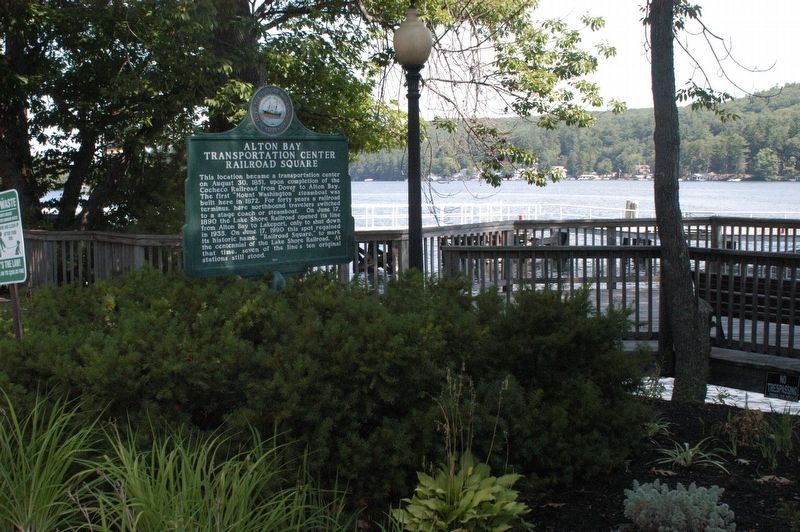
Alton Bay Transportation Center Marker
GEOGRAPHIC SORT Title Sort Marker Number Sort Marker Number Sort N Marker Number Sort T Publication Order Sort Publication Order Sort A Erected Year Sort Most Viewed Sort Most Recent-Interest Sort Most Recently Changed Sort SEE FAQ #33 FOR DESCRIPTIONS
On Rt. 11 (New Hampshire Route 11), on the right.
Near Endicott Street (U.S. 3) east of Lakeside Avenue, on the right when traveling west.
On Endicott Street (U.S. 3) east of Lakeside Avenue, on the right when traveling west.
Near West Main Street (U.S. 3) at Winter Street, on the left when traveling west.
On Passaconaway Road east of Kancamagus Highway (New Hampshire Route 112), on the right when traveling east.
On Main Street (U.S. 302) at River Street, on the right when traveling east on Main Street.
On New Hampshire Route 119 at Templeton Turnpike, on the left when traveling south on State Route 119.
On New Hampshire Route 119 west of Templeton Turnpike, on the left when traveling west.
On Canal Street (New Hampshire Route 119) 0.5 miles east of Chesterfield Road (New Hampshire Route 63), on the left when traveling east.
Near West Street at Federal Street.
On Main Street at Winchester Street, on the right on Main Street.
On Main Street (New Hampshire Route 12) north of Gates Street, on the right when traveling north.
On Central Square, 0.1 miles north of New Hampshire Highway 12.
On New Hampshire Route 12, 0.9 miles north of Upper Walpole Road, on the right when traveling north.
On River Road, 0.5 miles south of Stoneleigh Heights, on the right when traveling north.
Paid Advertisement
On Main Street (New Hampshire Route 16), on the right when traveling north.
On East Milan Road, 1.5 miles north of 12th Street, on the left when traveling north.
On U.S. 302 at Zealand Road, on the right when traveling east on U.S. 302.
On U.S. 302 at Base Station Road, on the right when traveling west on U.S. 302.
Near New Hampshire Route 26, 1.1 miles east of Cold Spring Road, on the right when traveling east.
On Main Street (U.S. 3) 0.1 miles north of Berlin-Groveton Highway (New Hampshire Route 110), on the right when traveling north.
On Meadows Road (New Hampshire Route 115A) 0.5 miles south of Presidential Highway (U.S. 2), on the right when traveling south.
On Route 3 at U.S. 2, on the right when traveling south on Route 3.
Near Main Street (Route 2) north of Mechanic Street, on the left when traveling north.
On Main Street, 0.1 miles south of Town Common Road, on the right when traveling south.
On New Hampshire Route 16 at milepost 99.6,, 10 miles south of Main Street (U.S. 2), on the left when traveling south.
On Hill Road at U.S. 3, on the right on Hill Road.
On Main Street (U.S. 3) at Back Lake Road, on the right when traveling west on Main Street.
Near Daniel Webster Highway (U.S. 3) 1 mile south of US-Canadian Border Station, on the right when traveling south.
On Hollow Road (New Hampshire Route 145) at Creampoke Road, on the right when traveling north on Hollow Road.
On Rum Hill Road (U.S. 302), on the right when traveling south.
Paid Advertisement
On E. Lost River Road (New Hampshire Route 112) at Tunnel Brook Road, on the right when traveling east on E. Lost River Road.
On Main Street at Blacksmith Alley, on the right when traveling east on Main Street.
On Main Street at Shaker Hill Road, on the left when traveling west on Main Street.
On New Hampshire Route 4A at Caleb Dyer Lane, on the right when traveling south on State Route 4A.
On Main Street (New Hampshire Route 116) 0.1 miles south of Sugar Hill Road (New Hampshire Route 117), on the left when traveling north.
On Dartmouth College Highway (New Hampshire Route 10 at milepost 113.6) at Court Street, on the right when traveling north on Dartmouth College Highway.
On Dartmouth College Road (U.S. 302) 2 miles south of Sugar Hill Road (New Hampshire Route 117), on the right when traveling south.
Near Kancamagus Highway (State Highway 112) 20 miles east of Daniel Webster Highway (U.S. 3), on the right when traveling east.
On South River Road (U.S. 3) 0.1 miles south of Kilton Road, on the right when traveling south.
On Main Street (New Hampshire Route 3/114) at Church Street, on the right when traveling south on Main Street.
On 2nd New Hampshire Turnpike (New Hampshire Route 31) north of Franklin Pierce Highway (New Hampshire Route 9), on the right when traveling north.
On Ash Street at Myrtle Street, on the right when traveling south on Ash Street.
On Daniel Webster Highway (U.S. 3) north of Woodbury Street, on the right when traveling north.
On Amherst Street (New Hampshire Route 101A) at Townsend, on the left when traveling west on Amherst Street.
On Main Street at Railroad Square, on the right when traveling north on Main Street.
On Gen. Miller Highway at Cemetery Lane, on the right when traveling north on Gen. Miller Highway.
Paid Advertisement
On Concord Stage Road (New Hampshire Route 77) at South Sugar Hill Road, on the right when traveling east on Concord Stage Road.
On South Stark Highway (New Hampshire Route 114) 0.1 miles south of Orchard Hill Road, on the right when traveling south.
On Eastman Street at Portsmouth Street, on the right when traveling north on Eastman Street.
On North Main Street (U.S. 3) at Capitol Street, on the right when traveling north on North Main Street.
On East Side Drive (New Hampshire Route 132), on the right when traveling south.
On North Main Street (U.S. 202) at Chapel Street, on the right when traveling south on North Main Street.
On Eastman Street, 0.1 miles north of Portsmouth Street, on the left when traveling north.
On North Main Street, 0.2 miles north of U.S. 202, on the right when traveling north.
On Pleasant Street (U.S. 202), on the right when traveling west.
On S Main Street (U.S. 3) 0.5 miles south of Holy Cross Road, on the left when traveling north.
On Commerce Street (New Hampshire Route 3A), on the right when traveling north.
On Rocky Pond Road (New Hampshire Route 106) at Shaker Road, on the right when traveling north on Rocky Pond Road.
On Keyser Street at Wadleigh Hill Road, on the right when traveling east on Keyser Street.
On Pembroke Street (U.S. 3) at Pembrook Hill Road, on the right when traveling north on Pembroke Street.
On Main Street at Union Street, on the left when traveling north on Main Street.
On Drinkwater Road at Rt. 111, in the median on Drinkwater Road.
Paid Advertisement
On Front Street, on the right when traveling north.
On Main Street (New Hampshire Route 107) south of Sandown Road, on the right when traveling south.
On Portsmouth Avenue at Post Road (New Hampshire Route 151), on the right when traveling west on Portsmouth Avenue. Reported damaged.
On Landing Road at Park Avenue, on the left when traveling east on Landing Road.
On Landing Road at Park Avenue, on the left when traveling east on Landing Road.
On Park Avenue at Cuss Lane, on the right when traveling west on Park Avenue.
On Park Avenue at Cuss Lane, on the right when traveling west on Park Avenue.
On Main Street (Route 1B) east of Atkinson Street, on the left when traveling east.
On General Sullivan Bridge at Shattuck Way, on the left when traveling north on General Sullivan Bridge.
On Raymond Road (New Hampshire Route 156) at Ledge Farm Road, on the right when traveling north on Raymond Road.
Near Ocean Boulevard (Route 1A).
On Ocean Boulevard (U.S. A1A) when traveling east.
Near Haverhill Road just north of Christine Lane, on the left when traveling north. Reported unreadable.
Near Haverhill Road west of Theodore Avenue, on the left when traveling north.
On Lafayette Road (U.S. 1) at Rocks Road, on the right when traveling north on Lafayette Road.
On Calef Highway (New Hampshire Route 125) 0.1 miles north of Beauty Hill Road, on the right when traveling north.
Paid Advertisement
On Central Avenue (New Hampshire Route 9) south of First Street, on the right when traveling south.
On New Hampshire Route 11, on the right when traveling north.
Near South Main Street just south of Liberty Street, on the right when traveling south.
On North Main Street (State Highway 202A) at Wakefield Street, on the left when traveling south on North Main Street.
On Sligo Road at Pinch Hill Road, on the right when traveling north on Sligo Road.
On Main Street (New Hampshire Route 12) north of Olcott Lane, on the left when traveling north.
On Main Street (New Hampshire Route 12) north of Olcott Lane, on the left when traveling north.
On New Hampshire Route 12 at Plains Road on State Route 12.
On Jarvis Hill Road (New Hampshire Route 12A) at Half Mile Road, on the right when traveling south on Jarvis Hill Road.
On River Road (SR 12A) at Depot Hill Road on River Road (SR 12A).
On South Main Street (New Hampshire Route 31), on the right when traveling north.
On Main Street (New Hampshire Route 31) at Halfmoon Pond Road, in the median on Main Street.
On Main Street (New Hampshire Route 31) at Halfmoon Pond Road, on the right when traveling north on Main Street.
On Main Street at Lempster Mountain Road, on the left when traveling north on Main Street.