The first colony of Muskogee-speaking Upper Creek Indians from Alabama was established nearby in 1767. British surveyor/naturalist Bernard Romans identified the settlement as "New Yufala, planted in a beautiful and fertile plain." It later became . . . — — Map (db m93307) HM
It’s July 23, 1539…
Conquistador Hernando de Soto and his advance guard of 12 horsemen have just passed the small Indian village of Vicela…
I have decided not to stop here. We must press on further north and reach the chiefdom of . . . — — Map (db m126575) HM
It’s July 20, 1539…
Here at the Indian village called Luca, Calvary Captain Baltasar de Gallegos reports back to Hernando de Soto –
My mission to meet with the great Chief Urriparacoxi was unsuccessful. The chief hid in the . . . — — Map (db m126574) HM
Lakewood Drive, part of old Seminole Indian trails, led to Fort Brooke and "Pease Creek". In 1876 Judge Joseph Gillette Knapp of Wis. settled and named Limona after citrus trees left by the Spanish. In 1877 the Elgin Watch Co. formed Limona Park . . . — — Map (db m57213) HM
It’s June 20, 1539…
Juan Ortiz, a lost Spaniard from an earlier expedition with Pánfilo de Narváez, is found by De Soto’s men not far from here. He tells his story –
Ten years ago I was captured by Chief Ucita. I later escaped to the . . . — — Map (db m126571) HM
It’s May 30, 1539…
Spanish conquistador Hernando de Soto has arrived here in La Florida, Land of Flowers, and stepped ashore –
My men can now offload our nine ships. We have sailed with 500 tons of materials needed for our . . . — — Map (db m126569) HM
(Left panel)
De Soto Trail
1539-1540
You are standing along the historic route of the conquistador Hernando de Soto and his expedition through the Florida Native American territories in his quest for gold and glory. . . . — — Map (db m126570) HM
"Knight's Point" is dedicated in memory of Charley Knight, a native Tampan, well-known property appraiser and prominent collector of Native-American artifacts. Knight always had a keen interest in and fond feelings for the 177-acre tract of . . . — — Map (db m216411) HM
1539 1926
[ DAR Emblem ]
This Tablet Erected By
De Soto Chapter
D.A.R.
Marks the tree under which tradition say's
De Soto
Parleyed with the Indians — — Map (db m20789) HM
The Seminole Nation fights for their identity and their homes.
This war was fought while Florida was still a Spanish colony; it passed to the Americans in 1821. — — Map (db m193910) HM WM
Somewhere along the shores of Tampa Bay during the summer of 1549, Catholic priest (from the Dominican Order) Fray Luis Cancer de Barbastro, fellow Dominican priest Fray Diego de Tolosa, and an oblate named Fuentes, were killed by a group of local . . . — — Map (db m182183) HM
During the Second Seminole War (1835-42) the U.S. Army established a cemetery at this site for soldiers, civilian employees, and Indians. In 1883, about 20 soldiers were removed to Barrancas National Cemetery, Pensacola. In time the grave sites . . . — — Map (db m44689) HM
The Old Military Road connecting Ft. Brooke (Tampa) and Ft. King (Ocala) ran through this vicinity. On Dec. 23, 1835, Maj. Francis L. Dade set out over the Trail with a detachment of 109 soldiers to reinforce the small garrison of Ft. King.
On . . . — — Map (db m126035) HM
Pioneer family listed in Tampa Blue Book settling in 1840. Founded 1st Indian trading post. Trusted friend of Chief Billy Bowlegs. Kennedys claim first recorded deed in county. — — Map (db m35785) HM
Side 1
Commanded from here, 1838-1840
the United States Army
in the 2nd Seminole Indian War
Erected by the Hillsborough County Historical Commission 1966
Monument restored by Hart with the Streetcar Extension in 2010
. . . — — Map (db m103266) HM
On this site was located the first cemetery for Fort Brooke, a U.S. military post dating from 1824 to 1882. Seminole Indians, soldiers and civilian settlers buried here were excavated by archaeologists in 1980 prior to construction of the parking . . . — — Map (db m44377) HM
United States’ Indian Removal Policy brings on another conflict.
Major Dades command from Fort Brooke, Tampa, was attacked and destroyed by Seminole warriors
[Captions:]
Brigadier General Thomas Sidney Jesus . . . — — Map (db m193858) HM WM
Both the American soldier and the Seminole warrior experience difficult and dangerous situations during these conflicts.
Casualties for the combatants were most often the results of injury or disease, not combat wounds. — — Map (db m193866) HM WM
MacDill's First Base Commander • Col. Clarence L. Tinker took command on March 11, 1940 • First Native American to attain the rank of Major General • Killed in action in Pacific Theater during Battle for Midway in 1942 • Tinker AFB . . . — — Map (db m34123) HM
Here lie buried the remains
of a small group of
Native Americans who perished
about 200 years ago.
These remains were discovered
in 1987 during the construction
of the Tampa Convention
Center.
Let us honor the memory
of these and . . . — — Map (db m27496) HM
African-Americans have served valiantly in all of America's wars. Although black soldiers fought and died in previous conflicts, they were not permitted to enlist as army regulars until after the Civil War. Organized into separate infantry and . . . — — Map (db m32837) HM
Provoked by state and federal Indian policy, bands of Seminoles executed attacks on isolated white settlements.
[Caption:]
Fighting in South Florida, U.S. Navy and Marine veterans fight the Seminoles in the . . . — — Map (db m193861) HM WM
Near this site on the shore of the bay, once stood a large Timuquan Temple Mound dating before the time of Christ. It was 50 feet in height with a large level space on top where elaborately decorated temples and residences of Indian chiefs and . . . — — Map (db m33865) HM
Both the American soldier and the Seminole warrior faced each other across a wide cultural gap. Each were trained and determined.
A large part of central Florida is established as Hillsborough County in 1834. — — Map (db m193913) HM WM
For centuries, Tocobaga Indians drew water from this deep natural spring. When U.S. Army troops arrived in 1824, they quickly discovered this natural resource. Twice a day, government wagons hauled water to Fort Brooke. Despite a strong taste of . . . — — Map (db m214924) HM
Old Fort King Trail is near the original Fort King Road. During the Second Seminole War, Fort King Road served as the main transportation and communication route between Fort Brooke (Tampa) and the Seminole Agency at Fort King (Ocala). Following an . . . — — Map (db m126033) HM
For centuries, Tocobaga Indians drew water from this deep natural spring. When U.S. Army troops arrived in 1824, they quickly discovered this natural resource. Twice a day, government wagons hauled water to Fort Brooke. Despite a strong taste of . . . — — Map (db m130374) HM
Late in July, 1715, a hurricane destroyed a fleet of eleven or possibly twelve homeward bound merchant ships carrying cargoes of gold and silver coinage and other valuable items from the American colonies to Spain. About 1500 men, women, and . . . — — Map (db m14306) HM
This point of land at the junction of the St. Sebastian River and the Indian River was once settled by aboriginal people, the Ais. Pottery shards and ancient shells can still be found along the shore.
In 1889, L.C. Moore built the . . . — — Map (db m93121) HM
The Ays Indians lived along the confluence of the St. Sebastian and the Indian River (Rio d'ays) when the Spanish arrived in the 1500s. For hundreds of years after that, settlements in the Indian River area were restricted to the coastal areas where . . . — — Map (db m93109) HM
A few miles southwest of this marker is the site of Fort Vinton. As white settlers moved into Florida, demands increased for the removal of the Seminole Indians to a western reservation. The Seminoles did not wish to leave, and in 1835 the conflict . . . — — Map (db m212677) HM
Two Dollar Bluff, prominently featured on the U.S. Geodetic Map of 1887, was considered a navigational aid for ships on the Indian River. Located on property owned by settler and citrus grower A.B. Michael, this bluff was an Ais Indian midden and . . . — — Map (db m212947) HM
Creek Town of the Spanish Era
Ekanachatte ("Red Ground") was an important Creek Indian town that stood here at Neal's Landing Park during the latter half of the 18th century and the first two decades of the 19th.
This site was known as . . . — — Map (db m201244) HM
American desire for the acquisition of Florida grew after 1800 as U.S. frontiers expanded. Border incidents provided motivation for General Andrew Jackson's 1818 expedition against Florida's Seminole Indians. Jackson's army destroyed Indian . . . — — Map (db m167155) HM
It’s October 3, 1539…
Hernando de Soto’s army has crossed a large swamp to the east of here and is attacked by Apalachee warriors –
Our cavalry proved useless against this attack, as the trails are too narrow. We were forced to . . . — — Map (db m126590) HM
Archaeologists have many types of tools for unearthing the story of human cultures. Between 2002 and 2005, archaeologists conducted several digs at Letchworth-Love Mounds Archaeological State Park. They used a variety of methods to learn about the . . . — — Map (db m153300) HM
If you were able to travel back in time over 1,100 years to the peak period of the Weeden Island civilization, you would witness the construction of one of the greatest feats of American Indian architecture in the region now known as Florida. You . . . — — Map (db m153298) HM
Cultures throughout history left their mark through art. Come and explore the art of architecture from an earlier time and culture here at Letchworth-Love Mounds Archaeological State Park. Constructed between 1,800 and 1,100 years ago by the Weeden . . . — — Map (db m153296) HM
Believe it or not, the discovery of the Great Mound was like finding a needle in a haystack. Although archaeologists began searching for the mound as early as the 1930s, and some even found the site, it was not officially recorded until 1975. The . . . — — Map (db m153299) HM
Imagine standing in this spot over 1,100 years ago. Surrounding you would be a large architectural complex, complete with ten small mounds, two cleared plazas and the Great Mound, with its platforms, earthen ramp and pyramid-like peak. While form . . . — — Map (db m153297) HM
A wide diversity of people have traversed this spot on the St. Johns River, starting with the ancient tribes and Timucuan and Mayacan Indians. The St. Johns River was named one of fourteen American Heritage Rivers because of its importance to the . . . — — Map (db m188477) HM
Lake Apopka has been home to generations of people who settled in this area. Over the years, the Lake has thrived and fallen into decline. It is now in recovery and revival since the 1990s, and is central to the Green Mountain Scenic . . . — — Map (db m165283) HM
During the Second Seminole War (1835-1842), troops under the command of Brig. Gen. Abraham Eustis left Volusia County headed toward the Withlacoochee River as part of a military action in response to the December 28, 1835 massacre of Major Francis . . . — — Map (db m56224) HM
Near here on the Caloosahatchee River a band of 160 Indians attacked the Fort and Trading Post at four o'clock on the morning of July 23, 1839. In the raid led by Chief Chekaika of the Spanish Indians, thirteen soldiers died and fourteen, including . . . — — Map (db m127695) HM
In this vicinity, Caloosa Indian villages were located in ancient times. Around this site, in the Seminole War of 1841-1842, a fort was established and named for Lieutenant John Harvie. The fort was re-established in 1850 and named Fort Myers, . . . — — Map (db m183545) HM
The story of people and plants provides a continuous thread from the Calusa to early Estero Island settlers, and to the present and future generations. With all the great advances in science and technology, people still rely on natural resources to . . . — — Map (db m90988) HM
The Caloosahatchee River was the main highway for travel and commerce for many years after the settlement of Fort Myers. Even before Fort Harvie was established in 1841 (later renamed Fort Myers, in 1850) and the first permanent settlers (led by . . . — — Map (db m183546) HM
Fort Braden was established in 1839 as a military outpost during the Second Seminole War (1835-1842). At the end of the war the fort was abandoned, but the small farming community that had developed nearby continued. A school in the Fort Braden area . . . — — Map (db m79475) HM
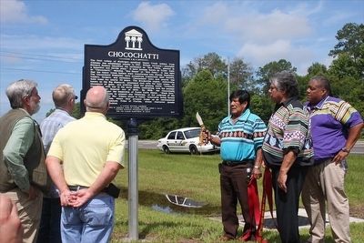
In 1778 the British mapped this once thriving community, originally called Mikasuki, with sixty houses, a square, 28 families and 70 gunmen. The village was first settled by Native Americans of Creek descent who were often in armed conflict with . . . — — Map (db m167466) HM
Daily life for Spaniards at San Luis was not unlike that in other Hispanic communities. Shoemakers and tailors plied their trades. Off-duty soldiers drank wine, played at cards or dice, and stringed guitars or similar stringed instruments known as . . . — — Map (db m239318) HM
The Apalachee ball game was an integral part of native life. The game was dedicated to the native gods of rain and thunder and was played to ensure rain for crops.
The game involved 50 or more players and was quite violent, sometimes . . . — — Map (db m239526) HM
In 1656, the Spaniards chose this hilltop because of its clear view of the countryside. A powerful Apalachee chief offered to build a blockhouse for the Spanish military garrison and moved his village to San Luis. The blockhouse added a formal . . . — — Map (db m239259) HM
The Apalachee were a matrilineal society. Inheritance and authority were passed down through the mother's family. Related groups were also combined into clans with each member belonging to the mother's clan. After marriage, the husband relocated to . . . — — Map (db m239379) HM
The dwelling frame to your right represents the shape and size of a typical Apalachee home. Although the Apalachee were skilled carpenters, their own dwellings were relatively simple. Most activities were conducted outside, with homes reserved for . . . — — Map (db m239388) HM
Living on the hilltop where the plaza and public buildings were located was an honor most likely reserved for the village's leaders. They attended daily meetings in a council house where community affairs were discussed and planned.
By . . . — — Map (db m239272) HM
Apalachee militias provided the bulk of the province's military power. Apalachee received training in the use of firearms from Spaniards. They served as sentries, some held military titles, and they always outnumbered Spanish soldiers on raids. . . . — — Map (db m239355) HM
The introduction of Catholicism to the Apalachee at San Luis brought fundamental changes. From marriage to funeral practices, holidays to education, the church influenced nearly every aspect of daily life.
Throughout the day, the church bells . . . — — Map (db m239520) HM
Most of the Apalachee who were not killed outright or enslaved moved north into British territory. Others migrated west to Pensacola and Mobile. A small number moved eastward eventually settling around St. Augustine. Once dispersed in 1704, the . . . — — Map (db m239362) HM WM
In the 1600s, Spanish Florida's Royal Road Connected
St. Augustine with the Missions of North Florida
From the time St. Augustine was established in 1565. Spanish military and religious authorities began extending their reach beyond . . . — — Map (db m239365) HM
It’s October 11, 1539…
Near here, Captain Juan Añasco of Hernando de Soto’s army has entered the Apalachee village of Aute -
The village is deserted, but we have found a small supply of corn. My men captured several Indians. One is . . . — — Map (db m126592) HM
By outward appearances, life in the Spanish village was European in nature. However, since Spanish soldiers commonly married Apalachee women, native wives continued some Indian traditions in their homes. Apalachee women perceived marriage to . . . — — Map (db m239322) HM
Mission San Luis de Talimali was among the largest and most important missions in Spanish Florida. Its parishioners were Apalachee Indians who were descendents of those people whose village Hernando de Soto appropriated during the winter of . . . — — Map (db m79564) HM
Beginning in 1702, British Carolina Governor James Moore began a full-scale attack on Spanish Florida aimed at St. Augustine and the missions along the Atlantic coast. Early in 1704, Moore mounted a campaign against Apalachee.
The strongly . . . — — Map (db m239357) HM WM
In this area, the St. Marks River disappears into sinkholes several times and reappears as springs. Here, it flows underground through a cavern and reappears 150 feet to your right. This has formed a land bridge which has been used by wild . . . — — Map (db m157204) HM
Apalachee rulers requested Spanish friars as early as 1607 when epidemics and the threat of foreign attacks brought about a loss of faith in their traditional customs and leadership. From 1633 to 1635 at least 5,000 Apalachee were baptized by two . . . — — Map (db m239250) HM
The council house at San Luis was one of the largest historic Indian structures in the southeastern United States.
Council houses were the focus of Apalachee religious and ceremonial activities, including dances, rituals, and preparations for war. . . . — — Map (db m239260) HM
Cassina, commonly called black drink, was a dark brew loaded with caffeine. It was popular with Spaniards and Apalachee alike.
Black drink could only be served in the council house unless the chief granted special permission to serve it . . . — — Map (db m239269) HM
The cemetery at San Luis is located beneath the floor of the church. Since all the residents of San Luis were Christians, a great number of them were buried in the church cemetery. As in other aspects of life, rank had its privileges. Important or . . . — — Map (db m239557) HM
You are standing on the edge of the main plaza of the village of San Luis. The path you are following traces the edge of the plaza that was the central hub of commerce and activities for the mission. Traditionally, both Spaniards and Apalachee built . . . — — Map (db m239528) HM
The friars lived in the convento (friary) where they used their time away from the church to read and improve their knowledge of the Apalachee language through native interpreters. They also traveled to outlying villages that had no friars . . . — — Map (db m239518) HM
On March 3, 1540…
Led by Hernando de Soto, the army departed these Apalachee lands to continue their expedition northward. They crossed the present-day Flint River and then traversed the Mississippi River several times –
From here, . . . — — Map (db m126596) HM
The agricultural wealth of Apalachee Province made the native inhabitants one of the most powerful and prosperous tribes in Florida.
The fertile soils and dense population were also what attracted Spaniards to the region and led to the . . . — — Map (db m239249) HM
Side 1
In 1633, the province of Apalachee in Spanish Florida received its first full-time resident missionaries. The Franciscan Mission of San Pedro y San Pablo de Patale which was located about one hundred yards north of this marker was . . . — — Map (db m79569) HM
From the 1650s when San Luis was first established, its military garrison had some type of casa fuerte or blockhouse. However, a full-scale fort was not constructed until the 1690s when the threat of British attack became imminent.
The . . . — — Map (db m239353) HM
Relatively easy access to the St. Marks River port of call enhanced San Luis' trading industry. Supplies could be unloaded at St. Marks River and, using small boats, could be brought to within 1.5 miles of the mission. Similarly, surplus goods . . . — — Map (db m239253) HM
Prior to European contact, the Apalachee used bone stone, shell, clay, plant fibers, and wood for most of their needs. The Spanish traded manufactured goods to the Indians. Iron tools, popular among the Indians for their durability, replaced bone, . . . — — Map (db m239378) HM
It’s October 5, 1539
Hernando de Soto’s army has reached the nearby village of Calahuchi -
We passed through fertile lands covered in large fields of corn - maize. While we marched, Apalachee warriors moved through the . . . — — Map (db m126589) HM
Mission San Luis was one of more than 100 mission settlements established in Spanish Florida between the 1560s and 1690s.
Between 1656 and 1704, more than 1400 Apalachee Indians and Spaniards lived at the mission. San Luis was a principal village . . . — — Map (db m239247) HM
The first Europeans known to have explored Tallahassee accompanied Spanish explorer Hernando de Soto. His entourage of over 600 soldiers, laborers and priests spent the winter of 1539 in a nearby Apalachee village before continuing their journey . . . — — Map (db m211624) HM
Native people inhabited the Tallahassee region for over 12,000 years before European contact. The earliest residents left evidence of seasonal camps, while later natives constructed large earthen mounds that served as civic and ceremonial centers . . . — — Map (db m211605) HM
In 1539, a Spanish expeditionary force led by Hernando de Soto landed in the Tampa Bay area. Nearly 600 heavily armed adventurers traveled more than 4000 miles from Florida to Mexico intending to explore and control the Southeast of North America. . . . — — Map (db m79522) HM
It’s October 6, 1539…
Hernando de Soto established his winter encampment here, at Anhayca, a principal Apalachee Village
”On Sunday, October 25, [De Soto] arrived at a town called Uzela, and on Monday, at Anhayca Apalachee . . . — — Map (db m126591) HM
On September 30, 1539…
Hernando de Soto’s army crossed into the land of the Apalachee. Its borders ran from southern Georgia to the Gulf of Mexico, and from the Aucilla River to the waters of the Ochlockonee.
A Complex Culture
Part of . . . — — Map (db m126588) HM
Having borrowed a canoe from some Indians, I visited a very grat and most beautiful fountain or spring which boils up from between the hills about 300 yards from the river, throwing up great quantities of white small pieces of shells & white shell . . . — — Map (db m191194) HM
"With their abundant food supply and pleasant surroundings, Indians at Manatee Springs probably lived a fairly comfortable life. The village was home to them, a place to which to return for rest and relaxation after the exertions of the . . . — — Map (db m191207) HM
It’s September 23, 1539…
Conquistador Hernando de Soto and his men have reached a large river, the present-day Suwannee –
My nose is broken, and we are weary from battle. We will rest here for two days before crossing. Envoys of . . . — — Map (db m126587) HM
In May 1894, Anna Maria Island's first modern-day pioneer -- George Emerson Bean -- took up a homestead, signed by President Wm. McKinley, that embraced the island's entire north point. Other daring settlers, such as Samuel C. Cobb and John R. . . . — — Map (db m72419) HM
Side 1
The Braden River is the largest tributary of the Manatee River and is 35 miles in length. It is named for Dr. Joseph Braden, a Tallahassee sugar planter who came here in 1842 and established a sugar plantation at the western . . . — — Map (db m146454) HM
Curry Houses National Register Historic District
On this site, Captain John and Mary (Kemp) Curry built 22 homes after purchasing 30 acres from Dr. Franklin Branch in 1859. Their extended family of 29 moved here from Key West on a . . . — — Map (db m168455) HM
Picture the past as you stand here. Indians once gathered oysters and clams along this shore and fished the river. On your left are remnants of a mound composed of shells they discarded after countless meals. Long after the Indians were gone road . . . — — Map (db m125368) HM
Born of Nomads
The early peoples of the Americas were descended from nomadic tribes that arrived during the last Ice Age—more than 12,000 years ago. Florida’s climate resembled that of savannah Africa. Early hunters tracked mastodons, . . . — — Map (db m126568) HM
Riverview Pointe and De Soto National Memorial are part of the Shaw's Point Archeological District. This thirty-five-acre archeological district is on the National Register of Historic Places and preserves a large prehistoric coastal village site . . . — — Map (db m125370) HM
Although the origin of the tabby ruins is not known for certain, William H. Shaw is credited with its construction soon after settling here in 1843. The Shaw family lived and worked here until a Seminole Indian uprising in 1856 drove them to Key . . . — — Map (db m125369) HM
Late in the afternoon of May 29, 1539, DeSoto's armada of nine ships rode at anchor in a deep Florida bay. Decks and holds were heavily burdened with 700 men, 350 horses, packs of bloodhounds and Irish greyhounds, a herd of pigs and a profusion . . . — — Map (db m217049) HM
Bountiful Waters
Early peoples living along the warm waters of this coast harvested the vast bounty of the Gulf of Mexico and surrounding lands. They built villages with intricate canals, lagoons, and mounds made of shell and earth. Early . . . — — Map (db m126565) HM
This large ceremonial mound and the adjacent Prine burial mound were part of an extensive Native America village and mound complex, now called the Terra Ceia site, that once occupied much of this peninsula (see map). Donated to the state by Karl . . . — — Map (db m185427) HM
A Name for Himself
On May 29, 1539, Hernando de Soto’s fleet of 9 ships passed here, carrying over 700 men, as well as women, children, and slaves. For De Soto, this was the realization of a long-awaited dream. In 1533, after participating . . . — — Map (db m126564) HM
It’s August 11, 1539…
Hernando de Soto has taken a small force of 60 cavalry and 100 foot soldiers north through Timucuan territory towards the land of the Apalachee -
I have entrusted Captain Moscoso to lead the army north, while I . . . — — Map (db m126580) HM
423 entries matched your criteria. Entries 101 through 200 are listed above. ⊲ Previous 100 — Next 100 ⊳