On 18th Avenue, 0.3 miles north of Cumberland Avenue, on the right when traveling south.
On this site once stood a Lutheran Church of the Norwegian Synod, from the years 1887 to 1921. This church developed because of a disagreement on some doctrinal points with the United Lutheran Church which stood one half mile south of here.
. . . — — Map (db m4657) HM
On Cypress Avenue west of 18th Avenue, on the left when traveling west.
In 1850, a group of Norwegian settlers from Koshkonong, the foremost Norwegian settlement colony in the United States at the time, left their southern Wisconsin home and migrated north, settling here in "Roch-a-Cree" or Roche-a-Cri. Imbued with . . . — — Map (db m36123) HM
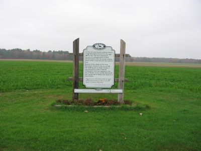
On 18th Avenue at Cumberland Avenue, on the left when traveling south on 18th Avenue.
In 1853, Norwegian immigrants to this area, organized the Norwegian Evangelical Church of Roche-a-Cri, in 1860. A log church was constructed one mile south of this location. It was destroyed by fire in 1866. A frame church was then erected on this . . . — — Map (db m4658) HM
On Stuntz Avenue at 3rd Street East, on the right when traveling south on Stuntz Avenue.
A man of indomitable faith, he brought culture to a wilderness.
Learning and religion were of first concern. Freely giving to both, he labored unceasingly for a city whose good lay very close to his heart. — — Map (db m94062) HM
On Chief Buffalo Lane west of Old Fort Road, on the left when traveling north.
Established about 1836 as part of a Roman Catholic mission under the guidance of the dynamic Austrian priest, Frederick Baraga, later made a bishop.
The white man's style of house was adopted as a grave cover by the Christianized Ojibway . . . — — Map (db m144130) HM
On 23rd Street, 0.1 miles north of 24th Avenue, on the right when traveling north.
The congregation for this church traces its roots back to 1870 when people first held services in their homes in what was originally called Stanfold. This community later became Dobie. Their first Catholic church was built in 1876 but was destroyed . . . — — Map (db m45151) HM
On W. Mission Road west of South Webster Avenue, on the left when traveling west.
Near this site stood the first Episcopal Mission in Wisconsin
Founded in 1827 by the Reverend Richard Fish-Cadle
Later first director of Nashotah House — — Map (db m68040) HM
On Riverside drive (State Highway 57) north of Allouez Avenue, on the left when traveling south.
The church of St. John the Evangelist, the first church of the Redemptorists in this hemisphere, stood 215 feet east of this marker. It was begun by Rev. S. Mazzuchelli, O. P. and completed by Redemptorist missionaries sent from Europe by Rev. . . . — — Map (db m66522) HM
Near Riverside Drive south of Iroquois Avenue, on the right when traveling south.
Built by the Indians for Father Claude Allouez in 1671, this is a replica of Wisconsin's first Catholic Church. The original was part of Mission St. Francis Xavior, about one mile south of this site. — — Map (db m68048) HM
Near North Broadway Street (State Highway 57), on the left when traveling south.
Here surrounded by his spiritual sons lies all that is mortal of Bernard Henry Pennings Canon Regular of Premontre founder of St. Norbert Abbey Born June 9, 1861 Gemert, Holland Ordained June 19, 1886 Berne Abbey Heeswijk, Holland Blessed . . . — — Map (db m97952) HM
The rapids at De Pere were well known to all early travelers along the Fox and Wisconsin rivers, which provided the best access to the Mississippi. Despite Indian domination, the waterway served explorers, fur traders and voyageurs, missionaries, . . . — — Map (db m11053) HM
On Pine Street at North Jackson Street, on the right when traveling east on Pine Street.
Upon this site stood Cnesses Israel Synagogue, the first Jewish congregation in Brown County dedicated September 4, 1904 (24 Elul 5664). Designed by local architect Henry A. Foeller, the synagogue was Moorish in design and had two octagonal towers . . . — — Map (db m51362) HM
On Washington Street at Adams Street on Washington Street.
Near this site stood the first Catholic church in Green Bay begun in the year of our Lord 1823 by Father Gabriel Richard Vicar Apostolic of the Northwest and finished by Father Stephen Badin first resident pastor and missionary.
A short . . . — — Map (db m39394) HM
On County Route F, on the right when traveling east. Reported missing.
The weather on April 21, 1980 was unseasonably hot and dry. On that day a temperature of 91 degrees combined with a humidity of 18 percent to set the stage for a catastrophic fire. At approximately 12:20 pm. that sweltering afternoon, the historic . . . — — Map (db m68642) HM
On County Route T at Church Road, on the right when traveling east on County Route T.
In 1853, a group of German Catholics from Silesia, Prussia, emigrated to the Charlestown area. By 1866, the congregation had built a log church where they could assemble for services. They erected the current church in 1875, using limestone from a . . . — — Map (db m145723) HM
On State Park Rd., on the right when traveling east.
About one mile north of this site was located the High Cliff Zion Evangelical Church (Now United Methodist Church)
Church Organized February 28, 1872
Consolidated July 9, 1919
Many of the early members of this church, of which this cemetery was . . . — — Map (db m132641) HM
On 15th Avenue west of Main Street (County Highway F), on the left when traveling west.
The First Congregational Church was organized in the Public Hall at Vanville (later renamed Bloomer) Chippewa County on November 20, 1868. In 1870, lots 4 and 5 of block 4 of the Town of Bloomer were donated by Mr. Samuel Gilbert of Gilberstville, . . . — — Map (db m55654) HM
On West Central Street east of Island Street, on the right when traveling west.
First Presbyterian Church is the oldest Protestant Church in the City of Chippewa Falls.
It was organized in 1855 by Rev. W. W. McNair. The first services were held in a log cabin 12 x 14 feet located on the east bank of Duncan Creek, just . . . — — Map (db m42611) HM
On Allen Street at South High Street, on the left when traveling west on Allen Street.
Notre Dame was Chippewa County’s first church, the Mother church of all area Catholic Churches. Originally called St. Mary’s (“Our Lady of the Pines”) was a 16' x 18' foot log structure erected in 1856. A carpenter’s bench served as . . . — — Map (db m39975) HM
On Allen Street west of South Prairie Street, on the left when traveling west.
Charles was born in Rochester, New York. At the early age of thirteen he entered the provincial seminary of St. Francis near Milwaukee. He graduated in 1864 and then entered the American College at Louvain, Belgium. There he earned two divinity . . . — — Map (db m39937) HM
Near Bridgewater Avenue west of Jefferson Avenue (Wisconsin Highway 124), on the left when traveling west.
He gave his life to the Jaycees and to his community, in the belief that service to humanity is the best work of life. We shall not forget...
Ronald P. Anders Memorial Pure Water Fountain was constructed by the Chippewa Falls Jaycees and . . . — — Map (db m41525) HM
On Island Street south of West Central Street, on the right when traveling south.
As early as 1846, Methodists were meeting in Chippewa Falls, with Thomas Randall preaching to his neighbors in a boarding house owned by the Chippewa Lumber and Boom Company. On March 10, 1860, Reverend Thomas Harwood, the first assigned . . . — — Map (db m42615) HM
On County Highway Q, 0.1 miles north of County Highway B, on the left when traveling north.
In the early 1850's, settlers from Rhine, Bavaria, Bohemia, and Luxembourg came to this part of Wisconsin now known as Tilden Township. They vowed to build a church in honor of the "Blessed Virgin Mother of God" giving thanks for their safe voyage . . . — — Map (db m55397) HM
On North Main Street (State Highway 73) at East Division Street, on the right when traveling north on North Main Street.
The Mormons, Clark County's first loggers, came in 1844 and established camps between Wedge's Creek and Greenwood to cut timber for their Illinois city of Nauvoo. After the murder of their leader Joseph Smith at Carthage, Illinois in mid-1844, the . . . — — Map (db m103977) HM
On North Fernwall Avenue, 0.3 miles south of Colby Factory Road, on the right when traveling south.
Site of The Worden Church
of the Brethren
Erected in 1904
Destroyed by tornado in 1958
Dedicated Sept. 28, 1975
by members and friends — — Map (db m22324) HM
On Gorman Avenue, 0.1 miles north of County Highway X, on the left when traveling north.
St. Hedwig's
In 1891, a wooden church was built and named St. Hedwig's for a queen of Poland. In 1904, the present-day structure was built and accommodated the growing congregation with seating for 700 people. Members of the congregation . . . — — Map (db m48771) HM
On Inglehart Road, on the left when traveling north.
A congregation of German settlers had been worshipping in a log cabin about 200 feet north of this sign, on property homesteaded by James Inglehart in 1846.
In 1867 the congregation decided to build a church.
James Inglehart offered this . . . — — Map (db m74235) HM
On State Highway 33, 0.2 miles west of County Road F, on the left when traveling east.
On June 14, 1673 Jacques Marquette and Louis Jolliet started the portage (1.28 miles) from here to the Wisconsin River, which led to their discovery of the Upper Mississippi June 17, 1673 at Prairie du Chien. The expedition, in two birch bark . . . — — Map (db m2341) HM
On Prospect Ave at Wisconsin Avenue (State Highway 16), on the right when traveling west on Prospect Ave.
Trinity United
Church of Christ
Has been placed on the
National Register
of Historic Places
by the United States
Department of the Interior
Trinitatus Evangelische
1871 — — Map (db m108279) HM
On Ridge Drive at Primrose Center Road, on the right when traveling west on Ridge Drive.
In the mid-nineteenth century, many newly arrived Norwegian immigrants in southern Wisconsin depended upon the spiritual and practical guidance of itinerant Lutheran ministers to help successfully adapt to the new land. One of the most influential . . . — — Map (db m55047) HM
On South Erbe Road, 2 miles south of U.S. 18-151, on the left when traveling south.
German immigrant families from Hesse began settling in this area of Blue Mounds Township in the 1840s. As early as 1856, Lutheran missionaries conducted home services for the rural community. In 1867, on acreage purchased from Justus Heuser, a frame . . . — — Map (db m75828) HM
On East Church Road, 0.4 miles west of Hillside Road, on the right when traveling west.
Koshkonong Prairie with its twin churches at both East and West Koshkonong is one of the focal points from which Norwegian Lutheranism spread to many parts of the American continent.
In 1844 at the request of pioneer Norwegian immigrants . . . — — Map (db m36145) HM
On County Route Z, 0.5 miles west of Wisconsin Highway 78, on the left when traveling north.
Early Norse pioneers who realized a need for a house of worship built the first Norwegian Lutheran Church in western Dane County from logs in the winter of 1851-52. First services held May 27, 1852 by the Rev. A.C. Preus. Previous itinerant pastors . . . — — Map (db m36718) HM
On South Main Street (County Highway CV) near Holum Street, on the right when traveling south.
Andreas Dahl came to DeForest from Valdres, Norway in 1869. For more than a decade as an itinerant photographer in southern Wisconsin, he took pictures that captured the essence of life at that time. His studio stood to the north of this site and . . . — — Map (db m37005) HM
On Wisconsin Avenue at East Gorham Street, on the right when traveling north on Wisconsin Avenue.
Designed with simplicity and grace, the First Church of Christ, Scientist is Georgian Revival in style, the form used for many early 20th century Christian Science churches across the country. It is the only Madison church designed by Frank Riley, . . . — — Map (db m40205) HM
On North Carroll Street at West Washington Avenue, on the right when traveling south on North Carroll Street.
Commemorating the one hundreth anniversary of the first service held in this church on Quinquagesima Sunday February 14, 1858 the Rt. Rev. Jackson Kemper Bishop of Wisconsin officiating. — — Map (db m38886) HM
On West Washington Avenue at North Carroll Street, on the left when traveling east on West Washington Avenue.
Designed by Milwaukee architect James Douglas, and constructed of local sandstone, Grace Episcopal Church is a distinguished example of the Gothic Revival style. Inspired by early English models, the corner tower contains a full carillon of bells. . . . — — Map (db m33076) HM
On North Park Street at West Washington Avenue, on the right when traveling north on North Park Street.
Once a marshy area off the shores of Lake Monona, this triangular shaped neighborhood became a dream for Italian immigrants during the early 1900's. Greenbush developed into one of America's countless Little Italys, complemented with Jewish, Black . . . — — Map (db m32636) HM
On John Nolen Drive, 0.2 miles north of Olin Avenue, on the right when traveling north.
Madison developers Delaplaine and Burdick erected the three-story Lakeside Water Cure here in 1854. This unsuccessful venture closed after three years and re-opened in 1866 as a summer resort hotel. Known as the "Newport of the West," it appealed to . . . — — Map (db m32955) HM
On West Johnson Street, 0.1 miles east of State Street, on the left when traveling east.
This is the first parish organized by German Catholics and is the second oldest Catholic church in Madison. This church replaces the original brick structure built on this site in 1857 by the 80 founding families The simple Romanesque Revival . . . — — Map (db m38884) HM
On West Johnson Street east of North Henry Street, on the left when traveling east.
The Holy Redeemer School was founded in 1865 by German Catholics who were granted their own parish after separating from the Irish Congregation of St. Raphael. Classes were held within the church until growing enrollment necessitated a separate . . . — — Map (db m170938) HM
On University Avenue at Lake Street, on the right when traveling west on University Avenue.
This limestone chapel was designed by the prolific Madison architectural firm of Claude and Starck in the Elizabethan Revival style. The building's asymmetrical design features a monumentally scaled entrance and a ribbon of Tudor-arched windows at . . . — — Map (db m69713) HM
On University Avenue at North Mills Street, on the left when traveling west on University Avenue.
The Gothic Revival style church by preeminent Madison architects Claude & Starck is a masterwork example of this style. The mid-century Gothic Revival style education building by Reginald Stehr is significant as a contemporary representation of the . . . — — Map (db m55933) HM
On East Wilson Street at South Pinckney Street, on the left when traveling west on East Wilson Street.
This Mediterranean Revival clubhouse has Art Moderne touches, reflecting its late 1930s date. It was built for the Knights of Columbus, a fraternal society for Catholic men. Several other Catholic groups met here and the building also housed the . . . — — Map (db m39930) HM
On Monona Drive, 0.1 miles south of Dean Avenue, on the right when traveling north.
A simple, flat-roofed brick structure with wood cornice and dentilation, this early Blooming Grove farmhouse was built for Nathaniel Dean, Madison dry goods merchant and real estate speculator. Dean, who lived in the house in the 1860's and the . . . — — Map (db m32457) HM
On Atwood Avenue at Corry Street, on the left when traveling east on Atwood Avenue.
Since it was founded in 1907, St. Bernard's Parish has been a religious and social focus of neighborhood life on the East side. This imposing church building was erected during a decade of heavy construction activity among Madison's religious . . . — — Map (db m40825) HM
On University Bay Drive, 0.2 miles north of University Avenue, on the left when traveling north.
Unitarian Meeting House has been designated a National Historic LandmarkDesigned by renowned architect Frank Lloyd Wright for the First Unitarian Society of Madison, the meeting house is an innovative building that has influenced religious . . . — — Map (db m32413) HM
On East Campus Mall at State Street, on the right when traveling north on East Campus Mall.
Commonly known as the Pres House, this building is significant as a masterfully executed example of the Gothic Revival style which was locally popular between 1915 and 1945 for the construction of churches. The primary façades are of rock-faced . . . — — Map (db m53066) HM
On South Fairchild Street, on the right when traveling south.
This is the once and future site of the cathedral church of the Diocese of Madison. Saint Raphael, the first Catholic parish in Madison, laid the cornerstone for its second church here in 1854. It was built of native stone and faced Main Street. . . . — — Map (db m74726) HM
On East Gorham Street at North Butler Street, on the right when traveling west on East Gorham Street.
Gates of Heaven was designed for Madison's first Jewish congregation by local architect August Kutzbock in the German Romanesque style. Kutzbock also used this distinctive style for the Pierce and Keenan houses at Pinckney and Gilman. The building . . . — — Map (db m32381) HM
On East Mifflin Street at North Hancock Street, on the left when traveling east on East Mifflin Street.
The Gloria Dei Church is a striking example of the Gothic Revival style, which was locally popular between 1915 and 1945 for the design of religious buildings. The façade is of brick and limestone. Decorative elements include Gothic-arched door and . . . — — Map (db m53469) HM
On East Main Street at South Hancock Street, on the left when traveling east on East Main Street.
Designed in a late Nineteenth Century eclectic style by Madison civil engineer and architect, John Nader, this church is the third oldest Catholic parish in the City. It was dedicated on St. Patrick's Day in 1889, Archbishop Heiss of Milwaukee in . . . — — Map (db m40207) HM
On East Dayton Street at North Blount Street, on the right when traveling east on East Dayton Street.
John Hill first set eyes on Madison while visiting a relative who was attending the University of Wisconsin. He moved his family here from Atlanta in 1910 to join a modest community of about 140 African Americans. In 1917, Hill bought a house and . . . — — Map (db m33612) HM
On East Dayton Street at North Blount Street on East Dayton Street.
These vernacular buildings are significant for their association with, and are among the last vestiges of, Madison's first African-American community. Both were moved to the site by African-American civic leader, John Turner. The two-story, . . . — — Map (db m54181) HM
Near State Highway 19 at Matz Road, on the left when traveling west.
On the brow of a hill, one-half mile east overlooking Indian Lake, rests a tiny stone chapel. The structure was built in 1857 by John Endres in fulfillment of a religious vow he made in return for protecting the lives of his family during a . . . — — Map (db m31809) HM
On Pleasant View Road at Old Sauk Road, on the right when traveling north on Pleasant View Road.
This plaque is dedicated to the early German immigrants who came to the Middleton area between 1840 and 1850 and chose this site for a church. A log church was built just north of this structure in 1854. It soon proved inadequate and a second church . . . — — Map (db m45342) HM
On Dean Avenue at Roigan Terrace, on the left on Dean Avenue.
This typical Wisconsin frame farmhouse was built by the son of a German immigrant on a forty-acre parcel. The land was later used as a truck farm and mink ranch. In 1950 an old chicken house on the property was converted to serve as the first . . . — — Map (db m31029) HM
On Town Hall Road at U.S. 18-151, on the right when traveling north on Town Hall Road.
Norwegians came to this peaceful area of rolling hills and valleys in 1846 and organized a Lutheran congregation in 1852, holding services outdoors and in homes. These God-fearing people purchased 2 acres of land for a church and cemetery in . . . — — Map (db m41931) HM
On County Road Y, 0.1 miles west of St. Norbert Street, on the right when traveling west.
Father Adalbert Inama a Norbertine Missionary was born in Wilton Tyrol Austria on December 26, 1798. He came to the Roxbury - Sac Prairie area in November 1845. Early the next year he built an 18 x 20 foot log cabin one mile west of here on the . . . — — Map (db m32352) HM
Near St. Norbert Street (County Road Y), on the right when traveling west.
Born in Wilton, Tyrol Dec. 26, 1798. Came to Roxbury in 1845. Dane County's first resident Catholic priest. Labored in Dane, Iowa, Columbia, Dodge, Jefferson, Sauk, Waukesha counties. Repeatedly read Mass in the Assembly chamber of the Capitol, . . . — — Map (db m33082) HM
On County Highway B at Spring Road, on the right when traveling east on County Highway B.
"Now may the Lord bless this step which we have taken not out of a desire for discord and dissuasion but compelled by the voice of our conscience." With this prayer on their lips, six families met at Lars Bovre's farm on June 22, 1860 to organize . . . — — Map (db m37293) HM
On Koshkonong Road at Church Street, on the left when traveling east on Koshkonong Road.
Founded on October 19, 1844 A part of the second oldest Norwegian Lutheran Parish in America Present structure built in 1892 Additions 1960 and 1967 — — Map (db m41586) HM
The Belgian immigrants who settled in this region, beginning in the 1850s, built many churches and roadside chapels, reflecting the value of their Catholic faith. Brussels and its surrounding communities form the largest Belgian settlement in North . . . — — Map (db m175533) HM
On North Cave Point Drive south of Wisconsin Highway 57, on the left when traveling south.
Also known as “The Little White Church by the Lake,” the Jacksonport United Methodist Church was completed in 1892. Its simple design is attributed to George Bagnall Sr., one of the original builders. Alex Halstead, Harry Wilson Sr. and . . . — — Map (db m12114) HM
On Wisconsin Route 57 at Lakeside Lane, on the right when traveling north on State Route 57.
French trader Médard Chouart des Groseilliers spent the winter of 1654–55 in Jacksonport, at the time a Potawatomi/Ottawa village known as Mechigan that was home to more than 3,000. Upon his return to Quebec, Groseilliers reported on the . . . — — Map (db m147221) HM
On County Route V, 0.2 miles west of County Road A, on the right when traveling west.
The Reverend W. R. Gardner founded the Episcopal Church of the Holy Nativity in 1882 to serve the Canadian Anglicans who had relocated to the area after the Civil War to cut and haul timber. Services were held once a month at the village . . . — — Map (db m59212) HM
Near County Road T at Wendt Lane, on the right when traveling north.
On January 18, 1889, Zion Evangelical Lutheran Church was formally incorporated. The congregation consisted mostly of German Lutheran immigrants from the district of Saxon-Weimar-Eisenach who settled in the Jacksonport area. That spring the newly . . . — — Map (db m67017) HM
On County Road DK east of County Road N, on the left when traveling east.
Wisconsin's and the nation's largest Belgian American settlement is located in portions of Brown, Kewaunee and Door counties adjacent to the waters of Green Bay. Walloon-speaking Belgians settled the region in the 1850s and still constitute a high . . . — — Map (db m12141) HM
On County Road DK, 0.1 miles east of County Road N, on the right when traveling west.
Introduction
You are in the Namur Belgian-American National Historic Landmark District, certified in 1900 and the only such District of Wisconsin. This rural landscape appears today much as it did a century ago, and harbors a number of . . . — — Map (db m145892) HM
On West Maple Street at North Kendall Avenue, on the left when traveling east on West Maple Street.
Most popular and widely accepted Christian hymn "The Old Rugged Cross" completed by Rev. George Bennard during Evangelistic meetings here Dec. 29, 1912 - Jan. 12, 1913
First sung as a quartet in the Friends Church Parlors and as a duet at . . . — — Map (db m59215) HM
On East Lake Street west of South Farwell Street, on the right when traveling west.
Historic Building
An excellent example of early twentieth century Neo-Gothic Church architecture. Designed by the Minneapolis firm of Purcell, Feick & Elmslie. Constructed over the period from 1910-1916.
Designated April Eighteen . . . — — Map (db m75531) HM
On Broadway Street west of Third Avenue, on the right when traveling west.
First Congregational Church
Established 1856. Erected 1919-1921 after fire destroyed the original edifice. Twentieth century Gothic architecture.
Approved June Sixteen
Nineteen Hundred and Eighty-Two
Community House
Erected . . . — — Map (db m76267) HM
Near Omaha Street west of Starr Avenue, on the right when traveling west.
Historic Building
Erected in 1896, St. Joseph's Chapel is the only example of a late Nineteenth Century Gothic chapel in Eau Claire. It was built by a member of Sacred Heart Parish.
Designated November Twenty-One
Nineteen Hundred and . . . — — Map (db m75654) HM
Near Kettle Moraine Scenic Drive (County Route S).
St. Matthias Mission
Built in 1861
Has been placed on the
National Register of Historic Places
By the United States Department of the Interior — — Map (db m73834) HM
On County Highway W at County Highway Q, on the right when traveling south on County Highway W.
Father Caspar Rehrl
A priest, missionary, teacher, founder of churches and schools, and organizer of parishes, Father Rehrl was born in Salzburg, Austria, in 1809. He became a missionary to North America, arriving in the new diocese of . . . — — Map (db m3293) HM
On County Road W at County Road Q, on the right when traveling south on County Road W.
Parish Founded in 1841
Present Church Built and Consecrated in 1857
Steeple Entrance and Sanctuary
added in the early 1890s
In Memory of
Clarence and Frances (Olig) Haensgen — — Map (db m162300) HM
On Kettle Moraine Scenic Drive (County Highway S) near Youth Camp Road (County Highway DD), on the right when traveling north.
Saint John Evangelical
Lutheran Church • Built 1871
New Fane, Wisconsin
Has Been Placed on the
National Register
of Historic Places
by the United States
Department of the Interior — — Map (db m60194) HM
On Rock Church Road, 0.3 miles north of County Road E, on the left when traveling north.
The Rock Church, originally part of the Methodist Episcopal Church, stands on land donated by a pioneer settler, Bosman Clifton, in memory of his daughter.
Construction began in 1851 and men and women alike, worked long and hard for several . . . — — Map (db m47089) HM
Near County Road Z at Sinsinawa Road, on the right when traveling south.
The original inhabitants of Sinsinawa Mound were Native Americans
who called it "Manitoumie", meaning
"land where the Spirit dwells".
In 1832, during the Black Hawk War, George Wallace Jones built a fort to
protect area settlers and his . . . — — Map (db m218533) HM
On English Settlement Road, 0.5 miles north of Dunphy Road, on the left when traveling north.
The first formal meeting elected the following to have charge of the building of a church: William Reese, Thomas Lewis, James Lloyd, Aaron Jones, Thomas Edmonds, James Francis and Rev. Austin
A sum of $505.00 was raised with a proposal that "a . . . — — Map (db m35402) HM
On 11th Street at 13th Avenue, on the left when traveling east on 11th Street.
Side A The First Methodist Episcopal congregation began building this church in 1869 to replace an earlier church built in 1843. The parsonage was completed in 1886 and the congregation dedicated the completed church in 1887.
The church . . . — — Map (db m35406) HM
On Lawson Drive, 0.1 miles west of Sunset Drive, on the right when traveling west.
Chapel Car "Grace" was one of seven such cars operated by the American Baptist Publication Society from 1891 to 1948. The car was commissioned in May 1915. Its first assignment was in Northern California. Its last work in Orem, Utah. The car was . . . — — Map (db m67833) HM
On County Road T, 0.2 miles east of State Highway 23, on the right when traveling east.
Unity Chapel
Dedicated 1886
has been placed on the
National Register
of Historic Places
by the United States
Department of the Interior
————————
In 1844, Richard and Mallie . . . — — Map (db m90106) HM
On U.S. 14 at Coffee Road, on the right when traveling east on U.S. 14.
On this site stood the Zion Helenville (Walther's) Evangelical Church dedicated in 1854. The first Evangelical service in this vicinity was held May 20, 1843 by Rev. J. G. Miller. Recommended to the ministry by this church were John M. Walther, Jr., . . . — — Map (db m135067) HM
On County Highway Q at County Highway B, on the left when traveling south on County Highway Q.
This one room log church was built in 1861 by German settlers north of Milford near the Crawfish River. In 1874 it was moved one mile east to Highway Q where it was enlarged to serve as a school room and to house the pastor's family. In 1996 the . . . — — Map (db m37312) HM
On Island Church Road at Blue Joint Road, on the right when traveling south on Island Church Road.
Built in 1863, St. Wenceslaus Church served families who came chiefly from Bohemia and Germany. The little church, significant in Wisconsin’s architectural heritage, closed in 1891. It still opens for special Masses. — — Map (db m37705) HM
On County Road O, 0.2 miles west of State Highway 58, on the left when traveling west.
Built by the Rock Valley Union Chapel Society. Used as a community center, church & Sunday school and 4-H meetings in the late 1940's. Lindinia Town Insurance Company was also organized here. This chapel marks the site of Stewart's Settlement . . . — — Map (db m56423) HM
On 8th Avenue at 60th Street, on the right when traveling south on 8th Avenue.
This historical landmark is dedicated to the worship of God, and to the promotion of Christian knowledge and charity
Chris George Builder
Kenosha Landmarks Commission
Kenosha County Historical Society — — Map (db m38117) HM
On Third Street at Lake Street (County Highway S), on the left when traveling north on Third Street.
The first church edifice, originally named "Grace Church", was erected on this site in 1878. This building was a brick veneer interpretation of the plan for a board and batten church found in Richard Upjohn's pattern book Rural . . . — — Map (db m77299) HM
On County Road G west of Norman Road, on the left when traveling west.
✝ St. Joseph's Church
Was Closed by the Diocese of
Green Bay
with a Final Mass on June 20th,
2010
The Site and Church Are
Now Privately Owned ✝
. . . — — Map (db m80031) HM
213 entries matched your criteria. The first 100 are listed above. Next 100 ⊳