Near East Broad Street (U.S. 78) 0.1 miles east of South Jackson Street.
Born in North Gilbert, Connecticut, November 2, 1754; graduate of Yale, 1772; licensed to preach by the New Haven Association of Ministers, 1775; Tutor in Yale, 1775 – 1779, Chaplain in the Continental Army, 1779 – 1783; Admitted to the . . . — — Map (db m20891) HM
Near Baldwin Street at South Thomas Street, on the right when traveling west.
Welcome to the Latin American Ethnobotanical Garden!
Constructed in 1998, this garden is managed by the Latin American and Caribbean Studies Institute (LACSI). Ethnobotany is the study of the traditional knowledge and customs of a people . . . — — Map (db m221587) HM
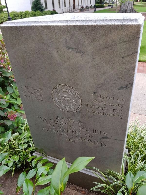
On West Hancock Street (Georgia Route 24) at S. Wilkinson Street, on the right when traveling east on West Hancock Street.
In May 1539 Hernando de Soto landed in Florida with over 600 people, 220 horses and mules, and a herd reserved for famine. Fired by his success in
Pizarro's conquest of Peru, De Soto had been granted the rights, by the King of Spain, to explore, . . . — — Map (db m27275) HM
On College Station Drive, 0 miles south of Columbus Road, on the right when traveling south. Reported missing.
Colonial Trading Path or “Lower Path” joined the heart of the Creek Nation on the Chattahoochee River to the English Trading Post in Ocmulgee Old Fields, now Ocmulgee National Monument. Here the chief towns of the ancient Creek Confederacy stretched . . . — — Map (db m206104) HM
On Willie Smokie Glover Drive, on the right when traveling west. Reported missing.
In May 1539 Hernando de Soto landed in Florida with over 600 people, 220 horses and mules, and a herd reserved for famine. Fired by his success in
Pizarro's conquest of Peru, De Soto had been granted the rights, by the King of Spain, to explore, . . . — — Map (db m27272) HM
On Mulberry Street at New Street, on the right when traveling west on Mulberry Street.
The first Masonic meeting in Georgia was held in 1734 at the town of Sunbury in what is now Liberty County, with General James Edward Oglethorpe serving as Worshipful Master. This was just seventeen years after the formation of the Grand Lodge of . . . — — Map (db m49663) HM
Near Park path north of Ocmulgee National Park Road, in the median.
Trading with the British 1690-1715
The Creek Trading Paths, the Trading Post Site, and Civil War (1864)
Hundreds of axes, beads, clay pipes, knives, swords,
bullets, flints, pistols, muskets, and burial pits were
found in this area, . . . — — Map (db m244440) HM
On Colonial Station Drive, 0 miles south of Columbus Road, on the right when traveling south.
During his 1775 visit, Bartram noted this area “exhibited a delightful diversified rural scene and promises a happy, fruitful, and salubrious region.” — — Map (db m49588) HM
On U.S. 80 near U.S. 280, on the right when traveling south.
The highway northward is the Old River Road, one of the earliest routes west of the Ogeechee and a leading way from Savannah to Georgia's western frontier. It followed an old Indian trial [sic] along the Ogeechee to a point west of Bartow, . . . — — Map (db m12474) HM
On Ford Avenue (State Highway 144) at Coastal Highway (U.S. 17), on the right when traveling east on Ford Avenue.
On May 10, 1754 GEORGE TOWN was established at the "Elbow" of Great Ogeechee River, eight miles east. In February, 1755, Gov. Reynolds, dissatisfied with Savannah as a capital and as a port, chose this new site because it has a . . . — — Map (db m8364) HM
On U.S. 144 at State Road 67, on the left when traveling south on U.S. 144.
Near here, on the West bank of the Ogeechee River, Fort Argyle was built in 1733, to command one of the main passes by which enemy Indians had recently invaded South Carolina, and to give protection to the settlers of Savannah from anticipated raids . . . — — Map (db m29523) HM
On Fort McAllister Road (State Highway 144 Spur) 2.1 miles east of Bryan Neck Road (State Route 144), on the left when traveling east.
This site on the Great Ogeechee, 14 miles from the Atlantic, was selected in 1755 by Governor John Reynolds for the capital of Georgia. He named it for his kinsman, Lord High Chancellor of England, Phillip Yorke Hardwicke. Reynolds said: "Hardwicke . . . — — Map (db m11225) HM
On Statesboro Highway (U.S. 301) near Old River Road North, on the right when traveling south.
The highway crossing here is the Old Savannah Road, one of the earliest vehicular routes west of the Ogeechee River. It led from Savannah to the Rock Landing on the Oconee, to the south of the present Milledgeville. There it connected with the main . . . — — Map (db m11101) HM
On Botsford Church Road, 0.1 miles east of Cemetery Road, on the right when traveling west.
Botsford Church, Constituted in 1773 by the Rev. Edmund Botsford, was the second Baptist church in Georgia. Originally located 25 miles below Augusta, known as the New Savannah Church, it was moved about 10 miles to this place after the Revolution. . . . — — Map (db m13116) HM
On North Liberty Street (U.S. 25) at Court Street, on the right when traveling north on North Liberty Street.
Burke County, an original county, was created by the Const. of Feb. 5, 1777, from Creek Cession of May 30, 1733. In 1758, it had been organized as the Parish of St. George. Originally, it contained parts of Jefferson, Jenkins and Screven Counties. . . . — — Map (db m7856) HM
On South Liberty Street (State Highway 24) at U.S. 25, on the left when traveling west on South Liberty Street.
The highway bearing left is the Old Quaker road, on of Georgia's earliest vehicular highways. It was opened about 1769 to provide a direct way from Savannah to a Quaker settlement centering around Wrightsboro in today's upper McDuffie County. . . . — — Map (db m8022) HM
On Charlie Smith Sr. Highway (Georgia Route 40 Spur) 0 miles north of Kings Bay Road, on the left when traveling north.
These are the ruins of a tabby sugar works built by John Houston McIntosh at New Canaan Plantation soon after 1825. In his sugar house McIntosh installed what was, according to Thomas Spalding, the first horizontal cane mill worked by cattle power. . . . — — Map (db m21289) HM
On U.S. 17 at Old Jefferson Highway, on the right when traveling south on U.S. 17.
This road, formerly an Indian trail which paralleled the coast, was used by the Spanish and the British.
In 1778 it was traveled by the Revolutionary soldiers who marched against Fort Tonyn at Point Peter.
Albert Gallatin while U.S. Secretary . . . — — Map (db m81752) HM
Near St. Marys Road (at milepost 1) east of Interstate 95, on the right when traveling north.
Georgia’s fate was decided in 1742 when Spanish and British forces clashed on St. Simons Island. Fort Frederica’s troops defeated the Spanish, ensuring Georgia’s future as a British colony. Today, the National Park Service manages Fort Frederica . . . — — Map (db m112210) HM
On Osborne Street (Georgia Route 40) at Dillingham Street, in the median on Osborne Street.
This town was built on the north bank of the St. Marys River at a place called Buttermilk Bluff. The original tract of land, containing 1620 acres, was purchased by the proprietors for laying out the Town of St. Marys for Jacob Weed for thirty eight . . . — — Map (db m14180) HM
Near Interstate 95 at milepost 1 south of St Marys Rd (Interstate 95), on the right when traveling north.
Nearby Cumberland Island is the largest and one of the most natural of Georgia's barrier islands, part of the chain of islands that stretches from Cape Code to beyond Key West. And, as a unite of the National Park System, Cumberland is yours to . . . — — Map (db m239234) HM
Near Bartlett Street at St Marys Street West, on the left when traveling north.
By 1740, English General James Oglethorpe had established two forts (Fort St. Andrew and Fort William) on Cumberland Island to monitor the Spanish to the south. When the St. Marys River separated nations, America’s military had an important . . . — — Map (db m144959) HM
On Bartlett Street at St. Marys Street West, on the left when traveling north on Bartlett Street.
Plans for the town of St. Marys, originally known as Buttermilk Bluff, were conceived by the British in 1767. The Articles of Agreement were signed on Cumberland Island in 1787 when the first American owner Jacob Weed, divided and sold land to 19 . . . — — Map (db m144903) HM
Near Bartlett Street near St Marys Street West, on the left.
These French-speaking refugees were forced to leave their homes in Nova Scotia by the British during the French & Indian War (1754-1763). The descendants of these oppressed Acadians ultimately sought refuge in St. Marys in the late 1790s after . . . — — Map (db m144939) HM
On Osborne Street (Georgia Route 40) at Conyers Street, in the median on Osborne Street.
There were originally six wells one in each square, the only source of pure water for St. Marys, (until the tidal wave of 1818).
On the day that the Father of the Country was buried at Mt. Vernon local services were also held throughout the . . . — — Map (db m14178) HM
On Newnan Street (Georgia Route 166) at Dixie Street, on the right when traveling east on Newnan Street.
Carroll County, created by an act of the Georgia legislature in December, 1826, proudly bears the name of Charles Carroll, of Carrollton.
Charles Carroll was born in Annapolis, Maryland, in 1737. He attended preparatory schools in this country . . . — — Map (db m12872) HM
On Tyson Road, 0.5 miles north of Flat Rock Road, on the right when traveling north.
In the mid-1600s, John Tyson traveled from the British Isles to Virginia. Over the next 200 years, his descendents migrated to North Carolina and on to Georgia. Alexander, Clement, and Jehu Tyson and their mother Penelope settled this land in 1853. . . . — — Map (db m10041) HM
On Laroche Avenue, 0.2 miles north of Raleigh Drive.
In 1736, Noble Jones, John Fallowfield and Henry Parker settled this important outpost on the colony's inland waterway to the south and named it Isle of Hope. Jones' Wormsloe plantation was fortified and armed against Spanish attack until
1742. . . . — — Map (db m9151) HM
In 1736, Noble Jones, John Fallowfield and Henry Parker settled this important outpost on the colony's inland waterway to the south and named it Isle of Hope. Jones' Wormsloe plantation was fortified and armed against Spanish attack until 1742. The . . . — — Map (db m16387) HM
On Augusta Road (State Highway 21/30) north of Drakie Road, on the right when traveling north.
Mulberry Grove which is located approximately 2 miles northeast from this marker is one of the most historic of the old Savannah River plantations.
In early Colonial days mulberry trees were cultivated at Mulberry Grove for use in Georgia's . . . — — Map (db m8064) HM
On Shipyard Road, 0.2 miles east of Ferguson Road, on the right when traveling west.
Approximately 300 yards northeast of this marker there was located in colonial days a shipyard where at least one vessel capable of engaging in overseas trade was built. The creek on which it stood is known as Shipyard Creek. The site of the . . . — — Map (db m9399) HM
Granted 1739 to William Stephens
Secretary
Colony of Georgia
1737 - 1740
President
1743 - 1751
Here in 1779 under
Count d'Estaing the
French landed to join
the Americans under
General Lincoln in
the Siege Of Savannah . . . — — Map (db m9149) HM
This 1½ mile oak avenue leads to the tabby ruins of Noble Jones’ colonial fortified plantation. Jones and his family were original settlers in Georgia, arriving in Savannah with founder James E. Oglethorpe on February 1, 1733. As a middle-class . . . — — Map (db m10960) HM
On Oglethorpe Avenue at Lincoln Street, on the left when traveling east on Oglethorpe Avenue.
Savannah Methodism's first church building was erected on this corner of Lincoln and South Broad (now Oglethorpe) streets in 1812 by its first pastor, Rev. James Russell. Bishop Francis Asbury preached twice in Wesley Chapel on November 21, 1813. In . . . — — Map (db m5447) HM
On River Street near Bull Street, on the left when traveling south.
We were stolen, sold and bought together from the African Continent
We got on the slave ships together, we lay back to belly in the holds of the slave ships in each others excrement and urine together. Sometimes died together and our lifeless . . . — — Map (db m5278) HM
"This is no time to talk of moderation; in the
present instance it ceases to be a virtue."
Speech to Provincial Congress, June 5, 1776 Foremost among Georgia's Revolutionary patriots stood Archibald Bulloch whose remains rest in this . . . — — Map (db m5335) HM
On Lincoln Street near East York Street, on the left when traveling south.
This Federal style house was constructed in the late eighteenth century as the residence of William Barnard, nephew of Sir John Barnard who, while serving in the British Parliament distinguished himself as a patron of the Georgia Colony
The . . . — — Map (db m9166) HM
On East Bay Street near Drayton Street, on the right when traveling west.
Directly across Bay Street from this marker formerly stood the brick building, built in late colonial days and known as the “Coffee House,” in which the Legislature of Georgia met in 1785. Owned by Thomas Stone, it was described in a . . . — — Map (db m6668) HM
This Memorial to
Button Gwinnett
Born 1735 Died 1777
Georgia Signer of The Declaration of Independence
President of Georgia
Whose remains, buried in this cemetery, are believed to lie entombed hereunder. Was erected by the . . . — — Map (db m241905) HM
On Abercorn Street, on the right when traveling north.
This grave links Savannah with one of history's greatest naval dramas - the epic fight in 1779 between the "Bon Homme Richard" and "Serapis" in which John Paul Jones immortalized himself.
Denis Nicolas Cottineau de Kerloguen received a commission . . . — — Map (db m5339) HM
On Bull Street near E. Congress St., on the right when traveling south.
†
I.H.S.
Christ Church
Founded A.D. 1733. Chartered 1789.
Destroyed by Fire 1796. Rebuilt & enlarged 1803.
Injured by a hurricane 1804. Constructed anew 1810.
Taken down, and
This Edifice Erected
1838. Partially . . . — — Map (db m13665) HM
This Episcopal Church was the first house of
worship established with the founding of Georgia in 1733. Early rectors included the Rev. John Wesley (1736-37), who began the earliest form of Sunday school and published the first English hymnal in . . . — — Map (db m5304) HM
This cemetery, the second in colonial Savannah, was the burying ground for the city from about 1750 until it was closed against burials in 1853. Among the distinguished dead who rest here are Archibald Bulloch, first President of Georgia; James . . . — — Map (db m5313) HM
On E. State Street near Habersham, on the left when traveling west.
In 1757, during the administration of royal Governor Henry Ellis, a line of earthwork defenses, including a palisade, was erected around Savannah. Immediately west of this marker was located Bethesda Gate, one of the six entrances into the town. . . . — — Map (db m5356) HM
The epitaph to James Wilde on the nearby tomb is a melancholy reminder of the days of duelling and, particularly, of a tragic affair of honor fought January 16, 1815, on the Carolina side of the river near Savannah. Lieutenant Wilde was shot through . . . — — Map (db m5376) HM
On Abercorn St, on the right when traveling north.
Lachlan McIntosh, Georgia's ranking Continental officer in the American Revolution, was the son of John Mor Mackintosh who settled with a group of Highlanders on the Altamaha in 1736. Lachlan served as a cadet in Oglethorpe’s Regiment and received . . . — — Map (db m5400) HM
On East Oglethorpe Avenue, on the right when traveling west.
First Constitutional Session
of the Georgia Legislature
held in the "Long Room"
Jany 1783
Headquarters
Genl George Washington
May 1791 — — Map (db m6470) HM
On Bull Street near Oglethorpe Avenue, on the left.
The Independent Presbyterian Church was organized in 1755. The first meeting house stood facing Market Square in Savannah, between what are now St. Julian and Bryan Streets, on property granted by King George II for the use and benefit of those . . . — — Map (db m5515) HM
When James Oglethorpe left England to begin the new colony of Georgia, in 1732, one of the passengers was Paul Amatis, an Italian artisan, skilled in producing silk. He was later placed in charge of Trustees Garden. Later, more Italian familes came . . . — — Map (db m9390) HM
On Bull Street at East Hull Street, on the left when traveling north on Bull Street.
The monument in this Square to James Edward Oglethorpe - the great soldier-philanthropist who founded the colony of Georgia - was erected by the State of Georgia, the City of Savannah and various Patriotic Societies. Impressive ceremonies marked . . . — — Map (db m5308) HM
Here rests James Habersham -- associate of George Whitefield and a leading merchant, planter, and public servant during Georgia's colonial era. Mr. Habersham came to the colony in 1738 as a youthful follower of the Rev. Whitefield and collaborated . . . — — Map (db m5357) HM
Here repose the remains of James Johnston (1738-1808) - - editor of Georgia's first newspaper. A native of Scotland, Johnston settled at Savannah in 1761. "Recommended as a person regularly bred and well skilled in the Art and mystery of . . . — — Map (db m5388) HM
On East Bay Street, on the right when traveling west.
Jane Cuyler (born Jeanne de la Touche) came to Savannah with her husband Teleman in 1768. After his
death in 1772, Cuyler took in lodgers, first at her home on the corner of Bull and Broughton Streets,
then at an undetermined location on Bay . . . — — Map (db m6159) HM
Near this site on July 11, 1733, five months
after Oglethorpe founded Georgia, 42 Jewish
colonists, having sailed from London,
disembarked from the William and Sarah.
It was the largest group of Jews ever to sail
on one vessel from . . . — — Map (db m26707) HM
On Bull St near Bay St., on the left when traveling south.
On this spot, where stood the
first public building erected in
Georgia, John Wesley preached
his first sermon on American soil.
March 7, 1736 (OS)
Text- 1 Corinthians XIII
— • —
This tablet commemorates the Bi-Centenary . . . — — Map (db m14128) HM
On Abercorn Street near E. St. Julian Street, on the left when traveling south.
South face:
Founder of Methodism
Minister
Of The
Church of England
In Savannah
1736-1737
East face:
My hearts desire
for this place
is not that it be
a famous or rich
but that it may be
a religous colony . . . — — Map (db m15622) HM
On the "trust lot" south of President Street and immediately west of this square stood in 1736- 37 the parsonage in which John Wesley resided. In the adjoining garden he read, prayed and meditated. Weekly meetings of members of his Christ Church . . . — — Map (db m5275) HM
Johnson Square is named for Governor Robert Johnson of South Carolina who befriended the colonists when Georgia was first settled. It was laid out by Oglethorpe and by Colonel William Bull in 1733, and was the first of Savannah's squares. In early . . . — — Map (db m5494) HM
On Montgomery Street near W. Bryan Street, on the left when traveling north.
Born in Pocotaligo, SC, Jonathan Bryan accompanied James Oglethorpe on his initial visit to Yamacraw Bluff in 1733. One of Georgia’s largest landholders, Bryan was a supporter of evangelist George Whitefield and encouraged religious services for his . . . — — Map (db m41816) HM
A native of Yorkshire, Joseph Clay (1741-1804) settled at Savannah at the age of nineteen. His uncle, James Habersham, declared that his "industry" was "highly commendable" and "his Abilities for Trade unquestionable." Fulfilling his early promise, . . . — — Map (db m5364) HM
The three Habersham brothers - who here rest beside their distinguished father, James Habersham - were prominent patriots in the American Revolution and outstanding public men during the early years of the republic. JOSEPH . . . — — Map (db m5361) HM
There was "None, No None!" reads the epitaph on this tomb.
"Against Whose Name the Recording Angel Would More Reluctantly Have Written Down Condemnation."
Born at Dublin, Ireland. Son of a Georgia planter, Joseph V. Bevan attended the Univ. of . . . — — Map (db m5551) HM
On Bay St at Bull St., on the right when traveling west on Bay St.
James Edward Oglethorpe, the founder of Georgia, landed with the original colonists, about 114 in number, at the foot of this bluff on February 1 (February 12, new style), 1733. The site where he pitched his tent is marked by the stone bench . . . — — Map (db m5263) HM
In 1775 John Berrien of New Jersey came to the province of Georgia, where one of his mother's kin had previously settled. His father, John Berrien (1711-1772), was a judge of the supreme court of New Jersey and a trustee of Princeton College. From . . . — — Map (db m5341) HM
On East Broad Street near East Bay Street, on the left when traveling south.
On this site
During the 1730's the Trustees of the Georgia Colony, aided by funds from the Worshipful Society Of Apothecaries of London sought to grow New World medical plants both for their therapeutic value and for the enrichment of empire. The . . . — — Map (db m6185) HM
On West Bay Street near Whitaker Street, on the left when traveling east.
On this spot one hundred and seventy three years ago James Oglethorpe the founder of the colony pitched his tent and here rested at the close of the day from which Georgia was settled. — — Map (db m16064) HM
On Bay Street at Bull Street, on the right when traveling east on Bay Street.
1736-1740
On this site stood the house
occupied by James Edward Oglethorpe
when in Savannah.
His home he made in Frederica
the better to protect
the young colony — — Map (db m6499) HM
On Hull Street near Bull Street, on the right when traveling west.
This wall is an adaptation of what is believed to be, after through archaeological research sponsored by Historic Savannah Foundation, the original Presbyterian Meeting House, now the Independent Presbyterian Church, housed on the land granted by . . . — — Map (db m5510) HM
On East Broughton Street, on the right when traveling east.
On this site stood the Printing Office of James Johnson Official Printer of Laws and Paper Currency of the province. He was the founder of "The Georgia Gazette" the only newspaper in the colony. The first issue appearing April 7, 1763 — — Map (db m6488) HM
On East River Street, on the left when traveling east.
Although slavery was illegal when the colony of Georgia was founded, it was a well established institution in other American colonies. Settlers were confronted with the economics to compete with slave labor. Carolinians produced cash crops with . . . — — Map (db m19587) HM
On River Street near Bull Street, on the left when traveling south.
The colony of Georgia began on Savannah's waterfront in 1733. The riverfront has always played an important role in Georgia, whether as a colonial port, exporter of cotton, or tourist destination. The first commercial house below the bluff opened in . . . — — Map (db m4900) HM
On E. Congress St. at Abercorn St. when traveling east on E. Congress St..
In March 1750, the Georgia Trustees in London resolved to allow colonists to elect a representative assembly to meet in Savannah, Georgia's colonial capitol. Sixteen delegates met on January 15,1751, for a twenty-four day session. Representative . . . — — Map (db m5794) HM
On East River Street, on the left when traveling east.
The earliest streets were little more than sandy avenues and virtually all residential, commercial, and public structures were wood. As sailing vessels arrived to discharge and take on cargos, the cobblestones they carried as ballast were often . . . — — Map (db m19499) HM
On West York Street, on the right when traveling east.
When Savannah was laid out in 1733, the two lots on which this building stands were set aside as a burying ground. William Cox, surgeon, who came on the "Ann," was the first of the colonists to die and was buried here with appropriate ceremonies. . . . — — Map (db m18259) HM
On East River Street, on the left when traveling east.
One of the first problems facing Savannah settlers was the lack of adequate facilities to dock vessels. While river depths along the bluff Oglethorpe selected for the town provided excellent anchorage, the swift currents and steep bank made . . . — — Map (db m19608) HM
On East River Street, on the left when traveling east.
On January 18,1733, the British galley Anne arrived in Charleston, South Carolina with James Oglethorpe, 144 "sober, moral, and industrious" colonists and provisions to build a new colony south of the Savannah River in Georgia. While the . . . — — Map (db m19545) HM
On Abercorn Street at E.St Julian Street, on the right when traveling north on Abercorn Street.
Where colony's production of silk was reeled until 1771. Building then used for public purposes. President Washington attended a ball here in 1791.
Building destroyed by fire in 1859. — — Map (db m9391) HM
On Barnard Street at President Street, on the right when traveling south on Barnard Street.
This building is one of the City's outstanding examples of Regency architecture. The main floor and basement kitchens are maintained as a historic house museum. The rotunda and west wing are later additions. It was left by Savannah's outstanding . . . — — Map (db m5524) HM
Near West Saint Julian Street east of Jefferson Street, on the right when traveling east.
The First Act of Alcohol Prohibition in America was decreed in Savannah in 1735 Issued by His Majesty King George II to General James Oglethorpe, founder of the Colony of Georgia
"Whereas it is found by Experience that the use of Liquors called . . . — — Map (db m133125) HM
On East Bay Street near Lincoln Street, on the right when traveling west.
This troop of Mounted Rangers was raised by General Oglethorpe to patrol and protect the Colony of
Georgia from the Spaniards and Indians. It fought at Bloody Marsh in 1742 and at the Siege of Savannah
in 1779. Its record during The War . . . — — Map (db m6163) HM
On Houston St near E. St Julian St, on the left when traveling north.
The first Medical Society in Georgia, sixth oldest in America, was organized June 28, 1804, and continues to be active in Savannah today. Dr. Noble Wimberly Jones, first President, was the son of a member of General Oglethorpe's first settlers of . . . — — Map (db m12082) HM
On this site
March 29, 1734 when Savannah was an English colony
stood the public oven and next door 22-24 Congress St. The house for strangers — — Map (db m22300) HM
On W. Bay Street near Bull Street, on the left when traveling south.
This is Yamacraw Bluff where the Colony of Georgia was founded February 12, 1733 by Gen. James Edward Oglethorpe. Voted by the Georgia Daughters of the American Revolution the Most Historic Spot In Georgia — — Map (db m27423) HM
On Bull Street near East Presidents Street, on the left when traveling north.
Tomo-Chi-Chi, Mico of the Yamacraws, a tribe of the Creek Indian Nation, is buried in this Square. He has been called a co-founder, with Oglethorpe, of Georgia. He was a good friend to the English, a friendship indispensable to the establishment of . . . — — Map (db m5406) HM
On W. River Street near N. Barnard St., on the left.
In 1765 John and William Bartram, naturalists, began an extended trail from Savannah through Georgia and left a legacy of impressions. — — Map (db m5087) HM
William Scarbrough (1776-1838) was the moving force among the enterprising business men of Savannah who in 1819 sent the first steamship across the Atlantic Ocean. The corporate charter which Scarbrough and his associates obtained from the Georgia . . . — — Map (db m5385) HM
Born January 1752 at Beaulieu (Bulie) near Savannah of distinguished English ancestry, William Stephens was an eminent lawyer and jurist during and after the War For Independence. Georgia’s first Attorney-General he was also Chief Justice of . . . — — Map (db m5432) HM
On Abercorn Street south of East Macon Street, on the left when traveling south.
Mary Musgrove was the daughter of an English trader and a Creek Indian mother. In 1717 she and her husband, John, established Cowpens trading post near the Savannah River which became a center of 18th century English-Indian trade for deer hides. . . . — — Map (db m132897) HM
On East Charlton Street at Bull Street, on the left when traveling east on East Charlton Street.
Here, in 1735, was the beginning of the road to Darien, now called the Ogeechee Road, probably the first road laid out in Georgia, with the assistance of Tomochichi. — — Map (db m6318) HM
Georgia colonists were quick to experiment with
plants that could be cultivated to supply income.
While growing mulberry to produce silk, grapes to
produce wine and indigo to produce dye were
marginally successful, those early . . . — — Map (db m19369) HM
On East River Street, on the left when traveling east.
A critical priority for the first Georgia colonists was to identify and develop economic enterprises that could support the colony. Trade with native Americans was established and exports included hides that could be shipped to England and sold in . . . — — Map (db m19500) HM
325 entries matched your criteria. The first 100 are listed above. Next 100 ⊳