Here meets the oldest congregation following the Reformed (Calvinistic) theological tradition in continuous service in Georgia. In 1737, 160 Reformed Germans came to Savannah seeking religious freedom. After working their terms as indentured . . . — — Map (db m121852) HM
On West Bryan Street, on the right when traveling west.
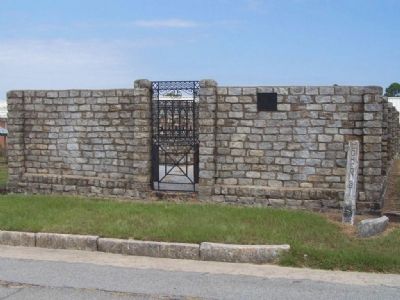
Andrew Bryan was born at Goose Creek, S.C. about 1716. He came to Savannah as a slave and here he was baptized by the Negro missionary, the Reverend George Leile, in 1781. Leile evacuated with the British in 1782 at the close of the American . . . — — Map (db m15624) HM
Near Martin Luther King Boulevard (West Broad Street) when traveling south.
He was a physician and planter
who also served as Speaker of the
Georgia Assembly during the
Royal and Revolutionary Period.
Imprisoned by the British, he later
held a seat in the Continental
Congress and Ga's Constitutional . . . — — Map (db m64444) HM WM
Near this spot two notable heroes of the American Revolution were mortally wounded in the ill-fated assault by the American and French forces upon the British lines here on October 9, 1779.
Brig. Gen. Casimir Pulaski, the famous Polish patriot, . . . — — Map (db m6698) HM
On West Libety Street near Martin Luther King Boulevard, on the right when traveling west.
(The Great Philadelphia Wagon Road) The most heavily traveled road in Colonial America passed through here, linking areas from The Great Lakes to Georgia. Laid on animal trails and Native American Trading/Warrior Paths. Treaties among the . . . — — Map (db m5648) HM
Served as a Lieutenant in Colonel Bull's Granville County, SC Regiment. Lt. Lawton was a Justice of the Peace in St. Peter's Parish. He owned land in St. Peter's Parish, St. Helena Parish, and Granville County, SC — — Map (db m6502) HM
On Louisville Road at Martin Luther King Boulevard on Louisville Road.
Savannah Merchant, organized and commanded Grenadier Company 1772; Member Council of Safety; Fought several battles as Continental Colonel; Captured twice; After release commanded stores at Yorktown; Promoted to Militia Major General, . . . — — Map (db m6440) HM
On McWhorter Drive at Ocean Science Circle, in the median on McWhorter Drive.
This location first appears (1734) in Georgia's history as a Savannah outpost. An original settler was Thomas Mouse who is remembered for his description of early hardships here. An evangelical visitor in 1736 was John Wesley. By 1740 the settlement . . . — — Map (db m9400) HM
Georgia was the last of the 13 colonies settled in 1733. It was a time of trial and hardship and called for persons bold in spirit, as well as resilience
to the hard life that came with pioneering. In this section we honor 13 of those men and . . . — — Map (db m10954) HM
On River Drive near Center St., on the right when traveling north.
Roger Lacy (Lacey) arrived in Savannah in 1734. While a resident
of the Georgia Colony, he spent most of his time at a trading
post in Augusta. There he gained employment as a trader and served
as the post commander. Roger Lacy (Lacey) was a . . . — — Map (db m9494) HM
Solomon's Lodge No. 1
Free and Accepted Masons
Savannah, Georgia
Established by
Worshipful Brother
James Edward Oglethorpe
February 21, 1734
at Sunbury, Georgia
Celebrating
275 Years
of Freemasonry
in Georgia
1734-2009 — — Map (db m171588) HM
On February 6, 1736, John Wesley, the founder of Methodism, landed at Peeper (now Cockspur) Island near here and there preached to his fellow voyagers his first sermon on American soil. A monument has been erected on Cockspur Island to commemorate . . . — — Map (db m5072) HM
On US 80 at Olde Tybee Rd., on the right when traveling east on US 80.
After the repeal of the anti-slavery provision in the Charter of the Colony of Georgia on 1749, an act permitting the importation of slaves ordered the erection of a Lazaretto (Quarantine Station) on Tybee Island. Not until 1767 were 104 acres . . . — — Map (db m12953) HM
On Fort Pulaski Road, 0.9 miles north of U.S. 80, on the right when traveling north.
Casimir Pulaski became a national hero in Poland when he fought for Polish liberty against Russian and Prussian forces in 1771. A year later, Poland lost the fight and Pulaski was forced to flee his homeland. He met Benjamin Franklin in Paris in . . . — — Map (db m134074) HM
Near Meddin Drive south of Taylor Street, on the right when traveling south.
The 1st Tybee Island Day Mark
When James Oglethorpe established the British colony in 1733, he recognized the need for a lighthouse on Georgia's coast, and and ordered that one be built on Tybee Island. When the wooden tower was completed in . . . — — Map (db m210677) HM
On Meddin Drive north of Gulick Street, on the right when traveling north.
The Middle Passage is a scar on the history of humanity. It is not a single race, religion or country's responsibility to bear; it belongs to the world. The enslavement of Africans was a global system that lasted more than 300 years. The Middle . . . — — Map (db m210667) HM
On Meddin Drive north of Gulick Street, on the right when traveling north.
Launched in 1994. the international and inter-regional project The Routes of Enslaved Peoples: Resistance, Liberty, Heritage addresses the history of the slave trade and slavery through the prism of intercultural dialogue, a culture of peace and . . . — — Map (db m210668) HM
On Broad Street (Georgia Route 520) 0 miles east of Lafayette Road, on the left when traveling east.
Kashita, “the Peace Town of the Lower Creeks,” one of two great Muskogee towns in the Creek Confederation of Indians, stood on the site of the Generals’ Headquarters at Fort Benning. Kashita, mentioned in the narrative of DeSoto’s . . . — — Map (db m38838) HM
On Ray Owens Road, on the left when traveling north.
Kiokee Church, the first Baptist Church to be constituted in Georgia, was organized in the Spring of 1772, by the Rev. Daniel Marshall, one of the founders of the Baptist denomination in Georgia. A meeting house was built, and the Rev. Daniel . . . — — Map (db m27064) HM
On Cobbham Road (State Road 150), on the right when traveling west.
On this site stood the home of William Few, one of Georgia's signers of the United States Constitution. Built in 1781, the house burned in 1930.
William Few was born near Baltimore, Maryland, June 8, 1748. In 1776 he moved to Augusta, . . . — — Map (db m27053) HM
On Carl Sutton Road, 0.4 miles north of Sandy Point Road, on the right when traveling north.
In July 1774 William Bartram entered Crawford County here, site of Marshall's Mill, going on to Knoxville, Roberta, and Cusetta. — — Map (db m59559) HM
On Cannon Road (Georgia Route 230) 0.2 miles south of Andersonville Trail (U.S. 280), on the right when traveling south.
Early in 1702 Joseph de Zuñiga, Spanish Governor of Florida, and Pierre le Moyne Iberville, French founder of Louisiana, made plans to check steadily increasing English trade with the Indian tribes in the interior, and perhaps to drive them out of . . . — — Map (db m22899) HM
On Albany Road (Georgia Route 97) 0 miles north of Carter Street, on the right when traveling north.
In this vicinity was fought the Flint Battle of 1702 between the English under Captain Antonio with Creek allies from Achito (near Columbus) and the Spaniards under Captain Francisco Romo Uriza with 800 Indians from Bacuqua (north of Tallahassee). . . . — — Map (db m55600) HM
On Albany Road (Georgia Route 97) at Carter Street, on the right when traveling north on Albany Road.
In this vicinity was fought the Flint Battle of 1702 between the English under Capt. Antonio with Creek allies from Achito (near Columbus) and the Spaniards under Capt. Francisco Romo Uriza with 800 Indians from Bacuqua (north of Tallahassee). In a . . . — — Map (db m55598) HM
On State Highway 119 at Tuckasee King Road (County Route 84), on the right on State Highway 119.
Soon after 1767, the Rev. Benjamin Stirk, who had been baptized at the Orphan House, visited Tuckasee King and, finding a number of Baptists there, began to preach to them. As there was then no Baptist Church in Georgia, an arm of the church at . . . — — Map (db m7537) HM
On Clyo-Stillwell Road at Sisters Ferry Road, on the right when traveling north on Clyo-Stillwell Road.
On these lands stood the home of John Adam Treutlen, the first Governor of Georgia after the State obtained Independence, being elected in 1777 under the first Constitution of Georgia. A Salzburger, born about 1733, John Adam Treutlen came to . . . — — Map (db m7255) HM
On Clyo-Kildare Road (County Route 81) at Taylor Chapel Road, on the right when traveling west on Clyo-Kildare Road.
Two miles east of here, on a bluff fronting Savannah River, is the site of Mt. Pleasant, a former Uchee Indian town and English trading post. Even before the foundation of Georgia, the spot was a key point on an arterial Indian path which had long . . . — — Map (db m7775) HM
On Railroad Avenue (State Highway 119) at Williams Avenue, on the right when traveling north on Railroad Avenue.
On the Savannah River, near here, two historic Ferries operated in Colonial Days, linking South Carolina and the Northern overland trade paths with Georgia and the routes leading South to the Savannah and East Florida markets. In 1739, General . . . — — Map (db m7194) HM
On Ebenezer Road (Georgia Route 275), on the left when traveling east.
[Marker's East face]:
To the Memory of the
Salzburgers
and
their faithful pastors.
Rev. John Martin Bolzius
and
Rev. Israel Christain Gronau
who for their faith in the doctrines
of Gods Word as taught
in . . . — — Map (db m14739) HM
On Ga 21 at Ga 275, on the right when traveling west on Ga 21. Reported missing.
Built in 1767- 69 by Lutheran Protestants who came to Georgia in 1734 after being exiled from Catholic Salzburg in Europe, the church is officially name Jerusalem Church. It stands on the site of a wooden building probably erected soon after the . . . — — Map (db m7629) HM
On Ebenezer Road (County Route 275) 0.1 miles east of Old Augusta Road (County Route 284), on the left when traveling east.
This cemetery has been the primary burial site for the town of New Ebenezer and the congregation of Jerusalem Lutheran Church since at least the mid-1740’s. An earlier burial ground dating from 1734 was located at the site of Old Ebenezer near . . . — — Map (db m156763) HM
On Ebenezer Road (Georgia Route 275), on the left when traveling north.
The Old River Road, one of Colonial Georgia's leading thoroughfares and the first highway to connect Savannah and Augusta, passed here. It was initially opened as a horse path by direction of General
Oglethorpe in the 1730's. During the early . . . — — Map (db m7649) HM
Silk culture began at Ebenezer in 1736, when each Salzburger was presented with a mulberry tree and two were instructed in the art of reeling. Two machines were soon in operation in Mr. Bolzius' yard near
the church, and in 1749, 762 lbs. of . . . — — Map (db m7694) HM
In this cemetery are buried the Rev. John Martin Bolzius and the Rev. Israel Christian Gronau, ministers who came to Georgia with the first company of Salzburgers. In March 1734, the Rev. Mr. Bolzius was Superintendent of the Latin Orphan House at . . . — — Map (db m7631) HM
On Ebenezer Road (County Route 275), on the right when traveling north.
Ebenezer was laid off in 1736, after the plan of Savannah, covering an area of a quarter of a mile square. Besides the homes, the plan included a church, parsonage, an academy, orphan house, public storehouse and market places. A thriving town at . . . — — Map (db m7576) HM
On Augusta Road (Georgia Route 21) just south of Old Augusta Road, on the right when traveling north.
Near here the Village of Abercorn was laid out, in 1733, and ten families assigned to it. In 1734, when the Salzburgers arrived in Georgia, many of them were stationed in Abercorn to wait for their homes to be built in Ebenezer and a road cut . . . — — Map (db m156762) HM
On Ebenezer Road (State Highway 275), on the right when traveling north.
(South Face)
John Adam Treutlen
1733 - 1782
First Constitutional Governor
of
The State Of Georgia
Elected May 1777
(East Face)
John Adam Treutlen
He was a member of the First Provincial Congress Of Georgia, . . . — — Map (db m7645) HM
On Stillwell-Clyo Road at Bethany Road, on the right when traveling north on Stillwell-Clyo Road.
The settlement of Bethany was effected near here in 1751 by John Gerar William DeBrahm, His Majesty's Surveyor General for the Southern District of North America. Comprised at first of 160 Germans, the group was joined 11 months later by an equal . . . — — Map (db m14587) HM
On N. Pine Street near Rabun Street, on the left when traveling east.
This is one of the eight original Counties created by the Georgia Constitution in 1777 and is named for Lord Effingham who was an ardent supporter of Colonial Rights. By Act of Feb. 26, 1784, the first County Site was located at Tuckasee-King near . . . — — Map (db m7505) HM
On State Highway 21 near Log Landing Road, on the right when traveling west.
About .5 miles East on this Road is the site of Old Ebenezer, the first settlement of the Salzburgers in Georgia. They selected this location and named it Ebenezer -- the stone of help. General Oglethorpe
marked out their town, and soon they . . . — — Map (db m7617) HM
On Stinchcomb Road, 0.5 miles south of Deep Creek Road, on the right when traveling south.
Stinchcomb Methodist Church was one of the first churches in this section of the state. On Dec. 30, 1794, Middleton Wood granted to Absalom Stinchcomb, John Gatewood and John Ham, the "privilege to erect a meeting house on his land on waters of . . . — — Map (db m14377) HM
On Calhoun Falls Highway (Georgia Route 72) at Pearl Mill Road, on the left when traveling east on Calhoun Falls Highway.
Rev. Daniel Tucker owned a large plantation on the Savannah River and is buried near his old homesite, “Point Lookout,” six miles from here. Born in Virginia, February 14, 1744, Daniel Tucker came here to take up a land grant. A . . . — — Map (db m38575) HM
On Calhoun Falls Highway (Georgia Route 72) at Bobby Brown State Park Road, on the right when traveling east on Calhoun Falls Highway.
“The Point,” where early settlers crossed into Georgia, is eight miles east of here. As soon as this area was ceded, Governor Wright opened a post at the confluence of the Broad and Savannah Rivers, known as Fort James. “The . . . — — Map (db m37051) HM
In May 1539 Hernando de Soto landed in Florida with over 600 people, 220 horses and mules, and a herd of swine reserved for famine. Fired by his success in Pizarro's conquest of Peru. De Soto had been granted the rights, by the King of . . . — — Map (db m30462) HM
Near Capitol Avenue Southwest north of Capital Square Southwest, on the right when traveling north.
Georgia’s most acclaimed female participant during the Revolutionary War was Nancy Morgan Hart. A devout patriot, Hart gained notoriety during the Revolution for her determined efforts to rid the area of Tories, English soldiers, and British . . . — — Map (db m215340) HM
The first Brunswick
Stew was made here in
the Brunswick - Golden
Isles area in early
colonial days. It remains
an American Favorite. — — Map (db m16615) HM
On Newcastle Street south of Mansfield Street, on the left when traveling north.
Came to Georgia in 1738 as an officer in the English forces located on St. Simons Island: Established a plantation known as "Carr’s Fields" and maintained a military outpost on the site of the City of Brunswick; assisted in repelling the Spanish . . . — — Map (db m155230) HM
On G Street at Union Street, on the left when traveling east on G Street.
Glynn County, one of the eight original Counties of Georgia, was organized under the 1777 Constitution of the State of Georgia. It was named in honor of John Glynn, a member of the British House of Commons who defended the cause of the American . . . — — Map (db m12226) HM
On Newcastle Street, 0.1 miles north of Mansfield Street, on the right when traveling north.
In memory of James Edward Oglethorpe Founder of the province now the state of Georgia Soldier philanthropist and lover of his fellowmen most ardently those of poor estate
Born 1696 • Died 1785
Erected by the efforts of Capt. . . . — — Map (db m155234) HM
Brunswick's first settler came to Georgia in 1738 with Oglethorpe's regiment. He was granted 500 acres at this place, on which he established his plantation.
Several tabby buildings erected by him stood nearby and a military outpost was . . . — — Map (db m12429) HM
On Newcastle Street north of Mansfield Street, on the right when traveling south.
Queen Square was named by colonial era founders of the city to honor the ruling queens of England. It was the most commercialized of the 14 original city squares.
Parks vs Prosperity
By the 1870s, the railroads, booming forest . . . — — Map (db m212679) HM
On Riverview Drive north of Major Horton Rd., on the right when traveling north.
William Horton, " Undersheriff of Herefordshire,"
England came to Georgia in 1736. He built this
building for his plantation residence and it was
his home until his death in 1749. Major Horton
succeeded Oglethorpe as Commander of the
Regiment . . . — — Map (db m18431) HM
Near Riverview Drive, 0.1 miles south of Clafin Road, on the right when traveling north.
Jekyll Island’s plentiful resources provided what was needed to feed and support those who lived here. When Major William Horton first arrived on Jekyll Island in 1736 to inspect his land grant, he “found the land exceedingly rich.” . . . — — Map (db m156861) HM
On Riverview Drive at Major Horton Road, on the right when traveling north on Riverview Drive.
William Horton worked and lived on this island until his death in 1748. He made numerous improvements to the land, unfortunately many of these buildings have been lost to time, and hidden by the sandy soil.
Horton completed the tabby . . . — — Map (db m17263) HM
On Riverview Drive near Major Horton Road, on the left when traveling north.
By the end of the 18th century, William
Horton's small farm had become a large and
prosperous plantation. After Horton's death, the
island had several owners prior to the arrival
of Christophe Anne Poulain du Bignon in 1791.
Christophe . . . — — Map (db m17338) HM
On Riverview Drive, on the right when traveling north.
William Horton decided to travel to Georgia with General James Oglethorpe in 1735. Unlike many passengers on the ship, Symond, he paid for his passage to America from England. Horton was granted 500 acres in return for paying for his . . . — — Map (db m17342) HM
On Riverview Drive, on the right when traveling south.
Jekyll Island was vey isolated from St.
Simons and Brunswick in the 18th & 19th
centuries. Due to this isolation the du Bignon
family was mostly self-sufficient, as were
previous owners of the island such as William
Horton. What is now . . . — — Map (db m17445) HM
Near Riverview Drive, 0.1 miles south of Chafin Road, on the left when traveling north.
In the 1500s Europeans began to document and explore the area around Jekyll Island. Though the French were the first to claim the area from Jacksonville, FL to Port Royal, SC, it was the Spanish who began making an enduring imprint on this . . . — — Map (db m156925) HM
On Riverview Drive near Major Horton Drive, on the right when traveling north.
Born in England Came to Georgia in 1736 Died at Savannah in 1748
These are the remains of Horton's tabby house. Major Horton of Oglethorpe's Regiment, the first English resident of Jekyll Island, erected on the north end of Jekyll a . . . — — Map (db m17577) HM
On Riverside Drive, 0.2 miles north of Plantation Road when traveling north.
McEvers Bayard Brown Oak
Centenarian Tree recognized by the Live Oak Society of the Louisiana Garden Club Federation, Inc.
This tree consists of a cluster of five trunks growing from the stump of a single live oak harvested between . . . — — Map (db m155960) HM
On Riverview Drive near Major Horton Drive, on the right when traveling north.
Tabby was the building material for walls, floors, and roofs widely used throughout coastal Georgia during the Military and Plantation Eras. It was composed of equal parts of sand, lime, oyster shell and water mixed into a mortar and poured into . . . — — Map (db m17578) HM
On Beachview Drive at Clam Creek Road, on the right when traveling west on Beachview Drive.
Within sight and sound of St. Simons Island, Jekyll Island was ideal for entertaining Spanish visitors to the settlement at Frederica. Major William Horton, resident of the island, received the guests while Oglethorpe on St. Simons, with cannon . . . — — Map (db m17281) HM
The skirmish at Bloody Marsh was more than a battle.
It was a clash of cultures - each vying for control of
what is now the southeastern United States.
Soldiers from Hispanic colonies in the New World
fought under the Spanish banner, with the . . . — — Map (db m63869) HM
On Arthur J. Moore Drive, 0.2 miles north of Hamilton Road.
On October 21, 1735, John and Charles Wesley and General James Oglethorpe (founder of the colony of Georgia) and eighty-four other passengers sailed from England on the ship "The Simmonds". After a hundred and fourteen days they sailed into the . . . — — Map (db m12549) HM
“Two coins were found on the floor. One was a British penny dated 1755, and the other was a United States cent dated 1798.” Archeological Report
The life span of Frederica was brief. Most of the ruins you see represent . . . — — Map (db m70227) HM
We are resolved not to suffer
defeat - we will rather die like
Leonidas and his Spartans - if we
can but protect Georgia and
Carolina and the rest of the Americans
from desolation Oglethorpe
Erected on the battlefield . . . — — Map (db m63868) HM
On Frederica Road, 0.1 miles east of Stevens Road, on the right when traveling west.
During the late morning of July 7, 1742 Georgia Rangers guarding the military road approach to the town of Frederica sighted a force of over 100 Spanish soldiers and their Indian allies. James Edward
Oglethorpe, founder of Georgia, quickly . . . — — Map (db m11634) HM
Near Mimosa Drive, 0.1 miles west of Frederica Drive, on the right when traveling west.
"The town is divided into several ? streets along ? sides are planted orange trees… London Magazine 1745
Imagine a typical day here on Broad Street in the early 1740s. Women worked in fenced gardens. Children played in the streets. . . . — — Map (db m70223) HM
In 1736 Captain Gascoigne of the
British Sloop-of War Hawk, established
here at Gascoigne Bluff the base for
the naval defense of the Colony of
Georgia. The Spaniards landed here
in the invasion of 1742.
In 1794 Live Oak timbers were . . . — — Map (db m13414) HM
On Frederica Road, on the left when traveling north.
This congregation was established as a mission of the Church of England in February, 1736. The Rev. Charles Wesley, ordained priest of that Church, conducted the first services in the chapel within the walls of Fort Frederica. The Rev. John . . . — — Map (db m17449) HM
On Demere Road at East Beach Causeway, on the left when traveling north on Demere Road.
From the site of the Battle of Bloody Marsh to the intersection with Ocean Boulevard, this road is part of the Military Road, sometimes called The King’s High Road, which was built by Frederica settlers in 1738 to connect Fort Frederica and Fort . . . — — Map (db m12473) HM
On 12th Street, on the right when traveling south.
The Spanish established several
missions along Georgia's coastal sea
islands. Two missions were located on
St. Simons Island, called " Isla De
Guadalquini" by the Spanish: Santo
Domingo de Asajo (Guale) and San
Buenaventura de . . . — — Map (db m13431) HM
Near Mimosa Drive, 0.3 miles west of Frederica Road.
”Gone to Carolina” Town Census 1743 Samuel Perkins, a coachmaker, arrived at Frederica with the first settlers. He built two good houses in town, one of them on this foundation. Outside town he cleared and fenced five acres, . . . — — Map (db m168384) HM
In 1736, on this historic site, Fort Frederica was constructed by the early settlers of the Colony of Georgia under General James Edward Oglethorpe. It was the strongest fortification built by Great Britain on American soil and its purpose was to . . . — — Map (db m18909) HM
On 12th Street, on the right when traveling south.
On this site Fort St. Simons was built by
English troops under command of General
James Edward Oglethorpe in 1738. It guarded
the entrance to the Frederica River through
which ships must pass to reach Fort Frederica.
With nearby Delegal's . . . — — Map (db m81904) HM
British settlement on St. Simons Island dates from 1736 when General James Edward Oglethorpe established the fortified town of Frederica seven miles northwest of today's lighthouse. Fort Frederica served as a defense against the Spanish in Florida . . . — — Map (db m106265) HM
" Frederica is situated on the Island of
St. Simons, in the middle of an Indian
field where our people found 30 or 40
acres cleared by them."
Francis Moore
1736
A Voyage to Georgia
The first British settlers landed . . . — — Map (db m18823) HM
John Calwell, the candlemaker, " had
built lately a large house of three storied
high which was looked on to be the best
in town, with storehouses, etc. for carrying
on the trade..."
Journal of William Stephens
June 25, 1745 During . . . — — Map (db m18906) HM
Near Mimosa Drive, 0.4 miles west of Frederica Road.
The Fort at Frederica has ”four bastions, a ditch palisaded, and a covered way [outer moat] defended by fifteen pieces of cannon.” Samuel Augspourguer Frederica engineer 1739 Cannon protected Frederica’s river approaches from . . . — — Map (db m168387) HM
" Some houses are built entirely of brick, some
of brick and wood, some few of tappy-work; but
most of the meaner sort of wood only."
London Magazine 1745 When Frederica was established in 1736, each
freeholder was given a lot 60 foot . . . — — Map (db m18905) HM
Mary Musgrove Matthews " has always
been in great esteen with the General,... for
being half Indian by extract, she had a very
great influence upon many of them, particulary
the Creek Nation...."
William Stephens
February 22, 1740 . . . — — Map (db m18908) HM
Near Mimosa Drive, 0.3 miles west of Frederica Road.
”They were pleased to appoint me to be Keeper of the Stores.” Francis Moore 1736 A Voyage to Georgia Francis Moore, like other Frederica settlers, wore many hats. He served as General Oglethorpe's secretary, town . . . — — Map (db m168389) HM
" The inhabitants of the town went
out on the 25th [September 1738] with
the General and cut a road through
the woods down to the soldiers fort..."
Gentleman's Magazine
January 1739 In front of you lies the trace of the . . . — — Map (db m18911) HM
Near Mimosa Drive, 0.4 miles west of Frederica Road.
This brick rectangle marks the site of the North Storehouse. It was a three-story brick and timber structure with a flat, tarred roof. Ship’s cargoes of food, tools, weapons, and other provisions vital to the colony were stored here. Frederica’s . . . — — Map (db m168388) HM
Near Mimosa Drive, 0.2 miles west of Frederica Road.
”There are two bastion towers of two stories each in the hollow of the bastions, defended on the outside with thick earthworks, and capable of lodging great numbers of soldiers.” London Magazine October 23, 1747 An earthwork . . . — — Map (db m168392) HM
This remnant is all
that time has spared of the
citadel of the town of Frederica
built by
General Oglethorpe
A.D. 1736
As an outpost against
The Spanish in Florida — — Map (db m18919) HM
" This Frederica is a very strange place; it
was once a town - the town, the metropolis of
the island."
Francis Anne Kemble
Visitor to Frederica
1839 Here, in unknown graves more than two centuries old,
lie many of the early . . . — — Map (db m18907) HM
Near Mimosa Drive, 0.3 miles west of Frederica Road.
Concerning the town doctor, Thomas Jones wrote in 1741, "He had not administered one dose of physic to any poor person, but refused unless paid…” This ruin represents two houses which may have shared a common wall, much like English . . . — — Map (db m168385) HM
"There are barracks in the town on
the north side, ninety feet square, built of tappy,
covered by cypress shingles; and a handsome
tower over the gateway...."
London Magazine
October 23, 1747 At the time of the Spanish attack in . . . — — Map (db m18917) HM
"In the morning, Mr. Oglethorpe began
to mark out a fort with four bastions, and
taught the men how to dig the ditch, and
raise and turf the rampart."
Francis Moore
1736
A Voyage to Georgia General Oglethorpe chose this . . . — — Map (db m18915) HM
Near Mimosa Drive, 0.4 miles west of Frederica Road.
”All sentrys are to be vigilant on their post; neither are they to sing, smoke tobacco, nor suffer any noise to be made near them.” Treatise of Military Discipline 1749 ”The Kings Magazine,” as it is known today, was . . . — — Map (db m168386) HM
Near Mimosa Drive, 0.3 miles west of Frederica Road.
”They make as fine an appearance upon the parade as any regiment in the King’s Service.” London Magazine 1745 This large, open area near the barracks was the parade ground. Some of the soldiers lived in huts along its edges. . . . — — Map (db m168391) HM
On Arthur J. Moore Drive at Hamilton Road, on the right when traveling north on Arthur J. Moore Drive.
Throughout the ages Gascoigne Bluff has been the gateway to St. Simons Island. An Indian village was located here. Capt. James Gascoigne of HM Sloop-of-war, HAWK, which convoyed the Frederica settlers on their voyage across the Atlantic in 1736, . . . — — Map (db m12229) HM
Throughout the ages Gascoigne Bluff has been the gateway to St. Simons Island. An Indian village was located here. Capt. James Gascoigne of HM Sloop-of-was, HAWK, which convoyed the Frederica settlers on their voyage across the Atlantic in 1736, . . . — — Map (db m13415) HM
On Lawrence Rd at Village Dr, on the right when traveling north on Lawrence Rd.
Here in 1736, Oglethorpe settled a group of German Lutherans, known as Salzburgers, and their settlement was called the German Village. These Salzburgers made their living by planting, fishing, and selling their products to the Frederica settlers. . . . — — Map (db m12389) HM
325 entries matched your criteria. Entries 101 through 200 are listed above. ⊲ Previous 100 — Next 100 ⊳