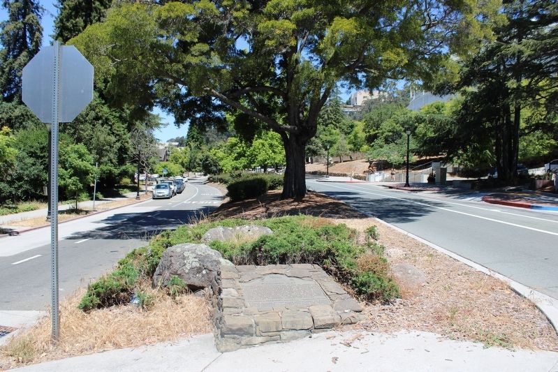
Piedmont Way was conceived in 1865 by Frederick Law Olmstead, America’s foremost landscape architect, as the centerpiece of a gracious residential community close beside the College of California, Olmstead envisioned a roadway that would follow the . . . — — Map (db m229320) HM
City of Berkeley Landmark
designated in 1983
This Zig-Zag Moderne building, designed for the sale and servicing of Buick automobiles, captures the glamour, rising affluence, and sophistication of the post-World War I era. Charles Howard, who . . . — — Map (db m54334) HM
For 86 years a favorite congregating spot. Built by John Green in 1860, with a balcony over the porch and a gabled roof. A famous cross-roads stop and transfer point on the Oakland-Stockton and Martinez-San Jose stagecoach routes intil the 1890's . . . — — Map (db m59944) HM
This was the main terminal for
the Key System Railway during World War II.
The Shipyard Railway – also known as the “Pass the Ammunition”
Railway – was built by the Key System for the United States Maritime . . . — — Map (db m72396) HM
A part of the cable winding mechanism of the San Francisco Cable Cars from 1873 to 1965
Replaced by D. W. Nicholson Corporation — — Map (db m201553) HM
There were many outbuildings on the Meek Property. In the early 1890s, the family built the carriage house for carriages and horses. The interior of the carriage house has been restored to replicate how the original building might have looked when . . . — — Map (db m210345) HM
This 1891 Victorian style, Italianate house was the residence of Daniel J. Murphy from 1891-1921. He was a prominent Livermore businessman and local government official. As an Alameda County Supervisor, Murphy improved the network of roads and . . . — — Map (db m195505) HM
Service Station and Car Dealership
Situated on the Original Route
of the Lincoln Highway
————————
City of Livermore
Historic Preservation Site
Dedicated July 1996
Operated by
The . . . — — Map (db m19994) HM
This wagon was built in 1849 by Martin Luther Marsh for M.L. and D. Marsh Lumber Co. in Nevada City. It was used until 1917; abandoned in Meeker Canyon; then trucked to Livermore in 1931 and used in the rodeo parades until 1936. It was displayed . . . — — Map (db m194541) HM
City of Livermore
Historic Preservation Heritage
District
Fuse works, office, and management housing for Coast Manufacturing and Supply Company.
From 1913 to 1968
— — Map (db m198576) HM
Latham Square is actually a triangle, an accidental space created
by the meeting of new and old roads. Broadway did not extend
above 14th Street until the late 1880s, when it was needed to
channel the city's expansion to the north. Telegraph . . . — — Map (db m160466) HM
Opened in 1903, the timber-lined Kennedy Tunnel was the fast route between Oakland and Lafayette, saving four hours of driving around the San Pablo Reservoir. In 1914, it was wired for lights and renamed the Broadway Tunnel. In 1937, after the . . . — — Map (db m71764) HM
Standing here amidst this beautiful natural landscape it is hard to imagine that tranquil,
Shepherd Canyon came very close to vanishing under concrete. With the growing
popularity of the automobile in the 1950s and the phasing out of the . . . — — Map (db m184848) HM
Looking up Broadway from the wharf, 1854
The waterfront at the foot of Broadway was the site of the first rents and small wooden buildings that became the ciy of Oakland. Settlers began
arriving in 1850 during the Gold Rush. When Oakland . . . — — Map (db m185869) HM
Designe: Henry H. Meyers
Construction Date: 1925-28
Architectural Style: Beaux Arts derivative/Art Deco
The Oakland Portal’s elaborate Beaux Arts façade conceals eight massive fans that draw in fresh air to the Posey Tube, an . . . — — Map (db m227915) HM
Spine of West Oakland
The elevated BART tracks are the latest link in Seventh Street's long history as the transportation spine of West Oakland. The street once led to the long Wharf and Mole on the western waterfront where the . . . — — Map (db m92787) HM
In 1867 the pink mineral springs which oozed from Bushy Dell Canyon began to attract visitors to Piedmont Park and the surrounding community. Generation after generation the park has changed to reflect the community that surrounds it, creating . . . — — Map (db m72297) HM
"The river here is…filled with large rocks. We crossed on a bridge but expect to ford the next times…We started through Mad Canyon which is rightly named…the hardest place for teams I ever saw" - Caroline L. Richardson, Sep 12, 1852 — — Map (db m211142) HM
This Sierra Crossing used by Jedediah Smith 1821 - Major John Ebbetts 1850 - Snowshoe Thompson 1856-76 - Gold Seekers 1850's. Old road left Carson Pass Road in Hope Valley, crossed Border Ruffian Pass to Hermit Valley, Pacific Summit and through . . . — — Map (db m10730) HM
The Carson River Route saw more wagon travel during the peak of the Gold Rush than any other emigrant trail. Most of these were Gold seekers headed for the diggings in Placerville, Volcano, Jackson, and Sutter Creek. In 1855, the California State . . . — — Map (db m211982) HM
Front of Marker
"After dinner we crossed the first mountain. The ascent is half a mile and much like going up the side of a house in steepness. With hughe stones in the road, aside the road and all around the road."- Henry Sheldon Anable, . . . — — Map (db m148705) HM
Below this ridge is what some pioneers dubbed the “Devils Ladder.” A name reflecting the steepness and extreme difficulty that pioneers experienced as they began their ascent over the Sierra Nevada. This climb was usually referred to as . . . — — Map (db m21284) HM
At this point in August 1849, a group of Odd Fellows nearing their goal, the California gold mines, paused in their struggle up these granite walls, to paint on this and adjacent boulders their names and the three links of the Great Order they so . . . — — Map (db m100569) HM
In February of 1844, John C. Fremont led a group of men over these mountains as they struggled to reach Sutter’s Fort. Little did they know that the pass, which lay 20 to 30 feet under the snow beneath them, would be a major route for the Gold Rush . . . — — Map (db m21278) HM
Here the Old Emigrant Road of 1848 swung down across the meadow now covered by Caples Lake (Twin Lakes) and climbed along the ridge at the right to the gap at the head of the valley. From this summit (9,460 feet) it descended to Placerville. This . . . — — Map (db m100570) HM
At this place the highway crosses the site of the old emigrant road which here began a long loop around the Silver Lake basin, taking it to an elevation of 9,640 feet at one place. This difficult portion of the road was used by thousands of . . . — — Map (db m175821) HM
Named after Major John Ebbett and pointed out in 1853 to surveyor G.H. Goodard who referred to it as a “route of great promise – probably the best one for a transcontinental railway.”
No emigrant train used this route but a . . . — — Map (db m11444) HM
In 1856 a road was completed following the present sign route 4 from Murphys to this point, and thence northward via Faith and Charity Valleys to Hope Valley where it joined the Carson Pass Road. This connection was used by emigrants in 1856 and . . . — — Map (db m10316) HM
[The first paragraph of the marker is unreadable]
One of the most popular passes through the Sierras along the Emigrant Trail was Carson Pass. This Pass was discovered by Kit Carson, a guide to the Fremont Party.
The Fremont Party, led by John . . . — — Map (db m223952) HM
"Passed over the summit of the first range and came to [Grass] lake situated nearly on the summit of the mountain....We began our decent [sic] down the mountain over as rough a road as we came up, into Lake Valley" - Luman A. Scott, Sep 8, 1859 — — Map (db m212025) HM
"Then up hill [from Hope Valley] and away, steep and rugged and we at last gain the first summit of the Nevada Mountains [at Luther Pass] and down t'other side more rugged than ever" - John McTurk Gibson, Sep 3 1859... — — Map (db m212003) HM
"We immerged [sic] from the canon [sic] into a pretty valley in between two ranges of high mountains. Pretty pine trees were scattered over a small grass lawn, and a beautiful mountain stream passed through it." - Lorena L. Hayes, Sep . . . — — Map (db m211992) HM
"We crossed Carson River, for here we leave the Carson Route and take what is called the Johnson Route or 'Johnson's Cut-Off to Hangtown'." - J. Robert Brown, Sep 25, 1856 — — Map (db m211987) HM
"We crossed Carson River, for here we leave the Carson Route and take what is called the Johnson Route or 'Johnson's Cut-Off to Hangtown'."
- J. Robert Brown, Sep 25, 1856 — — Map (db m212969) HM
During the initial five weeks of its operation in 1860, an important remount station of the famous Pony Express was located a few feet from here at Cary’s Barn.
This monument erected by the Historical Society of Alpine County.
National . . . — — Map (db m143520) HM
Historic Woodfords Station, the Eastern Sierra gateway to the goldfields of California, way station of the famed Pony Express, and entrance to Carson Pass on the Emigrant Trail to the Sacramento Valley. Beginning in 1849 with the building of the . . . — — Map (db m195369) HM
Mormon-Carson Pass Emigrant Trail, the heavily-travelled gateway to California gold fields, was blazed in 1848 by discharged members of the Mormon battalion traveling east to join their families.
Five hundred Mormon volunteers, recruited in . . . — — Map (db m10824) HM
This marker is made up of three separate panels.
[Panel 1:]
The Road
From a narrow dirt wagon road to a scenic byway, the Carson Route has evolved over time to meet the needs of generations of travelers and our changing means of . . . — — Map (db m45050) HM
This campsite on the Kit Carson Emigrant Trail was a resting place for California settlers. It was named by members of the Mormon Battalion enroute to Salt Lake Valley. Three of their men, serving as advance trail scouts, were murdered here by . . . — — Map (db m21273) HM
Michael (“Mike”) Tovey, Wells Fargo Messenger was killed and DeWitt Clinton Radcliff, stage driver injured on this spot, June 15, 1893, by a lone bandit who attempted to hold up the regular six-horse stage on the old Ione - Jackson Stage . . . — — Map (db m41555) HM
Copper mines patented 1873:
Peak Outputs: Early 1860’s, 1895-1917, 1943-1947,
Township organized 1854.
A Methodist center for many years
U.S. Postoffice: 1862-1905 — — Map (db m11361) HM
Stop(p)ed & camped Leek Springs. A beautiful little valley surrounded by a large pine and fur trees. The most romantic spot we have camped upon. Mendall Jewett, July 19, 1850. — — Map (db m227886) HM
Knight Foundry Scarifier, Patent No. US 1665277 A, was developed in 1926 and patented in 1928 by Daniel (Dan) V. Ramazzotti, owner of Knight Foundry, as an improved mechanical ripper for removing uneven surfaces and ruts from roads. With the advent . . . — — Map (db m106423) HM
“We left here at half past four intending to go as far as Bidwell Bar. We passed on a bridge which crosses a pond made by damming a stream for the purpose of running (a) sawmill which is situated here” – James Woodworth, Aug. 19, . . . — — Map (db m61682) HM
In June, 1864, the Chico and Humboldt Wagon Road Company began to construct a road to connect Chico with the Idaho mines. A toll station for the Chico and Humboldt Wagon Road stood nearby to the left.
A Georgian, Nick Spires, is said to have . . . — — Map (db m61766) HM
September 25, 1882 – August 1, 1968
Founder of Mother Lode Association in 1919, which created colorful Highway 49 – California’s first highway association.
Plaque and 100 year capsules placed on July 23, 1976 by Golden Chain . . . — — Map (db m6876) HM
Hotel and stagecoach relay station, halfway between Murphys and Big Trees. Settled in the 1850’s by Joseph and Sarah Goodell. Purchased by Peter Avery, then operated by three generations of Averys - Peter and Nancy, George and Henrietta and Morton . . . — — Map (db m10615) HM
(There are five markers and one dedication plaque affixed to the flagpole pedestal.)
History of Copperopolis
Copper (for ore) + opolos (for city)
Originally known as Copper Canyon, Copperopolis was established in 1860 when copper . . . — — Map (db m62356) HM
In 1852 a chain cable bridge replaced the ferries that once crossed here, to be supplanted in its turn by a covered truss structure in 1862. Some writers claimed this was the locale of Bret Harte's Poker Flat. In late “49” there was a large camp . . . — — Map (db m13013) HM
Board’s Crossing was first used as a cattle crossing in the early 1870’s. Brothers David and William Board moved here from Missouri in 1854. They settled in Salt Springs Valley and raised cattle. This shallow ford across the river was a favorite . . . — — Map (db m58791) HM
Built in 1860 by John and Rebecca Gardner, this was a stage coach stop on the Big Trees Carson Valley Road. A toll road from 1862 – 1910. The hotel served as a depot for stockmen and as a summer resort.
Noted for its ice cold . . . — — Map (db m57983) HM
Located on the Stockton-Murphy Road at the fourth crossing of the Calaveras River, this early mining settlement, once called Foremans, was famous in the 1850's for its rich placer ores. Later, it became an important stage and freighting depot and . . . — — Map (db m11969) HM
In 1892 Contra Costa County named Black Diamond Way, and maintained it as a road until 1982. (Locally it was also known as "Nortonville Road".) Black Diamond Way became part of Black Diamond Mt. Diablo Regional Trail in 1985.
Black Diamond . . . — — Map (db m27431) HM
During the Spanish colonial era, the train that would become San Pablo Avenue connected many ranchos across the East Bay. By the mid-1800s, it featured a state line connecting Oakland and Martinez. Today the Avenue remains the center of El . . . — — Map (db m94248) HM
In 1946, Charles Deabenderter constructed this building for his Chevrolet service and repair business. The building has remained an auto repair business since that time, although under different names and specializations. In 1974 the business was . . . — — Map (db m94277) HM
In 1928, San Pablo Ave. (U.S. 40) became part of America's 3,384 mi.
'Lincoln' Transcontinental Highway.
Marker rededicated April 10, 1988. — — Map (db m153013) HM
The 1951 opening of Broadway Shopping Center led to almost daily gridlock at Main and Mt. Diablo, streets that were also part of two state highways. Local officials used photos to "plead their case" for traffic relief. The freeway to bypass downtown . . . — — Map (db m93710) HM
The 1951 opening of Broadway Shopping Center increased traffic on Main Street, which also doubled as part of two state highways. Photos like this helped convince State officials to build a freeway bypass to ease congestion. The new freeway opened in . . . — — Map (db m93863) HM
First model built by International Harvester in 1924. Designed to cultivate or weed between rows. Instead of the traditional side-mounted flywheel to which a belt was attached to run machinery, the Farmall had what was known as a "power take-off," a . . . — — Map (db m93979) HM
The most important corner in Walnut Creek has alway been a center of transportation. In the late 1800's and early 1900s, a livery stable (horse barn) occupied this entire block, allowing locals and visitors to board or rent horses and buggies. — — Map (db m93728) HM
Preferring cars to the family meat business, Lester Lawrence opened this auto garage across from his brother's meat market in 1921. Soon, he also began selling cars. He owned several dealerships over the years, including a dealership on North Main . . . — — Map (db m93877) HM
Diagonally across the street stood Lommel's Creamery, opened in 1939 and a local favorite for 35 years. After Greyhound began commuter bus service to San Francisco, Lommel saw his chance and convinced the company to use his Creamery as the bus stop. — — Map (db m93809) HM
From earliest times, Main Street (then Pacheco Road) was a highway. It was a main stagecoach route from Martinez to San Jose. Main Street was paved in 1921 and served as a state highway until the freeway opened in 1960. — — Map (db m93703) HM
By a vote of 127-76, Walnut Creek residents chose to incorporate as a city in October 1914, largely to get Main Street paved. It took another seven years to secure the funds but, finally, Main Street was paved in 1921. — — Map (db m93873) HM
Constructed in 1858, this was the route of the Crescent City Turnpike. Following the present Elk Valley Road to Old Camp Lincoln, it then crossed the ridge, forded Smith River to low divide, and continued to Jacksonville, Oregon, by way of various . . . — — Map (db m176819) HM
In 1946, President James K. Polk authorized the Army to enlist Mormons to fight in the Mexican War. 496 men joined the Mormon Battalion in Council Bluffs, Iowa on July 16, 1846. They marched over 2,000 miles, building a wagon road from Santa Fe to . . . — — Map (db m215525) HM
Here in the Valley of the Cul-lum-mah Indians, James W. Marshall discovered gold on January 24, 1848, in the tailrace of Sutter’s sawmill. The Old Coloma Road, opened in 1847 from Sutter’s Fort to Coloma, was used by Marshall to carry the news of . . . — — Map (db m12272) HM
El Dorado, meaning “The Gilded One”, was first known as Mud Springs from the boggy quagmire the cattle and horses made of a nearby watering place.
Originally a important camp along the old Carson Emigrant Trail. By 1849 – 50 it . . . — — Map (db m13148) HM
At this site on the old Clarksville-White Rock Emigrant Road was Mormon Tavern. Constructed in 1849, this popular stage stop was enlarged and operated by Franklin Winchell in 1851. It became a remount station of the Central Overland Pony Express and . . . — — Map (db m12056) HM
The Central Overland Pony Express passed this site many times. Green Valley Road was the gateway to the gold region, and was the center of activities in the 1850’s & 60’s, where many early California Inns were located. In the late 1800’s a . . . — — Map (db m11311) HM
"Camping place called [Fresh] Pond at foot of Junction Hill, very long and steep." John McTurk Gibson, Sep 7, 1859
"We got some whisky [sic] for the cattle and drank it ourselves. It is the first I have had" - John W. Powell, Sep 7, 1859 — — Map (db m212408) HM
On Labor Day Weekend 2004, The Dysfunctional Organization held the first "Cantina for the Con." With the sale of that first "Dysfunctional" taco, "Cantina for the Con" became an annual Labor Day event. To date, "Cantina for the Con" has raised over . . . — — Map (db m106333) HM
Historically speaking, to cross the Rubicon River meant that you had passed the point of no return. This trail was originally used by Native Americans as a trade route. In the 1800s it became the main byway from Georgetown to Lake Tahoe. The route . . . — — Map (db m105984) HM
This was the site of a change station of the Pioneer Stage Company in the 1850’s and 1860’s. During 1860-1861, the Central Overland Pony Express maintained here the first pony remount station east of Sportsman’s Hall. — — Map (db m57977) HM
These stone obelisks are all that’s left of the original four that once stood on the corners of the stone arch bridge spanning the American River from 1900 to 1930.
This monument erected by Caltrans District 3 History Committee and the . . . — — Map (db m23183) HM
This was the site of Webster's Sugar Loaf House, well-known stopping place during the Comstock rush. Beginning in April 1860, it was used as a remount station of the Central Overland Pony Express. In 1861 it became a horse change station for . . . — — Map (db m14177) HM
"This is called 'Dry Diggins'...More gold has been raised (here) than in any other part of California. Here we made a final stop and unloaded our wagons & felt of a truth that we had at last reached the gold mines." - P. C. Tiffany, Aug 25, 1849 — — Map (db m212359) HM
"We decided to head for Placerville and cast out lot digging gold, and we expect to pass into this place to night....We passed...a good many cradling out gold, and we are all very enthusiastic to get started" - Albert G. Paschal, Aug 18, 1859 — — Map (db m211225) HM
"Entered Pleasant Valley in which are established several trading posts....We moved on and...descended into a valley in which is situated a few log huts & 1 tavern. This place is named Ring(g)old." James G. Shields, Aug 13, 1850 — — Map (db m211169) HM
"We have come four miles and come to a flourishing little town in the mountains. The original name of this town is Placerville.... Men are diging [sic] here in the middle of the streets in search of gold." - William H. Kilgore. Aug 5, 1850 — — Map (db m212362) HM
[Marker facing Bee Street]
Placerville
Known as Hangtown
In the days of “49”
to
Sutter’s Fort
Sacramento
50 Miles
[Marker facing Coloma Street-State Hwy . . . — — Map (db m16024) HM
Gold Rush town and Western Terminus of the Placerville – Carson Road to the Comstock. Placerville was a relay station of the Central Overland Pony Express, April 4, 1860 – June 30, 1861. Here on April 4, 1860 the first east-bound pony . . . — — Map (db m57973) HM
"After descending from this ridge by a long hill...at twilight entered on as beautiful a valley as ever I laid eyes on called Pleasant Valley." - Peter Decker, Aug 7, 1849 — — Map (db m211152) HM
"Came on the forks of the road - the left hand leading to Sutters Fort & the right hand to...Coloma...We here took the right hand fork and went...through Wevervill (and) came on...farther to Hang Town" - James A. Pritchard, Aug 11, 1849 — — Map (db m211151) HM
California’s only Home Station where riders changed on the Pony Express trail. Here, at 8:01 A.M. on April 4, 1860, Sam Hamilton, first eastbound rider, was relieved by Warren Upson who carried the initial mail over the then storm swept Sierras.
. . . — — Map (db m613) HM
"We moved on...to where the roads forked...the left hand road leads to Weberville & the right leads to Hangtown or Placerville. We concluded to take the left hand road, now we commence a gradual descent." - James G. Shields, Aug 12, 1850 — — Map (db m212434) HM
Cutoff to Johnson Ranch and Placerville
"Came...up to the forks of the road, one goes to Placerville and one to Weaver Town (Weberville), took our right hand road to Placerville or Hang Town, and came to what is called Johnson's ranch" . . . — — Map (db m212436) HM
"We now had to go up an ascent of four or five miles. The road would run along the side of the mountain, and then turn square up for a short distance. In this way we passed over many dangerous places" - J. Robert Brown, Sep 26, 1856 — — Map (db m212531) HM
"Traveled to the South Fork, here is a trading post and bridge, they charged 50¢ for a man and a horse,...we would not pay toll but forded, verry [sic] bad ford, went up a long mountain through the brush" - William Perry Hampton, Sep 13, 1852 — — Map (db m212509) HM
"We came to what is called Peavine Hill, and found a long steep descent, but we got down without difficulty, and nooned near an excellent spring (Granite Springs)"
J. Robert Brown, Sep 30, 1856 — — Map (db m212527) HM
"We came on over a ridge or backbone; the road is now much traveled, and is very dusty; the earth is very red and dry; the road is well worked here, for they haul much ice along here to Hangtown." - J. Robert Brown, Oct 2, 1856 — — Map (db m212524) HM
"The scenery is magnificent but it would be some task to come over these mountains with wagons. We saw any amount of grizzly bear tracks today." - George Washington King, June 6, 1853 — — Map (db m212523) HM
"To the fork of the road leading to Wever Town & Hangtown here we took the Hangtown Road it being the best thence to water on the left of road. Good grass one mile to right of road." Seth Lewelling, Aug 3, 1850 — — Map (db m212440) HM
"Started over the mountains again. Drove...over the [most] dusty roads we have ever saw since we left home. Camped about 6 in the evening at the Sportsmans Hall." - Abbey E. Fulkerth, Aug 3, 1863 — — Map (db m212443) HM
This was the site of Sportsman’s Hall, also known as Twelve-Mile House. The hotel operated in the late 1850’s and 1860’s by John and James Blair, a stopping place for stages and teams of the comstock. It became a relay station of the Central . . . — — Map (db m609) HM
Shortly after James W Marshall discovered gold at Sutter's Mill, his Mormon laborers were re-called to the Great Salt Lake Valley, Utah. On April, 9, 1848, a plan was devised to cut a wagon trail through the uncharted Sierra Nevada frontier. The . . . — — Map (db m94636) HM
771 entries matched your criteria. The first 100 are listed above. Next 100 ⊳