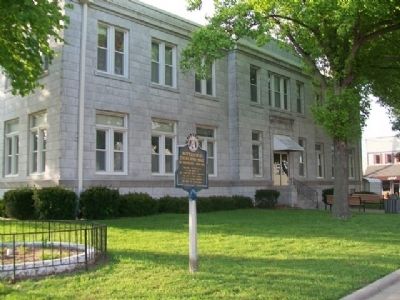
Cassville, the last town
on the route of
the Butterfield Mail in Missouri,
was not a relay station
but the coaches stopped
for mail and passengers — — Map (db m80212) HM
1806 15 Ms. South of Butler
Explorer Zebulon Pike Parley
With Osage Chief
1863 Burning of Butler by Order No. 11
During the Civil War
Where the Civil War Began
Brother Against Brother
Post Civil War Reconstruction
[Mural . . . — — Map (db m39898) HM
First Road Dragger in Bates County
He lived for others. He tried to live a humble Christian. The Lord blessed his life and will continue to bless all who trust fully in Him. — — Map (db m46088) HM
Warsaw, in Benton County, 55 miles from the Tipton Terminus, was a relay and meal station. Accommodations were provided by the Lemon, later Campbell House, and Nichols Tavern. Its building still stands. — — Map (db m140840) HM
During Columbia's formative years, the Flat Branch Creek area served as a crossroads for two important travel routes — the Booneslick Trail and the Providence Plank Road. Beginning in the early 1800s the Booneslick Trail was a passageway for . . . — — Map (db m169427) HM
Katy Trail State Park is one of Missouri's premier attractions, drawing about 400,000 visitors from across the United States and other countries. Stretching 225 miles from St. Charles in the east to Clinton in the west, the trail is the longest . . . — — Map (db m46383) HM
The Patee House was the Pony Express Company's Eastern Headquarters from April 3, 1860 to September 13, 1861. The company's official name was "The Central Overland California and Pike's Peak Express Company."
John Patee built the hotel from . . . — — Map (db m47398) HM
On this site, April 3, 1860, a ferry carrying a horse and rider crossed the Missouri River to start a 10 day journey of 1,966 miles to deliver mail to Sacramento, California.
The race against time, elements and a hostile land captured the spirit . . . — — Map (db m47470) HM
Each spring thousands of emigrants camped in these hills and meadows waiting for new grass to support their teams along the trail. Wagons lined St. Joseph streets to the east waiting for two to three days to be ferried from this point. The settlers . . . — — Map (db m47467) HM
On April 3, 1860, the Pony Express started from this neighborhood on its historic run to the West. Eight months after the Pony Express joined East and West, the country split North to South when South Carolina seceded. Missouri, including St. . . . — — Map (db m48063) HM
This monument erected by the
Daughters of the American Revolution
and
The City of St. Joseph
marks the place where the first
Pony Express started on April 3, 1860 — — Map (db m47492) HM
In 1913 the city completed 3-1/3 miles of brick streets along Main & Vine at the cost of $86,645 following specifications established for brick streets in New York City. These historic streets have served the city for nearly a century. — — Map (db m36140) HM
Originally located on a bluff on Stinson Creek in northwest Fulton, about 200 yards north of the Boone's Lick Trail, this rock bears the name D. Boone with the date 1801 and an arrow pointing due west. — — Map (db m69693) HM
Here at the North Jefferson Trail Head, on Sept. 29, 1996, the east and west sections of the Katy Trail were joined, forging the final link uniting St. Charles and Sedalia via Katy Trail State Park. — — Map (db m169404) HM
The list of recorded floods on the Missouri River is long, but the most devastating in recent history was the Great Flood of 1993. The river at Jefferson City crested more than 15 feet above flood stage. Throughout the Midwest that year, two . . . — — Map (db m169406) HM
Williamsburg and its rural neighborhood, including the Loutre River valley to the east, were home to several famous, even notorious Southern guerrillas.
One such was Capt. Alvin Cobb of "Cobbstown," in western Montgomery County, Mo. A large, . . . — — Map (db m212623) HM
At the beginning of the 1900s, Robert
McClure Snyder, a Kansas City businessman,
visited the area. He bought over 5,000 acres and
began construction of his dream-a magnificent
European-style mansion or "castle.” Material
for the . . . — — Map (db m162205) HM
Snyder’s Legacy
At the beginning of the 1900s, Robert McClure
Snyder, a Kansas City businessman, bought
over 5,000 acres and began construction of
use
his dream-a magnificent European-style
mansion or "castle."
Stone masons from . . . — — Map (db m162200) HM
1928 — The former Marquette Hotel was completed around the time the first bridge opened linking Cape Girardeau to Illinois. The bridge boosted Cape Girardeau's economy and became a popular place for traveling business men and families to stop . . . — — Map (db m236200) HM
In 1838 and 1839, twelve detachments with at least 11,000 weary Cherokee passed through Jackson, Missouri, on their journey to Indian Territory. Most of the groups followed the Northern Route of the Trail of Tears and came into town on Greensferry . . . — — Map (db m236844) HM
Home to thousands of men, women, and children, the Cherokee Nation once spread across parts of Georgia, North Carolina, Tennessee, and Alabama. The 1830 Indian Removal Act required that the Cherokee surrender their land and move west. In 1838, . . . — — Map (db m236826) HM
Before El Dorado Springs was founded, this stone wash basin sat before the Spring on rock supports. It was used by travelers along the trail. Some pioneer artisan cut it from a stone taken from Grindstone Quarry, located East of the Park Hotel. . . . — — Map (db m57377) HM
This wagon represented the State of Missouri in the 1976 Bicentennial Wagon Train Pilgrimage to Valley Forge, Pennsylvania
Wagon Master, Raymond Williams
Asst. Wagon Master, Jack Nolan
Outriders, Georgia Williams
Dixie Nolan-Peak and . . . — — Map (db m57421) HM
The John C. Ashmore Relay Station in northwest Christian County stood in Polk Township, 152 ½ miles from the Tipton Terminus. It was the only station in the county. — — Map (db m99690) HM
In 1860 Watkins Mill became the first industry in Clay County. Major industries that followed were Cook Paint and Varnish in 1913, Ralston Purina Company in 1940's and the Claycomo Ford Assembly Plant in 1951. The ASB Bridge was built in 1912 . . . — — Map (db m68311) HM
George W. Burruss, President
Robert W. Wilson, Vice-President
Dedication September 26, 2003
The Missouri Motor Carriers Association proudly dedicates this building in honor of these great men who have served the trucking industry with . . . — — Map (db m62223) HM
On June 17, 1861, the Battle of Boonville took place at this and other locations along this road. By most standards of warfare, the Battle of Boonville was more truly a skirmish or demonstration than a full blown battle. But small conflicts can . . . — — Map (db m46060) HM
Osage hunting and trading expeditions left clearly defined trails that were used to travel to the St. Louis area long before the white man's coming. The Osage Trail was later used for trading purposes and eventually became Route 66 and I-44, the . . . — — Map (db m139772) HM
Paul T. Carr, who also sold Pontiacs from the location, built this Phillips 66 cottage style station in 1932. The site was purchased in 1968 by Bill Wallis and was converted to Mobil that year as well as becoming the first office for Wallis Oil . . . — — Map (db m171955) HM
The Osage (Wa-zha-zhe) tribe were early inhabitants of the Missouri region. Their villages were located along the Osage and other Missouri rivers. French explorers first made contact with the Osage in the 1670s. At that time, the Osage were the most . . . — — Map (db m139826) HM
In the 1900's, Prosperity Corner drew citizens to meet, do business, and pass the time of day. H.H. Tieman's General Merchandise Store was the hub of this activity. Hayes Store stands on the original site of Prosperity Corner. — — Map (db m139829) HM
The Indian Removal Act was past [sic] by President Andrew Jackson in May of 1830. All Native Americans were rounded up and moved to the Indian Territory. The Cherokee, after being driven from their homes, were divided into detachments. Late in . . . — — Map (db m157668) HM
[Side A]
DeKalb County, 270,720 acres of rolling prairie land, is one of 19 Missouri counties organized in February, 1845. The name is for German-born Johann Kalb, member of the French army and general in the American Revolution, known as . . . — — Map (db m88146) HM
The forced migration of the Cherokee Indians in 1837-1838 was a tragic episode in American history. As early as 1802, Thomas Jefferson proposed relocating southern tribes to land west of the Mississippi River, but it was not until the Indian Removal . . . — — Map (db m99288) HM
This World War II era Quonset hut, with a unique stone façade was built here in 1950. It started out as a family-run dry cleaning business by the original owners. Over the years it has been a photo studio and the home of several roadside diners . . . — — Map (db m205178) HM
Extended employment sheltered workshop programs in America began in the state of Missouri, in the city of Sedalia in 1965, when a parent campaigned for a vocational program to better the life of his disabled child; who was finished with school . . . — — Map (db m139733) HM
This is an American Revolution Bicentennial Memorial marking the juncture of three famous pioneer trails here.
They are the Lewis and Clark Trail 1804-1806, the Ozark Frontier Trail mid-1800's and the Old Iron Road which linked the Meramec . . . — — Map (db m63207) HM
In 1830 an early settlement was formed around the junction of "Old Iron Road" and the "St Louis to Springfield Road" (now Springfield & Peters Streets). Seventeen years later, two friends named this settlement after playing a horseshoe game to . . . — — Map (db m139777) HM
(Front): Queen City of the Ozarks, settled in 1830 by Tennessee pioneers on what had been a Kickapoo, Osage, and Delaware Indian camping ground. Springfield was first called Campbell and Fulbright Springs after its first settlers. Rivalry . . . — — Map (db m35247) HM
Born in Fenton, MO in 1956 to
Russ and Judy Wallace
Attended Fox Senior High School
Married to Patti
Father to Greg, Katie, and Steve
Made driving debut at Lakehill (MO) Speedway - 1973
Central Auto Racing Association Rookie of the . . . — — Map (db m72151) HM
Site of Gen. Nicholas Smith's tavern on Boonville Road, earliest outlet of Springfield, also station of Butterfield Stage Route carrying first overland mail from St. Louis to Pacific Coast. Government subsidy $600,000 yearly. First mail left St. . . . — — Map (db m43089) HM
On April 30, 1926, a group of businessmen led by Cy Avery of Tulsa and John T. Woodruff of Springfield, sent a telegram from Springfield to the Bureau of Public Roads in Washington, D.C. with the suggestion of "66" as a number for the new . . . — — Map (db m170898) HM
These mounds mark the site of pre-historic Indian homes. They are believed to represent the remains of thatch-roofed circular adobe huts, similar to those now built by the Mandan Indians. Thousands of similar mounds are widely scattered in groups . . . — — Map (db m79805) HM
One of the few remaining "old style" designs for this chain of drive-in restaurants, opened in 1962. It still features curb service, steak burgers and hand-dipped milkshakes. — — Map (db m170629) HM
Red's Giant Hamburg was a business on the west end of Route 66 in Springfield, Missouri, which is believed to have been the world's first drive-through restaurant.
The business's name was supposed to be "Red's Giant Hamburger," but owner . . . — — Map (db m170766) HM
Built by George S. Day around 1875, the Day House is considered to be the oldest brick residence in Greene County. The Day House is constructed - both the interior and exterior -- of solid brick walls. There is no better example of post-Civil War, . . . — — Map (db m170832) HM
Commemorates Trenton’s founding and the significance of “Five Points” in Trenton’s development. The original pole was erected in 1872. The fourth pole was erected in 2012. — — Map (db m216937) HM
Louisiana Purchase 1803Numerous states emerged including Missouri in 1821, doubling the size of the United States. Acquisition of the Platte Purchase Indian Territory in 1836 extended the State boundary westward to the Missouri . . . — — Map (db m179439) HM
New Franklin, known as the city where four trails meet, owes its place in history to the Lewis & Clark Expedition of 1803-1806; the blazing of the Boonslick Trail pioneered by Daniel Boone from Kentucky to the original historic rivertown of . . . — — Map (db m46460) HM
This Trail
One of the Great Highways of the World
Stretched nearly one thousand miles from
Franklin, Missouri to Santa Fe, New Mexico
"From Civilization to Sundown"
[Relief Caption]
Captain William Becknell of Franklin
"Father of . . . — — Map (db m44292) HM
Father of the Santa Fe Trail
William Becknell led a small group out of Franklin in 1821 on the first trip along what would be known as the Santa Fe Trail. If his trip across the Great Plains was successful, the group would make money trading . . . — — Map (db m46932) HM
In March 1909, the Daughters of the American Revolution marked the Boonslick and Santa Fe Trails across the state of Missouri. This monument in New Franklin marks the end of the Boonslick Trail traversed by Daniel Boone and the beginning of William . . . — — Map (db m46505) HM
The Need
When the Missouri, Kansas and Texas (MKT) Railroad established a division in Franklin, Mo., a switching yard was located south of New Franklin. This switching yard contained seven sets of tracks plus the through line. Missouri . . . — — Map (db m46930) HM
The Union army evacuated Ft. Davidson at about 2:00 a.m. on September 28. Despite having to pass between the campfires of Dobbin’s brigade, Gen. Ewing marched his men undetected through the Confederate lines and to the Caledonia-Potosi Rd. After . . . — — Map (db m99212) HM
Government Reservation 1808
Marked by the Daughters of the American Revolution of Fort Osage Township 1918
Cross State Highway Buckner 1876 Jackson Co. Mo. — — Map (db m131967) HM
Hiram Young came to Missouri as an enslaved African American. He earned his freedom step by step. First he purchased his wife Matilda's freedom in the early 1840s. For children to be free, they had to be born to a free mother. The Youngs welcomed . . . — — Map (db m208243) HM
Being at leisure one day, I rode over to Independence [from Westport, in May 1846]. The town was crowded. A multitude of shops had sprang up to furnish the emigrants and Santa Fe traders with necessaries for the journey; and there was an . . . — — Map (db m208146) HM
This monument honors
the pioneer spirit of
those courageous men
and women who by
their heroic trek across
the continent established
homes and civilization
in the Far Northwest — — Map (db m34753) HM
People on steamboats loaded with goods traveled upstream on the Missouri River "highway" to Independence, where the overland journey on the Santa Fe, Oregon, and California trails began. Between March and November, steamboats passed by or stopped . . . — — Map (db m208241) HM
The Santa Fe Trail began in 1821 when William Becknell took trade items west and found a ready market in Mexico. He passed through this area before the village of Independence was platted in 1827 as the county seat for newly formed Jackson County. . . . — — Map (db m208242) HM
History of Byram's Ford
Freighter Augustine Byram from Kentucky settled here in 1839. Overlooking the Byram's Ford crossing of the Big Blue River, his log cabin stood 900 yards west of here on the rise dubbed by the soldiers in 1864 as . . . — — Map (db m187187) HM
This plaque is placed here in honor of James Gailey Ashley, Jr. and his wife, Pamela C. Ashley, who for 25 years struggled and sacrificed to preserve this railroad right-of-way, which provided freight and passenger service beginning in the . . . — — Map (db m69375) HM
The great trail to Santa Fe began substantially in 1849 when the Kansas City Levee became the major landing for Santa Fe trade. Beginning on the river front at 2nd and Grand, the wagons followed the route built by Peter Roy and John C. McCoy by . . . — — Map (db m194977) HM
On September 18, 1971, Roanoke Road was designated as a historic landmark by the Board of Parks and Recreation Commissioners and renamed Roanoke Boulevard. Originally constructed in 1915 the boulevard exists as one of the few remaining brick roads . . . — — Map (db m86253) HM
Amache Ochinee Prowers (ca. 1846-1905) was born near Bent's Fort, the daughter of a Cheyenne chief named Ochinee. In 1861, as a teenage girl, she married John Prowers, a trader with Bent, St. Vrain & Co. For a time, Amache and her husband lived in . . . — — Map (db m199381) HM
William Rockhill Nelson, visionary force in the development of Kansas City, was born March 7, 1841, in Fort Wayne, Indiana.
In September 1880 he arrived in Kansas City with business partner, Samuel Morss, and they launched the newspaper that . . . — — Map (db m144140) HM
Independence Avenue was given its name because it extended from the central business district of Kansas City to Independence. In 1893, the Board of Park Commissioners selected a portion of Independence Avenue to become the first boulevard in the . . . — — Map (db m63699) HM
The shared corridor of three major trails-the Santa Fe, Oregon, and California-once passed this way. Here on Hart Grove Creek, trail travelers stopped for water, wood, and a night's rest. Within a day's walk to the west was the Missouri state . . . — — Map (db m245098) HM
Built in 1855 by John and Henrietta Harris this Greek revival style all brick house was located on a slightly five acre tract on the ridge just east of Westport, MO. This site was on the southwest corner of Westport Rd. (Santa Fe Trail) and Main . . . — — Map (db m44411) HM
Near this point John McCoy built a log trading post in 1833 which launched the settlement of Westport, with the town becoming the westernmost point of American civilization. From Westport, the Santa Fe, California, and Oregon Trails reached out as . . . — — Map (db m21064) HM
(Main Marker)
Originally used as an outfitting store for wagon trains, this building was completed in 1850 by Indian traders George and William Ewing and was sold in 1854 to Albert Gallatin Boone for $7,000. Boone operated the store . . . — — Map (db m20921) HM
This map gives a geographic picture of the three trails during the opening of the west from 1845 to 1860. The years note when an area became a territory or was admitted as a state.
The Santa Fe Trail, 770 miles, blazed by William Bicknell in . . . — — Map (db m87320) HM
Thousands of wagon wheels, animal hooves, and human feet once passed this way – creating the deep depression in front of you. The swale, now worn by erosion, is grassed-over evidence of three trails once connecting frontier Missouri to . . . — — Map (db m87293) HM
Independence Avenue was given its name because it extended from the central business district of Kansas City to Independence. In 1893, the Board of Park Commissioners selected a portion of Independence Avenue to become the first boulevard in the . . . — — Map (db m63906) HM
From the late 1830s and into the 1860s, thousands of traders, emigrants, and gold prospectors passed this way. After crossing the Big Blue River, covered wagons struggled up this hill due to the mud left behind from torrential spring downpours. Over . . . — — Map (db m199357) HM
Alexander Doniphan (1808-1887) negotiated the 1837 Platte Purchase, which increased the size of Missouri. It included the acquisition of St. Joseph, an important waterfront town and a point of departure for the Oregon and California Trails.
As . . . — — Map (db m199440) HM
Alexander Majors (1814-1900) was one of the greatest of the overland freighters and traders of the nineteenth century. He first got started in the overland trade in 1848 by taking a few wagons down the Santa Fe Trail. From this small start, Majors . . . — — Map (db m199424) HM
Felipe Chavez (1834-1906) was a skillful and ambitious merchant and trader from Santa Fe, New Mexico. Born in 1834, he took over his family's business operations in 1856, and soon built a thriving and influential operation. Hispanic traders, such as . . . — — Map (db m199429) HM
Young (1812-1882) came to Missouri as a slave. He saved enough money to purchase both his freedom and his wife Matilda's freedom. By 1850, the Young family settled in Independence, where he became known for manufacturing high quality wagons for . . . — — Map (db m199428) HM
James P. Beckwourth (1798-1866) was born in Virginia in 1798 to a slave mother and a white father. His father brought James as a child to Missouri, and soon released him from slavery. Beckwourth, on the first of his several trips from Missouri to . . . — — Map (db m199380) HM
John Calvin McCoy (1811-1889), an enterprising young surveyor, built a two-story log trading post in the hills four miles south of the Missouri River in 1833. Later known as Westport, it became a trading and outfitting center for traders, fur . . . — — Map (db m199448) HM
(This marker has two panels. From the left panel:)
Key Map
Traveling across this bridge, the fourth Red Bridge near this location since 1859, you may notice art panels attached to each of the large pillars that rise at both . . . — — Map (db m210568) HM
Public/private partnerships preserve three National Historic Trails in south Kansas City, highlighting 19th century exploration and migration that shaped the nation. In the heart of the historic 3-Trails Corridor, the Trailside Center at East 99th . . . — — Map (db m199522) HM
Susan Magoffin (1827-1855) was one of the first European American women to travel the Santa Fe Trail, a two-way trading route with Mexico. She recorded her journey in Down the Santa Fe Trail and into Mexico, a diary that was first published . . . — — Map (db m199446) HM
Why Did The Historic Trails Go Where They Went?
When Mexico won its independence from Spain in 1821, trade with the United States soon followed. William Becknell and five companions from the Franklin, Missouri area were the first to use . . . — — Map (db m199377) HM
Byram's Ford Historic District
has been placed on the
National Register of Historic Places
by the United States
Department of the Interior
Site of the
Battle of the Big Blue
October 22 and 23, 1864
and the . . . — — Map (db m144706) HM
279 entries matched your criteria. The first 100 are listed above. Next 100 ⊳