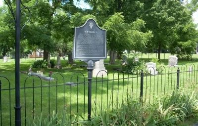
New Santa Fe, also known as Little Santa Fe, was not much more than an Indian settlement when the first wagon trains passed through on the Santa Fe Trail in the early 1820's. A popular stopping place because of its grass, water and room for . . . — — Map (db m20724) HM
Oregon and California National Historical Trails
The Oregon and California Trails were pathways to the Pacific for fur traders, gold seekers, missionaries, and emigrants. For 20 years, beginning in 1841, an estimated 300,00 emigrants . . . — — Map (db m206802) HM
(limestone marker)
"A Highway Between Nations"
Sen. Thomas Hart Benton, 1825
(red granite marker)
Santa Fe Trail
1821 - 1872
Marked by the
Daugters of the
American Revolution
and the
State of Missouri
1909 . . . — — Map (db m20610) HM
Sometimes muddy, often dusty, shared tack of three major roads - the Santa Fe, Oregon, and California Trails, once passed this way. It was created by teamsters urging heavy freight wagons to and from New Mexico. In the 1840's-50s, pioneer . . . — — Map (db m206803) HM
When Alexander Majors completed this house and its accompanying, but now demolished barns and pens, it formed a trading terminus for the firm of Russell, Majors and Waddell. By 1858 the firm was responsible for a force of 3,500 wagons carrying . . . — — Map (db m84746) HM
Built in 1949, the last of the original six drive-ins that were named after the famous "Mother Road'.
Recognized by Hampton Hotels Save-A-Landmark program as a site worth seeing — — Map (db m189152) HM
Formerly Electric Park (1909-1912), is traced to a multi-acre dairy farm in the 1890's. Charles Schifferdecker acquired the land in the early 1900s. On Nov. 1, 1913 he deeded forty acres to the city of Joplin. Schifferdecker Park eventually . . . — — Map (db m24674) HM
Starting as a mining camp, the growth of Webb City, Missouri reached a population of more than 15,000 people in a period of about 25 years. Webb City occupied the central district of the largest lead and zinc mining area in the world. More than . . . — — Map (db m174103) HM
(full title: The Citizens of Webb City and the Webb City Chamber of Commerce Welcome Visitors to Webb City, MO, Our "Gem" of the Ozarks)
We invite you to experience our history, enjoy our parks and recreational facilities, and shop in . . . — — Map (db m174107) HM
Historic Jefferson County, organized in 1818, the eighth to be formed in Missouri, lies in the southeast Lead Belt, region of the state's oldest settlements. Probably the first American settlement in Missouri was made in this county near the mouth . . . — — Map (db m143477) HM
Camp Joy on Route 66 was started in 1927 by Charles and Lida Spears with the help of their son Emis and his wife Lois. Leaving Nebraska in 1927 the Speares traveled Route 66 from Arizona eastward looking for a good place to establish a tourist camp. . . . — — Map (db m171960) HM
(each subject has its own square tile)
Gasconade River Bridge
A mixed-truss bridge built about 1924 near Hazelgreen, when the road was State Highway 14. It carried traffic until 2014.
Harris Café Conway
Built in . . . — — Map (db m186588) HM
(each subject has its own square tile)
A.T. Nelson
Col. Arthur T. Nelson was well-known throughout Missouri and the U.S. He was key in persuading authorities to built Route 66 through Lebanon and donated land for the new road. . . . — — Map (db m186582) HM
In August 1973, the U.S. Congress designated a cross-country stretch of Interstate as the “Dwight D. Eisenhower Highway,” in tribute to President Eisenhower’s early recognition of the need for a national network of highways to enhance . . . — — Map (db m140386) HM
Madonna of the Trail Monument
The "Madonna of the Trail" statue was designed and sculpted by August Leimbach of St. Louis. The statue was unveiled and dedicated on September 17, 1928 by the Missouri State Society Daughters of the . . . — — Map (db m241047) HM
Northwest across this intersection is the original site of the Home Office of Russell, Majors and Waddell, owners and operators of the Pony Express. Though operating headquarters was at Leavenworth, Kansas, and the Eastern Terminus at St. Joseph, . . . — — Map (db m90906) HM
The John I. Smith Relay Station was 172 ½ miles from the Tipton Terminus and stood in northeast Barry County, about 7 miles west of Crane. — — Map (db m99688) HM
This 66-foot obelisk stands as a tribute to the Ozark Trail and the foresight of its promoters in developing a system of good roads to bring farmers' goods to market and tourist dollars to destinations.
It began with the organization of the . . . — — Map (db m240185) HM
Canton, Missouri
"Most westerly Missouri town on Mississippi bank"
Founded May 30, 1830
—
Culver-Stockton
First coeducational college west of Mississippi. Overlooks river bluffs.
Established 1853
—
Federal Lock and Dam No. . . . — — Map (db m150341) HM
Laclede, Mo. was established in 1853. Conveniently located with access from the railroads, Laclede was at one time quite a prosperous town. general stores, banks, factory work, appliance retail, implement dealerships, upholstery, beauticians, . . . — — Map (db m67078) HM
Though its present setting suggests otherwise, this bridge was part of "Route 8," the first transcontinental highway in the United States and the primary east-west artery in Linn County. Prior to that designation, "Route 8" played an important . . . — — Map (db m67180) HM
Walt Disney's hometown of Marceline today is much as it was when he lived here. The first plans of Disneyland show a remarkable resemblance to the town, with it's store fronts on main street and locomotives coming and going. All who enter Disneyland . . . — — Map (db m62154) HM
This mural was chosen based on an 1890 postcard of Locust Street in its prime. The street scene depicts the original buildings in downtown Chillicothe with the activity of the day. Many of the buildings illustrated in the murals of Chillicothe are . . . — — Map (db m66736) HM
[Front]
Historic town in the annals of western transportation, Tipton, in 1858-59, was the eastern stagecoach terminus of the famous Butterfield Overland Mail. N.Y. expressman John Butterfield (1801-69), under contract to carry mail and . . . — — Map (db m62481) HM
The George Shackelford Relay and Meal Station stood ½ miles south of Syracuse in Morgan County. In 1859, when the railroad reached Syracuse, it succeeded Tipton as Stage terminus. Civil War activity closed the terminus in March, 1861. — — Map (db m61425) HM
The Spanish and El Camino Real
The Spanish Government in St. Louis authorized the construction of a military road from St. Louis to New Madrid shortly after New Madrid was established as a fortified settlement by Col. George Morgan in the . . . — — Map (db m178960) HM
They Passed This Way
Home to thousands of men, women, and children, the Cherokee Nation once spread across parts of Georgia, North Carolina, Tennessee and Alabama. The 1830 Indian Removal Act required that the Cherokee surrender their land . . . — — Map (db m213156) HM
Missouri's first century of road history was one of special legislation, local control and inadequate funds. Laws of 1907 and 1913 provided for a general state road fund and a highway engineer - the first effort toward state control.
The law of . . . — — Map (db m85046) HM
An achievement of engineering vision and finance made possible by the motoring public with the leadership of the
Automobile Club of Missouri — — Map (db m85043) HM
Clifton City, the next trail head east, is 11.7 miles by way of the old rail corridor. Due to an undeveloped section of trail immediately east of here, some travel over city streets is required, adding slightly to that distance. The grade is . . . — — Map (db m85314) HM
Site of hand-hewn log structure built in 1855 as contractors office for southwest branch of Pacific Railroad Later served as home of Edmund Ward Bishop — Founder of Rolla During Civil War was used as officers quarters As the Eagle Hotel it was . . . — — Map (db m186159) HM
"Beyond the woman entering the National Bank is the southeastern corner of Eighth and Pine streets and the Central Drug Store, circa 1885. The Hotel Edwin Long replaced the drug store in 1931. Contractor M.E. Gillioz rushed the Hotel Edwin Long . . . — — Map (db m139741) HM
"The highway helped sustain Rolla during hard times and war, but also brought increased traffic and stoplights, and, finally, new road construction. In just over a decade, traffic through town became heavy enough that the main stem of Route 66 was . . . — — Map (db m139757) HM
You are now entering one of Missouri's first trans-link roads. It is typical of many frontier wagon roads in the early 1800's that linked one small community to another. Stringtown Road served two purposes. This stretch of road form[ed] the . . . — — Map (db m157939) HM
Donated by Minnie Witzke
in honor
of her husband
Richard P. Witzke
Born - January 30, 1906
Deceased - August 2, 1981
A true village blacksmith . . . — — Map (db m157892) HM
Imagine this scene in 1850… a dry, hot summer day in the newly incorporated town of Kansas City. The street is crowded with wooden structures. Suddenly, swirls of black smoke stream from a saloon roof. The church bells begin to ring, calling for . . . — — Map (db m43193) HM
If you like a bit of history with your beer or burger, be sure to head for Kelly’s Westport Inn, in Kansas City’s Westport district. During the westward movement in the mid-1800s, Westport was a "re-fueling" stop where wagon trains could replenish . . . — — Map (db m43235) HM
In Weston's early boom days, the Missouri River ran at the foot of Main Street, adjacent to this area of town. Most of the buildings were occupied by low rent hotels, saloons and dance halls. In 1851, Weston newspapers advertised fifteen saloons. — — Map (db m44522) HM
Established, 1837; oldest existing town in the Platte Purchase. Boyhood home of "Buffalo" Bill Cody; last outfitting post for overland wagon trains; home of Ben Hollady, Stage Coach King. — — Map (db m44503) HM
Established in 1870 and named after a bad bend in the Big Piney River, this "devil of an elbow" was made famous by historic Route 66. — — Map (db m170623) HM
How did you get here today? There's a good chance that you traveled along a route used by travelers for centuries. Nearby I-44 and the historic Route 66 follow paths used by American Indians for trade and travel more than 500 years ago.
In the . . . — — Map (db m158009) HM
Located on the downtown Square was the Rigsby House and, next door, the building that was formerly Rigsby Standard Oil Station.
Claude and Eva Rigsby bought this house, which stands on lots 6 and 7 in block 4 of the original town of Waynesville, . . . — — Map (db m157295) HM
At the Arrow Rock State Park entrance stands this pioneer town as a memorial to the Boon's Lick Country and the expanding frontier. In the 24-acre park are Arrow Rock Tavern, built by Joseph Huston, ca. 1834, for travelers on the Santa Fe Trail, . . . — — Map (db m246742) HM
Early Santa Fe trading expeditions used this watering stop after leaving Franklin and crossing the Missouri River. Burton Lawless donated it to the town in 1829. The WPA started improvements in 1934. — — Map (db m246753) HM
You are visiting Arrow Rock's signature building, the J. Huston Tavern, sometimes known as the "old tavern" or "Arrow Rock Tavern."
Joseph Huston of Virginia settled in the area in 1819 and was one of the town commissioners. In November of . . . — — Map (db m246752) HM
When William Becknell's pioneer trading expedition crossed the Missouri River at the Arrow Rock Ferry on September 1, 1821, the site emerged as the gateway for western travel and commerce on what's known as the Santa Fe National Historic Trail. . . . — — Map (db m246740) HM
The second county formed in Missouri's famed Southeast Lowland Region, Scott was organized 1821, and named for John Scott, the State's first Congressman. Southerners were first settlers on Spanish land grants in the late 1790's. The King's Highway . . . — — Map (db m161191) HM
The Boone Trace was an important westward trail for American settlers. The Boone Trace probably followed a trail used by American Indians. In the early 1800s it was used by Daniel Boone's sons Nathan and Daniel Morgan Boone. For travel to the . . . — — Map (db m133212) HM
This "castlelike" abode built in 1895 is in style, Richardsonian Romanesque—an innovatively modified amalgamation of both Romanesque and Byzantine features. The interior is an architectural equivalent to the exterior, combining aesthetics . . . — — Map (db m133252) HM
1830 - Part of Nathan Boone's survey of the Commons
1837 - Andrew Wilson leased this and other land from Morgan to Seventh
1870 - This block sold to Henry G. Holtforester and Herman H. Schaberg.
1911 . . . — — Map (db m169226) HM
A variety of wagons used the trails during the westward migration. The Conestoga wagon was the most durable. It was built in the Pennsylvania Valley between 1750-1840. Prairie schooners and covered farm wagons were also used, pulled by horses, oxen . . . — — Map (db m124888) HM
Rolling Along the Katy Trail
• The Missouri-Kansas-Texas (MKT) railroad rolled along this route from 1870 to 1988. Locomotives of every era traveled here, tracing the path of the Missouri River, from the early, wood-burning steam engines, . . . — — Map (db m150851) HM
The Frenchtown neighborhood of Saint Charles owes its name and its most distinctive architecture to early French-Canadian settlers. The neighborhood has been the home of Jean Baptiste Pointe Du Sable, founder of Chicago who died here in 1818; Mother . . . — — Map (db m150944) HM
1769
Les Petites Côtes, River Gateway
St. Charles stands on the banks of the Missouri River as the gateway to the Missouri River valley. First known as Les Petites Côtes (Little Hills), it was founded by Louis Blanchette in 1769 as a . . . — — Map (db m169194) HM
In honor of all men and women of the Armed Forces past, present, and the future. In memory of all those who have sacrificed their lives for our freedom.
In remembrance of Tom and Jean Jackson — — Map (db m178406) WM
The distance from St. Charles to Greens Bottoms is 6.20 miles. Traveling west toward Greens Bottom, the elevation remains almost constant. In St. Charles, the route of Katy Trail State Park runs beside the Missouri River bluffs. The . . . — — Map (db m169210) HM
A trace first marked by the Indians. The trail followed by trappers and hunters and by Daniel Boone when he discovered the salt springs, afterwards called Boone's Lick which gave to this road its name. The main highway out of which grew the Santa Fe . . . — — Map (db m162700) HM
The beginning point of the "Western Plank Road," a toll road of two bits (25 cents) per person, extended nine miles to Cottleville, connecting with Boone's Lick Road. Stagecoaches left from St. Charles here at the Boone's Lick Trading Post circa . . . — — Map (db m124885) HM
The overland route linking St. Charles with the future sight of Fort Osage in present-day Jackson County was likely the earliest trail used by American settlers heading west. On its eastern end the trail passed in the vicinity of the later towns of . . . — — Map (db m124814) HM
Cribbin's Home
• This park, historically known as the Cribbin's Home, Kuhlmann's Grove, and even Cedar Grove in 1875, features a well-known home built in the mid-1800s.
• The home was built by Lawrence Cribbin (sometimes spelled . . . — — Map (db m150854) HM
Americans were reading Mark Twain's satire A Connecticut Yankee at King Arthur's Court and verses by St. Louisan Eugene Field. Tap dancing Irish-American George M. Cohan was entertaining vaudeville audiences. Americans were singing popular . . . — — Map (db m133137) HM
Pershing Place began as Berlin Avenue, delineated between Taylor and Kingshighway on an 1862 land survey at the time of the Civil War. Most of its houses were built at the time of the 1904 St. Louis World's Fair, when No. 4946 was leased to the . . . — — Map (db m236902) HM
The Preetorious-Schurz-Daenzer Memorial Association commissioned the Naked Truth Monument to honor three St. Louis German Language newspaper editors: Carl Schurz, Emil Preetorious and Carl Daenzer. These former German revolutionaries became American . . . — — Map (db m144265) HM
This building, designed by Wm. A. Balsch, Architects, was built by Cadillac Automobile Co., of St. Louis, when it outgrew its building at 2920-22 Locust St. The dealership became Oliver Cadillac in 1927, and remained here through 1930. . . . — — Map (db m133099) HM
English
La Grande Rue, la Rue Principale or La Rue Royale (“Royal Street” or First Street) was considered “Main Street” of Colonial-era St. Louis. Residences and businesses that lined Rue Royal had the best locations . . . — — Map (db m78842) HM
English La Rue Missouri (Chestnut Street), probably named for the Missouria Indians, rather than the river, was the first cross-street north of Market, and several leading families lived nearby - including Madame Marie Therese Chouteau, her . . . — — Map (db m78870) HM
English
Rue de l’Eglise (“Church Street” or Second Street) was named for the Catholic Church that it ran alongside the center of the town. The first church was a small cabin that lasted six years, from 1770-1776. The . . . — — Map (db m151506) HM
English:
La Rue de la Tour ("Tower Street" or Walnut Street) was named for the defensive stone tower hastily built in 1780 to help defend the town in the "Battle of St. Louis" - the first fortification built since its founding. . . . — — Map (db m151755) HM
English:
La Rue des Granges ("Barn Street" or Third Street), farthest from the river, formed the western boundary of the town. It had many small homes of tradesmen and laborers built along its east side, while the west side had . . . — — Map (db m151508) HM
La Rue Quicapou ("Kickapoo Street" or Pine Street) was located north of La Rue Missouri. It is probably named for the Kickapoo Indians, originally a Great Lakes tribe closely related to the Sac and Fox, who displaced the native Illinois . . . — — Map (db m236906) HM
La Grande Rue, la Rue Principale or la Rue Royale ("Royal Street" or First Street) was considered "Main Street" of Colonial-era St. Louis. Residences and businesses that lined Rue Royale had the best locations for trade, and all of the . . . — — Map (db m151507) HM
Today you can get a package from St. Louis to California in less than 24 hours. But before planes and trains, speedy deliveries to the West went by stagecoach.
Henry Wells, William Fargo, and John Butterfield capitalized on the country's rapid . . . — — Map (db m124961) HM
America's first seam locomotive lost its first race to a horse-drawn carriage. Credit: U. S. Department of Transportation Federal Highway Administration. — — Map (db m219056) HM
The eastern, two level portion of this building was built in 1914 and for two years was the home of the Hudson-Phillips Motor Car Co. In 1916, Mendenhall Motor Co. opened its Ford dealerships in the building. In 1924, Mendenhall added the matching, . . . — — Map (db m133085) HM
This structure was built by O.L. Halsey by permission of the Packard Motor Car Co., to serve as St. Louis' Packard dealership and distributorship. It was designed by architect J.L. Wees. Halsey had been the first car dealer in St. Louis. By 1915, . . . — — Map (db m133081) HM
This building, designed by Jacob Hirshstein, was, from 1916 to 1918, home of Phillips Motor Co., dealers for Detroit Electric autos. From 1918 to 1922, Murphy Machinery and Equip. Co. sold, in this building, Premier and Skelton autos, as well as . . . — — Map (db m133084) HM
This building, designed by the firm of Mills, Rhones, Bellman and Norhoff, was built by the Willys-Overland Co., to serve as the St. Louis distributorship for Willys Overland and Willys-Knight automobiles.
Overland Auto Co., had been founded in . . . — — Map (db m133029) HM
At times, Forest Park's land has been valued for needs other than recreation. Both the 1936 Oakland Express Highway (today's I-64) and the 1959 Forest Park Expressway brought high speed traffic through the park. — — Map (db m133305) HM
Established in the 1940s, the Eat Rite-Diner is one of the few nostalgic Route 66 diners left for great burgers and a friendly atmosphere. — — Map (db m139770) HM
This imposing Greek Revival Mansion began in 1848 with the construction of a four room farmhouse by Henri Chatillon and his then wife Odile Delor Lux Chatillon. They built their home facing Carondelet Avenue, the road that linked St. Louis with . . . — — Map (db m133183) HM