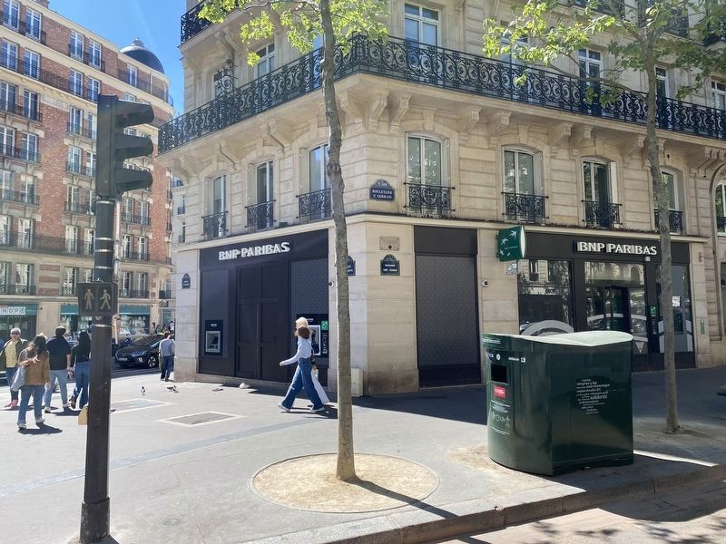
On Boulevard Saint-Germain at Rue de Four, on the right when traveling east on Boulevard Saint-Germain.
Ici
s'élevait la Prison de l'Abbaye.
ou les massacres de septembre 1792
tirent 326 victimes
(English translation:)
This was the location of the Prison de l'Abbaye, where the massacres of September, 1792 took . . . — — Map (db m199514) HM
A la mémoire des Algériens qui, manifestant pacifiquement le 17 octobre 1961 pour leurs droits et leur liberté, furent assassinés au cours d’une répression sanglante.
Contre l’oubli et le silence (English . . . — — Map (db m245065) WM
On North Greenwood Avenue north of East Archer Street, on the right when traveling north.
In the early 1900s, Tulsa's black community, the "Greenwood District," gained national renown. Dubbed "Black Wall Street," the neighborhood teemed with entrepreneurial and business activity: doctors, lawyers, pharmacists, dentists, beauty parlors, . . . — — Map (db m171410) HM
On Rocky River Road (State Highway 522) at Pageland Highway (State Highway 9), on the left when traveling south on Rocky River Road.
Obelisk
The mass grave located within the ring of white stones contains the bodies of 84 Continentals who were buried where they fell on May 29, 1780. The presence of these Patriots who made the ultimate
sacrifice for our freedoms makes . . . — — Map (db m232346) HM
Near U.S. 91 near Hot Springs Road, on the right when traveling north.
The four-hour fight left the Shoshone band decimated and terrified. Lodges, food caches and belongings were burned and women and children murdered. Chief Bear Hunter was cruelly tortured to death. When the killing ceased, the massacre field was . . . — — Map (db m165798) HM
Before dawn on the bitterly cold day of January 29, Shoshone leader Sagwich rose early to survey the area. As he looked toward the bluffs to the south he observed what seemed to be a mist of fog crawling down the bluffs across the river from the . . . — — Map (db m165797) HM
October 15, 1778, the largest military engagement in what is today Ocean County occurred near this site. A force of 200 British and Loyalist Troops under the command of Capt. Patrick Ferguson surprised and defeated a portion of Brig. Gen. Casmir . . . — — Map (db m92441) HM
On Main Street (New York State Route 166) at Wall Street, on the right when traveling west on Main Street.
The Cherry Valley Massacre of 1778
was led by British Captain Walter Butler
and Mohawk Chief Joseph Brant
on this strategically important
frontier settlement. — — Map (db m33655) HM
Near Mountain Meadow, 0.2 miles west of County Road 375, on the right when traveling west.
In 1859, Major James H. Carleton interviewed Mrs. Rachel Hamblin, who lived a few miles north of the massacre field. Major Carleton carefully recorded her account of the surviving children, who were brought to her home on September 11, 1857, . . . — — Map (db m240466) HM
On Soda Point Power Plant Road near Reservoir Road, on the right when traveling south.
Oregon Trail Memorial
Erected 1931
Restored 1978
Caribou County 4H Builders Club
In honor of William Henry Harrison of Massachusetts who lost his life on the Oregon Trail about 1850.
Erected by his niece Mrs. Alura F. . . . — — Map (db m106732) HM
On Boulevard Saint-Joseph close to 12 Avenue, on the left when traveling east.
English:
During the night of the 4-5 August 1689, fifteen hundred Iroquois landed at Lachine and placed themselves in small groups near all the houses along the shore. At a given signal the massacre began; two hundred persons perished and . . . — — Map (db m82105) HM
Near County Road W, 1.3 miles east of County Road 54.
On November 29, 1864, U.S. Colonel John Chivington and 700 volunteer troops attacked an encampment of Cheyenne and Arapaho along Sand Creek. The thunderous approach of horses galloping toward camp at dawn sent hundreds fleeing from their tipis. Many . . . — — Map (db m180927) HM
Near County Road W, 1.3 miles east of County Road 54. Reported permanently removed.
Though the Sand Creek Massacre has long passed, memories live on. Cheyenne and Arapaho return here to pray and pay tribute to ancestors who both perished and survived that dreadful day.
Ever resilient, the Cheyenne and Arapaho nations of today . . . — — Map (db m181060) HM
Near County Road W, 1.3 miles east of County Road 54. Reported permanently removed.
"All we ask is that we may have peace with the whites...We want to take good tidings home to our people, that they may sleep in peace."
Cheyenne Chief Black Kettle
As tensions mounted, Chiefs Black Kettle and Left Hand pled . . . — — Map (db m181243) HM
Near County Road W, 1.3 miles east of County Road 54. Reported permanently removed.
”Many years have passed. The land is still here. We lived here, our clans lived here. The land here is our home - we have come back home.”
Arapaho:
Wonoo3ei’i ceciniihi’ coowoo’ou’u. Nih’iine’etiino’ hiitiino. Neito’eininoo . . . — — Map (db m180923) HM
Near County Road W, 1.3 miles east of County Road 54. Reported permanently removed.
In the aftermath of Sand Creek, federal investigations and military inquiry took place. Dozens of eyewitness' provided testimony. Taken in Washington, D.C., Denver City, Fort Lyon, and other locations, officers, soldiers, and civilians came forth. . . . — — Map (db m181061) HM
On County Road W, 1.3 miles east of County Road 54. Reported permanently removed.
For years, Cheyenne and Arapaho traveled and hunted the Great Plains in the shadow of the Rocky Mountains. But in 1858, gold fever struck in Colorado Territory. Miners rushed in and tens of thousands of settlers followed. Competition for land became . . . — — Map (db m181241) HM
On County Highway 44 at County Highway 61.5, on the right when traveling west on County Highway 44.
The following statements are from people who were involved with the tragedy. They come from official records and oral histories.
"They used to scrub by hand, go fetch the water a mile [or] two, [at] 3:00 in the morning. We used to make . . . — — Map (db m193570) HM
On West 1st Street at Court Street, on the right when traveling west on West 1st Street.
This memorial commemorating the Old Pueblo Fort Site erected by The Arkansas Valley & Pueblo Chapters, Daughters of the American Revolution. Dedicated Nov. 17, 1923.
On Christmas Day, 1854, a massacre occurred at Fort Pueblo on the . . . — — Map (db m64755) HM
On Lincoln Road, 0.2 miles east of Middleton Road, on the left when traveling east.
On August 20, 1854, the Alexander Ward Party of 20 men, women, and children were traveling on the Oregon Trail with five wagons, a day behind a larger party led by Alexander Yantis. The Wards pulled their wagons off the Trail for lunch and to water . . . — — Map (db m22398) HM
On Lincoln Road, 0.2 miles east of Middleton Road, on the left when traveling east.
In the 1830's, local tribes, including the Shoshone, Paiute, and Bannock began trading with Euro-American fur trappers and missionaries passing through southern Idaho. Peaceful exchanges beneficial to both groups increased in 1842 when wagon trains . . . — — Map (db m22333) HM
On Lincoln Road, 0.2 miles east of Middleton Road, on the left when traveling east.
To the memory of the pioneers who were massacred by Indians near this spot August 20, 1854.
This monument is dedicated by Pioneer Chapter
Daughters of the American Revolution Boise, Idaho
William Ward Age 44
Margaret Ward " . . . — — Map (db m22336) HM
On Lincoln Road, 0.2 miles Middleton Road, on the left when traveling east.
In early September, 1854, Major Granville Hallar set out with a US military force from their post in Oregon to avenge the Ward-party deaths. Upon arrival at the rebuilt Hudson Bay's Fort Boise near the mouth of the Boise River, the Indians they . . . — — Map (db m22366) HM
Near U.S. 91 near Hot Springs Road, on the right when traveling north.
The tensions between the Shoshone and the settlers eventually led to a call from Utah territorial leaders of help from the Army, but the Civil War was on and military resources were stretched thin. In 1861 the third California Volunteer Infantry has . . . — — Map (db m105801) HM
Near U.S. 91 near Hot Springs Road, on the right when traveling north.
End of a Way of Life
The delicate balance in which the Shoshone managed food resources for thousands of years was drastically altered by colonization. By the mid-1800s, the Oregon and California Trails brought thousands of pioneers and . . . — — Map (db m105799) HM
Near U.S. 91 near Hot Springs Road, on the right when traveling north.
Bia Ogoi - Big River
The Bear River -- called Bia Ogoi or Big River by the Shoshone people -- runs west and south through this semiarid valley, eventually emptying into the Great Salt Lake. The river and its many tributaries create . . . — — Map (db m105797) HM
Near U.S. 91 near Hot Springs Road, on the right when traveling north.
We cry for the loss and sacrifice of those who did not survive and we honor the strength of those who lived.
After the massacre, the survivors, now under Chief Sagwitch, were aided by other bands as they escaped southward. Most of the . . . — — Map (db m165799) HM
Near U.S. 91 near Hot Springs Road, on the left when traveling north.
Newe, The People
The Shoshone refer to themselves as Newe, the People. Their ancestral territory reached from the Wind River Range in western Wyoming to the middle of Nevada, and from the Salmon River in northeastern Idaho to central . . . — — Map (db m105795) HM
Near Group Campground Road near Levi Jackson Mill Rd (Kentucky Route 1006).
At this site on October 3, 1786 a young woman of the McNitt Party, settlers who came to be known as the “Defeated Camp”, gave birth to a daughter in a hollow tree after escaping an Indian massacre that killed all but 3 members of their . . . — — Map (db m172971) HM
On Central Avenue (New Hampshire Route 9) south of First Street, on the right when traveling south.
Dover’s early settlers lived in relative peace with the local Pennacook tribe, learning hunting, fishing, and farming skills from the natives in the early 17th century. Passaconaway, highly respected leader of the Pennacook Confederacy, forged . . . — — Map (db m152213) HM
This tablet erected by the Society of Cincinnati in the State of New Jersey to commemorate the massacre of a portion of the legion commanded by Brigadier General the Count Casimir Pulaski of the Continental Army in the Affair at Egg Harbor, New . . . — — Map (db m29783) HM
On Calle Aurora at Marina (Puerto Rico Route 123), on the left when traveling west on Calle Aurora.
El 21 de marzo de 1937, Domingo de Ramos, aconteció en este lugar uno de los sucesos más trágicos y conmovedores de nuestra historia: La Masacre de Ponce.
Ese día, una marcha pacífica organizada por el partido nacionalista fue . . . — — Map (db m225729) HM
Near Guyan Street north of 5th Avenue, on the left when traveling south.
When the Civil War began, few of Guyandotte’s residents were slaveholders, but many townspeople resented any infringement on their right as Virginians to own slaves. Guyandotte was reportedly the only town on the Ohio River that voted in favor of . . . — — Map (db m144784) HM
On Rue de Luxembourg at Rue de Walmes on Rue de Luxembourg.
To the memory of the soldiers of the United States Army who while prisoners of war were massacred by Nazi troops on this spot on 17 December 1944.
A la memoire des soldats de l'armee des etats unis, prisonniers de guerre massacres par des . . . — — Map (db m92232) WM
On Snowbird Highway (National Highway 2), on the left when traveling south.
An Indian legend from the 1800s reveals how Old Wives Lake, to the west, was named. One winter a Cree party went beyond their traditional area in search of buffalo. They ventured into territory claimed by both the Cree and Blackfoot.
The Cree . . . — — Map (db m204855) HM
On Avenida Duarte just east of Calle 27 de Febrero, on the right when traveling east.
En memoria de los casi 15,000 negros haitianos y negros dominicanos que fueron
brutalmente asesinados por órdenes del tirano Rafael Leonidas Trujillo durante los ultimos meses de 1937. Y en homenaje a los dominicanos valientes que . . . — — Map (db m114780) HM
†
∙ Ignacio Ellacuria
∙ Amando Lopez
∙ Joaquin Lopez
∙ Ignacio Martin-Baro
∙ Segundo Montes
∙ Juan Ramon Moreno
16 de noviembre de 1989 — — Map (db m84130) HM
On Autopista Norte just east of Avenida Don Bosco, on the left when traveling east.
Homenaje de la Comunidad Universitaria a los Martires Caidos en la Masacre del 30 de Julio de 1975 Carlos Fonseca ∙ Carlos Humberto Hernández ∙
Roberto Antonio Miranda ∙ Eber Gómez Mendoza ∙ Balmore Cortez . . . — — Map (db m142522) HM WM
On Place du 8 Mai 1945, on the right when traveling north.
Á la mémoire
des milliers de victimes
de la répression coloniale
perpétrée en Algérie à
Sétif, Guelma et Kherrata
le 8 mai 1945 (English translation:)
In memory of the thousands of victims of the colonial . . . — — Map (db m245043) WM
On 9a Avenida, 0.05 kilometers north of 10A Calle, on the right when traveling north.
Primer marcador: Guatemalteco: Aquí sacrifico su juventud el Br. Cesar Armando Funes, la tarde del 12 de abril de 1962, en defensa de la libertad y la democracia. Guatemala, Sept. de 1962 Segundo marcador: Cesar Armando . . . — — Map (db m98013) HM WM
1968-1993
…Adelante!!
A los compañeros caídos
el 2 de octubre de 1968 en esta plaza
Cuitlahuac Gallegos Bañuelos, 19 años. Ana María Maximiana Mendoza, 19 años. Gilberto Reynoso Ortíz, 21 años. Antonio Solorzano Gaona, 47 años. . . . — — Map (db m91671) HM
On Benito Juárez just south of Portal Aldama, on the left when traveling south.
“La sangre de hombres y mujeres por la democracia, no ha sido en vano…hoy los ciudadanos de estas tierras del Bajío, mantienen el alto el estandarte del Municipio Libre” H. Ayuntamiento de León 1992-1994 Rinde Homenaje a los . . . — — Map (db m127458) HM
On Principal just east of Pino Suárez, on the left when traveling east.
1er. Regimiento de Caballería de la Matriz General San Felipe, Gto. En memoria de los caidos en esta plaza durante el zafarrancho del domingo 29 de marzo de 1936 que propició el arribo del Presidente de México Lázaro . . . — — Map (db m132044) HM
On Calle Gutemberg just west of Guerrero, on the left when traveling west.
En este lugar, a las puertas del Palacio de Gobierno,
el 28 de marzo de 2011, se instaló una Ofrenda ante
el vil asesinato de 7 personas: Juan Francisco Sicilia Ortega,
Julio César Romero Jaime,
Luis Antonio Romero Jaime,
Jaime . . . — — Map (db m207053) HM
This Cross
is Reverently Erected
in the Memory of McIan Chief of the MacDonalds
of Glencoe
Who fell with his people
in the Massacre of Glencoe
of 13 Feb: 1692
By his direct descendant
Ellen Burns MacDonald of Glencoe . . . — — Map (db m85791) HM
On Pineapple Highway (Alabama Route 10) 0.8 miles west of Bibb Road (County Road 5), on the right when traveling west.
(obverse)
The Butler Massacre
On March 20, 1818, Capt. William Butler, Capt. James Saffold, William Gardener, Daniel Shaw and John Hinson left Fort Bibb to meet Col. Sam Dale. They were attacked near Pine Barren Creek by Savannah . . . — — Map (db m83259) HM
On Sherling Lake Road (Road 44) 0.4 miles north of Ridge Road (County Road 54), on the right when traveling north.
Ogly-Stroud Massacre
William Ogly built his cabin near this site at Poplar Springs along the Federal Road, and was killed here with most of his family on March 13, 1818. His friend Eli Stroud's wife was fatally wounded and their infant . . . — — Map (db m120933) HM
On U.S. 84 at County Road 22, on the right when traveling west on U.S. 84.
Sept. 1, 1813
Creek Indian War. 1813-14
Part of War of 1812. British used Pensacola as base to arm, incite Indians against U.S..
Prophet Francis led Indians in this raid on Kimbell home. They killed and scalped 12 of 14 (two survivors . . . — — Map (db m47635) HM
On Rainbow Drive (U.S. 411) east of Peteet Street, on the right when traveling east.
The lone survivor being Edmond Jones, 5 year old son of William and Hannah Humphries Jones, who later gave the land for the cemetery. — — Map (db m156398) HM
On North Main Street (Business U.S. 65) at West Rush Avenue, on the right when traveling south on North Main Street.
In early September, 1857, the train arrived in a valley known as Mountain Meadows in southwestern Utah. Beginning early on the morning of September 7, the emigrants' camp was attacked by a group of Mormon militiamen and some Paiute Indians whom the . . . — — Map (db m225250) HM
On North Main Street (Business U.S. 65) at West Rush Avenue, on the right when traveling south on North Main Street.
Modern historical research has yielded information which was not readily available to those who designed the 1955 monument. Here is presented updated information and a modified more accurate map of the emigrants' route. Dedicated . . . — — Map (db m225248) HM
On North Main Street (Business U.S. 65) at West Rush Avenue, on the right when traveling south on North Main Street.
In memory of those who were killed in the Mountain Meadows Massacre, in September of 1857. Dedicated in 2020.
Modern historical research has yielded information which was not readily available to those who designed the 1955 monument. . . . — — Map (db m225251) HM
On North Main Street at West Rush Avenue, on the right when traveling south on North Main Street.
In memory of 140 men, women and children N.W. Arkansas emigrants to California. In 1857 under leadership of Alexander Fancher (Piney Alex) left from Caravan Spring 4 miles south of here around May 1st - Camped at Mountain Meadows, Utah in early . . . — — Map (db m143889) HM
On County Road 912, 0.1 miles north of U.S. 412, on the right when traveling north.
In early April 1857, a large wagon train known as the Fancher-Baker train left Caravan Spring (south of Harrison) and headed for California. They camped at this site en route to intercept the Cherokee trail at the Grand Saline in Indian territory. . . . — — Map (db m225245) HM
On West War Eagle Avenue at West Main Street (Business U.S. 412), on the right when traveling west on West War Eagle Avenue.
Front
On January 10, 1863, nine men, including two Confederate officers and prominent local citizens and Masonic lodge members, were taken from a guardhouse near here, led to Samuel Vaughn's farm one mile northeast of Huntsville, and shot. . . . — — Map (db m141514) HM
On Los Angeles Street north of U.S. 101, on the right when traveling south.
Chinese immigrants established their first community in Los Angeles in what is now part of El Pueblo de Los Angeles Historical Monument. By 1870 about two hundred Chinese had settled in
Los Angeles Street across from the Garnier Building, then . . . — — Map (db m140033) HM
The controversy surrounding this Civil War Monument has become a symbol of Coloradans' struggle to understand and take responsibility for our past. On November 29, 1864, Colorado's First and Third Cavalry, commanded by Colonel John Chivington, . . . — — Map (db m6755) HM
On Unnamed entrance road north of County Road W, in the median.
We ran up the creek with the cavalry following us…The dry bed of the stream was
now a terrible sight: men, women, and children lying thickly scattered on the sand, some dead and the rest too badly wounded to move… George . . . — — Map (db m181944) HM WM
On April 20, 1914, the State Militia unleashed an un-warranted attack on striking coal miners and their families living in a tent colony at this site. Eleven children and two women suffocated in a cellar beneath a tent when flames engulfed the . . . — — Map (db m100509) HM
Near El Moro Road (at milepost 18) at Linden Avenue (County Road 71.1).
Panel 1
The Ludlow Massacre
By April 1914, the striking coal miners encamped at Ludlow (ten miles northwest of here) had nothing to lose but their lives. Poor, powerless, largely immigrant, they had held out for . . . — — Map (db m97716) HM
Near County Highway 35.25 south of County Highway JJ.
I saw the American flag waving and heard Black Kettle
tell the Indians to stand around the flag. I also saw a
white flag raised. These...were in such a conspicuous
position they could not have been missed.
-Robert Bent, son of William . . . — — Map (db m181015) HM
Near Battlefield Trail, 0.4 miles north of U.S. 90.
At this point in the battle, the Union had five cannons
captured and nearly every other cannon was
rendered useless. “The horses and men were nearly all
killed or wounded, and it was the greatest slaughter
among artillery known in the . . . — — Map (db m146303) HM
Near Freedom Avenue, 0.3 miles south of Parker Street, on the right when traveling south.
On January 1, 1923 a massacre was carried out in a small, predominantly Black town of Rosewood in Central Florida. The massacre was instigated by the rumor that a white woman, Fanny Taylor, had been sexually assaulted by a black man in her home . . . — — Map (db m179269) HM
This monument marks the site of the William Cooley plantation. Cooley arrived here in 1824 and soon became the leader of the small settlement that grew along the New River.
On January 6, 1836, local Indians attacked Cooley's homestead, killing . . . — — Map (db m127510) HM
In the closing phases of the First Seminole War (1817-1818), a U.S. supply boat was attacked by Creek Indians. The boat was ascending the Escambia River from Pensacola in Spanish West Florida, and was bound for Fort Crawford in the American Alabama . . . — — Map (db m242608) HM
On South River Landing Road, 0.5 miles south of Washington Street (U.S. 90), on the right when traveling south.
The first U.S. defeat of the Seminole Wars took place here on November 30, 1817. Several hundred Seminole, Creek and maroon (Black Seminole) warriors came to this site following raids by U.S. troops on the Creek Indian village of Fowltown near . . . — — Map (db m113147) HM
December 28, 1835
The start of the Second Seminole War:
The first attack on that deadly day
Dade Massacre
On December 23, 1835, two companies of U.S. troops were dispatched from Fort Brooke in Tampa under the . . . — — Map (db m201516) HM
Near East Fort King Street, 0.1 miles south of East Silver Springs Boulevard.
Dade Massacre
Dec. 28, 1835
Major Francis L. Dade and 110 men were attacked six miles north of Withlacoochee River. Four survived and one lived to tell the story. Troop was en route to Ft. King.
Same day, Gen. Thompson and . . . — — Map (db m198813) HM WM
On North Lakeshore Drive at Oakland Avenue, on the right when traveling south on North Lakeshore Drive.
Orange County Election Day Violence
Leading up to Election Day on November 2, 1920, the Ku Klux Klan and the United Confederate Veterans held rallies and parades to discourage African Americans from voting. County officials arranged for . . . — — Map (db m160890) HM
On Bellamy Brothers Boulevard (County Road 581) south of Darby Road, on the right when traveling north.
Near this spot, on May 14, 1856, a Seminole war party attacked the home of an early settler Capt. Robert Duke Bradley of the Florida Foot Volunteers. Two of the Bradley children were killed before the Indians withdrew. This was the last such attack . . . — — Map (db m37715) HM
On North Ocean Boulevard (State Road 1A), on the right when traveling south.
In 1565 some 300 French castaways, under Jean Ribault, were massacred here by Spaniards, crushing their attempt to occupy Florida. The French ships, sailing from Fort Caroline to attack St. Augustine, were driven ashore by a storm. At this inlet . . . — — Map (db m46145) HM
On Blue Ridge Drive (Georgia Route 5) 0 miles south of Toccoa Street (Georgia Route 60), on the right when traveling south.
North of here on Madden Branch in Polk County, Tennessee, on November 29, 1864, during the American Civil War, six Georgians trying to enlist in the U.S. Army—Thomas Bell, Harvey Brewster, James T. Hughes, James B. Nelson, Elijah Robinson, . . . — — Map (db m47731) HM
On Courtland Street Northeast at John Wesley Dobbs Avenue Northeast, on the left when traveling south on Courtland Street Northeast.
Lynching in America Racial terror lynching between 1865 and 1950 claimed the lives of thousands of African Americans and created a legacy of injustice that can still be felt today. During this era, lynching emerged as the most notorious form . . . — — Map (db m227435) HM
Near Gammon Street Southeast, 0.2 miles west of Lansing Street Southeast, on the left when traveling west.
The History of Brownsville
The origins of Brownsville began as the 12-year period of Reconstruction was ending following the Civil War. The Reconstruction era was a period of legal, political, and social recreation, during which Black people's . . . — — Map (db m227410) HM
On West Broad Street at North Court Avenue, on the right when traveling west on West Broad Street.
In one of the most violent episodes in Reconstruction Georgia, a rally in Mitchell County in September 1868 resulted in about a dozen freedmen being killed and several dozen wounded. Georgia had been re-admitted to the United States just two . . . — — Map (db m218685) HM
On Memorial Drive (Georgia Route 4) at Screven Avenue, on the right when traveling east on Memorial Drive.
Here, on a Sunday morning in July, 1832, seven members of the Wildes Settlement were murdered by an Indian raiding party from the Okefenokee Swamp. Six of the victims were of the Wildes family, one was a 12-year-old girl of the Wilkinsons. Five . . . — — Map (db m53057) HM
On Lincoln Road, 0.2 miles east of Middleton Road, on the left when traveling east.
Only 2 young boys survived the Indian attack on Alexander Ward's 20 member party, Oregon bound on August 20, 1854. Military retaliation for the slaughter so enraged the Indians that Hudson's Bay Co. posts Fort Boise and Fort Hall had to be . . . — — Map (db m22328) HM
On Elba-Almo Road at 3000 South, on the right when traveling south on Elba-Almo Road.
Dedicated to the Memory
Of those who lost their lives in a most
Horrible Indian Massacre 1861
Three hundred immigrants west bound
Only five escaped — — Map (db m119536) HM
On U.S. 91 just south of Hot Spring Road, on the right when traveling north.
Very few Northwestern Shoshoni survived a battle here that turned into a massacre by Col. P.E. Connor’s California Volunteers.
In 1863, Conner and his force set out from Salt Lake City on a cold January campaign in response to friction between the . . . — — Map (db m165800) HM
On Highway 91 (State Highway 91) just south of Hot Spring Road, on the right when traveling north.
Attacks by the Indians on the peaceful inhabitants in this vicinity led to the final battle here January 29, 1863. The conflict occurred in deep snow and bitter cold. Scores of wounded and frozen soldiers were taken from the battlefield to the . . . — — Map (db m105785) HM
On Highway 78 near Bailey Street, on the left when traveling west.
Erected to the memory of the
Otter Massacre
1860
Forty four persons ambushed by Shoshoni Indians either killed or scattered. Most awful human experience. Site ten miles east on Sinker Creek. — — Map (db m110210) HM
Near Park Lane near Register Road, on the left when traveling west.
These reported incidents of Shoshone Indian attacks on emigrant wagon trains in this gap and surrounding area between 1851 and August 10, 1862, led to the naming of these rock outcrop as "Massacre Rocks."
The granite marker was dedicated by the . . . — — Map (db m124160) HM
Near Park Lane near Register Road, on the left when traveling west.
In this defile on August 10, 1862 a band of Shoshone Indians ambushed an Immigrant Train bound for Oregon killing nine white men and wounding six. — — Map (db m124159) HM
On College Avenue (Illinois Route 140) at Park Road (Illinois Route 140), on the right when traveling west on College Avenue.
In remembrance of the pioneer days of this area and to the memory of the victims of the Wood River Massacre
who were killed by Indians near this site on July 10, 1814 - Rachel Reagan, Elizabeth 7, Timothy 3 wife and children of Reason Reagan - . . . — — Map (db m47661) HM
Near James R Thompson Boulevard south of South 5th Street.
One of American history's most violent race riots took place here on July 2, 1917. Hundreds of citizens were brutalized in a day of death, burning, and destruction. White rioters lynched, shot, and burned innocent blacks, burned their homes, and . . . — — Map (db m228260) HM
(front:)
In recognition of the men who lost their lives in the conflict of June 21 & 22, 1922. A time of labor unrest and lawlessness which still stands as the largest loss of life due to a labor dispute in the country. A tragedy known as . . . — — Map (db m216308) HM
Near Riverview Drive south of East Laughery Creek Road, on the right when traveling south.
In memory of
Col. Archibald Lochry
and the members of the Westmoreland County, Pennsylvania
Militia, who were defeated near here August 24, 1781
by Chief Joseph Brant and a coalition of Ohio Indians.
Killed
Col. Archibald Lochry . . . — — Map (db m222279) WM
Near Riverview Drive south of East Laughery Creek Road, on the right when traveling south.
In memory of
Colonel Archibald Lochry
and his command who were massacred by the Indians and
British near this site August 24, 1781
Major Creacroft • Adjt Guthrie • Quartermaster Wallace • Capt. Campbell • Capt. Thomas Stokely • Capt. . . . — — Map (db m244090) WM
On State Road 38 E, 0.5 miles west of Chesterfield Road (400 E), on the right when traveling west.
In 1824, nine Indians were murdered by white men
near this spot. The men were tried, found guilty and hanged. It was the first execution of white men for killing Indians. — — Map (db m170002) HM
On State Road 63 at West Market Street, on the left when traveling north on State Road 63.
A War of 1812 military action occurred in September 1812 three miles west/southwest of here. While escorting supplies from Fort Knox near Vincennes to Fort Harrison at Terre Haute, Sergeant Nathan Fairbanks and approximately a dozen soldiers were . . . — — Map (db m21761) HM
On East de la Balme Road west of South Johnson Road, on the right when traveling west.
In Memory of
Col. Augustin de La Balme and his
Soldiers who were killed in
Battle with the Miami Indians,
Under Little Turtle, at this place,
November 5th, 1780 — — Map (db m52758) HM
(Side One:)
The pioneer settlers named below were massacred by Sioux Indians March 8 to 13 1857. This barbarous work was commenced near this spot and continued to Springfield now Jackson Minn.
Robert Clark ·
Rowland Gardner · . . . — — Map (db m82847) HM