Across the Puerco River, the tracks of the Burlington Northern Santa Fe Railroad stretch for miles to the east and to the west. With no landforms or forests to block your view, you can see very long trains from beginning to end. More than 60 . . . — — Map (db m119934) HM
U.S. Route 66 (US 66 or Route 66), also known as the Will Rogers Highway, the Main Street of America or the Mother Road, was one of the original highways within the U.S. Highway System. US 66 was established on Nov. 11, 1926, with road signs erected . . . — — Map (db m184319) HM
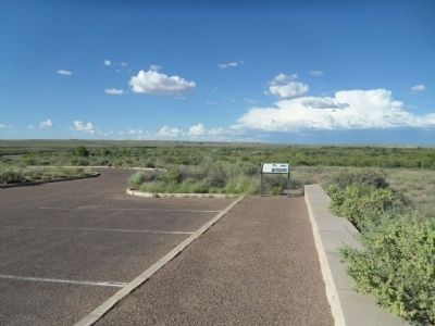
Petrified Forest is the only National Park in the country with a portion of Historic Route 66 within its boundaries. You are currently standing where the Mother Road used to be, with the line of telephone poles paralleling its alignment through the . . . — — Map (db m163277) HM
You are standing near old Route 66. The line of the roadbed and the telephone poles in front of you mark the path of the famous "Main Street of America" as it passed through Petrified Forest National Park. From Chicago to Los Angeles, this heavily . . . — — Map (db m68904) HM
The K.J. Nackard family came to Flagstaff in 1912 and opened a small general store at 106 E. Railroad Avenue. The store was successful. In 1921, Nackard built a home on this property, just a stone's throw from the store.
Soon afterwards, . . . — — Map (db m119932) HM
Beneath the inverted, forked ponderosa entryway awaits an adventure in pioneer history, country-western legends and ghost stories - one of northern Arizona's liveliest landmarks since 1931.
Recognized by Hampton Hotels Save-A-Landmark . . . — — Map (db m192855) HM
This trail follows the south side of historic Route 66 from downtown Flagstaff to the east side of town. In the mid 1990s the City removed a series of Billboards from the strip or land between Route 66 and the BNSF railroad tracks, and replaced it . . . — — Map (db m263060) HM
During the summer of 1947, the Arizona Highway Department constructed a 6.5 mile cut-off alignment of Route 66 through Flagstaff. This re-alignment shifted Route 66 away from the older Camp Townsend- Winona Road/U.S. Highway 89 alignment that . . . — — Map (db m263116) HM
Heading west, Route 66 helped determine Flagstaff's urban form by creating the long commercial corridor that provided travelers with motels, auto repair, gas, entertainment and food. The buildings along Route 66 that remain today are a living museum . . . — — Map (db m263117) HM
Built in 1931 by Dean Eldredge
Restored by Martin and Stacie Zanzucchi
Placed in the National Register of Historic Places
by the U.S. Department of the Interior on May 3, 1994
under the authority of Interior Secretary Bruce Babbitt
. . . — — Map (db m236440) HM
This trail follows the south side of historic Route 66 from downtown Flagstaff to the east side of town. In the mid 1990s the City removed a series of Billboards from the strip or land between Route 66 and the BNSF railroad tracks, and replaced it . . . — — Map (db m263109) HM
In 1926, the Old Trails Highway was officially designated U.S. Highway 66, and it became the "Main Street of America." In 1984, Williams was the last Route 66 town in America to be bypassed by the interstate highway system. Built in 1907, this . . . — — Map (db m33375) HM
Built of locally quarried volcanic rock in 1901, this edifice housed a bank and many businesses displaced by the 1901 fire. These included the local newspaper, telegraph office, and eventually Arnold's, a famous Route 66 eatery. In 1928, the Masonic . . . — — Map (db m33382) HM
1925 - Williams had two car camps to service travellers along Route 66 and those going to the Grand Canyon. A car camp consisted of cabins that served as both a garage and sleeping quarters.
1936 - An early gas station on Route 66 after a . . . — — Map (db m193234) HM
Welcome to Williams, Arizona, located in the heart of the Kaibab National Forest at an elevation of 6,770 feet.
Founded in 1881, Williams was named for the famous trapper, scout and mountain man, "Old Bill Williams." A statue of "Old Bill" . . . — — Map (db m193233) HM
The area around what now is Williams, Arizona, was first explored by a Mountain Man who came to this area in 1876, William Shirley Williams, who was called “Old Bill”.
The town site was created by a cowboy named C.T. Rogers in 1879. . . . — — Map (db m48351) HM
A Route 66 icon since the 1940's. Meteor City Trading Post is home to the "World's Longest Map of Route 66."
Recognized by Hampton Hotels Save-A-Landmark program as a site worth seeing — — Map (db m194738) HM
Sitting on the eastern slope of the Black Mountains, is the site of Cool Springs. An important life saving water source for the desert native tribes of Mohave and Haulapai Indians. In the 1850's Lieutenant Ned Beale and his camel brigade used this . . . — — Map (db m271274) HM
The Powerhouse, Arizona's oldest known reinforced concrete industrial building, generated electricity from 1909 to 1938. After serving as a substation and later a recycling center, it was renovated to its current use and condition in 1997 by the . . . — — Map (db m193159) HM
This turn of the century gold mining camp was on the original road through the Black Mountains and eventually became Route 66. Burrows came with the miners and still roam the streets today.
Get you Kicks on Route 66 in Arizona. — — Map (db m188974) HM
World War I was funded partially by the gold out of these mountains in 1912. Oatman boomed from 1910 to the 1920's. Upwards to 8,000 people lived here. Gold mines were closed about 1942. Mines were needed to mine copper for World War II. Blue Ridge . . . — — Map (db m119942) HM
The Changing Decades
In the decades between the 1930s and 1950s, travellers along Historic Route 66 changed markedly … along with their hopes and dreams, their vehicles and accommodations, and their perspective of the Black Mountains.
. . . — — Map (db m288513) HM
These grounds belong in spirit and enthusiasm to Dallas Quasula Sr., a member of the Hualapai tribe. Dallas, a tribal councilman and elder, was also a highly regarded citizen of the county and graduate of Seligman High School. Dallas served . . . — — Map (db m119933) HM
This property was listed in the National Register of
Historic Places on March 15, 2012. The John Osterman
Gas Station was one of several privately-owned and
operated businesses in the town of Peach Springs during the 1920's through the 1950's. . . . — — Map (db m58605) HM
This property was listed in the National Register of
Historic Places on November 21, 2003. The Historic
Peach Springs Trading Post, in downtown Peach Springs
circa 1932, was an important commercial enterprise for
Peach Springs citizens and . . . — — Map (db m58607) HM
Mary Colter's masterpiece, La Posada was one of the last great railroad hotels and known as one of the fanciest on Route 66.
Recognized by Hampton Hotels Save-A-Landmark program as a site worth seeing — — Map (db m192857) HM
This area was dedicated on September 11, 1999 as a tribute to the memorable song of the 1970's that made Winslow, Arizona a town to sing about on famous Route 66. — — Map (db m36329) HM
This date medallion is from the Winslow Bridge that once spanned the Little Colorado River on historic Route 66 just east of Winslow. Because the river had always proved a daunting impediment to travelers, this bridge crossing became a strategic . . . — — Map (db m32781) HM
Ash Fork is located near the 35th Parallel where, in the 1850's the Army Corps of Topographical Engineers began surveying a future railroad route. Camels were imported and used as beasts of burden, adding to the colorful history of the region. A . . . — — Map (db m33442) HM
Built circa 1926-27
by the Arizona Department
of Transportation
This building constructed of Moenkopi Sandstone, has been listed on the National Register of Historic Places.
The Ash Fork Camp location was selected because it is a . . . — — Map (db m33443) HM
Ashfork, Arizona
Founded 1882
The Coming of Route “66”
1926
Ash Fork was a junction point of the Old Trails (Route 66) and the Grand Canyon – Nogales Highways (US 89), leading to the southern sections of the state. . . . — — Map (db m33502) HM
An Arizona natural wonder in continuous operation since 1927.
Recognized by Hampton Hotels Save-A-Landmark program as a site worth seeing — — Map (db m194739) HM
Juan Delgadillo built the now famous Snow Cap in Seligman, Arizona in 1953 out of scrap lumber. Home of the "Cheeseburger with cheese" and "Dead Chicken".
Get your Kicks on Route 66 in Arizona, learn more at www.historicaz66.com . . . — — Map (db m201770) HM
The Trails Restaurant started small but vigorous in 1952 on land acquired in unincorporated territory along a two lane road known as Route 66. A welcome stop for travelers, the steak house earned a reputation for its hefty portions, thick soups, . . . — — Map (db m52460) HM
Original terminus of Route 66 (1926-1939) in the heart of
the Historic Broadway Theatre District.
Recognized by Hampton Hotels Save-A-Landmark program as a site worth seeing. — — Map (db m189349) HM
America’s Mother Road
U.S. Route 66, established in 1926, was one of the original highways of the United States Highway System. It originally ran from Chicago, Illinois in the east to its western terminus in Downtown Los Angeles, on . . . — — Map (db m130182) HM
Dedicated 1952 to Will Rogers, Humorist - World Traveler - Good Neighbor.
This Main Street of America, Highway 66, was the first road he traveled in a career that led him straight to the hearts of his countrymen. — — Map (db m119616) HM
A singular example of functional public art by architects Charles and Henry Greene, this 1906 span was one of the country's first reinforced concrete bridges.
Recognized by Hampton Hotels Save-A-Landmark program as a site worth seeing. . . . — — Map (db m206059) HM
Albert Okura, a third-generation Japanese-American, was born and raised in Southern California during the
Baby Boom era. Growing up during the economic boom in the United States after World War II, he
considered himself a proud American who . . . — — Map (db m263606) HM
Amboy, settled as early as 1858, became a water stop when the Southern Pacific Railroad laid its tracks through the Cadiz Valley in 1883-84. Following the course of the railroad and the National Old Trails Highway, Route 66 was opened in 1926. Amboy . . . — — Map (db m78532) HM
Perhaps no other highway in the U.S. is as fabled as old Route 66. It has been immortalized in song, literature, and even a T.V. series as the main street of America. Automobiles came early to the desert, following the railroad with its reliable . . . — — Map (db m78574) HM
Panel 1:
The Story of Route 66
Commissioned in 1926 and soon dubbed "The Mother Road," Route 66 was a great asphalt river linking Chicago and Los Angeles – a highway of hope that led thousands of people to a new life. . . . — — Map (db m33446) HM
The mural depicts the interesting places and people of Barstow Route 66.
On the far left of the mural you will see a 1947 three wheeled Harley Davidson Service Car used by Barstow Police department for parking enforcement to collect money and . . . — — Map (db m286075) HM
One of the finest surviving examples of California's depot-hotels built around the turn of the 19th century. It's also home to the Route 66 "Mother Road" Museum and the Western American Railroad Museum (W.A.R.M.).
Recognized by Hampton . . . — — Map (db m193156) HM
In 1857, under orders to survey a wagon road from New Mexico to California, General Edward Beale followed the 35th parallel to paths opened by Francis Aubry and Lt. A.W. Whipple. Beale’s orders required importation of camels and drivers to . . . — — Map (db m50561) HM
Chronicled in the National Register of Historic Places, U.S. Highway 66 or “Route 66” is arguably the oldest, most popular highway in America. Also known as “The Mother Road” and “America's Main Street”, its 2,448 miles first connected Chicago to . . . — — Map (db m288501) HM
The MCLB was established as the Marine Corps Depot of Supplies on December 28, 1942. The Navy turned it over to the corps as a storage site for supplies and equipment. By the end of WWII, the base had outgrown its facilities. An additional 2,000 . . . — — Map (db m286053) HM
When families headed west to California in the early
1920's, they came on the old National Trails
Highway through Barstow. "Dusty Rusty" the
large rabbit can be seen in each Main
Street Mural on Main Street. This was the first
mural by the . . . — — Map (db m50530) HM
From Chicago to Santa Monica Route 66 was dotted with roadside cafes and gas stations. These stops provided a respite for those traveling The Mother Road offering a refreshing soft drink, a burger and fries, or an eye-popping cup of coffee as well . . . — — Map (db m242749) HM
The first school in Goffs opened its doors for the fall term in 1911 serving the needs of cattle ranches, mining districts, homesteaders, the railroad, and, most of all, the people supporting expanding travel on the National Old Trails Road – . . . — — Map (db m78575) HM
America's Main Street, Route 66, was officially paved and opened in the Helendale area in 1926. The National Old Trails Road Association, whose President was Harry S. Truman in 1925-26, devised a program to create a national highway system that . . . — — Map (db m268201) HM
This was as close as Hesperia
got to Route 66. In 1940, Leroy
and Della Rolar opened a
service station-cafe on this
property to help serve
increasing motorists'
needs along Route 66.
State Highway 31-C
became U.S. Route 66 in
1928. Actually . . . — — Map (db m166730) HM
Cajon Pass, separating the San Bernardino and San Gabriel ranges, has long been an important natural gateway. It is traversed by Indian trails, emigrant routes, railroads, and a superhighway. Early in the nineteenth century it became the southern . . . — — Map (db m119252) HM
The Evolution of Route 66
Commissioned in 1926 and dubbed the "Mother Road," Route 66 linked Chicago and Los Angeles - a highway of hope that led thousands of people to a new life in the West.
In 1926, less than half of Route 66 was . . . — — Map (db m201747) HM
Formerly one of the grandest Harvey House Hotel, Restaurant & Santa Fe Train Stations. The hotel and restaurant were open from 1908 to 1949. The train station closed in 1988.
Recognized by Hampton Hotels Save-A-Landmark program as a site . . . — — Map (db m33445) HM
Originally built in the 1950s, this world-famous restaurant was the location of the 1988 film, "Bagdad Café," which became the new name of the restaurant in 1995. — — Map (db m160081) HM
The history of Newberry Springs can be traced back more than 20,000 years. Digs at the Early Man Site north of here discovered tools dating prior to 20,000 BC. At that time, much of the land was covered by the prehistoric Lake Manix. Then, . . . — — Map (db m119927) HM
Welcome to Camp Cajon
William M. Bristol, founder of Camp Cajon: 1859-1941.
William Bristol came to Southern California in 1882, and purchased an orange orchard in East Highland in 1891. He married Francis "Fannie" Dearborn in . . . — — Map (db m208068) HM
Dedicated July 4, 2019 in commemoration of the original
Camp Cajon Monument located about
300' north of this site, and
dedicated July 4, 1919. — — Map (db m158045) HM
Erected in honor of the brave pioneers of California in 1917 by pioneers Sheldon Stoddard, Sydney F. Waite, John Brown Jr., George Miller, George M. Cooley, Silas C. Cox, Richard Weir, Jasper N. Corbett
This monument was dedicated on . . . — — Map (db m157687) HM
The Cucamonga Service Station was built by Henry Klusman in 1915 on the State Route which would 10 years later, be designated as U.S. Route 66. This type and style of station is one of the few remaining that once numbered in the thousands and . . . — — Map (db m119923) HM
Established by Tiburcio Tapia, to whom the Cucamonga Rancho was granted March 3, 1839 by Governor Juan Bautista Alvarado of Mexico. — — Map (db m149064) HM
The "El Camino Real Bells" have long been in place since the early part of the last century to mark the original route of "El Camino Real" from San Diego to Sonoma in California. The El Camino Real, (Royal Highway or King's Highway), closely follows . . . — — Map (db m150315) HM
Directly to your right are examples of the types of pavements used in California highway building during the early 1900s.
This road was originally part of the Old Spanish Trail, used by early California explorers and settlers as a stagecoach . . . — — Map (db m120642) HM
The Magic Lamp Inn has been a dining tradition on Route 66 since 1955.
Recognized by Hampton Hotels Save-A-Landmark program as a site worth seeing. — — Map (db m158338) HM
This site sits at the base of the prominent Red Hill Landmark. The early historic importance of the property stems from its proximity to a reliable water source, Cucamonga Creek, and to its location on the major roadway between Los Angeles and San . . . — — Map (db m117911) HM
McDonalds hamburgers and fries represent a true slice of Americana. This site is ground zero for all modern day fast food chains.
Museum owned and operated by Juan Pollo restaurants — — Map (db m204525) HM
Built in 1945, this park continues to provide a center reminiscent of early Mexican Heritage.
Recognized by Hampton Hotels Save-A-Landmark program as a site worth seeing. — — Map (db m204524) HM
Established in 1937, this family-owned restaurant has brought history and tradition to San Bernardino's west side for more than 60 years.
Recognized by Hampton Hotels Save-A-Landmark program as a site worth seeing — — Map (db m204523) HM
Route 66 was established in 1926 as the original U.S. Highway linking Chicago and Los Angeles. The route passed right by this property. During its early years, automobiles were fairly primitive and unreliable. Cars similar to this "Model T" kiddie . . . — — Map (db m211854) HM
Dick and Mac McDonald opened the world’s first McDonald’s Self-Service, Drive-In Restaurant on this site in San Bernardino, California, December 1948.
They previously operated a successful Drive-In Barbeque Restaurant with Carhop Service on . . . — — Map (db m120644) HM
Built in the late 1930s as "Red Rooster," later "Les Pyrenees Restaurant." Museum dedicated to those who lived, passed through and passed on here.
Recognized by Hampton Hotels Save-A-Landmark program as a site worth seeing — — Map (db m193155) HM
Emma Jean's Holland Burger Cafe a Route 66 icon has been serving up meals to locals and hungry travelers on the highway since 1947. The building was built by Bob and Kate Holland from cinder blocks manufactured at the old fiber tile plant located . . . — — Map (db m78518) HM
This corridor was a gateway into the country’s interior. Several well worn Indian trails were traveled by fur traders and explorers. One trail, the future Ogden Avenue, was improved into a plank toll road creaking beneath the weight of settlers’ . . . — — Map (db m157105) HM
Route 66 was a traveling showroom for new cars in the 1950s. Bold design, streamlining, chrome, and flaring fins captured people’s imagination. Ogden Avenue became a hub for automobile businesses in the Chicago area. In its heyday, the strip . . . — — Map (db m157677) HM
This 23-foot-tall sculpture pays homage to an original Berwyn landmark. In 1989, artist Dustin Schuler erected a sculpture named Spindle, which showcased eight actual cars impaled on a 50-foot spike. After a cameo in the 1992 movie . . . — — Map (db m292873) HM
(front:)
Route 66, the Mother Road, is an American icon that symbolizes romance and freedom of the open road. Born in 1926, Route 66 was one of the first numbered U.S. highways, journeying 2,500 miles from Chicago to Los Angeles. Today, . . . — — Map (db m159132) HM
Art and wacky roadside attractions have long been a staple on Route 66. Cigars and Stripes owner Ronnie Lottz keeps this tradition alive. The cigar-smoking giant on the roof is a nostalgic throwback to "Muffler Men" that appeared along the . . . — — Map (db m294057) HM
Ogden Avenue was designed for automobiles when the car was king of American culture. A wide street lined with drive-through businesses and convenient parking served both travelers and residents. Drive-in restaurants, service stations, and auto . . . — — Map (db m157675) HM
Looking for a quick bite? After World War I, fast food restaurants sprang up along Route 66, offering cheap and speedy meals for people on the go. Ogden Avenue is still home to many restaurants that were popular during the heyday of the Mother . . . — — Map (db m157676) HM
[English-language text on the west-facing side of the marker:]
The Main Street of America
In 1916, Cook County Hospital emerged as an important establishment for the Tri-Taylor neighborhood in Chicago. This imposing structure, characterized . . . — — Map (db m251638) HM
[English-language text on the west-facing side of marker:]
The Main Street of America
The large park in this neighborhood predated Ogden Avenue, formerly known as Route 66, but its layout was adjusted to accommodate the roadway that . . . — — Map (db m251658) HM
[English-language text on the west-facing side:]
The Main Street of America
In the 1950s and '60s, a thriving automotive scene unfolded along Ogden Avenue in North Lawndale, directly influenced by Route 66. As American car culture started . . . — — Map (db m251713) HM
[English-language text on the west-facing side of the marker:]
“The Main Street of America”
In the 1920s, America became an automobile nation. At the start of the decade, there were 8 million cars on the road, but roughly 32,000 of the . . . — — Map (db m251544) HM
The vertical profile and stepped silhouette of the facade, together with a sleek two-story lobby, make the Field Building one of the most distinctive Art Deco buildings in the city. Built by the estate of department store founder Marshall Field, it . . . — — Map (db m248525) HM
Steam shovels are the earliest type of power shovel and were designed for lifting and moving large amounts of rock and soil. Steam shovels played a major role building roads and railroads in America during the 19th and early 20th century. While . . . — — Map (db m293634) HM
Early travelers on Route 66 raced through open lands once they left Chicago. This was truly “countryside,” a rich region of farms and quarries on the outskirts of the city. Few farms remained by the time the City of Countryside was . . . — — Map (db m157673) HM
The Chicken Basket was established in 1946 born out of a gas station next door that sold fried chicken. It was a Blue Bird bus stop as well as a restaurant and used to have ice skaters on the roof to attract Route 66 travelers. It became Dell . . . — — Map (db m157104) HM
Most businesses on Route 66 began as combinations of gas stations, garages, and lunch counters. At the Chicken Basket, tasty food won out over gasoline sales. Throughout the 1940s and 50s, hungry travelers flocked to the popular restaurant. But in . . . — — Map (db m157100) HM
Thank you to Bob and Peggy Kraft for donating this Route 66 Hall of Fame streetcar to Gardner.
The Krafts provided years of food, fun and nostalgia at their Riviera Roadhouse located on Route 66. The Riviera unfortunately burned down on June 8, . . . — — Map (db m159247) HM
This nostalgic barn has been restored by volunteers of the Route 66 Association of Illinois Preservation Committee. August 30, 1998 — — Map (db m157025) HM
The architecture of Dwight has always attracted Route 66 travelers. The Keeley Institute for treating alcoholism was founded here and brought the Village national attention. As the institute gained popularity, Dwight became a “model . . . — — Map (db m158401) HM
Built in 1933, Ambler's Texaco was the longest operating service station to pump gas on historic Route 66.
Recognized by Hampton Hotels Save-A-Landmark program as a site worth seeing — — Map (db m189147) HM
418 entries matched your criteria. The first 100 are listed above. Next 100 ⊳