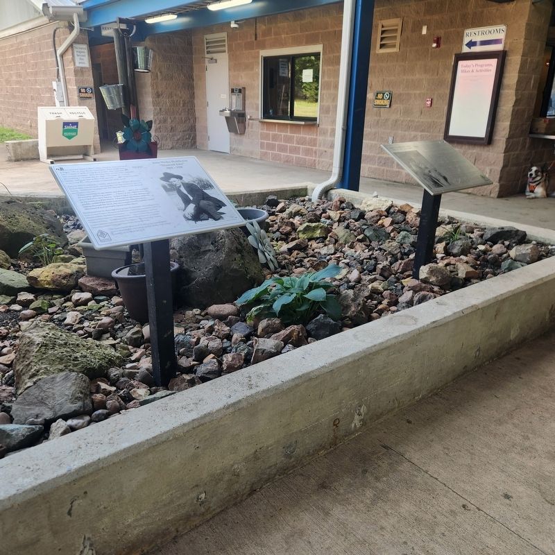
The first diamonds found in Pike County, Arkansas were discovered
in August 1906 by John Wesley Huddleston. These stones were
sent to Charles S. Stifft, a Little Rock jeweler, who confirmed they
were genuine diamonds. Stifft described them as . . . — — Map (db m274212) HM
4.21 carats (rough) Marvin Culver, of Nowata, Oklahoma, unearthed a large, canary yellow diamond near this location on
March 12, 2006.
Culver and his family decided to visit the park
after watching a television program featuring the
Crater . . . — — Map (db m274879) HM
Two and a half miles southeast of this point is the only locality in North America where diamonds have been found in the rock in which they were formed. They have been found principally in one igneous pipe which, with three small pipes, aggregates . . . — — Map (db m121290) HM
6.07 carats (rough)
2.88 carats (cut)
Ray Schall, of Murfreesboro, Arkansas, found a
dime-sized white diamond on top of the ground
under a nearby tree on November 14, 1981.
"I could see it was a diamond, and I just fell on it,"
Schall . . . — — Map (db m274758) HM
While digging near this site on June 23, 1981,
Carroll Blankenship, of Shreveport, Louisiana,
found the second-largest diamond registered
since the Crater of Diamonds became an Arkansas
State Park in 1972.
Blankenship and his wife were . . . — — Map (db m275332) HM
40.23 carats (rough)
12.42 carats (cut)
The Uncle Sam diamond is the largest gem-quality
diamond ever found in North America and was
unearthed here in 1924.
Wesley Basham, Uncle Sam to his family and friends,
worked for the Arkansas . . . — — Map (db m275426) HM
"Pocahontas is beautifully situated on the west bank of Black River… As a trading point, it is unsurpassed by any town of its size in the state."
J. C. Martin of Pocahontas
1857
As agriculture in Randolph . . . — — Map (db m170298) HM
While no fighting took place in Sevier Co. during the Civil War, local men served in Confederate units. Men gathered at Belleville Church as part of Pettus’ Battalion of State Troops, marching to Arkadelphia under Gov. Harris Flanagin’s General . . . — — Map (db m121145) HM
On January 10th, 1921, shortly after 4:00 P.M., on a cold January day, a
deafening roar from a drilling rig one mile west of El Dorado announced the
discovery of oil in Arkansas. Dr. Samuel Busey brought in the Armstrong #1
as an earthshaking, . . . — — Map (db m121350) HM
A little over a year after the initial oil discovery by Dr. Busey, the Oil
Operators Trust--Murphy #1, a wildcat well staked on a geologic feature
called the Norphlet dome, drilled into the gas-cap of what would become the
huge Smackover Oil . . . — — Map (db m121356) HM
Joseph Silviera Leal and Julia Perry Leal built this tank house on their ranch in the Mission San Jose area of Fremont in 1925. The lower floor was a storage room and the upper floor a bedroom. The tank on top stored 5,000 gallons of water pumped . . . — — Map (db m29090) HM
[Panel 1:]
Pleasanton’s past and the rich stories of the people that have come before can be discovered in the landscape and features of this park. Three periods of occupation trace regional settlement from prehistory to the present day. . . . — — Map (db m24685) HM
On Feb. 8, 1871 two men, the names of Neal F. Taylor and Timothy Cox, were looking for coal in the area and found more than they were looking for. On this creek which comes down through the then Dougherty Ranch the two men found a gold nugget. They . . . — — Map (db m69728) HM
Public outcry led Oakland councilman George Pardee, who later became Governor of California, to campaign Contra Costa Water Company for a clean reliable water system. The Hyatt filters were installed, along with pump houses and filtration basins, . . . — — Map (db m113822) HM
The construction of this historical complex was initiated in 1964, "Alpine County's Centennial Year", by the Historical Society of Alpine County. With concerted effort and fortitude it was completed and duly dedicated as a historical landmark on . . . — — Map (db m3088) HM
Telltale signs of geologic activity surround Grover Hot Springs State Park. Bold granite peaks to the northwest are the work of immense mountain building forces. Old lava flows cover hundreds of square miles to the east, giving the Markleeville area . . . — — Map (db m13239) HM
The mine was first worked as the Rancheria Mine in 1853. Was renamed the South Mayflower in 1893. It was organized in 1899 as the Bunker Hill Consolidated Mine and operated till 1922, producing $5,154,382 in gold. The shaft reached 3440’ on an . . . — — Map (db m44619) HM
Opened in 1852 from six claims. Renamed Original Amador Consolidated working till 1918. Reopened in 1935 till 1937. Shaft reached 1238’. Total production was $3,500,000. — — Map (db m10329) HM
Founded in 1851 working continuously till 1893. Purchased by Keystone Company in 1920 and connected to it. Closed in 1942. Contained 3 shafts: South Spring Hill 1200’, Tallisman 600’, and Medean at 600’ deep. Produced $1,092,472 from . . . — — Map (db m44608) HM
Owned by the Treasure Mining Company of San Francisco. Founded prior to 1867. Sometimes called the Hazard Mine. Shaft reached 3030’ on the incline with winzes. Was connected to the Bunker Hill Mine to the south at the 1600; level. Produced . . . — — Map (db m44620) HM
In the mineral rich Ione Valley, between Ione and the southern Mokelumne River, where once mining communities like, Lancha Plana, Camp Opra and Camanche dotted the maps, is the town of Buena Vista. Situated at the intersections of two thoroughfares . . . — — Map (db m101437) HM
Buena Vista's store and house situated in Jackson Valley, was built by John Fitzsimmons, then sold to Sam Cook, then to James Norris and afterwards to Jacob and Verona Strohm. Once situated in Lancha Plana it was moved by the Chinese who discovered . . . — — Map (db m10189) HM
General merchandise store built by Daniel Stewart in 1856. First brick building erected in Ione Valley from nearby Muletown brick. Ione, once known as "Bed-Bug" and "Freeze-Out” was an important supply center on the main road to the Mother Lode and . . . — — Map (db m100587) HM
In 1848, was a village of huts and tents called
"Bottileas”
by the Mexicans from the bottles strewn about by those who tarried here.
In 1849, it was named
Jackson
for Colonel Jackson an early day resident.
In 1853, Amador . . . — — Map (db m72060) HM
Viewpoint: 50 yards west, Two of the richest gold mines in Amador County, both reached depths of over one mile. Worked until 1942. Kennedy produced $28.5 million, the Argonaut $ 25 million. Notice headframes west toward Highway 49 and tailing wheels . . . — — Map (db m44586) HM
In the late 1850’s, Andrew Kennedy discovered gold in an outcropping of quartz. The mine produced over $34.2 million in gold, making it one of the richest gold mines in the world. With a depth of 5,912 feet, it was the deepest mine in North America . . . — — Map (db m19797) HM
Founded and active in the 1880’s. 10 stamp mill and a 640’ shaft. Re-opened 1921 till 1929. 20 stamp mill and a 2,291’ incline shaft. Tailing dam north to Raley’s. Produced $564,624 in gold.
Nearby Mines: South Jackson, Fern, Kearsling, . . . — — Map (db m44582) HM
Under This Tablet Is
The Court House Well
Dug in 1851, 52 feet in depth
For generations it was a main
source of domestic water
for the community.
“Gone is the ancient equipment
but still the living water flows.” . . . — — Map (db m27908) HM
Founded in the 1860’s as the Coney Mine, operated continuously from 1875-1914. Later sold to Kennedy. Incline shaft 1865’ deep. Total production $5 million. Note powder house on road to the east. — — Map (db m44585) HM
Copper mines patented 1873:
Peak Outputs: Early 1860’s, 1895-1917, 1943-1947,
Township organized 1854.
A Methodist center for many years
U.S. Postoffice: 1862-1905 — — Map (db m11361) HM
Founded in 1852 from several claims and consolidated in 1883. Sold to the Argonaut company in 1925 and closed in 1943. Empire workings reopened 1946-47. Pacific shaft 4450’ deep. Total production $13,500,000. Mines north to Cosumnes River: Aden, . . . — — Map (db m44622) HM
Eastern Shaft of the Wildman Mine located at the Post Office site. Used as an air chute and hoist shaft to dispose of waste rock later used to pave roads. The mine founded by William T. Wildman, circa 1851 — — Map (db m12601) HM
Knight Foundry was established in 1873 to supply heavy equipment and repair facilities to the gold mines and timber industry of the Mother Lode. Samuel N. Knight developed a high speed, cast iron water wheel which was a forerunner of the Pelton . . . — — Map (db m100590) HM
First (1851) quartz mine & mill in Sutter Creek on Amador Road. Leland Stanford financier, politician and benefactor controlled this mine (1859-1872). Under Supt. R. C. Downs it proved a bonanza, aided Stanford to join the builders of the Central . . . — — Map (db m42409) HM
Founded in 1851 as Amador #2. Renamed the Union Mine and finally the Lincoln Mine by new owner Leland Stanford. Worked until 1924, producing $2 million. Consolidated with Wildman- Mahoney Mines. Foundations and dump remain. — — Map (db m44607) HM
Founded by Jerry Mahoney from Killarney, Ireland in 1851. Claim purchased from Alvinza Hayward. Merged with the Wildman Mine and reached a depth of 1200 feet. Produced $5 million in gold. Later part of Lincoln Consolidated Co. — — Map (db m12606) HM
Sutter Creek, California
Left Panel:
Like many communities in the Sierra Foothills, Sutter Creek grew out of the great gold rush of 1849. Thousands of men of every nationality arrived seeking fortunes through toil, sweat, and luck. . . . — — Map (db m106380) HM
Founded in early 1850’s by Alvinza Hayward, owner of the Badger and Wolverine Mines. Earned $65,000 a month, reaching a depth of 2,250 in late 1800’s. Shaft sunk to 3,500 feet in 1916. In 1924 was purchased by Central Eureka Company. Closed in 1942 . . . — — Map (db m44606) HM
Leland Stanford acquired the Union Mine in 1859 for debt. He formed a partnership with R. C. Downs and renamed it the Lincoln Mine.
The Lincoln Mine produced $2,200,000. in gold by 1873, he then sold it to the British Syndicate for $800,000. . . . — — Map (db m42407) HM
Founded by William T. Wildman in 1851. Merged with Mahoney Mine and reached a depth of 1500 feet. Combined mines operated a 70 stamp mill and produced a total of $5 million in old by 1924. Powder house used to store explosives. Became part of . . . — — Map (db m12598) HM
Discovered in 1848 by Colonel Stevenson’s men who mined Soldiers’ Gulch in ’49. First covered wagon party sluiced rich gravel beds. By ’53, men swarmed flats and gulches naming them picturesquely. Hydraulic operations, begun in ’55, brought . . . — — Map (db m11365) HM
[Larger Marker]:
Started 1848 by soldiers of Colonel Stevenson’s Regiment. Named by miners because of apparent volcanic appearance. Here the first California rental library, 1850, was established. And one of the first “Little . . . — — Map (db m100574) HM
This marker symbolizes the discovery of the first large gold nugget in California. It was found across this canyon in Willard Gulch April 12, 1859. Weight 54 pounds. — — Map (db m29663) HM
Led from Indian Territory by their New England schoolmaster, a band of young Cherokee Argonauts discovered gold here 1850. Town established 1853 when first stores erected by Welsh miners. During heyday of 1875, Cherokee boasted its own theatre, race . . . — — Map (db m234) HM
Edison Ore Mining & Miocene Mining Co. Oct. 1879 to May 1881 by Major Frank McLaughlin searched for platinum to use in Edison’s electric light globe. Used a process to remove gold from black sands found in mine tailings.
Miocene Mining Co. . . . — — Map (db m61556) HM
Is the site of the longest running continuously operated foundry west of the Mississippi River. All quartz machinery needed for the numerous mines surrounding the Altaville, Angels Camp area was cast here. It was previously known as Altaville . . . — — Map (db m13005) HM
A gold furnace was commonly used to separate mercury from the gold. In gold placer mining, in which small specks and veins of gold were often found in quartz, mercury was used to separate the gold from the quartz. This bonding of the mercury . . . — — Map (db m57172) HM
In 1895 Harry Hogarth, James Candy and Naylor Williams filed a claim for the Relief Quartz Mine on a hillside above Six Mile Creek near Angels Camp. In 1920, after working the claim by hand for many years, the Hogarths; Harry Sr, Harry Jr, and . . . — — Map (db m56553) HM
This mine site was located in 1855 by Peter Cameron, A.M. Wood, Will Powell and C.G. Lake. Lightner Mining Company organized and operated from 1896-1915. A 40 stamp mill crushed 500,000 tons of ore from vein which widened to 120’. Ore stopped at . . . — — Map (db m10633) HM
Common in California after 1853, the stamp mill consisted from one to five heavy pillar-like stamps whose bottom, (or shoes), were cylindrical hammers made of iron, each weighing as much as one thousand pounds. Power to operate the stamps was . . . — — Map (db m56556) HM
Hydraulic Mining was the largest and most destructive form of mining. Water, brought through flumes and ditches from high up in the mountains, was redirected into an ever-narrowing channel and out through a giant iron nozzle, called a . . . — — Map (db m56649) HM
The body of water you see before you, known as New Melones Lake, is formed by the building of the New Melones Dam. The 625-foot high earth-fill dam was completed in 1979 by the Army Corp of Engineers. A man-made reservoir, the lake hosts a variety . . . — — Map (db m32433) HM
Utica Mine, the most important mine in the Angels District, set national records in the 1890's producing more than 4 million dollars in gold in 30 months. The Utica was also the site of Angels Camp's worst mine disaster when 17 men were buried when . . . — — Map (db m25646) HM
Water wheels were commonplace to the gold mining regions, providing power for mining and milling operations. Powered by water the wheel was attached to a series of belts and gears which turned the machinery to crush the ores. This water wheel . . . — — Map (db m56559) HM
[Upper Marker:]
Named Camanche in 1849 after Camanche, Iowa. Once called Limerick. Peak population 1500. Rich mining at nearby Cat Camp, Poverty Bar, and Sand Hill. Mokelumne River water brought in by Lancha Plana and Poverty Bar ditch. . . . — — Map (db m19752) HM
Copper here discovered by W. K. Reed and Thomas McCarty in 1860. Mines utilized during the Civil War and the First and Second World Wars. During Civil War period was the principal copper producing section of the United States. — — Map (db m13002) HM
Although Copperopolis is known for copper mining, gold was discovered here in 1858, copper in 1860. The gold belt was a mile west of the copper belt.
The Madame Felix Mining District produced 200,000 ounces of gold between 1864 and 1974. . . . — — Map (db m58927) HM
Built is 1861 by Antonio and Caterina Gagliardo. Served as a Post Office and social center for the community of Douglas Flat. A hand dug well located next to the store supplied Douglas Flat with good fresh water and remains in good shape today. . . . — — Map (db m58852) HM
Richest placer mining section, extending five miles, in Calaveras County. Received name from Chileans who worked gulch in 1848 and 1849, and scene of the so-called Chilean War. Largest known quartz crystals recovered from mine on south side of gulch. — — Map (db m11515) HM
A thriving mining camp on rich Pennsylvania Gulch in the 1850’s and 1860’s. Named for Alfred Brown, former owner of Table Mountain Ranch. Laws of Brownsville Mining District provided that each miner could own one wet and one dry claim, not to exceed . . . — — Map (db m11501) HM
Located on the Stockton-Murphy Road at the fourth crossing of the Calaveras River, this early mining settlement, once called Foremans, was famous in the 1850's for its rich placer ores. Later, it became an important stage and freighting depot and . . . — — Map (db m11969) HM
Settled by Mexicans in 1848. Named after Catholic Parish of St. Andrew. First newspaper published here Sept. 24, 1856. Destroyed by fire June 4, 1858 and in 1863. County seat of Calaveras County since 1866. Rendezvous of Joaquin Murietta. Black . . . — — Map (db m11503) HM
Gwin Mine, Paloma, and Lower Rich Gulch were mined for placer in 1849. Quartz was discovered by J. Alexander in 1851. Property acquired by Wm. M. Gwin, California's first U.S. Senator, in 1851. The Gwin Mine closed, in 1908, yielded millions. — — Map (db m14449) HM
From 1860 to 1906, this area was the largest coal mining district in California. Five towns (Nortonville, Somersville, Stewartville, Judsonville and West Hartley) grew up around twelve major mines. Today the towns are gone. The buildings having been . . . — — Map (db m139449) HM
Miwok Indians inhabited this valley at the base of Mt. Diablo when Spanish explorers came in the 1770’s. Scouts, trappers, prospectors and settlers followed.
In 1857 Clayton was founded by Joel Clayton, a miner, farmer, and wagonmaster from . . . — — Map (db m59954) HM
This grove is given to the State of California for the preservation of these ancient trees by Mr. and Mrs. Jesse H. Metcalf of Rhode Island. — — Map (db m1510) HM
Here in the Valley of the Cul-lum-mah Indians, James W. Marshall discovered gold on January 24, 1848, in the tailrace of Sutter’s sawmill. The Old Coloma Road, opened in 1847 from Sutter’s Fort to Coloma, was used by Marshall to carry the news of . . . — — Map (db m12272) HM
El Dorado, meaning “The Gilded One”, was first known as Mud Springs from the boggy quagmire the cattle and horses made of a nearby watering place.
Originally a important camp along the old Carson Emigrant Trail. By 1849 – 50 it . . . — — Map (db m13148) HM
One and a half miles north of Georgetown sailors from Georgia established claims in 1849. General store and mining camp in 1850 which later produced by seam diggins hydraulic and flood sluicing methods. The famous Blue Rock, Pacific Beattie and . . . — — Map (db m54943) HM
The Gold Bug is like the thousands of small mines that once dotted the Sierra foothills. Surprisingly enough, most of the digging in this mine occurred in the 1920’s and 30’s, and not during the Gold Rush. Mines like this were worked by small . . . — — Map (db m69863) HM
Did you know that Gold Bug Park has nearly 100 years of gold mining history?
The 61 acres of the park include six mining claims that were once a part of the Poverty Ridge Mining District. Some of the richest deposits of the Mother Lode were . . . — — Map (db m69861) HM
Local residents remember that the thunderous crashing staccato of the ore stamp mill could be heard for miles in the narrow canyon. The song of the stamps had been a familiar sound in this area for since George Cozens erected the first mill here in . . . — — Map (db m69864) HM
On this site the Boston-Newton Joint Stock Association encamped on September 26, 1849. The company left Boston April 16 and arrived at Sutter’s Fort September 27. After a remarkable journey across the continent a rich store of written records . . . — — Map (db m11568) HM
This pumping unit, known as a wooden walking beam, was one of the oldest and last remaining in actual use within the Coalinga oil fields. Put into service in July of 1918, it was in continuous use until November 1979. Initial production was 170 . . . — — Map (db m64108) HM
Station A was one of three mines (A. B. & C.) in the Coalinga Hills where coal was mined. The coal was transfered (sic) from mule driven ore wagons. Then by coal cars pulled by old Betsy to the transfer dock at Alcalde in Warthan Canyon, from there . . . — — Map (db m229468) HM
On this spot in the early days was a flowing spring beside which stood a large green bush. Wild horses, deer, elk and antelope watered here and it served as a watering place for sheep and cattle.
The presence of this water caused the . . . — — Map (db m291108) HM
The Birth of Lookouts
From the days of the old west, through the trials of World
War II, to our current high-tech world, the story of the fire
lookout is laced with history, heroics and romance. The
history of fire lookouts in . . . — — Map (db m213281) HM
[Marker Front:]
Groundwater Irrigation Beginnings
The San Joaquin Valley's groundwater reservoir was first tapped with a practical pumping plant 4 miles northeast of here on Dec. 12, 1894. William De La Grange of Selma, tired of . . . — — Map (db m28594) HM
Crafted in 1946 from a 2100 year old redwood, this section of the tree weighed 42 tons and took 8 months of labor to hollow out a room 7' high and 32' long. With wheels attached, it toured the United States in its early years, then settled in . . . — — Map (db m190820) HM
California's first drilled oil wells producing crude to be refined and sold commercially were located on the north fork of the Mattole River approximately three miles east of here. The old Union Mattole Oil Company made its first shipment of oil . . . — — Map (db m51955) HM
The largest gravity fed irrigation district in the western hemisphere, established in 1911. They later assumed control of several water companies and were instrumental in getting the Hoover Dam and the All American Canal built.
They commenced . . . — — Map (db m62035) HM
Opened by placer miners after 1852, the gold mines expanded into hard rock quarrying by 1872. Picacho employed 700 miners at its peak from 1895 to 1900. Mill accidents, low ore quality, and the loss of cheap river transport with the building of . . . — — Map (db m50584) HM
On February 13, 1913, a small group of people from Los Angeles converged on
the newly completed Los Angeles Aqueduct intake in the Owens Valley. In a
modest ceremony that was captured on film and in photographs, they opened
the intake gates, . . . — — Map (db m287180) HM
Near this site lies the Intake of the Los Angeles
Aqueduct. The Aqueduct was constructed from
1907 to 1913 by William Mulholland, an Irish
immigrant and self-taught engineer; the 233-
mile long aqueduct would affect the future of
the Owens . . . — — Map (db m287581) HM
World's foremost conservationist. A founder and second director,
U.S. National Park Service. Born
Bishop, California, January 6, 1890,
near this monument. — — Map (db m288371) HM
The geothermal spring water has been used for
recreational and healing purposes for many years.
Established in 1919, Phillip Keough envisioned the hot
springs as a first class health resort. During it's
heyday in the 1920's & 30's, the . . . — — Map (db m287886) HM
When purchased by the City of Los Angeles in 1927, this property was an irrigated pasture
of native grasses and clover.
Prior to European settlement, however, the site was a small part of an area known as
"pitana patu," a . . . — — Map (db m288349) HM
In June 1873 Colonel Sherman Stevens built a sawmill and flume on Cottonwood Creek high in the Sierras directly west of this spot. The flume connected with the Los Angeles Bullion Road. The lumber from the flume was used for timbering in the mine . . . — — Map (db m33877) HM
The Salt Tram is an engineering and construction marvel for the turn of the century. It transported salt
from Saline Valley, over the Inyo Mountains and down to a processing station just north of the town of
Swansea at Owens Lake, where it was . . . — — Map (db m288824) HM
In the 1930s, this billboard directed travelers to the Coso Hot Springs resort, which was 10 miles to the east.
Molten rock, or magma, lies about five miles below the earth's surface. Groundwater
percolates through rock fractures, is . . . — — Map (db m195627) HM
The foundations of the Ashford Mill
are set into the hillside directly ahead,
with the concrete walls of the office
building to the left framing the desert
beyond. Ore hauled down from the
Golden Treasure Mine five miles to the
east in . . . — — Map (db m89558) HM
Near this spot the Bennett-Arcane contingent of the Death Valley '49ers, emigrants from the Middle West, seeking shortcut to California gold fields, were stranded for a month and almost perished from starvation. William Lewis Manley and John Rogers, . . . — — Map (db m159315) HM
A few structural remains and the nearby borax
windrows are the most visible reminders of
Eagle Borax Works, the first borax refinery in
Death Valley.
Businessman Isador Daunet founded the Eagle
operation on this site, producing borax by . . . — — Map (db m159313) HM
Roy Journigan acquired this mill site in Emigrant Canyon shortly after passage of the 1934 Gold Reserve Act caused the price of gold to jump from $20 to $35 an ounce. His strategy was to operate a custom mill for local mines, so both he and the . . . — — Map (db m212389) HM
Good fortune inspired the name “King of the Desert,“ coined for the Keane Wonder Mine by the Rhyolite Herald in 1911. The mine was discovered by Jack Keane and Domingo Etcharren in 1904. Producing over a million dollars in gold from 1904 to 1917, . . . — — Map (db m159260) HM
The Roaring '20s, like the 1990s and
early 2000s, fueled an age of excess and
speculation, setting the stage for Leadfield,
a town built on dreams of wealth.
Lead deposits attracted prospectors to Titus
Canyon as early as 1905, but . . . — — Map (db m195240) HM
On the marsh near this point borax was discovered in 1881 by Aaron Winters who later sold his holdings to W. T. Coleman of San Francisco. In 1882 Coleman built the Harmony Borax Works and commissioned his superintendent J. W. S. Perry to design . . . — — Map (db m158971) HM
1892 entries matched your criteria. Entries 101 through 200 are listed above. ⊲ Previous 100 — Next 100 ⊳