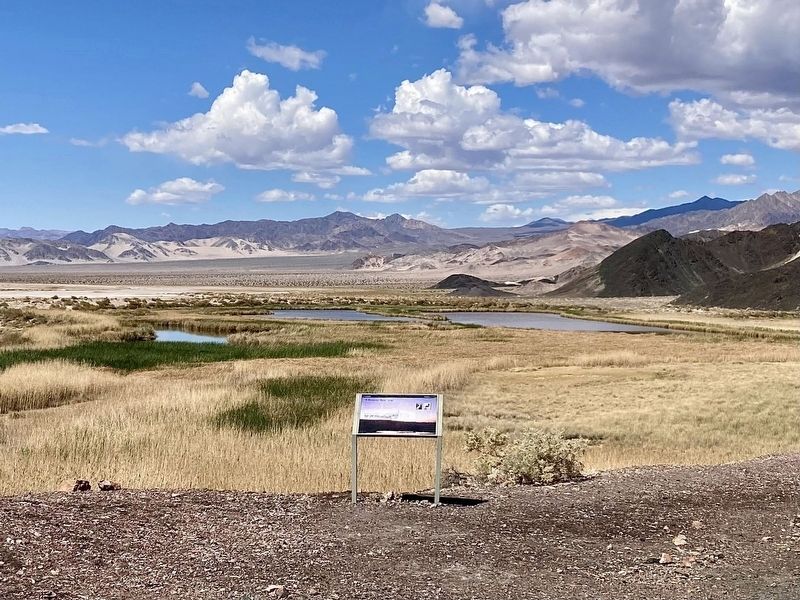
Named after the famed Saratoga Springs in
New York state, the springs here create
open-water ponds that contrast starkly
with the hot, dry, desolate floor of Death
Valley. The first visitors to its refreshing
waters included resident and . . . — — Map (db m235621) HM
Powered by water piped from a spring high in the Panamint Range, the Skidoo Mill extracted gold from ore and was one of Death Valley's most profitable operations. Skidoo had the only water-powered milling plant in Death Valley.
The Skidoo . . . — — Map (db m159375) HM
Independent from an early age, Louise Grantham moved from Ohio to California
in her twenties and, without training or experience, became a prospector. The fact
that this land belonged to someone else did not deter her.
In 1929, . . . — — Map (db m238062) HM
Eagle Borax Works, 12 miles (19 km):
This was the first borax refinery in
Death Valley. It operated for only two
years, closing in 1884 after refining
150 tons of relatively low-grade borax.
Dayton-Harris Graves, 11 . . . — — Map (db m269264) HM
Eagle Borax Works, 28 miles (45 km):
This was the first borax refinery in
Death Valley. It operated for only two
years, closing in 1884 after refining
150 tons of relatively low-grade borax.
Dayton-Harris Graves, 29 . . . — — Map (db m269266) HM
Though steeped in legend, the frenzied search
for gold and other materials in Death Valley
produced few fortunes. Borax, the "White
Gold of the Desert," ranks as the valley's
most profitable mineral.
Harmony Borax works, in front of you, . . . — — Map (db m32661) HM
Built in 1877, these kilns produced charcoal for the Modock Mine smelter about 20 miles to the west. Workers filled the stone kilns with piñon pine logs (relatively abundant in this area) and fired them. The burning, which reduced the wood to . . . — — Map (db m159369) HM
This property has been listed in the National Register of Historic Places by the United States Department of the Interior.
Ryan Historic District, est. 1914 — — Map (db m298073) HM
The Reward Mine is made up of multiple mining claims that have
merged over time. Following its discovery in 1870 the Reward Mine
primarily produced gold and silver, with copper and lead being
secondary minerals. The Reward Mine sat adjacent . . . — — Map (db m288132) HM
"We have problems to combat here which are new to us.
We don't know these hot dry winds. There were no
rabbits to plague us... Everything is so different and we
have to do much experimenting."
-John Fukasawa,
a Manzanar farm . . . — — Map (db m288411) HM
Cerro Gordo discovered by Mexicans in 1865 was at $17,000,000 Inyo's wealthiest mineral producer. Silver, lead, zinc, water and supplies all went by mule train, tram. The "Bessie Brady" boat across Owens Lake and Remi Nadeau mule teams to build the . . . — — Map (db m72747) HM
In 1862 this high quality deposit of dolomitic limestone was discovered. Its remorte location delayed development until 1883, when the Carson & Colorado Railroad was constructed. In 1885, Drew Haven Dunn filed a mining claim and the Inyo Marble . . . — — Map (db m72577) HM
In 1865 Pablo Flores found the richest vein of silver
California has ever had ($17 million) overlooking
Owens Lake at the crest of the Inyo Mountains. By 1868
Cerro Gordo Landing was growing to supply the mines.
Water went up the "Yellow . . . — — Map (db m221858) HM
Owens Lake was once over 300 feet deep and part of a large ancient freshwater lake. As the climate changed over centuries, the lake began to dry up leaving behind concentrated minerals and salts. By 1905, diversion of water by farmers in the Owens . . . — — Map (db m72575) HM
The Alabama Gates and gate house were constructed in 1913 when the Los Angeles Aqueduct was built to dewater the aqueduct when maintenance is necessary. On November 16, 1924, seventy or more local citizens seized the aqueduct at the Alabama Gates . . . — — Map (db m93252) HM
People have long benefitted from the richness of the Owens
Lake area. For at least 10,000 years, American Indians have
lived here and harvested resources, including glass-sharp
obsidian for arrow points and spearheads.
In the . . . — — Map (db m221929) HM
Located high above the Panamint Valley, Lookout supported the needs of miners
working at the Modoc and Minietta mines
below. Lookout sprang up in May of 1875
with the discovery of silver/lead ore
which proved to be quite abundant. In . . . — — Map (db m289060) HM
The town of Reilly was established on a mining claim purchased
by Edward Reilly of New York in September 1882. By October,
Reilly had ordered a 10 stamp mill and began to organize his
mining district. This rapidly growing "company town" . . . — — Map (db m260671) HM
Kern County experienced a mining boom just like other parts of California. Prospectors arriving from near and far found gold, silver and other valuable ore in Kern County’s mountains beginning in the 1850s.
An assayer tests the purity of . . . — — Map (db m26080) HM
Kern County is one of the top oil producing areas in the United States. Four oil fields in Kern County have each produced over one billion barrels of oil.
In 1899, the discovery of oil on land near the Kern River started an oil boom. . . . — — Map (db m25692) HM
Oil was discovered at 70 feet in 1899, when Tom Means persuaded Roe Elwood and Frank Wiseman, aided by Jonathan, Bert, Jed, and Ken Elwood, George Wiseman, and John Marlowe, to dig here for oil. On June 1, 1899, 400 feet to the north, Horace and . . . — — Map (db m168102) HM
Access to adequate water supplies was crucial to the settlement of Kern County.
Water from the Kern River was diverted to irrigate farmlands, but most towns relied on wells for drinking water.
The Fairhaven Water Company built this . . . — — Map (db m25493) HM
This standard end pumping unit was salvaged and erected by the Production Department, Chevron U.S.A., Inc., La Habra to commemorate the 100th anniversary of Standard Oil Company of California
The unit is composed of original parts from the San . . . — — Map (db m26118) HM
In the 1880s, the famous twenty-mule
teams hauled borax from mines in Death
Valley to the railroad junction in Mojave. The
wagon route passed just north of here.
In 1925, a huge deposit of borax ores was
discovered near Boron. By the . . . — — Map (db m155972) HM
This is one of the original twenty mule team wagon sets, used to carry borax out of Death Valley, through 165 miles of desolate mountains and blistering deserts, to the closest railroad spur in Mojave, California. It took 20 days for the 20 Mule . . . — — Map (db m123897) HM
Indian water hole on Joseph R. Walker trail of 1834 where Manly-Jayhawker parties of 1849 found their first water after five days of travel from Argus Range. During 1860's was site of stage and freight station from Los Angeles to Coso and Cerro . . . — — Map (db m50243) HM
In the background of this sign are the huge tailing piles of The Baltic Mine.
This area is part of the old Stringer District and was discovered in 1896 (a year after the famous Yellow Aster Mine in
Randsburg was happened upon) by William . . . — — Map (db m269974) HM
The King Solomon Mine here in Johannesburg had lots of gold pulled out of this mine and some speculate
that it may be an extension of the Butte Mine over the hill in Randsburg. Historically the site has been
associated with the Rand Mining . . . — — Map (db m181227) HM
America's most spectacular gusher blew in here on March 14, 1910. Initially 18,000 barrels per day, the flow later reached an uncontrolled peak of 100,000 barrels per day, completely destroying the derrick. This Union Oil Company well produced nine . . . — — Map (db m54267) HM
Eight miles due west of this marker stood one of California's first commercial oil refineries. Between August 1864 and April 1867, approximately 4,000 gallons of illuminating oil produced there was shipped to San Francisco by the Buena Vista . . . — — Map (db m78295) HM
This display commemorates the Mojave area's rich mining history, which began with the discovery of gold on the Little Buttes north of the present day Silver Queen Road.
That discovery by W.W.Bowers was followed by many others in the region, . . . — — Map (db m53129) HM
Just west of this point was the Southern Pacific terminus for the Twenty-Mule-Team Borax wagons that operated between Death Valley and Mojave from 1884 to 1889. The route ran from the Harmony Borax Mining Company works, later acquired by the . . . — — Map (db m123891) HM
In May 1899, Thomas A. Means owned the land where James and Jonathan Elwood discovered oil on the North Bank of the Kern River. They used a hand auger under the edge of the cliff checking for oil, and later moved to the top to drill. Oil surfaced . . . — — Map (db m64665) HM
The El Paso Mountain Range holds some of the richest gold-bearing dirt in the region. Goler Gulch, Benson Gulch, Reed
Gulch, Bonanza Gulch/Last Chance Canyon, Red Rock Canyon, and many other canyons. Enjoy the beauty of this
historical area! . . . — — Map (db m270203) HM
The Yellow Aster, or Rand Mine, was discovered in April, 1895 by Singleton Burcham and Mooers. The town of Randsburg quickly developed followed by the supply town of Johannesburg in 1896. Both names were adopted from the profusion of minerals . . . — — Map (db m50461) HM
Gold was discovered on the slope of Rand Mountain in 1895. From this discovery, the town of Randsburg sprang up almost overnight. By 1899, the town had over 3500 residents. Randsburg boasted a 100-stamp mill and conservative estimates are that . . . — — Map (db m78578) HM
After the famous Yellow Aster Gold Mine was discovered up the road in 1895,
many other smaller but rich lode mines were also located. The Consolidated
Gold Mine was one of them! This is a hard-rock mine and the gold ore
needed to be blasted . . . — — Map (db m269994) HM
Yellow Aster Mining & Milling Co. owned 49 patented and 6
unpatented claims. It was the principal source of gold in Kern County and had
an output of $12,000,000 most of which was mined and sold at pre-1934
prices. The mine was operated . . . — — Map (db m270190) HM
North of this sign is the famous Yellow Aster Gold Mine in Randsburg. Three friends, Fredrick Mooers, John Singleton
and Charles Burcham discovered the Yellow Aster Gold Mine in 1895 and so was the beginning of the famous Rand
Mining District! . . . — — Map (db m270166) HM
Rand Camp began as a tent city, erected by eager miners who rushed to the Mojave Desert following a major gold discovery in April 1895. A year later, the town of 1,500 had been renamed "Randsburg." Saloons sprouted, a U.S. Post Office was . . . — — Map (db m153141) HM
Kelly Silver Mine
Silver was discovered directly behind this building around 1918. The Kelly Silver Mine was the richest in the world at the time, albeit other silver mines in the area were very profitable as well. As a result, the . . . — — Map (db m152428) HM
One of the richest silver strikes occurred in the community of Red Mountain. The Kelly and Grady claims started a silver boom which brought prosperity to this region in the 1900's. In one 60 day period over $170,000 in silver was mined from a hole . . . — — Map (db m158901) HM
In the background of this sign are the huge tailing piles of The Baltic Mine.
This area is part of the old Stringer District and was discovered in 1896 (a year after the famous Yellow Aster Mine in
Randsburg was happened upon) by William . . . — — Map (db m153090) HM
Few local miners still burrow underground, lured by the rich yellow gleam of gold. Most gold now recovered from California’s Rand Mining District is microscopic in size, and so finely dispersed that it is invisible to the naked eye. Rock containing . . . — — Map (db m153105) HM
South of this sign (in Red Mountain) is The Kelly Silver Mine. Discovered around 1919, it was the richest Silver Mine in the United States
at the time! Its total output was around $13 Million Dollars (more in today's prices!) When first . . . — — Map (db m153132) HM
North of this sign is the famous Yellow Aster Gold Mine in Randsburg. Three friends, Fredrick Mooers, John Singleton
and Charles Burcham discovered the Yellow Aster Gold Mine in 1895 and so was the beginning of the famous Rand
Mining District! . . . — — Map (db m153138) HM
On March 15, 1910, at a depth of 2,225 feet,
Lakeview #1 blew in. Union Oil was the
Producer*. Flowing at an estimated rate of 18,000
barrels a day, the oil demolished the derrick.
Sand covered the engine house and bunkhouses.
Men . . . — — Map (db m286402) HM
You are in a part of the historic
Midway Sunset oilfield.
In 1990 this 100 year old giant
oilfield was again the top oil producer
in the lower 48 states.
In 2003 Midway Sunset & the Westside
oil fields produced one half of
the oil in the . . . — — Map (db m286393) HM
History of Taft
As Taft’s first 100 years is being celebrated in 2010, let’s look back to see from where we came. Taft got its start when the railroad laid tracks to Taft and beyond. Siding Number Two was where it all started along the . . . — — Map (db m54388) HM
The Jameson # 17 oil derrick, which was drilled in 1917 and produced until
the 1980’s, was scheduled to be torn down. In 1974 the local American
Association of University Women and several dedicated people convinced
Jameson Oil Company to . . . — — Map (db m88603) HM
This sulphur mine also produced quicksilver and
became one of most noted producers in world.
First worked for sulphur in 1865 and in four
years produced total of 2,000,000 pounds.
Reopened and developed for quicksilver in 1873
and credited with . . . — — Map (db m240310) HM
The Dawn Station "Trolley Stop" in this photograph is
located to the left of this sign. A 2.4 mile trail led from Dawn
Station to the mine located down in the canyon. Partially
processed ore from the mine was brought up to this Station . . . — — Map (db m248031) HM
This area was originally homesteaded by John Henninger
in 1886. From 1902-1907 the United States Forest Service
maintained on the flats an experimental nursery, in charge
of Arthur Lukins. The results of these experiments, as
shown by the . . . — — Map (db m272909) HM
Located about 10 miles south of here between Lake Pyramid and Castaic Lake lies the Castaic Powerplant. This facility, unlike others along the West Branch, is a pumping-generating plant owned and operated by Los Angeles Department of Water and . . . — — Map (db m196318) HM
On this site, bubbling springs once flowed from their source in a deep water basin which has existed continuously since the Pleistocene Era. Prehistoric animals, Indians, and early Inglewood settlers were attracted here by the pure artesian water. . . . — — Map (db m126337) HM
The C.C.C. and the Forest Service
The Civilian Conservation Corps was established by President
F.D. Roosevelt in 1933 to maintain public lands and provide
jobs during the Great Depression. The CCC were active in fire
prevention . . . — — Map (db m264035) HM
This large wiry creosote bush (Larrea tridentata) before you, the only creosote bush in this woodland, is about 10 feet high and 20 feet in diameter; it has been estimated to be nearly 800 years old by botanists. This may be the oldest . . . — — Map (db m145769) HM
Water Wagon ca. 1908-1913
This water wagon
was used by George W. Lane
during the construction of
the Los Angeles Aqueduct
through the Antelope Valley.
George moved to the
Antelope Valley in 1908 and
was a mule skinner by . . . — — Map (db m245924) HM
The reservoir and more than 225 acres of surrounding
watershed land are owned and operated by the City of Los
Angeles Department of Water and Power. This large protected
area, which is not open to public access, provides a high
quality . . . — — Map (db m255758) HM
1910 - City of Los Angeles water system purchases land for reservoir in Ascot Hills.
El sistema de agua de la ciudad de Los Ángeles compra terrenos para embalses en Ascot Hills.
1915 - City of Los Angeles water . . . — — Map (db m229925) HM
Built by United States Work Projects Administration, 1940.
second marker:
Exact Center - City of Los Angeles
Point of balance of the plane of the City of Los Angeles, Lat. 34°07'31"N, Long. 118°23'57"W, Alt. 920 ft, . . . — — Map (db m199910) HM
The California Outstanding
Civil Engineering Achievement - 1988,
Los Angeles Aqueduct Filtration Plant,
designated by
Los Angeles Section, ASCE,
California State Council, ASCE. — — Map (db m294297) HM
A penniless Irish immigrant boy who rose by the force of his industry, intelligence, integrity and intrepidity to be a sturdy American citizen, a self-educated engineering genius, a whole-hearted humanitarian, the father of the city's water system, . . . — — Map (db m164804) HM
Designer - Walter S. Claberg. Built 1940. Declared 1976, Historic-Cultural Monument No. 162, City of Los Angeles, Cultural Heritage Commission, Cultural Affairs Department. — — Map (db m164812) HM
Presented to the citizens of Los Angeles County in December 1916 by Captain Allan Hancock with a request that the scientific
features be preserved.
First historic reference to the tar pools recorded in the diary of Gaspar de Portolá on August . . . — — Map (db m126874) HM
A replica of one in Cordoba, Spain; was built around 1812-1814 and was part of the water system in San Fernando Mission garden.
100 years later this garden was the property of Mr. Leslie C. Brand, who donated a part of it to Los Angeles for a . . . — — Map (db m130560) HM
The varied habitats of Guashna, which includes the Ballona Wetlands, nurtures the Gabrielino-Tongva people
of the past, present, and future. Discover how this biodiversity contributes to their rich culture and survival.
Ti'at (Plank . . . — — Map (db m216623) HM
Charles and Lotte Melhorn
More than fifty-year residents of the Santa Monica Mountains, Charles and Lotte Mel horn fought for the recognition of the natural areas and viewshed along Mulholland Drive as a precious public resource. . . . — — Map (db m164714) HM
Where Does Your Water Come From?
Discover the history of water in Los Angeles and learn how the future of water is our future.
The Los Angeles River
About 15,000 years ago, people began moving into the Los Angeles Basin . . . — — Map (db m188162) HM
Silver Lake & Ivanhoe Reservoirs.
Engineer - William Mulholland.
Built 1906. Declared 1989,
Historic-Cultural
Monument No. 422,
City of Los Angeles,
Cultural Heritage Commission,
Cultural Affairs Department.
Donated by
the Silver . . . — — Map (db m231685) HM
Barbara A. Fine dedicated much of her life to protecting
open space in the Santa Monica Mountains from development.
Barbara understood early on the unique appeal of the Santa
Monica Mountains, the only mountain range to traverse a . . . — — Map (db m255773) HM
The Native Americans who inhabited
the Big Tujunga Wash were called the
Tongva. They used many local native
plants for food, shelter, medicine,
and in their ceremonies.
Can you find these plants in the garden?
Many of these plants . . . — — Map (db m207433) HM
The Verdugo Hills and Tujunga Wash
hold a surprising wealth of biodiversity.
When you look out at these areas, what do you see?
You might be looking at plants that grow in
the San Gabriel Mountains but not in the Santa Monica
Mountains — and . . . — — Map (db m198564) HM
This is the terminus of the Los Angeles-Owens River Aqueduct, which brings water 338 miles from the eastern slopes of the Sierra Nevada to the City of Los Angeles. Begun in 1905, the great aqueduct was completed November 5, 1913. The Mono Craters . . . — — Map (db m164815) HM
On November 5, 1913, 40,000 people gathered here to witness the dedication of the Los Angeles - Owens River Aqueduct. The terminus of a 233-mile long engineering marvel, the Cascades were the site of William Mulholland‘s famous speech: “There it is, . . . — — Map (db m165409) HM
The use of the windmill is confined almost exclusively to the pumping of water.
Sufficient water should be stored to last at least three days. The windmill is used
in a limited way for grinding feed and for running machines, such as . . . — — Map (db m261891) HM
Malibu Potteries was located on the beach about a
half mile beyond the pier and used clay from the ranch.
Mrs. Rindge, trying to supplement her income following a disastrous
legal battle, was looking for oil on her property but found . . . — — Map (db m206576) HM
Hundreds of years ago, the abundance
of oak trees allowed California's
indigenous inhabitants to achieve one
of the highest population densities in
the Americas. Oakwood became an
integral part of many communities’
material cultures and . . . — — Map (db m268768) HM
This marker locates the site near which the Indians and early California settlers came to obtain their salt, which at many times was more valuable than gold. — — Map (db m50973) HM
Problems With Design
Too Tall
Final design was 20 ft higher than the
original plan, without increasing the base
width to support the additional height.
Hydraulic Uplift
The design did not . . . — — Map (db m285494) HM
Geology That Contributed to the Failure
Landslides of the eastern abutment, oversaturated
sandstone and conglomerate of the western abutment,
and an active thrust fault under the footing contributed
to the failure. The Sespe . . . — — Map (db m285501) HM
Hello Girls
Telephone operators such as Louise Gipe in Santa
Paula and Reicel Jones in Saticoy - subsequently
nicknamed the "Hello Girls" - bravely stayed at
their posts after being notified of the flood headed
their way. They . . . — — Map (db m285495) HM
San Francisquito Canyon is located within the Angeles National Forest. The canyon is characterized by unique geology, a perennial creek that hosts sensitive plant and animal species, and vital water infrastructure.
The Los Angeles . . . — — Map (db m264073) HM
What Were the Water Wars?
The California Water Wars were a series of political conflicts that took place in the
late 19th and early 20th centuries in Owens Valley. These conflicts centered around
Los Angeles' expanding population . . . — — Map (db m285492) HM
Early Life
William Mulholland joined the British
Merchant Navy at the age of 15 and
sailed as an apprentice for several years.
After landing in the United States, he
worked on the Great Lakes and in the
lumber camps of Michigan . . . — — Map (db m285493) HM
In 1839, the Mexican Government granted to
Antonio del Valle some 48,000 acres of
The Santa Clarita Valley known as the Del Valle Rancho.
On March 9, 1842, Francisco Lopez y Arbello, the brother-in-law of Antonio del Valle, visited the . . . — — Map (db m20112) HM
In Placeritas Canyon, March 1842, Francisco Lopez y Arballo, while gathering wild onions from around an old oak, discovered gold particles clinging to the roots of the bulbs. It is estimated that $80,000 in gold was discovered as a result of this . . . — — Map (db m154258) HM
In Placeritas Canyon, March 1842, Francisco Lopez y Arballo, while gathering wild onions from around an old oak, discovered gold particles clinging to the roots of the bulbs. It is estimated that $80,000 in gold was discovered as a result of this . . . — — Map (db m154260) HM
Francisco Lopez made California’s first authenticated gold discovery on March 9, 1842. While gathering wild onions near an oak tree in Placerita Canyon he found gold particles clinging to the roots of the bulbs. The San Fernando placers and nearby . . . — — Map (db m154261) HM
The Southern California oil industry began in the Newhall area in the late nineteenth century. Remnants of the industry on display include an oil pump, oil production packer, rotary rock drill bit, and tool rack which were all manufactured in . . . — — Map (db m180432) HM
In 1875 the Star Oil Company, one of the predecessors of the Standard Oil Company of California, drilled its first Pico Canyon well, which yielded about one hundred barrels per day. The discovery resulted in the erection of the first commercial oil . . . — — Map (db m145418) HM
California's first oil refinery operated on a commercial scale, erected 1876. Restored by the Standard Oil Company of California in 1930 as a memorial to D. G. Scofield and his pioneer associates of the California Star Oil Works company, a . . . — — Map (db m165742) HM
Walker Ranch is located at the eastern end of Placerita Canyon Natural Area and was purchased by the California Parks Department in the late 1950's. It was the home of Frank Walker and his family beginning in the mid 1920's. The Walker's . . . — — Map (db m180445) HM
What you are smelling is a pool of bubbling white oil. This very rare geologic feature of translucent petroleum has been filtered by nature. This special resource originates from deep within the earth in the Placerita Schist basement complex . . . — — Map (db m243727) HM
Mentryville, named after Charles Alexander Mentry, who drilled California's first successful commercial oil well in 1876, was one of the first oil towns in the state. Mentry's restored home, barn and Felton School remain on the site where the . . . — — Map (db m165661) HM
In Placeritas Canyon, March 1842, Francisco Lopez y Arballo, while gathering wild onions from around an old oak, discovered gold particles clinging to the roots of the bulbs. It is estimated that $80,000 in gold was discovered as a result of this . . . — — Map (db m154259) HM
The grunion is a small fish that has swarmed
sandy beaches from Point Conception to Baja
California for centuries, creating a spectacle
unique to the Southern California area. At night
grunions "run" up on shore during annual high
tides in . . . — — Map (db m277004) HM
In 1920, Signal Hill was a grassy dome dotted with seasonal farms. Though there was interest, opinions among oil company geologists about the prospects for oil here were mixed. A well near the corner of Wardlow and Atlantic Streets, drilled to 3,449 . . . — — Map (db m100450) HM
This eight-ton, short-wheel base, wood burning locomotive, built by the H. K. Porter Co. of Pittsburg, Pennsylvania, was delivered to the Merced Mining Company of Coulterville in 1897. All of "Billy’s" active life was spent hauling gold-bearing . . . — — Map (db m5956) HM
1902 entries matched your criteria. Entries 201 through 300 are listed above. ⊲ Previous 100 — Next 100 ⊳