3762 entries match your criteria. Entries 201 through 300 are listed.⊲ Previous 100 — Next 100 ⊳
Bridges & Viaducts Topic
By James King, August 10, 2013
Mountain Quarries Railroad Bridge Sign
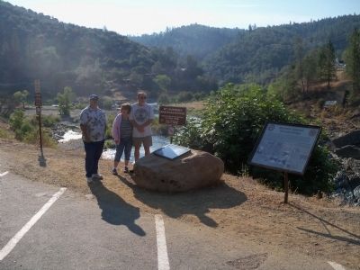
| 201 ► California, Placer County, Auburn — 1051 — Mountain Quarries Railroad Bridge — |
| On Old Foresthill Road east of Golden Chain Highway (California Highway 49), on the right when traveling east. | |||
| 202 ► California, Placer County, Auburn — GPY 135-10 — Mountain Quarries Railroad Bridge — |
| On Old Foresthill Road east of Golden Chain Highway (California Highway 49), on the right when traveling east. | |||
| 203 ► California, Placer County, Lincoln — Colonel C. Lincoln Wilson — |
| On 5th Street west of E Street, on the right when traveling east. | |||
| 204 ► California, Placer County, Roseville — 2 — Reuben F. Nelson Footbridge — Roseville Historical Society Marker No. 2 — |
| Near Oak Street near Lincoln Street. | |||
| 205 ► California, Placer County, Tahoe City — Roads and Bridges — |
| On W Lake Blvd, on the right when traveling north. | |||
| 206 ► California, Riverside County, Riverside — 54 — Victoria Bridge — 1928 — |
| On Victoria Avenue just south of Woodbine Street. | |||
| 207 ► California, Sacramento County, Fair Oaks — "Jim’s Bridge" — |
| Near Pennsylvania Avenue near the north bank of the American River. | |||
| 208 ► California, Sacramento County, Folsom — Folsom Dam Improvements — Promoting Public Safety for the Sacramento Region — |
| Near East Natoma Street. | |||
| 209 ► California, Sacramento County, Sacramento, CSUS — The Guy West Bridge — |
| Near State University Drive East. | |||
| 210 ► California, Sacramento County, Sacramento, Old Sacramento — R Street Bridge — |
| On Front Street south of O Street, on the right when traveling north. | |||
| 211 ► California, Sacramento County, Sacramento, Old Sacramento — The Northern Electric Bridge — |
| Near Capital Mall. | |||
| 212 ► California, Sacramento County, Sacramento, Old Sacramento — The Tower Bridge — |
| Near Capital Mall. | |||
| 213 ► California, Sacramento County, Sacramento, Old Sacramento — Tower Bridge: Gateway to the Capital — |
| Near Capital Mall. | |||
| 214 ► California, San Bernardino County, Redlands — 17 — Mill Creek Zanja — Santa Fe and Southern Pacific Railroad Bridges — |
| Near Laramie Avenue at Lincoln Street, on the left when traveling east. | |||
| 215 ► California, San Bernardino County, Rialto — The Bridge To Progress — |
| On North Fillmore Avenue. | |||
| 216 ► California, San Diego County, Coronado — San Diego-Coronado Bay Bridge — |
| Near State Highway 75 when traveling east. | |||
| 217 ► California, San Diego County, San Diego, Balboa Park — Balboa Park West Mesa — |
| On El Prado, on the right when traveling east. | |||
| 218 ► California, San Diego County, San Diego, Balboa Park — Cabrillo Bridge — |
| On El Prado east of Balboa Drive, on the right when traveling east. | |||
| 219 ► California, San Diego County, San Diego, Bankers Hill — First Avenue Bridge — 1931 — |
| On First Avenue north of Nutmeg Street, on the right when traveling north. | |||
| 220 ► California, San Diego County, San Diego, Bankers Hill — 211 — Quince Street Footbridge — San Diego County's Oldest Bridge — 1905 — |
| On Quince Street east of Second Avenue. | |||
| 221 ► California, San Diego County, San Diego, Bankers Hill — 116 — Spruce Street Suspension Footbridge — |
| On Spruce Street west of First Avenue, on the right when traveling west. | |||
| 222 ► California, San Diego County, San Diego, Old Town — 244 — Derby Dike — |
| On Presidio Drive at Taylor Street, on the right when traveling west on Presidio Drive. | |||
| 223 ► California, San Francisco City and County, San Francisco, Fisherman's Wharf — San Francisco's Most Popular Postcard. — |
| Near Pier 39 north of The Embarcadero. | |||
| 224 ► California, San Francisco City and County, San Francisco, Golden Gate Park — Alvord Lake Bridge — National Historic Civil Engineering Landmark — Built 1889 — |
| Near Haight Street west of Stanyan Street. | |||
| 225 ► California, San Francisco City and County, San Francisco, Lincoln Park — The Golden Gate — Deep Sea Geology Exposed — |
| Near El Camino Del Mar near Seal Rock Drive. | |||
| 226 ► California, San Francisco City and County, San Francisco, Mission Bay — Peter R. Maloney (4th Street) Bridge — |
| On 4th Street, on the right when traveling north. | |||
| 227 ► California, San Francisco City and County, San Francisco, Presidio of San Francisco — A Bathtub for the South Tower — |
| Near Coastal Trail. | |||
| 228 ► California, San Francisco City and County, San Francisco, Presidio of San Francisco — A Lasting Monument — |
| Near Coastal Trail. | |||
| 229 ► California, San Francisco City and County, San Francisco, Presidio of San Francisco — All in a Day's Work — |
| Near Coastal Trail. | |||
| 230 ► California, San Francisco City and County, San Francisco, Presidio of San Francisco — Art Deco on a Grand Scale — |
| Near Coastal Trail. | |||
| 231 ► California, San Francisco City and County, San Francisco, Presidio of San Francisco — Battery Lancaster — |
| Near Coastal Trail. | |||
| 232 ► California, San Francisco City and County, San Francisco, Presidio of San Francisco — Bridging the Gate — the Beginning — |
| Near Coastal Trail. | |||
| 233 ► California, San Francisco City and County, San Francisco, Presidio of San Francisco — Engineering the Design — |
| Near Coastal Trail. | |||
| 234 ► California, San Francisco City and County, San Francisco, Presidio of San Francisco — Facts & Figures About the Bridge — |
| Near Coastal Trail. | |||
| 235 ► California, San Francisco City and County, San Francisco, Presidio of San Francisco — Fort Point Arch — |
| Near Coastal Trail. | |||
| 236 ► California, San Francisco City and County, San Francisco, Presidio of San Francisco — Hanging the Roadway Deck — |
| On Coastal Trail. | |||
| 237 ► California, San Francisco City and County, San Francisco, Presidio of San Francisco — Joseph Strauss Legacy Circle — |
| Near Lincoln Boulevard. | |||
| 238 ► California, San Francisco City and County, San Francisco, Presidio of San Francisco — Making the Impossible, Possible: The Story of the Golden Gate Bridge — |
| Near Coastal Trail. | |||
| 239 ► California, San Francisco City and County, San Francisco, Presidio of San Francisco — Men of Vision — |
| Near Golden Gate Bridge. | |||
| 240 ► California, San Francisco City and County, San Francisco, Presidio of San Francisco — Resisting the Twisting — |
| Near U.S. 101 at Lincoln Boulevard. | |||
| 241 ► California, San Francisco City and County, San Francisco, Presidio of San Francisco — Spinning the Main Cables — |
| Near Coastal Trail. | |||
| 242 ► California, San Francisco City and County, San Francisco, Presidio of San Francisco — Steel, Fog, Salt, Rust, and Paint — |
| Near Coastal Trail. | |||
| 243 ► California, San Francisco City and County, San Francisco, Presidio of San Francisco — Tall and Strong — |
| Near Coastal Trail. | |||
| 244 ► California, San Francisco City and County, San Francisco, Presidio of San Francisco — The Golden Gate Bridge — |
| Near Lincoln Boulevard. | |||
| 245 ► California, San Francisco City and County, San Francisco, Presidio of San Francisco — The Golden Gate Bridge: Vision, Genius and Expert Care — |
| Near Lincoln Boulevard west of Chrissy Field Avenue. | |||
| 246 ► California, San Francisco City and County, San Francisco, Presidio of San Francisco — The PG&E Tower — Golden Gate Bridge — |
| On Golden Gate Bridge, on the right when traveling north. | |||
| 247 ► California, San Francisco City and County, San Francisco, Presidio of San Francisco — Types of Bridges — |
| Near Coastal Trail. | |||
| 248 ► California, San Francisco City and County, San Francisco, Presidio of San Francisco — Working Under Water — |
| Near Coastal Trail. | |||
| 249 ► California, San Francisco City and County, San Francisco, Presidio of San Francisco — World's Tallest Bridge Towers — |
| Near Coastal Trail. | |||
| 250 ► California, San Francisco City and County, San Francisco, Rincon Hill — Klockars' Blacksmith Shop — |
| On Folsom Street north of 1st Street, on the right when traveling east. | |||
| 251 ► California, San Francisco City and County, San Francisco, SoMa — Pause traveler and be greatful to Norton 1st — |
| Near Minna Street. | |||
| 252 ► California, San Francisco City and County, San Francisco, South Beach — The Bay Bridge — |
| On The Embarcadero near Beale Street. | |||
| 253 ► California, San Francisco City and County, San Francisco, South Beach — The Francis "Lefty" O'Doul Third Street Bridge — |
| Near Third Street south of Willie Mays Plaza. | |||
| 254 ► California, San Francisco City and County, San Francisco, Treasure Island — Signal — Tom Loughlin — 2019 — |
| On Avenue of the Palms at 9th Street, on the left when traveling north on Avenue of the Palms. | |||
| 255 ► California, San Francisco City and County, San Francisco, Yerba Buena Island — Defending the Bay for 150 Years — |
| On Treasure Island Road north of Macalla Road, on the right when traveling north. | |||
| 256 ► California, San Joaquin County, Clements — Mackville Road Bridge — |
| On Mackville Road near East Jahant Road, on the left when traveling south. | |||
| 257 ► California, San Joaquin County, Tracy — Lincoln Highway — 1913 - 1928 — |
| On 11th Street (California Route 205) east of Cable Road, on the right when traveling west. | |||
| 258 ► California, San Luis Obispo County, Arroyo Grande — Arroyo Grande Swinging Bridge — |
| Near Branch Street at Short Street, on the right when traveling east. | |||
| 259 ► California, San Luis Obispo County, Morro Bay — A Bridge to the Sandspit — |
| Near Embarcadero north of Harbor Street. | |||
| 260 ► California, San Mateo County, Burlingame — Eugene A. Doran Memorial Bridge — 1922 – 1959 — One-Half Mile South — |
| Near State Highway 280. | |||
| 261 ► California, San Mateo County, Half Moon Bay — First Concrete Bridge Erected in San Mateo Co — 1900 — |
| On Main Street, on the left when traveling south. | |||
| 262 ► California, San Mateo County, Redwood City — A Feat of Gravity — The Hetch Hetchy Regional Water System — |
| Near California 35. | |||
| 263 ► California, San Mateo County, San Mateo — History of San Mateo’s Bridges — |
| Near South Hart Clinton Drive. | |||
| 264 ► California, San Mateo County, South San Francisco — Cut Stone Bridge — |
| On Centennial Way Trail at Spruce Avenue, on the right when traveling north on Centennial Way Trail. | |||
| 265 ► California, Santa Cruz County, Felton — 583 — Felton Covered Bridge — |
| Near Covered Bridge Road 0.5 miles south of Graham Hill Road. | |||
| 266 ► California, Santa Cruz County, Felton — Roaring Camp Covered Bridge — |
| Near North Big Trees Park Road. | |||
| 267 ► California, Santa Cruz County, Santa Cruz — The Wharf Links Land and Sea — Welcome to the Sanctuary Scenic Trail — |
| On West Cliff Drive at Gharkey Street, on the right when traveling north on West Cliff Drive. | |||
| 268 ► California, Shasta County, Anderson — Balls Ferry — |
| On Gover Road at Ash Creek Road, on the right when traveling south on Gover Road. | |||
| 269 ► California, Shasta County, Anderson — SHA-013 — The Flume — Point of Historical Interest — Dept. of Parks and Recreation – Reg. No. SHA-013 — |
| On Olinda Road, on the left when traveling west. | |||
| 270 ► California, Shasta County, Castella — 1 — Sims Bridge: A CCC First — |
| On Sims Road. | |||
| 271 ► California, Shasta County, Redding — Diestelhorst Auto Camp / Reid’s Ferry — |
| On Middle Creek Road at Benton Drive, on the right when traveling west on Middle Creek Road. | |||
| 272 ► California, Shasta County, Whiskeytown — Toll Bridge — Whiskeytown National Recreational Area — Tower House Historic District — |
| Near State Highway 299 Highway. | |||
| 273 ► California, Siskiyou County, Fort Jones — John F. Williams Memorial Bridge — |
| On Scott River Road (at milepost 18), on the right when traveling north. | |||
| 274 ► California, Siskiyou County, Tule Lake — Civilian Conservation Corps — |
| On Hill Road, on the right when traveling north. | |||
| 275 ► California, Siskiyou County, Weed — The Weed Arch — To the City of Weed from the People of Its Community — |
| On Main Street at South Weed Boulevard, on the right when traveling north on Main Street. | |||
| 276 ► California, Solano County, Vallejo — The Carquinez Strait: Gateway to California's Riches — |
| Near Dump Road at Lawes Street. | |||
| 277 ► California, Sonoma County, Glen Ellen — Historical Tid-bits about Glen Ellen — |
| On Arnold Drive west of Carmel Avenue, on the right when traveling west. | |||
| 278 ► California, Stanislaus County, Knights Ferry — 347 — Knight's Ferry — ← 1 Mile — |
| On State Highway 120 at milepost 16.4 at Kennedy Road, on the left when traveling west on State Highway 120. | |||
| 279 ► California, Stanislaus County, Knights Ferry — Knight's Ferry Bridge — National Historic Landmark — |
| Near Covered Bridge Road east of Sonora Road (Main Street), on the right when traveling east. | |||
| 280 ► California, Stanislaus County, Knights Ferry — Knights Ferry Covered Bridge — |
| Near Knights Ferry Road. | |||
| 281 ► California, Stanislaus County, Newman — Hills Ferry — Historic Landmark — |
| On River Road, on the right when traveling north. | |||
| 282 ► California, Tehama County, Tehama — The Tehama Railroad Bridge — |
| On C Street near Cavalier Drive, on the left when traveling east. | |||
| 283 ► California, Trinity County, Douglas City — Steel Bridge — |
| Near Steel Bridge Road, on the left when traveling north. | |||
| 284 ► California, Tuolumne County, Moccasin — 4 — Stevens Bar Bridge — |
| On Jacksonville Road at River Road, on the right when traveling south on Jacksonville Road. | |||
| 285 ► California, Yolo County, Davis — Davis Subway — Richards Blvd. Underpass — |
| Near Richards Boulevard 0.5 miles south of 1st Street, on the left when traveling north. | |||
| 286 ► California, Yolo County, West Sacramento — Pony Express Bridge — |
| Near 2nd Street. | |||
| 287 ► California, Yolo County, West Sacramento — Tower Bridge — West Sacramento River Walk — |
| Near West Capitol Avenue. | |||
| 288 ► California, Yolo County, West Sacramento — Tower Bridge — Gateway to the Capitol — |
| On Tower Bridge Gateway (California Route 275) at The American River, on the left when traveling east on Tower Bridge Gateway. | |||
| 289 ► California, Yuba County, Camptonville — Marysville to Virginia City in 32 Hours — 49 Miles Along Highway 49 — |
| On Alleghany Ridge Road at Highway 49, on the right when traveling north on Alleghany Ridge Road. | |||
| 290 ► California, Yuba County, Camptonville — Oregon Creek Covered Bridge — |
| On Alleghany Ridge Road. | |||
| 291 ► California, Yuba County, Smartsville — The Yuba River Bridge at Parks Bar — 1913 - 1994 — |
| On Timbuctoo Road south of Highway 20. | |||
| 292 ► Colorado, Chaffee County, Poncha Springs — Poncha Springs Country — |
| Near U.S. 285 just north of U.S. 50, on the right when traveling south. | |||
| 293 ► Colorado, Delta County, Delta — “Modern” Ferry — Crossing the Gunnison River — 1891 — |
| Near Gunnison River Drive (North Palmer Street) 0.3 miles west of U.S. 50. | |||
| 294 ► Colorado, Denver County, Denver, Ballpark District — Up a Lazy River — Bridging the Centuries — |
| On 19th Street just south of Platte Street, on the right when traveling south. | |||
| 295 ► Colorado, Denver County, Denver, Central — Manny's Bridge — |
| On Wynkoop Street 0.1 miles west of 15th Street, on the left when traveling west. | |||
| 296 ► Colorado, El Paso County, Colorado Springs, Northwest Colorado Springs — John Blair Bridge — Circa 1880 — |
| On North 30th Street at Glen Eyrie, on the right when traveling north on North 30th Street. | |||
| 297 ► Colorado, El Paso County, Green Mountain Falls — Lake Gazebo & Gazebo Bridge — |
| Near Lake Street just east of Ute Pass Avenue, on the right when traveling east. | |||
| 298 ► Colorado, Fremont County, Cañon City — Bustling Center for Trade, Transportation, and Tourism — |
| On Royal Gorge Boulevard (U.S. 50) east of South 3rd Street, on the right when traveling east. | |||
| 299 ► Colorado, Fremont County, Cañon City — Cañon City — Railroads Moving Goods, Moving People — |
| On South 3rd Street 0.1 miles south of Royal Gorge Boulevard (U.S. 50), on the right when traveling south. | |||
| 300 ► Colorado, Fremont County, Cañon City — How the Bridge Became Royal — Come Across — Royal Gorge Bridge & Park — |
| Near County Road 3A 4.5 miles south of U.S. 50 when traveling south. | |||
3762 entries matched your criteria. Entries 201 through 300 are listed above. ⊲ Previous 100 — Next 100 ⊳