In memory of our fallen Currahees Operation Iraqi Freedom V-VII
506th Regimental Combat Team 101st Airborne Division (Air Assault)
"We have only died in vain if you believe so; You must decide the wisdom of our choice. By the world that . . . — — Map (db m247915) WM
In September 1864, after Union Gen. William T. Sherman defeated Confederate Gen. John Bell Hood at Atlanta, Hood led the Army of Tennessee northwest against Sherman's supply lines. Rather than contest Sherman's "March to the Sea", Hood then moved . . . — — Map (db m247958) HM
Constructed around 1830 with bricks made on the plantation by slave labor, this building served as one of Overton's smokehouses. More than just a place to preserve meats, the smokehouse symbolized the planter's ability to provide food for his family . . . — — Map (db m247942) HM
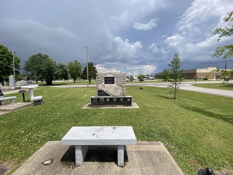
In memory of the soldiers of the 4th Brigade Special Troops "Apache" Battalion who gave their lives in the service of the United States Army
Your courage will always be an example of what all soldiers strive to possess
Spc Prince K Teewa . . . — — Map (db m247913) WM
Dedicated to those of the 506th Parachute Infantry Regiment who gave their lives for their country.
First Airborne battle group 506th Infantry
Fort Campbell, Kentucky July 20, 1958
From the people of Toccoa, Georgia — — Map (db m247910) WM
Roy Eldon "Buck" White was born in Brownwood on 28 February 1900. He changed his date of birth so he could enlist in the Navy on 20 April 1917 when he was only 17 years old. Fireman Second Class White was on the USS Alcedo when it was sunk by a . . . — — Map (db m247848) HM WM
Marvin Lee "Lefty" Gardner was born on 10 September 1921. He joined the Army Air Corps at age 21. Lefty flew 34 missions in the European theater in World War II in B-24s and B-17s and received the Distinguished Flying Cross, Air Medal with three oak . . . — — Map (db m247844) WM
Lieutenant Colonel (LTC) John (Jake) Spearman Palmer Jr was born in Brown county on 26 January 1902. He went to school in Brown County and graduated with a civil engineering degree from Texas A&M&m in 1923. He joined the Texas National Guard 36th . . . — — Map (db m247843) HM WM
The Queen Mary was launched on September 28, 1934, and made her maiden voyage May 27, 1936. This is one of the four matched propellers which drove the vessel on her 14,555 mile "Last Great Cruise" from Southampton to Long Beach, October 31 - . . . — — Map (db m247963) HM
Designed and built by FMC Corporation from 1954-1959. The M59 was amphibious with two engines from General Motors Corporation. The M59 was used as an ambulance, load carrier, and command vehicle. Experimental models included a flamethrower, . . . — — Map (db m247839) HM
The 8cm kanon vz. 30 (canon model 30) was Czech field gun used in World War II. It was in service from 1930-1945. Gun captures after the German invasion of Czechoslovakia in March 1939 were taken into Wehrmacht service as the 8cn FK 30(t). It was . . . — — Map (db m247838) HM
The 10.5 cm leFH 18 (German: leichte Feldhaubitze "light field howitzer") is a German light howitzer used in World War II and the standard artillery piece of the Wehrmacht, adopted for service in 1935 and used by all divisions and artillery . . . — — Map (db m247836) HM
The Brick Tavern, also known as the "Brick Tavern House," "The Tavern Stand," and "Lentz Tavern" is a Greek Revival example of a roadside inn built circa 1828 by Samuel Robinson. This tavern is one of a handful of known structures still standing . . . — — Map (db m247961) HM
The Great Western School, located on the Ohio University Eastern Campus, was built by the Clark Construction Company in 1870. It is situated on property that was owned by Mr. Simon Lentz, the local tavern proprietor. Bricks for the school were made . . . — — Map (db m247957) HM
After completion of this building in 1909, the US Post Office occupied two of its
three storefronts #16 and #18. A meat market occupied #14.
Residents had to collect their mail at Blendon Four Corners, the juncture of
Westerville Road and . . . — — Map (db m247945) HM
This building was the site of the first soda fountain in Westerville.
Local businessman J.R. Williams began a bakery and confectionary
here in 1887, and it quickly became a hangout for Otterbein students
and a favored spot for locals hungry for . . . — — Map (db m247946) HM
Built in 1883, this house is an excellent example of Stick style
architecture popular during the Victorian period of the 19th
century. These designs had decorative trim called “stick work”
including such features as large brackets/braces, . . . — — Map (db m247944) HM
Westerville's first permanent movie theatre, the Winter Garden,
operated in this building from 1913 until the late 1920's.
Seating 180 moviegoers, the Winter Garden offered serials like
the “Perils of Pauline” which would run weekly for . . . — — Map (db m247943) HM
Built in 1922 as three storefronts, this building housed a variety of small retail
businesses including one that drew widespread attention – Taylor's Pool Hall.
Prior to the December 1933 repeal of the Prohibition Amendment, the . . . — — Map (db m247940) HM
Keyes & Sammons Furniture opened here in 1924. The Public Opinion newspaper
reported a grand opening crowd of over 3,000 had passed through the doors by
the end of the day. The second floor included an undertaking business with a
display . . . — — Map (db m247937) HM
The first sermon preached for Presbyterians in this area was held in 1812 in
a log cabin where City Hall stands today. Eventually a building to serve the
village of Westerville was desired, and the edifice pictured above was
constructed here in . . . — — Map (db m247936) HM
This Craftsman-style house was built in 1910 by the Reverend Purley Baker and
his wife Lillie. They named it Greendale. The property included a greenhouse
(pictured) from which to sell vegetable plants, a milk house from which to run
a dairy . . . — — Map (db m247933) HM
The University's main building, pictured here, was destroyed by fire on a
January night in 1870. Towers Hall replaced it in the same year and was
positioned to be the focal point of College Avenue entering campus from
the Uptown.
Towers Hall . . . — — Map (db m247929) HM
Founded in 1851, the United Brethren Church first held services in buildings on the Otterbein University campus. Early on, it was listed in U.S. Denomination records as “Otterbein Station.”
In 1890, the ladies of the church organized the . . . — — Map (db m247924) HM
Methodism in Westerville dates to 1815 when a log meeting house was built
near Alum Creek. Outgrown, a new brick structure was built in 1838 near the
corner of what today is North State and West Home Streets.
In that same year, Methodists . . . — — Map (db m247911) HM
Lutherans in this area first began meeting at St. Paul's Lutheran Church
in Blendon Township four miles east of town. As attendance by
Westerville residents grew, Sunday worship shifted in 1904 to the
local town hall on State Street. By 1909, a . . . — — Map (db m247909) HM
Vine Street School, designed by the renowned Columbus architectural
firm of Yost and Packard, housed students first grade through high
school. It opened to the public on March 19, 1896. The very rainy day
featured a ceremony led by Ohio Governor . . . — — Map (db m247904) HM
J.W. Markley operated a grocery store at this location for over 30 years.
Beginning in a small frame building with limited stock, his business
grew allowing him to erect this fine two-story building in 1886. With
additional space, he turned his . . . — — Map (db m247901) HM
The Bank of Westerville was established in 1883. In 1911, it built a new building on
this site. The Depression hit Westerville November 1931, when the bank failed. Local
businessmen banded together to form Citizens Bank which opened in April 1932, . . . — — Map (db m247900) HM
Thomas Holmes built this fine three-story hotel in 1889-90.
Designed by the renowned Columbus architectural firm
of Yost & Packard, it included thirty guest rooms, two
storefronts facing State Street with an extensive livery stable
and . . . — — Map (db m247899) HM
The old Town Hall and
Preaching Cross stood in
the street outside this fine
medieval building which
has been an inn since
the 17th century. — — Map (db m247935) HM
One of the oldest remaining commercial buildings in Westerville,
this 1870s Italianate style structure was built by Peter Guitner to
house his dry goods business. Guitner, a prominent citizen, was
elected as one of the first trustees after . . . — — Map (db m247896) HM
A shared stairway to the upper rooms separates these two circa 1870 structures.
They were constructed on land previously occupied by the residence of
William Westervelt.
42 North State was built by Malachi Wheatcraft, an insurance agent. The . . . — — Map (db m247895) HM
Op 28-6-1922 is de eerste de tak, Wijlre-Vaals, van stoomtrambaan van de Limburgsche Tramweg Maatschappij (LTM) geopend, op 16-4-1925 de tak Maastricht Gulpen. Gulpen vormde het knooppunt van deze 2 takken. Op deze plek werd
een remise . . . — — Map (db m247920) HM
Los Angeles City
Fireboat 2 - Ralph J. Scott - commissioned 1925,
has been designated a
National Historic Landmark.
This vessel possesses national significance
in commemorating the history of the
United States of America. . . . — — Map (db m247914) HM
Andrew B Middleton MRCS
1819-1879
Eradicated cholera in Salisbury by
replacing open canals with drains and
covered sewers as recommended by
the Public Health Enquiry
held in this building 1851 — — Map (db m247365) HM
This park is situated on land that was once a station for the Ojai Railroad. The railroad was dedicated on March 12, 1898, bringing rail passengers for the first time to the Ojai Valley. The railroad originated in Ventura on Ventura Avenue, and . . . — — Map (db m247905) HM
The first Westerville newspaper was printed in 1867. Published by the
Guthrie Brothers, James and John, it was named The Reveille. The brothers
found that the newspaper business was not an easy way to make a living.
They were reduced to . . . — — Map (db m247894) HM
In the 1900 census the assessor counted 136 horses. By 1916, there were 94
motorized vehicles in the village of Westerville. Car dealerships, repair shops
and gas stations sprang up to keep pace with the demand for automobile
related services. . . . — — Map (db m247893) HM
Constructed by M. R. Weyant in 1881, this building is an excellent
example of Italianate architecture.
Initially the first floor housed two store fronts. The University
Bookstore, operated by J. L. Morrison, who is pictured here,
occupied . . . — — Map (db m247890) HM
From 1941 to 1967, Isaly's Dairy Store occupied this structure which
had an Art Deco influenced design. Isaly's was one of the first chain
businesses to come to Uptown.
The Isaly family, Swiss immigrants who settled in Monroe County,
Ohio, . . . — — Map (db m247891) HM
This Italianate building was constructed in 1883 to house the
Bank of Westerville which relocated across the street in 1913.
The porch on the south end was later enclosed in brick.
Generations of Otterbein students shopped at the . . . — — Map (db m247876) HM
This theatre-restaurant-store complex was constructed on the former site of
a saloon operated by Henry Corbin which was dynamited during the battle
against liquor sales in the 1870s. Opened in 1927 by A.D. Cariman Sr. the
State Theatre was the . . . — — Map (db m247875) HM
Constructed in 1905, this significant uptown corner building opened
as two storefronts housing First National Bank and W.C. Bale
Hardware.
After a merger in 1929, the bank moved to the block across the
street at which time the entire floor . . . — — Map (db m247874) HM
The Robinson Block is one of the oldest structures in Uptown Westerville.
It was home to drugstore businesses from its construction in the early 1870s
until Brinkman's Rexall Pharmacy closed in 1994.
Original building owner, George W. . . . — — Map (db m247873) HM
D.H. Budd was an enterprising businessman who operated a buggy
“infirmary” at this location in the 1880s. Equivalent to a used car dealer
of today, Budd would find broken buggies and wagons, bring them to
his shop, and repair them for resale. He . . . — — Map (db m247870) HM
This circa 1875 structure was originally built for commercial use on the north
side and residential use on the south side. It has housed a variety of businesses
with the longest use as a floral shop.
Among floral shop tenants was Mary E. Lee, . . . — — Map (db m247869) HM
During the Great Depression, numerous public works projects turned the country's
unemployed into wage earners. The construction of this post office by the Works
Progress Administration (WPA) in 1935 is an example of one of those projects.
One . . . — — Map (db m247868) HM
In 1876, Reverend Emanuel Wengerd and a small group of parishioners
began meeting in a school on South State Street which was outside the
village of Westerville at the time. The next year Salem Evangelical Church
was built on this lot donated by . . . — — Map (db m247867) HM
Due to overcrowding and outdated facilities, Westerville's only
school (Vine Street) lost its accreditation in 1921. Voters were
inspired to action and approved a levy to build this new school
to house grades 7-12. The Westerville High School was . . . — — Map (db m247862) HM
Constructed in 1959 to house medical offices, this post World
War II architecture became known as “mid-20th century
modern.” The style featured a low wide footprint with clean
lines, minimal ornamentation, floor-to-ceiling windows, and
an . . . — — Map (db m247860) HM
From 1893 to 1933, the Anti-Saloon League was a major force in American politics.
Influencing the United States through lobbying and the printed word, it turned a
moral crusade against the manufacture, sale and consumption of alcohol into . . . — — Map (db m247858) HM
In 1862, the Grand Lodge of Ohio chartered Blendon Lodge
as their 339th lodge. It was one of twenty-two Ohio lodges
chartered during the Civil War years. The first Master and
many of the charter members had been members of Charity
Lodge 53 of . . . — — Map (db m247857) HM
In 1921, the Ohio National Guard organized Company “D” of the 112th Medical
Regiment in Westerville and also relocated a veterinary regiment to Westerville.
Initially these two units drilled at the town hall located on East Main Street.
Company . . . — — Map (db m247852) HM
This “Erected 1842” cornerstone was originally part of
Main Hall. The three-story brick structure, once
located northwest of the present Sanctuary, was built to
serve the Central College of Ohio – a Presbyterian
college of higher learning . . . — — Map (db m247845) HM
This Wickes House located on Congress Street was built five years prior to the battle of New Market. From the rooftop Southern Soldiers signaled with flags to the soldiers on the rooftop of "Stanley Hall" and "Marva" at various times during the . . . — — Map (db m247908) HM
In Memoriam
Jan Hubert Vrancken
overleden 29 september 1944 te Maastricht
Frans Alexander Cobbenhagen
overleden 20 december 1944 te Langenstein
Zij vielen als slachtoffer
1940 - van den oorlog - 1945 . . . — — Map (db m247906) WM
Revolutionary War Soldier
Philip Smith
Captain-Albany County Militia, 10th Regiment
under Cols. Livingston and Graham
Baptized on May 11, 1738
Died in 1823 in Hillsdale, Columbia Co., NY — — Map (db m247903) HM
Fransche Molen
De naam 'Fransche Molen' is in de volksmond ontstaan nadat Bertrand Loisel,
afkomstig uit Frankrijk en geëmigreerd naar Zuid-Limburg, in 1804 hier de eerste constructie van een graanmolen voltooide. Deze was bedoeld . . . — — Map (db m247897) HM
A prominent Winchester Citizen and Philanthropist, James R. Wilkins Sr., had an idea dating back to the 1950's for a lake to serve the residents of Winchester, Virginia. He also felt that you must reinvest your profits into your community. This . . . — — Map (db m247885) HM
1885 -
The Ohio General Assembly established the State Forestry Bureau.
1915 - The General Assembly appropriated $10,000 for the purchase of
two forested areas in southern Ohio: Waterloo State Forest in
Athens County and Dean State Forest in . . . — — Map (db m247892) HM
KIA
Supreme Sacrifice
Joseph M. Allen · Peter Jonas Carlson · Andrew J. Colby · Volora D. Eddy · Johan A. Gustafson · Ola Isaksson · Abraham Larson · John Magnus · William McLinn · Magnus Monson · Hakan Olson · Charles M. . . . — — Map (db m247889) WM
236 Dejean
R. S. Wilkins built this home. His
son-in-law, Dr. Edwin Cushman,
later located his home and office
here. John Mark and Naia Ardoin
Landreneau purchased the home in
1935. It is still owned by the
Landreneau family. — — Map (db m247888) HM
This Japanese weapon was designed for long range fire. Distinctive features include the pronounced length of sleigh and the three step interrupted breechblock. The recoil system is hydro pneumatic. Types of projectiles used are high explosive, . . . — — Map (db m247834) HM
Created in 2014, this park protects one of the few remaining undisturbed Mississippian period villages in Davidson County. The Native Americans who lived here were part of a landscape of farms, villages, and mound centers that flourished along the . . . — — Map (db m247864) HM
Hidden Lake is a small area but its history and experiences run miles deep. The lake itself began its life as a limestone quarry until it flooded and was abandoned. Though the lake is next to the Harpeth River, it is tucked away between two bluffs, . . . — — Map (db m247863) HM
The Newsom Crushed Stone and Quarry Company
The Newsom Crushed Stone and Quarry Company began operation at this site in 1904. A number of quarries were dug here and the largest later became the Hidden Lake. The limestone quarried was used in . . . — — Map (db m247861) HM
A World War II military transport
aircraft, the C-47 carried Soldiers
of the 101st Airborne Division
behind enemy lines during
Operation Overlord (D-Day) in
Normandy and during Operation
Market-Garden
in
Holland.
Developed from the pre-war . . . — — Map (db m247049) HM
Karl Oskar and Kristina are fictitious characters portrayed in The Emigrants, Unto a Good Land and The Last Letter Home, a trilogy written by the Swedish author, Vilhelm Moberg. They symbolize migration to America by Swedish peasants, who . . . — — Map (db m247887) HM
The primary antitank gun of the Allies during World War II, this 57mm weapon was more powerful than earlier two- pounder guns. Mounted so it could be carried in CG-4 Waco gliders, the M1 was issued to antitank battalions, glider infantry regiments, . . . — — Map (db m247048) HM
Die Steinmetzarbeit zierte den unteren Ansatz der Stütze
des gotischen Erkers des wohl zweiten Rathauses
am Altstädter Markt / Metzgerstraße (erbaut 1484).
Ursprünglich bunt bemalt, trägt die männliche Halbfigur
aus Sandstein einen . . . — — Map (db m247884) HM
"Scouting will deliver to a nation a great gift, a new generation of prepared, young citizens-physically strong, mentally awake, and morally straight-young people who are growing through their scouting experience, learning the lessons of responsible . . . — — Map (db m247819) HM
This tablet marks the site where the council of the first Territorial Legislature of Wyoming convened which legislature enacted the first woman suffrage law passed in the United States.
Approved by
John Allen Campbell
First Governor of . . . — — Map (db m247880) HM
508 N. Corso Street This house was originally built by
Marie Josette Carro. Her father,
Marie Joseph Carron, acquired
several land patents in the
Washington area. Bayou Carron in
Washington was named after this
family. — — Map (db m247882) HM
Deze "Panzerabwehrkanone" of PAK-40 gebruikten de Duitsers bij de verdediging van Valkenburg in september 1944. PAK-stellingen werden doorgaans op belangrijke kruispunten geplaatst om zo de oprukkende Amerikaanse tanks te stoppen. Dit . . . — — Map (db m247877) HM
The steamship Queen Mary was built in 1936 and for the next
30 years carried passengers and troops across the Atlantic
with record-breaking speed. In 1967, the Queen Mary arrived in
Long Beach to become a tourist attraction. This . . . — — Map (db m247872) HM
„Mann mit Bart“
Die Steinmetzarbeit aus dem 16. Jahrhundert
stammt von der Hofeinfahrt der Brauerei
Zum neuen Rappen, die in der
Großen Dechaneigasse ihr Domizil hatte.
Das Gebäude wurde wie die gesamte Innenstadt
kurz vor . . . — — Map (db m247866) HM
The M60, the first American main battle tank entered service in 1960. it succeeded the M48 Sherman Tank, providing increased operation range and mobility while only requiring minimum refueling and servicing. The M6043 is a fully tracked heavily . . . — — Map (db m247832) HM
The M44 was an American-made self-propelled 155 mm howitzer based on the M41 Walker Bulldog tank chassis, first introduced in the early 1950s. Flaws in its design prevented it from seeing action in the Korean War, but the type went on to serve in . . . — — Map (db m247830) HM
(German:)
Ehemaliger Schererwinkel
In der vorindustriellen Zeit Wohn- und Werkstätten von Scherern
Nach dem Weben war das Scheren der Tuche als Teil der Appretur
ein wichtiger Arbeitsgang bei der Feintuchherstellung, . . . — — Map (db m247865) HM
13 september 1944
Gulpen bevrijd door onderdelen van het
Amerikaanse 19de legerkorps onder commando van
generaal-majoor Charles Corlett
(English translation:)
September 13, 1944
Gulpen is liberated by . . . — — Map (db m247854) HM
[English] Opened in 1904, with a lift of 19.8 metres, this is the highest hydraulic lift lock in the world and the first of two built in North America, both on the Trent-Severn Waterway. It operates on a balance principle. A . . . — — Map (db m247847) HM
Selinde Roosenburg was raised on her family's tree farm near Amesville, Ohio. Lindy grew up
a barefoot woodland explorer, building fairy houses in the forests and splashing in the creeks.
She blossomed into a steward of the Appalachian forests: . . . — — Map (db m247850) HM
Mission Statement of ELPC
We show God's unconditional love by providing refuge for spiritual growth, ardently pursuing justice, and extending Christ's radical hospitality to all.
ELPC is a multicultural, diverse, and inclusive congregation . . . — — Map (db m247288) HM
Korea Veterans
• Andreas Clair
• Andreas Robert
• Berger Warren C
• Doll Willard C
• Evert Lyle D
• Frey John A
• Kriner Richard M Jr
• Kurdilla Daniel
• Rehrig Clair N
• Rehrig Dale A
• Rehrig Gene E
• Smith Marvin F
• . . . — — Map (db m247280) WM
Preserved between McLean Road and a tank trail, training & cultural resource
management coexist. Four members of the Blue Eyed Six took out an insurance
policy on Joseph Raber, an elderly farmer, and promised to take care of him until
his death. . . . — — Map (db m247222) HM
The original Harrison School built in 1890
as a combination grade and high school,
was named for President Benjamin Harrison
It was located on the southwest corner
of 7th and Maple Streets in what was then
the Lebanon Independent Borough. . . . — — Map (db m247220) HM
In the early history of Lebanon County
Lebanon Independent Borough was a part
of North Lebanon Township.
In 1871 the Lebanon Independent School
and Road District was formed. Early
industries included iron furnaces, a rope
factory, a . . . — — Map (db m247219) HM
The Fire Company was organized on September
10, 1910. Its first fire hall was located at 6th
and Canal Streets. In 1911 a Ladies Auxiliary
was formed. On September 25, 1915, the Fire Co
moved into the new Independent Borough Hall
on the . . . — — Map (db m247218) HM
10446 entries matched your criteria. The first 100 are listed above. Next 100 ⊳