3153 entries match your criteria. The first 100 are listed. ⊳
Disasters Topic
By Mark Hilton, April 6, 2019
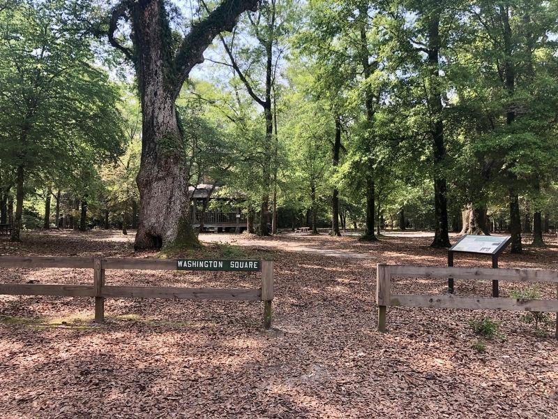
The Town of Blakeley Marker at Washington Square.
| 1 ► Alabama, Baldwin County, Blakeley — The Town of Blakeley — |
| On Franklin Street, 0.1 miles north of Washington Avenue, on the left when traveling north. | |||
| 2 ► Alabama, Baldwin County, Gulf Shores — Post Hospital Complex — |
| Near Fort Morgan Road (Alabama Route 180) 1.2 miles west of Dune Road, on the right when traveling west. | |||
| 3 ► Alabama, Baldwin County, Orange Beach — Perdido Pass — |
| On Perdido Beach Boulevard (Alabama Route 182) east of Parkway Drive, on the right when traveling east. | |||
| 4 ► Alabama, Barbour County, Eufaula — Fire Bell from B. Young Fire Company — |
| On East Broad Street at North Randolph Avenue, on the right when traveling west on East Broad Street. | |||
| 5 ► Alabama, Bibb County, Brent — Proven by Tempest: City of Brent — Founded in 1898, Forever Changed on May 27, 1973 — |
| On Main Street (Alabama Route 25) at 1st Street, on the right when traveling south on Main Street. | |||
| 6 ► Alabama, Cherokee County, Leesburg — Tennessee, Alabama & Georgia Railway — |
| On Blue Pond Road (State Highway 273) at County Road 365, on the right when traveling south on Blue Pond Road. | |||
| 7 ► Alabama, Clarke County, Thomasville — Thomasville's Early History — |
| On Wilson Avenue at Nicol Avenue, on the left when traveling west on Wilson Avenue. | |||
| 8 ► Alabama, Colbert County, Tuscumbia — Judge Charles Womble — (1818-1876) — |
| On North Water Street at West 4th Street, on the left when traveling north on North Water Street. | |||
| 9 ► Alabama, Cullman County, Cullman — Bent But Not Broken — |
| Near Lee Avenue SW near Broadway Ave SW. | |||
| 10 ► Alabama, Elmore County, Wetumpka — High Water Mark — 57 Feet 11 Inches — (12 Feet 11 Inches Above Flood Stage) — |
| On Orline Street, 0.1 miles south of Hill Street, on the right when traveling south. | |||
| 11 ► Alabama, Elmore County, Wetumpka — Wetumpka Impact Crater — |
| On U.S. 231 at East South Boundary Street, on the right when traveling west on U.S. 231. | |||
| 12 ► Alabama, Etowah County, Rainbow City — Old Harmony Cemetery — |
| On Rainbow Drive (U.S. 411) east of Peteet Street, on the right when traveling east. | |||
| 13 ► Alabama, Franklin County, Russellville — Ascension — |
| On U.S. 43 at Village Wood Drive SE, on the right when traveling north on U.S. 43. | |||
| 14 ► Alabama, Houston County, Cowarts — Cowarts Baptist Church / Cowarts School — |
| On Jordon Street, on the right when traveling west. | |||
| 15 ► Alabama, Jackson County, Stevenson — Flight 800 Memorial — |
| On Kentucky Avenue (Alabama Route 117) at River Road, on the right when traveling south on Kentucky Avenue. | |||
| 16 ► Alabama, Lauderdale County, Florence — Driven Up The Waters — Natchez Trace Parkway — |
| Near Natchez Trace Parkway (at milepost 328.7) west of County Route 2, on the left when traveling west. | |||
| 17 ► Alabama, Lauderdale County, Waterloo — Waterloo — Settled 1819~Incorporated 1832 — |
| 18 ► Alabama, Lawrence County, Oakville — Town of Oakville — |
| Near County Road 187 when traveling north. | |||
| 19 ► Alabama, Lee County, Auburn — Founders' Oak — |
| Near Garden Drive, 0.1 miles west of South College Street (Alabama Route 15), on the left when traveling west. | |||
| 20 ► Alabama, Limestone County, Athens — East Side of Square — |
| On South Marion Street north of West Washington Street, on the right when traveling north. | |||
| 21 ► Alabama, Limestone County, French Mill — Limestone County Tornado Memorial — |
| On Lee Highway (U.S. 72) 0.3 miles east of Mooresville Road (County Route 71), on the right when traveling west. | |||
| 22 ► Alabama, Macon County, Tuskegee Airmen National Historic Site — FIRE! — Tuskegee Airmen National Historic Site — National Park Service, U.S. Department of the Interior — |
| 23 ► Alabama, Madison County, Huntsville — Grissom • White • Chaffee — Date of Incident: January 27, 1967 • Intended Launch Date: February 21, 1967 — "Fire in the Cockpit!" — |
| Near Tranquility Base, 0.5 miles west of Old Madison Parkway NW, on the left when traveling west. | |||
| 24 ► Alabama, Marion County, Guin — City of Guin, Alabama: The Early Years / The Storms of 1974 — |
| On 11th Avenue (U.S. 43) at U.S. 278, on the right when traveling west on 11th Avenue. | |||
| 25 ► Alabama, Marshall County, Guntersville — Faith • Strength • Hope • Service — |
| On Gunter Avenue (U.S. 431) at Court Street, on the left when traveling south on Gunter Avenue. | |||
| 26 ► Alabama, Mobile County, Mobile — L'Arbre de Pau — |
| On Theatre Street at South Royal Street, on the right when traveling west on Theatre Street. | |||
| 27 ► Alabama, Mobile County, Mobile — Protestant Children's Home — |
| On Dauphin Street, 0.1 miles east of Common Street, on the right when traveling east. | |||
| 28 ► Alabama, Mobile County, Mobile — The Little Colt — Little Colt of Córdoba — (Potro de Córdoba) — |
| Near South Franklin Street south of Government Street (U.S. 90), on the left when traveling north. | |||
| 29 ► Alabama, Montgomery County, Montgomery — Augusta and the Old Augusta Cemetery — Circa 1819 — |
| On Wares Ferry Road (County Route 64) 0.4 miles east of Dozier Road, on the left when traveling east. | |||
| 30 ► Alabama, Montgomery County, Montgomery — Old Elam Baptist Church — |
| On Cong W L Dickinson Drive (County Road 21) north of Gunter Park Drive, on the right when traveling north. | |||
| 31 ► Alabama, Morgan County, Decatur — Old Decatur Historic District / Old State Bank — |
| On Bank Street NE at Church Street NE on Bank Street NE. | |||
| 32 ► Alabama, Morgan County, Vinemont — The "Katy-Did" Crash — |
| On University of North Alabama Highway (Alabama Route 157 at milepost 19), 0.4 miles south of State Crusher Road, on the right when traveling north. | |||
| 33 ► Alabama, Perry County, Marion — South College Barracks Fire of 1924 — |
| Near Washington Street south of Wilkerson Street. | |||
| 34 ► Alabama, Shelby County, Helena — Harmony Graveyard — Shelby County — |
| On Helena Road (County Road 261) at Cemetery Circle, on the right when traveling north on Helena Road. | |||
| 35 ► Alabama, Shelby County, Helena — Helena Freight House & Depot — |
| On Lake Davidson Lane at Helena Road (Alabama Road 261), on the right when traveling west on Lake Davidson Lane. | |||
| 36 ► Alabama, Shelby County, Helena — Helena, Alabama — |
| On Helena Road (State Road 261) at 1st Avenue East, on the right when traveling north on Helena Road. | |||
| 37 ► Alabama, Tallapoosa County, Alexander City — First Presbyterian Church — |
| On Main Street at Tallapoosa Street, on the right when traveling east on Main Street. | |||
| 38 ► Alabama, Tuscaloosa County, Tuscaloosa — April 2011 Tornado Outbreak — City of Tuscaloosa — |
| Near 7th Street at 22nd Avenue, on the right when traveling west. | |||
| 39 ► Alaska, Anchorage — 1964 Earthquake — |
| On Steward Highway. | |||
| 40 ► Alaska, Anchorage — Measuring the Magnitude of Damage — |
| On West Northern Lights Boulevard. | |||
| 41 ► Alaska, Anchorage — The Earth Did Quake — |
| On West Northern Lights Boulevard. | |||
| 42 ► Alaska, Anchorage — Tsunami! — |
| 43 ► Alaska, Anchorage — Turnagain Heights Slide — |
| 44 ► Alaska, Juneau Borough, Juneau, Downtown Juneau — Cape Saint Elias — |
| Near Marine Way. | |||
| 45 ► Alaska, Juneau Borough, Juneau, Downtown Juneau — Cape Sarichef & Scotch Cap — |
| Near Marine Way. | |||
| 46 ► Alaska, Juneau Borough, Juneau, Downtown Juneau — Eldred Rock — |
| Near Marine Way. | |||
| 47 ► Alaska, Juneau Borough, Juneau, Downtown Juneau — Five Finger — |
| Near Marine Way. | |||
| 48 ► Alaska, Juneau Borough, Juneau, Downtown Juneau — Juneau Remembers: — Sea & Sky: Juneau's Links to the World — |
| Near Marine Way. | |||
| 49 ► Alaska, Juneau Borough, Juneau, Downtown Juneau — Sentinel Island — |
| Near Marine Way. | |||
| 50 ► Alaska, Juneau Borough, Juneau, Downtown Juneau — USS Juneau (CL-52) Memorial — 'Lest We Forget' — |
| On The 'Sea Walk' at the Cruise Ship Landing Pier west of South Franklin Street. | |||
| 51 ► Alaska, Ketchikan Gateway Borough, Ketchikan — Trials by Fire — Frontier, flames and fortitude — |
| On Front Street at Spruce Mill Way, on the right when traveling south on Front Street. | |||
| 52 ► Alaska, Sitka Borough, Sitka — St. Michael's Russian Orthodox Cathedral — |
| On Lincoln Street, on the left when traveling east. | |||
| 53 ► Arizona, Apache County, St. Johns — Lyman Dam — On The Colorado River — |
| On U.S. 191 at Arizona Route 81, on the right when traveling north on U.S. 191. | |||
| 54 ► Arizona, Coconino County, Flagstaff — 1956 Plane Crash Mass Grave and Memorial — |
| Near South San Francisco Street when traveling east. | |||
| 55 ► Arizona, Coconino County, Grand Canyon National Park — 1956 Grand Canyon TWA-United Airlines Aviation Accident Site — |
| Near Desert View Road, 0.5 miles north of Desert View Drive. | |||
| 56 ► Arizona, Coconino County, Grand Canyon Village — Tragedy Remembered — TWA-United Airlines Accident — Grand Canyon — |
| Near Desert View Drive (Arizona Route 64) 21.4 miles east of South Entrance Road, on the left when traveling east. | |||
| 57 ► Arizona, Coconino County, Marble Canyon — Lewis Nez — |
| Near U.S. 89A at milepost 537, on the right when traveling west. | |||
| 58 ► Arizona, Coconino County, North Rim — Grand Canyon Lodge — Grand Canyon National Park — |
| Near Grand Canyon Highway (Arizona Route 67) 43 miles south of U.S. 89A. | |||
| 59 ► Arizona, Coconino County, North Rim — Grand Canyon Lodge, A Legacy Rebuilt — Grand Canyon National Park — |
| Near Grand Canyon Highway (Arizona Route 67) 43 miles south of U.S. 89A, on the left when traveling south. | |||
| 60 ► Arizona, Coconino County, Sunset Crater Volcano National Monument — Changes to Come — |
| 61 ► Arizona, Coconino County, Walnut Canyon National Monument — A Time of Change — |
| 62 ► Arizona, Gila County, Globe — Globe Mine Rescue Station — |
| On North Broad Street, on the right when traveling south. | |||
| 63 ► Arizona, Gila County, Payson — The Dude Fire — |
| On Fire Control Road or "Control Road" (Route NF 64) 13.8 miles east of Arizona Route 260, on the left when traveling east. | |||
| 64 ► Arizona, Gila County, Payson — The Great 1970 Rim Country Flood Disaster — |
| On West Main Street. | |||
| 65 ► Arizona, Gila County, Payson — These Trees Planted in Memory of the Firefighters Who Died in the Dude Fire June 26, 1990 — |
| On Myrtle Point Trail, 0 miles north of NF 431, on the left. | |||
| 66 ► Arizona, Navajo County, Lakeside — Rodeo-Chediski Fire — June 18th 2002 – July 7 2002 — |
| On White Mountain Boulevard (Arizona Route 260) at Woodland Road, on the right when traveling west on White Mountain Boulevard. | |||
| 67 ► Arizona, Pima County, Summerhaven — Lemmon Rock Lookout Tower — Coronado National Forest — |
| 68 ► Arizona, Pinal County, Florence — Bear Down — |
| On Arizona Route 79, on the left when traveling north. | |||
| 69 ► Arizona, Santa Cruz County, Madera Canyon — Boy Scout Memorial — |
| Near Madera Canyon Road. | |||
| 70 ► Arizona, Yavapai County, Prescott — Our Creeks are Alive! — |
| On South Cortez Street just north of West Goodwin Street, on the left when traveling north. | |||
| 71 ► Arizona, Yavapai County, Prescott — Prescott — |
| On S. Montezuma Street (Arizona Route 89) near W. Gurley St and S. Montezuma St., on the left when traveling south. | |||
| 72 ► Arizona, Yuma County, Yuma — Yuma East Wetlands — The Colorado River Before the Dams — |
| Near Prison Hill Road, 0.5 miles north of Harold C. Giss Parkway. | |||
| 73 ► Arizona, Yuma County, Yuma — Yuma Territorial Prison — Yuma Territorial Prison State Historic Park — |
| Near Prison Hill Road, 0.5 miles north of Harold C. Giss Parkway. | |||
| 74 ► Arkansas, Arkansas County, Bayou Meto — 17 — Bayou Meto Schoolhouse — |
| On State Highway 276 just east of Lumsden Road, on the left when traveling east. | |||
| 75 ► Arkansas, Arkansas County, St. Charles — St. Charles Battle Monument — |
| On West Broadway Avenue at Arkansas Street, in the median on West Broadway Avenue. | |||
| 76 ► Arkansas, Benton County, Bella Vista — The Terrible Cost of World War II — |
| 77 ► Arkansas, Benton County, Bella Vista — War on Terrorism — |
| 78 ► Arkansas, Benton County, Lowell — Original Site of Bloomington (Mudtown) Arkansas — |
| On Jackson Place at McClure Avenue (Route 923), on the left when traveling north on Jackson Place. | |||
| 79 ► Arkansas, Boone County, Harrison — C-21 — Boone County Caravan Spring — |
| On State Highway 7, 0.3 miles north of Doe Run Lane West, on the right when traveling north. | |||
| 80 ► Arkansas, Boone County, Harrison — Mountain Meadows Massacre – The Attack — |
| On North Main Street (Business U.S. 65) at West Rush Avenue, on the right when traveling south on North Main Street. | |||
| 81 ► Arkansas, Boone County, Harrison — Mountain Meadows Massacre – The Journey — |
| On North Main Street (Business U.S. 65) at West Rush Avenue, on the right when traveling south on North Main Street. | |||
| 82 ► Arkansas, Boone County, Harrison — Mountain Meadows Massacre – The Victims — |
| On North Main Street (Business U.S. 65) at West Rush Avenue, on the right when traveling south on North Main Street. | |||
| 83 ► Arkansas, Boone County, Harrison — The First National Bank of Berryville — |
| On North Walnut Street at East Rush Avenue, on the right when traveling north on North Walnut Street. | |||
| 84 ► Arkansas, Carroll County, Alpena — The Mountain Meadows Massacre — |
| On County Road 912, 0.1 miles north of U.S. 412, on the right when traveling north. | |||
| 85 ► Arkansas, Clark County, Arkadelphia — Hollywood Methodist Church — |
| On State Highway 26, 0.1 miles east of State Highway 53, on the right when traveling west. | |||
| 86 ► Arkansas, Crittenden County, Marion — Rhodes Storefronts — Circa 1925 — Courthouse Square Walking Trail — |
| On Court Street north of East Military Road, on the left when traveling north. | |||
| 87 ► Arkansas, Crittenden County, Marion — 62 — The Sultana Tragedy — |
| Near Arkansas Route 77 north of East Military Road, on the right when traveling south. | |||
| 88 ► Arkansas, Crittenden County, Marion — The Loss of the Sultana — |
| Near Arkansas Route 77 north of Military Road, on the right when traveling south. | |||
| 89 ► Arkansas, Crittenden County, Marion — The Sinking of the Sultana — The Worst Maritime Disaster In United States History — |
| On East Military Road at Sycamore Street, on the right when traveling north on East Military Road. | |||
| 90 ► Arkansas, Cross County, Parkin — The Flood of 1912 — |
| On Wilson Street at Lake Street, on the left when traveling south on Wilson Street. | |||
| 91 ► Arkansas, Desha County, Kelso — Old Town of Napoleon — → — |
| On Arkansas Route 1, 0.1 miles south of Arkansas Route 138. | |||
| 92 ► Arkansas, Faulkner County, Conway — Cherokee Memorial — |
| Near State Highway 319, 1.7 miles west of Old Morrilton Highway (U.S. 64). | |||
| 93 ► Arkansas, Garland County, Hot Springs — Hot Springs Flood of 1923 — Hot Springs Central Avenue Historic District — |
| Near Central Avenue (Arkansas Route 7) north of Bath, on the right when traveling south. | |||
| 94 ► Arkansas, Garland County, Hot Springs — Hot Springs' Major Fires — Hot Springs Central Avenue Historic District — |
| Near Central Avenue (Arkansas Route 7) south of Mountain Street, on the right when traveling south. | |||
| 95 ► Arkansas, Grant County, Sheridan — American Legion B-17 Veterans Memorial Park — |
| On Grant 51 ( County Rd. 51), 2 miles east of State Road 35, on the right when traveling east. | |||
| 96 ► Arkansas, Lincoln County, Gould, Auburn Township — 14 — South Bend Plantation — |
| On Drake Road, 2.5 miles east of County Route 62, on the left when traveling east. | |||
| 97 ► Arkansas, Mississippi County, Etowah — Joseph Allen Sisco — |
| On Route 140 east of Arkansas Route 136, on the left when traveling east. | |||
| 98 ► Arkansas, Monroe County, Clarendon — Clarendon — |
| On U.S. 79, 0.3 miles west of State Highway 86, on the right when traveling west. | |||
| 99 ► Arkansas, Ouachita County, Camden — AF 45-35160 — World War II — They lived as they died, for their country — |
| On Ouachita Road 64 east of Arkansas Highway 7, on the left when traveling east. | |||
| 100 ► Arkansas, Phillips County, Helena — Does the river ever flood? — |
| On Elm Street. | |||
3153 entries matched your criteria. The first 100 are listed above. Next 100 ⊳