Near Gateway Road, 0.7 miles north of Prairie Parkway (East 64th Avenue), on the left when traveling east.
Early Years of Statehood
In the early years of statehood, silver strikes at Leadville and Aspen brought settlers and money into Colorado. Rail lines, smelters, and refineries were built, and large coalfields were opened up.
The High . . . — — Map (db m119387) HM
Near Gateway Road, 0.7 miles north of Prairie Parkway (East 64th Avenue), on the left when traveling east.
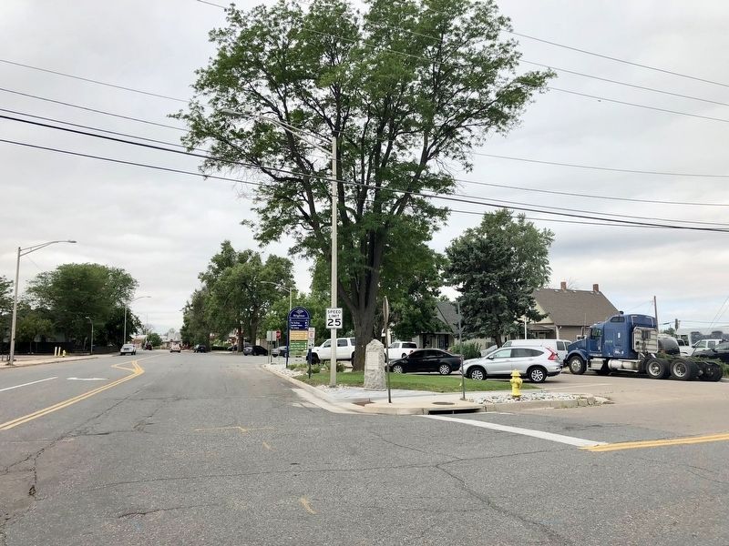
Commerce City
Commerce City was incorporated as Commerce Town in 1952 and became Commerce City in 1970. In 2004 the Prairie Gateway, a 917-acre parcel of land located along the western edge of the Rocky Mountain Arsenal National Wildlife . . . — — Map (db m119381) HM
The first U.S. citizen known to have seen the site of present-day Alamosa, Lt. Zebulon M. Pike, was arrested nearby in 1807 for trespassing on Spanish soil. But the Spanish were trespassers themselves—the Utes occupied the land. The . . . — — Map (db m160914) HM
[Map captions, clockwise from top right, read]
• Penitente Canyon [informational]
• Great Sand Dunes National Park [informational]
• Stations of the Cross Shrine [informational]
• The Fort Garland Museum is a restored . . . — — Map (db m160927) HM
On State Avenue at the railroad tracks, on the right when traveling north on State Avenue.
This monument is placed here to preserve the important history of the start of the whole San Luis Valley, by the Denver and Rio Grande Railroad's entrance to Alamosa.
The work train arrived in Alamosa in late 1877, and the first passenger train . . . — — Map (db m160877) HM
On Denver Avenue/Broadway Avenue (U.S. 160) at 4th Street, on the left when traveling north on Denver Avenue/Broadway Avenue.
Colorado's first home railroad was begun in 1871. William J. Palmer, Civil War veteran and founder of the Denver and Rio Grande, felt that transportation was the key to success in this new, undeveloped land.
"Narrow gauge" railroad was a new . . . — — Map (db m160929) HM
On Denver Avenue/Broadway Avenue (U.S. 160) at 4th Street, on the left when traveling north on Denver Avenue/Broadway Avenue.
Emblematic of the courage, fortitude, and vision of those stalwart pioneers and valiant railroad builders who foresaw a great future in the Southwest, this monument is installed to guide the way for posterity in this mighty empire.
On State Highway 150, 0.2 miles north of U.S. 160, on the right when traveling north.
You have entered the land of the Río Bravo del Norte, the northernmost outpost of sixteenth century Spain. To the Spanish people, the San Luis Valley was a wild and unexplored place known only to the Native people. Amidst the beauty and towering . . . — — Map (db m71878) HM
On Lane 6N east of State Highway 17, on the left when traveling east.
In an attempt to settle unknown territory, the Mexican government offered a large gift of land, la merced, for anyone brave enough to attempt to settle the San Luis Valley. Mexican land grants made it possible for even a poor man to . . . — — Map (db m160677) HM
On Lane 6N east of State Highway 17, on the left when traveling east.
You have entered the land of the Río Bravo del Norte, the northernmost outpost of sixteenth century Spain. To the Spanish people, the San Luis Valley was a wild and unexplored place known only to the Native people. Amidst the beauty and towering . . . — — Map (db m160674) HM
On State Highway 150, 11.4 miles north of U.S. 160, on the left when traveling north.
29th January. Thursday. Finding the distance too great to attempt crossing immediately to the river, in a direct line, we marched obliquely to a copse of woods, which made down a considerable distance from the mountains. Distance 17 miles. Saw . . . — — Map (db m145393) HM
On Lane 6N east of State Highway 17, on the left when traveling east.
¡Bienvenidos! Caminantes!
Come! Take a walk with us. We know an old song, El Caminante, which tells of taking a long walk along the ancient roads. Like the first prehistoric inhabitants, you too are a ‘caminante’, or one who walks upon . . . — — Map (db m160668) HM
On Lane 6N east of State Highway 17, on the left when traveling east.
Ready or not, with the Treaty of Guadalupe Hidalgo in 1848, Hispano settlers (pobladores) of the San Luis Valley became Americans overnight. The pobladores of the large land grants were legally granted citizenship of the United . . . — — Map (db m160679) HM
High-Five Plains Towns
Watkins, Bennett, Strasburg, Byers, Peoria, Deer Trail, Agate, Godfrey, Cedar Point, Riverbend—most of these Colorado high plains towns were founded around the time when the Kansas Pacific Railroad arrived in . . . — — Map (db m70522) HM
Alfred Packer was born on January 21, 1842, in Allegheny County, Pennsylvania. He served in the Union Army during the Civil War and was discharged in June 1863 for epilepsy. Packer traveled to the Rockies and worked for the mines for 9 years. In . . . — — Map (db m182105) HM
Near South Prince Street south of West Alamo Avenue, on the left when traveling south.
The first railroad to reach present-day Littleton was the Denver & Rio Grande on October 28, 1871. The line was being built by William Jackson Palmer to connect Denver to the resort community he had just founded, Colorado Springs. Richard Little's . . . — — Map (db m177545) HM
On South Rapp Street at West Littleton Boulevard, on the right when traveling south on South Rapp Street.
One of the earliest buildings in Littleton was the J. D. Hill General Store. Julius D. Hill, known as J.D., was born in Massachusetts in 1843 and served in the Union Army during the Civil War. Hill came to Littleton in 1870 and was employed by the . . . — — Map (db m177629) HM
Near South Prince Street south of West Alamo Avenue, on the left when traveling south.
At various points in its history, the Rough and Ready Mill churned out flour, lumber, and livestock feed. But the end product was always the same: growth for Littleton. Built in 1867 by pioneers Richard Little, Joseph Bowles, and John Lilley, among . . . — — Map (db m177558) HM
Near South Prince Street south of West Alamo Avenue, on the left when traveling south.
Colorado CannibalAside from his conviction for cannibalism, Alfred Packer was a fairly commonplace frontier character: He came West to find his fortune but found trouble instead. Packer, like most, brought his woes upon himself. A . . . — — Map (db m177559) HM
On South Rapp Street at West Littleton Boulevard, on the right when traveling south on South Rapp Street.
The Weston Lodge Number 22 of the Ancient Free and Accepted Masons was organized in Littleton in 1872. It was named for Allyn Weston, a Harvard graduate who had published a Masonic magazine in Detroit before moving to Colorado in 1860 to practice . . . — — Map (db m177636) HM
Pagosa Springs has a rich history, beginning with the Anasazi Indians. Later the Utes, Navajos and Apaches inhabited this beautiful corner of the Southwest. They also visited the great “Pagosah” hot springs which they believed had . . . — — Map (db m27527) HM
Near S. Main Street (U.S. 287) at 6th Street, on the right when traveling north.
"There really is a Place Called Baca County;
I think she’s mighty fine;
She was good enough for my dad’s kids;
Likewise she’ll do for mine;
Her sunrises are all colors;
Her sunsets are all the same;
The only thing she needs more . . . — — Map (db m106474) HM
On Colorado Route 101, 0.6 miles south of County Road 10.75, on the right when traveling north.
This tablet is the
property of the State of Colorado
—
Boggsville
Established in 1866.
Named for Thomas O. Boggs,
first settler on this site.
Home of Kit Carson and
John W. Prowers, noted . . . — — Map (db m119664) HM
Near Colorado Route 101, 1 mile south of County Road 10.75.
"...On crossing the river [Purgatoire] we found a large well-filled ranch...which had only just been built by two enterprising Yankees.:"
–William Bell, railroad surveyor, 1867
Boggsville was established in the early . . . — — Map (db m120701) HM
Near Carson Avenue (Colorado Route 101) north of 8th Street, on the right when traveling north.
This region was once buffalo hunting grounds for the Cheyenne, Apache, Arapaho, Kiowa and Comanche. Tribes followed the buffalo throughout the plains and controlled the land. During this time, everything south of the Arkansas river was Mexico and . . . — — Map (db m120709) HM
Near Colorado Route 101, 1 mile south of County Road 10.75, on the left when traveling south.
The Arkansas River Valley is a historical frontier in both the American and European sense. Americans view the frontier as unsettled or a sparsely settled area lands on the edge of "civilization." To Europeans, frontiers are boundaries or borders . . . — — Map (db m120698) HM
On West Baseline Road at Crossing Drive, on the right when traveling west on West Baseline Road.
This mural is a composite of two historical photographs. One is the 1862 image of our town's founder, Mary Miller with her husband, Lafayette, (D. 1878), for whom she named the town. Mary platted 150 acres and sank the first coal mine shaft in 1887. . . . — — Map (db m87606) HM
On Delaware Avenue, 0 miles east of South Coffman Street, on the right when traveling west.
Beginning in 1860 as one log cabin on the south bank of the St.Vrain, just west of an
old trail which in 1862 became the route of the Overland Stage (and is now U.S. 287),
Burlington in 1863 began to grow. In 1869, to the three hotels and two . . . — — Map (db m199337) HM
On U.S. 24, 1 mile east of County Highway 397, on the left when traveling east.
Native peoples traveled through the Upper Arkansas Valley for centuries before European and American explorers.
Ute, Comanche and other tribes traveled on foot until the arrival of the Spanish and the introduction of the horse in the 1600’s. . . . — — Map (db m107827) HM
On U.S. 24, 1 mile east of County Highway 397, on the left when traveling east.
With the discovery of gold in California Gulch in 1860, getting to Oro City (now Leadville) meant an opportunity for fame and fortune.
It would, however, be twenty years before railroad service traversed the Upper Arkansas . . . — — Map (db m107833) HM
On U.S. 24, 1 mile east of County Highway 397, on the left when traveling east.
In the late 1800’s, transportation of goods and people could be an arduous undertaking.
Gold and silver fever led many to endure travel up the Arkansas River from Canon City to Leadville.
Although arguably the largest and most notorious, . . . — — Map (db m107835) HM
On U.S. 285, 2 miles south of Chalk Creek Drive, on the right when traveling south.
Dominating the view to the west, the peaks of the Sawatch Range define the Continental Divide. Fifteen of the peaks in the Upper Arkansas River Valley are "fourteeners," boasting summits exceeding 14,000 feet.
Between the peaks, creeks flow . . . — — Map (db m158531) HM
On U.S. 285, 2 miles south of Chalk Creek Drive, on the right when traveling south.
Agriculture in the Upper Arkansas Valley was initially developed to meet the demand of area mining camps. The flood of fortune-seekers created a market for meat, flour, vegetables, and other foods.
French immigrant Frank Mayol, credited . . . — — Map (db m158536) HM
On U.S. 285, 2 miles south of Chalk Creek Drive, on the right when traveling south.
As trappers, miners, and settlers migrated west they encountered an arid environment. Early explorers referred to the West as the Great American Desert and many believed it could not be settled. Unlike the wetter eastern United States, . . . — — Map (db m158541) HM
The Jackson Hotel was built in 1878 by Henry A. Jackson who left his home in Kentucky looking for a place where his family could escape the turmoil of post-Civil War reconstruction. A former Memphis steamboat captain, Jackson found himself high and . . . — — Map (db m117048) HM
On U.S. 285, 5 miles north of U.S. 50, on the left when traveling north.
Frustrated in their attempt to climb Pike’s Peak on November 27, 1806, Zebulon Pike and his party of 15 trudged on through South Park looking for the Red River, southern boundary of the Louisiana Purchase. After crossing Trout Creek Pass, the . . . — — Map (db m127876) HM
Marker A:Finding Our Roots Following ancient paths The history of Chaffee County as part of the United States began in 1803, with the purchase of the Louisiana Territory from France. But human history was established here centuries . . . — — Map (db m116085) HM
On U.S. 287 at milepost 130, on the right when traveling west.
Named for the great western scout, guide, trapper, and Indian fighter. Located on famous trails – at the junction of the Smoky Hill stagecoach route and the Texas – Montana, Potter and Bacon, and Chisum cattle trails. On the old Kansas . . . — — Map (db m88444) HM
On State Highway 59 south of County Route CC, on the right when traveling south.
The Texas-Montana, Bacon and Potter, and J.S. Chisum trails converged in this vicinity. Over these routes great herds of Texas Longhorns, scions of hardy stock from Spain, moved northward. Big Springs, 2.4 miles west, was an important cattle . . . — — Map (db m87888) HM
On Rose Street, 0.1 miles south of Sixth Street, on the left when traveling south.
The Griffith Lode (2,500 ft. N.E.), later a silver producer, was discovered June 17, 1859, by George W. Griffith, for whom Georgetown was named. Town site claimed June 29, 1860. The Belmont Lode (5.7 miles S.W.), first important silver discovery in . . . — — Map (db m173244) HM
On Argentine Street south of 4th Street, on the left when traveling south.
Thomas Cornish built this elaborate home that combines a French Mansard roof with
Italianate and Gothic Revival detailing. It is one of the last homes in Georgetown to display such exuberance in Victorian architectural styles.
Cornish came to . . . — — Map (db m152842) HM
On Sixth Street at Taos Street, on the right when traveling west on Sixth Street.
In the fall of 1872, William Cushman was busily erecting two fine brick buildings, one on either side of his bank building. This one, on the west, had its roof completed as workers laid the foundation for the other one. Undoubtedly Cushman leased . . . — — Map (db m173241) HM
On Sixth Street at Taos Street, on the right when traveling west on Sixth Street.
William H. Cushman built this imposing brick Italianate commercial building in two phases. He completed the western part as a two-story structure in 1872. Three years later, Cushman built an adjoining three-story edifice on the corner lot; he . . . — — Map (db m173242) HM
On Sixth Street at Rose Street, on the right when traveling west on Sixth Street.
Charles R. Fish, a local banker, built this fine structure for his Bank of Clear Creek County. Today the Fish Block is one of the more prominent and substantial brick commercial buildings in town. It is similar in design, though less elaborate in . . . — — Map (db m173243) HM
On Sixth Street just west of Taos Street, on the right when traveling east.
Brothers James F. and Alfred C. Tucker conducted their grocery and provisions business out of this building during the 1870s. They advertised “Wines, Liquors, Tobacco, Queens-ware, Clothing, Boots and Shoes.” Here a customer in 1879 . . . — — Map (db m173240) HM
On County Road 24, 0.8 miles south of County Road Y, on the right when traveling east.
Near here, on the banks of the Conejos River, Zebulon M. Pike built a log stockade in early February, 1807, and for the first time raised an American flag over what is now Colorado. Pike's trek of 1806-07 was the second official United States . . . — — Map (db m22701) HM
On State Highway 159, 0.2 miles south of U.S. 160, on the left when traveling north. Reported permanently removed.
This memorial is the
Property of the State of Colorado
———
Fort Garland
United States military outpost
to protect settlers from
hostile Indians. Named for
Brig. Gen. John Garland . . . — — Map (db m22731) HM
On Broadway at State Route 96, on the right when traveling north on Broadway.
Times of Thriving, Times of Striving
Fertile soil and plenty of irrigation water
set the stage for farms that thrived for
forty years, beginning in 1919. The area
around Crowley was bursting with
orchards, vegetable farms, an . . . — — Map (db m119634) HM
On Colorado Route 96 at Broadway, on the right when traveling west on State Route 96.
Crowley Communities
If the dry summers of the late 1920s spelled trouble for Crowley County, the Dust Bowl of the 1930s spelled disaster. Many farmers simply packed up and left, and their acreage reverted to grasslands and became cattle . . . — — Map (db m120745) HM
On Colorado 96, 0.4 miles west of County Road 387, on the right when traveling west.
In 1844. Mathew Kinkead established the first American-owned cattle ranch tn the Rocky Mountains at the junction of the North and South Hardscrabble Creeks.
Even before Kinkead settled at the mouth of Hardscrabble Canyon, the canyon had been an . . . — — Map (db m153187) HM
On Colorado Route 69, 0.7 miles south of Verdemont Road (County Road 182), on the right when traveling south.
Mining and Ranching
For a time, the Wet Mountain Valley appeared destined for mining glory. Silver strikes at Rosita (about fifteen miles southeast of here) in 1872, Querida (about twelve miles southeast) in 1877, and Silver Cliff (six . . . — — Map (db m120228) HM
On Colorado 67 (at milepost 2) at County Road 19C, on the right when traveling south on Colorado 67. Reported unreadable.
The long battle between colonial Spain and the Comanche people climaxed in 1779, when Juan Batista de Anza's army killed the great chief Cuerno Verde (Green Horn) southeast of here at the foot of Greenhorn Mountain. De Anza, the governor of New . . . — — Map (db m219465) HM
On Colorado 67 (at milepost 2) at County Road 19C, on the right when traveling south on Colorado 67.
Much of this area's early history occurred on nearby trading posts and settlements, which lived and died leaving little trace of their existence. Such was the post built one mile west by Maurice Leduc in the 1830's and the village of Hardscrabble . . . — — Map (db m153183) HM
On Colorado 67 (at milepost 2) at County Road 19C, on the right when traveling south on Colorado 67. Reported unreadable.
Alexander Barclay
Like so many early Colorado settlers, Alexander Barclay came here in search of fortune but found something else entirely. The British-born corset-maker arrived in 1836 and spent the next nineteen years chasing his dream. He . . . — — Map (db m154830) HM
On Blake Street at 14th Court, on the left when traveling west on Blake Street.
This tablet is the property of the State of Colorado ——— Immediately north-east of this point and covering much of Block 18 East Denver stood the famous Elephant Corral camp ground, immigrant headquarters and stock . . . — — Map (db m203481) HM
On Auraria Parkway at 12th Street, on the right when traveling east on Auraria Parkway.
Auraria is the site of the first informal gathering of Freemasons in what is now Colorado in Fall of 1858 and the first regular communication of Freemasons in the Territory of Colo. on October 1, 1859. These Freemasons were gold seekers. The search . . . — — Map (db m203471) HM
The Auraria higher education center is located on the site of Denver’s oldest continuously occupied settlement. In 1858, William Green Russell and his brothers found gold nearby and established this pioneer town of Auraria, which merged with Denver . . . — — Map (db m51708) HM
On 20th Street at Blake Street, on the right when traveling south on 20th Street. Reported permanently removed.
During the 1860's, the first Chinese settled in Colorado, drawn here by the completion of the transcontinental railroad as well as by other demands for cheap manual labor. Existing amidst persecution, poverty and wretched living conditions, the . . . — — Map (db m96238) HM
On 15th Street at Wazee Street, on the left when traveling north on 15th Street.
At the very heart of Denver’s rough beginnings, Fifteenth Street actually followed the old military trails from Santa Fe, Fort Union and trading posts north and south of Denver. It was here that General Larimer expropriated the one . . . — — Map (db m118601) HM
On 16th Street at Market Street on 16th Street. Reported missing.
In the 1860’s, when gold from Colorado’s grubstakes began flowing into Denver at a mad pace, the costly and risky problem of shipping it to banks back East was neatly solved by Clark, Gruber and Co. In a building near this site, the banking firm . . . — — Map (db m51712) HM
On Blake Street at 14th Street, on the right when traveling south on Blake Street.
The area known today as Lower Downtown, is the Location of the original town of Denver. Gold seekers from Lawrence, Kansas staked the first claim in September of 1858, under the name St. Charles Town Association, but they left only one man to . . . — — Map (db m27493) HM
On Larimer Street at 15th Street on Larimer Street.
General William H. Larimer, Jr., founder of Denver City which was established on November 22, 1858, named the city after the Governor of the Kansas Territory and the principal street after himself. Some of Denver’s first cabins were located at the . . . — — Map (db m51710) HM
The controversy surrounding this Civil War Monument has become a symbol of Coloradans' struggle to understand and take responsibility for our past. On November 29, 1864, Colorado's First and Third Cavalry, commanded by Colonel John Chivington, . . . — — Map (db m6755) HM
On Wazee Street, 0.1 miles south of Fifteenth Street, on the left when traveling west.
An ancestor to the beginnings of the National Western Stock Show, the Elephant Corral was home to prairie oxen and mountain mules, horses, and cows, but not a single elephant. In fact, the name is said to relate to a metaphor for the Gold Rush days . . . — — Map (db m199427) HM
On Wynkoop Street, 0.1 miles west of 15th Street, on the left when traveling south.
Denver's first settlement was along the confluence of the South Platte River and Cherry Creek. Arapahoe Indians named Cherry Creek for the wild chokecherries they harvested here in the fall. They respected the stream's power and warned the first . . . — — Map (db m96283) HM
Near 17th Street at Arapahoe Street, on the left when traveling south.
The legend says that Denver's early settlers, who made their camp on the banks of Cherry Creek, laughed at the Arapaho, a local Indian tribe, for making their camp inconveniently far from the water's edge.
The Arapaho warned the settlers of . . . — — Map (db m135440) HM
Near 17th Street, on the left when traveling south.
Before the founding of the City of Denver, the tribe that camped in the area called themselves “Inuna-ina" meaning, “Our people.”
This tribe was also known as “Arapaho,” the word for “trader” or “buyer” in Pawnee. Denver’s founders honored . . . — — Map (db m135442) HM
Near 17th Street at Lawrence Street, on the left when traveling south.
Unlike San Francisco, which the Spanish founded as a mission, and Salt Lake City, which the Mormons started as a communal religious utopia, Denver originated as a place to make money.
From the beginning, the town aspired to be the supply hub: . . . — — Map (db m135357) HM
This tablet is the
Property of the State of Colorado
——
Here was the end of the famous Smoky Hill Trail
Immigrant and stage road extending
from the Missouri River to Denver.
Traversed by pioneers in 1858. . . . — — Map (db m4678) HM
Near 17th Street at Welton Street, on the right when traveling south.
Mr. Barney Ford (1822-1902) was a former slave who dared to venture forth in the new frontier of Colorado. He eventually settled in Denver becoming a political activist, prominent businessman and sometimes millionaire. — — Map (db m135510) HM
Near 17th Street at Tremont Place, on the left when traveling south.
Orphaned at age seven, Henry C. Brown worked on a farm in Ohio where he learned carpentry. In 1860, Brown moved to Denver and set up shop. He went on to become one of Denver’s most important early developers. He donated land for the State Capitol, . . . — — Map (db m135541) HM
On Brighton Boulevard (State Highway 265) at York Street, on the right when traveling north on Brighton Boulevard.
This memorial is the property of the State of Colorado ——— Commemorating the route of the Platte River Trail principal route of Colorado pioneers trail of Major S.H. Long in 1820 trappers’ trail of 1830s and 1840s the . . . — — Map (db m203494) HM
Near Sheridan Boulevard (Colorado Route 95) just north of West 49th Avenue, on the left when traveling north.
This tablet is the property of the State of Colorado ——— One mile north of this point Gold Was Discovered on June 22, 1850, by a party of California-bound Cherokees. The discovery was made by Louis Ralston, whose name . . . — — Map (db m203500) HM
Near West Jewell Avenue at South Huron Street, on the right when traveling west.
This tablet is the property of the State of Colorado ——— Most historical of Denver’s municipal parks. Created in 1882. This site was homesteaded in 1862 by “Potato” Clark. Jim Beckwourth, Mulatto “Daredevil”, erected a home in 1860 .6 . . . — — Map (db m203446) HM
Near West Byron Place just east of Wolff Street, on the right when traveling east.
This tablet is the property of the State of Colorado ——— On the northwest shore of Sloan’s Lake was Manhattan Beach popular amusement park of the Gay Nineties, with a theater, boating, dancing, and specialties. Opened . . . — — Map (db m203490) HM
On U.S. 491 at Guyrene Street, on the right when traveling west on U.S. 491.
Ancestral Puebloans
Beginning around A.D. 600, Ancestral Puebloans built Colorado's first permanent towns in the canyon country south of here. Hundreds of these settlements sprawled across the desert, with an overall population possibly . . . — — Map (db m160128) HM
On U.S. 491 at Guyrene Street, on the right when traveling west on U.S. 491.
The World War I veterans who claimed homesteads near here in the [illegible] had never fought an enemy quite as intractable as sagebrush. Clearing the land of it required decades of backbreaking hand-to-hand combat. But the army of farmers . . . — — Map (db m160121) HM
On U.S. 491 at Guyrene Street, on the right when traveling west on U.S. 491.
[Text blocks, counter-clockwise from top left, read]
• The Unaweep/Tabeguache Scenic and Historic Byway is a remarkable tour through western Colorado's remote canyon country. Copper, radium, vanadium, and uranium all enticed miners here; . . . — — Map (db m160155) HM
The Rico area was originally inhabited by natives including the Utes. In the 1700’s Spanish explorers were in the area. In 1833, trappers like W. Walton of the St. Louis Fur Co., came and reported remains of Spanish smelters. Mining began about . . . — — Map (db m118655) HM
On Wilcox Street at 4th Street NE & Wilcox Street, on the right when traveling west on Wilcox Street. Reported missing.
The founders of Castle Rock platted their town beneath a prominent rock outcrop of the same name in 1874, and proudly advertised it as a year-round resort, knowing the value of beautiful scenery to attract settlers and tourists. But even greater . . . — — Map (db m49803) HM
Near Enderud Boulevard, on the right when traveling west.
Founders' Founding
Frank X. Flierl and Frank Hagg were neighboring homesteaders on the southern portion of the land that would become Founders Village in the late 20th century. They, like many other residents of the Ridge Road-Lower Lake . . . — — Map (db m120794) HM
On State Highway 83, 0.1 miles south of State Highway 86, on the right when traveling south.
This tablet is the
property of the State of Colorado
——
Franktown
Named for J. Frank Gardiner, a
pioneer who settled here in 1859.
First known as "California Ranch,"
it was a way . . . — — Map (db m96174) HM
On State Highway 83 at Lost Lake Drive, on the right when traveling south on State Highway 83.
Panel 1
Russellville
For a few exciting months, Russellville felt like Colorado's gold-rush capital. The town rose five miles southeast of here in late 1858, after William Green Russell discovered a few gleaming . . . — — Map (db m97969) HM
Near East Valley Hi Drive at South Parker Road (State Highway 83).
In 1846 the unsettled area that is now Parker, Colorado, consisted of wild open plains, inhabited only by local Indian tribes and passing trappers and traders. The Crosby-Brown Company, otherwise known as the Mississippi Saints, and detachments of . . . — — Map (db m97420) HM
On East Mainstreet at South Pikes Peak Drive, on the right when traveling west on East Mainstreet.
Celebrated as Parker's "most significant early doctor,"
Dr. Walter Heath was born in 1867 and died in 1912.
In addition to serving patients in Parker,
Dr. Heath was known for making "patient house calls" via carriage and then . . . — — Map (db m97576) HM
Near East Valley Hi Drive at Parker Road (Colorado Highway 83).
In September of 1911, Fredrick B. Hood had come to Parker not only as a stock holder in the newly formed Parker State Bank, but to serve as the bank's cashier and manager as well. He purchased land on what was then called Rural Road (now Pikes Peak . . . — — Map (db m97575) HM
On South Pikes Peak Drive south of Pilgrims Place, on the right when traveling south.
In 1910, newlyweds James and Victoria Newcomb bought this property from George Parker for $150. In January of 1911 they built their first home, which is the central portion of the present house. Reputedly, it was built quickly, "up and all closed . . . — — Map (db m97972) HM
On Mainstreet at Victoria Drive, on the right when traveling east on Mainstreet.
This tablet is the
property of the State of Colorado
— —
Due West ¼ mile stood the
TWENTY MILE HOUSE
(Twenty miles from Denver)
First house built in Parker, 1864.
On the . . . — — Map (db m96176) HM
On Midland Avenue west of Midland Spur, on the right when traveling west.
Basalt was formed in the late 1800s. Settlement of the West was influenced by many factors: miners looking for precious metals; ranchers providing meat, grains and vegetables; and the railroads, which served both. Railroads became the lifelines that . . . — — Map (db m152906) HM
On Dorchester Drive west of Woodburn Street, on the right when traveling west.
This land you are standing on was already rich in history when General
William Jackson Palmer founded the City of Colorado Springs in 1871.
This land was home to American Indian people for thousands of years.
Cheyenne Creek and its majestic . . . — — Map (db m208668) HM
Soon after President Abraham Lincoln signed the Homestead Act in 1862, homesteaders moved west across the prairies and spread into the hills of Pikes Peak. In the 1870s, the Crowe family claimed 160 acres in this valley that later came to be known . . . — — Map (db m45936) HM
On Pikes Peak Avenue at South Cascade Avenue, on the right when traveling east on Pikes Peak Avenue.
The First Stake of the Fountain Colony was driven here
July 31 1871
Rededicated
NSDAR
Zebulon Pike Chapter
Kinnikinnik Chapter
August 1, 1983
D.A.R.
July 1, 1895 — — Map (db m202572) HM
On Colorado Avenue west of South 24th Street, on the right when traveling west.
Cries of "gold!" lured countless
prospectors to Colorado's Rocky
Mountains in 1859. And while
miners went bust or hit pay dirt in
South Park, Leadville and later Cripple
Creek, Colorado City supplied the
means to continue the quest. At . . . — — Map (db m201136) HM
On Colorado Avenue west of South 24th Street, on the right when traveling west.
This tablet is the
Property of the State of Colorado
———
Colorado City
Founded here in August, 1859
then in El Paso County Kansas.
So named because at the gateway
to mines thought to be on the
Colorado . . . — — Map (db m200383) HM
On South 24th Street at Colorado Avenue, on the right when traveling south on South 24th Street.
The first permanent settlement of the Pikes Peak Region.
The capital city of the Colorado Territory for four days in July 1862.
El Paso county seat for 10 years.
This location at the foot of Pikes Peak laid the foundation for the entire
Pikes . . . — — Map (db m201102) HM
On Colorado Avenue west of South 24th Street, on the right when traveling west.
The cabin came home in 1961. It
was placed in Bancroft Park, on
the site of the playground for the
old Bancroft School, in the 2400
block of West Colorado Avenue. The
school was named for prolific
nineteenth-century Western History
writer . . . — — Map (db m201144) HM
This monument erected in memory of those unsung pioneers who helped build the Pikes Peak Region, the infants born to pioneer families of this area, and those later residents, both known and unknown, who came to this final resting place: Blocks 20, . . . — — Map (db m19080) HM
320 entries matched your criteria. The first 100 are listed above. Next 100 ⊳