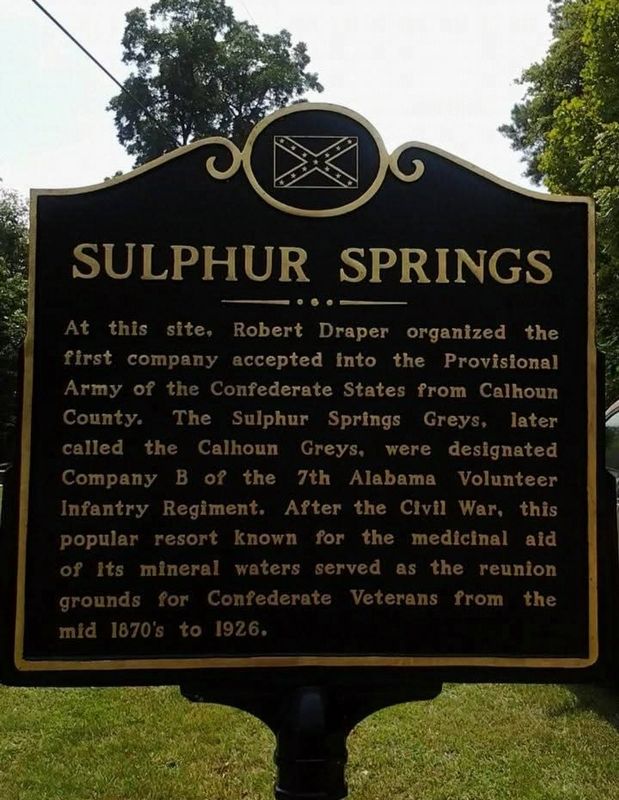
On Ranch Road 0.1 miles east of Old Sulphur Springs Road, on the left when traveling south.
At this site, Robert Draper organized the first company accepted into the Provisional Army of the Confederate States from Calhoun County. The Sulphur Springs Greys, later the Calhoun Greys, were designated Company B of the 7th Alabama Volunteer . . . — — Map (db m271705) HM
Near Mountain Street Northwest west of Woodward Avenue Northwest.
The Depot was constructed in 1860 by the Selma, Rome and Dalton (GA) Railroad. It was used as a transfer and storage point for Confederate troops and materials during the War Between the States. — — Map (db m36443) HM
On Pelham Road (State Highway 21) at 5th Street NE, on the right when traveling north on Pelham Road.
Prominent citizen of Jacksonville who served Alabama as Brigadier General, State Militia; member Legislature and Pres. of Senate; Circuit Court Judge; and Pres. Ala. and Tenn. Railroad
He owned extensive cotton plantations and mining interests . . . — — Map (db m29921) HM
On Ladiga Street Southwest at Gayle Ave SW, on the right when traveling east on Ladiga Street Southwest.
This Arkansas congressman and General had lived here (1833-1844).
Veteran of War with Mexico.
Elected to U.S. Congress in 1858 and 1860.
Served in Trans-Mississippi Dept. C.S.A as Brigadier General 1861-1862 served with Army of Tennessee . . . — — Map (db m267232) HM
On Public Square East (State Highway 21) south of Clinton Street Southeast, on the left when traveling north.
Brigadier General C.S.A.
With Army of Virginia 1861-1865.
Wounded in battle five times.
He was one of four distinguished sons
of Jacob Forney and Sabina Swope Hoke
of Jacksonville who held commissions
in the Confederate Army.
. . . — — Map (db m36480) HM
On Janney Road 0.1 miles east of Spring Road, on the left when traveling east.
The furnace was constructed by Montgomery businessman Alfred A. Janney, reportedly using slaves brought from Tennessee by a "Dr. Smith." The furnace was completed and ready to produce pig iron when, on July 14, 1864, a Union cavalry raiding force of . . . — — Map (db m25544) HM
On Main Street at East Oak Street, on the right when traveling north on Main Street.
First incorporated as a town, February 7, 1852, in Benton County, Oxford's second incorporation was approved February 21, 1860 in Calhoun County. Long before this territory was “settled”, it was inhabited by Creek Indians. In the time . . . — — Map (db m106589) HM
Near Recreation Drive east of Mc Cullars Lane, on the right when traveling east.
Great citizen, eminent lawyer, valiant soldier, renowned statesman, diplomat, Christian gentleman. Near this spot, 1862, he mustered into service 51 Ala. Regt. Cavalry, Army Confederate States of America. Ala. U.S. Senator, 1877 until his death. . . . — — Map (db m217250) WM
On Main Street south of East Oak Street, on the right when traveling north.
The town of Oxford was first incorporated by the Alabama legislature in 1852. The original boundaries included a one square mile area enlarged in 1860. Oxford became active as a cotton and trading center but during the Civil War growth slowed, and . . . — — Map (db m106591) HM
On Southeast Avenue A (County Route 50) 0.1 miles east of Southeast 3rd Street, on the right when traveling east.
LaFayette Cemetery, also known as Westview, began in 1934 with the death of Miss Sarah Gipson. Many early pioneers and veterans of East Alabama are buried here including Revolutionary War Patriot Capt. Alexander Dunn, Col. Charles McLemore, . . . — — Map (db m83263) HM
The Confederate States of America in 1862 commissioned the Noble Brothers of Rome, Georgia to erect a cold blast furnace to produce needed pig iron for the war effort.
The skilled labor was detailed from Confederate army personnel. It is . . . — — Map (db m83267) HM
On County Road 251 0.1 miles north of County Road 714, on the left when traveling north.
Built in late 1862 by the Noble brothers, Cornwall Furnace was named for a similar blast iron furnace in James Noble's home state of Pennsylvania. The pig iron ingots produced from this facility were taken to the Noble Foundry in Rome where they . . . — — Map (db m156264) HM
On County Road 251 0.1 miles north of County Road 714, on the right when traveling north.
The furnace was constructed 1862-1863 by the Nobles Brothers Foundry from Rome, GA using financing from the Confederate States of America. Slave labor was used to dig a half mile canal upstream to the Chattooga River, which powered the airblast. A . . . — — Map (db m156261) HM
On Alabama Route 273 at County Route 275, on the right when traveling south on Alabama Route 273.
Gen. Hood, commanding the Dept. of Tennessee and Georgia for the Confederate Army, made his headquarters in this house on Oct. 19, 1864 on his retreat from Atlanta to Tennessee via Gadsden. His army numbered approximately 40,000 troops. — — Map (db m116615) HM
On College Street (Route 20) 0.1 miles south of South River Road, on the right when traveling north.
Final resting place of Chief Pathkiller (B. 1749 - D. 1827) who served as principal chief of the Cherokee Nation. Many prominent early settlers are also interred here including newspaper editor and publisher, Confederate infantry captain and . . . — — Map (db m114282) HM
On Riverside Lane at Canyon Drive ( Route 35), on the left when traveling west on Riverside Lane.
The river originates in Lafayette in Walker County, Georgia, flows through Chattooga County, Georgia and then enters Cherokee County before emptying into Weiss Lake. Prior to the construction of the lake, the Chattooga River converged with the Coosa . . . — — Map (db m137513) HM
Col. Charles Rattray served in the 57th Ill. Infantry. He served in Sherman's command at Gaylesville in October 1864. He fell in love with Theodora McWhorter and promised to return and marry her when the war ended. He was a man of his word. His . . . — — Map (db m202257) HM
On Canyon Drive (Alabama Route 35) at Main Street ( Route 68), on the right when traveling south on Canyon Drive.
Post Office est. in 1836. During the Civil War, the main body of U.S. General William Tecumseh Sherman's Army camped around the town in October 1864. A private home served as his headquarters. Despite pleas from citizens, his troops burned the mill . . . — — Map (db m114532) HM
On Alabama Route 273 near County Road 81, on the left when traveling north.
Cherokee County established - 1836
Area Cherokee Indians relocated - 1838
Taff Community established - 1842
Community named in honor of Taff family - 1842
Union and Confederate soldiers occupied the area - 1864
Taff post office established . . . — — Map (db m114743) HM
On Main Street (Alabama Route 68) at College Street, on the left when traveling north on Main Street.
Maj. Gen. W.T. Sherman commanding the Union Military Div. of the Mississippi at Summerville, GA., on Oct. 19, 1864 moved the Army of the Tennessee, the Army of the Ohio, and the Army of the Cumberland to Gaylesville. The Armies with attachments . . . — — Map (db m202456) HM
On U.S. 411 at John L Foster Drive (County Highway 20), on the right when traveling north on U.S. 411.
On October 23, 1864, U.S. troops under Brig. Gen. W.L. Elliot, Chief of U.S. Calvary, Dept. of the Cumberland, advanced upon Maj. Gen. Joseph Wheeler's Confederate forces positioned on King's Hill. The C.S. troop's fell back to another line of . . . — — Map (db m115399) HM
On County Route 48 0.2 miles south of County Route 600, on the left when traveling south.
(side 1)
Put into blast by noted Southern ironmaster Moses Stroup in 1852, the Round Mountain Furnace was the fourth oldest blast furnace in Alabama. It was the first furnace to make use of red fossiliferous iron ore.
Driven by steam . . . — — Map (db m139401) HM
On County Route 8 at Highway 9, on the right when traveling east on County Route 8.
On the night of May 2, 1863, John H. Wisdom passed through Spring Garden on his way to warn Rome, Ga. about approaching U.S. Troops. Wisdom, originally from Rome, Ga., lived near Gadsden which was part of Cherokee Co. at that time. Upon learning . . . — — Map (db m133475) HM
Near County Route 587 at Troy Lane, on the right when traveling south.
Last fighting between armies of Hood and Sherman. Here Ferguson turned back Kilpatrick's larger force.
These two armies had fought all summer from Chattanooga to Atlanta, west to here.
To split South, Sherman turned, led Union forces . . . — — Map (db m132782) HM
After the war broke out, wooden frame barracks were built by North and South at permanent installations such as forts, arsenals, coastal installations, and training camps. In winter, smaller barracks were constructed with available materials and man . . . — — Map (db m129426) HM
On County Road 63 0.7 miles north of State Route 143, on the left when traveling north.
On this site stood "Memorial Hall," the two story, log and shingle administrative and social center of the Alabama Confederate Soldiers' Home. Construction was partially financed by individuals from across the state who purchased "Memorial Logs" for . . . — — Map (db m129410) HM
On County Road 63 0.7 miles north of State Route 143, on the left when traveling north.
Two cedar trees were planted and dedicated at the Alabama Confederate Soldiers' Home on February 12, 1928 in memory of Mrs. Sarah H. Bellinger and 1st Lt. Robert C. Norris.
Mrs. Bellinger and her husband, Dr. Carnot Bellinger, established the . . . — — Map (db m129412) HM
On County Road 63 0.7 miles north of State Route 143, on the left when traveling north.
After the death of Jefferson Manly Falkner, Soldiers' Home founder in 1907, the Soldiers'
Home Board of Control commissioned this obelisk in his honor. The monument was erected in 1908 under the northeast corner of the veranda of Memorial Hall. . . . — — Map (db m129411) HM
On County Road 63 0.7 miles north of State Route 143, on the right when traveling north.
This is the site of Alabama's only Confederate veterans' home. The Alabama Confederate Soldiers' Home operated for 37 years as a haven for many of Alabama's destitute Confederate veterans and their wives or widows.
Twenty two buildings once . . . — — Map (db m129359) HM
On County Road 63 0.6 miles north of State Route 143, on the right when traveling north.
Completed in 1904, this is one of only three remaining sections of the original woven wire fence at the Soldiers' Home.
During the latter half of the nineteenth century woven wire and barbed wire began to replace wooden rail fences.
Woven . . . — — Map (db m129332) HM
Completed in 1904, this is one of only three remaining sections of the original woven wire fence at the Soldiers' Home.
During the latter half of the nineteenth century woven wire and barbed wire began to replace wooden rail fences.
Woven . . . — — Map (db m129425) HM
Near County Road 45 0.3 miles west of State Route 22, on the right when traveling west.
On April 1, 1865 near here the forces of Lt Gen Nathan Bedford Forrest, CSA, engaged the forces of Maj Gen James H. Wilson, USA. The 17th Indiana Infantry Regiment, led by Lt Col Frank White, made a cavalry charge with sabers, resulting in hand to . . . — — Map (db m133588) HM
On Alabama 22 at County Road 45, on the right when traveling south on Alabama 22.
On July 31, 1819, Ebenezer Baptist Church was constituted by Isaac Suttle, Lewis C. Davis (“Old Club Axe”), and William Harrod. The first house of worship was a large log house located one mile south of this site, near Bogle's Creek. After fire . . . — — Map (db m217203) HM
Near County Road 45 0.3 miles west of State Route 22, on the right when traveling north.
Cavalry engagement here among fiercest of war.
To defend arsenal at Selma Forrest (CSA) charged with 1500 into Wilson (USA) moving south with 7500.
Forrest was seeking to delay Wilson pending arrival of . . . — — Map (db m37617) HM
On West Cobb Street at North Jackson Street ( Route 295) on West Cobb Street.
Far beneath parts of Clarke, Washington, and Mobile
counties sit vast deposits of salt. In some places, natural
springs bring salty water known as brine from this
enormous underground salt dome up to the surface.
For as long as this geological . . . — — Map (db m234677) HM
On Commerce Street (Alabama Route 177) at Magnolia Drive, on the right when traveling south on Commerce Street.
The Brooke cannon designed by Captain John M. Brooke C.S. Navy, and manufactured in Selma, Alabama, was credited by experts North and South the most powerful cannon used in the War for Southern Independence its range was up to 2200 yards.
The . . . — — Map (db m101571) HM WM
On Commerce Street (Alabama Route 177) near South Portis Avenue, on the right when traveling west.
Dedicated 1998 A.D.
to the Clarke
Countians
Known and unknown
That made the
Supreme sacrifice
By giving their
Lives for their
Country and for
What they believed in — — Map (db m101813) WM
Near Rockville Road (County Road 15) at Christian Vall Road, on the right when traveling south.
Here was located the large and important Central Salt Works. Official government reports indicate that salt was being mined at this works as early as 1816, but the Indians had obtained salt here for centuries prior to this. During the blockade of . . . — — Map (db m101605) HM
On Winn Road (County Road 3) 0.7 miles north of Zimco Road (Route 23), on the right when traveling north.
Established 1858, ¼ mile east of here. Camp meetings were held in summers. Congregation moved to site near Peniel 1894. The "arbor" and church building were left at original site. These buildings convenient for annual encampment of county . . . — — Map (db m101579) HM
On Vickery Street at Hunnicutt Street, on the right when traveling south on Vickery Street.
Cleburne County was created December 6, 1866, and was named for Confederate Major General Patrick R. Cleburne. He was born March 17, 1828 in Ireland. He was the South's highest-ranking foreign-born officer and one of the best of any nationality. . . . — — Map (db m83273) HM
Near Alabama Route 141 0.6 miles south of U.S. 84, on the left when traveling south.
The death of Mrs. Alberta Martin, affectionately known a "Mz. Alberta", symbolizes the passing of an age and the closing of a chapter in the history of the South. As the last known living widow of a Confederate veteran, she was the "Last Link to . . . — — Map (db m284938) HM
On Alabama Route 87, on the left when traveling south.
The only battle fought in Coffee County during The War Between the States.
Just east of this spot, at the branch head, a battle occurred between the Coffee County Home Guards and Ward’s Raiders, a group of Confederate deserters who had . . . — — Map (db m83328) HM
On Old Lee Highway (County Road 20) at Garner Lane, on the right when traveling west on Old Lee Highway.
Bullet - marked tombstones in this cemetery show evidence of a brisk skirmish here Oct. 26, 1863, when Gen. P.J. Osterhaus's first division of Sherman's Corps came under fire from Gen. S.D. Lee's Confederate troops. CSA artillery on a hill near a . . . — — Map (db m83329) HM
On LaGrange College Road south of Route 157, on the right when traveling north.
In the early 1820s, wealthy landowners in the Leighton, Alabama, area established a village on the crest of the mountain to the southwest of this site. This community eventually had about 400 inhabitants and became known as LaGrange. In the 1820s, . . . — — Map (db m141747) HM WM
Near LaGrange College Road 0.9 miles west of Route 157.
(side 1)
After LaGrange College moved to Florence in January 1855, a group of LaGrange citizens organized a college in the vacant buildings under the old name. Rev. Felix Johnson was elected president. To increase the patronage, a . . . — — Map (db m278612) HM
On Old Highway 20 south of King's Lane, on the right when traveling north.
A strong Union column from Corinth commanded by Brig. Gen.
Grenville M. Dodge invaded the Tennessee Valley in April, 1863 to
create a diversion while a brigade mounted on mules and
commanded by Col. Abel D. Streight tried to march . . . — — Map (db m278606) HM
This is the site of LaGrange College Chartered in 1830 by act of the Legislature of Alabama An Institution of High Order for men attended chiefly by students from the southern states.
The college was burned April 28, 1863 by Federal Cavalry . . . — — Map (db m141745) HM
On Shaw Road 0.2 miles 6th Street, on the left when traveling north.
Baldy Shaw purchased this property from the state of Alabama in 1830. In 1844, he constructed this home. Over the years, various property owners made changes and addition to the Shaw Home and its outbuildings. The canning building is directly north . . . — — Map (db m209816) HM
On George Wallace Highway (U.S. 43) at Lynwood Avenue (County Route 77), on the right when traveling north on George Wallace Highway.
(side 1)
Capt. Benjamin F. Little, a former Confederate soldier, opened a store here after the railroad from Tuscumbia to Russellville was built in 1887. A train station and several houses were soon erected. A rail spur provided access to . . . — — Map (db m68954) HM
On Bainbridge Road north of Bainbridge Circle, on the left when traveling north.
The town of Bainbridge was located at the head of navigation on the Tennessee River. The first state highway called the Byler Road was built through Bainbridge. A ferry was located here where the water was deep and the current not as strong as other . . . — — Map (db m205286) HM
On Bainbridge Road (County Road 83) 0.3 miles north of River Road (County Route 40), on the right when traveling north.
After the battles of Franklin and Nashville, the defeated Confederate Army of the Tennessee retreated southward in severe winter weather. At Old Bainbridge near here on December 26, 1864, its soldiers began to cross the Tennessee River on a . . . — — Map (db m205285) HM
Near Ashe Boulevard 0.4 miles north of NE 16th Street.
In 1832, the Alabama legislature authorized the Florence Bridge Company to construct this bridge across the Tennessee River. In 1840, it opened as a toll bridge. Twice damaged by storms, it was reopened in 1858 as a double-decked bridge by the . . . — — Map (db m40596) HM
On North Main Street at West 4th Street, on the right when traveling south on North Main Street.
A tribute
to the
Confederate soldiers
of
Colbert County
by the
Tuscumbia Chapter
United Daughters
of the
Confederacy
1911
The men were right
who wore the gray
and right can never die
"The . . . — — Map (db m192073) WM
On Old Lee Highway at East Lee Highway (U.S. 72), on the right when traveling west on Old Lee Highway. Reported missing.
As Maj. Gen. William T. Sherman attempted to rebuild the Memphis & Charleston Railroad in the fall of 1863 to relieve the besieged Union Army in Chattanooga, his 15th Army Corps encountered stiff resistance from Confederate cavalry and . . . — — Map (db m260542) HM
On North Main Street at East 1st Street, on the right when traveling north on North Main Street.
Gov. Robert Burns Lindsay
July 4, 1824 - February 13, 1902
A native of Lochmaben, Scotland, Robert Burns Lindsay was Alabama's only foreign-born governor. He immigrated to North Carolina in 1844 and relocated to Tuscumbia in 1849, where he . . . — — Map (db m229461) HM
On South Main Street at West 6th Street, on the right when traveling south on South Main Street.
(Obverse):
The area around the Big Spring was inhabited by prehistoric Native Americans as early as 10,000 years ago. The first settlement was a French trading post and Indian village about 1780 on Cold Water Creek (Spring Creek) near the . . . — — Map (db m83396) HM
On North Dickson Street at East 3rd Street, on the right when traveling north on North Dickson Street.
This congregation was organized in the 1830's, with services being held in private homes and the Methodist meeting house. The present building was first used in October 1852 and completed the following year. During the Civil War, Union troops . . . — — Map (db m28422) HM
On Spring Park Road, on the left when traveling west.
Big Spring (average daily flow 35,000,000 gallons) provided water for town founded on its banks.
Michael Dickson of Tennessee was first settler (about 1817). Town laid out in 1819 and incorporated as Ococoposo (Cold Water, 1820).
Name changed to . . . — — Map (db m83453) HM
On South Commons Street at South Hickory Street, on the right when traveling west on South Commons Street.
This burial ground was designated on General John Coffee's 1817 survey and original map "Plan of a Town at the Coldwater Spring." The oldest tombstone carries the burial date 1821 and the cemetery contains graves of veterans from all wars beginning . . . — — Map (db m28567) HM
On North Commons Street East east of North Dickinson Street, on the right when traveling east.
Construction on the home which became the center building of Deshler High School was begun in 1824 by Clark T. Barton. William Winston purchased and completed the Georgian-style dwelling in 1833. The largest remaining antebellum house in Tuscumbia, . . . — — Map (db m273878) HM
On SW 14th Avenue near SW 7th Street, on the right when traveling east.
The Winston family settled this area in the early 1820s. Andrew Jackson purchased the property at the U.S. government land sale and conveyed it to Col. Anthony Winston (1782-1841) who lived nearby in a two-story brick Federal-style house (razed . . . — — Map (db m28566) HM
On South Main Street (County Road 42) at Cemetery Avenue, on the left when traveling south on South Main Street.
The Louise Short Baptist Widows’ and Orphans’ Home, consisting of a 10-room brick residence and related buildings on 80 acres of land fronted on Main Street, Evergreen, for more than ¼ mile.
It was established by the Alabama Baptist State . . . — — Map (db m81293) HM
On Nymph Road (County Route 85) at Hickory Tree Road, on the left when traveling south on Nymph Road.
Stephen Decatur Miller Jr., namesake of a former governor and U.S. Senator from South Carolina, moved to rural Conecuh County in 1850. He brought with him to this place at least thirteen enslaved people. Within a decade, farming interests enriched . . . — — Map (db m305848) HM
On U.S. 278 at County Road 1145, on the right when traveling west on U.S. 278.
Here Gen. Forrest (C.S.A.) overtook
Col. Streight’s raiders (U.S.A.)
In hand-to-hand battle after dark 3 horses shot from under Forrest, Union force fled southward with Forrest in . . . — — Map (db m33802) HM
Near Sportsman Lake Road NW 0.4 miles west of 2nd Avenue NW (Route 31).
This monument is dedicated
to the brave men of the
Confederacy, who gave
their lives and livelihood
for the noble cause. Mere
words on a stone are
little tribute to the
measure they gave. But
we do this so that future . . . — — Map (db m101105) WM
On U.S. 31 south of Day Gap Road, on the right when traveling north.
Pursuit and Union Col. Streight’s defense, from Battle Ground (26 M. - NW) to capture at Lawrence (80 M. - East) - said to be greatest cavalry fight in modern warfare. It passed here May 1, 1863. — — Map (db m33801) HM
Here Gen. Forrest (C.S.A.) overtook larger force of Col. Streight (U.S.A.)
Forrest attacked three times. Streight fled toward Rome to destroy Confederate railroad. — — Map (db m33808) HM
On State Highway 157 at County Road 1101, on the right when traveling south on State Highway 157.
Named after a Civil War Battle fought April 30, 1863, between Confederate troops commanded by General Nathan Bedford Forrest and Union troops commanded by Colonel Abel D. Streight. Confederates lost 50 to 75 men killed or wounded. Union lost 30 men. . . . — — Map (db m33807) HM
On County Road 1136 0.4 miles north of County Road 1145, on the right when traveling north.
"This was a glorious fight, one that did the soldiers' hearts good to look upon, made there in the mountains in the darkness of the night, almost hand-to-hand, with only the light from the vivid flash of the artillery and . . . — — Map (db m101089) HM
On County Road 1136 0.4 miles north of 1145, on the right when traveling north.
"The thanks of Congress are again due to General N. B. Forrest and the officers and men of his command, for meritorious service in the field, and especially for the daring, skill, and perseverance exhibited in the pursuit . . . — — Map (db m101090) HM
On Clio Road (State Highway 51) at Powell Circle, on the right when traveling east on Clio Road.
Born in Houston County, Georgia, Civil War veteran, farmer, merchant and civil leader, founder of Dean Station, 1888, the beginning of Township of Charlton which was later united with Ariosto
and named Ariton, donor of land for first school . . . — — Map (db m289264) HM
On U.S. 231 north of State Road 123, on the right when traveling north.
Veterans Memorial Bridge - 1921 This reinforced concrete river bridge, thought to be the first in Alabama. Was erected over Pea River in 1920-21 at a cost of $92,108.97. It was dedicated on August 3, 1921 as a memorial to the 57 men from Dale . . . — — Map (db m36511) HM
On College Street (Alabama Route 134) at Queen Street, on the right when traveling south on College Street.
Town on the Hill - 1843. Newton was hub of Dale County activities from 1843 until 1870. During War Between the States (1861-1865), Newton was center of recruiting, including the Home Guards. In March 1865, local militia repulsed attack by . . . — — Map (db m242761) HM
On College Street (Alabama Route 123) north of Queen Street, on the right when traveling north.
In memory of
Confederate Veterans
and
Home Guards
in the defense of
the Town of Newton, Alabama,
near the close of the War
Between the States. — — Map (db m115010) WM
Near Alabama Route 123 0.3 miles south of Waterford Road, on the right when traveling south.
Near this site on Dec. 3, 1864 Bill Sketoe, a Methodist minister was
hanged by Newton Home Guards who thought that he was a traitor
to the Confederacy. In truth, Mr. Sketoe had served 3 years in the
Confederate army and had come home on leave . . . — — Map (db m115011) HM
On South Union Avenue (Alabama Route 123) at West Reynolds Street, on the right when traveling south on South Union Avenue.
North Face Confederate Dead West Face In memory of the Dale County Confederate soldiers, who fought in the War Between the States from 1861 to '65. South Face These were men who, by the simple manhood of their lives, by their . . . — — Map (db m36564) HM
On State Road 22 at County Route 9, on the right when traveling west on State Road 22. Reported missing.
Site of Alabama's first permanent capital 1820-26. County seat Dallas County, 1820-66. Prison for Union soldiers during the War Between the States 1863-65. Indians were the first inhabitants over 4000 years ago. Their large fortified village could . . . — — Map (db m75779) HM
This engraving of the Union Prison at Cahaba was published in 1877 by Benson J. Lossing. The stockade had already been removed, so the details of the brick structure are visible.
The artist apparently was in a boat in the Alabama River, . . . — — Map (db m83506) HM
On Oak Street north of Fifth North Street, on the left when traveling north. Reported permanently removed.
Two story brick slave quarters like the
one before you were not typical, but they
could be found in wealthy towns like
Cahawba.
Stephen Barker built these quarters in
1860 on the northern edge of town.
As you can see in the . . . — — Map (db m112472) HM
Near Cahaba Road at Capitol Street, on the right when traveling north.
"Cahawba's magnificent churches,
splendid mansions and business houses
will become the habitations of owls and
bats," predicted a concerned citizen
in a letter to the editor of the Dallas
Gazette in February of 1857. He
warned . . . — — Map (db m245237) HM
In 1862 the Confederacy used one of
Cahawba's brick cotton warehouses to
temporarily house men captured at the
Battle of Shiloh. In 1863, they officially
converted the warehouse into a military
prison. The inmates called it "Castle . . . — — Map (db m112528) HM
The Union soldiers held captive in Cahaba's Civil War Prison, called the place Castle Morgan in honor of a daring Confederate raider. In 1888 Jesse Hawes published a book about his imprisonment in Castle Morgan. He drew this diagram from memory. . . . — — Map (db m22668) HM
In 1858, the railroad company graded away an Indian mound that stood here. A brick warehouse was built in its place. From 1863 - 1865 the Confederate government used this warehouse to hold captured Federal Soldiers. You are standing on a pile of . . . — — Map (db m22666) HM
On Vine Street, on the right when traveling north. Reported permanently removed.
This cellar was under Joseph Babcock's brick store. During the Civil War the building was used as a commissary.
Babcock's warehouse and cotton shed were located to your right on the bluff overlooking the river. The family home, kitchen, and . . . — — Map (db m23287) HM
On Oak Street (County Road 155), on the left when traveling north. Reported permanently removed.
In 1866, shortly after the Civil War and a severe flood, the county seat was moved from Cahaba to Selma. Residents rapidly abandoned the town. Many homes were dismantled and reassembled elsewhere.
Despite this trend, returning Confederate . . . — — Map (db m83516) HM
On January 20th, 1865, Major Hanchett lead a daring, but unsuccessful escape from the military prison that was located on this spot.
He was then moved to the dungeon of the county jail, located on First North Street. In March the other Union . . . — — Map (db m22669) HM
These are not graves.
These are markers to memoralize
the Federal soldiers who died in the
Cahawba Military Prison during the
Civil War. The men within the prison
called it "Castle Morgan."
No one knows where in Cahawba these . . . — — Map (db m112409) HM
On Vine Street north of Capitol Avenue, on the right when traveling north.
Brick Store to Depot
In 1858, the Cahaba, Marion and Greensboro Railroad company laid train tracks down Capitol Street so bales of cotton could be transported from distant plantations to warehouses in Cahaba. From the warehouses, the cotton . . . — — Map (db m150848) HM
A New York merchant, Richard Conner
Crocheron, built a magnificant mansion
on this spot. The adjacent photograph
captured the decayed splendor of this
home before it burned. Look closely
at the photograph. Try to identify the
columns . . . — — Map (db m112582) HM
Near County Road 189 0.4 miles west of County Road 45. Reported missing.
Prosperity Associate Reformed Presbyterian
Church Cemetery is the resting place of many
members of the church from 1846 until 1961. The
Church was organized in 1822 by Isaac Grier. A
church building stood on this site from 1844 until
1891, . . . — — Map (db m112357) HM
On Union Street at Furniss Avenue, on the left when traveling north on Union Street.
This Greek revival mansion was built c. 1853 for William B. King and named “Fairoaks” for the many trees found about the place. King was the nephew of Vice President William Rufus King. Ann B. Wilson, a half-sister of the builder, . . . — — Map (db m83521) HM
On Sylvan Street at Water Avenue, on the right when traveling north on Sylvan Street.
Anvil used in Selma’s Confederate Arsenal to make armament for Southern forces.
Presented to Sturdivant Museum Association April 1, 1961 by the Southern Railway Company which as the Selma, Rome and Dalton Railroad Company purchased the anvil . . . — — Map (db m37690) HM
On Arsenal Place at Church Street on Arsenal Place.
This memorial marks the site of the Arsenal, a unit of the Great Ordnance Works in Selma destroyed by the Union Army April 6, 1865.
These ordnance works stood second only to those of Richmond in the manufacture of war materials for the . . . — — Map (db m37661) HM
26482 entries matched your criteria. Entries 101 through 200 are listed above. ⊲ Previous 100 — Next 100 ⊳