On Main Street north of Huron Street, on the left when traveling north.
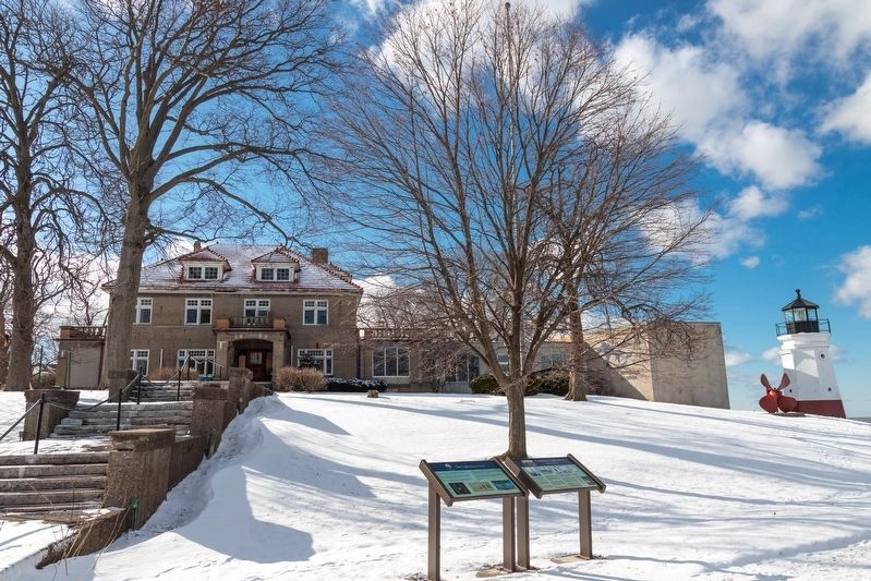
The lens in Vermilion’s lighthouse is powered by a single, 100-watt-equivalent LED
bulb, no more than an ordinary household lamp. Yet its light reaches 10 miles out across
Lake Erie. The technology that makes this possible was developed in the . . . — — Map (db m147935) HM
On Main Street (Ohio Route 60) north of Ohio Street, on the right when traveling north.
Vermillion. Founded 1808, incorporated 1837.
• Settled by Connecticut “Firelanders.”
• Name derived from red banks along river.
• Old Indian Fort, up river, famous for giving protection to Vermilion Tribe and roving bands. . . . — — Map (db m147774) HM
On Main Street north of Huron Street, on the left when traveling north.
At the time Vermilion became a village in 1837,
the people had built their own navigational
aid at the mouth of the river using wooden
stakes topped with oil-burning beacons.
In 1840, the U.S. Army Corps of Engineers
dredged the river . . . — — Map (db m147951) HM
On West Market Street (Ohio Route 256) at West Water Street, on the right when traveling east on West Market Street.
The Ohio & Erie Canal and the "Twin Cities"
On this site the Ohio & Erie Canal flowed south and down-level under the Market Street Bridge. Nearby Pawpaw Creek and the canal culturally divided the Swiss settlers to the west in Basil and the . . . — — Map (db m183071) HM
On Center Street just north of Canal Street, on the left when traveling east.
Canals were an important means of transportation when Carroll was founded in 1829 by William Tong and his brother Oliver, who chose this site because it was where the proposed intersection of the Lancaster Lateral Canal and Ohio-Erie Canal would be . . . — — Map (db m80624) HM
Ohio's 1000-mile network of navigable canals, constructed between 1825 and 1847, provided a system of economical transportation where none had previously existed. The canals opened many markets for its agriculture and industrial products, and . . . — — Map (db m17139) HM
On Lancaster Street (Ohio Route 204) at Canal Drive, on the right when traveling south on Lancaster Street.
Deep Cut at the Licking Summit
Digging of the Ohio-Erie Canal began in 1825, and the first canal boat navigated the Deep Cut at Licking Summit in 1831. The surrounding swamps were drained to create the Licking Reservoir, today known as . . . — — Map (db m14461) HM
On South High Street, on the right when traveling north.
[Marker Front]:
You are standing on the site of Ohio and Erie Canal. The canal helped to open the interior of Ohio to trade and settlement and played a part in Winchester's prosperity during the mid-1800s. Local farmers exported grain from . . . — — Map (db m12530) HM
Erected in 1905 by the Scioto Valley Traction Company, this station served as a terminal for passenger and freight service as part of an electric railway that connected Canal Winchester with neighboring towns in central Ohio. Known as the . . . — — Map (db m31375) HM
On King Avenue at the Olentangy River, on the right when traveling east on King Avenue.
Streams are both a principal economic resource and a natural hazard in Ohio. Accurate and systematic streamflow records are crucial in protecting lives and property and ensuring an adequate water supply. At this site in 1892 and 1893, engineering . . . — — Map (db m12763) HM
On West Main Street (Ohio Route 3) at West Rich Street (U.S. 62), on the right when traveling east on West Main Street.
The historic district extends from the former Main Street Bridge to Long Street and encompasses the public buildings on either side of the Scioto River. The 580 foot long low-head concrete arch Main Street Dam was constructed in 1918 in response to . . . — — Map (db m107780) HM
On West Long Street west of Marconi Boulevard, on the right when traveling east.
A Brief History:
At over 231 miles long, the Scioto River bisects half the longitude of the State of Ohio The river has historically served as fertile hunting grounds for several Native American tribes a navigational tool for European . . . — — Map (db m203903) HM
On Long Street (U.S. 33), on the left when traveling east.
The confluence of the Scioto and Olentangy Rivers is just northwest of North Bank Park, and the rivers were the major attraction for both Native American and white settlers. The river and its tributaries were the life-blood to the region providing . . . — — Map (db m29966) HM
On Broad Street (U.S. 40) at West Innerbelt (State Route 315), on the right when traveling east on Broad Street. Reported missing.
This tablet is placed to mark the home of
Lucas Sullivant
who under authority from Virginia came to an unbroken wilderness and with twenty men surveyed this portion of the Virginia Military Lands. Later he returned and in 1797 laid out the . . . — — Map (db m13066) HM
On West Lane Avenue at Oletangy River Road, on the right when traveling west on West Lane Avenue.
The Lane Avenue Bridge over the Olentangy River is the second cable-stayed suspension bridge constructed in Franklin County. The structure is 370 feet long, the twin support towers rise 165 feet above the water and the deck is 112 feet wide. The . . . — — Map (db m200917) HM
On West Lane Avenue at Olentangy River Road, on the right when traveling east on West Lane Avenue.
• In the late 1800's a steel truss was constructed across the Olentangy River at Lane Avenue. Its primary function was to gain access across the Olentangy River from the main campus of The Ohio State University to the agricultural land on the west . . . — — Map (db m200920) HM
On 2nd Street at West Main Street (U.S. 62), on the left when traveling north on 2nd Street.
This cast-bronze eagle once adorned the
Battleship U.S.S. Ohio
Restoration has been made possible through
donations by
five Columbus Women’s Service Clubs
Altrusa Club • Quota Club
Pilot Club • Zonta Club
Soroptimist . . . — — Map (db m88248) HM
On West Main Street (U.S. 62) at South Civic Center Drive, on the right when traveling west on West Main Street.
(side A)
Columbus Feeder Canal
Col. Nathaniel McLean removed the first earth for the Columbus Feeder Canal not far from this site, April 27, 1827. The earth was wheeled away by Ralph Osborn and Henry Brown, auditor and . . . — — Map (db m88254) HM
On West Rich Street (Route 3) at South Front Street, on the right when traveling west on West Rich Street.
The bioretention basins in this area along Town, Front, Rich, and Main Streets were installed during three roadway projects from 2008 to 2011 as part of Mayor Michael B. Coleman's Green Columbus Initiative. A bioretention basin is a landscaped area . . . — — Map (db m203906) HM
Named by resolution of City Council adopted May 24 – 1943 – in recognition of 12 years of active service as mayor in promoting the beautification of the reservoir lands. — — Map (db m13049) HM
On Mill Street (U.S. 62) at Carpenter Street, on the right when traveling south on Mill Street.
Historical Flood Mark, Jan.-Feb. 1959.
“Encroachment on flood plains, such as artificial fill, reduces the flood-carrying capacity, increases the flood heights of streams, and increases flood hazards in areas beyond the encroachment . . . — — Map (db m14446) HM
On Alkire Road at Gardner Road (County Route 281), on the left when traveling west on Alkire Road.
Recognized for their biodiversity and high quality aquatic habitat, Big Darby Creek and Little Darby Creek were designated as state and national scenic rivers. These riparian ecosystems provide modern recreational opportunities while allowing a . . . — — Map (db m12514) HM
On Wilt Road, 0.1 miles west of Walnut Street, on the right when traveling east.
Built on Main Street, circa 1815, this two story log residence was later sided. In 1974 during new post office site preparation, the log structure was discovered and moved to present location along Ohio-Erie Canal route. In adjoining Groveport . . . — — Map (db m12521) HM
Pioneers began to settle in the Groveport area around the year 1800. Subsequent growth was spurred by the opening of the Ohio Erie Canal, and, in 1847, the adjacent settlements of Rarey's Port and Wert's Grove merged to form the village of . . . — — Map (db m12522) HM
On Blacklick Street, 0.2 miles Front Street, on the right when traveling east.
Ohio and Erie Canal in Groveport
The Ohio and Erie Canal was Ohio's solution to the lack of a reliable and fast transportation system to move goods to outside markets. The canal opened in the then unplatted village of Groveport on September 25, . . . — — Map (db m12659) HM
Near Groveport Road, on the right when traveling west.
The Ohio and Erie Canal Lock 22, constructed from 1830-1831, is the only canal lock in Groveport. Constructed by W.H. Richardson as part of his $2,937 bid to build section 52 of the canal, the sandstone lock is 117 feet long and ten feet deep and . . . — — Map (db m13724) HM
On Commerce Street at Decker Street, on the left when traveling west on Commerce Street.
Anticipating a boom in canal commerce, Colonel James Kilbourne (1770-1850) platted Lockbourne in 1831 at the junction of the Ohio-Erie Canal and the Columbus Feeder, which was completed the same year. Lockbourne derives its name from the . . . — — Map (db m23086) HM
On Commerce Street at Denny Street, on the right when traveling west on Commerce Street.
Ohio-Erie Canal and Locks
The Ohio-Erie Canal was built between 1825 and 1832 and extended 308 miles from Lake Erie at Cleveland to the Ohio River at Portsmouth. The greatest engineering achievement in Ohio up to that time, the canal gave . . . — — Map (db m12902) HM
On Commerce Street at Denny Street, on the right when traveling west on Commerce Street.
Ohio-Erie Canal and Locks
The Ohio-Erie Canal was built between 1825 and 1832 and extended 308 miles from Lake Erie at Cleveland to the Ohio River at Portsmouth. The greatest engineering achievement in Ohio up to that time, the canal gave the . . . — — Map (db m119209) HM
On Kitzmiller Road, on the right when traveling north. Reported missing.
In 1833, Archibald Smith (1803-83) began to build a sawmill a short distance east of here where a tributary enters Blacklick Creek. His work was soon destroyed, he wrote, by a “rise of water known as the great Fourth of July Flood.” Undaunted, he . . . — — Map (db m223490) HM
On Riverside Drive (U.S. 33), on the right when traveling north.
A network of Native American trails, usually following waterways, traversed Ohio and often determined the routes of military roads and improved highways. U.S. Route 33 follows the route of the Scioto Trail from the confluence of the Scioto and . . . — — Map (db m17415) HM
On Sunbury Road, on the right when traveling north.
Clarence Boal Hoover
First employed by city
September 1, 1904
Appointed Chief Engineer
May 1, 1920
Appointed Superintendent of Water
December 1, 1921
Deceased
November 5, 1949
Charles Potter Hoover
First employed by . . . — — Map (db m18327) HM
On Chestnut Street west of Lawrence Avenue, on the left when traveling east.
This is considered a soft pine with needles in bundles of five. The tall straight trees were used for ship masts, some grew up to 100 feet tall. Its seed is food for songbirds, ruffed grouse, turkey, quail and mice. — — Map (db m235810) HM
Near Lawrence Avenue (County Road 15) north of Fairway Lane, on the right when traveling north.
This is considered a soft pine with needles in bundles of five. The tall straight trees were used for ship masts, some grew up to 100 feet tall. Its seed is food for songbirds, ruffed grouse, turkey, quail and mice. — — Map (db m228960) HM
The Ohio River, the southeast border of Gallia County, played a significant role in the development of Gallipolis and Gallia County. One of the state's first thoroughfares, this waterway enabled pioneers to settle in what was known as the Northwest . . . — — Map (db m30497) HM
On April 1, 1818, six families from the Cilcennin area of Mid-Wales sailed from Aberaeron, Wales to Baltimore. The group of 36 people was led by John Jones Tirbach. From Baltimore they traveled to Pittsburgh and then by flatboats down the Ohio . . . — — Map (db m30501) HM
Mrs. Margaret Beard • Eliza Beck and Infant
Mrs. Joseph J. Blazer • Richard Blazer
Wellington Blazer • Claudius J. Brothers
Mrs. Claudius J. Brothers • Mrs. Elizabeth Brothers
James Brown • Margaret Brown
William Buck • Clayton . . . — — Map (db m30625) HM
On Water Street close to Main Street (Ohio Route 72), on the left when traveling west.
A continuous mill on this site last operating mill in the Little Miami Watershed one of the largest remaining
water powered grist mills — — Map (db m188241) HM
On Huffman Dam Road (Ohio Route 444), on the right when traveling east.
Huffman
one of five dams
built by the Miami
Conservancy District
for flood control
in the Miami Valley
completed 1922
height 73 ft. length 3300 ft.
width at base 380 — — Map (db m97233) HM
On Ohio Route 725 at Main Street, on the left when traveling north on State Route 725.
Side A: An important route north from the Ohio River for Indians, frontiersmen, soldiers, and settlers. Pre-historic Indian mounds and village sites are throughout the valley. In 1788 the river was a boundary between two major survey districts, . . . — — Map (db m26223) HM
Albert Bettinger
of Cincinnati
A.D. 1854 A.D. 1922
One of the pioneers of waterway
improvements throughout the United
States and an especially earnest
and eloquent advocate of the
canalization of the Ohio River
He blazed the trail that those . . . — — Map (db m135214) HM
John L. Vance
Gallipolis, Ohio
A.D. 1839 A.D. 1921
He served untiringly as president of
the Ohio Valley Improvement Association
for more then a quarter of a century
and weary with the weight of the years
he passed on, bequeathing to others . . . — — Map (db m135213) HM
Plaque A
“River Ohio so called by the Iroquois on account
of its beauty- descended by Sieur Robert de la Salle.”
Discovered by the French explorer LaSalle, about
1670 and claimed by him for Louis XIV of France.
Seized by the . . . — — Map (db m135159) HM
Near Vine Street north of Erkenbrecher Avenue, on the right when traveling north.
African penguins, whose populations have declined by 97% over the last 100 years, and people both rely on healthy oceans for food, oxygen, stable weather patterns, and more. We can protect our oceans through the choices we make in our daily . . . — — Map (db m201142) HM
Near Vine Street north of Erkenbrecher Avenue, on the right when traveling north.
As man domesticated dogs from the wolf, Japanese farmers cultivated koi from the common carp. Bred for their striking colors, koi are cherished and considered lucky in Asian culture. More recently, keeping koi in home . . . — — Map (db m201138) HM
Near Vine Street north of Erkenbrecher Avenue, on the right when traveling north.
On March 8, 2019, a Ranger with the Southern African Foundation for the Conservation of Coastal Birds (SANCCOB) spotted a juvenile African penguin with a hard, plastic ring around its head. This curious young bird likely saw the ring floating at . . . — — Map (db m201141) HM
Near Vine Street north of Erkenbrecher Avenue, on the right when traveling north.
Aqueducts carry water great distances to areas that do not have their own water supply. Middle Eastern cultures have used them since at least the 10th Century BCE (Before the Common Era).
Early aqueducts — some of which are still in use . . . — — Map (db m201156) HM
Near Vine Street north of Erkenbrecher Avenue, on the right when traveling north.
The waterwheel was the first tool used to harness a power source other than animals.
The design is simple: water flows from a stream or reservoir against the wide paddles of a wheel. The wheel's rotating axle may turn machinery, a mill . . . — — Map (db m201155) HM
Side A:
In 1749, the French in North America perceived a threat by British expansion west of the Allegheny Mountains to the Ohio River Valley and beyond. The French commander, Pierre Joseph Celeron, sieur de Blainville, with 250 men, left . . . — — Map (db m24610) HM
Welcome to a spectacular recreational area created as a gift from the people of Cincinnati to the people of Cincinnati in honor of the city's Bicentennial in 1988.
Originally, this land was an untouched tree-covered bank along a . . . — — Map (db m25597) HM
A Neighborhood That No Longer Exists
Cincinnati is a city of neighborhoods. One of them is very, very special—because it is no longer there. The Bottoms: a dense urban neighborhood full of churches, full of people. It ran from the River . . . — — Map (db m24995) HM
Side A:
Cincinnati, along with Milwaukee and St. Louis, is one of the three corners of the "German Triangle," so-called for its historically high concentration of German-American residents. During the 19th century, Cincinnati was both a . . . — — Map (db m24615) HM
On Central Parkway at West Fourteenth Street, in the median on Central Parkway.
The Miami and Erie Canal
———— • ————
Over this site once flowed the Miami and
Erie Canal, linking the Ohio River with the
Maumee and Lake Erie. The canal was opened
in 1827 and was finally . . . — — Map (db m43960) HM
On Miami Avenue on Miami Avenue. Reported missing.
Harrison, later to become the ninth president of the United States,
was a strong supporter of the Cincinnati & Whitewater Canal project
and a major subscriber of stock in the canal company. He sold
land from his North Bend farm for the . . . — — Map (db m238950) HM
On West Wyoming Avenue at Williams Street, on the left when traveling west on West Wyoming Avenue.
Canal Days in Lockland
The canal was a place for fun as well as commerce; for boys, a place to swim, boat, and fish; for the whole family, a place to skate when the canal became a frozen ribbon of ice; for lodge and church groups, a place for . . . — — Map (db m163571) HM
On Trail 32 (County Road 32) at Trail 66 (County Road 66), on the left when traveling west on Trail 32.
In the month of May, 1831, a group of emigrants from the Odenwald region of Germany started on the 400 mile trip through Darmstadt and Kassel to Bremen, where they finally sailed for America in late July. They severed all ties that bound them to . . . — — Map (db m158918) HM
Near McManness Avenue at Cherry Street, on the right when traveling north.
A grist mill seven miles upstream, around witch Tell Taylor played as a boy gave him the inspiration for his song "Down By The Old Mill Stream."
Near this spot Tell Taylor, while fishing along the Blanchard River bank one summer day in 1908, . . . — — Map (db m228521) HM
On County Route 236, 0.2 miles north of Carey Road (Ohio Route 568), on the left when traveling north.
The Blanchard River was named after Jean-Jacques Blanchard, a French tailor, trapper and trader who worked with the Shawnees. Blanchard came to this area in 1770. He and his Shawnee wife lived with the tribe for over thirty years before Blanchard . . . — — Map (db m245413) HM
Near McManness Avenue at Center Street, on the right when traveling north.
The Park's Early History
Before Riverside Park, there was simply a riverside. In 1888, the Findlay City Council improved the riverfront, building a water works, reservoir, and Ice house on the banks of the Blanchard River. Findlay residents . . . — — Map (db m228509) HM
On Ohio Route 81, 0.2 miles east of County Route 95, on the right when traveling east.
Comprising 8,000 acres of Brookston-Crosby soils, the marsh is named for Hog Creek which drains it. Once a shallow lake, cranberries, wild flags and grasses flourished here. Reclamation (1868) cost $13.00 per acre. Dredging was done by steam scow; . . . — — Map (db m29032) HM
On Ohio Route 195 at County Route 110, on the right when traveling south on State Route 195. Reported missing.
The Scioto Marsh, the largest of three extensive marsh areas in western Hardin County, was formed in the low basins left by the last retreating glacier 10,000 years ago. It covered more than 16,000 acres and was thought to be a source of malaria by . . . — — Map (db m173935) HM
On Cadiz-Piedmont Road (Route 22) west of Belmont Ridge Road (County Road 10), on the right when traveling east.
Located on Stillwater Creek. Constructed and operated by Corps of Engineers, U.S. Army. This earth dam is one of a series designed for flood control, navigation improvement and water conservation in the Muskingum Valley.
On West Wabash Street just west of South Damascus Street, on the left when traveling west.
Liberty Center, Ohio. In 1847, after completion of the Miami & Erie Canal,
66 residents were recorded in Liberty Township.
Construction of Wabash Railway in 1854 encouraged
trade at the half way point between Washington
Station and . . . — — Map (db m172744) HM
On Henry Wood County Line Road (Ohio Route 65) at Henry-Wood County Line Road (County Road 1), on the right when traveling east on Henry Wood County Line Road.
Historic canal town founded 1833 as Gilead renamed in 1868. Applebutter Festival since 1977 — — Map (db m239649) HM
One of the oldest buildings in downtown district. It served as a boarding house for canal travelers.
Finerty Shoe Repair 1947-1985 — — Map (db m157984) HM
On East Riverview Avenue (Route 424) just north of East Clinton Street, on the left when traveling east.
The Miami & Erie Canal stretched approximately 250 miles from Cincinnati to Toledo. Napoleon and other towns on the Maumee River's banks were on a slackwater section of the canal. Between 1825 and 1845, laborers constructed the canal using . . . — — Map (db m160264) HM
On West Riverview Road (County Route 424) at West Front Street, on the right when traveling east on West Riverview Road.
Riverfront Industries Powered by Canal Water. The completion of the Miami and Erie Canal passing through Napoleon in 1843 provided a way to receive manufactured goods, export farm products, and power local mills. The early industries of . . . — — Map (db m122324) HM
On Haydenville Road, 0.1 miles north of Wandling Road, on the left when traveling south.
Side A: Historic Haydenville
Originally known as Hocking Furnace, Haydenville was founded by and named for Columbus industrialist Peter Hayden (1806-1888), who energetically developed the coal, iron, sandstone, and fire clay deposits . . . — — Map (db m20351) HM
As the water works its way down through Old Man’s Cave Gorge, one of the first unusual areas that it encounters here at Devil’s Bathtub. This is an area in the sandstone that has been cemented together more tightly than the other nearby rock layers. . . . — — Map (db m2431) HM
On South Market Street south of West Main Street, on the right when traveling south.
In Honor of the
U.S.S. Hocking
APA-121
and all who served on board
Commissioned
October 22, 1944
Decommissioned
May 10, 1946
Received 2 Battle Stars
For World War II
Iwo Jima
Okinawa
Dedicated on
U.S.S. . . . — — Map (db m195115) WM
On Dupler Road, 0.8 miles east of Mill Road, on the left when traveling east.
Side A:
The twelfth lock on the Hocking Canal, the Sheep Pen lock, underscores Southeast Ohioans' efforts to open their region to the world during the mid-nineteenth century. Built as a guard lock, it was intended to permit slackwater . . . — — Map (db m202657) HM
On Ohio Route 56, on the left when traveling west. Reported missing.
Modern roads often have their precedents in much older thoroughfares. Two ancient paths once converged near this point. As late as the 1700s, the Salt Trail guided Native Americans from the upper Scioto Valley plains past Cantwell Cliffs, Cedar . . . — — Map (db m218379) HM
On Township Road 421, on the right when traveling north.
Peace-Loving Amish Pioneers Build Brotherly Native American Frontier Relations An unbarred log cabin door could mean vulnerability. But for one of the earliest pioneering families of the Ohio country the peace-loving Amish Jacob Mast . . . — — Map (db m240036) HM
On Williams Street, on the right when traveling south.
This structure is on the site of a mill dam built
of logs in 1815 by Richard Burt. At that time the
banks of the Huron River were heavily wooded
and the channel was only 62 feet wide. A water
mill was operated here until 1944. — — Map (db m204622) HM
Near Washington Street (Ohio Route 164) 0.2 miles Church Street.
About 8 pm on the evening of July 25, 1863, Brigadier General John Hunt Morgan and fewer than 500 Confederate raiders arrived at Nebo, now known as Bergholz, and set up camp throughout the village. Selecting the Herdman Taylor farm as his . . . — — Map (db m111197) HM
Lock and Dam 10, completed in 1915, was part of a slack-water navigation system built for the Ohio River. The site included a brick powerhouse and two lockkeeper houses. The lock and dam was replaced when Pike Island Dam was completed in 1965. The . . . — — Map (db m44147) HM
On Newcastle Road (Ohio Route 229), on the right when traveling south.
Along with abundant wildlife and tranquil beauty, the banks of State Scenic Kokosing River
reveal stories of our past.
A River Sentinel: the Sycamore Tree
Sycamore trees are fixtures along rivers. Their noble white branches
extend from . . . — — Map (db m166944) HM
On Lower Gambier Road (County Route 262) at Mount Vernon Avenue, on the right when traveling south on Lower Gambier Road.
Named for the Native Americans who first dwelled here along both sides of the Kokosing River, the Little Indian Fields is adjacent to the site of the first white settlement of Knox County. Early white inhabitants of this land were Andrew and . . . — — Map (db m18747) HM
On 2nd Street at High Street, on the right when traveling west on 2nd Street.
Lighthouse and keeper's dwelling, erected in 1871 to replace the 1825 structures designed by Jonathan Goldsmith. From the time it guided early settlers into the Western Reserve until it was decommissioned in 1925, this station served Great Lakes . . . — — Map (db m19364) HM
For over 200 years, the Mentor Lagoons have had a major impact on northeastern Ohio and its people. Located on the site of a large estuary where the Grand River once flowed into Lake Erie, the area evolved into a large marsh. It was here in 1797 . . . — — Map (db m43748) HM
[History related excerpts from the marker]
Natural Shoreline of Lake Erie
The Mentor Lagoons Nature Preserve's 1.5-mile shoreline represents the longest stretch of publicly accessible natural beach in Ohio. Because it is one of the last . . . — — Map (db m49134) HM
Near Ridge Road (Ohio Route 84) just east of Bishop Road (Ohio Route 84), on the right when traveling west.
Dedicated in honor of Wickliffe citizens Harry and May Allen Coulby. Coulby Park is part of the original Coulby estate called Coulallenby. Harry C. Coulby (1865–1929) was known as Czar of the “Great Lakes,” was a partner in a shipping company with . . . — — Map (db m134106) HM
Near Lakeshort Boulevard at Bayridge Boulevard and East 305th St, on the right when traveling west.
Following the completion of the Erie Canal from Albany to
Buffalo, New York, Lake Erie became an important link in an
all-water route for immigrants traveling from the eastern
seaboard into the Midwest. The 600-ton lake steamer G.P. . . . — — Map (db m134097) HM
On Ohio Riverfront Park, on the right when traveling north.
In 1849, the city of Ironton was founded by local ironmasters, railroaders, and financiers associated with the Ohio Iron and Coal Company. They saw the city as a manufacturing and shipping point for their products. As a young industrial city, . . . — — Map (db m60016) HM
On Main Street (Ohio Route 37) at Granville Street, on the right when traveling west on Main Street.
This grindstone from the farm of William Mears Dawes Gristmill built 1840 on Raccoon Creek one mile west. Stone quarried by Ephraim Cutler on Ohio River, brought here on steamboat and cart by Henry Dawes, grandfather of Beman Gates Dawes, . . . — — Map (db m16710) HM
On Walnut Road (Ohio Route 79) at Cottage Street, on the right when traveling east on Walnut Road.
[Marker Front]:
Formed by the retreating glacier more than 14,000 years ago, Buckeye Lake first existed as a shallow, swampy pond, named "Buffalo Swamp" by Ohio Company explorer Christopher Gist in 1751. Beginning in 1826 the State . . . — — Map (db m183075) HM
[Marker Front]:
Using a four-mile long dam, the state of Ohio impounded the Licking Summit Reservoir in the mid-1820s to supply water for the Ohio and Erie Canal. In 1894, the state renamed it Buckeye Lake and developed it for recreational . . . — — Map (db m12960) HM
On Hebron Road (Ohio Route 79) near Coffman Boulevard, on the right when traveling north.
At this site on July 4, 1825, Governor DeWitt Clinton of New York turned the first shovelful of dirt for the Ohio Canal. The ceremony was attended by area citizens of Master Masons.
In the early 1840’s James A. Garfield, who was to become the . . . — — Map (db m2377) HM
Where the Water Met the Road
While the citizens of St. Clairsville, in eastern Ohio, celebrated the groundbreaking for the National Road on July 4, 1825, construction began on the Ohio & Erie Canal on the same day at Licking Summit (now . . . — — Map (db m97542) HM
On Main Street (U.S. 40) at Basin Street, on the right when traveling west on Main Street.
Located at the crossing of the Ohio and Erie Canal and the National Road, Hebron was a favored commercial and agricultural center for Licking County in the nineteenth century. Only four miles north of the city Governor DeWitt Clinton of New York . . . — — Map (db m13878) HM
690 entries matched your criteria. Entries 201 through 300 are listed above. ⊲ Previous 100 — Next 100 ⊳