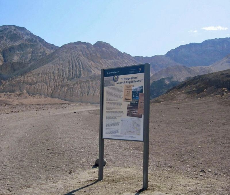
In 1949, the government of California hosted
several statehood centennial celebrations across
the state. One such event was hosted here at the
mouth of Desolation Canyon in what was then
Death Valley National Monument. The . . . — — Map (db m275649) HM
He laid the foundation of the National Park Service, defining and establishing the policies under which its areas shall be developed and conserved unimpaired for future generations. There will never come an end to the good that he has done. — — Map (db m158620) HM
Between 1905 and 1913, the Nevada-California Power Company, a predecessor of the Southern California Edison Company, built a chain of five hydroelectric power plants along Bishop Creek. Water flowed from one power plant to the next through . . . — — Map (db m245639) HM
Born in Bakersfield, Mojave residents since 1948, always giving of himself to make Mojave and East Kern County a better place. He was a founding member of the East Kern-Antelope Historical Society, a founding member of the Mojave Transportation . . . — — Map (db m305703) HM
Built in 1913, this building has been the home of the Westwood Fire Department since its beginning. O.L. Lunt was the 1st Chief until 1918. Maurice Hertzig was appointed Chief in 1946 and served for 32 years, he was the last official chief. Once the . . . — — Map (db m56708) HM
Memorial Ceremony honoring Horace Marden Albright (January 6, 1890 - March 28, 1987)
His footprints are on the United States and
the world because all other national park systems
are modeled on the one he built.
April 4, 1987, . . . — — Map (db m236742) HM
You're looking out at El Prieto Canyon. In Spanish
"El Prieto" refers to the dark one - and this scenic
place was named for Robert Owens. He settled here
in the early 1850s, after being born into slavery and through
years of hard labor . . . — — Map (db m251867) HM
In memory of
Cecil B. DeMille,
his Paradise Ranch
was given by
the Cecil B. DeMille Trust
with the hope that it would be a
Paradise for children. — — Map (db m218483) HM
Welcome to the Vetter Mountain Fire Lookout Tower in the Angeles National Forest. As you can see from the spectacular vistas, Vetter Mountain is an ideal location for a fire lookout.
The Vetter Mountain Lookout was constructed in 1937 and . . . — — Map (db m201274) HM
Upon arriving at the Beverly Hills trolley station, which was located just to the south of this site across Santa Monica Boulevard, residents and visitors would be greeted by this early Beverly Hills landmark. Originally installed in 1907, the lily . . . — — Map (db m204422) HM
This amazing playground has been made possible
by the generous contributions of so many amazing
people.
Brandon was born on February 9, 1994 to Dina and
Michael Kaplan. It was soon apparent that he had
many physical and developmental . . . — — Map (db m261871) HM
Helen Goodwin Renwick was many things - one of Claremont's first philanthropists, a published poet, a patron of the arts, a world traveler, an active member of her church and the sponsor of many of Claremont's early social and cultural events. A . . . — — Map (db m269769) HM
Judy C. Wright's stewardship of this Santa Fe Depot began in 1982 when she nominated the abandoned building to the National Register of Historic Places. Her visionary and tenacious work in historic preservation and transportation ensured the . . . — — Map (db m249660) HM
This 5.8-acre neighborhood park was
originally dedicated on October 9, 1978 in
honor of Mrs. June Vail. The dedication was
designed to recognize Mrs. Vail's outstanding
leadership, and volunteer service in the
Spanish Trails Girl Scout Council . . . — — Map (db m287928) HM
This 5.2-acre neighborhood park is named in honor of Ralph and Goldy Lewis. The Lewis family lived in the area and built the housing tract surrounding the park. They are the founders of the Lewis Homes group of companies, which is well known for . . . — — Map (db m287867) HM
This land was first traversed by Native Americans, called Tongva, (later known as the Gabrielinos). Under Spanish rule, it was settled as a portion of Rancho La Ballona. After Culver City was incorporated in 1917, the property became a horseracing . . . — — Map (db m49961) HM
Built in the 1880’s. One of the last remaining examples of Queen Anne-Eastlake architectural style in Glendale. Home of Ed Goode, 1897-1917, outstanding community leader. — — Map (db m143602) HM
In 1922, Anderson W. Clark, a retired Baptist minister and
humanitarian, came to the Crescenta Valley. His plans to
quietly retire were quickly altered. As the Great Depression
began, Dr. Clark founded an organization, Crescenta . . . — — Map (db m275850) HM
In recognition of the leadership of Assistant City
Manager Bob McFall to preserve this heritage oak
during the 2009 Station Fire, the Community Services
& Parks Department has designated this stately tree as
"The McFall Oak." — — Map (db m239335) HM
Established in 1919. Constructed in 1926. Designed by Clarence L. Jay and Lincoln Rogers.
Spanish Colonial Revival architecture.
City of Glendale Historical Landmark. — — Map (db m210004) HM
The Masonic Temple was dedicated on June 11, 1929 and served as a
meeting place for several Masonic Lodges for nearly three decades.
The building, constructed by J.V. McNeil, was designed by architect and
engineer Arthur Lindley who was also . . . — — Map (db m214526) HM
Built in 1925. Exemplary Spanish Colonial Revival home
with elements of Moorish and Pueblo Revival styles. Built for local businessman Robert Jensen.
Named for Mrs. Carmen Issai Ovanesian, noted
local philanthropist for children's causes. — — Map (db m173515) HM
A twelve foot deodar tree was dedicated in this park on December 26, 1928
by the Montrose - La Crescenta Boy Scouts, Verdugo Hills Council, to honor
the short meritorious life of the valley's model Boy Scout. A small
concrete bench was later . . . — — Map (db m275996) HM
The C.C.C. and the Forest Service
The Civilian Conservation Corps was established by President
F.D. Roosevelt in 1933 to maintain public lands and provide
jobs during the Great Depression. The CCC were active in fire
prevention . . . — — Map (db m264035) HM
“That beauty might prevail,”
honorable William H.Workman & Mrs.Workman
donated the major portion of Hollenbeck Park
in 1892. This plaque is installed in appreciation for
the many contributions to the City of Los Angeles
which were made by . . . — — Map (db m191551) HM
Time in the Tropics
John Edward Hollenbeck and his wife, Elizabeth
Hatsfeld, were among the most notable and
influential of the early residents of
Boyle Heights. Like many others,
Hollenbeck (an Ohio native)
was drawn to . . . — — Map (db m219231) HM
Dedicated to the firemen of the Los Angeles Fire Department - past, present and future - who, since 1871, by their courage and faithful devotion to duty have protected the lives and property of the citizens of Los Angeles from the ravages of . . . — — Map (db m51301) HM
Without the determined effort of Christine Sterling and a handful of supporters, the birthplace of the City of Los Angeles would have been lost forever. By 1900 the city center had moved south, leaving the old plaza area to deteriorate. Finally, in . . . — — Map (db m162598) HM
Arguably the most popular player in Kings history, Luc Robitaille was a catalyst for elevating the game of hockey on the West Coast. He had his jersey No. 20 retired on January 20, 2007. In 2009 he was inducted into the Hockey Hall of Fame. The . . . — — Map (db m205078) HM
After a fire in 1971, which left this hilltop scorched and blackened, Amir Dialameh
climbed to the top of this hill, carrying by hand most of the plants and trees we
enjoy in the garden today. Over the years, some of those trees Amir hauled . . . — — Map (db m177491) HM
4218 acres of public park
gifted to the city in 1896 by
Colonel Griffith Jenkins Griffith.
Cultural Heritage Board
Monument No. 942 City of Los Angeles — — Map (db m223802) HM
At one time the Los Angeles River, which runs just beyond
our garden walls, was a vital resource to the first peoples
of Los Angeles (the Tongva) and for a variety of plant
and animal life. Today it runs through a 51 mile concrete
channel, which . . . — — Map (db m237724) HM
Shane's Inspiration was founded in April 1998 by Catherine Curry-Williams and Scott Williams in memory of their son Shane, who passed away two weeks after birth. Had Shane lived he would have spent his life in a wheelchair. When the Williams' . . . — — Map (db m260692) HM
The CCC had two camps in Griffith Park. Camp Griffith Park, originally located just east of this site, was occupied from May 1934 to May 1936. A statue honoring the CCC was sculpted by John Palo-Kangas as a WPA Federal Art Project and placed in that . . . — — Map (db m137298) HM
Robert Edmund Williams House
(Hathaway Children and Family Services),
Craftsman style.
Architects - Train & Williams.
Built 1905. Declared 1989,
Historic Cultural Monument No. 411,
City of Los Angeles,
Cultural Heritage . . . — — Map (db m293877) HM
Westcoast Prairie style, built in 1913.
Sumner P. Hunt and Silas Burns, architects.
1938 addition designed by Sidney Clifton.
Historic-Cultural Monument No. 284,
August 29, 1984.
City of Los Angeles,
Cultural Heritage Commission, Cultural . . . — — Map (db m175867) HM
Hollywood Reservoir
Capacity 2,500,000,000 gallons.
Maximum depth of water 183 feet.
Mulholland Dam
Work started August 1923.
Dam completed December 1924.
172,000 cubic yards of concrete.
Elevation of . . . — — Map (db m167864) HM
In 1995, this building was named in
honor of Johnny
Grant, Hollywood's
long-time honorary
mayor, Walk of
Fame chairman,
and good will ambassador. Built in 1919, it housed
the Meglin Dance Studio and later the Arthur Murray
Dance Studio on . . . — — Map (db m232574) HM
The Los Angeles Board of
Recreation and Park Commissioners
honors Dick Whittinghill
for his community involvement and for his
assistance in the development of Woodbridge Park, June, 1978. — — Map (db m257949) HM
The half mile long mural on the history of California depicting
prehistory to the 1950's is a work in progress.
The mural is a landmark to the history of America and California and a monument to inter-racial harmony created between the . . . — — Map (db m155522) HM
This plaza is dedicated to the memory of Carl Schaefer Dentzel (1913-1950), Northridge pioneer and Chamber of Commerce president; director of the Southwest Museum for 25 years; and founding member of Los Angeles’ Cultural Heritage Board.
It was . . . — — Map (db m157887) HM
Pacoima means “Rushing Waters”, named by the first occupants of the land: the Gabrielino Native Americans.
Pacoima’s First Elementary School, 1888.
Pacoima’s First Railroad Station, 1888.
Pacoima Flood, 1891. . . . — — Map (db m175733) HM
Charles and Lotte Melhorn
More than fifty-year residents of the Santa Monica Mountains, Charles and Lotte Mel horn fought for the recognition of the natural areas and viewshed along Mulholland Drive as a precious public resource. . . . — — Map (db m164714) HM
The YMCA "Colored Branch"
The 28th Street Young Men's Christian
Association (YMCA) of Los Angeles,
also known as the "Colored Branch or
"Colored Y," opened its new building
in November 1926 at the corner of
East 28th Street and . . . — — Map (db m229206) HM
Black Americans In The Golden State
Africans have had a presence and stake in California since before there was a California. Some 300 Africans accompanied the Spanish conquistador Hernan Cortes to the New World in 1519. And more than two . . . — — Map (db m216966) HM
Offering Light Amid California Sunshine
An amazing variety of people have called
this place home: turn-of-the-century
debutantes, science fiction writer and
Scientology founder L. Ron Hubbard, luckless women - and an evangelist . . . — — Map (db m239657) HM
Exposition Park, originally named Agricultural Park, was developed in 1876 as a showground for agricultural and horticulture fairs. The property became state land in 1880, the same year USC was founded, but during the 1890s, it fell into private . . . — — Map (db m218541) HM
The Board of Trustees of the University of Southern California met for the first time on September 3, 1880, culminating years of efforts by leaders of the Methodist Episcopal Conference of Southern California. The Board accepted the gift of this . . . — — Map (db m129945) HM
In honor of Leon “Ted” Garr, a veteran,
philanthropist and founder of
Garr Enterprises — Construction, motels, senior citizen housing,
child care centers, community college
and Founder's National Bank. — — Map (db m226393) HM
As an institution that has always been
inextricably linked to the region it calls home, the
University of Southern California has long been
a source of formal and informal community service. During its early years, much of that service took
the . . . — — Map (db m130194) HM
A Shrine To Entertainment And Service
When the original Shrine Auditorium opened in 1906, the movies that would make it internationally recognizable were in their infancy; the first dramatic film made entirely in Los Angeles was being . . . — — Map (db m138639) HM
As long as USC has been in existence, there has been music in the air. Musical instruction was listed in the university’s first catalog in 1880, and the first USC band was started in 1881. A student served as band director, and although the group . . . — — Map (db m130533) HM
A native of Illinois, Bernardi toured as a saxophone
player and arranger with Benny Goodman, Tommy
Dorsey and other greats of the Big Band Era before
moving in the 1940s to the San Fernando Valley, where
he became a building contractor. He . . . — — Map (db m227106) HM
This building, built in 1951, was purchased by Ramona Parlor No.109
Native Sons of the Golden West in 1998 and renovated as a meeting
hall and a place to display their early California artifacts in their efforts to preserve the “Spirit of . . . — — Map (db m124459) HM
The Santa Monica Bay Woman's Club, an
excellent example of the Classical Revival
style, was built in 1914 from a design by
local architect Henry Hollwedel. Club
members featured prominently in community
life, providing public services such as . . . — — Map (db m287773) HM
South Pasadena's
original Carnegie Library,
built in 1907.
In memory of
Mary Helen Wayne (1913 - 2007)
City Librarian 1972 - 1978. — — Map (db m216153) HM
Home of San Anselmo American Legion Post 179. Built by the veterans of World War I, Post Ladies Auxiliary, Boy Scout Troops and dedicated community volunteers.
Construction began April 23, 1933 and was completed and dedicated May 27, 1934. . . . — — Map (db m102721) HM
Who for 60 years owned and operated the Marin Fruit Co. 160 ft. south of this point and who was a never ending source of friendship and help for many Sausalitans in need.
To know him was to love him — — Map (db m284353) HM
Angel Island has served many people and their needs for thousands of years. Its secluded harbors and sweeping vistas have provided food, protection, recreation, and even isolation.
Angel Island is alive with history. The island has . . . — — Map (db m316128) HM
In 1969, a visionary named Sam Shapero (who served as Tiburon’s Town Treasurer), decided that Blackie’s Pasture needed to be preserved and protected.
Sam did two things. He bought one-third of the land and donated it to a foundation he created – . . . — — Map (db m204147) HM
”You can save a place, but it’s never really safe. It always takes people caring. It always takes vigilance. It always takes effort to keep those forces at bay that want to crowd in, want to change it, want to over-commercialize it. Once it’s . . . — — Map (db m160410) HM
This building was donated May 29, 1973, by the Independent Insurance Agents Association of Merced County in recognition of Harry P. Schmidt’s 28 years of public service as county supervisor of Merced County.
Merced County Independent Insurance . . . — — Map (db m212243) HM
There is one description of Henry Miller, California's cattle king, that sums up his contributions to this community: Henry Miller - Founding Father of Los Banos.
Born 1827 in Brackenheim, Kingdom of Wurtemberg, Germany, Miller left the family . . . — — Map (db m41164) HM
During the California gold rush, E Clampus Vitus was a fraternal order and benevolence society for miners. It was rumored to be one of the secret societies in the town of Bodie during its heyday.
Today, ECV is dedicated to the preservation of . . . — — Map (db m8493) HM
It began as the county hospital in Bodie in 1879. With the decline of Bodie in the mid 1880’s, the hospital was moved eventually to a site east of this monument and Highway 395 to the rear of the small meadow that you see. At that time it became . . . — — Map (db m11347) HM
East of this site was located West Portal, the largest of 4 'camps' or company towns, built in 1934 by the Los Angeles Department of Water and Power for employees and their families who worked on the Mono Basin Project. At the height of . . . — — Map (db m8173) HM
Robert F. Ford (1907-1979) knew he was "home" when he passed by this meadow. A generous donor to the work of the Del Monte Forest Conservancy, this meadow was dedicated to his memory on August 26, 1981. — — Map (db m296770) HM
In 1947, Bing Crosby brought to Pebble Beach the original Pro-Am tournament, which pairs celebrity entertainers, athletes, and business leaders with the greatest professional golfers from around the world. Affectionately known then as the "Crosby . . . — — Map (db m296852) HM
This house was constructed in 1868 by Isaac J. Harvey, before the arrival of the railroad, before the town's founding when only twelve other structures stood. Salinas City grew and the Harvey family helped lay its foundation. With son Benton, Isaac . . . — — Map (db m118242) HM
Named in honor of Davis Ernest Cavagnaro, who served as a director of the Napa Town and Country Fair board for 20 years. A devoted, active circus fan, originator of Napa’s fair parades, civic minded citizen who was lovingly known as Mayor of East . . . — — Map (db m54576) HM
On Oct. 25, 1882, the Veterans Home of California Association purchased 910 Acres in
Yountville for $17,750. On this site the first
building was erected.
Opened April 1, 1884 for Civil and Mexican
War veterans. By July 1, 1889, the Home . . . — — Map (db m144263) HM
Built by the Reverend Thomas J. Dalton and dedicated May 2, 1865 by Bishop Eugene O’Connell as Sacred Heart Convent and Holy Angels Orphanage. Under the Sisters of Mercy it served from 1866 to 1932 as the first orphanage of the Northern Mines. It . . . — — Map (db m12898) HM
This picnic area, sponsored by Wm. Bull Meek-Wm. Morris Steward Chapter Number 10, E Clampus Vitus, is for the enjoyment of all. The redwood lumber for the tables came from Nevada City's Christmas Tree, a Sequoiadendron Giganteum and continues to . . . — — Map (db m857) HM
Nevada Hose Co. No. 1 occupied this firehouse from May 30, 1861 to 1938. Hand pulled hose carts, horse drawn engines and motorized pumpers all rolled out of this building to save life and property. — — Map (db m40266) HM
Fire Company formed June 13, 1860 as Eureka Hose No.2 with 34 volunteers. Name changed in August of that year to ‘Pennsylvania Engine’. Construction money raised in 1859 by popular subscription and a grand ball staged by the town’s women. This . . . — — Map (db m281237) HM
History
Today people travel swiftly along I-80 to their destinations in the Sierra, many times not even staying overnight. When they do stay overnight it is most likely in hotels or rental houses.
It was not always that way. Before I-80 . . . — — Map (db m81970) HM
The Pioneer Monument honors all the emigrants who followed the Truckee River route into California.
Unveiled in 1918, this monument stands at one of the most historic sites in emigrant history. Nearby, trapped by snow during the winter of . . . — — Map (db m275513) HM
Many of the kids designed water features for their play areas like the ones you
see here. This idea was incorporated into the final play area design through
the use of the dry creek running through the site. This dry creek acts as a way
to catch . . . — — Map (db m230824) HM
In 2012, Mojang, the creators of Minecraft, partnered with the United Nations Human Settlements Programme (UN-Habitat) to launch an initiative called Block by Block, which uses Minecraft to help communities reimagine public spaces.
At the . . . — — Map (db m230829) HM
Since 1920, the American Legion has had an active presence in Brea. Post #181 dedicated a structure on this site on November 8, 1924 followed by a transformation to this Mission Style building in 1931.
It housed the Brea Women's Club during . . . — — Map (db m199553) HM
The residents of Dana Point gratefully recognize Bill Steinriede's many contributions that help improve the quality of our local Dana Point beaches and ocean. Through his concern, dedication and tenacity, Bill was instrumental in energizing Dana . . . — — Map (db m190509) HM
The city council of Huntington Beach has dedicated this park to Ted W. Bartlett who served as Mayor from 1946 to 1948 and as city councilman from 1944-48, 1954-58 and 1966-78--a total of twenty years of service to his city.
A native of North . . . — — Map (db m309228) HM
Designed by artists Marilyn Brame, Misha
Ma'Heo, Aileen May, Dru Maurer, Sophia
Imai, Liz Canales, Greg Nelson, Bob
Knoke, Alisha Mather, students of the
Visual Arts School, Cal State Fullerton art
students, and Mission Viejo children.
. . . — — Map (db m230935) HM
The garden was created in 2002 after the library expansion.
It is located on the site of the "Garden of Knowledge", originally constructed as a place for library patrons to enjoy reading outdoors.
Designed and maintained by the Rose . . . — — Map (db m215645) HM
History
The Oso Creek Trail started in April 1997 as a community collaboration where volunteers gather in late spring to celebrate the Earth and the arts in Mission Viejo. The trail is nestled along the riparian corridor of the Oso Creek . . . — — Map (db m228112) HM
Artist Marilyn Brame designed the Mountain Wall in 2001, as part of the Terra Native/Celebration of the Native Land Earth Day event.
Constructed or concrete with an overlay of mosaic tiles, the Wall educates the community about the . . . — — Map (db m230933) HM
This monument is dedicated in memory of Roger Seitz, FAIA from his friends and colleagues at The Irvine Company.
He was a talented, passionate master architect and urban designer responsible for creating places for all of us to enjoy such as . . . — — Map (db m194161)
Steven Frank Ambriz was elected to the Orange City Council in 2002, becoming one of the youngest members of the Council in our City's history. Born and raised in Orange, Steve was a "Proud Panther" from Orange High School. An important personal . . . — — Map (db m224293) HM
Dedicated to the proud men and women who have put their lives on the line in order to save others. For the past 75 years, over 75,000 swimmers have been aided by these dedicated professionals. The City of San Clemente and its citizen appreciated . . . — — Map (db m190445) HM
The San Juan Elementary School, established in 1850 in what was then Los Angeles County, is the oldest school site in Orange County. This 2.5 acre plot was originally Mission San Juan Capistrano property, and was gifted by Don Juan Forster who owed . . . — — Map (db m188643) HM
In the spring of 1974, two brothers, Pete and Jim Yyson,
from Newport Beach, California, negotiated a land
lease with the Santa Fe land and improvement company
on this site.
The original depot was built circa 1894-1895, the 1905
freight . . . — — Map (db m232716) HM
Eugene Oyharzabal and her daughter Carmelita (Carmen) are greatly respected for their vision and generosity in the Los Rios District and San Juan Capistrano.
In 1878, Domingo was the first Oyharzabal to arrive in San Juan Capistrano. Having . . . — — Map (db m276437) HM
Roland Bigonger will always be remembered as one of the founding fathers of Yorba Linda. A resident of the City for 36 years, he was elected to the first City Council in 1967 and served as the City's first Mayor. He went on to serve over eight years . . . — — Map (db m196371) HM
9431 entries matched your criteria. Entries 301 through 400 are listed above. ⊲ Previous 100 — Next 100 ⊳