13641 entries match your criteria. Entries 301 through 400 are listed.⊲ Previous 100 — Next 100 ⊳
Parks & Recreational Areas Topic
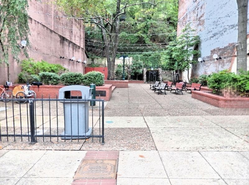
By Cosmos Mariner, September 13, 2024
Kenneth Adair Memorial Park Marker
301 ► Arkansas, Garland County, Hot Springs — Kenneth Adair Memorial Park — Hot Springs Central Avenue Historic District —  |
| On Central Avenue (State Highway 7) just north of Mountain Street, on the left when traveling north. | |||
| 302 ► Arkansas, Garland County, Hot Springs — Lamar Bathhouse — Hot Springs National Park — |
| On Central Avenue. | |||
| 303 ► Arkansas, Garland County, Hot Springs — Maurice Bathhouse — Hot Springs National Park — |
| On Central Avenue (Arkansas Route 7) 0.2 miles north of Reserve Street, on the right when traveling north. | |||
| 304 ► Arkansas, Garland County, Hot Springs — Ozark Bathhouse — Hot Springs National Park — |
| On Central Avenue. | |||
| 305 ► Arkansas, Garland County, Hot Springs — Peak Trail — |
| On Grand Promenade Trail 0.2 miles south of Fountain Street, on the right when traveling south. | |||
| 306 ► Arkansas, Garland County, Hot Springs — Ral Springs — |
| On Grand Promenade 0.2 miles south of Fountain Street, on the left when traveling south. | |||
| 307 ► Arkansas, Garland County, Hot Springs — The Bandstand — Hot Springs National Park — National Park Service, U.S. Department of the Interior — |
| Near Promenade Trail 0.2 miles north of Reserve Street, on the right when traveling south. | |||
| 308 ► Arkansas, Garland County, Hot Springs — The Ostrich Farm — Hot Springs Central Avenue Historic District — |
| On Central Avenue (State Highway 7) at Whittington Avenue, on the right when traveling north on Central Avenue. | |||
| 309 ► Arkansas, Garland County, Hot Springs — Tufa Terrace Trail — |
| On Grand Promenade Trail 0.6 miles south of Fountain Street, on the left when traveling south. | |||
| 310 ► Arkansas, Garland County, Hot Springs — Whittington Park — Hot Springs Central Avenue Historic District — |
| On Central Avenue (State Highway 7) 0.1 miles north of Canyon Court, on the right when traveling north. | |||
| 311 ► Arkansas, Garland County, Hot Springs — "Where Fun, Frolic and Frivolity Reigns" — Hot Springs National Park — |
| On Fountain Street 1.2 miles north of Central Ave. ( Route 7), on the left when traveling west. | |||
| 312 ► Arkansas, Garland County, Hot Springs, Hot Springs National Park — Advocate for Nature — |
| On Central Avenue. | |||
| 313 ► Arkansas, Garland County, Hot Springs, Hot Springs National Park — Cold Water Springs — Hot Springs National Park — |
| On Mountain Drive 0.1 miles south of Fountain Street, on the right when traveling south. | |||
| 314 ► Arkansas, Garland County, Hot Springs, Hot Springs National Park — Dressed to Hike — |
| Near Hot Springs Mountain Drive, on the left when traveling north. | |||
| 315 ► Arkansas, Garland County, Hot Springs, Hot Springs National Park — Erosion Effects — |
| On Hot Springs Mountain Drive, on the left when traveling north. | |||
| 316 ► Arkansas, Garland County, Hot Springs, Hot Springs National Park — Imperial Bathhouse — Hot Springs National Park — National Park Service, U.S. Department of the Interior — |
| On Reserve Street 0.1 miles east of Central Avenue. | |||
| 317 ► Arkansas, Garland County, Hot Springs, Hot Springs National Park — Mountain Towers — Hot Springs National Park — |
| On Hot Springs Mountain Drive, on the left when traveling east. | |||
| 318 ► Arkansas, Garland County, Hot Springs, Hot Springs National Park — Native Americans and Quarries — Hot Springs National Park — |
| On North Mountain Drive 0.5 miles north of Fountain Street, on the right when traveling north. | |||
| 319 ► Arkansas, Garland County, Hot Springs, Hot Springs National Park — Open Springs — |
| On Central Avenue 0.2 miles north of Reserve Street. | |||
| 320 ► Arkansas, Garland County, Hot Springs, Hot Springs National Park — Pleasure Drive Through Nature — |
| On Hot Springs Mountain Drive, on the right when traveling north. | |||
| 321 ► Arkansas, Garland County, Hot Springs, Hot Springs National Park — Ral City — |
| Near Central Avenue. | |||
| 322 ► Arkansas, Garland County, Hot Springs, Hot Springs National Park — Strolling the Grand Promenade — |
| Near Central Avenue. | |||
| 323 ► Arkansas, Garland County, Hot Springs, Hot Springs National Park — The Evolution of Whittington Park — |
| On Whittington Avenue, on the left when traveling east. | |||
| 324 ► Arkansas, Garland County, Hot Springs, Hot Springs National Park — Trail Shelters — Hot Springs National Park — |
| On Hot Springs Mountain Drive at Fountain Street, on the right when traveling north on Hot Springs Mountain Drive. | |||
| 325 ► Arkansas, Garland County, Mountain Pine — Three Sisters Springs — |
| On State Park Lane, on the right when traveling north. | |||
| 326 ► Arkansas, Garland County, Mountain Pine — Three Sisters Springs History — |
| On State Park Lane, on the right when traveling north. | |||
| 327 ► Arkansas, Garland County, Mountain Pine — Three Sisters Springs History — |
| On State Park Lane, on the right when traveling north. | |||
| 328 ► Arkansas, Greene County, Walcott — CCC Pavilion — |
| Near Arkansas Route 168 0.6 miles north of Route 141, on the right when traveling north. | |||
| 329 ► Arkansas, Independence County, Batesville — Sara Low Memorial Dog Park — |
| On Chaney Drive at Riverbank Rd., on the left when traveling east on Chaney Drive. | |||
| 330 ► Arkansas, Jackson County, Jacksonport — Welcome to Jacksonport State Park — |
| On Avenue Street west of Adams, on the right when traveling west. | |||
| 331 ► Arkansas, Jefferson County, Wabbaseka — The Arkansas Flag/Wabbaseka Memorial — |
| On U.S. 63/79 0.1 miles north of Myrtle Street, on the right when traveling north. | |||
| 332 ► Arkansas, Lawrence County, Powhatan — Powhatan Courthouse State Park — Northeast Arkansas Discovery Tour — |
| Near Arkansas Route 25 at 3rd Street, on the left when traveling south. | |||
| 333 ► Arkansas, Lawrence County, Powhatan — Uses of the Jail House — |
| On State Highway 25 just west of 3rd Street, on the right when traveling east. | |||
| 334 ► Arkansas, Logan County, Paris — Eiffel Tower Park — Paris, Arkansas — |
| On North Express Street at West Walnut Street (State Highway 22) on North Express Street. | |||
| 335 ► Arkansas, Miller County, Fouke — Brief Moments in Fouke History — From the Native Americans… — |
| On East Main (County Road 9) just west of Snell Street, on the right when traveling west. | |||
| 336 ► Arkansas, Miller County, Texarkana, Downtown — Arkansas Municipal Auditorium Walk of Fame Park — |
| On East 3rd Street at Hazel Street, on the right when traveling east on East 3rd Street. | |||
| 337 ► Arkansas, Monroe County, Holly Grove — Life in the Swamp — Louisiana Purchase Historic State Park — |
| Near State Highway 362 1.8 miles east of U.S. 49. | |||
| 338 ► Arkansas, Monroe County, Holly Grove — Louisiana Purchase State Park — Louisiana Purchase Historic State Park — |
| Near State Highway 362 1.8 miles east of U.S. 49. | |||
| 339 ► Arkansas, Monroe County, Holly Grove — The Opening of the American West — Louisiana Purchase Historic State Park — |
| Near State Highway 362 1.8 miles east of U.S. 49. | |||
| 340 ► Arkansas, Monroe County, Holly Grove — The Purchase: 1801-1803 — Louisiana Purchase Historic State Park — |
| Near State Highway 362 1.8 miles east of U.S. 49. | |||
| 341 ► Arkansas, Monroe County, Holly Grove — The Survey: 1815 — Louisiana Purchase Historic State Park — |
| Near State Highway 362 1.8 miles east of U.S. 49. | |||
| 342 ► Arkansas, Monroe County, Holly Grove — The Swamp — Louisiana Purchase Historic State Park — |
| Near State Highway 362 1.8 miles east of U.S. 49. | |||
| 343 ► Arkansas, Monroe County, Holly Grove — Two Lines Mark the Future of the United States — Louisiana Purchase Historic State Park — |
| Near State Highway 362 1.8 miles east of U.S. 49. | |||
| 344 ► Arkansas, Phillips County, Helena — Explore Our Top Outdoor Destinations — |
| On Elm Street. | |||
| 345 ► Arkansas, Pike County, Murfreesboro — A Multifaceted History — |
| Near State Park Road. | |||
| 346 ► Arkansas, Pike County, Murfreesboro — Amarillo Starlight — |
| On State Park Road. | |||
| 347 ► Arkansas, Pike County, Murfreesboro — An Attempt at Riches — The Martin Processing Plant — |
| On State Park Road. | |||
| 348 ► Arkansas, Pike County, Murfreesboro — Authentic Ore Cart — |
| On State Park Road. | |||
| 349 ► Arkansas, Pike County, Murfreesboro — End of a Mystery: What is Below the Surface? — |
| On State Park Road. | |||
| 350 ► Arkansas, Pike County, Murfreesboro — Esperanza Diamond — |
| Near State Park Road. | |||
| 351 ► Arkansas, Pike County, Murfreesboro — First Diamonds — |
| On State Park Road. | |||
| 352 ► Arkansas, Pike County, Murfreesboro — James "Diamond Jim" Archer — Feb. 23, 1925 - Jan. 8, 2003 — |
| On State Park Road. | |||
| 353 ► Arkansas, Pike County, Murfreesboro — John Wesley Huddleston — "Diamond John" — 1860-1936 — |
| On State Park Road. | |||
| 354 ► Arkansas, Pike County, Murfreesboro — Mine Shaft / Guard House — |
| On State Park Road. | |||
| 355 ► Arkansas, Pike County, Murfreesboro — Okie Dokie — |
| On State Park Road. | |||
| 356 ► Arkansas, Pike County, Murfreesboro — Schall Diamond — |
| On State Park Road. | |||
| 357 ► Arkansas, Pike County, Murfreesboro — Star of Arkansas — |
| On State Park Road. | |||
| 358 ► Arkansas, Pike County, Murfreesboro — Star of Shreveport — |
| Near State Park Road. | |||
| 359 ► Arkansas, Pike County, Murfreesboro — Uncle Sam — |
| Near State Park Road. | |||
| 360 ► Arkansas, Poinsett County, Harrisburg — Veterans Park — |
| On North Main Street at Court Street, on the right when traveling north on North Main Street. | |||
| 361 ► Arkansas, Pulaski County, Little Rock — A Wild Look Back — Cat House — |
| On Zoo Drive 0.1 miles west of S. Monroe Street when traveling west. | |||
| 362 ► Arkansas, Pulaski County, Little Rock — Over the Jumps — |
| On Zoo Drive 0.2 miles west of Fair Park Drive when traveling west. | |||
| 363 ► Arkansas, Pulaski County, Little Rock, Heights — The Heights • A History — |
| On Kavanaugh Boulevard at North Grant Street, on the left when traveling east on Kavanaugh Boulevard. | |||
| 364 ► Arkansas, Pulaski County, Little Rock, Hillcrest — 36 — War Memorial Golf Course — Formerly Called Fair Park Golf Course — |
| On West Markham Street near S Taylor Street, on the right when traveling east. | |||
| 365 ► Arkansas, Pulaski County, North Little Rock — The Arkansas River Trail Story — Arkansas River Trail — |
| On Cook's Landing Road, on the left when traveling east. | |||
| 366 ► Arkansas, Pulaski County, North Little Rock — The Old Mill at T. R. Pugh Memorial Park — |
| Near Lakeshore Drive. | |||
| 367 ► Arkansas, Randolph County, Pocahontas — Baltz Lake Fishing Pier — |
| On Baltz Lake Dam Road west of U.S. 67, on the left when traveling north. | |||
| 368 ► Arkansas, Saline County, Bryant — Ashley Park — Parks Build Community — |
| On Southwest 2nd Street 0.1 miles north of Short Street, on the left when traveling north. | |||
| 369 ► Arkansas, Union County, El Dorado — O.L. Bodenhamer Memorial Park — |
| On North West Avenue, on the right when traveling north. | |||
| 370 ► Arkansas, Washington County, Fayetteville — Wilson Park History — |
| On Wilson Park Trail north of North Park Avenue, on the left when traveling north. | |||
| 371 ► Arkansas, Yell County, Dardanelle — Cornwell House — |
| On State Highway 155, on the right when traveling north. | |||
| 372 ► Arkansas, Yell County, Dardanelle — 25 — Mount Nebo — Civilian Conservation Corps — |
| Near Arkansas Route 155 0.2 miles north of County Road 92, on the right when traveling north. | |||
| 373 ► California, Alameda County, Alameda — 15 — Lincoln Park, 1909 — City Historical Monument #15 — |
| On High Street north of Central Avenue, on the right when traveling north. | |||
| 374 ► California, Alameda County, Alameda, Bay Farm Island — Tillman Park — Dedicated on September 25, 1991 in honor of — Charles Tillman — |
| Near Kofman Parkway at Aughinbaugh Way, on the right when traveling west. | |||
| 375 ► California, Alameda County, Alameda, Krusi Park — Krusi Park — Alameda, Ca. — |
| On Otis Drive south of Court Street, on the right when traveling north. | |||
| 376 ► California, Alameda County, Alameda, Leonardville — 1890 Seawall — |
| On Union Street south of Clinton Avenue. | |||
| 377 ► California, Alameda County, Alameda, West Alameda — Jean Sweeney - Alameda's "Little Engine That Could" — |
| Near Atlantic Avenue. | |||
| 378 ► California, Alameda County, Albany — Albany Waterfront - Nature Transforms — Albany Waterfront Trail — A Portion of the Bay Trail — |
| Near Buchanan Street. | |||
| 379 ► California, Alameda County, Albany — Albany Waterfront History (Post-1900) — |
| On Buchanan Street, on the right when traveling west. | |||
| 380 ► California, Alameda County, Berkeley, Berkeley Hills — John Hinkel Park — Clubhouse: John Gregg, Designer, 1918 — Amphitheater: Vernon Dean, Designer, 1934 — |
| Near Somerset Place. | |||
| 381 ► California, Alameda County, Berkeley, Berkeley Marina — Berkeley Municipal Pier — Berkeley History — 1926 |
| On Seawall Drive at University Avenue, on the right when traveling south on Seawall Drive. Reported missing. | |||
| 382 ► California, Alameda County, Berkeley, Central Berkeley — Becky Temko Tot Park — Berkeley History — |
| On Roosevelt Avenue, on the left when traveling north. | |||
| 383 ► California, Alameda County, Berkeley, Central Berkeley — Ohlone Dog Park — Berkeley History — |
| On Hearst Avenue west of Martin Luther King Jr. Way. | |||
| 384 ► California, Alameda County, Berkeley, Poets Corner — Garden History — |
| On Bancroft Way west of West Street, on the left when traveling west. | |||
| 385 ► California, Alameda County, Dublin — Heritage Park & Museums — |
| Near Donolon Way. | |||
| 386 ► California, Alameda County, Dublin — Iron Horse Regional Trail — |
| On Tassajara Road, on the left when traveling north. | |||
| 387 ► California, Alameda County, Dublin — The Kolbs of Dublin — Working the Land — |
| Near Donlan Way. | |||
| 388 ► California, Alameda County, Emeryville — 335 — Shell Mound Park — |
| Near Horton Street. | |||
| 389 ► California, Alameda County, Emeryville — Sherwin-Williams — “Cover the Earth” — |
| On Sherwin Avenue at Halleck Street, on the left when traveling north on Sherwin Avenue. | |||
| 390 ► California, Alameda County, Emeryville — Welcome to the Emeryville Greenway — |
| On Halleck Street, on the right when traveling north. | |||
| 391 ► California, Alameda County, Emeryville — Xučyun Park (Huchiun Park) — |
| Near Hubbard Street north of Sherwin Avenue. | |||
| 392 ► California, Alameda County, Fremont, Niles — Boxed Tree Forest and Fruit Tree Orchard — Present Day Features — |
| Near Nursery Avenue near Niles Avenue. | |||
| 393 ► California, Alameda County, Fremont, Niles — Buildings & Structures — Historical Features — |
| Near Nursey Avenue near Niles Boulevard. | |||
| 394 ► California, Alameda County, Fremont, Niles — California Nursery Historical Park Master Plan — |
| Near Nursery Avenue near Niles Avenue. | |||
| 395 ► California, Alameda County, Fremont, Niles — Gardens, Orchards & Plants — Historical Features — |
| Near Nursey Avenue near Niles Boulevard. | |||
| 396 ► California, Alameda County, Fremont, Niles — Legendary Nursery Innovators — Historical Features — |
| Near Nursey Avenue near Niles Boulevard. | |||
| 397 ► California, Alameda County, Fremont, Niles — The Garden Store — Historical Significance of — |
| Near Nursery Avenue near Niles Boulevard. | |||
| 398 ► California, Alameda County, Fremont, Vineyards - Avalon — Preservation Efforts, The Land Developer, and Reconstruction of the Higuera Adobe — Rancho Higuera Historical Park — |
| On Rancho Higuera Road near Curtner Road, on the left when traveling south. | |||
| 399 ► California, Alameda County, Fremont, Vineyards - Avalon — The Curtner, the Silva and the Goularte Families — Rancho Higuera Historical Park — |
| On Rancho Higuera Road near Curtner Road, on the left when traveling south. | |||
| 400 ► California, Alameda County, Fremont, Vineyards - Avalon — The Rancho del Agua Caliente and The Higuera Adobe — Rancho Higuera Historical Park — |
| On Rancho Higuera Road near Curtner Road, on the left when traveling south. | |||
13641 entries matched your criteria. Entries 301 through 400 are listed above. ⊲ Previous 100 — Next 100 ⊳