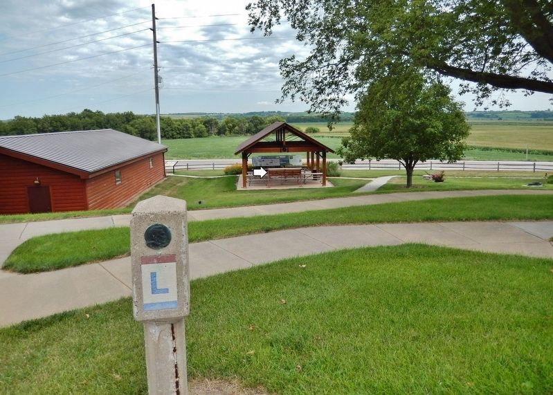
Near Lincoln Highway (U.S. 30) just west of Monroe Avenue, on the right when traveling west.
In 1912, there were approximately one million motor vehicles registered in the United States but few good roads. Most of the roads outside of urban areas were dirt that turned to mud when wet. Long-distance travel by car was still very much a . . . — — Map (db m162418) HM
Near Lincoln Highway (U.S. 30) just west of Monroe Avenue, on the right when traveling west.
Ninety percent of Iowa's land area is in agriculture, the highest of any state in the United States. As you travel the roads in Iowa, you will notice most of the crops are one of two types: corn or soybeans. Corn Native to central Mexico, where . . . — — Map (db m162420) HM
Near Lincoln Highway (U.S. 30) just west of Monroe Avenue, on the right when traveling west.
Loess Light-weight grains of feldspar, quartz, and mica are the material of loess. It is homogenous, clayless, and porous. The Hills are strengthened with a dry climate and endangered by erosion when excessive moisture occurs. The . . . — — Map (db m162417) HM
On Monroe Avenue just north of Lincoln Highway (U.S. 30), on the left when traveling north.
What is a Freedom Rock and the Freedom Rock Tour? The Freedom Rock (established in 1999) is a large boulder located in rural Iowa that is repainted every year with a different Thank You for our nations Veterans to honor their service to our . . . — — Map (db m291000) HM
On Huron Street 0.1 miles east of Shawmult Street, on the left when traveling west.
Left column
God Bless America
Seals of Armed Forces Center column
In Honor of All Those Who Served This Great Nation in War and Peace Time
American Flag . . . — — Map (db m30575) WM
Near Lincoln Highway (U.S. 30) just west of Monroe Avenue, on the right when traveling west.
The Loess Hills of Western Iowa are made of wind-blown soils that are highly susceptible to erosion if not protected by a patchwork of conservation practices. All throughout the Loess Hills region, farmers use multiple practices, placed in specific . . . — — Map (db m162419) HM
On Morton Avenue at King Street, on the left when traveling west on Morton Avenue.
This memorial is dedicated to
the Veterans of World War II
Roll of Honor
[Killed or Died in Service]
Harry Dodson • Arthur Frazier
Robert Leu • Clair Mayberry
[Others not transcribed] — — Map (db m93951) WM
On Lake Drive at East Sharp Street, on the left when traveling south on Lake Drive.
Early pioneer of this community arrived Coonville (Glenwood) July 4, 1849 from England. Operated first grist mill built on this site by J.W. Coolidge in 1849. Established Sivers-Deupree Mill on Keg Creek north of Glenwood 1865. Operated Vinton Mill . . . — — Map (db m93065) HM
On Lake Drive at East Sharp Street, on the right when traveling south on Lake Drive.
This Marker Commemorates The Early Trails Across Mills Co. Dragoon 1835 Mormon 1846 Stagecoach 1850 And Honors The Valiant Pioneers Who Travelled Them — — Map (db m93052) HM
Near Benton Street north of East Broadway, on the right when traveling north.
As the Mormon Battalion began their march to an unknown future in July 1846, they looked back on their families, fearing for their welfare and wondering when they would meet again. They marched from Iowa to California, where they were discharged. . . . — — Map (db m264592) HM
On Lafayette Avenue west of Oakland Avenue, on the left when traveling west.
"A king of men,
whose crown was love,
whose throne was gentleness."
This monument is to
commemorate the visit of
Abraham Lincoln
to Council Bluffs, Aug. 19, 1859
From this point he viewed
the extensive panorama of the . . . — — Map (db m241041) HM
On South 7th Street south of Willow Avenue, on the right when traveling south.
President of Iowa Suffrage Assn. 1871-1873. Advocate for temperance, women's rights & equal pay for women school teachers in Council Bluffs. — — Map (db m264547) HM
Near Monument Road 0.8 miles north of Mynster Springs Road, on the left when traveling north.
President Jefferson gave detailed instructions to Captain Meriwether Lewis - they were to seek out, meet with, and learn from the American Indian nations along the journey.
On July 28, 1884, the Lewis and Clark Expedition passed this . . . — — Map (db m264668) HM
Dedicated to the memory of the defenders of our flag. “Greater love hath no man.”
(reverse) Erected 1926 by Abe Lincoln’s Woman’s Relief Corps, No. 180, Council Bluffs, Iowa, 1861-1865. — — Map (db m45066) HM
Teacher in the public schools
of Council Bluffs,
Lieutenant and Captain Co. B.
4th Iowa Infantry,
Lieutenant-Colonel and Colonel
23rd Iowa Infantry.
[Dedicated] May 17, 1902 . . . — — Map (db m93985) HM WM
On Pearl Street, on the right when traveling south.
The Glory of their Spirit. When destiny demanded and country called, They in answer left our rolling hills and great river valley, and learned the arts of war. Then, on and beneath restless waves of the deep, in endless skies and across vast oceans . . . — — Map (db m44840) WM
Near Benton Street north of East Broadway, on the right when traveling north.
Drusilla Hendricks depended on her 16-year-old son, William, to help care for her family of six. Her husband, James, had been partially paralyzed during a battle in Missouri. Since the Church needed able-bodied young men to march with the battalion, . . . — — Map (db m264613) HM
Near Benton Street north of East Broadway, on the right when traveling north.
Elizabeth had benefited from the help of her parents-in-law many times while her husband, William, served as a missionary. This time felt different. This time he would have to leave Elizabeth and their children with "no dwelling, save a wagon." . . . — — Map (db m264615) HM
Near Benton Street north of East Broadway, on the right when traveling north.
Fanny Taggart arrived at Winter Quarters after her husband, George, had already left with the Mormon Battalion. With no means of her own and a stepdaughter, Eliza Ann, to care for, she "felt like bursting into tears." At the advice of Brigham Young, . . . — — Map (db m264617) HM
On West Broadway (U.S. 6) west of 25th Street, on the right when traveling east.
Fountain of Honor erected by the people of Council Bluffs, Iowa, in honor of those who served in the World War 1917 — 1918
For universal peace they died and here by love are glorified
Otto Achatz ·
Reuben Albertson ·
Sylvester Allen . . . — — Map (db m264550) WM
Near South 25th Street north of 2nd Avenue, on the right when traveling north.
In 1863, this area designated by President Lincoln as eastern end of first transcontinental railroad. Union Pacific built railroad west to Utah. — — Map (db m264544) HM
Near East Pierce Street 0.2 miles east of Canning Street, on the left when traveling east.
Through the efforts of General Dodge, as Chief Engineer of the Union Pacific Railroad, and the foresight of Abraham Lincoln, Council Bluffs became the hub of the first Transcontinental Railroad. — — Map (db m82165) HM
On Dumfries Avenue 1.5 miles south of Pioneer Trail, on the right when traveling south.
Hyde Park was a small farming community just west of here, founded in 1847 by Mormon pioneers. It was named for Orson Hyde, an Apostle of The Church of Jesus Christ of Latter-Day Saints who took up residence here when he returned that spring from . . . — — Map (db m93960) HM
On Pioneer Trail at Dumfries Avenue, on the right when traveling east on Pioneer Trail.
Some 10,000 goldseekers ferried the Missouri River at Council Bluffs in 1849. The settlement was "only a little Burg between two high bluffs," but over the next two decades it became the preferred "jumping off" point for thousands of overland . . . — — Map (db m93961) HM
On Oakland Avenue at Lafayette Avenue, on the right when traveling north on Oakland Avenue.
This historic cemetery of Kanesville (now Council Bluffs) was created as the resting place for the mortal remains of several hundred Mormon pioneers. From 1846 to 1853, thousands of members of The Church of Jesus Christ of Latter-Day Saints (the . . . — — Map (db m93973) HM
Near Monument Road 0.8 miles north of Mynster Springs Road, on the left when traveling north.
Beneath the bluffs on the Missouri Lewis and Clark held parley with the Otoe and Missouri Indians and named the locality Council Bluffs
August 3-1804
A memorial to the Lewis and Clark expedition erected by the Colonial Dames of America in the . . . — — Map (db m264676) HM
Near U.S. Highway 275 (U.S. 275) 0.1 miles Iowa Highway 92 (State Highway 92).
One of the most remarkable infantry marches in American history began here in July 1846 with the mustering of the Mormon Battalion. Members of The Church of Jesus Christ of Latter-day Saints (Mormon) responded to the request from President James . . . — — Map (db m22662) HM
This boulder commemorates the early travel upon the Mormon Trail through Kanseville, now Council Bluffs, and is dedicated to the memory of the throngs who crossed Iowa in advance of settlements. Here thousands of pioneers encamped awaiting pasturage . . . — — Map (db m45065) HM
On East Pierce Street at Union Street, on the right when traveling east on East Pierce Street.
Ministered to the Pottawattamie Indians 1838 to 1840 in the blockhouse built near this spot by U.S. dragoons in 1837. With love, faith and courage he labored for the cause of humanity. — — Map (db m264555) HM
Dedicated to the public on May 22, 2013, Tom Hanafan River's Edge Park reflects the power of the Missouri River and mirrors the strength and grace of the Bob Kerrey Pedestrian Bridge.
Carved from the river's riparian woodlands, the . . . — — Map (db m272074) HM
Near Benton Street north of East Broadway, on the right when traveling north.
Building a permanent home for Latter-day Saints required unexpected sacrifices.
Shortly after Latter-day Saints began gathering here in 1846, they received a difficult request. The United States government asked for a battalion of 500 men . . . — — Map (db m264588) HM
Near Benton Street north of East Broadway, on the right when traveling north.
The gathering of Saints included welcoming back friends who had once lost their faith.
At a meeting here in Kanesville on October 21, 1848, Elder Orson Hyde of the Quorum of the Twelve Apostles suddenly stopped speaking in the middle of a . . . — — Map (db m264595) HM
Near Benton Street north of East Broadway, on the right when traveling north.
Sarah Allen was grieving the loss of two children and had recently recovered from cholera herself when she bade farewell to her husband, Ezra. A miscommunication with merchants left her without provisions, and she chose to stay behind when her wagon . . . — — Map (db m264620) HM
Monumental in scale and daring in concept, the Bob Kerrey Pedestrian Bridge was selected by Travel+Leisure Magazine as one of the Worlds's [sic] Most Spectacular Pedestrian Bridges and has also received the prestigious Project of the Year . . . — — Map (db m272344) HM
French, Spanish, and British traders already controlled trade empires west of the Mississippi river when Lewis and Clark began the Expedition in 1804. but President Thomas Jefferson wanted the United States to control trade in the newly acquired . . . — — Map (db m45162) HM
Near Benton Street north of East Broadway, on the right when traveling north.
When Sophronia's husband, Henry, joined the battalion, he lamented leaving her on land belonging to a friend "with but little provisions, 3 dollars in money, [and] one cow." Before Henry marched away, he looked back one last time and saw Sophronia . . . — — Map (db m264616) HM
On Pearl Street near 5th Street, on the right when traveling south.
The Historic Pottawattamie County Squirrel Cage Jail. Built in 1885 and in continuous use as a jail until 1969. Acquired by the Park Board in 1971 for preservation. Named to the National Register of Historic Places in 1972 by the United States . . . — — Map (db m44839) HM
Near Benton Street north of East Broadway, on the right when traveling north.
Latter-day Saints were willing to give their all for their religious convictions.
Thousands of members of The Church of Jesus Christ of Latter-day Saints poured into western Iowa and eastern Nebraska in 1846. Fleeing religious intolerance . . . — — Map (db m264584) HM
On Harry Langdon Boulevard at Iowa School for Deaf Drive when traveling west on Harry Langdon Boulevard.
At the Grand Encampment, 490 men, 12 boys and 20 women joined the Mormon Battalion. The Grand Encampment was the gathering Point for Mormon Wagon Trains, 1846.
During the spring and summer of 1846, many pioneer companies of The Church of . . . — — Map (db m293316) HM
On 3rd Street at Story Street, on the right when traveling east on 3rd Street. Reported missing.
Built by General Grenville M. Dodge in 1869 and designated a National Historic Landmark by the United States Department of Interior of the National Park Service in 1963.
Acquired as a museum through public donations and restored by the . . . — — Map (db m249839) HM
Near Benton Street north of East Broadway, on the right when traveling north.
Learning the will of God concerning Church leadership took unified thoughts and prayers.
On December 5, 1847, members of the Quorum of the Twelve Apostles met in Kanesville. Their meeting lasted late into the night. Under the leadership of . . . — — Map (db m264594) HM
After traveling 68 days and 600 miles, it was time for the Corps of discovery to stop for a rest. On July 22, 1804, William Clark wrote, they camped on the east side of the Missouri River, about 10 miles above the mouth of the Platte River, on land . . . — — Map (db m45164) HM
The Western Historic Trails Center welcomes you to the story of America’s trails west. The trip across the county from the Mississippi to the Pacific required stamina and ingenuity to overcome the challenges of the landscape. Walk along the levee . . . — — Map (db m45161) HM
Near Monument Road 0.8 miles north of Mynster Springs Road, on the left when traveling north. Reported permanently removed.
One of President Jefferson’s goals for this expedition was to seek out the native peoples and council with them. On July 28, 1804, the expedition passed this overlook area early in the morning and noted of this area “a bluff on the S.S. . . . — — Map (db m45111) HM
Near Monument Road 0.8 miles north of Mynster Springs Road, on the left when traveling north.
During late July and early August of 1804, the Lewis and Clark Expedition traveled the length of the Missouri River that today is the boarder between Iowa and Nebraska. Meriwether Lewis and William Clark studied the river, forests, and prairies. . . . — — Map (db m45117) HM
Near Monument Road 0.8 miles north of Mynster Springs Road, on the left when traveling north.
In 1804-1806, Captains Meriwether Lewis and William Clark led the Corps of Discovery on an epic journey. Charged by President Thomas Jefferson to find a water route to the Pacific Ocean through the newly acquired Louisiana territory, they mapped the . . . — — Map (db m264664) HM
Near Monument Road 0.8 miles north of Mynster Springs Road. Reported permanently removed.
In 1804-06, Captains Meriwether Lewis and William Clark led about 40 soldiers and boatmen on an epic journey. President Thomas Jefferson commissioned this “Corps of discovery” to find a route to the Pacific Ocean through the newly acquired Louisiana . . . — — Map (db m45116) HM
On U.S. 6/59 at Oakland Avenue, on the right when traveling south on U.S. 6/59.
To Our Armed Forces;
You go where we ask, never with complaint
You fight with honor, never demanding praise
You sacrifice greatly, never yielding courage
You always protect our freedoms, never will you fail
"Thank you"
Citizens of Oakland . . . — — Map (db m93776) WM
Near Interstate 80 at milepost 19, 3.6 miles west of 298th Street (Iowa Highway 244), on the right when traveling west.
The Council Bluffs area was the scene of such important events in Iowa history as the explorations of Lewis and Clark, the Mormon Trail, the Missouri River steamboat traffic and the railroad industry. Francois Guittar established the first white . . . — — Map (db m224579) HM
Near Interstate 80 at milepost 19, 2 miles east of Magnolia Road, on the right when traveling east.
The Council Bluffs area was the scene of such important events in Iowa history as the explorations of Lewis and Clark, the Mormon Trail, the Missouri River steamboat traffic and the railroad industry. Francois Guittar established the first white . . . — — Map (db m224580) HM
Near Eugene T. Mahoney State Park Road 1.4 miles north of State Highway 66.
From 1050-1400 the lower Platte and Missouri River valleys were home to prehistoric Indian farmers. These people lived in small villages and isolated farmsteads, cultivated corn and beans, and hunted game. The Indians built square-shaped houses . . . — — Map (db m298136) HM
On East F Street at 5th Street (Local Route F St), on the left when traveling north on East F Street.
"Love is more like a light that you carry .... that is what love is to a woman - a lantern in her hand," says Abbie Deal the courageous heroine in Bess Streeter Aldrich's novel about the pioneers who with dreams and hard work forged this great . . . — — Map (db m82510) HM
This Property
is listed in the
National Register
of Historic Places
By the United States
Department of the Interior
Blake Building 305 Main Street 1883 ca
John Blake, proprietor of a local saloon, erected this building. The . . . — — Map (db m78059) HM
This Property
is listed in the
National Register
of Historic Places
By the United States
Department of the Interior
Budweiser Building 1888
Anheuser-Busch Brewing Co built for $20,000 to house a saloon and liquor business. . . . — — Map (db m78051) HM
Near Main Street, on the right when traveling west.
Two markers, to the left and right of the front entrance.
Has been placed on the
National Register
of Historic Places
By the United States
Department of the Interior
1985
This Property
is listed in the
. . . — — Map (db m78049) HM
On Main Street west of North 6th Street, on the right when traveling west.
When the outbreak of war between the states became imminent in the spring of 1861, the citizens of Plattsmouth were quick to respond to the impending crisis. Without waiting for President Lincoln's call for volunteers, Dr. Robert R. Livingston . . . — — Map (db m78024) HM
This Property
is listed in the
National Register
of Historic Places
By the United States
Department of the Interior
Drew/Weckbach 317, 321, 325 Main Street 1881 & 1886
Joseph V. Weckbach came to Plattsmouth in 1865. After . . . — — Map (db m78056) HM
This Property
is listed in the
National Register
of Historic Places
By the United States
Department of the Interior
Excelsior Building 313 Main Street 1884
Three business owners, in succession, J.C. & R. Peterson, brothers, . . . — — Map (db m78058) HM
On Livingston Highway (U.S. 34), on the right when traveling east.
This Property
is listed in the
National Register
of Historic Places
By the United States
Department of the Interior
Plattsmouth Bridge 1930
The bridge was built to replace the ferry service that had started in 1848. It was . . . — — Map (db m78061) HM
This Property
is listed in the
National Register
of Historic Places
By the United States
Department of the Interior
Vienna Bakery 329 Main Street 1881
Built by William Stadelman, First occupant was a bakery run by William . . . — — Map (db m78054) HM
This Property
is listed in the
National Register
of Historic Places
By the United States
Department of the Interior
Wetenkamp Building 337 Main Street 1890
Many businesses occupied this site. Among them were various stores, . . . — — Map (db m78053) HM
On State Highway 50, on the left when traveling north.
This building was constructed by community effort in 1871 of native limestone as the Congregational Church and served in that capacity until a new brick church was constructed 1887-1890. The nearby stone parsonage, first occupied in 1867, was sold . . . — — Map (db m82521) HM
On North Park Avenue at East 5th Street, on the right when traveling north on North Park Avenue.
Fremont was laid out in August 1856. The town site was named for John C. Frémont, the new Republican Party's nominee for president in 1856, although Democrat James Buchanan was elected. Between 1842 and 1844 Frémont, then a U.S. Army topographical . . . — — Map (db m223447) HM
Near West 6th Street near North Broad Street, on the left when traveling east.
In 1917, the stately, six-story Hotel Pathfinder was built on the Southeast corner of 6th & Broad streets in Fremont. The hotel had 115 rooms and guest capacity of 360. The Pathfinder also included a barbershop, restaurant, and ballroom. The hotel . . . — — Map (db m251170) HM
On Military Avenue, on the right when traveling east.
The Mormon Pioneer Trail from Nauvoo, Illinois to the Rocky Mountains passed here April 17, 1847. In this vicinity a military-type organization was formed with Brigham Young, Lieutenant General; Stephen Markham, Colonel; John Pack and Shadrach . . . — — Map (db m58566) HM
On Old Lincoln Highway (Old U.S. 30) 0.1 miles east of Timberwood Drive, on the right when traveling west.
Overland Trail 1813 to 1867
Mormon Trail 1847 to 1864
Military Road to New Fort Kearny 1856
Site of Albion, Lincoln P.O. and Timberville P.O. from 1856 to 1868 — — Map (db m251179) HM
On U.S. 77 0.1 miles south of Riverview Road, on the left when traveling south.
Before the Pawnee Indians were placed on a reservation, they located their last earthlodge villages on these nearby bluffs. Pa-hŭk’ hill, one of the five sacred places of the Pawnee, was also near here. The villages were occupied from . . . — — Map (db m287986) HM
On West Old Highway 30 at Puttle Huttle Road on West Old Highway 30.
The north bank of the Platte River, from the 1830's through the 1860's, served as a major overland route to the West. It was used by fur traders, soldiers, gold seekers and other emigrants. The expedition of Major Stephen H. Long passed through . . . — — Map (db m251176) HM
On Main Street near 5th Avenue, on the right when traveling south.
The Union Pacific reached Fremont in 1866. The new Union Depot was erected at a cost of $50,000 and gave the approach to the city a dignified and completed appearance, with its winding gravel walks, grass and flower plots and wide frontage.
As a . . . — — Map (db m58553) HM
On North Yager Road (County Road 23) just south of Rosedale Road, on the right when traveling south.
In 1872 Dodge County purchased 160 acres at this site to provide relief for the needy. In 1884 a residence was added for those receiving aid; by 1888 the farm comprised 245 acres. Paid stewards oversaw its operation. After 1935, federal and state . . . — — Map (db m288000) HM
On North Main Street (Nebraska Route 79) at West 7th Street, on the right when traveling north on North Main Street.
Before this was the Datel Block, it was the Doubrava corner. A general store was opened on this site in 1869. Fredrick F. Doubrava took over the store in 1881 and A.F. Doubrava operated the store until 1911. The building had a few owners over the . . . — — Map (db m251834) HM
On North Main Street (Nebraska Route 79) north of East 7th Street, on the right when traveling north.
On one of the coldest days of 2009, smoldering insulation around a light caught fire around 1:30 p.m. The blaze grew to take out the south of the alley, the Pour House bar and apartment above, the North Bend Eagle, A Little Off the Top salon and a . . . — — Map (db m251900) HM
On North Main Street (Nebraska Route 79) at East 7th Street, on the right when traveling north on North Main Street.
In late 1871, T.B. Purcell built a frame building here at Seventh and Main and ran a grocery store under the name Dowling and Purcell. The grocery store moved elsewhere and Milton May rented the building for a hardware store. North Bend's . . . — — Map (db m251820) HM
On this site once stood a 2-story brick building. C.W. Hyatt in 1883 to house
the newspaper he started the year before, the North Bend Flail. He moved the
paper to Fremont in 1888 and soon after
the building was bought by Charles S.J. Lee for a . . . — — Map (db m251839) HM
On North Main Street (Nebraska Route 79) at West 8th Street, on the right when traveling south on North Main Street.
Victor W. Jansen came to North Bend in 1897 and joined C.L. Kelly Hardware as a sheet metal worker, a trade he learned as a teenager in Denmark. Jansen Hardware was established in 1907, adding plumbing and hardware to his sheet metal work. In 1916 . . . — — Map (db m251891) HM
On North Main Street (Nebraska Route 79) north of West 8th Street, on the left when traveling north.
This park is dedicated to all those who served in the Armed Forces of the United States of America. The founders of this memorial ask that you never forget
the sacrifices of these men and women especially those who died for the freedoms we enjoy . . . — — Map (db m251912) WM
On Old Lincoln Highway (Old U.S. 30) 0.3 miles east of County Route 6, on the right when traveling west.
First settlement of area by
George Young and Robert Millar
July 4, 1856 30 rods south-west
where Seth Young, the first son of
Dodge County settlers, was born
Nov. 30, 1856. — — Map (db m251917) HM
On North Main Street (Nebraska Route 79) at East 7th Street, on the right when traveling north on North Main Street.
P.F. Carey bought the Farnham Building in 1919 for his furniture and undertaking business, but he soon built a new building across the street and moved there. In 1923 carey tore down the Farnham Building and transformed it into a filling station . . . — — Map (db m251822) HM
On State Highway 79 at County Highway K, on the right when traveling south on State Highway 79.
The establishment of the Webster community was centered around this intersection. Beginning in 1871 the village of Webster grew to include a post office, blacksmith shop, telephone company, store, school, and Webster Hall. Webster Hall hosted . . . — — Map (db m223448) HM
On Flanagan Boulevard at Heroes Boulevard, on the right when traveling west on Flanagan Boulevard.
Dedicated to Boys Town's
sons & daughters who
have served their country in the
Armed Forces
July 1991
Honoring
Boys Town Alumni
who gave the
Ultimate Sacrifice
Ask not what your country can do for you
ask what you can do for . . . — — Map (db m58573) WM
On Flanagan Boulevard, on the right when traveling west.
Boys Town was founded as a home and school for homeless, abandoned, neglected or otherwise underprivileged boys, regardless of color or creed, by Father Edward J. Flanagan (1886-1948) on December 10, 1917. The first Father Flanagan's Boy's Home at . . . — — Map (db m53109) HM
Founder of Boys Town
Omaha, Nebraska, U.S.A.
"The work will continue, you see,
whether I am there or not,
because it is God's work, not mine."
Msgr. Edward J. Flanagan
Mol an oige
agus tiocfaidh si
Ni neart go cur le cheile . . . — — Map (db m58482) HM
On Heroes Boulevard south of Flanagan Boulevard, on the left when traveling north.
In memory of
Rt. Rev. Monsignor
Edward J. Flanagan
Founder of Boys Town and
Recipient of Variety Clubs
First Humanitarian Award
His dictum:
"There is no such thing as a bad boy" — — Map (db m58481) HM
On Pawnee Road (State Highway 36) 0.6 miles east of Highway 275, on the left when traveling east.
Just to the southwest is the Platte River, whose valley was one of the great roadways to the west, used by fur traders, emigrants, military expeditions, gold seekers, and Mormons. Mormon migration to the Salt Lake Valley began at Winter Quarters, . . . — — Map (db m290932) HM
Near Abbott Drive near East Locust Street, on the right when traveling south.
Because he was a slave, one member of the expedition had no a first name -- York.
Stories about York's role in the Lewis and Clark Expedition sometimes paint him as either larger-than-life or as unimportant to the venture's success. Some . . . — — Map (db m286312) HM
324 entries matched your criteria. The first 100 are listed above. Next 100 ⊳