1716 entries match your criteria. Entries 101 through 200 are listed.⊲ Previous 100 — Next 100 ⊳
Historical Markers and War Memorials in Arkansas
By William Fischer, Jr., September 27, 2017
Frisco Depot and NRHP Marker
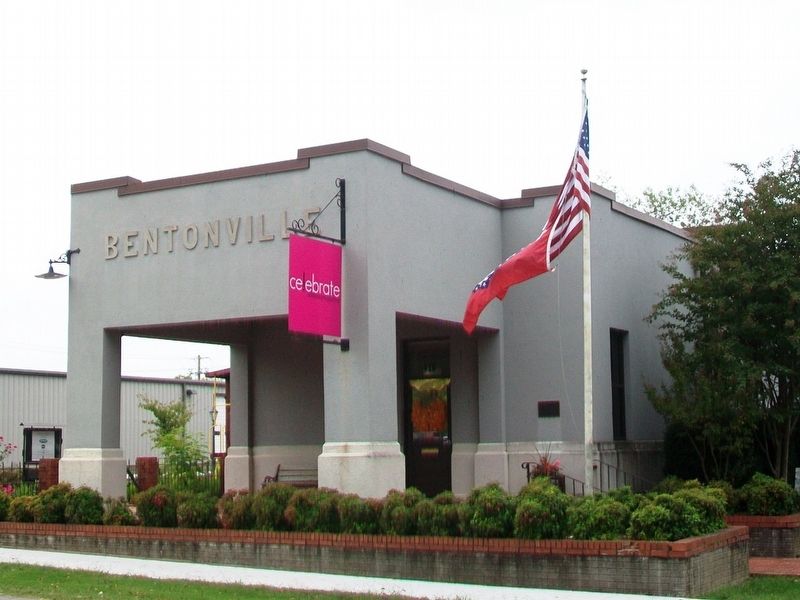
| 101 ► Arkansas, Benton County, Bentonville — Frisco Depot — |
| On Main Street at the Downtown Trail, on the right when traveling south on Main Street. | |||
| 102 ► Arkansas, Benton County, Bentonville — Integrating With Nature / The Journey — |
| 103 ► Arkansas, Benton County, Bentonville — Meteor Theatre — |
| On West Central Avenue, on the right when traveling west. | |||
| 104 ► Arkansas, Benton County, Bentonville — Peoples Bank — |
| On West Central Avenue, on the left when traveling north. | |||
| 105 ► Arkansas, Benton County, Bentonville — Putman Cemetery — Benton County, Arkansas — |
| On Southeast Metro Parkway south of Southeast Walton Boulevard (Business U.S. 71), on the left when traveling south. | |||
| 106 ► Arkansas, Benton County, Bentonville — Roy's Office Supply — |
| On East Central Avenue, on the right when traveling east. | |||
| 107 ► Arkansas, Benton County, Bentonville — Terry Block — |
| On Central Avenue (State Highway 72) at Main Street, on the right when traveling west on Central Avenue. | |||
| 108 ► Arkansas, Benton County, Bentonville — The Ivy House — 901 McCollum Drive — Built 1926 — |
| On Ivy Circle at McCollum Drive, on the left when traveling west on Ivy Circle. | |||
| 109 ► Arkansas, Benton County, Bentonville — Walton's 5 &10 — |
| On Main Street near Central Avenue (Arkansas Highway 72), on the left when traveling north. | |||
| 110 ► Arkansas, Benton County, Bentonville, Downtown Bentonville — Bentonville's Early History — |
| On North Main Street at East Central Avenue (State Highway 72), on the right when traveling north on North Main Street. | |||
| 111 ► Arkansas, Benton County, Bentonville, Downtown Bentonville — Burns House — |
| On Southeast 3rd Street at Southeast A Street, on the right when traveling east on Southeast 3rd Street. | |||
| 112 ► Arkansas, Benton County, Bentonville, Downtown Bentonville — Colonel Young House — |
| On Southeast 5th Street west of Southeast J Street, on the right when traveling west. | |||
| 113 ► Arkansas, Benton County, Bentonville, Downtown Bentonville — Craig-Bryan House — |
| On West Central Avenue (Arkansas Route 72) 0.1 miles east of Southwest D Street, on the right when traveling east. | |||
| 114 ► Arkansas, Benton County, Bentonville, Downtown Bentonville — Elliot-McGinly Home — |
| On Southeast 3rd Street at Southeast B Street, on the right when traveling west on Southeast 3rd Street. | |||
| 115 ► Arkansas, Benton County, Bentonville, Downtown Bentonville — Famous Outlaws that Robbed Bentonville — |
| Near South Main Street. | |||
| 116 ► Arkansas, Benton County, Bentonville, Downtown Bentonville — Iris Louise McPhetridge Thaden — (November 12, 1905 November 9, 1979) — Was an American aviation pioneer and holder of numerous aviation records. — |
| Near South Main Street north of Southeast 2nd Street, on the left when traveling south. | |||
| 117 ► Arkansas, Benton County, Bentonville, Downtown Bentonville — James A. Rice House — |
| On Southeast 3rd Street at Southeast A Street, on the right when traveling east on Southeast 3rd Street. | |||
| 118 ► Arkansas, Benton County, Bentonville, Downtown Bentonville — McAndrews-Pace Home — |
| On Southeast 3rd Street at Southeast B Street, on the left when traveling west on Southeast 3rd Street. | |||
| 119 ► Arkansas, Benton County, Bentonville, Downtown Bentonville — Miner Home — (AKA Charles Rice House) — |
| On Northwest A Street at Northwest 5th Street, on the left when traveling north on Northwest A Street. | |||
| 120 ► Arkansas, Benton County, Bentonville, Downtown Bentonville — The Henry House — |
| On Southeast 2nd Street at Southeast B Street, on the right when traveling east on Southeast 2nd Street. | |||
| 121 ► Arkansas, Benton County, Bentonville, Downtown Bentonville — The Lawson Building — (AKA Charles R. Craig Building) — |
| On South Main Street north of Southeast 2nd Street, on the right when traveling north. | |||
| 122 ► Arkansas, Benton County, Garfield — "Dat De Shpot, Sergent!" — Pea Ridge National Military Park — National Park Service, U.S. Department of the Interior — |
| On Military Park Road (County Road 65), on the right when traveling south. | |||
| 123 ► Arkansas, Benton County, Garfield — A Crisis in Command — Pea Ridge National Military Park — National Park Service, U.S. Department of the Interior — |
| On Military Park Road (County Road 65), on the left when traveling north. | |||
| 124 ► Arkansas, Benton County, Garfield — A Fierce Tangle in Morgan's Woods — Pea Ridge National Military Park — National Park Service, U.S. Department of the Interior — |
| On Military Park Road (County Road 65), on the right when traveling north. | |||
| 125 ► Arkansas, Benton County, Garfield — A Long, Cold Hungry March — Pea Ridge National Military Park — National Park Service, U.S. Department of the Interior — |
| On Military Park Road (County Road 65), on the right when traveling east. | |||
| 126 ► Arkansas, Benton County, Garfield — A Perfect Storm of Shot and Shell — Pea Ridge National Military Park — National Park Service, U.S. Department of the Interior — |
| On Military Park Road (County Road 65), on the right when traveling south. | |||
| 127 ► Arkansas, Benton County, Garfield — A Reunited Soldiery Monument — |
| On Military Park Road (County Road 65), on the right when traveling south. | |||
| 128 ► Arkansas, Benton County, Garfield — A Village Full of Wounded Men — Pea Ridge National Military Park — National Park Service, U.S. Department of the Interior — |
| On Military Park Road (County Road 65), on the left when traveling west. | |||
| 129 ► Arkansas, Benton County, Garfield — City of Soldiers — Pea Ridge National Military Park — National Park Service, U.S. Department of the Interior — |
| On Military Park Road (County Road 65), on the right when traveling west. | |||
| 130 ► Arkansas, Benton County, Garfield — Confederate Sunset — Pea Ridge National Military Park — National Park Service, U.S. Department of the Interior — |
| On Military Park Road (County Road 65), on the left when traveling south. | |||
| 131 ► Arkansas, Benton County, Garfield — Disastrous Retreat — March 8, 1862 - Afternoon — Pea Ridge National Military Park — |
| Near Military Park Road (County Road 65), on the left when traveling south. | |||
| 132 ► Arkansas, Benton County, Garfield — Elkhorn Tavern Taken — March 7, 1862 - Early Afternoon — Pea Ridge National Military Park — |
| Near Military Park Road (County Road 65), on the left when traveling south. | |||
| 133 ► Arkansas, Benton County, Garfield — Fiery Finale on Ruddick's Field — Pea Ridge National Military Park — National Park Service, U.S. Department of the Interior — |
| Near Military Park Road (County Road 65), on the right when traveling south. | |||
| 134 ► Arkansas, Benton County, Garfield — Getting Ready To Fight — March 6, 1862 - Late Afternoon — Pea Ridge National Military Park — |
| On Military Park Road (County Road 65), on the right when traveling west. | |||
| 135 ► Arkansas, Benton County, Garfield — Hard Fighting Near Leetown — Pea Ridge National Military Park — National Park Service, U.S. Department of the Interior — |
| Near Military Park Road (County Road 65), on the right when traveling south. | |||
| 136 ► Arkansas, Benton County, Garfield — It was the Grandest Thing I Ever Saw... — Pea Ridge National Military Park — National Park Service, U.S. Department of the Interior — |
| Near Military Park Road (County Road 65), on the right when traveling south. | |||
| 137 ► Arkansas, Benton County, Garfield — Leetown — |
| Near Military Park Road (County Road 65), on the left when traveling west. | |||
| 138 ► Arkansas, Benton County, Garfield — Lifeline for Two Armies — Pea Ridge National Military Park — National Park Service, U.S. Department of the Interior — |
| On Military Park Road (County Road 65), on the left when traveling south. | |||
| 139 ► Arkansas, Benton County, Garfield — Night Moves — Pea Ridge National Military Park — National Park Service, U.S. Department of the Interior — |
| Near Military Park Road (County Road 65), on the right when traveling south. | |||
| 140 ► Arkansas, Benton County, Garfield — Pea Ridge and the Trail of Tears — Trail of Tears National Historic Trail — National Trails System — |
| On Military Park Road (County Road 65), on the left when traveling south. | |||
| 141 ► Arkansas, Benton County, Garfield — Pea Ridge Confederate Monument — |
| On Military Park Road (County Road 65), on the right when traveling south. | |||
| 142 ► Arkansas, Benton County, Garfield — Potts' Hill — |
| On N. Old Wire Road (County Road 67) 1.5 miles north of Gann Ridge Road, on the right when traveling north. | |||
| 143 ► Arkansas, Benton County, Garfield — Remembrance and Reunion — Pea Ridge National Military Park — National Park Service, U.S. Department of the Interior — |
| On Military Park Road (County Road 65), on the right when traveling south. | |||
| 144 ► Arkansas, Benton County, Garfield — Save the Cannon! — March 7, 1862 - Mid-Morning — Pea Ridge National Military Park — |
| On Military Park Road (County Road 65), on the left when traveling north. | |||
| 145 ► Arkansas, Benton County, Garfield — Slaughter in the Rocks — March 8, 1862 - Morning — Pea Ridge National Military Park — |
| Near Military Park Road (County Road 65), on the right when traveling south. | |||
| 146 ► Arkansas, Benton County, Garfield — Stand to Your Posts! — March 7, 1862 - Mid-Morning — Pea Ridge National Military Park — |
| On Military Park Road (County Road 65), on the right when traveling north. | |||
| 147 ► Arkansas, Benton County, Garfield — That Beautiful Charge — March 8, 1862 - Mid-Morning — Pea Ridge National Military Park — |
| On Military Park Road (County Road 65), on the right when traveling south. | |||
| 148 ► Arkansas, Benton County, Garfield — The Butterfield Overland Mail Route — |
| Near Military Park Road (County Road 65). | |||
| 149 ► Arkansas, Benton County, Garfield — The Enemy Is Behind Us! — March 7, 1862 - Mid-Morning — Pea Ridge National Military Park — |
| On Military Park Road (County Road 65), on the right when traveling west. | |||
| 150 ► Arkansas, Benton County, Garfield — They Passed This Way — Trail of Tears National Historic Trail — National Trails System — |
| On Military Park Road (County Road 65). | |||
| 151 ► Arkansas, Benton County, Garfield — Two Armies Collide — Pea Ridge National Military Park — National Park Service, U.S. Department of the Interior — |
| On Military Park Road (County Road 65), on the left when traveling north. | |||
| 152 ► Arkansas, Benton County, Garfield — U.S. Army Headquarters 1862 — |
| On U.S. 62, on the right when traveling east. | |||
| 153 ► Arkansas, Benton County, Garfield — Vulnerable in Victory — March 7, 1862 - Mid-Night — Pea Ridge National Military Park, National Park Service, U.S. Department of the Interior — |
| Near Military Park Road (County Road 65), on the left when traveling south. | |||
| 154 ► Arkansas, Benton County, Garfield — Where I Knew I Might Make the Best Fight — Pea Ridge National Military Park — National Park Service, U.S. Department of the Interior — |
| On Sugar Creek Road (County Road 44), on the right when traveling east. | |||
| 155 ► Arkansas, Benton County, Gentry — Carl and Evans House — 70 W Main Street — |
| On West Main Street (State Highway 59) east of South Giles Street, on the right when traveling east. | |||
| 156 ► Arkansas, Benton County, Gentry — Carpenter Building — |
| On East Main Street (State Highway 59) at North Rust Avenue, on the right when traveling west on East Main Street. | |||
| 157 ► Arkansas, Benton County, Gentry — Gentry Grand Army of the Republic Monument — |
| On Pioneer Lane, 0.2 miles south of Mockingbird Lane, on the left when traveling south. | |||
| 158 ► Arkansas, Benton County, Gentry — Mitchell House — |
| On North Nelson Avenue at East Arkansas Avenue, on the right when traveling north on North Nelson Avenue. | |||
| 159 ► Arkansas, Benton County, Gentry — Mitchell-Ward House — 1897 — |
| On North Nelson Avenue at East Arkansas Street, on the left when traveling north on North Nelson Avenue. | |||
| 160 ► Arkansas, Benton County, Gravette — 13 — Arkansas & Oklahoma Railroad — Gravette — |
| On 4th Avenue Southeast just south of Atlanta Street Southeast (State Highway 72), on the right when traveling south. | |||
| 161 ► Arkansas, Benton County, Gravette — 144 — Camp Jackson / Confederate Dead — |
| On Georgia Flat Road (County Road 503) at Kane Road (County Road 422), on the left when traveling west on Georgia Flat Road. | |||
| 162 ► Arkansas, Benton County, Gravette — Georgia Cemetery — 4th Arkansas Infantry C.S.A. — “Camp Jackson” Benton County, Arkansas — |
| Near Georgia Flat Road (County Road 503) south of Kane Road (County Road 422), on the left when traveling south. | |||
| 163 ► Arkansas, Benton County, Gravette — Kansas City Southern Railway Caboose #383 — |
| On 1st Avenue Southeast (Arkansas Route 59) south of Main Street Northeast, on the right when traveling south. | |||
| 164 ► Arkansas, Benton County, Lowell — Canning Factory — |
| On Monroe Avenue east of Lincoln Street, on the left when traveling east. | |||
| 165 ► Arkansas, Benton County, Lowell — City of Lowell — |
| On Jackson Place at McClure Avenue (County Road 923), on the left when traveling north on Jackson Place. | |||
| 166 ► Arkansas, Benton County, Lowell — Evaporator Near Railroad Track — |
| On Jackson Street south of McClure Avenue (County Road 923), on the right when traveling south. | |||
| 167 ► Arkansas, Benton County, Lowell — Evaporator Near School — |
| On McClure Avenue (County Road 923) at Jackson Street, on the right when traveling east on McClure Avenue. | |||
| 168 ► Arkansas, Benton County, Lowell — First Baptist Church — |
| On McClure Avenue (County Road 923) at Johnson Avenue, on the right when traveling east on McClure Avenue. | |||
| 169 ► Arkansas, Benton County, Lowell — First Free Will Baptist Church — |
| On Madison Avenue at Washington Street, on the right when traveling east on Madison Avenue. | |||
| 170 ► Arkansas, Benton County, Lowell — IOOF/Masonic Lodge Building — |
| On Jackson Street at Johnson Avenue, on the right when traveling north on Jackson Street. | |||
| 171 ► Arkansas, Benton County, Lowell — L. P. Davis House and Grounds — |
| On Jackson Street at Johnson Avenue, on the right when traveling south on Jackson Street. | |||
| 172 ► Arkansas, Benton County, Lowell — Lowell Postal Service — |
| On Jackson Street south of McClure Avenue (County Road 923), on the left when traveling south. | |||
| 173 ► Arkansas, Benton County, Lowell — 107 — Mudtown — |
| On Jackson Place north of McClure Avenue (County Road 923), on the left when traveling north. | |||
| 174 ► Arkansas, Benton County, Lowell — Old City Jail |
| On Jackson Street south of Johnson Avenue, on the right when traveling south. Reported missing. | |||
| 175 ► Arkansas, Benton County, Lowell — Old City Jail — |
| On Jackson Street south of McClure Avenue (County Road 923), on the right when traveling south. | |||
| 176 ► Arkansas, Benton County, Lowell — Old School on South Lincoln Street — |
| On McClure Avenue (County Road 923) west of Jackson Street, on the right when traveling east. | |||
| 177 ► Arkansas, Benton County, Lowell — Original Site of Bloomington (Mudtown) Arkansas — |
| On Jackson Place at McClure Avenue (Route 923), on the left when traveling north on Jackson Place. | |||
| 178 ► Arkansas, Benton County, Lowell — Rev. James M. Ingram — (abt. 1826 - Sept. 4, 1870) — |
| On Primrose Road at Phillips Road, on the left when traveling south on Primrose Road. | |||
| 179 ► Arkansas, Benton County, Lowell — School House on McClure Street — |
| On Jackson Street at McClure Avenue (County Road 923), on the right when traveling south on Jackson Street. | |||
| 180 ► Arkansas, Benton County, Lowell — Service Station and Garage — |
| On Jackson Place at McClure Avenue, on the left when traveling north on Jackson Place. | |||
| 181 ► Arkansas, Benton County, Lowell — The Bank of Lowell — |
| On Jackson Street south of McClure Avenue (County Road 923), on the left when traveling south. | |||
| 182 ► Arkansas, Benton County, Lowell — The Butterfield Stagecoach Road — Established 1858 — |
| On Jackson Place at McClure Avenue (Route 923), on the right when traveling north on Jackson Place. | |||
| 183 ► Arkansas, Benton County, Lowell — The Lowell Historical Museum — |
| On Jackson Place at McClure Avenue (County Road 923), on the left when traveling north on Jackson Place. | |||
| 184 ► Arkansas, Benton County, Lowell — Train Depot — |
| On Jackson Street south of McClure Avenue (County Road 923), on the right when traveling south. | |||
| 185 ► Arkansas, Benton County, Maysville — Camp Walker — |
| On Arkansas Route 72 at Busse Road, on the left when traveling north on State Route 72. | |||
| 186 ► Arkansas, Benton County, Maysville — The Battle of Maysville — |
| On State Highway 43 near State Highway 72, on the right when traveling south. | |||
| 187 ► Arkansas, Benton County, Pea Ridge — Memorial to the Old Pea Ridge College and Gym — |
| On East Pickens Road (Arkansas Route 72) east of North Curtis Avenue, on the left when traveling east. | |||
| 188 ► Arkansas, Benton County, Pea Ridge — Pea Ridge Veterans Memorial — |
| On Arkansas Route 72 at North Curtis Avenue, on the right when traveling west on State Route 72. | |||
| 189 ► Arkansas, Benton County, Pea Ridge — Texas Memorial — |
| On N. Curtis Avenue at E. Pickens Road, on the right when traveling north on N. Curtis Avenue. | |||
| 190 ► Arkansas, Benton County, Pea Ridge — United States Submarine Veterans on Eternal Patrol — |
| On State Highway 72 at North Curtis Avenue when traveling west on State Highway 72. | |||
| 191 ► Arkansas, Benton County, Rogers — All Vietnam Veterans Memorial — In Memory Of — |
| On Hudson Road (U.S. 62) near Cass Hough Drive, on the left when traveling north. | |||
| 192 ► Arkansas, Benton County, Rogers — Applegate Drugstore — |
| On South 1st Street south of West Walnut Street, on the right when traveling south. | |||
| 193 ► Arkansas, Benton County, Rogers — Arvest Bank — |
| On Walnut Street (State Highway 12) at 2nd Street (State Highway 12), on the right when traveling west on Walnut Street. | |||
| 194 ► Arkansas, Benton County, Rogers — Bank of Rogers — |
| On South 1st Street south of West Walnut Street, on the right when traveling south. | |||
| 195 ► Arkansas, Benton County, Rogers — 59 — Camp Halleck at Osage Springs — |
| On West New Hope Road at South Osage Springs Drive, on the right when traveling west on West New Hope Road. | |||
| 196 ► Arkansas, Benton County, Rogers — Campbell House — |
| On South 3rd Street south of West Pine Street, on the right when traveling south. | |||
| 197 ► Arkansas, Benton County, Rogers — Cross Hollows — |
| On South Old Wire Road (County Road 83) 0.2 miles north of Dogwood Drive/Cross Hollow Road (County Road 1189), on the left when traveling north. | |||
| 198 ► Arkansas, Benton County, Rogers — Cross Hollows — |
| On South Old Wire Road (County Road 83) 0.2 miles north of Dogwood Drive/Cross Hollows Road (County Road 1189), on the left when traveling north. | |||
| 199 ► Arkansas, Benton County, Rogers — Daisy Airgun Museum — 202 W. Walnut — [Juhre Building] — |
| On 2nd Street (State Highway 12) at Walnut Street (State Highway 12), on the right when traveling south on 2nd Street. | |||
| 200 ► Arkansas, Benton County, Rogers — F-101B Voodoo — |
| On Hudson Road (U.S. 62) at Cass Hough Drive, on the left when traveling north on Hudson Road. | |||
1716 entries matched your criteria. Entries 101 through 200 are listed above. ⊲ Previous 100 — Next 100 ⊳