503 entries match your criteria. The first 100 are listed. ⊳
Historical Markers and War Memorials
in Greater Charleston Area Region
By Tom Bosse, September 19, 2025
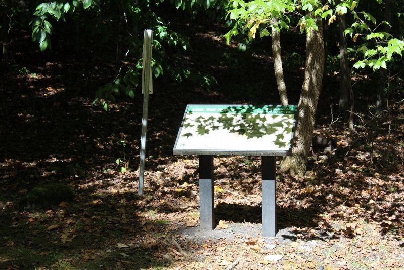
Adair, West Virginia Marker
1 ► West Virginia, Clay County, Avoca — Adair, West Virginia — Buffalo Creek Recreational Trail —  |
| On Hamrick Road (County Road 11/2) south of Triplett Ridge Road (County Road 11), on the left when traveling south. | |||
| 2 ► West Virginia, Clay County, Bickmore — Solomon Osborne — |
| On West Virginia Route 16 just south of Jess Reedy Road, on the left when traveling south. | |||
| 3 ► West Virginia, Clay County, Bomont — Golden Delicious Apple — 1912-1959 — |
| On Lizemore Road south of Homewood Lane, on the right when traveling north. | |||
| 4 ► West Virginia, Clay County, Clay — Benjamin L. Stephenson — |
| On Main Street (West Virginia Route 16) east of Locust Street, on the right when traveling east. | |||
| 5 ► West Virginia, Clay County, Clay — Clay — |
| On Main Street (West Virginia Route 16) east of Locust Street, on the left when traveling east. | |||
| 6 ► West Virginia, Clay County, Clay — Clay County Korean Veterans Memorial — |
| On Main Street, on the left when traveling north. | |||
| 7 ► West Virginia, Clay County, Clay — Clay County Viet Nam Veterans Memorial — |
| On Main Street, on the left when traveling north. | |||
| 8 ► West Virginia, Clay County, Clay — Clay County WWI & WWII Veterans Memorial — |
| On Main Street, on the left when traveling north. | |||
| 9 ► West Virginia, Clay County, Clay — Dundon, West Virginia — Buffalo Creek Recreational Trail — |
| On Buffalo Creek Road north of East Dundon Road, on the left when traveling north. | |||
| 10 ► West Virginia, Clay County, Clay — Floyd T. Sargent — |
| On Main Street (West Virginia Route 16) 0.1 miles east of Locust Street, on the left when traveling north. | |||
| 11 ► West Virginia, Clay County, Clay — 436 — Old Clay County Courthouse — |
| On Main Street east of Locust Street, on the right when traveling west. | |||
| 12 ► West Virginia, Clay County, Clay — Union Militias — |
| On Main Street (West Virginia Route 4) at Main Street ( Route 16), on the left when traveling east on Main Street. | |||
| 13 ► West Virginia, Clay County, Hartland — Jones Brothers Memorial Bridge — |
| On West Virginia Route 16 at Elkhurst Road, on the right when traveling south on West Virginia Route 16. | |||
| 14 ► West Virginia, Clay County, Maysel — William C. Markle — |
| On Procious Maysel Road (West Virginia Route 4) east of Maysel Clay Road (Local Route 26), on the right when traveling east. | |||
| 15 ► West Virginia, Clay County, Nebo — Clay County / Calhoun County — |
| On Big Otter Highway (West Virginia Route 16) 1 mile north of Nebo Walker Road (Local Route 16/1), on the right when traveling south. | |||
| 16 ► West Virginia, Fayette County, Ansted — "Contentment" — |
| On West Main Street (U.S. 60). | |||
| 17 ► West Virginia, Fayette County, Ansted — "Halfway House" — |
| On James River and Kanawha Turnpike East (County Road 60/33) at Tyree Street, on the right when traveling east on James River and Kanawha Turnpike East. | |||
| 18 ► West Virginia, Fayette County, Ansted — Contentment — Home of George W. Imboden — |
| On West Main Street (U.S. 60) at 3rd Street, on the right when traveling south on West Main Street. | |||
| 19 ► West Virginia, Fayette County, Ansted — Did You Know? — |
| Near East Main Street (U.S. 60) at Holley Street. | |||
| 20 ► West Virginia, Fayette County, Ansted — Hawk’s Nest — |
| On U.S. 60 1.7 miles west of Fox Avenue, on the right when traveling east. | |||
| 21 ► West Virginia, Fayette County, Ansted — Hawk’s Nest Tunnel — |
| On Midland Trail (U.S. 60), on the left when traveling west. | |||
| 22 ► West Virginia, Fayette County, Ansted — Hawks Nest Strike — |
| Near East Main Street (U.S. 60) at Holley Street. | |||
| 23 ► West Virginia, Fayette County, Ansted — Hawk's Nest Tunnel Disaster — |
| Near East Main Street (U.S. 60) at Holley Street. | |||
| 24 ► West Virginia, Fayette County, Ansted — FA 1 — Hawk's Nest Tunnel Disaster — |
| Near Midland Trail (U.S. 60) 0.4 miles west of Short Street. | |||
| 25 ► West Virginia, Fayette County, Ansted — History Around the Cupola — |
| Near East Main Street (U.S. 60) at Holley Street. | |||
| 26 ► West Virginia, Fayette County, Ansted — Jackson's Mother — |
| On East Main Street (U.S. 60) at Cemetery Street, on the left when traveling west on East Main Street. | |||
| 27 ► West Virginia, Fayette County, Ansted — New Haven Veterans' Memorial — VFW Post 7695 — |
| On East Main Street (U.S. 60) at Cemetery Street, on the left when traveling west on East Main Street. | |||
| 28 ► West Virginia, Fayette County, Ansted — Paul Peck — |
| On Holley Street at Midland Trail (U.S. 60), on the right when traveling north on Holley Street. | |||
| 29 ► West Virginia, Fayette County, Ansted — Salt Sand — |
| Near West Main Street (U.S. 60) near Orchard Street. | |||
| 30 ► West Virginia, Fayette County, Ansted — The Town of Ansted — America's Byways / National Coal Heritage Area — |
| On Holley Street at Midland Trail (U.S. 60), on the right when traveling north on Holley Street. | |||
| 31 ► West Virginia, Fayette County, Ansted — Tyree Tavern — Confederate and Union Headquarters — |
| On James River and Kanawha Turnpike (County Route 60/33) at Tyree Street, on the right when traveling east on James River and Kanawha Turnpike. | |||
| 32 ► West Virginia, Fayette County, Ansted — Westlake Cemetery — Burial Place of Julia Jackson — |
| On Cemetery Street at Clay Street on Cemetery Street. | |||
| 33 ► West Virginia, Fayette County, Ansted — William Nelson Page — |
| Near East Main Street (U.S. 60) at Holley Street. | |||
| 34 ► West Virginia, Fayette County, Belva — Seaberry Arms Osborne — |
| On Dixie Highway (West Virginia Route 16) just north of Twenty Mile Creek Road (Route 16/3), on the left when traveling south. | |||
| 35 ► West Virginia, Fayette County, Boomer — Ancient Works — |
| On U.S. 60 0.4 miles east of Park Road. | |||
| 36 ► West Virginia, Fayette County, Clifftop — Camp Washington Carver — African American Heritage Tour — |
| On Camp Carver/Washington Carver Road. | |||
| 37 ► West Virginia, Fayette County, Clifftop — Camp Washington-Carver — |
| On Camp Carver Road (Local Route 11/3) 1.2 miles west of Clifftop Road (County Route 11), on the right when traveling north. | |||
| 38 ► West Virginia, Fayette County, Fayetteville — Abraham Vandal — |
| On North Court Street (West Virginia Route 16). | |||
| 39 ► West Virginia, Fayette County, Fayetteville — American Legion Post 149 Veterans Memorial Torch — |
| On County Route 8, on the right when traveling west. | |||
| 40 ► West Virginia, Fayette County, Fayetteville — Battle of Fayetteville — Defense and Retreat |
| On North Court Street (State Highway 16) at East Maple Avenue, on the right when traveling north on North Court Street. Reported permanently removed. | |||
| 41 ► West Virginia, Fayette County, Fayetteville — Battle of Fayetteville — (1862) / (1863) — |
| On North Court Street (Route 16) at Keller Avenue (County Route 82), on the right when traveling north on North Court Street. | |||
| 42 ► West Virginia, Fayette County, Fayetteville — Battle of Fayetteville — Defense and Retreat — West Virginia Civil War Trails — |
| On North Court Street (West Virginia Route 16) at East Maple Avenue, on the right when traveling north on North Court Street. | |||
| 43 ► West Virginia, Fayette County, Fayetteville — Changing Community — New River Gorge National Park and Preserve — National Park Service, U.S. Department of the Interior — |
| On Long Point Trail (County Road 9-8) north of Timber Ridge Trail, on the left when traveling north. | |||
| 44 ► West Virginia, Fayette County, Fayetteville — Enduring Beauty — New River Gorge National River — |
| On Access road to Lower New River Take-Out parking near Fayette Station Road (County Route 82). | |||
| 45 ► West Virginia, Fayette County, Fayetteville — Faith During War — A Jewish Seder in the Wilds — |
| On Rotan Street (Local Road 19/15) at Austin Street and King Avenue, on the right when traveling south on Rotan Street. | |||
| 46 ► West Virginia, Fayette County, Fayetteville — Fayette County Law Enforcement Officers' Memorial — |
| Near North Court Street south of West Wiseman Avenue ( Route 16), on the left. | |||
| 47 ► West Virginia, Fayette County, Fayetteville — Fayette County Soldiers & Sailers Memorial Building — |
| On West Maple Avenue, on the right when traveling west. | |||
| 48 ► West Virginia, Fayette County, Fayetteville — Fayetteville — |
| On North Court Street (West Virginia Route 16), on the left when traveling west. | |||
| 49 ► West Virginia, Fayette County, Fayetteville — Fayetteville Korean War Memorial — |
| Near Park Drive. | |||
| 50 ► West Virginia, Fayette County, Fayetteville — Fayetteville Town Park — |
| On Academy Court (County Road 8) at Park Drive, on the right when traveling east on Academy Court. | |||
| 51 ► West Virginia, Fayette County, Fayetteville — Forever Changing Forest — New River Gorge National Park and Preserve — National Park Service, U.S. Department of the Interior — |
| On Long Point Trail north of Butchers Bridge Trail, on the right when traveling north. | |||
| 52 ► West Virginia, Fayette County, Fayetteville — From Coal Mining to Rock Climbing — New River Gorge National River — National Park Service, U.S. Department of the Interior — |
| On Fayette Station Road (County Road 82), on the right when traveling east. | |||
| 53 ► West Virginia, Fayette County, Fayetteville — Growth of an Era — New River Gorge National River — National Park Service, U.S. Department of the Interior — |
| On Fayette Station Road (County Road 82) 2.9 miles west of Lansing Loop (County Road 85/3), on the left when traveling west. | |||
| 54 ► West Virginia, Fayette County, Fayetteville — Indirect Firing — |
| On Nickelville Road (County Route 19/1) north of Talbert Road, on the left when traveling south. | |||
| 55 ► West Virginia, Fayette County, Fayetteville — Land Of The Free — |
| On West Maple Aenue, on the right when traveling west. | |||
| 56 ► West Virginia, Fayette County, Fayetteville — Lest We Forget — |
| On West Maple Avenue, on the right when traveling east. | |||
| 57 ► West Virginia, Fayette County, Fayetteville — Marquis de Lafayette — (1757-1834) — |
| On North Court Street (West Virginia Route 16), on the left when traveling east. | |||
| 58 ► West Virginia, Fayette County, Fayetteville — Morris Harvey House — |
| On East Maple Avenue, on the right when traveling east. | |||
| 59 ► West Virginia, Fayette County, Fayetteville — Natural Renewal — |
| On Fayette Station Road (County Road 82), on the right when traveling east. | |||
| 60 ► West Virginia, Fayette County, Fayetteville — New River Gorge Bridge — |
| On Visitors Center Road 0.2 miles west of Fayette Mine Road (County Road 85/9), on the left when traveling west. | |||
| 61 ► West Virginia, Fayette County, Fayetteville — Spanning the Gorge — New River Gorge National River — National Park Service, U.S. Department of the Interior — |
| On Fayette Station Road (County Road 82), on the right when traveling east. | |||
| 62 ► West Virginia, Fayette County, Fayetteville — The Right for Safety and Equality — New River Gorge National River — |
| On a day-use area parking lot near Fayette Station Road (County Route 82). | |||
| 63 ► West Virginia, Fayette County, Fayetteville — Townsend’s Ferry — |
| On Fayette Station Road (State Road 82) near the Tunney Hunsaker Bridge. | |||
| 64 ► West Virginia, Fayette County, Fayetteville — Vandalia Cemetery — |
| On High Street north of West Wiseman Avenue, on the left when traveling west. | |||
| 65 ► West Virginia, Fayette County, Fayetteville — Working In a Coal Mine — New River Gorge National River — |
| On a day-use area parking lot near Fayette Station Road (County Route 82). | |||
| 66 ► West Virginia, Fayette County, Gauley Bridge — Battles For The Bridges — Gauley Bridge - A Town in Between |
| On Midland Trail (U.S. 60) at Taylor Hill Road, on the right when traveling west on Midland Trail. Reported missing. | |||
| 67 ► West Virginia, Fayette County, Gauley Bridge — Christopher Q. Tompkins / Gauley Mount — |
| On Midland Trail (U.S. 60) 9.7 miles west of Route 16, on the right when traveling west. | |||
| 68 ► West Virginia, Fayette County, Gauley Bridge — Gauley Bridge — |
| On U.S. 60 0.1 miles east of Route 16, on the right when traveling east. | |||
| 69 ► West Virginia, Fayette County, Gauley Bridge — Gauley Bridge — Gateway to the Kanawha Valley — West Virginia Civil War Trails — |
| On Midland Trail (U.S. 60), on the right when traveling west. | |||
| 70 ► West Virginia, Fayette County, Gauley Bridge — Gauley Bridge War Memorial — |
| On Main Street/Gauley River Road at River Street, on the left when traveling east on Main Street/Gauley River Road. | |||
| 71 ► West Virginia, Fayette County, Gauley Bridge — Less We Forget — |
| On Midland Trail, on the right when traveling west. | |||
| 72 ► West Virginia, Fayette County, Gauley Bridge — Veterans Memorial — |
| On Midland Trail, on the right when traveling east. | |||
| 73 ► West Virginia, Fayette County, Glen Ferris — Camp Reynolds — |
| On U.S. 60, on the right when traveling east. | |||
| 74 ► West Virginia, Fayette County, Glen Jean — Bank of Glen Jean — New River Gorge National River — National Park Service, U.S. Department of the Interior — |
| On Glen Jean Lane (Local Road 94) at McKell Avenue, on the right when traveling north on Glen Jean Lane. | |||
| 75 ► West Virginia, Fayette County, Glen Jean — Glen Jean — New River Gorge National River — National Park Service, U.S. Department of the Interior — |
| On Main Street (County Road 25/9) just south of McKell Avenue, on the right when traveling south. | |||
| 76 ► West Virginia, Fayette County, Glen Jean — Glen Jean Athletic Club — |
| On Main Street. | |||
| 77 ► West Virginia, Fayette County, Glen Jean — Play Ball! — New River Gorge National River — National Park Service, U.S. Department of the Interior — |
| On Glen Jean Lane (Local Road 94) at McKell Avenue, on the right when traveling north on Glen Jean Lane. | |||
| 78 ► West Virginia, Fayette County, Hilton Village — Andrew & Charles Lewis March — |
| On U.S. 60 at Route 41, on the right when traveling east on U.S. 60. | |||
| 79 ► West Virginia, Fayette County, Kaymoor — A Busy Bench — New River Gorge National Park and Preserve — |
| On Kaymoor Miners Trail, on the left when traveling north. | |||
| 80 ► West Virginia, Fayette County, Kaymoor — A Trip Back In Time — New River Gorge National River — |
| On Fayette Station Road, on the right when traveling east. | |||
| 81 ► West Virginia, Fayette County, Kaymoor — From Top to Bottom — New River Gorge National Park and Preserve — National Park Service, U.S. Department of the Interior — |
| On Kaymoor Miners Trail at Kaymoor Trail, on the right when traveling west on Kaymoor Miners Trail. | |||
| 82 ► West Virginia, Fayette County, Kaymoor — Getting Coal Down — New River Gorge National Park and Preserve — National Park Service, U.S. Department of the Interior — |
| On Kaymoor Miners Trail at Kaymoor Trail, on the right when traveling west on Kaymoor Miners Trail. | |||
| 83 ► West Virginia, Fayette County, Kaymoor — Going Up? — New River Gorge National River — National Park Service, U.S. Department of the Interior — |
| On Kaymoor Miners Trail east of Kaymoor Trail, on the right when traveling east. | |||
| 84 ► West Virginia, Fayette County, Kaymoor — Kaymoor Bottom — New River Gorge National River — |
| On Kaymoor Miners Trail, on the right when traveling south. | |||
| 85 ► West Virginia, Fayette County, Kaymoor — Kaymoor One Mine — |
| On Kaymoor Road (County Route 9/2), on the right when traveling north. | |||
| 86 ► West Virginia, Fayette County, Kaymoor — Kaymoor One Mine — New River Gorge National Park and Preserve — |
| On County Route 82, on the right when traveling east. | |||
| 87 ► West Virginia, Fayette County, Kaymoor — Mountain Haulage — |
| On Kaymoor Road (County Route 9/2), on the right when traveling north. | |||
| 88 ► West Virginia, Fayette County, Kaymoor — Protecting Bats — New River Gorge National Park and Preserve — National Park Service, U.S. Department of the Interior — |
| On Kaymoor Miners Trail at Kaymoor Trail, on the left when traveling west on Kaymoor Miners Trail. | |||
| 89 ► West Virginia, Fayette County, Kaymoor — Valuable Air — New River Gorge National Park and Preserve — National Park Service, U.S. Department of the Interior — |
| On Kaymoor Trail north of Kaymoor Miners Trail, on the left when traveling north. | |||
| 90 ► West Virginia, Fayette County, Lansing — A Tale of Two Towns — Fayette and South Fayette — New River Gorge National River — |
| On Fayette Station Road (County Route 82) 2.7 miles south of the Canyon Rim Visitors Center, on the right when traveling south. | |||
| 91 ► West Virginia, Fayette County, Lansing — A Vital Link — Fayette Station Bridge — New River Gorge National River — |
| On Fayette Station Road (County Route 82) 2.7 miles south of the Canyon Rim Visitor Center, on the right when traveling south. | |||
| 92 ► West Virginia, Fayette County, Lansing — An Obstacle and an Avenue — New River Gorge National Park and Preserve — National Park Service, U.S. Department of the Interior — |
| On Canyon Rim Boardwalk west of Visitor Center Road, in the median. | |||
| 93 ► West Virginia, Fayette County, Lansing — Find Your Connection — New River Gorge National Park and Preserve — National Park Service, U.S. Department of the Interior — |
| On Canyon Rim Boardwalk west of Visitor Center Road, on the right when traveling west. | |||
| 94 ► West Virginia, Fayette County, Lansing — Industrial Past of the New River Gorge — New River Gorge National Park and Preserve — National Park Service, U.S. Department of the Interior — |
| On Visitor Center Road. | |||
| 95 ► West Virginia, Fayette County, Lansing — Layers of History — New River Gorge National Park and Preserve — |
| On U.S. Highway 19, on the left when traveling east. | |||
| 96 ► West Virginia, Fayette County, Lansing — New River — An Eastern Oddity — |
| On Visitor Center Road. | |||
| 97 ► West Virginia, Fayette County, Lansing — New River Gorge Scenic Drives — New River Gorge National River — |
| On Visitor Center Road. | |||
| 98 ► West Virginia, Fayette County, Lansing — Smoke, Coke, Coal, and Kaymoor — New River Gorge — |
| On Visitor Center Road. | |||
| 99 ► West Virginia, Fayette County, Lansing — The Bridge — |
| On Visitor Center Road. | |||
| 100 ► West Virginia, Fayette County, Lansing — The Bridge — |
| On Visitors Center Road, on the left when traveling west. | |||
503 entries matched your criteria. The first 100 are listed above. Next 100 ⊳