179 entries match your criteria. The first 100 are listed. ⊳
Historical Markers and War Memorials
in the Uinta Mountains Region
By Jimmy Emerson, September 4, 2025
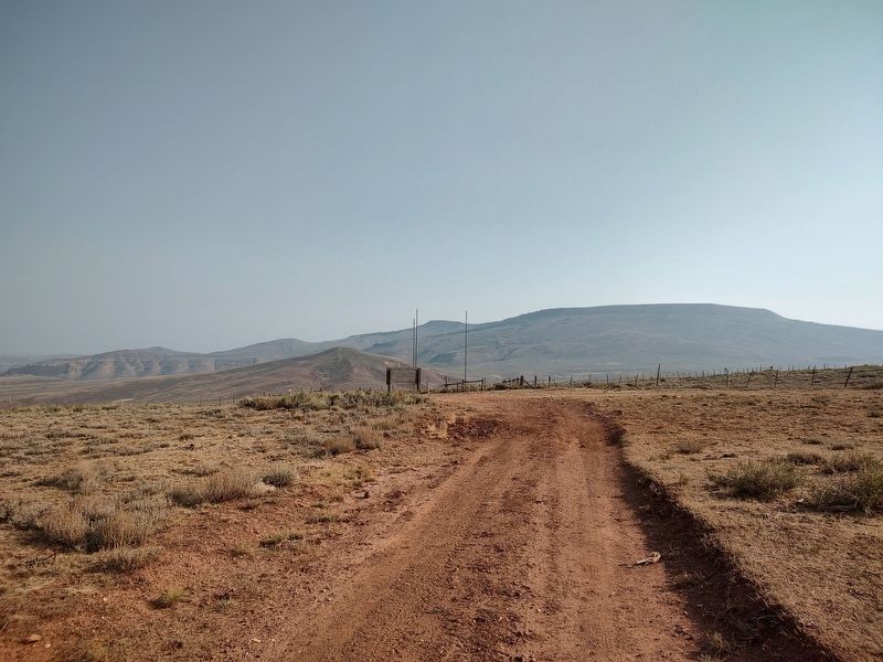
Tri-State Corner of Wyoming, Utah and Colorado Monument
1 ► Utah, Daggett County, Browns Park — Tri-State Corner of Wyoming, Utah and Colorado — Public Land Survey Monument — Lat 41° 00’ 42 616” N. Long. 109° 02’ 42 158” W. Elevation 8402' —  |
| On Three Corners Monument Road. | |||
| 2 ► Utah, Daggett County, Dutch John — Flaming Gorge Dam: The Good, the Bad & the Beautiful — |
| Near U.S. 191 7 miles north of State Route 44, on the left when traveling north. | |||
| 3 ► Utah, Daggett County, Dutch John — William H. Ashley — |
| Near U.S. 191 7 miles north of State Route 44, on the left when traveling north. | |||
| 4 ► Utah, Daggett County, Dutch John, Brown's Park — N-910 — John Jarvie Ranch Historic District — Utah Historic Site — |
| On Red Creek Road, on the left when traveling west. | |||
| 5 ► Utah, Duchesne County, Altamont — Altamont Veterans Memorial — |
| On 4000 North at N 100 E, on the right when traveling west on 4000 North. | |||
| 6 ► Utah, Duchesne County, Altamont — Moon Lake Electric Association — "Together, We have come a long way." — |
| On 4000 North at N 100 E, on the right when traveling west on 4000 North. | |||
| 7 ► Utah, Duchesne County, Bluebell — 355 — Lake Fort — |
| On South 12000 West south of W 1500 S, on the right when traveling south. | |||
| 8 ► Utah, Duchesne County, Duchesne — 207 — Duchesne — |
| On West Main Street (U.S. 40) at N 100 West Street, on the right when traveling west on West Main Street. | |||
| 9 ► Utah, Duchesne County, Duchesne — 16 — Father Escalante — |
| Near U.S. 40/191 at West East River Road, on the right when traveling west. | |||
| 10 ► Utah, Duchesne County, Duchesne — Local Highlights — |
| Near U.S. 40/191 at West East River Road, on the right when traveling west. | |||
| 11 ► Utah, Duchesne County, Duchesne — Over Almost Impassable Terrain — [Dominguez Escalante Expedition 1776 - 1976] — |
| On Highway 40 (U.S. 40), on the right when traveling west. | |||
| 12 ► Utah, Duchesne County, Duchesne — Saint Rose Philippine Duchesne — Aug. 29, 1769 – Nov. 18, 1852 — |
| Near U.S. 40/191 at West East River Road, on the right when traveling west. | |||
| 13 ► Utah, Duchesne County, Myton — 388 — Myton — |
| On East Main Street 0.1 miles west of South 100 East, on the right when traveling east. | |||
| 14 ► Utah, Duchesne County, Neola — 163 — The Bell of Neola — |
| On West 9000 North, on the right when traveling east. | |||
| 15 ► Utah, Duchesne County, Roosevelt — 368 — Roosevelt — |
| On U.S. Highway 40 at S 400 W, on the right when traveling north on U.S. Highway 40. | |||
| 16 ► Utah, Duchesne County, Tabiona — 151 — First Indian Agency — |
| On West 3750 North east of 37900 W, on the right when traveling west. | |||
| 17 ► Utah, Duchesne County, Talmage — 399 — Moonlake — |
| On Utah 87, on the left when traveling west. | |||
| 18 ► Utah, Rich County, Garden — 521 — Meadowville Pioneer Cemetery — |
| Near Meadowville Road. | |||
| 19 ► Utah, Rich County, Garden City — 74 — Fur Traders Rendezvous — |
| Near Utah Route 30 0.2 miles south of N. Meadowville Drive. | |||
| 20 ► Utah, Rich County, Garden City — Garden City Bell — |
| On South Bear Lake Boulevard at W 50 S, on the right when traveling south on South Bear Lake Boulevard. | |||
| 21 ► Utah, Rich County, Garden City — The First Oregon Trail — |
| On National Park Highway/Oregon Trail (U.S. 89), on the right when traveling south. | |||
| 22 ► Utah, Rich County, Laketown — Laketown Veteran's Memorial — |
| On West Round Valley Drive, on the right when traveling east. | |||
| 23 ► Utah, Rich County, Laketown — The Legacy of Laketown — Population 1896--321 1996--330 — |
| On South Main Street at West Round Valley Drive, on the right when traveling south on South Main Street. | |||
| 24 ► Utah, Rich County, Randolph — Chandler-Price Platen, Treadle Press (circa 1885) — |
| On South Main Street (Utah Route 16) north of West Park Street, on the left when traveling north. | |||
| 25 ► Utah, Rich County, Randolph — Randolph — |
| On South Main Street (Utah Route 16) north of West Park Street, on the left when traveling north. | |||
| 26 ► Utah, Rich County, Randolph — Randolph — Population — 1896~472 • 1996~488 — |
| On South Main Street (Utah Route 16) north of West Park Street, on the left when traveling north. | |||
| 27 ► Utah, Rich County, Randolph — 127 — Randolph — |
| On South Main Street (Utah Route 16) 0.4 miles south of Pond Street, on the right when traveling south. | |||
| 28 ► Utah, Rich County, Randolph — Rich County WWI Memorial — |
| On South Main Street at E Church Street, on the right when traveling north on South Main Street. | |||
| 29 ► Utah, Rich County, Randolph — Wilford Woodruff — 1 March 1807 - 2 September 1898 — |
| On South Main Street (Utah Route 16) north of West Park Street, on the left when traveling north. | |||
| 30 ► Utah, Rich County, Sage Creek Junction — Idaho, Utah and Wyoming Intersect Point — |
| Near no nearby road. | |||
| 31 ► Utah, Rich County, Woodruff — Our Old Community Bell - Woodruff — |
| On South Main Street, on the right when traveling south. | |||
| 32 ► Utah, Rich County, Woodruff — Woodruff — |
| On South Main Street, on the right when traveling north. | |||
| 33 ► Utah, Rich County, Woodruff — 456 — Woodruff — |
| On South Main Street, on the right when traveling south. | |||
| 34 ► Utah, Summit County, Coalville — Coalville Honor Roll — |
| On North Main Street, on the right when traveling north. | |||
| 35 ► Utah, Summit County, Coalville — Control of Influence — |
| On South Echo Road, on the right when traveling north. | |||
| 36 ► Utah, Summit County, Coalville — Echo Canyon — |
| Near Interstate 80 at milepost 171, on the right when traveling east. | |||
| 37 ► Utah, Summit County, Coalville — First Settler of Kamas — |
| On East 100 South, on the right when traveling east. | |||
| 38 ► Utah, Summit County, Coalville — Iron Rails and Silver Dreams — |
| On South Echo Road, on the right when traveling north. | |||
| 39 ► Utah, Summit County, Coalville — 37 — Old Fort and Hoyt Grist Mill — |
| On S. Hoytsville Road at E 1100 S Road, on the right when traveling north on S. Hoytsville Road. | |||
| 40 ► Utah, Summit County, Coalville — 13 — Old Rock School House — |
| On S. Main Street at W 100 S Street ( Route 280), on the right when traveling south on S. Main Street. | |||
| 41 ► Utah, Summit County, Coalville — Pulpit Rock — |
| On South Echo Road, on the right when traveling north. | |||
| 42 ► Utah, Summit County, Coalville — Southwest Corner of Wyoming — |
| Near East Chalk Creek Road, on the right when traveling east. | |||
| 43 ► Utah, Summit County, Coalville — S-23 — Summit County Courthouse and Jail — Utah Historic Site — National Register of Historic Places — |
| On North Main Street at 50 N, on the right when traveling north on North Main Street. | |||
| 44 ► Utah, Summit County, Coalville — 330 — Summit Stake Tabernacle — |
| On Hoytsville Road, on the right when traveling north. | |||
| 45 ► Utah, Summit County, Coalville — The Founding of Coalville City — |
| On N. Main Street at Center Street, on the right when traveling north on N. Main Street. | |||
| 46 ► Utah, Summit County, Coalville — The Historic Coalville Ledge — |
| On 200 North, on the right when traveling north. | |||
| 47 ► Utah, Summit County, Coalville — The Road to Zion — |
| Near Interstate 80 at milepost 171, on the right when traveling east. | |||
| 48 ► Utah, Summit County, Coalville — 165 — Wanship Station — |
| On Hoytsville Road 0.3 miles north of Old Lincoln Highway, on the left when traveling north. | |||
| 49 ► Utah, Summit County, Coalville — Witch Rocks — |
| On South Echo Road, on the right when traveling north. | |||
| 50 ► Utah, Summit County, Echo — S-80 — Echo Church and School — Utah Historic Site — |
| On East Temple Lane. | |||
| 51 ► Utah, Summit County, Echo — N-1016 — Echo School and Church — Utah Historic Site — |
| On East Temple Lane. | |||
| 52 ► Utah, Summit County, Echo — 85 — Temple Camp and Supplication Hills — |
| On South Echo Road, on the right when traveling north. | |||
| 53 ► Utah, Summit County, Echo — The Battle of the Signs — |
| On South Echo Road, on the right when traveling west. | |||
| 54 ► Utah, Summit County, Echo — Weber Pony Express Station — |
| On South Echo Road, on the right when traveling west. | |||
| 55 ► Utah, Summit County, Echo — Welcome to Echo Canyon — One of Summit County's Historic and Picturesque Treasures — |
| Near Interstate 80 at milepost 170, on the right when traveling west. | |||
| 56 ► Utah, Summit County, Heber City — 24 — Rhoades Valley Fort — |
| On West Center Street at S 100 W, on the right when traveling east on West Center Street. | |||
| 57 ► Utah, Summit County, Henefer — 4 — "Mormon" Pioneer Trail — |
| On North Main Street (Utah Route 65) just south of 100 North, on the right when traveling south. | |||
| 58 ► Utah, Summit County, Henefer — 87 — Deputy Sheriff Rodney Badger Gave His Life — |
| On Old Highway 30, on the left when traveling north. | |||
| 59 ► Utah, Summit County, Henefer — 316 — Echo Gristmill — |
| On North Main Street, on the right when traveling north. | |||
| 60 ► Utah, Summit County, Henefer — Intersection of Old Pioneer Trail of 1847 and the Lincoln Highway — 1847-1927 — |
| On North Main Street, on the right when traveling north. | |||
| 61 ► Utah, Summit County, Henefer — James and William Hennefer — |
| On North Main Street, on the right when traveling north. | |||
| 62 ► Utah, Summit County, Henefer — Native Americans — |
| On North Main Street, on the right when traveling north. | |||
| 63 ► Utah, Summit County, Henefer — Over a Century of Building — |
| On North Main Street south of E Center Street, on the right when traveling north. | |||
| 64 ► Utah, Summit County, Henefer — The Pioneer Camp — |
| On North Main Street, on the right when traveling north. | |||
| 65 ► Utah, Summit County, Henefer — Weber Canyon Explorers Trail — |
| On South Echo Road, on the right when traveling north. | |||
| 66 ► Utah, Summit County, Henefer — 86 — Weber River Crossing and Campsite — |
| On Old Highway 30, on the left when traveling north. | |||
| 67 ► Utah, Summit County, Kamas — 214 — Francis — |
| On West 2200 South, on the right when traveling west. | |||
| 68 ► Utah, Summit County, Kamas — 51 — Indian Trail — |
| On East Center Street, on the right when traveling east. | |||
| 69 ► Utah, Summit County, Park City — 503 — Snyderville Pioneer Cemetery — |
| On Roffe Road, on the right when traveling west. | |||
| 70 ► Utah, Summit County, Park City — 88 — Snyderville Pioneer Cemetery — |
| On Roffe Road, on the right when traveling west. | |||
| 71 ► Utah, Summit County, Park City, Deer Valley — "Ten O'Clock Whistle" and Old Public Library — |
| On Main Street near 5th Street, on the right when traveling north. | |||
| 72 ► Utah, Summit County, Park City, Deer Valley — Anderson Apartments — |
| On Main Street at 5th Street, on the right when traveling south on Main Street. | |||
| 73 ► Utah, Summit County, Park City, Deer Valley — Arlene Loble — August 18, 1945-June 10, 2019 — |
| Near Marsac Avenue. | |||
| 74 ► Utah, Summit County, Park City, Deer Valley — Bardsley Building — |
| On Main Street, on the right when traveling south. | |||
| 75 ► Utah, Summit County, Park City, Deer Valley — Bogan Boarding House — Utah Historic Site — National Register of Historic Places — |
| On Main Street south of 4th Street, on the right when traveling south. | |||
| 76 ► Utah, Summit County, Park City, Deer Valley — Car 19 — |
| On Main Street south of 5th Street, on the right when traveling north. | |||
| 77 ► Utah, Summit County, Park City, Deer Valley — City Hall — |
| On Main Street, on the right when traveling north. | |||
| 78 ► Utah, Summit County, Park City, Deer Valley — S-36 — City Hall Park City — Utah Historic Site — National Register of Historic Places — |
| On Main Street, on the right when traveling north. | |||
| 79 ► Utah, Summit County, Park City, Deer Valley — City Park — XIX Olympic Winter Games — February 8-24, 2002 — |
| On Park Avenue. | |||
| 80 ► Utah, Summit County, Park City, Deer Valley — Emmett "Bud" Wright — |
| On Main Street north of 5th Street, on the right when traveling north. | |||
| 81 ► Utah, Summit County, Park City, Deer Valley — Fifth Street — XIX Olympic Winter Games — February 8-24, 2002 — |
| On Main Street at Fifth Street, on the right when traveling north on Main Street. | |||
| 82 ► Utah, Summit County, Park City, Deer Valley — Frank Andrew Building — |
| On Main Street, on the right when traveling north. | |||
| 83 ► Utah, Summit County, Park City, Deer Valley — Giacoma Building — |
| On Main Street south of 4th Street, on the right when traveling north. | |||
| 84 ► Utah, Summit County, Park City, Deer Valley — Hulbert's Drugs — |
| On Main Street at 4th Street, on the right when traveling north on Main Street. | |||
| 85 ► Utah, Summit County, Park City, Deer Valley — Jenkins Photography Studio — 430 Main Street — Jenkins Confectionery — |
| On Main Street north of 4th Street, on the right when traveling north. | |||
| 86 ► Utah, Summit County, Park City, Deer Valley — John C. Green, Jr. — 1916-1986 — |
| On Sullivan Road, on the right when traveling north. | |||
| 87 ► Utah, Summit County, Park City, Deer Valley — Library & Education Center & Park — XIX Olympic Winter Games — February 8-24, 2002 — |
| Near Park Avenue. | |||
| 88 ► Utah, Summit County, Park City, Deer Valley — N-853 — Marsac Elementary School — Utah Historic Site — National Register of Historic Places — |
| Near Utah 224. | |||
| 89 ► Utah, Summit County, Park City, Deer Valley — Marsac School — |
| Near Utah 224, on the left when traveling north. | |||
| 90 ► Utah, Summit County, Park City, Deer Valley — Masonic Hall — |
| On Main Street, on the right when traveling north. | |||
| 91 ► Utah, Summit County, Park City, Deer Valley — Miner's Monument — |
| On Main Street north of 4th Street, on the right when traveling south. | |||
| 92 ► Utah, Summit County, Park City, Deer Valley — Miner's Plaza — XIX Olympic Winter Games — February 8-24, 2002 — |
| On Main Street north of 4th Street, on the right when traveling south. | |||
| 93 ► Utah, Summit County, Park City, Deer Valley — Park City — |
| On Main Street, on the right when traveling south. | |||
| 94 ► Utah, Summit County, Park City, Deer Valley — Park City Community Church — |
| On Park Avenue at 4th Street, on the right when traveling north on Park Avenue. | |||
| 95 ► Utah, Summit County, Park City, Deer Valley — N-371 — Park City Community Church — |
| On Park Avenue at 4th Street, on the right when traveling north on Park Avenue. | |||
| 96 ► Utah, Summit County, Park City, Deer Valley — Park City Miners Hospital — |
| Near Sullivan Road, in the median. | |||
| 97 ► Utah, Summit County, Park City, Deer Valley — 128 — Park City Pioneers — |
| On Park Avenue, on the right when traveling east. | |||
| 98 ► Utah, Summit County, Park City, Deer Valley — Rocky Mountain Bell Telephone Office — |
| On Main Street, on the right when traveling north. | |||
| 99 ► Utah, Summit County, Park City, Deer Valley — Rodney W. Schreurs Centennial Park — |
| On Main Street, on the right when traveling south. | |||
| 100 ► Utah, Summit County, Park City, Deer Valley — Samuel LePage Raddon — 1858-1948 — Owner, Editor, Publisher The Park Record — |
| On Main Street north of 4th Street, on the right when traveling north. | |||
179 entries matched your criteria. The first 100 are listed above. The final 79 ⊳