687 entries match your criteria. The first 100 are listed. ⊳
Historical Markers and War Memorials in
By Barry Swackhamer, June 24, 2026
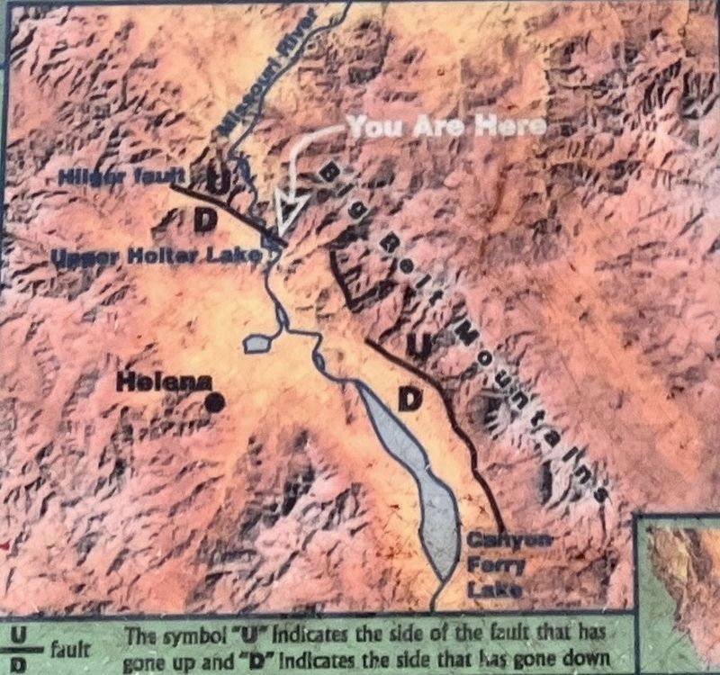
Gates of the Mountains Marker, detail
1 ► Montana, Old Wiess and French Place — Gates of the Mountains —  |
| Near Gates to the Mountains Road near Interstate 15. | |||
| 2 ► Washington, Charleston — Lewis and Clark National Historic Trail — |
| Near Silcott Road near U.S. 12. | |||
| 3 ► Argentina, Mendoza, Mendoza — Monument to Hispanic-Argentine Brotherhood — Monumento a la Hermandad Hispano-Argentina — |
| Near Montevideo. | |||
| 4 ► Argentina, Mendoza, Mendoza — The Hill of Glory — Cerro de la Gloria — |
| On Bajada del Cierro. | |||
| 5 ► Barbados, Christ Church, Bridgetown, Saint Matthias — Ordnance Hospital Kitchen — Built in 1831 known today as Lechworth House — |
| On Letchworth Complex. | |||
| 6 ► Barbados, Saint Michael, Bridgetown — Barbados Independence Monument — |
| On Hastings Main Road (Route H7) just west of Garrison Road, on the right when traveling west. | |||
| 7 ► Barbados, Saint Michael, Bridgetown — Commissariat for the British Garrison — |
| On Hastings Main Road (Route H7) at Bush Hill Road, on the left when traveling north on Hastings Main Road. | |||
| 8 ► Barbados, Saint Michael, Bridgetown — Commonwealth War Graves — |
| Near Unnamed road just east of Drill Hall Beach, on the left when traveling south. | |||
| 9 ► Barbados, Saint Michael, Bridgetown — Engineer’s Office & Quarters — Barbados Garrison — |
| On Garrison Road just east of Bush Hill, on the left when traveling east. | |||
| 10 ► Barbados, Saint Michael, Bridgetown — Errol Walton Barrow — |
| On Aquatic Gap just west of Hastings Main Road (Route H7), on the right when traveling west. | |||
| 11 ► Barbados, Saint Michael, Bridgetown — Hastings — Historic Bridgetown & Its Garrison — |
| On Hastings Main Road west of Harts Gap, on the left when traveling west. | |||
| 12 ► Barbados, Saint Michael, Bridgetown — Memorial to Barbadian Merchant Seamen of World War II — |
| Near Unnamed road just east of Drill Hall Beach, on the left when traveling south. | |||
| 13 ► Barbados, Saint Michael, Bridgetown — Monument to Those Lost in the 1831 Hurricane — |
| On Garrison Road at Bush Hill Road, on the left when traveling north on Garrison Road. | |||
| 14 ► Barbados, Saint Michael, Bridgetown — Royal Artillery Barracks — Barbados Garrison — |
| On Garrison Road just north of Hastings Main Road (Route H7), on the left when traveling north. | |||
| 15 ► Barbados, Saint Michael, Bridgetown — Saint Matthias Anglican Church — |
| On St. Matthias Road just south of Balmoral Gap, on the left when traveling south. | |||
| 16 ► Barbados, Saint Michael, Bridgetown — Sir Grantley Herbert Adams — |
| On Bay Street just north of Chelsea Road, on the right when traveling north. | |||
| 17 ► Barbados, Saint Michael, Bridgetown — The Barbados Military Cemetery — |
| On Unnamed road just east of Drill Hall Beach Road, on the right when traveling east. | |||
| 18 ► Barbados, Saint Michael, Bridgetown — The Main Guard — Barbados Garrison — |
| On Garrison Road just north of Hastings Main Road (Route H7), on the left when traveling north. | |||
| 19 ► Barbados, Saint Michael, Bridgetown, Garrison — Soldiers Brick Barracks — Built in 1808, Known Today as Block A — |
| On Dalkeith Road. | |||
| 20 ► Barbados, Saint Michael, Bridgetown, Saint Matthias — Ordnance Hospital Ward — Built in 1831, Known Today as Geneva — |
| On Garrison Road. | |||
| 21 ► Belize, Belize District, Ladyville — 18th Century Cannon — |
| On Old Airport Road just west of Philip Goldson Highway, on the right when traveling west. | |||
| 22 ► Belize, Corozal, Corozal Town — 6 of 7 — Corozal Town Central Park — Corozal Town Historical Walk — |
| On 1st Street South just south of 5th Avenue, on the left when traveling south. | |||
| 23 ► Belize, Corozal, Corozal Town — 5 of 7 — Corozal Town Hall — Corozal Town Historical Walk — |
| On 1st Street South just south of 5th Avenue, on the right when traveling south. | |||
| 24 ► Belize, Corozal, Corozal Town — Felipe Santiago Ricalde — |
| On 1st Street North just west of 4th Avenue, on the left when traveling west. | |||
| 25 ► Belize, Corozal, Corozal Town — 7 of 7 — Fort Barlee — Corozal Town Historical Walk — |
| On 5th Avenue at 1st Street North, on the left when traveling east on 5th Avenue. | |||
| 26 ► Belize, Corozal, Corozal Town — 2 of 7 — Her Majesty's Prison — |
| On 2nd Street South just south of 4th Avenue, on the right when traveling south. | |||
| 27 ► Belize, Corozal, Corozal Town — 1 of 7 — House of Culture/Public Market — Corozal Town Historical Walk — |
| On 1st Avenue at 2nd Street South, on the left when traveling west on 1st Avenue. | |||
| 28 ► Belize, Corozal, Corozal Town — 4 of 7 — Parish Office/Priest’s Residence/Xavier College — Corozal Town Historical Walk — |
| On 1st Street South just south of 4th Avenue, on the left when traveling south. | |||
| 29 ► Belize, Corozal, Corozal Town — 3 of 7 — Schofield Residence — Corozal Town Historical Walk — |
| On 1st Avenue at 1st Street South, on the right when traveling east on 1st Avenue. | |||
| 30 ► Belize, Orange Walk, Indian Church — Royal Complex at Lamanai — |
| Near no nearby street. | |||
| 31 ► Belize, Orange Walk, Indian Church — Stela 9 at Lamanai — |
| Near no nearby street. | |||
| 32 ► Belize, Orange Walk, Indian Church — The High Temple at Lamanai — |
| Near no nearby street. | |||
| 33 ► Belize, Toledo, Harvest Caye — Antillean Manatee — |
| On no nearby street. | |||
| 34 ► Brazil, Amazonas, Manaus — Praça São Sebastião — Monumento Comemorativo a Abertura dos Portos — Monument to the Opening of the [Amazon] Ports — |
| On Rua Tapajós just north of Rua Dez de Julio. | |||
| 35 ► Brazil, Paraná, Foz do Iguaçu — Alberto Santos-Dumont Memorial — Parque Nacional do Iguaçu — Patrimonio Natural da Humanidade — |
| On Avenida das Cataratas (National Route BR-469). | |||
| 36 ► Prince Edward Island, Albany — Getting On and Off the Island / Liaison Entre l’Île et le Continent — |
| On North Carleton - Route 10 Road, on the right when traveling north. | |||
| 37 ► Prince Edward Island, Albany — Pioneer Cemetery — |
| On North Carleton - Route 10 Road, on the left when traveling north. | |||
| 38 ► Prince Edward Island, Bedeque — George Uglow Pope — 1820-1908 — |
| On Noonans Lane. | |||
| 39 ► Prince Edward Island, Bedeque — Seacow Head Lighthouse — |
| On Lighthouse Road. | |||
| 40 ► Prince Edward Island, Belfast — Acadian Departure / Départ des Acadiens — |
| On Selkirk Park Road, on the left when traveling north. | |||
| 41 ► Prince Edward Island, Belfast — Acadian Settlement / Établissement acadien — |
| On Selkirk Park Road, on the left when traveling north. | |||
| 42 ► Prince Edward Island, Belfast — Arrival and Legacy — |
| On Selkirk Park Road. | |||
| 43 ► Prince Edward Island, Belfast — Clan Macnícol (Nicholson) — |
| On Selkirk Park Road, on the left when traveling north. | |||
| 44 ► Prince Edward Island, Belfast — In Memory of Thomas Douglas Selkirk — |
| On Selkirk Park Road, on the left when traveling north. | |||
| 45 ► Prince Edward Island, Belfast — Original Lighthouse Keeper's Cottage — La petite maison originale du gardien de phare — |
| Near Point Prim Road. | |||
| 46 ► Prince Edward Island, Belfast — Ross — |
| On Selkirk Park Road, on the left when traveling north. | |||
| 47 ► Prince Edward Island, Belfast — Saint-Paul a la Pointe-Prim 1752-1758 — |
| On Selkirk Park Road, on the left when traveling north. | |||
| 48 ► Prince Edward Island, Belfast — Scottish Settlement — |
| On Selkirk Park Road. | |||
| 49 ► Prince Edward Island, Belfast — The Belfast Historical Society — |
| On Selkirk Park Road. | |||
| 50 ► Prince Edward Island, Belfast — The Croft House — Home of the Belfast Historical Society — |
| On Selkirk Park Road, on the right when traveling north. | |||
| 51 ► Prince Edward Island, Belfast — The Honourable J. Angus MacLean — L'Honorable J. Angus MacLean — |
| On Selkirk Park Road. | |||
| 52 ► Prince Edward Island, Belfast — The Selkirk Settlement / L’Établissement de Selkirk — |
| On Selkirk Park Road, on the left when traveling north. | |||
| 53 ► Prince Edward Island, Belfast — This Summer Will Be Different — |
| On Point Prim Road. | |||
| 54 ► Prince Edward Island, Belfast — To Commemorate the Honourable J. Angus MacLean P.C, O.C., D.F.C. 1914-2000 — |
| On Selkirk Park Road. | |||
| 55 ► Prince Edward Island, Belle River — Belle River Church of Scotland — |
| On Greys Road west of Dan Comptons Road, on the right when traveling west. | |||
| 56 ► Prince Edward Island, Borden-Carleton — CNR Station — |
| On Borden Avenue, on the right when traveling south. | |||
| 57 ► Prince Edward Island, Borden-Carleton — Confederation Bridge — |
| Near Borden Avenue, on the right when traveling south. | |||
| 58 ► Prince Edward Island, Borden-Carleton — Ice Boats |
| On Borden Avenue, on the right when traveling south. Reported damaged. | |||
| 59 ► Prince Edward Island, Central Bedeque — 1784 Bedeque Harbour Loyalists — |
| On Callbeck Street, on the right when traveling east. | |||
| 60 ► Prince Edward Island, Central Bedeque — Lucy Maud Montgomery Lower Bedeque Schoolhouse — |
| On Callbeck Street at Linkletter Avenue, on the right on Callbeck Street. | |||
| 61 ► Prince Edward Island, Charlottetown — Brighton Beach Front Range Lighthouse — Heritage Lighthouse — |
| On York Lane west of Queen Elizabeth Drive. | |||
| 62 ► Prince Edward Island, Charlottetown — History of Joseph A. Ghiz Memorial Park — |
| On Edward Street at Grafton Street, on the right when traveling west on Edward Street. | |||
| 63 ► Prince Edward Island, Charlottetown — Rena McLean Veterans Garden / Jardin d’anciens combattants Rena McClean — |
| On Terry Fox Drive. | |||
| 64 ► Prince Edward Island, Charlottetown — The Trans Canada Trail on Price Edward Island — Le sentier Transcanadien sur l‘Île-du-Prince-Èdouard — |
| On Kent Street. | |||
| 65 ► Prince Edward Island, Charlottetown, Downtown — Fairholm — |
| On Fitzroy Street at Prince Street, on the left when traveling east on Fitzroy Street. | |||
| 66 ► Prince Edward Island, Charlottetown, Downtown — King Square |
| On Ole King Square south of Weymouth Street, on the right when traveling north. Reported unreadable. | |||
| 67 ► Prince Edward Island, Charlottetown, Downtown — Lieutenant-Colonel J. David Stewart, DSO, ED, CD Armoury — |
| On Haviland Street, on the left when traveling north. | |||
| 68 ► Prince Edward Island, Charlottetown, Downtown — Notre Dame Convent — |
| On Weymouth Street at Dorchester Street, on the right when traveling south on Weymouth Street. | |||
| 69 ► Prince Edward Island, Charlottetown, Downtown — Prince Edward Island Regiment 140th Anniversary Commemoration — |
| On Haviland Street, on the right when traveling south. | |||
| 70 ► Prince Edward Island, Charlottetown, Mount Edward — A Staunch Supporter of Confederation / Un ardent défenseur de la Confédération — Ardgowan National Historic Site — |
| Near Mount Edward Road at Confederation Street, on the right when traveling north. | |||
| 71 ► Prince Edward Island, Charlottetown, Mount Edward — Ardgowan — |
| Near Confederation Street at Mount Edward Road, on the right when traveling west. | |||
| 72 ► Prince Edward Island, Charlottetown, Mount Edward — Canada Department of Agriculture Research Branch — |
| On Indigo Crescent. | |||
| 73 ► Prince Edward Island, Charlottetown, Mount Edward — What's in a name? — Ardgowan National Historic Site — |
| On Confederation Street at Mt Edward Road, on the right when traveling west on Confederation Street. | |||
| 74 ► Prince Edward Island, DeSable — Franklin Knight Lane — 1864-1921 — |
| On Monument Road at Prince Edward Island 19 on Monument Road. | |||
| 75 ► Prince Edward Island, Kensington — Here Settled James Campbell — |
| On Prince Edward Island 20 (Prince Edward Island Route 20), on the right when traveling east. | |||
| 76 ► Prince Edward Island, Kensington — Museum Celebrates all Things Anne / Un Musée Dédié à Anne — |
| On Prince Edward Island 20 (Prince Edward Island Route 20), on the right when traveling east. | |||
| 77 ► Prince Edward Island, Lot 34, York — The Changing Landscape / Un paysage en évolution — |
| On Prince Edward Island 25. | |||
| 78 ► Prince Edward Island, Morell — St. Peters Harbour Lighthouse / Le phare du port de St. Peters — |
| On Lighthouse Road. | |||
| 79 ► Prince Edward Island, Orwell Corner — Wendall Boyle Orwell Corner Memorial — |
| On Old Uigg Road. | |||
| 80 ► Prince Edward Island, Rustico — Farmers' Bank of Rustico / La Banque De Rustico — 1864-1894 — |
| On Church Road, on the right when traveling north. | |||
| 81 ► Prince Edward Island, Rustico — Les Familles Fondatrices de Rustico / The Founding Families of Rustico — |
| Near Church Road, on the right when traveling north. | |||
| 82 ► Prince Edward Island, Rustico — Parc National du Canada de l'Île-du-Prince-Edouard / Prince Edward Island National Park of Canada — |
| Near Church Road, on the right when traveling north. | |||
| 83 ► Prince Edward Island, Rustico — Welcome - Rustico / Bienvenue - Rustico — |
| On Church Road north of Rustico Road, on the right when traveling north. | |||
| 84 ► Prince Edward Island, Stanhope, York — Stanhope Cemetery — |
| Near Gulf Shore Parkway East, on the right when traveling east. | |||
| 85 ► Prince Edward Island, Stanhope, York — Stanhope Community Cemetery — |
| Near Gulf Shore Parkway East, on the right when traveling east. | |||
| 86 ► Prince Edward Island, Stanhope Bayshore, York — Bushing the Bay / Buissons sur la Baie — |
| On Prince Edward Island 25, on the left when traveling north. | |||
| 87 ► Prince Edward Island, Stanhope Bayshore, York — The Gale of 1851 — |
| On Gulf Shore Parkway East, on the left when traveling east. | |||
| 88 ► Prince Edward Island, Summerside — 2001 World Junior Curling Champions — |
| On Heather Moyse Drive, on the right when traveling east. | |||
| 89 ► Prince Edward Island, Summerside — Architectural Features Summerside Heritage District: Bargeboard — |
| On Water Street at Queen Street, on the right when traveling east on Water Street. | |||
| 90 ► Prince Edward Island, Summerside — Architectural Features Summerside Heritage District: Belt Course — |
| On Water Street east of Queen Street, on the left when traveling west. | |||
| 91 ► Prince Edward Island, Summerside — Architectural Features Summerside Heritage District: Column — |
| On Water Street at Queen Street on Water Street. | |||
| 92 ► Prince Edward Island, Summerside — Architectural Features Summerside Heritage District: Verandah — |
| On Water Street east of Queen Street, on the right when traveling east. | |||
| 93 ► Prince Edward Island, Summerside — Bicentennial of United Empire Loyalists and Disbanded Troops — |
| On Heather Moyse Drive east of Granville Street, on the right when traveling west. | |||
| 94 ► Prince Edward Island, Summerside — British Commonwealth Air Training Plan Memorial — |
| On Spring Street. | |||
| 95 ► Prince Edward Island, Summerside — Commemorating The Park Island Hotel - 1872 — |
| On Heather Moyse Drive, on the right when traveling east. | |||
| 96 ► Prince Edward Island, Summerside — Head of Queen's Wharf — |
| On Queens Wharf, on the right when traveling south. | |||
| 97 ► Prince Edward Island, Summerside — In memory of Carrie Ellen Holman — |
| On Fitzroy Street at Summer Street, on the right when traveling east on Fitzroy Street. | |||
| 98 ► Prince Edward Island, Summerside — In Memory of Sir Ira Enman — |
| On Summer Street at Church Street, on the right when traveling north on Summer Street. | |||
| 99 ► Prince Edward Island, Summerside — Irony of History: England, First Nation to Salute the Acadian Flag — Ironie de l'histoire : l'Angleterre, première nation à saluer le drapeau acadien — |
| On Heather Moyse Drive, on the right when traveling east. | |||
| 100 ► Prince Edward Island, Summerside — R.C.A.F. Station/C. F. B. Summerside 1941-1992 — |
| On Summer Street, on the right when traveling north. | |||
687 entries matched your criteria. The first 100 are listed above. Next 100 ⊳