By Cosmos Mariner, August 2, 2021
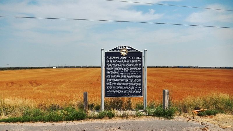
Alliance Army Air Field Marker
| On Perkins Road (State Highway 2) just east of County Road 57, on the left when traveling east. |
| On Box Butte Avenue just south of West 18th Street, on the right when traveling south. |
| On State Highway 87 at Dodge Road (State Highway 7E), on the right when traveling north on State Highway 87. |
| On Gold Rush Byway (U.S. 385) 0.3 miles south of Local Road 38, on the left when traveling north. |
| On Main Street (Lincoln Highway) (U.S. 30) at Road 79, on the right when traveling east on Main Street (Lincoln Highway). |
| On Front Street at Elm Street, on the left when traveling west on Front Street. |
| On Cabela Drive just south of Old Post Road, on the left when traveling south. |
| On Illinois Street (Lincoln Highway) (U.S. 30) at 8th Avenue, on the right when traveling west on Illinois Street (Lincoln Highway). |
| Near Interstate 80 (at milepost 61), 1.3 miles east of Upland Parkway (Alternate Interstate 80), on the right when traveling west. |
| On Illinois Street (aka Lincoln Highway) (U.S. 30) at Ball Street, on the right when traveling east on Illinois Street (aka Lincoln Highway). |
| On Hickory Street at 10th Street, on the left when traveling east on Hickory Street. |
| On Cabela Drive at Old Post Road, on the right when traveling south on Cabela Drive. |
| On Fort Sidney Road 0.1 miles north of Deaver Drive, on the left when traveling north. |
| On Elm Street at County Route 113, on the left when traveling east on Elm Street. |
| On U.S. 30 1.5 miles east of County Route 117, on the left when traveling east. |
| Near Interstate 80 (at milepost 61), 1.3 miles east of Upland Parkway (Alternate Interstate 80), on the right when traveling west. |
| Near Interstate 80 (at milepost 61), 1.3 miles east of Upland Parkway (Alternate Interstate 80), on the right when traveling west. |
| On Lincoln Highway (U.S. 30) 1 mile west of 13th Avenue, on the left when traveling west. |
| On Lincoln Highway (U.S. 30) near Road 99, on the left when traveling east. |
| On Bordeaux Street north of 2nd Street, on the left when traveling north. |
| On Gold Rush Highway (U.S. 385) near Country Club Road, on the right when traveling north. |
| On East 10th Street just east of Main Street, on the right when traveling east. |
| On Main Street at 4th, on the right when traveling south on Main Street. |
| On U.S. 385 at West 16th Street, on the left when traveling north on U.S. 385. |
| On U.S. 385 at West 16th Street, on the left when traveling north on U.S. 385. |
| On West 2nd Street at Chadron Avenue, on the left when traveling east on West 2nd Street. |
| On Gold Rush Byway (U.S. 385) 0.3 miles Crazy Horse Memorial Highway (U.S. 20), on the left when traveling north. Reported missing. |
| On Main Street south of 4th Street, on the right when traveling south. |
| On Bordeaux Street at West 2nd Street on Bordeaux Street. |
| On West 4th Street just east of Chadron Avenue, on the right when traveling west. |
| On U.S. 385 0.3 miles north of U.S. 20, on the left when traveling north. |
| On Main Street just south of West 1st Street, on the left when traveling north. |
| Near Bridges to Buttes Byway (U.S. 20) 0.1 miles west of Soldier Creek Road, on the right when traveling west. |
| On Bridges to Buttes Byway (U.S. 20) near 3200 Bridges to Buttes Byway, on the right when traveling south. |
| Near Bridges to Buttes Highway (U.S. 20). |
| Near Bridges to Buttes Byway (U.S. 20) 0.1 miles south of Soldier Creek Road, on the right when traveling south. |
| On Forest Road 902 1.4 miles west of Toadstool Road, on the right when traveling west. |
| On Smiley Canyon Scenic Drive at Bridges to Buttes Byway (U.S. 20), on the right when traveling west on Smiley Canyon Scenic Drive. |
| Near U.S. 20 0.5 miles north of U.S. 20. |
| Near Bridges to Buttes Byway (U.S. 20). |
| On Bridges to Buttes Byway (U.S. 20) 0.1 miles Soldier Creek Road, on the right when traveling south. |
| On McPhearson Street (U.S. 20) at State Highway 2, on the right when traveling east on McPhearson Street. |
| On 5th Street at Coates Street, on the right when traveling north on 5th Street. |
| Near Bridges to Buttes Byway (U.S. 20) 0.2 miles south of Soldier Creek Road, on the left when traveling south. |
| On 2nd Street just south of Ash Street, on the left when traveling north. |
| On Old Smiley Scenic Road/Smiley Canyon Scenic Drive 3 miles west of Bridges to Buttes Byway (U.S. 20), on the right when traveling west. |
| Near Bridges to Buttes Byway (U.S. 20) 0.1 miles south of Soldier Creek Road, on the right when traveling south. |
| On Highway 20 (U.S. 20), on the right when traveling east. |
| Near Bridges to Buttes Byway (U.S. 20) south of Soldier Creek Road, on the right when traveling east. |
| On Bridges to Buttes Byway (U.S. 20) 0.1 miles south of Soldier Creek Road, on the right when traveling south. |
| Near Bridges to Buttes Byway (U.S. 20). |
| Near Bridges to Buttes Byway (U.S. 20) 1.3 miles west of 1st Street, on the left when traveling west. |
| Near Bridges to Buttes Byway (U.S. 20) 0.1 miles south of Soldier Creek Road, on the right when traveling north. |
| On Main Street just west of 1st Street, in the median. |
| Near Bridges to Buttes Byway (U.S. 20) just south of Soldier Creek Road, on the right when traveling west. |
| Near Bridges to Buttes Byway (U.S. 20) 0.1 miles south of Soldier Creek Road, on the right when traveling south. |
| On Bridges to Buttes Highway (U.S. 20) near Soldier Creek Road. |
| On Bridges to Buttes Byway (U.S. 20) 0.2 miles west of Soldier Creek Road, on the left when traveling west. |
| Near Bridges to Buttes Byway (U.S. 20) 1.3 miles west of 1st Street, on the left when traveling west. |
| On 2nd Street at Main Street, on the right when traveling north on 2nd Street. |
| Near Bridges to Buttes Byway (U.S. 20) 0.2 miles south of Soldier Creek Road, on the left when traveling south. |
| Near Forest Road 90 west of Toadstool Road. |
| On Nebraska Route 2 15 miles south of U.S. 20, on the left when traveling south. |
| On U.S. 20 at Betson Road, on the right when traveling east on U.S. 20. |
| On Old U.S. 20 0.8 miles west of Whitney Lake Road, on the left when traveling west. |
| On Old U.S. 20 0.6 miles west of Whitney Lake Road, on the left when traveling west. |
| Near Interstate 80 at milepost 100, on the right when traveling east. |
| On County Highway 36 at County Highway 63.2, on the left when traveling south on County Highway 36. |
| On Interstate 80 at milepost 99, on the right when traveling east. |
| On County Highway 36 at County Highway 63.2, on the left when traveling south on County Highway 36. |
| On County Highway 36 at County Highway 63.2, on the left when traveling south on County Highway 36. |
| On Pine Street (State Highway 138) at West Second Street on Pine Street. |
| On Railroad Street (State Highway 138) at Pine Street (State Highway 138) on Railroad Street. |
| Near Interstate 80 at milepost 100, on the right when traveling east. |
| On Pine Street at West Second Street on Pine Street. |
| On Railroad Street (State Highway 138) at Pine Street on Railroad Street. |
| On State Highway 25A at County Route 165, on the right when traveling north on State Highway 25A. |
| On State Highway 25A at County Route 165, on the right when traveling north on State Highway 25A. |
| On Gold Rush Byway (U.S. 385), on the left when traveling north. |
| On 2nd Street (U.S. 30) east of Vincent Avenue when traveling west. |
| On County Route 25A near Airport Road, on the left when traveling south. |
| On 2nd Street (U.S. 30) at Matlock Avenue, on the right when traveling west on 2nd Street. |
| Near U.S. 26, on the right when traveling south. |
| Near U.S. 26, on the right when traveling south. |
| On U.S. 26, on the right when traveling north. |
| Near U.S. 26, on the right when traveling south. |
| Near U.S. 26, on the left when traveling south. |
| On U.S. 26, on the right when traveling east. |
| Near U.S. 26, on the right when traveling south. |
| Near U.S. 26, on the left when traveling south. |
| Near U.S. 26, on the right when traveling south. |
| Near U.S. 26, on the right when traveling south. |
274 entries matched your criteria. The first 100 are listed above.
Next 100 ⊳
