1166 entries match your criteria. The first 100 are listed. ⊳
Lighthouses Historical Markers
Lighthouses mark dangerous coastlines, hazardous shoals, reefs, rocks, and safe entries to harbors. Once widely used, the number of operational lighthouses has declined due to the expense of maintenance and have become uneconomical since the advent of cheaper electronic navigational systems. Many remain standing due to historic preservation efforts. This Series is all about lighthouses. It includes lightships; artifacts from lighthouses; the Coast Guard's lighthouse service; replica, non-working lighthouses (such as those for tourism or novelty); lighthouse keepers' housing; and descriptions from lighthouse keeper's lives; and even markers with a photo or drawing of a lighthouse.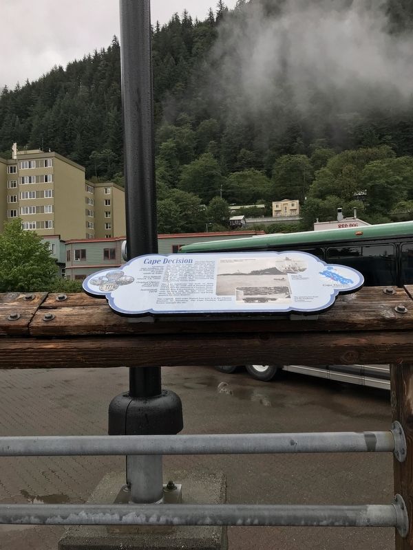
By Duane and Tracy Marsteller, September 3, 2021
Cape Decision Marker
1 ► Alaska, Juneau Borough, Juneau, Downtown Juneau — Cape Decision —  |
| Near Marine Way. | |||
| 2 ► Alaska, Juneau Borough, Juneau, Downtown Juneau — Cape Hinchinbrook — |
| Near Marine Way. | |||
| 3 ► Alaska, Juneau Borough, Juneau, Downtown Juneau — Cape Saint Elias — |
| Near Marine Way. | |||
| 4 ► Alaska, Juneau Borough, Juneau, Downtown Juneau — Cape Sarichef & Scotch Cap — |
| Near Marine Way. | |||
| 5 ► Alaska, Juneau Borough, Juneau, Downtown Juneau — Cape Spencer — |
| Near Marine Way. | |||
| 6 ► Alaska, Juneau Borough, Juneau, Downtown Juneau — Eldred Rock — |
| Near Marine Way. | |||
| 7 ► Alaska, Juneau Borough, Juneau, Downtown Juneau — Five Finger — |
| Near Marine Way. | |||
| 8 ► Alaska, Juneau Borough, Juneau, Downtown Juneau — Guard Islands — |
| Near Marine Way. | |||
| 9 ► Alaska, Juneau Borough, Juneau, Downtown Juneau — Lighthouses of Alaska — |
| Near Marine Way. | |||
| 10 ► Alaska, Juneau Borough, Juneau, Downtown Juneau — Lincoln Rock, Fairway Island & Point Sherman — |
| Near Marine Way. | |||
| 11 ► Alaska, Juneau Borough, Juneau, Downtown Juneau — Mary Island — |
| Near Marine Way. | |||
| 12 ► Alaska, Juneau Borough, Juneau, Downtown Juneau — Point Retreat — |
| Near Marine Way. | |||
| 13 ► Alaska, Juneau Borough, Juneau, Downtown Juneau — Sentinel Island — |
| Near Marine Way. | |||
| 14 ► Alaska, Juneau Borough, Juneau, Downtown Juneau — Tree Point — |
| Near Marine Way. | |||
| 15 ► California, Alameda County, Oakland, East Peralta — Early Harbor |
| On Embarcadero, on the right when traveling south. Reported permanently removed. | |||
| 16 ► California, Contra Costa County, Richmond — East Brother Light Station — |
| Near Stenmark Drive. | |||
| 17 ► California, Del Norte County, Crescent City — 951 — Battery Point Lighthouse — |
| Near Lighthouse Way. | |||
| 18 ► California, Del Norte County, Crescent City — St. George Reef Lighthouse — |
| On South Pebble Beach Drive south of West 9th Street, on the right when traveling south. | |||
| 19 ► California, Humboldt County, Ferndale — Cape Mendocino Lighthouse Lenses — Humboldt County Fair — |
| On 5th Street near Van Ness Avenue, on the left when traveling south. | |||
| 20 ► California, Humboldt County, Petrolia — Cape Mendocino Lighthouse |
| On Mattole Road, on the right when traveling south. Reported missing. | |||
| 21 ► California, Humboldt County, Shelter Cove — Built to Last — Withstanding the fury of the coast — |
| On Lower Pacific Drive, on the left when traveling west. | |||
| 22 ► California, Humboldt County, Shelter Cove — Cape Mendocino Lighthouse — |
| On Lower Pacific Drive, on the left when traveling west. | |||
| 23 ► California, Humboldt County, Shelter Cove — Saving Lighthouse History — |
| On Lower Pacific Drive, on the left when traveling west. | |||
| 24 ► California, Humboldt County, Trinidad — 146 — Trinidad Memorial Lighthouse — A New Home! — |
| On Lighthouse Road near Bay Street. | |||
| 25 ► California, Los Angeles County, Los Angeles, San Pedro — Fort MacArthur — 500 Varas Square Historic District — Port of Los Angeles — |
| On Pacific Avenue south of Meyler Road, on the right when traveling north. | |||
| 26 ► California, Los Angeles County, Los Angeles, San Pedro — 1237 — Point Fermin Lighthouse — |
| Near Point Fermin Park south of Paseo Del Mar. | |||
| 27 ► California, Los Angeles County, Rancho Palos Verdes — Point Vicente Lighthouse — |
| Near Palos Verdes Drive West 0.5 miles south of Hawthorne Boulevard. | |||
| 28 ► California, Marin County, Inverness — Point Reyes Light — Point Reyes National Seashore — |
| Near Sir Francis Drake Boulevard. | |||
| 29 ► California, Marin County, Sausalito, Fort Barry — Battery Alexander — |
| Near Field Road west of Rathbone Road, on the right when traveling west. | |||
| 30 ► California, Marin County, Sausalito, Fort Barry — Point Bonita Lighthouse — Golden Gate National Recreation Area — |
| On Field Road south of Conzelman Road. | |||
| 31 ► California, Mendocino County, Mendocino — Point Cabrillo Light Station — |
| Near Point Cabrillo Drive, on the left when traveling north. | |||
| 32 ► California, Mendocino County, Point Arena — 1035 — Point Arena Lighthouse — |
| On Lighthouse Road 2.5 miles north of California Route 1, on the right when traveling north. | |||
| 33 ► California, Monterey County, Big Sur — On Top of the Rock — |
| Near Cabrillo Highway (State Highway 1 at milepost 54). | |||
| 34 ► California, Monterey County, Big Sur — 951 — Point Sur Light Station — |
| Near Cabrillo Highway (California Route 1), on the right when traveling south. | |||
| 35 ► California, Monterey County, Pacific Grove — Point Pinos Lighthouse Oil House — |
| Near Asilomar Boulevard at Lighthouse Avenue, on the right when traveling south. | |||
| 36 ► California, San Diego County, San Diego, Old Town — Old Ballast Point Lighthouse — San Diego — |
| On Congress Street, on the right when traveling east. | |||
| 37 ► California, San Diego County, San Diego, Point Loma — Harbor Lights — |
| Near Cabrillo Memorial Drive south of Cabrillo Road, on the right when traveling east. | |||
| 38 ► California, San Diego County, San Diego, Point Loma — High and Dry — |
| Near Cabrillo Memorial Drive, on the right when traveling south. | |||
| 39 ► California, San Diego County, San Diego, Point Loma — 51 — Old Point Loma Lighthouse — |
| Near Humphreys Road south of Cabrillo Memorial Drive, on the left when traveling south. | |||
| 40 ► California, San Diego County, San Diego, Point Loma — Point Loma - The Early Years — |
| Near Humphreys Road 0.1 miles south of Cabrillo Memorial Drive, on the left when traveling south. | |||
| 41 ► California, San Diego County, San Diego, Point Loma — Point Loma Lighthouse — (1855-1891) — |
| Near Humphreys Road 0.1 miles south of Cabrillo Memorial Drive, on the left when traveling south. | |||
| 42 ► California, San Diego County, San Diego, Point Loma — The Heart and Soul of Lighthouses — |
| Near Humphreys Road south of Cabrillo Memorial Drive. | |||
| 43 ► California, San Francisco City and County, San Francisco, Alcatraz Island — Alcatraz Lighthouse — Oldest beacon on the West Coast — Golden Gate National Recreation Area — |
| Near no nearby street. | |||
| 44 ► California, San Francisco City and County, San Francisco, Alcatraz Island — Warden's House — |
| Near no nearby street. | |||
| 45 ► California, San Francisco City and County, San Francisco, Lincoln Park — Historic Shipwrecks - Lost at the Golden Gate — |
| On Lands End Trail north of El Camino del Mar. | |||
| 46 ► California, San Francisco City and County, San Francisco, Lincoln Park — Navigating the Golden Gate — Bonfires, Buoys & Foghorns — |
| Near Lands End Loop Trail near Seal Rock Drive. | |||
| 47 ► California, San Francisco City and County, San Francisco, Lincoln Park — Navigating the Golden Gate - Bonfires, buoys, and foghorns |
| On Lands End Trail west of El Camino del Mar. Reported permanently removed. | |||
| 48 ► California, San Francisco City and County, San Francisco, North Waterfront — Lighthouse Keepers — Alcatraz Landing — Keepers & the Kept — |
| Near The Embarcadero south of Bay Street, on the right when traveling north. | |||
| 49 ► California, San Francisco City and County, San Francisco, North Waterfront — 10 — Warden’s House and Lighthouse — |
| Near The Embarcadero south of Bay Street, on the right when traveling north. | |||
| 50 ► California, San Francisco City and County, San Francisco, Presidio of San Francisco — Fort Point Light — |
| Near Marine Drive. | |||
| 51 ► California, San Francisco City and County, San Francisco, Yerba Buena Island — Defending the Bay for 150 Years — |
| On Treasure Island Road north of Macalla Road, on the right when traveling north. | |||
| 52 ► California, San Luis Obispo County, Avila Beach — Point San Luis Light Station — Head Keeper’s Quarters & Lighthouse — |
| Near Lighthouse Road. | |||
| 53 ► California, San Luis Obispo County, Cambria — Piedras Blancas Lighthouse Lens — |
| On Main Street near Cambria Road, on the left when traveling west. | |||
| 54 ► California, San Mateo County, Pescadero — A Bright Beacon — Pigeon Point Light Station — |
| Near Pigeon Point Road 0.2 miles west of Cabrillo Highway (State Route 1). | |||
| 55 ► California, San Mateo County, Pescadero — Año Nuevo Island |
| Near Año Nuevo State Park Road near Cabrillo Highway (State Route 1), on the left when traveling south. Reported missing. | |||
| 56 ► California, San Mateo County, Pescadero — Light Up the Future — The Campaign to Save Pigeon Point Lighthouse — |
| Near Pigeon Point Road. | |||
| 57 ► California, San Mateo County, Pescadero — Light Up the Future — The Campaign to Save Pigeon Point Lighthouse — |
| Near Pigeon Point Road near Cabrillo Highway ( Route 1). | |||
| 58 ► California, San Mateo County, Pescadero — Pigeon Point Light Station State Historic Park — A Rich and Colorful History — |
| On Pigeon Point Road near Cabrillo Highway ( Route 1), on the right when traveling south. | |||
| 59 ► California, San Mateo County, Pescadero — 930 — Pigeon Point Lighthouse — |
| Near Pigeon Point Road near Highway 1. | |||
| 60 ► California, San Mateo County, Pescadero, Pigeon Point Light Station State Historic Park — Savage Seas — A Workhorse of the Pacific Comes to Grief — |
| Near Pidgeon Point Road west of Cabrillo Highway ( Route 1). | |||
| 61 ► California, Ventura County, Port Hueneme — 57 — Point Hueneme Lighthouse — Hueneme: “Resting Place” — |
| Near Surfside Drive 0.6 miles west of Market Street, on the left when traveling west. | |||
| 62 ► California, Ventura County, Ventura — The Channel Islands — |
| Near the Ventura Pier near Harbor Boulevard. | |||
| 63 ► Connecticut, Greater Bridgeport Region, Stratford, Lordship — Stratford Point Lighthouse — Est. - 1822 — |
| On Prospect Street 0.1 miles east of Riverside Drive, on the right when traveling east. | |||
| 64 ► Connecticut, Lower Connecticut River Valley Region, Old Saybrook, Old Saybrook Center — Lighthouses and River Pilots — |
| Near College Street (Connecticut Route 154) east of Fenwick Street, on the left when traveling east. | |||
| 65 ► Connecticut, Northwest Hills Region, Barkhamsted, Riverton — Barkhamsted Lighthouse Village — A Connecticut State Archaeological Preserve — |
| On East River Road 1.7 miles south of Route 20, on the left when traveling south. | |||
| 66 ► Connecticut, Northwest Hills Region, Barkhamsted, Riverton — Barkhamsted Lighthouse Village Cellar Holes — A Connecticut State Archaeological Preserve — |
| Near East River Road 1.7 miles south of Route 20. | |||
| 67 ► Connecticut, Northwest Hills Region, Barkhamsted, Riverton — Barkhamsted Lighthouse Village Cemetery — A Connecticut State Archaeological Preserve — |
| Near East River Road. | |||
| 68 ► Connecticut, Northwest Hills Region, Barkhamsted, Riverton — Barkhamsted Lighthouse Village Charcoal Kilns — A Connecticut State Archaeological Preserve — |
| Near East River Road 1.7 miles south of Route 20. | |||
| 69 ► Connecticut, Northwest Hills Region, Barkhamsted, Riverton — Barkhamsted Lighthouse Village Grind Stone — A Connecticut State Archaeological Preserve — |
| Near East River Road 1.7 miles south of Route 20. | |||
| 70 ► Connecticut, Northwest Hills Region, Barkhamsted, Riverton — Barkhamsted Lighthouse Village Stone Quarry — A Connecticut State Archaeological Preserve — |
| Near East River Road 1.7 miles Route 2. | |||
| 71 ► Connecticut, South Central Region, Guilford — Faulkner's Island — |
| Near Farmers Wharf Road south of Whitfield Street, on the right when traveling south. | |||
| 72 ► Connecticut, South Central Region, New Haven, East Shore — So Who Lives Here, Anyway? — |
| On Lighthouse Road. | |||
| 73 ► Connecticut, South Central Region, New Haven, East Shore — The Butterfly Garden at Lighthouse Point Park — |
| On Lighthouse Road. | |||
| 74 ► Connecticut, South Central Region, New Haven, East Shore — Winged Migration — |
| Near Lighthouse Road, on the right when traveling north. | |||
| 75 ► Connecticut, Southeastern Region, New London — New London Harbor — New London Waterfront Park — |
| Near S Water Street near Bank Street Connector, on the right when traveling east. | |||
| 76 ► Connecticut, Southeastern Region, New London — The Roots of the US Coast Guard — Supporting and Defending Maritime Trade — |
| On State Street at Bank Street, on the right when traveling west on State Street. | |||
| 77 ► Connecticut, Southeastern Region, Stonington, Mystic — Reproduction of Nantucket Island’s Brant Point Lighthouse |
| Near Greenmanville Avenue (Connecticut Route 27) at Bruggeman Place, on the right when traveling south. Reported permanently removed. | |||
| 78 ► Connecticut, Southeastern Region, Stonington, Mystic — Reproduction of Nantucket Island's Brant Point Lighthouse — |
| Near Greenmanville Avenue (Route 27) south of Rossie Street, on the left when traveling north. | |||
| 79 ► Connecticut, Southeastern Region, Stonington, Pawcatuck — Stonington — |
| On Stonington Road (U.S. 1) 0.5 miles north of Elm Street, on the left when traveling north. | |||
| 80 ► Delaware, New Castle County, Port Penn, Saint George's Hundred — NC-131 — Port Penn Front Range Light — |
| On St. Augustine Road Rt. 9, on the right when traveling north. | |||
| 81 ► Delaware, New Castle County, Wilmington, Brandywine Hundred — Delaware: Trading with the world — |
| On Lighthouse Road 0.9 miles north of Ellerslie Road, on the right when traveling north. | |||
| 82 ► Delaware, Sussex County, Fenwick Island, Baltimore Hundred — Fenwick Island Lighthouse |
| On Lighthouse Road (146th Street), on the right when traveling west. Reported permanently removed. | |||
| 83 ► Delaware, Sussex County, Fenwick Island, Baltimore Hundred — The Fenwick Island Lighthouse — |
| On 146th Street at Lighthouse Ave, on the left when traveling east on 146th Street. | |||
| 84 ► Delaware, Sussex County, Fenwick Island, Baltimore Hundred — The History of the Lighthouse |
| On Lighthouse Road, on the right when traveling west. Reported permanently removed. | |||
| 85 ► Delaware, Sussex County, Lewes, Lewes-Rehoboth Hundred — SC-185 — Delaware Breakwater East End Lighthouse — |
| Near U.S. 9 north of Cape Henlopen Drive. | |||
| 86 ► Delaware, Sussex County, Lewes, Lewes-Rehoboth Hundred — SC-186 — Harbor of Refuge Lighthouse — |
| Near Cape Henlopen Drive. | |||
| 87 ► Delaware, Sussex County, Lewes, Lewes-Rehoboth Hundred — Howard Schroeder — Soldier, Artist, Conservationist — |
| Near Walking Dunes Trail. | |||
| 88 ► Delaware, Sussex County, Lewes, Lewes-Rehoboth Hundred — 6 — Lighthouses — Lewes Maritime History Trail — |
| On Bayview Avenue. | |||
| 89 ► Delaware, Sussex County, Lewes, Lewes-Rehoboth Hundred — Lightship LV-118 Overfalls — |
| Near Shipcarpenter Street north of PIlottown Road, on the right when traveling north. | |||
| 90 ► Delaware, Sussex County, Lewes, Lewes-Rehoboth Hundred — SC-175 — Lightship Overfalls — |
| On Shipcarpenter Street, on the left when traveling north. | |||
| 91 ► Delaware, Sussex County, Lewes, Lewes-Rehoboth Hundred — 3 — Overfalls Lightship — Lewes Maritime History Trail — |
| On Shipcarpenter Street near Pilottown Road, on the right when traveling north. | |||
| 92 ► Delaware, Sussex County, Lewes, Lewes-Rehoboth Hundred — The Cape Henlopen Lighthouse — Beacon in the Night — |
| Near Dune Road. | |||
| 93 ► Delaware, Sussex County, Rehoboth Beach, Lewes-Rehoboth Hundred — SC-281 — Cape Henlopen Lighthouse Replica — |
| On Rehoboth Avenue (Delaware Route 1A) at Columbia Avenue, on the right when traveling west on Rehoboth Avenue. | |||
| 94 ► Delaware, Sussex County, Rehoboth Beach, Lewes-Rehoboth Hundred — 3/5 — Walk the Boards / Greetings from Rehoboth Beach, Delaware — Rehoboth Beach — Beach Blast Facts — |
| On Rehoboth Avenue (Route 1A) at 3rd Street, on the right when traveling west on Rehoboth Avenue. | |||
| 95 ► Delaware, Sussex County, Seaford, Seaford Hundred — SC-114 — Nanticoke Post No. 6 — |
| On North Front Street close to Poplar Street, on the right when traveling south. | |||
| 96 ► Florida, Brevard County, Cape Canaveral — Cape Canaveral Air Force Station — |
| Near Dave Nisbet Drive 0.2 miles north of George King Boulevard, on the right when traveling north. | |||
| 97 ► Florida, Brevard County, Cape Canaveral — Cape Canaveral Light Station — |
| On Lighthouse Road north of Control Tower Road, on the left when traveling north. | |||
| 98 ► Florida, Brevard County, Cape Canaveral — Cape Canaveral Lighthouse — |
| On Lighthouse Road near Control Tower Road, on the right when traveling north. | |||
| 99 ► Florida, Brevard County, Cape Canaveral — F-628 — Cape Canaveral Lighthouse — |
| On Lighthouse Road, on the left when traveling north. | |||
| 100 ► Florida, Brevard County, Cape Canaveral — Early Cape Life — |
| On Lighthouse Road north of Control Tower Road, on the left when traveling north. | |||
1166 entries matched your criteria. The first 100 are listed above. Next 100 ⊳