On Military Park Road (County Road 65), on the right when traveling south.
(Front):THE BRAVE CONFEDERATE DEAD, WHO FELL ON THIS FIELD, Mar. 6, 7, & 8, 1862.The graves of our dead with the grass overgrown, May yet form the footstool of Liberty's throne; And each single wreck in the war-path of Might, Shall yet be . . . — — Map (db m242713) WM
On N. Old Wire Road (County Road 67) 1.5 miles north of Gann Ridge Road, on the right when traveling north.
On the Arkansas—Missouri line where the Telegraph Road entered ten-mile long Cross Timber Hollow, on February 16, 1862, occurred the first skirmish on Benton County soil. Brig. Gen. Curtis’ Federal army overtook the rear guard of Maj. Gen. . . . — — Map (db m99705) HM
On Military Park Road (County Road 65), on the right when traveling south.
The two stone monuments you see here reflect the long-lasting grief - and the hopes - of the generation of Americans who survived the Civil War. After the war, young men whose lives had been forever changed by this battle began returning to these . . . — — Map (db m35642) HM
On Military Park Road (County Road 65), on the left when traveling north.
Like maddened hornets, Confederate infantrymen boiled out of Morgan's Woods, crossed Leetown Road, and swarmed toward the six Federal cannon that had unlimbered in this corner of Oberson's cornfield. Captain William Black stood in front of the . . . — — Map (db m35562) HM
Near Military Park Road (County Road 65), on the right when traveling south.
Below you here stand 30-foot-tall columns of stone. Bone-tired Confederates of the 2nd Missouri Brigade took shelter amid these rocky dens after the first day's hard marching and fighting. What at first seemed like a good natural defense became a . . . — — Map (db m35638) HM
On Military Park Road (County Road 65), on the right when traveling north.
Officers and men, you have it in your power to make or prevent another Bull Run affair. I want every man to stand to his post! Nicholas Greusel, colonel, 36th Illinois Infantry Regiment Yankee cavalrymen, mauled from a sharp fight with . . . — — Map (db m35591) HM
On Military Park Road (County Road 65), on the right when traveling south.
That beautiful charge I shall never forget; with banners streaming, with drums beating, and our long line of blue coats advancing upon the double quick, with their deadly bayonets gleaming in the sunlight, and every man and officer . . . — — Map (db m35677) HM
John Butterfield was born in Berne, New York in 1801 and grew up on a farm amid the technological revolution of the first steamboat, the Erie Canal, the steam locomotive, and the electric telegraph.
In 1857, John Butterfield won a lucrative . . . — — Map (db m84484) HM
On Military Park Road (County Road 65), on the right when traveling west.
It was still below freezing at 10:30 a.m. March 7, 1862, when an alarmed messenger thundered into Union headquarters. The news he carried was startling: Confederates were moving down the Telegraph Road a mile north of Elkhorn Tavern. All . . . — — Map (db m35459) HM
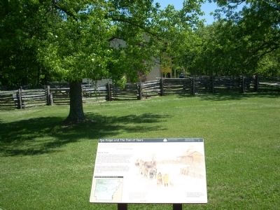
"Long time we travel on way to new land.... Womens cry... Children cry and men cry...but they say nothing and just put heads down and keep on go towards West. Many days pass and people die very much." -Recollection of a survivor of the Trail of . . . — — Map (db m35436) HM
On Military Park Road (County Road 65), on the left when traveling north.
Imagine 7,000 Confederate troops crowded in close order along Ford Road, the lane you see on the right edge of this field. As they trudged east toward Elkhorn Tavern, a small Union force of Iowa cavalrymen - only 600 men - unexpectedly appeared . . . — — Map (db m37755) HM
This site was the camp-ground for commanding officers and headquarters of U.S. Army for Battle of Pea Ridge. Here councils of war were held. Camp for 10,500 soldiers. U.S. Army located 1 ½ miles south. Depot of supplies 1 mile north of this site. — — Map (db m35688) HM
Near Military Park Road (County Road 65), on the left when traveling south.
It was the fiery end of the best day of Earl Van Dorn's 20 years as a professional soldier. Bone-tired from the jarring of a week-long ambulance ride and still feverish from pneumonia, the Confederate commander lay down here in the side yard of . . . — — Map (db m35661) HM
On Sugar Creek Road (County Road 44), on the right when traveling east.
The high bluffs here on Little Sugar Creek were a scene of frantic activity on the morning of March 6, 1862 as Federal soldiers shoveled out rifle pits and cut down trees for hasty field fortifications. With no hope of reinforcements from St. . . . — — Map (db m35690) HM
On Pioneer Lane 0.2 miles south of Mockingbird Lane, on the left when traveling south.
(South face)
To the
heroes
who fell or fought for
the land they loved during
the Civil War 1861-65.
Their sacrifices cemented
our union of states and made
our flag glorious forever.
On fame's eternal camping ground . . . — — Map (db m225024) WM
On 4th Avenue Southeast just south of Atlanta Street Southeast (State Highway 72), on the right when traveling south.
The Arkansas & Oklahoma Railroad, owned by John Bayless and William Felker, was the train route west from Bentonville to Gravette from 1898 to 1900. Besides transporting passengers, this route played a major role in the growth of the Ozark fruit . . . — — Map (db m266017) HM
On Georgia Flat Road (County Road 503) at Kane Road (County Road 422), on the left when traveling west on Georgia Flat Road.
Camp Jackson Confederate Gen. Ben McCulloch established
Camp Jackson in July 1861 before marching into
Missouri. After the Aug. 11 Battle of Oak Hills
he returned to Camp Jackson. The 4th Arkansas
Infantry Regiment, which formed Aug. 17, . . . — — Map (db m224988) HM
Near Georgia Flat Road (County Road 503) south of Kane Road (County Road 422), on the left when traveling south.
Soldiers who died at Camp Jackson in 1861
and buried here in unmarked graves
Calhoun Escopets – Co. A
Adolphus P. Williams - Pvt. • Francis C. Harbor - Pvt. • Benjamin F. Bearden - Pvt. • James W. Strong - Pvt. • John C. Farmer - Pvt. • . . . — — Map (db m225001) WM
On 1st Avenue Southeast (Arkansas Route 59) south of Main Street Northeast, on the right when traveling south.
United States Department of Interior
National Register of Historic Places
Kansas City Southern Railway Caboose #383 has been placed on the National Register of Historic Places for its local significance and for its engineering as a rare and . . . — — Map (db m224965) HM
On Monroe Avenue east of Lincoln Street, on the left when traveling east.
January 1936, Tom Farish & Joe Steele started building a canning factory using a lot of donated labor. The first run of green beans was June 26, 1936, tomatoes July 22, 1936, followed by spinach and other products later on.
After Tom Farish . . . — — Map (db m93283) HM
On Jackson Place at McClure Avenue (County Road 923), on the left when traveling north on Jackson Place.
Started as Robinson's Cross Roads east of here on the historic Old Wire Road. It was on the Main Line of the Butterfield Stage Route. Its name changed to Bloomington in 1885, nicknamed “Mudtown.”
After completion of the railroad in 1881, city . . . — — Map (db m224828) HM
On Jackson Street south of McClure Avenue (County Road 923), on the right when traveling south.
This evaporator dried apples over wooden racks with wood fired furnace heat. After drying, the peeled, sliced apples were sprinkled with powdered sulphur as a preservative. They were shipped out in big barrels by railroad cars. This work was . . . — — Map (db m93259) HM
On McClure Avenue (County Road 923) at Jackson Street, on the right when traveling east on McClure Avenue.
In 1881 J. W. Phillips owned and operated an evaporator (fruit dryer) here. Later it was operated by Mr. Adams.
Hundreds of bushels of apples were peeled, sliced, dried on wooden racks and sprinkled with sulphur as a preservative. Wood-fired . . . — — Map (db m224837) HM
On McClure Avenue (County Road 923) at Johnson Avenue, on the right when traveling east on McClure Avenue.
The First Baptist Church of Lowell was first organized as the Bloomington Baptist Church in 1868. The first pastor was W.E. Green.
The building was re-located to Lowell after a tornado destroyed most of Bloomington.
Years later an addition to . . . — — Map (db m224851) HM
On Madison Avenue at Washington Street, on the right when traveling east on Madison Avenue.
The First Five Will Baptist Church in one of the oldest buildings in town. It started as the Lowell Cumberland Presbyterian Church. Warranty Deed filed September 19, 1892, shows land conveyancy by A. Douglas, Trustee of the St. Louis & San Francisco . . . — — Map (db m224813) HM
On Jackson Street at Johnson Avenue, on the right when traveling north on Jackson Street.
John W. Looney built the IOOF/Masonic Lodge building here in 1913 after the wooden store burned. The Masonic Lodge was upstairs. The Post Office was in one end downstairs.
Looney sold groceries, feed, and general merchandise at this store. He . . . — — Map (db m224842) HM
On Jackson Street at Johnson Avenue, on the right when traveling south on Jackson Street.
This 1890's house is one of the oldest homes in Lowell. In 1881, L.P. Davis owned outlot No. 1 and 34 acres used for his plant nursery. An adjoining 40 acres is clearly defined on a 1905 map.
The 1904 photo, above, was given to the museum by . . . — — Map (db m224846) HM
On Jackson Street south of McClure Avenue (County Road 923), on the left when traveling south.
The earliest postal area was at Cross Hollows. Records show the Bloomington Post Office was changed to Lowell, March 9, 1881 with Paul F. Lewis, Postmaster. Insets show a 1900 Post Office building on North Jackson Street. The one next door to . . . — — Map (db m93274) HM
On Jackson Place north of McClure Avenue (County Road 923), on the left when traveling north.
The Old Wire Road at Mudtown was used by the
Butterfield Overland Mail Co. and both Union and
Confederate soldiers during the Civil War. In
February 1862, Union troops ate food left behind
at a Confederate camp and were sickened. Some
died, . . . — — Map (db m224817) HM
On Jackson Street south of Johnson Avenue, on the right when traveling south. Reported missing.
Location: West of the railroad tracks on Lincoln Street between McClure & Monroe, almost directly across from Allen Canning Company Warehouse. It was about 12' x 12', made of native stone, cemented together. One small window on the north side was . . . — — Map (db m93282) HM
On Jackson Street south of McClure Avenue (County Road 923), on the right when traveling south.
Location: West of the railroad tracks on Lincoln Street between McClure & Monroe, almost directly across from Allen Canning Company Warehouse.
It was about 12' x 12', made of native stone, cemented together. One small window on the north side was . . . — — Map (db m224840) HM
On McClure Avenue (County Road 923) west of Jackson Street, on the right when traveling east.
The school is documented on out Lot No. 22 on Lowell 1881 maps. Goodspeed's 1899 History of Benton County reported the village has a brick school house and Masonic Lodge combined, owned completely by the Masons and the Public School Board, . . . — — Map (db m224830) HM
On Jackson Place at McClure Avenue (Route 923), on the left when traveling north on Jackson Place.
Mar. 20, 1839 Trail of Tears Mar. 8, 1847 Robinson's Crossroads First Post Office Feb. 5, 1858 Name changed to Bloomington Sept. 18, 1858 Butterfield Stage Stop to 1861 Dec. 9, 1862 Civil War Skirmishes Aug. 24, 1864 "Camp Mudtown" Mar. 9, 1881 . . . — — Map (db m33712) HM
On Primrose Road at Phillips Road, on the left when traveling south on Primrose Road.
James Miller Ingram was a captain in the Confederate 6th Provisional Cavalry Partisan Rangers. Years after the war ended, as a self-taught minister he went to preach at a church and was murdered - shot in the back by 19 year old John M. Stone. . . . — — Map (db m68790) HM
On Jackson Street at McClure Avenue (County Road 923), on the right when traveling south on Jackson Street.
A red brick, two-story elementary school was built here in 1913. The land was purchased from Humphrey Barr. It was funded with $5,000 worth of bonds. Dr. A. J. Harrison, School Board President, handled the bond sales in Fort Smith.
In 1915 Lowell . . . — — Map (db m224843) HM
On Jackson Place at McClure Avenue, on the left when traveling north on Jackson Place.
The original Lowell Garage, owned by Thurman Moody, was located on the corner of what is now Lincoln Street and McClure Avenue. The old 71 Highway used to run along Lincoln Street so it was right on the highway, when the new Highway 71 was located . . . — — Map (db m224826) HM
On Jackson Street south of McClure Avenue (County Road 923), on the left when traveling south.
Humphrey Barr, brother of Mrs. L. P. Davis, was an early banker. We know Henry Neal was the banker in 1918. He loaned Elza Tucker's mother $75 to buy a family sewing machine. He charged 10% interest and had a loan limit of $100. Elza has the . . . — — Map (db m93279) HM
On Jackson Place at McClure Avenue (Route 923), on the right when traveling north on Jackson Place.
This marker, set on the Butterfield Stagecoach Road, is placed near the spot where the trail crossed the east-west road between Huntsville and the Robinson settlement in western Benton County. John Robinson, a Revolutionary soldier, settled here . . . — — Map (db m68781) HM
On Jackson Place at McClure Avenue (County Road 923), on the left when traveling north on Jackson Place.
The Lowell Historical Museum was started with a Bicentennial Project Grant in 1976. Great community spirit and effort really stretched that seed money. Citizens donated or loaned cherished family heirlooms. Donated labor built display cases, sorted, . . . — — Map (db m224818) HM
On Jackson Street south of McClure Avenue (County Road 923), on the right when traveling south.
The St. Louis & San Francisco Railroad was established
in 1881. Lowell was a village at that time. The 1889 Goodspeed's History of Benton County says greens, fruits, poultry, timber and railroad ties shipped extensively from the depot. The . . . — — Map (db m93263) HM
On Arkansas Route 72 at Busse Road, on the left when traveling north on Arkansas Route 72.
This camp was established in June, 1861, by Brig. Gen. Nicholas Bart Pierce, a Benton County man, to train recruits from Western Arkansas and the Indian Nation. He was a West Point graduate.
Many Arkansas units, Greer's Texas regiment, . . . — — Map (db m77950) HM
On Arkansas Route 43 near Route 72, on the right when traveling south.
Occurred on Oct. 22, 1862. While Gen. James G. Blunt was encamped on the old Pea Ridge battlefield, word came that Gen. Douglas H. Cooper and Col. Stand Watie's Indian regiment were at old Fort Wayne across the line from Maysville. On Oct. 20 he . . . — — Map (db m52281) HM
On Arkansas Route 72 at North Curtis Avenue, on the right when traveling west on Arkansas Route 72.
To honor those who served
[Slab #1] SCPO Robert W. Mix Sr. - U.S. Navy - Korea/Vietnam • MSgt. Kently H. Easley - U.S. Army -Korea/Vietnam • AirLO A. “Gus” Flory - U.S. Army - WWII • Tech 4 Reginald C. Tyndall - U.S. Army - World War II . . . — — Map (db m225103) WM
On N. Curtis Avenue at E. Pickens Road, on the right when traveling north on N. Curtis Avenue.
Texas
Remembers the Valor and Devotion of
Her Sons Who Served at Elkhorn Tavern
(Pea Ridge), Arkansas
March 7-8, 1862
In Van Dorn’s attack of March 7, these Texas units under Brig. Gen. Ben McCulloch assaulted the Union right center:
. . . — — Map (db m99763) WM
On State Highway 72 at North Curtis Avenue when traveling west on State Highway 72.
[North face]
This memorial is dedicated to
all the men lost while serving
in the U.S. Submarine Service
“It is to the everlasting honor and glory of our submarine
personnel that they never failed us in our days of peril.” . . . — — Map (db m225146) WM
On Hudson Road (U.S. 62) near Cass Hough Drive, on the left when traveling north.
This memorial was erected in memory of the young individuals who went to war as kids and lost their youthful dreams, and some their lives, for a cause - freedom and honor - and came back as men with the horrors of war instilled in every fiber of . . . — — Map (db m62588) WM
On Walnut Street (State Highway 12) at 2nd Street (State Highway 12), on the right when traveling west on Walnut Street.
The American National Bank built a new building on this corner in 1962. Prior to that year, it was located at 114 S. First Street and was the only bank in Rogers from 1931 until 1956. The bank was under the leadership of T.E. Harris, and his . . . — — Map (db m93332) HM
On South 1st Street south of West Walnut Street, on the right when traveling south.
114 South First Street
A.O. Clarke, Architect
Built 1905-1907
The Bank of Rogers building opened in 1907. By 1918, the building was home to the Farmers State Bank. In 1937, the American National Bank moved to this location, followed by the . . . — — Map (db m224882) HM
On West New Hope Road at South Osage Springs Drive, on the right when traveling west on West New Hope Road.
Shortly after the Union Army of the Southwest entered Arkansas in February 1862, three divisions moved to Osage Springs in a bid to trap Confederate troops in their winter quarters. The trap failed, but the soldiers established Camp Halleck, . . . — — Map (db m224877) HM
On South Old Wire Road (County Road 83) 0.2 miles north of Dogwood Drive/Cross Hollow Road (County Road 1189), on the left when traveling north.
This post office was established in 1843. Nov. 29, 1861, Gen. Ben McCulloch moved his army into winter quarters here. Numerous, large, two-room, plank barracks were built in two rows facing each other, extending eastward more than a mile. Ten or . . . — — Map (db m68788) HM
On South Old Wire Road (County Road 83) 0.2 miles north of Dogwood Drive/Cross Hollows Road (County Road 1189), on the left when traveling north.
This site was donated to the Benton County Historical Society by Scarlett Biggs Wilson and Lara Wilson Rosenblum in honor of their parents/grandparents, Guy and Nell Biggs, early pioneers of the Cross Hollows area. Cross Hollows is recognized for . . . — — Map (db m300185) HM
On 2nd Street (State Highway 12) at Walnut Street (State Highway 12), on the right when traveling south on 2nd Street.
Charles Juhre built this building in 1894 for the Rogers Grocery Company. In 1900, the building was occupied by the J.W. Ford Grocery and Feed Store. In 1918, McGill's Drug Store was here and then, in 1925, it became The Corner Drug Store, which . . . — — Map (db m93335) HM
On Hudson Road (U.S. 62) at Cass Hough Drive, on the left when traveling north on Hudson Road.
USAF Century Series aircraft flown by active interceptor squadrons, the Air Defense Command, and the Air National Guard from 1959 - 1983.
The Voodoo is well known for its NATO role as a nuclear deterrent during the Cold War.
The RF-101 . . . — — Map (db m62520) HM
On Elm Street at 3rd Street, on the right when traveling west on Elm Street.
This building is a pinnacle of A.O. Clarke's interweaving use of limestone and brick, Romanesque arches, and stained glass window detail. In 1996, the historic sanctuary was renovated and is one of the highlights of the church. The trademark steeple . . . — — Map (db m93331) HM
On Poplar Street at 2nd Street, on the right when traveling east on Poplar Street.
This building constructed in 1918-19 cost a total of $75,000 including the site, furnishings, and fixtures. Listed on the National Register of Historic Places, it served as the U.S. Post Office for Rogers for over four decades. These 1918 . . . — — Map (db m90744) HM
On Mount Hebron Road (County Road 238) 0.2 miles south of Stratsman Lane, on the right when traveling south.
1.6 acres for the
purpose of establishing
a church & cemetery.
Donated by L.E. Mason
& Ann Mason (wife)
Deeded July 20, 1861.
Trustees;
Thomas Bingham
Samuel H. Johnson
John Mason — — Map (db m224875) HM
On South 1st Street north of West Elm Street, on the right when traveling north.
To commemorate the Centennial passage, through Benton County of the First Westbound Stage coach on the Butterfield Overland Mail Route from St. Louis to San Francisco. Callahan's Tavern, the site of which is about a half a mile northeast of this . . . — — Map (db m216324) HM
On State Highway 12 0.1 miles west of Van Winkle Place Road, on the left when traveling west.
Peter Van Winkle’s saw mill cut lumber for Confederate soldiers’ winter quarters at Cross Hollow and Oxford Bend in early 1862. Gen. Earl Van Dorn’s Confederates used the mill to grind corn after their March 1862 defeat at Pea Ridge, and wounded men . . . — — Map (db m90738) HM
On 2nd Street south of Walnut Street ( Highway 12), on the right when traveling south.
The Rogers Victory Theater
Opened Monday, December 5, 1927, to a packed crowd of 750.
First Production: "American Beauty"
Notable Performers Over the Years:
Will Rogers, Conway Twitty
Designed by A.O. Clarke
Built by John Myler
It . . . — — Map (db m90740) HM
On West Walnut Street (U.S. 71B) at North 8th Street (County Highway 94), on the left when traveling east on West Walnut Street.
Walmart
Walmart, the world’s largest retailer, first opened at this location in Rogers in 1962 after Sam Walton owned and operated smaller retail models in Newport, Bentonville, and elsewhere. For much of its history, the company has been . . . — — Map (db m312115) HM
On War Eagle Road (County Route 98) at Bettis Hill Road (County Route 1059), on the left when traveling west on War Eagle Road.
In 1832, Sylvanus Blackburn left Tennessee with a wagon and four oxen, and came to the War Eagle River valley in Arkansas. He spent the winter building a log home and clearing the land of his homestead. He brought his wife from Tennessee the next . . . — — Map (db m50367) HM
On War Eagle Road, on the right when traveling east.
The Ozark Arts and Crafts Fair was founded on War Eagle Mills Farm by Lester and Blanche Elliott and friends in October 1954 for the purpose of giving recognition to Ozark artists and craftsmen who work with their hands and hearts to preserve the . . . — — Map (db m52066) HM
On East Main Street west of South Maxwell Street, on the right when traveling east.
For God and Country Dedicated as a memorial to all that served in the Armed Forces of the United States of America Past · Present · Future
Sponsored by Disabled American Veterans, The American Legion, Veterans of Foreign Wars, Citizens of . . . — — Map (db m220471) WM
On East Main Street at South Lincoln Street, on the right when traveling west on East Main Street.
Battery B 2d Battalion 142d Field Artillery
Honoring those who served in Operation Desert Shield/Desert Storm
Nov. 1990 - May 2001
Commander Cpt. Commerford, J. B.
Executive Officer 1Lt. Huey, Eddie G.
Fire Direction Officer 2Lt. . . . — — Map (db m309919) WM
Near South Mount Olive Street, on the right when traveling north.
Accepted by the National Register of Historic Places
February 1996
Built Circa 1932
Burt and Grace Pyeatte
Pioneer citizens coming to Siloam Springs in 1918
The house is locally significant as the finest example of English Revival . . . — — Map (db m299579) HM
On North Eagle Drive, on the left when traveling north.
Birthplace of Amna Sager Chastain
July 4, 1847 - 1919
Wife of 4th generation descendant of revolutionary patriot the Rev. John Chastain of Virginia, her husband Jehu Thomas Chastain
March 4, 1844 - 1931 — — Map (db m299583) HM
Near East Main Street west of South Maxwell Street.
Restoring the Twin Springs Park & Gardens
In January of 2003, the Siloam Springs Garden Restoration Club, an affiliate of the Arkansas State Federation of Garden Clubs, took on the task of restoring the Twin Springs Park historic garden. . . . — — Map (db m220476) HM
On Fair Avenue east of Highway 59, on the right when traveling east.
Founded in 1889 has been entered into the National Registry of Historical Places by the United States Department of the Interior on 7-8-99. — — Map (db m224982) HM
On State Highway 59 at East Patterson Street, on the right when traveling south on State Highway 59.
These stones from the foundation of a farm house at Breezy Point, one mile west of this spot, where the first Summer Institute of Linguistics (Camp Wycliffe) was held June-September 1934, stand here as a memorial to God's faithfulness. From that . . . — — Map (db m224973) HM
On High Sky Inn Road (State Highway 303) 0.2 miles west of Bettis Hill Road, on the right when traveling north.
Sylvanus Blackburn came to the War Eagle in 1832. By 1838 he had a saw mill, a grist mill, and a house. Peter Van Winkle came about 1850. By 1860, this was a thriving crossroads. March 8, 1862, Generals Van Dorn and Price, retreating from the . . . — — Map (db m19492) HM
On West War Eagle Avenue at West Main Street (Business U.S. 412), on the right when traveling west on West War Eagle Avenue.
On January 10, 1863, nine men, including two Confederate officers and prominent local citizens and Masonic lodge members, were taken from a guardhouse near here, led to Samuel Vaughn's farm one mile northeast of Huntsville, and shot. Only one man . . . — — Map (db m141514) HM
On West War Eagle Avenue at West Main Street (U.S. 412), on the right when traveling west on West War Eagle Avenue.
Front
Isaac Murphy was born Oct. 16, 1799, in Pennsylvania. A teacher and lawyer, he moved to Fayetteville in 1834 and became involved in politics. Murphy took part in the 1849 Gold Rush, but lost his farm to creditors. He, his wife and . . . — — Map (db m141518) HM
On West Main Street (Business U.S. 412) at West War Eagle Avenue, on the right when traveling east on West Main Street.
A county government was organized in Madison County in 1836, in the barn of Evan S. Polk, a short distance northwest of the present town of Huntsville which was laid out as a town and made the permanent seat, of government in 1839. The county was . . . — — Map (db m141599) HM
On College Road, on the left when traveling north.
Archie Leonard Reed is a life-long Cane Hill resident. As a Cane Hill Harvest Festival committee member and longtime festival volunteer, Archie helped train the next generation of sorghum cookers. In 2024, Historic Cane Hill dedicated this sorghum . . . — — Map (db m311416) HM
Cane Hill College, the first collegiate
institution of learning established in
Arkansas was founded here by Cumberland
Presbyterians on October 28, 1834. The
following persons were named by the
founders as the board of trustees: Col.
John . . . — — Map (db m66703) HM
Near East Munyon Road (County Road 442) 0.3 miles south of State Route 45, on the left when traveling south.
First public cemetery for
Washington County Arkansas
has been placed on the
National Register
of Historic Places
by the United States
Department of the Interior
c. 1830 — — Map (db m225062) HM
Near East Munyon Road (County Road 442) 0.3 miles south of State Route 45, on the left when traveling south.
This is the site of
the first church established
in Washington County Arkansas
Bethlehem
Methodist-Episcopal
Church South
established April 17th, 1827 — — Map (db m225061) HM
On College Road near McClellan Road, on the left when traveling north. Reported permanently removed.
As James Blunt's First Division of the Army of the Frontier massed in front of the Confederate artillery at the Cane Hill Cemetery, General John Marmaduke ordered J.O. Shelby's Rebels to (unreadable) through the hamlet of Boonsboro. As the . . . — — Map (db m261490) HM
Near State Highway 45 south of Patterson Road, on the right when traveling north.
William Blackwell Welch was born in 1828 in Scottsville, Kentucky and graduated from the University of Tennessee Medical School in 1849. In 1851, he married Alabama native, Laura F. McClellan, and the couple moved to Cane Hill in 1855. Here they . . . — — Map (db m240271) HM
On State Highway 45 south of Patterson Road, on the right when traveling north.
Stone fruit cellars, like this one, were once popular in the Ozarks. They were designed to keep food cool in the summer months and above freezing in the winter months.
Most were constructed in the 1920s and early 1930s as home canning was . . . — — Map (db m240312) HM
On State Highway 45 just north of Patterson Road. Reported missing.
Late in November 1862, Gen. John S. Marmaduke with 2,000 cavalry occupied Cane Hill Ridge. Gen. James G. Blunt with 5,000 cavalry and infantry and 30 pieces of artillery met them at dawn Nov. 28, 1862. Retreating slowly, making stands at Boonsboro . . . — — Map (db m261493) HM
On College Road near McClellan Road, on the left when traveling north. Reported permanently removed.
The Fourth Division, Trans-Mississippi Army Maj. Gen. Thomas C. Hindman's Trans-Mississippi Army contained four divisions: One of cavalry under John S. Marmaduke, infantry divisions under Francis A. Shoup and Daniel M. Frost, and a reserve . . . — — Map (db m261492) HM
On State Highway 45 near Patterson Road, on the right when traveling north.
Zebulon “Zeb” Edmiston was the patriarch of one of Cane Hill's most prosperous Victorian era families. Zeb and Eunice Jane Gray were married in 1852 and had four children: Nina, James, David and John The Edmistons farmed in what is now Clark County, . . . — — Map (db m225063) HM
On Water Avenue at North Elm Street (State Highway 112), on the right when traveling west on Water Avenue.
A half block west across the street is the big spring that gave the town its name. Tents of the 16th Arkansas Infantry covered the campus of the academy to the east near the head of Brush Creek during the winter of 1861-62. Dr. M.D. Steele's . . . — — Map (db m167821) HM
338 entries matched your criteria. Entries 101 through 200 are listed above. ⊲ Previous 100 — Next 100 ⊳