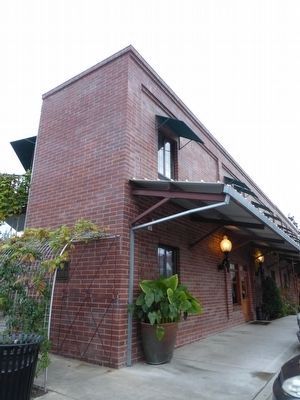
This was the former site of Napa's original Embarcadero and home of two Banner warehouses constructed in 1862 and later acquired by Charles Carpy for wine storage. Captain A. Hatt purchased the property in 1895 for storage. Behind the current . . . — — Map (db m92486) HM
About 200 feet north of this site, a short distance from the Napa River ford, stood Don Salvador Vallejo’s Casa Las Trancas, headquarters for his Rancho Napa— a land grant of over 3000 acres. Established in the 1840’s and known as “The . . . — — Map (db m84129) HM
On Soscol Avenue at Silverado Trail, on the right when traveling north on Soscol Avenue. Reported missing.
Don Cayetano Juarez, (1809-1883) was given Rancho Tulocay in 1840 by General Mariano Vallejo for his decade of service to the government of Mexico, as a soldier and as mayordomo at Sonoma. He married Maria de Jesus Higuera in 1835 and they raised 11 . . . — — Map (db m123859) HM
On First Street east of Main Street, on the right when traveling east.
Lower Marker:
Chinatown
Napa’s China Town was situated on both sides of First Street from this point west to Napa Creek. It occupied the area south of First to the Napa River where the Joss House stood near the juncture of Napa . . . — — Map (db m54550) HM
Francis Cutting was born in Lowell, Massachusetts in 1834 and arrived in San Francisco in 1858. After establishing himself in the fruit packing business he sought to expand operations to fruit growing as well and looked here for a wharf site and . . . — — Map (db m54605) HM
Named in honor of Davis Ernest Cavagnaro, who served as a director of the Napa Town and Country Fair board for 20 years. A devoted, active circus fan, originator of Napa’s fair parades, civic minded citizen who was lovingly known as Mayor of East . . . — — Map (db m54576) HM
Near this site was located the Embarcadero de Napa. While the exact date of establishment is unknown, it is recorded that Captain John Sutter sent his schooner Sacramento here in 1844 to get lime from Nicholas Higuerra, the first nonnative . . . — — Map (db m25754) HM
This building, constructed in 1886 is the last remaining example of a 19-th century, three-level gravity flow winery built entirely of wood in Napa County. — — Map (db m176334) HM
On Third Street, on the right when traveling east.
Designed by pioneer architects R.H. Daly and Theodore Eisen, this church is an outstanding example of late Victorian Gothic architectural styling. It is the best surviving example in this region of early works associated with Eisen, who later became . . . — — Map (db m18781) HM
On Main Street north of Third Street, on the left when traveling south.
Historic Site
Here, on July 6, 1846, 160 mounted riflemen volunteers under
the Bear Flag Republic Banner crossed the Napa estuary,
led by Captain, U.S. Army, John C. Fremont and U.S. Marine Lt.
Archibald H. Gillespie. To gain California's . . . — — Map (db m153424) HM
Near Main Street near 5th Street, on the right when traveling south.
Requiring more space to expand his warehousing operations, Captain Hatt added this two story building in 1886, to accommodate the increasing demand for storage for wine and spirits. The brick facing was made from brick obtained from the San Quentin . . . — — Map (db m92523) HM
This small building was constructed by Captain A. Hatt in 1893 with an accompanying wharf. This building may have been the first in Napa constructed of poured-in-place concrete reinforced with twisted square rebar. A rolling door in the southwest . . . — — Map (db m92487) HM
The Hay Barn was constructed in 1959 after an earlier hay barn building burned in the 1958 inferno. The building was rebuilt to allow sunken drive through access for hay trucks through the Main Street opening. The building is constructed of a myriad . . . — — Map (db m92488) HM
On Franklin Street at Pine Street, on the left when traveling north on Franklin Street.
This home was built by Samuel E. Holden in 1886. Mr. Holden was born in Concord, New Hampshire, Feb. 1845. During his youth he gained experience in the wool industry. At the time of the Civil War Holden served with the New Hampshire Volunteers. He . . . — — Map (db m237645) HM
James Clyman - Trapper and Explorer. Prominent in opening the Far West. He was with Jedediah Smith in 1824 at South Pass. Prepared the way for the pre-Gold Rush pioneers. Settled in Napa County in 1848. — — Map (db m54549) HM
On Jefferson Street near First Street, on the right when traveling south.
Near this site in 1856, John M. Patchett, native of England, opened the first commercial winery in the Napa Valley. Patchett's Grove Winery produced over 6,000 gallons of wine shipped to fine restaurants in San Francisco. The vineyard extended from . . . — — Map (db m91340) HM
On Main Street at Caymus Street, on the left when traveling north on Main Street.
"Sewing Machine Johnson" - built this carriage house with the expectation that his sewing machine, horse drawn buggy & bicycle business would soon be relocated and transformed into a luxury automobile showroom and repair shop. In 1914 James H. . . . — — Map (db m91391) HM
On April 8th, 1944 while flying a routine combat training mission over Napa, Army Air Force Lt. Murphy's aircraft went out of control at 5,000 feet and plunged into the Napa River, not far from this site.
Lt. Murphy, a veteran combat pilot . . . — — Map (db m92526) HM
Last surviving native-stone winery in Napa. Built and operated by Joseph Mathews (Mateus), a native of Portugal, this winery produced a variety of wines including prize-winning sherry. Mathews was a pioneer in the exportation of fine Napa wines to . . . — — Map (db m16731) HM
On Randolph Street at First Street, on the left when traveling south on Randolph Street.
Credit the 1908 Napa City & County Portfolio & Directory, published
by Mr. H. A. Darms of Napa, and considerable research in the archives
of the Napa County Historical Society by Napa artist Miky Kravjansky
for the concept behind this montage of . . . — — Map (db m153396) HM
On First Street west of Main Street, on the left when traveling east.
Peter Jensen and
Edwin Pridham's
invention occurred at
1606 F St. in May of 1915.
This statue, unveiled
on May 18, 1985
is the work of Napa
sculptor Franco Vianello — — Map (db m91327) HM
On Brown Street at 2nd Street, on the left when traveling east on Brown Street.
“This block donated by Senator Nathan Coombs. Second County Courthouse constructed on this site in 1856. Present courthouse constructed in 1878 and restored in 1979.”
Dedicated November 4, 1979 by The Native Sons of the Golden West
Colin B. . . . — — Map (db m286510) HM
On Main Street at Third Street, on the right when traveling north on Main Street.
Fallen But Not Forgotten
In honor of our military fallen, those
who have served and those still serving,
we salute your sacrifices and
will never forget
This memorial is dedicated in memory of the
men and women of Napa County who
lost . . . — — Map (db m153419) WM
First constructed 1892-3.
Restored under volunteer leadership of Solano-Napa Builders Exchange through contributions and skilled labor of these citizens and organizations of Napa County.
Dedicated April 13, 1985
By the
Native Sons of the . . . — — Map (db m16404) HM
On Magnolia Drive at North Oak Drive on Magnolia Drive.
Situated on 192 acres of Rancho Tulocay land purchased from Don Cayetano Juarez, this hospital opened its doors in November 1875. The central building was constructed of native stone and millions of bricks made on this site. Over the years the . . . — — Map (db m54613) HM
The Napa Valley Railroad ran from Soscol Landing, the most northerly terminus of the larger bay steamers, north 4.5 miles to this site in Napa City. Ground was broken on November 21, 1864, and by January 1865 the grade and track laying was . . . — — Map (db m54595) HM
Historic Commerce Along Napa River
As other modes of transportation became more dominant, the waterfront declined. But in the 21st century, Napa has turned again to embrace the river. Much of the riverfront as been redesigned and . . . — — Map (db m92484) HM
On Coombs Street at 1st Street, on the right when traveling south on Coombs Street.
The Napa Native Sons of the Golden West hall was constructed by the order in 1914. The three story steel-framed brick building is a heritage property and an excellent example of civic properties in Napa. It was the tallest structure in Downtown for . . . — — Map (db m106386) HM
On Main Street at Second Street, on the right when traveling north on Main Street.
Built in 1893, the Oberon was the hub of activity in downtown Napa. Patrons could buy a cigar, get a shave and a haircut for two bits, or relax with a cold beer while playing a leisurely game of pool or cards. Many a shoe was shined here. In 1932 . . . — — Map (db m69324) HM
On Coombs Street at Coombs Street, on the left when traveling north on Coombs Street.
This property has been listed in
the National Register of Historic
Places by the United States
Department of the Interior.
This building was designed by
Napa's leading architect of the
time, Luther M. Turton. The
structure was built for use . . . — — Map (db m153385) HM
On Main Street at Clinton Street, on the right when traveling south on Main Street.
First stone and oldest surviving commercial building in Napa. Built by Philip Pfeiffer as brewery 1875. Other uses included "Stone Saloon" and Sam Kee Laundry (1920's-1970's). Italianate front represents a much earlier style of wooden construction . . . — — Map (db m16416) HM
On First Street near Main Street, on the right when traveling east.
Built by Bartolomeo Semorile and designed by Napa architect Luther M. Turton as an outstanding example of Victorian commercial architecture.
The Semorile family came to Napa in 1869 and started their grocery business just east of this site. . . . — — Map (db m16477) HM
Napa Milling Company demolished earlier buildings to construct this building in 1932 which was later to include the 84' tall silos constructed in 1944 and the hoppers placed in 1965. The Silo Building was home to the egg candling operation. The big . . . — — Map (db m92489) HM
Near Devlin Road, on the left when traveling south.
Built by Elijah True at the junction of the county road from Napa City and Old Ferry Road, now Soscol, which served the Soscol Ferry Crossing at Napa River west of here. The thriving transportation center developed here from the stagecoach and wagon . . . — — Map (db m54838) HM
Near Main Street near 5th Street, on the right when traveling south.
Long considered nature's thoroughfare for pioneer settlement and development, the Napa River has played a major role in the growth and prosperity of Napa County. From its headwaters near Mt. St. Helena to its southern mouth merging with San . . . — — Map (db m92527) HM
On First Street at Main Street, on the right when traveling east on First Street.
When E.A. Winship arrived from Minneapolis in 1887, it became clear that he was a gentleman and that he had money to invest. In March 1888, he purchased this site for $15,000 and announced plans for a brick building. This building, designed by . . . — — Map (db m54531) HM
On Aetna Springs Road at Aetna Mine Road, on the right when traveling west on Aetna Springs Road.
This intersection of the Phoenix Mining claim, patented November 15, 1861 and the Washington Mining claim, patented December 20, 1862 once was inhabited by a community of several hundred people and gave the appearance of a small town.
The . . . — — Map (db m200310) HM
On Pope Valley Road 2 miles north of Howell Mountain Road, on the right when traveling north.
This is one of California's exceptional Twentieth Century folk art environments. Over a period of 30 years, Emanuele 'Litto' Damonte (1892-1985), with the help of his neighbors, collected more than 2,000 hubcaps. All around Hubcap Ranch are . . . — — Map (db m149172) HM
On Pope Valley Road near Howell Mountain Road, on the left when traveling west.
At the crossroads of Howell Mountain and Pope Valley Roads, the Pope Valley Garage came into existence in 1915 to provide repairs for farm equipment, cars, trucks, tractors and towing as Pope Valley began to grow. In 1927 the Pope Valley Garage was . . . — — Map (db m57622) HM
This property was used for family burial in 1880, when the property owner Elias Barnett, who arrived in Pope Valley by 1845, died. In 1903, Elias’ oldest son Jesse and his wife Loraine Barnett set aside the small piece of land “to be used for the . . . — — Map (db m176295) HM
Standing at the crossroads of Pope Valley, this store was the center of activities for the area's residents for nearly a century, and served as a stopover for people traveling to the mines in Lake County. It was built about 1875 and in 1913 a second . . . — — Map (db m54772) HM
On Howell Mountain Road at Pope Valley Road, on the left when traveling south on Howell Mountain Road.
Henry Haus, a native of Switzerland, came to Pope Valley in 1889 at the age of 16. He opened his blacksmith shop in the adjacent wooden structure in 1897, caring for the needs of this valley until 1950.
In 1899 he married Regula Anna and they . . . — — Map (db m57623) HM
Built by Frederick and Jacob Beringer, natives of Mainz, Germany. This winery has the unique distinction of never having ceased operations since its founding in 1876. Here, in the European tradition, were dug underground wine tunnels hundreds of . . . — — Map (db m18734) HM
Near St. Helena Highway (State Highway 29/128) south of Deer Park Road.
Cesare Mondavi, an Italian immigrant, settled first in Minnesota in 1908. After a brief career in the iron mines, he opened a saloon. In 1922 he moved his family to California’s Central Valley, where he became an independent fruit shipper, sending . . . — — Map (db m18701) HM
Near St. Helena Highway (State Highway 29/128) south of Lewelling Lane.
In 1858 Swiss-German John Thomann arrived in California and, by 1874, had built this winery. He built his family home next to the winery in 1884. The Sutter family purchased a small vineyard nearby in 1891 to supply their wine and spirits business . . . — — Map (db m54749) HM
Near St. Helena Highway (State Highway 29/128) south of Deer Park Road.
Charles Krug, a Prussian immigrant with controversial political beliefs for which he was briefly jailed, finally arrived in San Francisco in 1852. He likely came with no grape-growing or winemaking experience, but his insight, thirst, and inherent . . . — — Map (db m54535) HM
Near St. Helena Highway (State Highway 29/128) south of Deer Park Road.
Founded in 1861 by Charles Krug (1825 – 1892). This is the oldest operating winery in Napa Valley. The pioneer wine maker of this world famous wine region, Krug made the first commercial wine in Napa County in 1858, at Napa. — — Map (db m18693) HM
The Hudson House, constructed in 1852, was residence of David Hudson, a California pioneer involved in the Bear Flag Revolt. That revolt is credited with the design of the California State Flag and established California as a republic.
In 1883, . . . — — Map (db m18702) HM
Near Larkmead Lane 0.4 miles east of St. Helena Highway (California Highway 29/128).
Felix Salmina arrived from Switzerland in the 1860’s and in 1892 purchased this winery that had been established in 1884 by Lillian Hitchcock Coit. Felix converted the winery into a larger facility using stone quarried from nearby hills and . . . — — Map (db m18601) HM
Near Sage Canyon Road (California Route 128), on the right when traveling south.
Placed to commemorate the founding of the Nichelini Winery in 1890 by Anton Nichelini. Here on the southern slope of Sage Canyon he and his wife Caterina built their home and winery and raised twelve children. Ownership passed to eldest son, . . . — — Map (db m54839) HM
On Spring Street south of Oak Avenue, on the left when traveling south.
The Native Sons of the Golden West Hall has served for more than a century as a gathering place and social center of community activity within St. Helena. It is situated just outside the SW edge of the St. Helena Historic Commercial District, which . . . — — Map (db m55661) HM
On Main Street south of Adams Street, on the right when traveling south.
A fine example of Victorian architecture, this building was erected in 1892 by M. G. Richie. For many years it has served the city’s business community. In 1893 the hall and banquet rooms upstairs were leased to Saint Helena Lodge No. 93 Free & . . . — — Map (db m54543) HM
In 1880 Robert Louis Stevenson, for health reasons, spent a week with his bride in one of Sam Brannan’s cottages in Calistoga. He then spent nearly two months on Mt. St. Helena at the old Silverado Mine, scene of the Silverado Squatters. — — Map (db m155272) HM
On White Sulphur Spring Road 1 mile west of Spring Street, on the right when traveling west.
Home of
Sophie Alstrom Mitchell
From 1862 to 1882
An artist
noted for her water color paintings
of California wildflowers
Dedicated April 16, 1988
Napa County Chapter, California Native Plant Society
Napa County Museum . . . — — Map (db m91726) HM
Departed this life February 1953
Located on the hill to the east and south of this point was a haven of comfort to many a man from the late 1800’s until closed in 1953. Condemned by certain elements of our society yet venerated by others that . . . — — Map (db m54583) HM
Near Redwood Road, on the right when traveling south.
The Christian Brothers started their wine business September 2, 1882, at Martinez, California. On May 29, 1930, they bought the Mont La Salle property from Theodore Gier and began to move winery equipment and 54,000 gallons of wine from Martinez to . . . — — Map (db m163559) HM
On Chiles-Pope Valley Road, on the left when traveling north.
One and one half miles north of here, at the second crossing of Chiles Creek, is the spot known as “Whiskey Crossing”. Although shrouded in folklore, the origin of the name is based upon a probable incident that took place in the early . . . — — Map (db m54591) HM
On White Sulphur Springs Road, on the right when traveling west.
Situated on what was once a Mexican Land Grant to Dr. Edward Bale, White Sulphur Springs was discovered in 1848 and a resort was opened in 1852, making this California’s oldest. Wealthy San Franciscans traveled here in the latter half of the 19th . . . — — Map (db m82602) HM
Dedicated to the honor of the men who were mustered in San Francisco to serve in the companies A, E, F, L, and M of the 2nd Regiment, Massachusetts Volunteer Cavalry, 1862-1865.
Dedicated by Company A, “The California 100" re-enactors
and Sam . . . — — Map (db m54755) HM
Near Washington Street near Yount Street, on the left when traveling north.
In 1870, the year in which the Groezinger Winery (now Vintage 1870) was built, these flags: the California Bear flag (note how much more primitive in design it is in contrast with the present day version) and the American flag (then with 37 . . . — — Map (db m103540) HM
Near Washington Street at Yount Street, on the right when traveling north.
George Yount, American frontiersman, was born in North Carolina in 1794. When he was 10 years old Yount moved with his family to Missouri and in 1831 he came to California. Yount received a large tract of land in the Napa Valley from the Mexican . . . — — Map (db m103536) HM
Near Jackson Street near Lincoln Avenue. Reported missing.
Interred in this spot are the ashes of the Wappo village Kaymus (Caymus) Indian Tribe, who in the American Period were known as the George C. Yount Indians. This tribe cremated their dead and all their articles, usually on a pyre or in a sweat . . . — — Map (db m16578) HM
George Calvert Yount (1794-1865) was the first United States citizen to be ceded a Spanish land grant in Napa Valley (1836). Skilled hunter, frontiersman, craftsman and farmer, he was the true embodiment of all the finest qualities of an advancing . . . — — Map (db m18632) HM
Near Washington Street near Yount Street, on the left when traveling north.
This winery, once known as one of the finest cellars in the State, was erected by Mr. G. Groezinger in 1870. The winery stands on part of the original land grant made to Salvador Vallejo by the government of Mexico in 1838. Vintner Groezinger . . . — — Map (db m103539) HM
On Washington Street at Yount Street when traveling north on Washington Street.
On March 7, 1874, the map of Groeziner's addition to Yountville was filed and recorded. This plaque is on a portion of "the lot plotted by G. Groezinger as a flower garden." Therefore it is dedicated in his memory.
Yountville Firemen's Auxiliary . . . — — Map (db m103537) HM
On Silverado Trail 1 mile north of Yountville Crossroad, on the right when traveling north.
Napa P.O.W. Camp
At the request of Great Britain, over 700 POW camps were built within the USA to help alleviate the overcrowding of British camps. On August 14, 1945, three months after Germany surrendered and the day before Japan surrendered, . . . — — Map (db m98282) HM
On Yount Mill Road at Cook Road, on the right when traveling north on Yount Mill Road.
In this vicinity stood the log blockhouse constructed in 1836 by George Calvert Yount, pioneer settler in Napa County. Nearby was his adobe house in 1837. And across the bridge his grist and saw mills, erected before 1845. Born in North Carolina in . . . — — Map (db m18737) HM
On Washington Street at Lincoln Avenue, on the right when traveling north on Washington Street.
This bell cast in 1848, hung from 1854 until 1896 in the Pioneer Christian Church (Disciples of Christ). On demolition of the church, the bell was rescued by Senator C.L. LaRue. Presented by the Ellis McLanahan family, In the interest of local . . . — — Map (db m49553) HM
On California Drive, on the left when traveling north.
On Oct. 25, 1882, the Veterans Home of California Association purchased 910 Acres in
Yountville for $17,750. On this site the first
building was erected.
Opened April 1, 1884 for Civil and Mexican
War veterans. By July 1, 1889, the Home . . . — — Map (db m144263) HM
On California Drive at Solano Avenue, on the left when traveling west on California Drive.
Established in 1884 by Mexican War Veterans and members of the Grand Army of the Republic who recognized the need for a home for California’s aged and disabled veterans. In January 1897 the Veterans Home Association deeded the home and its 910 acres . . . — — Map (db m18743) HM
On Yount Street at Finnell Road, on the right when traveling north on Yount Street.
Yount town site was established by George C. Yount in 1855 at the southern boundary of his Rancho Caymus encompassing Madison Street and the area north thereof. The original site contained four full and two partial blocks including six streets: . . . — — Map (db m54575) HM
On Washington Street at Yount Street, on the left when traveling south on Washington Street.
Built in 1926 on land donated to the Catholic archbishop by the DeBenadetti Family. The hall opened April 17, 1926 and soon became the focal point of social life throughout the Valley.
In 1956 use of the hall was restricted to church functions . . . — — Map (db m192054) HM
On Washington Street at Webber Avenue, on the left when traveling south on Washington Street.
On this site in April, 1929, the County of Napa built Yountville's first fire house, with Homer Douglas serving as volunteer fire chief and Silvio Tonascia as assistant fire chief. The county provided a 1929 Fageol fire truck to be used by the . . . — — Map (db m49605) HM
On Bodega Highway (California Route 12) at Salmon Creek Road on Bodega Highway.
Named for Lt. Juan Francisco de la Bodega y Quadra, who discovered the Bay of Bodega on October 3, 1775.
Russian settlement originally called Kuskoff, founded by M de Kuskoff.
In 1843 Stephen Smith an American, erected in this vicinity the first . . . — — Map (db m73709) HM
On Bodega Highway 0.2 miles west of Bodega Lane, on the right when traveling east.
Constructed of redwood in 1859 by New England ship's carpenters on land donated by Jasper O'Farrell, the church has served this coastal community continuously for over a century. Father Louis Rossi was appointed pastor on March 8, 1860, and . . . — — Map (db m78171) HM
On Bodega Lane near Bodega Highway, on the left when traveling south.
Sheriff Samuel Potter donated the land for this public school in 1872. In September of
1873 classes for grades 1 through 8 were held in two large classrooms on the first floor.
The upstairs functioned as a multi-use room and community hall. In . . . — — Map (db m87564) HM
On Bodega Highway, on the right when traveling east.
On September 11, 2001 the Board of Supervisors of the County of Sonoma selected this site to commemorate the contribution of Christo and Jeanne-Claude. Their vision, dedication and perseverance made the Running Fence possible. This art project . . . — — Map (db m80698) HM
On Bodega Highway, on the right when traveling east.
Built in 1856 Watson District School is an example of one-room schools in Sonoma County. This is the original site and the school remains in its original condition. It served as a public school for 111 years, longer than any other one-room school in . . . — — Map (db m81126) HM
On Doran Beach Road west of Route 1, on the left when traveling west.
Discovered in 1602-03 by the expedition of Vizcaíno. It was named by Bodega in his survey of 1775. The harbor was used in 1790 by Colnett and by the Kusov expeditions in 1809 and 1811. The Russian-American company and their Aleut hunters used the . . . — — Map (db m856) HM
The Children's Bell Tower is dedicated to children everywhere. It was inspired by the death of seven-year old Nicholas Green of Bodega Bay who was shot by highway robbers while on vacation with his parents in Italy, on September 29, 1994.
All . . . — — Map (db m87570) HM
Near Petrified Forest Road near Porter Creek Road, on the left when traveling east.
The Petrified Forest, dating from the Eocene Period, is the only known example of a petrified forest in California. Its size, scope and variety of petrification is unique in the world. Opalized wood, obsidian, quartz crystal, petrified coral and . . . — — Map (db m102520) HM
Near Petrified Forest Road 0.7 miles east of Porter Creek & Calistoga Roads.
The petrified forest, dating from the Eocene Period, is the only known example of a petrified forest in California. Its size, scope and variety of petrification is unique in the world. Opalized wood, obsidian, quartz crystal, petrified coral and . . . — — Map (db m175865) HM
Near Petrified Forest Road near Porter Creek Road, on the left when traveling east.
To Commemorate
... The discovery of the petrified forest by "Petrified Charlie" in the year 1870.
... The meeting with Robert Louis Stevenson immortalized in the book, "Silverado Squatters."
... All those others whose lives were devoted to . . . — — Map (db m102524) HM
On North Cloverdale Boulevard near West 2nd Street, on the left when traveling north. Reported missing.
The "Cloverdale Reveille" is the oldest weekly newspaper continuously published under the same name in the state of California. Founded in the 1870s, and surviving the ups and downs of frontier journalism, the "Cloverdale Reveille" was adjudicated . . . — — Map (db m102479) HM
On North Cloverdale Boulevard (Highway 101), on the right when traveling south.
Gould-Shaw House
Thomas Jefferson Gould, an Indiana born blacksmith, built this house, which has become an important part of the town’s history, in 1862. One of the few surviving examples of Gothic Revival architecture, the house is the oldest . . . — — Map (db m109979) HM
On Asti Road near Airport Road, on the left when traveling north.
Icaria-Speranza was a utopian community based on the writings of French philosopher Etienne Cabet. In 1881, at Cloverdale, French immigrant families led by the Dehay and Leroux families began their social experiment in cooperative living based on . . . — — Map (db m160857) HM
On North Cloverdale Boulevard near East 2nd Street, on the left when traveling north.
This property
is listed in the
National Register of Historic Palces
by the United States
Department of the Interior
c. 1880
reg. 90002155 — — Map (db m102480) HM
Here in 1881 Italian Swiss immigrants established an agricultural colony. Choice wines, produced from grape plantings from the old world, soon brought wide acclaim. By 1905, ten gold medals were awarded these wines at international competitions. — — Map (db m102481) HM
Cotati's hexagonal town plan, one of only two such in the United States, was designed during the 1890s by Newton Smyth as an alternative to the traditional grid land planning. The six-sided town plaza was designed for founder Thomas Page, and each . . . — — Map (db m11998) HM
On El Rancho Drive at East School Street, on the right when traveling north on El Rancho Drive.
The City of Cotati was once the Coast
Miwok village of Kota'ti. By 1850,
it became a 17,000-acre ranch set
in the center of Sonoma County's golden
fields. Dr. Thomas Stokes Page and his heirs
ran their ranch until the 1890s when they
laid out . . . — — Map (db m152689) HM
Petaluma & Santa Rosa Railroad Company wooden box cars nos. 100 and 102 (original numbers 66 and 68) were built in the P.&S.R. Petaluma shops in May 1910/ Salvaged at Cotati and restored by Duncans Mills Trading Co. July to Nov. 1982.
North . . . — — Map (db m102508) HM
On Steelhead Boulevard near Moscow Road, on the right when traveling east.
On 3 August 1877 the Wells Fargo stage from Fort Ross to Duncans Mills was robbed by Black Bart (aka Charles E. Boles, Bolton, T.Z. Spaulding) using his feared command, “Throw down the box!” It was Black Bart’s fourth stage holdup and . . . — — Map (db m80693) HM
On Arnold Drive near Harney Street, on the right when traveling south.
"The Main Building" was constructed in 1908 to replace the administration wing that had been severely damaged in the 1906 earthquake.
The building served as the main administration building from 1908 to 1957. It was used as the professional . . . — — Map (db m102558) HM
On River Road at Mirabel Road, on the left when traveling west on River Road.
In 1834, Mariano G. Vallejo's brother-in-law, John B.R. Cooper, constructed California's first known power-operated commercial sawmill. In addition to sawing redwood lumber, the mill and settlement served as a barrier to Russian encroachment from . . . — — Map (db m102484) HM
"Any time you happen up in this part of the country, look us up. We have blankets, grub, and a latchstring alway out." -- Jack London
Jack and Charmian London lived in the Cottage from 1911 to 1916. They often greeted their guests on the . . . — — Map (db m102553) HM
On Arnold Drive at London Ranch Road, on the left when traveling north on Arnold Drive.
Site of the Poppe
Dry Goods & General Merchandise Store
1883-1937
and
Glen Ellen Post Office
First built of wood in 1883
Destroyed by fire in 1905
Rebuilt of stone with two stories in 1906
Damaged in 1906 Earthquake
Rebuilt with . . . — — Map (db m26468) HM
Eucalyptus were introduced in California before Jack London's time. Pioneer families needed wood, which was in short supply, for many items such as furniture and utility poles. Planting eucalyptus, a fast-growing import from Australia, was believed . . . — — Map (db m102537) HM
On London Ranch Road at Arnold Drive, on the right when traveling west on London Ranch Road.
In early 1905 through the efforts of General Wagner, this Civil War Era cannon was delivered to Glen Ellen where it was placed in the center of town. It has continuously been recognized as the town marker and as a symbol of community for the town. . . . — — Map (db m24961) HM
353 entries matched your criteria. Entries 101 through 200 are listed above. ⊲ Previous 100 — Next 100 ⊳