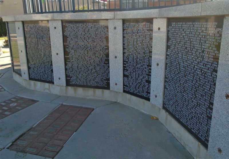
Colorado Western Slope Vietnam Casualties
Charles Leland Adkins • Adam David Ballard • John Alvin Berry
Thomas Louis Brown • Sam Burnell Jr • Austin Ray Chenoweth
Billy Floyd Clark • George Arthur Clark • Mark Giles Danielson
Leroy . . . — — Map (db m159770) WM
On Main Street west of South 5th Street, on the right when traveling west.
William H. Bannister came from Molina, Colorado in the 1890s and in 1897,
bought an established furniture store and funeral parlor from M.O. Whitehead. At
the time, many furniture stores sold caskets and had an undertaker on staff.
W.H. . . . — — Map (db m120072) HM
On Main Street west of North 6th Street, on the right when traveling west.
Benge's store is the oldest shoe store in the state, possibly the oldest shoe store west of the Mississippi River. Founded in October of 1911, three generations of the Benge family have operated the business.
Founder Bertrand Benge moved from . . . — — Map (db m120051) HM
On South 4th Street at Ute Avenue (U.S. 50), on the right when traveling south on South 4th Street.
Lodge #575 was founded in 1900 by local drug clerk, 32-year-old J. Morrison Wohlfort. Before the present Lodge home was built, the founding Benevolent and Protective Order of Elks met in the I.O.O.F Hall at 454 Main Street.
Lodge #575 was . . . — — Map (db m120078) HM
On Main Street east of South 4th Street, on the right when traveling east.
Upon this site in October 1882
a vital cultural influence in the town
of Grand Junction was established by
the printing of the first newspaper ~
The Grand Junction News
Edwin Price, Editor — — Map (db m120052) HM
On Main Street west of North 6th Street, on the right when traveling west.
This building originally housed the Mesa Opera Rink, which opened in 1885. It offered a 300-seat playhouse for live theater, musical, and vaudeville acts. Ballroom dancing was on the large wooden "Rink" floor. In 1907, the front of the building was . . . — — Map (db m120045) HM
The Prinster family opened the first City Market Store in the back of this location with a storefront facing Fourth Street in 1924. By 1940, the Prinster Brothers built western Colorado's first supermarket one block to the north of this location. . . . — — Map (db m120073) HM
The first people to witness this view were probably Indians who had to scale the steep cliffs and talus slopes. Later, ranchers dug narrow passages up into the canyons to bring their cattle to graze in the rich highland trails below.
Begun during . . . — — Map (db m61910) HM
On Main Street at South 4th Street, on the right when traveling east on Main Street.
In the 1890s, Joseph and Albert Sampliner started a small business selling men's
fine clothing from a pushcart. The Sampliner cousins purchased their goods from
bankrupt dry good stores in the Red Mountain mining district.
The Sampliners . . . — — Map (db m120071) HM
On South 4th Street at Colorado Avenue, on the right when traveling south on South 4th Street.
An early stagecoach stop, The Grand Hotel, welcomed visitors with a tin-faced, two-story building, surrounded by shade trees, wooden sidewalks, and spacious lobby. In 1904 the building was purchased from William and Allie Neff and Anna Scott by . . . — — Map (db m120050) HM
On Main Street at South 5th Street, on the right when traveling east on Main Street.
William J. Moyer was one of Mesa County's leading businessmen and philanthropists. He arrived in Grand Junction in 1890 and opened the original Fair Store across the street in a room measuring 12 ft. x 20 ft. with $700 in stock. In 1904, Moyer . . . — — Map (db m120055) HM
On South 4th Street at Ute Avenue (U.S. 50), on the right when traveling north on South 4th Street.
This building was constructed in 1925, and served as an elementary school until
1965. It and the adjoining park, formerly known as Cottonwood, were named the
Whitman School and Whitman Park, in honor of frontier missionary Marcus
Whitman, who . . . — — Map (db m120079) HM
Near Glade Park Road, on the left when traveling north.
Designed by the National Park Service (NPS) in 1940 and constructed by the Civilian Conservation Corps (CCC) in 1941 (with the help of local craftsmen), the picnic shelter is an excellent example of NP Rustic Architecture. The sandstone was . . . — — Map (db m282776) HM
On U.S. 40 at milepost 97.5, 0.9 miles east of County Road 29, on the right when traveling west.
[center panel] Elkhead Creek drains an area to the north and east. It is 37 miles long and empties into the Yampa River a short distance to the south of this point. Elkhead Reservoir is a 25,500 acre-feet body of water, four miles north of . . . — — Map (db m166697) HM
Near Harpers Corner Road 8 miles north of U.S. 40.
From this spot in the fall of 1776, you might have seen a small expedition crossing the plains below, heading west into Utah. The group was led by Atanasio Dominquez and Silvestre Velez de Escalante, two Franciscan friars attempting to find a . . . — — Map (db m154613) HM
On Harpers Corner Road, on the right when traveling north.
"Echo Park Dam would back water so far that ... Echo Park and its magnificent rock formations would be submerged. Dinosaur National Monument as a scenic
spectacle would cease to exist." Shall We Let Them Ruin Our National . . . — — Map (db m163444) HM
On no nearby street, on the left when traveling south.
"A wilderness, in contrast with those areas where man and his own works
dominate the landscape, is hereby recognized as an area where the earth
and its community of life are untrammeled by man, where man himself is
a visitor who does not . . . — — Map (db m163443) HM
On U.S. 40 west of County Highway 143, on the left when traveling west.
On July 16, 1988, a lightning-caused wildfire burned over 15,000 acres of public and private land here as far as the eye can see.
The “I Do” fire, named for a Bureau of Land Management (BLM) firefighter who was married on that day, became the . . . — — Map (db m114442) HM
On 114 1 mile south of State Highway 318, on the left when traveling south.
Built in this valley in 1837 by mountain men Thompson, Craig and Sinclair, was the winter rendezvous of traders, trappers and Indians until 1840, after which it fell into decay and was abandoned. — — Map (db m154044) HM
On County Route 114, on the right when traveling south.
This property has been placed on the National Register of Historic Places by the United States Department of the Interior Old Lodore School 1911 — — Map (db m154049) HM
On U.S. 40 6 miles east of Lowell Street, on the left when traveling east.
Edwin C. Johnson served thirty four
continuous years in public service to
Colorado; Moffat and Routt County
Legislator, Lt. Governor, three times
Elected Governor and eighteen
years as a United States Senator.
In dedication
to all . . . — — Map (db m114444) HM
Over a billion years ago, molten rock was squeezed into fissures forming the light-colored bands which thread Black Canyon's otherwise dark walls. You are standing on one of these bands. As the hot fluid slowly cooled and hardened, minerals formed . . . — — Map (db m158993) HM
At 2300 feet, Painted Wall is the highest cliff in Colorado. If the Empire State Building stood on the canyon floor, it would reach slightly more than halfway to the top of the cliff.
The patterns that inspired the name Painted Wall were created . . . — — Map (db m159001) HM
On Morrow Point Dam Road 1 mile north of U.S. 50, on the left when traveling north.
Promoters called this the "Scenic Line of the World" to entice travelers to see western Colorado by rail. The Denver & Rio Grande guidebook Around the Circle invited readers to join the trip: "Unlike many of the Colorado canyons, . . . — — Map (db m158937) HM
On Morrow Point Dam Road 0.1 miles north of U.S. 50, on the right when traveling north.
The Denver & Rio Grande Railroad opened up vast new markets to sheep and cattle ranchers. Cimarron grew to become one of the busiest loading stops in Colorado.
Breeding stock wintered in valleys to the west. Trains or spring drives brought . . . — — Map (db m158946) HM
Near Morrow Point Dam Road 0.1 miles U.S. 50, on the right when traveling north.
The Gunnison River carved Black Canyon through a 50-mile block of rock called the Gunnison Uplift. Look up to the slopes above to see the edge of the uplift. The Cimarron River cut through its walls and into the canyon creating a geographic . . . — — Map (db m158945) HM
On Morrow Point Dam Road 0.1 miles north of U.S. 50, on the right when traveling north.
When you build a new railroad, what possible difference can 20½ inches between rails make? In the 1880s, the decisions to use a narrow gauge here in the mountains opened up trade across Colorado.
In 1863 Congress set the standard guage for . . . — — Map (db m158942) HM
On Morrow Point Dam Road 0.1 miles north of U.S. 50, on the right when traveling north.
Like a snarling dragon, the river kept an endless attack on the rail bed in the canyon. Slumping soils on the hills near Cerro Summit pushed tracks toward nearby creeks. Keeping the tracks east and west from Cimarron in good working shape was a . . . — — Map (db m158986) HM
Fir logs, up to 30 feet in length, formed the base for the diversion dam. Although built in the winter when the river was sluggish, pumps were needed to divert the flow around the construction site. The dam is used to fill the tunnel when the water . . . — — Map (db m120247) HM
Near Chipeta Road north of U.S. 550, on the right when traveling north.
The Spanish empire's influence on the American southwest began long before the 1776 journey of Dominguez and Escalante. Indeed, Spanish conquistadors, in search of gold and silver, explored the region as early as 1540. Santa Fe, the capital of New . . . — — Map (db m120221) HM
Near Rim Drive Road, on the right when traveling west.
Standing here, it is difficult to imagine anyone trying to cross the canyon or navigate its waters. Like hikers today, the Utes and early explorers faced rigorous hardships.
In 1900, William Torrence led a crew to explore the possibility of . . . — — Map (db m120242) HM
On North Rio Grande Avenue north of West Main Street, on the left when traveling north.
Bull Whackers and Mule Skinners
Discovery of gold and silver in the 1870s in the San Juan Mountains south of Montrose created a demand for freighting services to haul equipment and supplies into the mines and carry out ore bound for . . . — — Map (db m120127) HM
Early Irrigation in the Uncompahgre Valley
In the late 1800s, local irrigation companies constructed canals and ditches to divert water from the Uncompahgre River for farming and City use. Water was scarce and there was not enough for City . . . — — Map (db m158987) HM
On US 550 Frontage Road just south of Uncompahgre Road, on the right when traveling south.
Following the Meeker Massacre of 1879 and the ambush of Major T.T.
Thornburgh's relief force, Colorado residents demanded the removal of
the Ute Indians. A treaty was signed, but the Uncompahgre Utes proved
defiant, and in July, 1880, the . . . — — Map (db m261621) HM
On US 550 Frontage Road just south of Uncompahgre Road, on the right when traveling south.
During the years 1880-1890, a U.S. military fort with over 32 buildings spread across the fields before you...
Tensions were high on the Western Slope of Colorado in 1879: white settlers had been trespassing on treaty-designated Ute . . . — — Map (db m261767) HM
On North Rio Grande Avenue north of West Main Street, on the left when traveling north.
This plaque commemorates the establishment of
the City of Montrose. First called Pomona, the
original 320 acre townsite was laid out in January
1882 by O.D. Loutsenhizer and Joseph Selig. They
were assisted by A. Pumphrey, John Baird, . . . — — Map (db m120006) HM
On Chipeta Road north of U.S. 550, on the right when traveling north.
As Father Escalante so appropriately recorded in his diary, the
Dominguez Escalante expedition was made “in behalf of the Light."
Dominguez and Escalante were Franciscan priests, and their religion
strongly influenced the course of their . . . — — Map (db m120222) HM
On Townsend Avenue (U.S. 550) at 1st Street, on the left when traveling south on Townsend Avenue.
Instrument of Surrender
[not transcribed]
The End of the Second World War
After 1364 days, 5 hours and 14 minutes, World War II, Pacific, ended officially at 0904 September 2, 1945 with the signing of this Instrument of Surrender on . . . — — Map (db m159102) HM
Surveyors took daily measurements to ensure that drillers, powdermen, muckers, and haulers stayed on course inching their way toward the valley. Crews at the other end plowed toward the canyon. Using points across the river, as well as in the . . . — — Map (db m120245) HM
On Townsend Avenue (U.S. 550) at 1st Street, on the left when traveling south on Townsend Avenue.
Erected through the cooperation of
federal · state · and local governments
by Works Progress Administration
Dedicated to the enrichment of human lives
A record of permanent achievement — — Map (db m159106) HM
Near Chipeta Road north of U.S. 550, on the right when traveling north.
On July 29, 1776, two Franciscan priests, Fray Francisco Atanasio Dominguez
and Fray Silvestre Velez de Escalante, led their eight companions out through
the gates of Santa Fe and into the heart of the American southwest. Their
five-month . . . — — Map (db m120225) HM
On East Main Street, on the right when traveling north.
Within a few years, one generation passes and another comes on the scene. If those who follow are to have any notion of what it was that went before, it must fall to those who possess a tie to the past to preserve what may be known. In that . . . — — Map (db m120137) HM
On East Main Street, on the right when traveling north.
Within a few years, one generation passes and another comes on the scene. If those who follow are to have any notion of what it was that went before, it must fall to those who possess a tie to the past to preserve what may be known. In that . . . — — Map (db m120138) HM
On East Main Street, on the right when traveling north.
Within a few years, one generation passes and another comes on the scene. If those who follow are to have any notion of what it was that went before, it must fall to those who possess a tie to the past to preserve what may be known. In that . . . — — Map (db m120139) HM
On East Main Street, on the left when traveling north.
Within a few years, one generation passes and another comes on the scene. If those who follow are to have any notion of what it was that went before, it must fall to those who possess a tie to the past to preserve what may be known. In that . . . — — Map (db m120141) HM
On East Main Street, on the left when traveling north.
Within a few years, one generation passes and another comes on the scene. If those who follow are to have any notion of what it was that went before, it must fall to those who possess a tie to the past to preserve what may be known. In that . . . — — Map (db m120142) HM
On North Rio Grande Avenue, on the left when traveling north.
Within a few years, one generation passes and another comes on the scene. If those who follow are to have any notion of what it was that went before, it must fall to those who possess a tie to the past to preserve what may be known. In that . . . — — Map (db m120144) HM
On West Main Street, on the left when traveling north.
Within a few years, one generation passes and another comes on the scene. If those who follow are to have any notion of what it was that went before, it must fall to those who possess a tie to the past to preserve what may be known. In that . . . — — Map (db m120146) HM
On South First Street at South Uncompahgre Avenue, on the left when traveling north on South First Street.
Within a few years, one generation passes and another comes on the scene. If those who follow are to have any notion of what it was that went before, it must fall to those who possess a tie to the past to preserve what may be known. In that . . . — — Map (db m120147) HM
Near Chipeta Road north of U.S. 550, on the right when traveling north.
It took bold men to ride into a bold land—a land of raging rivers,
burning deserts, towering mountains, and rugged canyons.
The land of the Southwest through which Dominguez and
Escalante travelled in 1776 was awesome in beauty and . . . — — Map (db m120226) HM
Near Chipeta Road north of U.S. 550, on the right when traveling north.
The Dominguez-Escalante Expedition
Just south of here on August 27, 1776, the Spanish explorers Dominguez and Escalante met a Ute Indian whom they called El Surdo (The Deaf One). They were seeking a route west, the two Spaniards . . . — — Map (db m120219) HM
On West Main Street at Townsend Avenue, on the right when traveling north on West Main Street.
The Tunnel That Made the Desert Bloom
Early settlers in the Uncompahgre Valley found getting water to the fertile but arid soil an ongoing challenge. Originally, irrigation water from the Uncompahgre River was diverted onto the land through . . . — — Map (db m120134) HM
On U.S. 550 0.1 miles south of Chipeta Road, on the right when traveling north.
From this tree one George Bikford was lynched for alleged robbery and horse stealin' in Montrose County.
Bikford at one time rode with the Daltons and was said to have participated in the Coffeville, Kansas Raid.
Footnote:
The following . . . — — Map (db m186922) HM
On Chipeta Road at U.S. 550, on the right when traveling north on Chipeta Road.
They called themselves "Nuche," meaning "the people." The Ute Indian people lived in a land of diversity - from dry desert-scrub to verdant river valleys, from dense forests to high mountain meadows. To survive, they had to know where to find plants . . . — — Map (db m186957) HM
On Chipeta Road north of U.S. 550, on the left when traveling north.
The Utes
An Abundant Earth
The bountiful food resources of the Uncompahgre Valley normally allowed the Tabeguache Utes a life free from hunger. Elk and deer ranged through the valley in profusion, as did antelope, mountain sheep, beaver, . . . — — Map (db m120289) HM
Near South 1st Street near South Uncompahgre Avenue.
For hundreds of years, American Indians were virtually the sole inhabitants of western Colorado. Isolated by the towering mountain peaks and rugged canyons and plateaus, members of the Ute Indian tribe lived relatively undisturbed here until their . . . — — Map (db m120148) HM
On Townsend Avenue (U.S. 550) at 1st Street, on the left when traveling south on Townsend Avenue.
We dedicate this memorial to all
veterans, men and women, who
served in any branch of the Armed
Services of the United States of
America in the past - the present -
and in the future - to preserve
the right for us to be free . . . — — Map (db m159094) WM
On East Main Street at Cascade Avenue, on the left when traveling east on East Main Street.
The town of Montrose was originally known as Pomona, but early settler and town father, Joseph Selig, suggested the name Montrose after a favorite character in Sir William Scott's popular novel, The Legend of Montrose.
Uncompahgre . . . — — Map (db m120135) HM
On Main Street (U.S. 550) at 5th Avenue, on the right when traveling north on Main Street.
Built 1886
Abandoned 1967-1998 Restoration 1998-2003
"Presidents and Celebrities Gave It Fame, Dan and Mary Gave It Life." National Trust Awards Ceremony
2004 Inaugural Presidential Preserve America Awards
2003 Inaugural Colorado . . . — — Map (db m186920) HM
On Main Street (U.S. 550) just north of 5th Avenue, on the right when traveling north.
Standing here, one sees significant change across the street between the mid-1880's, 1902, and the present. In 1876 two wooden buildings were erected at the north end of this block. The next year a two-story frame building, known as the Bucket of . . . — — Map (db m294698) HM
On Main Street (U.S. 550) just north of 4th Avenue, on the right when traveling north.
Imagine being an early pioneer here and building a cabin on the main trail through town. You are fascinated by the passing bands of Ute Indians, and admire the cascading falls, and magnificent amphitheatre high above you to the east. Uncompahgre . . . — — Map (db m294690) HM
On Main Street (U.S. 550) just south of 7th Avenue, on the right when traveling south.
Picture yourself walking along the east side of Main Street between 6th and 7th Avenues during Ouray’s early times. You will meet some of Ouray's important businessmen. These men — Otto Mears, David Day, and Dr. William Rowan — were also colorful . . . — — Map (db m294939) HM
On Main Street (U.S. 550) just south of 6th Avenue, on the right when traveling south.
Illustrated here are two early periods of structural development across Main Street from this location. There were only four buildings occupying four of the twelve lots on the block, circa 1880-1883. The one-story building at 515 Main is thought to . . . — — Map (db m294812) HM
On Main Street (U.S. 550) just north of 8th Avenue, on the right when traveling north.
Looking across Main Street at part of the notorious “red light district,” called the Vanoli Block, try to visualize how it looked and hear how it sounded in the late 1890s and early 1900s. On the alley at the back of lots 23 and 24 was freighter . . . — — Map (db m294983) HM
On Main Street (U.S. 550) just north of 7th Avenue, on the right when traveling north.
Substantial brick buildings replaced wooden structures on this block by the 1890s. Louis King's two-story wagon and carriage shop dominated the south end when a wooden structure in the 1880s and as a brick beauty in the '90s. James Pierson's . . . — — Map (db m294976) HM
On Million Dollar Highway (U.S. 550) 2 miles south of County Highway 30, on the left when traveling north.
The history of the Red Mountain Mining District mirrors the story told in countless boom-and-bust mining areas throughout the West. As prospectors, miners, cooks, freighters, prostitutes, gamblers, saloon keepers, boarding house operators, and . . . — — Map (db m179030) HM
On Main Street (U.S. 550) just north of 4th Avenue, on the right when traveling north.
Box Canon Sign History In 1903, the city (of Ouray) decided Box Canon Park should be lighted. Community interest in the park was increasing. A year previously, the Ouray Board of Trade had requested $500 from the city to be used in beautifying . . . — — Map (db m282660) HM
On Main Street (U.S. 550) at 10th Avenue, on the right when traveling south on Main Street.
The Fellin family has left a huge landmark in Ouray County In approximately 1895 Joseph Fellin, a miner from Revo, Austria, came to Ouray, Colorado. In 1902, Joseph's wife Serafina and his sons Sam, Oliver, and Angelo arrived. Five years later . . . — — Map (db m294697) HM
On Million Dollar Highway (U.S. 550) 2 miles south of County Highway 30, on the left when traveling north.
The history of the Idarado Mine goes back to 1896 with the creation of the Treasury Tunnel. In 1934 the San Juan Metals Company purchased the old Treasury Tunnel site and by 1937 a new 300-ton per day mill was in operation. In 1939 the Idarado . . . — — Map (db m179083) HM
You are standing at the Ouray Fault, the first step in the formation of Box Cañon Falls. Millions of years ago a deep crack in the earth caused the harder rocks to move upward, while the soft sedimentary rocks to the north moved downward. As you . . . — — Map (db m191376) HM
On Million Dollar Highway (U.S. 550) 0.2 miles west of County Highway 20, on the left when traveling east.
W.C. Davis and G.C. McGee recorded the Ida L. and Dauntless mining claims in 1888. In 1893 Davis sold his interest in these and other claims to W.F. Abrams of San Diego, California. McGee kept his interest until selling it to A.G. Bruner in 1910. . . . — — Map (db m238162) HM
On Million Dollar Highway (U.S. 550) 2 miles south of County Highway 30, on the right when traveling north.
Panel 1 This region was founded by gold and silver miners in the 1870s. This 17-square mile area has produced 4 million ounces of gold, 21 million ounces of silver, and 12 million tons of lead, zinc and copper. The natural resources from . . . — — Map (db m179088) HM
On Million Dollar Highway (U.S. 550) 0.1 miles south of County Highway 16, on the left when traveling north.
Ouray was just eleven years old when the Beaumont Hotel celebrated its grand opening on July 25, 1887. The building immediately gained fame as western Colorado's most elegant hotel, marking Ouray as a place of wealth, importance, and permanence. For . . . — — Map (db m186905) HM
On Million Dollar Highway (U.S. 550) 2 miles south of County Highway 31, on the left when traveling north.
Before...
Many of the creeks in the Red Mountain Mining District are devoid of aquatic life due to the natural geologic setting and historic mining. Within the thirty-square mile district over one hundred historic mines have been located. . . . — — Map (db m179029) HM
On Million Dollar Highway (U.S. 550) 0.1 miles south of County Highway 16, on the left when traveling north.
The San Juan Mountains have long posed a barrier to travel and, by extension, to economic development. Early miners had to transport ore via pack animals over rocky trails, a process so inefficient that it rendered many claims unworkable. Matters . . . — — Map (db m186903) HM
On Main Street (U.S. 550) at 10th Avenue, on the right when traveling south on Main Street.
Joe Wood was born Howard Ellsworth Wood in Kansas City on October 25, 1889, the second son of John and Rebecca Wood. At a young age he was given the nickname of a famous circus clown “Joe” and the name stuck for the rest of his life. Joe's father . . . — — Map (db m294699) HM
On Million Dollar Highway (U.S. 550) 2 miles south of County Highway 30, on the left when traveling north.
Before you is the historic Red Mountain Mining District. In the early 1880s, valuable columns of silver ore called "pipes" were discovered in this valley and extraction began. By 1883, nearly forty mines were sending silver ore to smelters. . . . — — Map (db m179032) HM
On Million Dollar Highway (U.S. 550) 2 miles south of County Highway 31, on the left when traveling north.
The Idarado Mining Company was founded in 1939 in a consolidation of mining claims including the Black Bear, Treasury Tunnel, Barstow, and the Imogene mines. In June 1943, work began to extend the Treasury Tunnel below the Black Bear Mine to . . . — — Map (db m179028) HM
On Million Dollar Highway (U.S. 550) 2 miles south of County Highway 30, on the left when traveling north.
The eighteen-mile Silverton Railroad was truly a "little train that could." Incorporated by Otto Mears on July 5, 1887, this narrow gauge railroad connected the communities of Albany, Ironton, Guston, Red Mountain Town, Congress (Red Mountain . . . — — Map (db m179033) HM
On Million Dollar Highway (U.S. 550) 2 miles south of County Highway 30, on the right when traveling north.
This is the eastern end of the Idarado Mine. As one of the San Juans' larger mines, it contains nearly 100 miles of underground tunnels. Miners would enter here at the Treasury Tunnel and ride the underground trams to their work station. The . . . — — Map (db m179085) HM
On 6th Avenue just east of Main Street, on the left when traveling east.
Presented to the City of Ouray in 1900 A.D. by Thos. F. Walsh, original owner of the Camp Bird Mine. The bell hung in the City Hall bell tower until 1950, when it was cracked by fire. — — Map (db m294499) HM
On Million Dollar Highway (U.S. 550) 2 miles south of County Highway 30, on the left when traveling north.
Before you, on the east side of Red Mountain Creek, is the headframe of the Yankee Girl Mine.
In 1882, prospector John Robinson discovered a massive "pipe" of silver ore and staked the Yankee Girl claim. He developed an exploratory shaft and . . . — — Map (db m179031) HM
On Million Dollar Highway (U.S. 550) 1.5 miles south of Highway 18, on the right when traveling north.
Who were swept to their deaths 1,000 feet north of this marker in the East Riverside Slide Sunday March 3, 1963 while answering the call to Christian duty of his pastorate in Silverton, Colorado
In Honor
Of the many friends & . . . — — Map (db m179139) HM
On 4th Street just south of 6th Avenue, on the left when traveling south.
Interior courthouse scenes from the movie True Grit were shot here. Dissatisfied with the sheriff's efforts to track down her father's killer, Mattie takes matters into her own hands. Following Cogburn's testimony, she runs after him down the . . . — — Map (db m282786) HM
On Main Street (U.S. 550) just north of 6th Avenue, on the left when traveling north.
Restaurant owner Addie Bonatti was mortified to discover it was John Wayne calling after telling him she was too busy serving customers to put a crew member on the phone. Later when he met this saucy woman, Wayne gave her his hat, and returned . . . — — Map (db m282657) HM
On Million Dollar Highway (U.S. 550) 0.1 miles south of County Highway 16, on the left when traveling north.
Nineteenth-Century Newspapers
At one point in the 1880s, Ouray newspaper publisher David Day had forty-two libel suits pending against him-and he wore them like a row of combat medals. Day's broadsheet, the Solid Muldoon, placed less emphasis . . . — — Map (db m186909) HM
Near North Railroad Street just north of Sherman Street (State Highway 62), on the right when traveling north.
This caboose was built in Denver at the Burnham shops in 1886. It is a 17-foot caboose often called a 'crummy'. When new it was DRG 91 as seen on the west side. When it was taken out of service in 1953 it looked like it does on the east side as the . . . — — Map (db m295882) HM
Near North Railroad Street just north of Sherman Street (State Highway 62), on the right when traveling north.
This car was built in 1904 by American Car and Foundry in St. Louis, MO for the Denver and Rio Grande Railroad. It was one of 350 such cars built. It was built to haul cattle (16) or sheep (40 with double deck) shippers actually loaded much more . . . — — Map (db m295975) HM
Near North Railroad Street just north of Sherman Street (State Highway 62), on the right when traveling north.
• Built in Ridgway from a 1926 Model 33 Pierce Arrow Limo 5/4/32 • Weighed 14,950 lbs, was about 43 ft long and cost $2584.56 • Painted silver in 1936 • Sunset herald and centered rear doors in 1940 • Modified from 4 door Pierce Arrow to Wayne . . . — — Map (db m295799) HM
On Sherman Street (State Highway 62) at North Railroad Street, on the right when traveling west on Sherman Street.
History of Ridgway The San Juan Mountains — a land of towering mountains, deep canyons, and shadowed valleys. Native peoples have lived here for thousands of years, an occupation that ended in this region only when the Utes ceded the . . . — — Map (db m282794) HM
Near North Railroad Street just north of Sherman Street (State Highway 62), on the right when traveling north.
This car was built by Jackson and Sharp in 1880 as the D&RG 'Gothic', sold to Otto Mears and lettered Rio Grande Southern 252 in 1891. It was used on the daily passenger train between Ridgway and Durango until 1932 when the passenger trains were . . . — — Map (db m295901) HM
Near North Railroad Street just north of Sherman Street (State Highway 62), on the right when traveling north.
The original RGS No. 1 was built in Ridgway in 1931 to carry mail, a few passengers, and a little express freight (up to 4000 lb). The idea was to more economically handle the daily passenger train business (including the mail) than could be done . . . — — Map (db m295899) HM