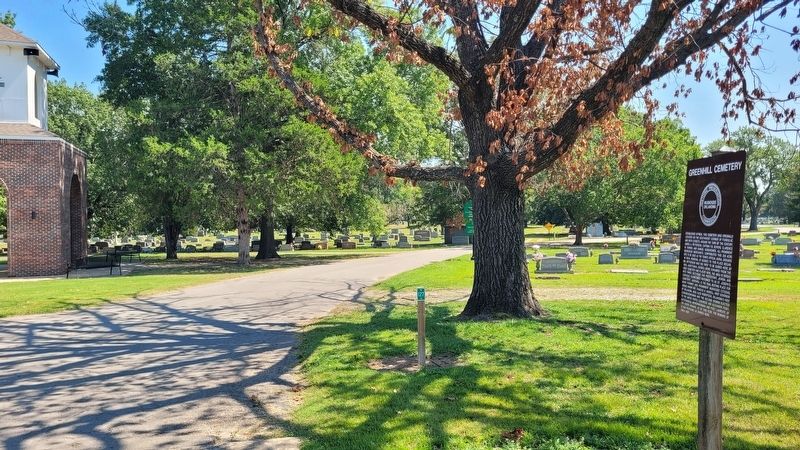
Established in 1894, this cemetery was originally located on the southwest corner of Fondulac and Sixth Streets. Around the turn of the century, James A. Patterson, Captain F.B. Severs, Clarence W. Turner, and Samuel Sondheimer, all prominent . . . — — Map (db m284374) HM
This park is laid like a Wreath of Honor
on the highland of this city
by the People of Muskogee
as a tribute to those of our country
who served in the World War 1914-1918
in camp or in field
at home or abroad in all
the multitudes of . . . — — Map (db m108932) WM
Built in 1937, this Classical Revival building originally constructed as a men's dormitory is named for prominent Baptist missionary Isaac McCoy, who founded the first Baptist church of Oklahoma, Muscogee Baptist Church, Ebenezer Station, just north . . . — — Map (db m251419) HM
The historic Jefferson Highway route was established in 1916 and went from Winnipeg, Canada, to New Orleans, Louisiana, over approximately 2,400 miles. The route was one of the first North-South highway routes across the country. The route through . . . — — Map (db m259599) HM
This salt kettle was one of more than 100
forming part of the equipment of Mackey's
Salt Works on the Illinois River, Indian territory,
an important station on the military
road to Ft Smith, Arkansas. For many years
before the Civil War . . . — — Map (db m249966) HM
This station was established in 1925 by Muskogee businessman James M. Anthis at an important intersection of the Jefferson Highway through Muskogee. The station was designed with an English cottage-style look that was favored by Marland Oil founder . . . — — Map (db m259579) HM
In 1919 a group of Ancient Free and Accepted Masons organized the Masonic Building Association in order to purchase this property on which to erect a Masonic building. The land was formerly owned by Pleasant Porter of the Creek Nation. This early . . . — — Map (db m192355) HM
Name Rate
Theodore A. Bellard MMI · Walter Blanchard CTM · John A. Bolton RM1 ·
Thomas L. Brannan S1Grady G. Byus, Jr. MM1 ·
Earl W. Cassidy LTJG ·
John P.Cooley MM2 ·
Billy B. Crawford F3 ·
Albert E. Croft EM2 ·
William T. Dawson EM2 . . . — — Map (db m108912) HM WM
The Midland Valley Railroad Company was incorporated in 1903 and headquartered in Muskogee. This passenger station was built in 1917 and during the 1920's as many as eight trains carrying 9,000 passengers per day traveled from Tulsa to this point. . . . — — Map (db m108907) HM
Milly Francis was the daughter of the Creek Chief Hillis Hadjo during the Florida War 1817. Fifteen-year-old Milly by her pleas saved the life of a young white officer Duncan McKrimmon, whom they were about to kill. She later declined his offer of . . . — — Map (db m115647) HM
Friday evening, November 7, 1888, a special communication of the Grand Lodge was held in Muskogee Lodge No. 28 in this city for the purpose of constituting and consecrating said lodge. One hundred twenty-five years later, November 7, 2013, . . . — — Map (db m192528) HM
This stone intended for
Washington Monument
Preserved by A.C. Trumbo
—————————
[Capstone reads]
1932
George Washington Bicentennial
Erected in Memory Garden
by
Lions Club — — Map (db m108937) HM
Oct. 10, 1969 Merle Haggard recorded the live album, Okie From Muskogee, at the Muskogee Civic Assembly Center. The concert emerged from the song, "Okie from Muskogee," released Sept. 29, 1969, and co-written by Haggard and Eddie Burris when . . . — — Map (db m217471) HM
Built in 1922, the Samuel Richard Memorial Hall was named in memory of Samuel Richard, a Bacone student who died while he was attending school at Bacone in 1916. The building cost $150,000 to build, with $58,000 of the funding used to build this . . . — — Map (db m251413) HM
Captain F.B. Severs erected the original Severs Block Building, with its historic Gothic entrance at Main Street and Broadway, in 1890 to house the newly organized First National Bank of Muskogee, Indian Territory.
Between 1901 and 1903 the . . . — — Map (db m108896) HM
The ten story Severs Hotel was completed in 1912 by Muskogee businessman F.B. Severs who died shortly before its opening. The hotel hosted numerous events and many celebrities over the years including Babe Ruth, Helen Keller, Burt Lancaster and . . . — — Map (db m259600) HM
This 160 acre site was given to the American Baptist Home Mission Society by an act of the National Council of the Muscogee (Creek) Nation on October 29, 1881,
for the purpose of educating American Indian students from all tribal nations, Bacone . . . — — Map (db m251421) HM
Muskogee Oil Refining Company, organized in March 1905, built a finishing plant near this site in November, 1904. It soon was producing lamp kerosene, lubricating oil and industrial fuel - the beginning of oil refining in Oklahoma, a leading . . . — — Map (db m73123) HM
Amendment ICongress shall make no law respecting an establishment of religion, or prohibiting the free exercise thereof; or abridging the freedom of speech, or of the press; or the right of the people peaceably to assemble, and to petition the . . . — — Map (db m259699) HM
This home, at 1315 West Okmulgee Avenue, was built in 1906 by V.R. Coss, early banker and real estate dealer. In later years the home was occupied by James Egan, Mayor of Muskogee from 1962-1968. Private home — no visitors. — — Map (db m259689) HM
In 1876, the Baptist Mission Board of Nashville, Tennessee established a mission school for Indians and freedmen under the leadership of N.A. Leslie and wife, Indians and Reverend Cain and wife, negroes. The school was located originally at Fourth . . . — — Map (db m259697) HM
This home, at 1321 West Okmulgee Avenue, was built in 1907 for Colonel George A. Murphy, a prominent Muskogee attorney. He also served on the Board of Directors for the American National Bank of Muskogee. His widow Clara contributed funds which . . . — — Map (db m259692) HM
This home at 1303 West Okmulgee was built in 1917 by Charles C. Hultquist, a native of Shafer, Minnesota. He practiced law in Texas before coming to Indian Territory. At one time, he is said to have owned sixteen cotton gins and a cotton seed oil . . . — — Map (db m259696) HM
This home at 1320 West Okmulgee, was built in 1906 by A.W. Patterson, who was president of the Bank of Muskogee, located at Okmulgee Avenue and Second Street in 1901. He was also an investment broker and owned much property in this area. Patterson . . . — — Map (db m259657) HM
This home, at 1321 West Broadway, built in 1906 by A.C. Trumbo, is a replica of one of Mark Twain’s homes. Mr. Trumbo was the son-in-law of A.W. Patterson, and both men were pioneer bankers and promoters of Muskogee and early Arkansas River . . . — — Map (db m259680) HM
This home at 1405 West Okmulgee Avenue was built in 1904 by J. C. Welch, pioneer merchant and was credited with being one of the most beautiful and lavishly decorated in Indian Territory. Private home — no visitors. — — Map (db m259694) HM
This house was built in 1898 by John R. Thomas, Federal Judge from 1897-1901. As a former congressman from Illinois, his influence was responsible for the increase of the United States Navy from one battleship to that equal other nations of the day. . . . — — Map (db m77870) HM
On this spot
on
May 12, 1898
200 men of
the City of
Muscogee
and the
Indian Territory
were sworn into the service
of their country. They valiantly
defended it's ideals at
San Juan Hill, Cuba
as
Roosevelt's . . . — — Map (db m108920) HM WM
Consolidated U. S. Indian office for Five Civilized Tribes. Cornerstone of old stone building here laid Aug. 18, 1875, in ceremony led by Agent G. W. Ingalls, with address by Wm. P. Ross, Chief, Cherokee Nation; first Masonic cornerstone laying in . . . — — Map (db m108935) HM
Begun in 1875, this Agency was the first building erected by the U.S. government to house the superintendencey [sic] of the Five Civilized Tribes. Used briefly, the building was leased in 1875 to the Baptist Mission Society as a school for the . . . — — Map (db m108939) HM
Dedicated to the memory of the
Muskogee area men who made the
supreme sacrifice for freedom's
cause in Vietnam
by the
Kiwanis Club of Muskogee
Ronald Stewart Allen III SSgt
Jedd Edward Ashby Sgt
Rex Lee Brown PFC
Michael Gene . . . — — Map (db m108921) WM
In Memoriam
to those who served and died
in defense of their country
Spanish American War
Mexican War
World War I
———————————
In Memoriam
to those who fought . . . — — Map (db m108923) WM
(East Elevation)
Erected in commemoration of
members of the Five Civilized Tribes,
whose record of enlistment, conduct in camp,
and fortitude and valor on the battlefield,
added lustre to the triumphant victory of our country
in . . . — — Map (db m108942) HM WM
The infantry bore the brunt of the heaviest fighting. The
concentrated fire of disciplined, well-armed, and drilled
infantrymen proved devastating to the ill-equipped American
Indian and Texas Confederates. An infantry regiment
consisted of . . . — — Map (db m243492) HM
In 1861 there were two Confederate Cherokee regiments: the 1st Cherokee Mounted Rifles under the command of Col. John Drew and the 2nd Cherokee Mounted Rifles commanded by Col. Stand Watie. Confederate authorities promised both regiments they would . . . — — Map (db m243655) HM
The 1st Regiment of Creek Mounted Volunteers was organized in August 1861 under the command of Col. Daniel N. McIntosh. The regiment saw action at Cane Hill, Prairie Grove, and Van Buren in Arkansas, and Round Mountain, Chusto-Talasah, . . . — — Map (db m243649) HM
The Creek Indians loyal to the Union
were driven out of the Indian Territory
into Kansas in December 1861. They
suffered through the next winter with
little food and shelter. Following the
Battle of Pea Ridge, Arkansas, they were
anxious to . . . — — Map (db m243522) HM
The 1st Kansas was one of the first
African American units organized
in the Federal Army. Members were
recruited in August 1862 under the
authority of Kansas Senator James
Lane, but without permission of President
Lincoln. These soldiers were . . . — — Map (db m243516) HM
29th Texas Cavalry
This regiment was organized
in July 1862 by Clarksville, Texas,
newspaper publisher Charles
DeMorse, who served as its colonel.
In March 1863 Col. DeMorse
received orders to move his regiment
to Indian Territory . . . — — Map (db m243611) HM
These Federal soldiers, recruited in
the summer of 1862 from the Colorado
gold mining districts, were stationed
at Fort Lyons, Colorado; Forts Larned,
Scott, and Leavenworth, Kansas; and
Kansas City, Missouri, before marching
to Indian . . . — — Map (db m243521) HM
Organized along with the 1st Indian Home Guard in May 1862, the 2nd Indian Home Guard consisted of one company each of Delaware, Kickapoo, Quapaw, Seneca, and Shawnee, two companies of Osage, and two of Cherokee. It took longer to organize, due to . . . — — Map (db m243513) HM
The 3rd Indian Home Guard, composed of ten companies
of Federal Cherokee commanded by Col. William A. Phillips,
was organized at Fort Scott, Kansas, in the summer of 1862.
They saw action in several northwest Arkansas engagements. In
Indian . . . — — Map (db m243518) HM
The 3rd Wisconsin Cavalry was organized in January 1862.
The regiment marched to Fort Leavenworth, Kansas, and the three
battalions were stationed throughout the state. The battalion that
fought at Honey Springs was commanded by Capt. Edward . . . — — Map (db m243512) HM
The 9th Texas Cavalry Battalion and the 10th Texas
Cavalry Battalion consolidated to create the 5th Texas
on February 16, 1863, under the command of Col.
Leonidas M. Martin. Most of the companies had been at
Fort Washita in the Chickasaw Nation . . . — — Map (db m243604) HM
In July 1861 self-appointed Brig. Gen. James Lane
resigned from the US Senate and recruited a regiment to
guard the Kansas border towns against raids from Missouri
guerillas. The regiment was mixed cavalry and infantry but
called a cavalry . . . — — Map (db m243525) HM
The 6th Kansas Cavalry and 1st Indian Home Guard turned the
Confederate's right flank. Federal artillery and infantry fire devastated
the center units on the Texas Road. Confederate forces began a
withdrawal toward the bridge. Some soldiers . . . — — Map (db m244788) HM
In the confusion of battle, the 2nd Indian Home Guard on
the right crossed into the line of fire of the 1st Kansas. Lt. Col.
Bowles ordered the 1st Kansas to cease firing so they would
not kill fellow soldiers. Lt. Col. F. W. Schuarte of the . . . — — Map (db m243499) HM
An artillery barrage that lasted more than an hour dismounted
one of the four Confederate cannons and killed most of the gun crew.
After this initial bombardment, the Federal soldiers advanced upon
the Confederate positions. As the Confederate . . . — — Map (db m243637) HM
After the Confederates gave
way and the main line collapsed,
the fighting became frantic as they
made several stands at the bridge
and along the creek to halt or slow
the Federal advance. The remaining
three Confederate cannons retired
across . . . — — Map (db m243562) HM
The landscape up and down the Texas Road was part of the Muscogee (Creek) Nation. It was dotted with homes, barns, orchards, pastures, and trading posts. On both sides of Elk Creek are remnants of farmhouses and family cemeteries.
The area is . . . — — Map (db m243564) HM
Soldiers recruited at Quindaro, Kansas, in late
1861 were assigned to the 9th Kansas Cavalry and
stationed in Kansas. They joined Blunt's brigade
and fought in Missouri and Arkansas. Company B
was detached from the regiment and designated . . . — — Map (db m243527) HM
Newspapermen, sketch artists, and even photographers reported on the Civil War. Frank Leslie's Illustrated Newspaper was represented at the Battle of Honey Springs by James R. O'Neill, whose sketch and report on the battle appeared in that . . . — — Map (db m243557) HM
Many resources provide information including battle reports, diaries,
letters, and newspapers. Interviews with those who participated in or were
affected by the war, as well as their published memoirs, also provide firsthand
information. During . . . — — Map (db m243543) HM
The War of the Rebellion: A Compilation of the Official Records of the Union and
Confederate Armies is a series of books edited by former Union and Confederate officers. It consists of 128 thick volumes, published by the US Government . . . — — Map (db m243563) HM
In July 1863, Confederate troops commanded
by Brig. Gen. Douglas H. Cooper waited at
Honey Springs supply depot for Brig. Gen.
William L. Cabells 3,000 reinforcements from
Fort Smith, Arkansas. The combined forces
planned to capture the Federal . . . — — Map (db m244789) HM
At the next interpretive trail turnout, about one-half mile
south, Trail #4 will offer you a gravel path to the south side
of Elk Creek leading to an area of combat near the historic
bridge site. However, if you are adventurous, you may want
to . . . — — Map (db m243659) HM
This short trail leads
to an area where a
shelf of bedrock forms
a place to cross this
creek.
A bench for resting is
located near the creek. — — Map (db m243528) HM
Smith's Kansas Battery was organized in August 1862
as light artillery. The battery was equipped with two
12-pounder field howitzers and four 6-pounder guns,
all captured from Confederate units. First stationed at
Fort Scott, Kansas, the battery . . . — — Map (db m243514) HM
In January 1863, the 1st, 2nd, and 3rd Indian Home
Guard, consisting of Cherokee, Creek, Seminole,
Kickapoo, Quapaw, Seneca, Shawnee, Osage, and
Delaware soldiers, were organized into the Federal
Indian Brigade commanded by Col. William . . . — — Map (db m243509) HM
A field artillery unit was called a battery and consisted
of two or more sections, each section having two guns.
Seven or eight cannoneers were necessary to serve
a gun. It took 25 to 30 men to keep a single gun in
operating condition. At Honey . . . — — Map (db m243497) HM
After a brief rest, the Federal Army moved south toward the Confederate
forces concealed in the timber north of Elk Creek. They formed a battle line
about one mile wide centered on the Texas Road. Artillery opened the battle;
12 Federal guns . . . — — Map (db m244790) HM
Cavalry troops served as the army's "eyes," scouting
enemy troop movements. They formed the army's
advance guard, making first contact. When serving
with infantry and artillery, they dismounted and fought
as skirmishers on foot. The 20th Texas . . . — — Map (db m243493) HM
Brig. Gen. Cooper alerted his troops to the coming battle and
positioned his men to the left and right of the Texas Road with his
seasoned veterans in the center. Three cavalry regiments presented a front
about one-quarter mile in width. This . . . — — Map (db m243597) HM
Brig. Gen. Douglas H. Cooper alerted his troops to the coming battle
and positioned his men to the left and right of the Texas Road, with his
seasoned veterans in the center to oppose the Federal troops. On his right
were the men of the two . . . — — Map (db m243641) HM
Col. William Phillips, Federal Indian Brigade
commander, led the left wing of the attack east of the
Texas Road. His main force consisting of a battalion
of the 2nd Colorado Infantry and the 1st Indian Home
Guard engaged Confederate Texas and . . . — — Map (db m243500) HM
Col. William R. Judson, 6th Kansas
Cavalry, commanded the attacking
brigade on the right, west of the Texas
Road. His command consisted of the
1st Kansas Colored Volunteer Infantry
Regiment and 2nd Indian Home Guard
supporting Smith's Kansas . . . — — Map (db m243491) HM
Federal troops crossed the rain-swollen Arkansas
River on flatboats on the night of July 16, 1863. The
cavalry led the way as the column marched south on
the Texas Road toward Honey Springs. At daybreak on
July 17, advance units engaged rebel . . . — — Map (db m243510) HM
Long before the resettlement of the Cherokee and Muscogee
Creek, the Osage and other tribes used this region for hunting.
The trail, known as the Osage Trace, was a major route used by
American Indians for travel between winter and summer . . . — — Map (db m243607) HM
Elk Creek is normally shallow enough to wade
across, but can flood over its banks following even
moderate rains. Wagons pulled by mule teams or
oxen often forded the creek by going down the
steep banks east or west of the bridge at the . . . — — Map (db m243560) HM
The timber and brush concealed the main Confederate force aligned on either side of the Texas Road. The 20th and 29th Texas Cavalry, the 5th Texas Partisan Rangers, and four guns of Capt. Roswell W. Lee's battery waited to repel the advance of . . . — — Map (db m244793) HM
On June 16, 1863, a moving skirmish flowed across the prairie near present-day Camp Gruber to
the Arkansas River. It was the final action in an unsuccessful attempt by Confederate Colonel
Stand Watie and his Cherokee regiment to disrupt Union . . . — — Map (db m261261) HM
Settled in 1829, named for Walter Webber, Western Cherokee Chief, who had a trading post here. Home of "Rich Joe" Vann to 1844, owner of "Lucy Walker," quarter mile race horse, for which he named his Mississippi River steamboat. In Civil War battle, . . . — — Map (db m52567) HM
The all-Black towns of Oklahoma represent a unique chapter in American history. Nowhere else, neither the Deep South nor the far West, did so many African American men and women come together to live in and govern their own communities. By 1920, . . . — — Map (db m281943) HM
J.B. Foley, a White Man, was roadmaster for the Fort Smith and Western Railroad which passed a few feet south of this point. Mr. Boley had faith in the Black Man to govern himself and persuaded the railroad to establish a townsite here; thus the . . . — — Map (db m234462) HM
In 1911, Booker T. Washington, head of Tuskegee Institute in Alabama, asked Julius Rosenwald, a Jewish Philanthropist, to serve on the board of directors at Tuskegee. Washington shared his vision with Rosenwald; lifting the veil of ignorance would . . . — — Map (db m234456) HM
Boley, Creek Nation, I.T., established as an all Black town on land of Creek Indian "Freedwoman" Abigail Barnett. Organized by T.M. Haynes first townsite manager. Named for J.B. Boley, white roadmaster, who convinced Fort Smith & Western Railroad . . . — — Map (db m234464) HM
The all-Black towns of Oklahoma represent a unique chapter in American history. Nowhere else, neither the Deep South nor the far West, did so many African American men and women come together to live in and govern their own communities. By 1920, . . . — — Map (db m282007) HM
This memorial is dedicated to all who served -- and to all who fought in foreign wars. We will never forget the three brave men who lost their lives on the battlefields protecting our freedom. They are:
• James B. Black WWII 1944 U.S. Army
• . . . — — Map (db m282020) WM
Okemah, Oklahoma
Nestled in the Oklahoma hills and the birthplace on July 14, 1912 of
Woody Guthrie
the renowned poet and folk singer. The hometown that influenced songs such as the American classic This Land Is Your Land and . . . — — Map (db m211574) HM
Woodrow Wilson “Woody” Guthrie, composer of “This Land is Your Land” and known around the world as “The Dustbowl Balladeer,” was born in Okemah, Oklahoma on July 14, 1912. His parents, Charley and Nora Belle Guthrie, raised their five children here . . . — — Map (db m165707) HM
Paden, Oklahoma was founded in Jan. of 1903 by former US Deputy Marshall Paden Tolbert while he was working for the Smith and Western Railroad. Tolbert rode for the hanging judge, Isaac Parker of Old Fort Smith, during the territorial period. . . . — — Map (db m281935) HM
The “American Doughboy” represents the American Soldier of WWI. He is charging over the top towards the enemy line, carrying full field equipment. He was erected as a memorial to the war veterans “by the people.” He arrived . . . — — Map (db m90793) WM
In memory of 2nd Lt. Kenneth Strang Feb 13, 1942 - Mar 1, 1980
Graduate of 21st Oklahoma Highway Patrol Academy July 3, 1966 - Aug. 20, 1966
In the early morning hours of March 1, 1980 2nd Lt. Strang lost his life in an accident on the . . . — — Map (db m203189) HM
Erected 1878, Ward Coachman, Principal Chief. Creek Nation organized 1867 under written constitution, and Okmulgee named as capital. Noted Chiefs here included Samuel Checote, Joseph Perryman, Isparhecher, Pleasant Porter. “Okmulgee . . . — — Map (db m76561) HM
The first contingent of the Creek Indians came from Alabama to the Indian Territory in 1829 under the leadership of Roley McIntosh, Chief of the Loyal Creeks. The main body of the Creek tribe was transported under contract in 1836. There were about . . . — — Map (db m213352) HM
Chilocco Indian School Graduate
Lieutenant Colonel U.S. Army Retired
Medal of Honor, World War II
Valor
Ernest Childers earned the Medal of Honor, the United States of America's highest military honor, when he was a 2nd Lt. in the Army's . . . — — Map (db m181810) WM
Near this site in 1900, The First Bank of Okmulgee opened for business and, about 1907, changed its name to The First National Bank. In 1924 First National Bank was merged into the Central National Bank, which was chartered in 1917, with the main . . . — — Map (db m213387) HM
The vision for this building became a
reality when the city acquired four
lots from William Morton in 1920. In
1922 Okmulgee's Black citizens secured
$25,000 in donations from Federated
Clubs and their own leading citizens
to complete the . . . — — Map (db m282023) HM
Founded by Presbyterian Bd. and Creek Nation 1882, through work of Alice Robertson, later
first woman elected to Congress from state. Augusta Robertson Moore, 1st supt. of mission
school. Nuyaka town nearby was the seat of the Loyal Creek . . . — — Map (db m282022) HM
This noted Creek leader, b. 1819, Ala., had attended old Asbury Mission before he came to Ind. Ty. He was a Methodist preacher for 32 years until his death, 1884. He served as Lieut. Col. of First Regt. Creek Mounted Vols., C.S.A., during the Civil . . . — — Map (db m76604) HM
During 1836-37, U. S. soldiers herded up about 14,000 "hostile",
mainly Upper Creek Indians in Alabama and Georgia, who had
refused to move to Indian Territory (Oklahoma). They were
placed in stockades until their forced removal to Indian . . . — — Map (db m200313) HM
The Cromwell oil field and town were named for Joe Cromwell of Muskogee, Oklahoma. A gas well, the #1 Jim Willis in the SE/4 SE/4 NW/4 of section 15-10N-8E, was completed at a depth of 3,466 feet by the Cosden Oil, Co. on November 14, 1922. However, . . . — — Map (db m181735) HM
Home of Gov. John F. Brown, for 34 yrs. Principal Chief, Seminole Nation, succeeding his father-in-law, Chief John Jumper, Col. 1st Regt. Seminole Mtd. Vols., Confederate Army in Civil War. Young Brown was Lieut., 1st Regt. Creek Mtd. Vols., C.S.A. . . . — — Map (db m181696) HM
Established and handsome building erected by Seminole Nation. Opened for Seminole boys, 1891. "Mikasuki" was name of ancient "war" town whose people were noted for courage. From 1914, school was coeducational: closed 1930. Building later . . . — — Map (db m204142) HM
385 entries matched your criteria. Entries 101 through 200 are listed above. ⊲ Previous 100 — Next 100 ⊳