620 entries match your criteria. Entries 101 through 200 are listed.⊲ Previous 100 — Next 100 ⊳
Delaware Public Archives Historical Markers
The Delaware Historical Marker Program began in 1931 and the Delaware Public Archives (DPA) has administered the program since 1990. The State of Delaware has erected more that 680 historical markers which represent Delawareans’ shared history.
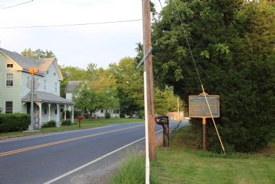
On Halltown Road (Delaware Route 8), on the right when traveling east.
Originally part of St. Jones Hundred, renamed Dover Hundred 1823, the boundaries being Little Creek on the north and St. Jones Creek on the south, extending from Delaware River to Maryland Line. Dover Hundred was divided 1877 into two Hundreds, . . . — — Map (db m74137) HM
It is believed that parishioners of Bethel African Methodist Episcopal Church were worshiping in a private residence on North Street by 1859. The church eventually moved to a site on Church Street to accommodate the growing congregation. On March 2, . . . — — Map (db m69034) HM
Christ Church Mispillion was the second parish in Delaware established by the Society for the Propagation of the Gospel in Foreign Parts. The Rev. Thomas Crawford first held services of the Church of England in lower Kent County in 1704. The . . . — — Map (db m69033) HM
Colonel John Haslet-A native of Ulster, Ireland, John Haslet was born circa 1728 and emigrated to America about 1757. After playing an active role in the Pennsylvania militia during the French and Indian War, Haslet eventually settled in the Milford . . . — — Map (db m142542) HM
On N Front Street (Delaware Route 14) near Maple Street, on the right when traveling west.
Town laid out by Joseph Oliver 1787. Village was located on tract then called “Saw-Mill Range.” Named Milford from fording place near mill-dam erected by Rev. Sydenham Thorne across Mispillion Creek, 1787. First incorporated 1807. Old town in Kent . . . — — Map (db m36909) HM
On N Walnut Street (County Route 20), on the right when traveling south.
Town laid out by Joseph Oliver 1787. Village was located on tract then called “Saw-Mill Range.” Named Milford from fording place near mill-dam erected by Rev. Sydenham Thorne across Mispillion Creek, 1787. First incorporated 1807. Old town in Kent . . . — — Map (db m36950) HM
The metal observation tower at Big Stone Beach was one of five constructed in Delaware between World Wars I and II to reinforce nearby Fort Saulsbury. These towers formed an integral part of the fort’s fire control system. Built from metal and . . . — — Map (db m142612) HM
Near NW Front Street (Delaware Route 14) near Maple Avenue, on the left when traveling east.
This historic building lies within a 1,750
acre Duke of York land patent called Saw Mill
Range granted to Henry Bowman in 1680. The
first known resident of this portion of the
tract was Joseph Booth, who purchased 510
acres from the Bowman . . . — — Map (db m37393) HM
On North Street at NW 3rd Street, on the right when traveling north on North Street.
The beginning of Methodism in this community
can be traced to the organization of a local
“society” in 1777. Early meetings were held
in the homes of its members. On December 3, 1787,
Joseph Oliver conveyed a lot of ground at this
location . . . — — Map (db m36888) HM
On Willow Grove Road (Delaware Route 10) east of Mt. Olive Cemetery Rd, on the right when traveling west.
Organized on July 18, 1781, the "Baptist Church at Mount Moriah" also called Cow Marsh Baptist Church, is the fourth Primitive Baptist congregation formally constituted in Delaware. For many years members met in area homes. In 1793, Job Meredith . . . — — Map (db m113687) HM
On West Glenwood Avenue at North Walnut Street, on the right when traveling east on West Glenwood Avenue. Reported permanently removed.
In 1924, the members of the David C. Harrison American Legion Post # 14 initiated the first American Legion ambulance service in the world. Its eighteen founding members were veterans of World War I who volunteered their time to transport the . . . — — Map (db m39026) HM
On Smyrna Clayton Boulevard (Delaware Route 6) just west of Wheatleys Pond Road ( Route 300), on the right when traveling west.
In 1924, the David C. Harrison American Legion Post #14 in Smyrna formed the first American Legion Ambulance Service in the world. The 18 founding members were veterans of World War I who volunteered to transport sick and injured community members . . . — — Map (db m174556) HM
In 1706 John Allee, of a Huguenot family, bought a
600-acre tract, "Woodstock Bower," of which this land
is a part. One of his sons, Abraham, was prominent in
Kent County affairs until his death in 1776: Member
of the General Assembly 1726, . . . — — Map (db m39589) HM
The history of Citizens Hose Company No.1, Inc. began on January 6, 1886, when thirty residents of Smyrna voted to "go into permanent organization" to serve the firefighting needs of the community. Their charter was approved by the Delaware . . . — — Map (db m141288) HM
On U.S. 13 close to S. East Street, on the right when traveling north.
Born 1768, near this site. Commanded U.S. Sloop Wasp in notable victory over superior British sloop Frolic, October, 1812, off Cape Hatteras. Commanded frigate Constitution 1818-1829. Died August, 1850. Buried at Cecilton, Maryland. Reinterred in . . . — — Map (db m39031) HM
Whitehall Plantation, once owned by the Chew family, contained over 400 acres of land and was worked solely by enslaved labor. Among those enslaved was Richard Allen who was born here and later founded the African Methodist Episcopal Church. By 1798 . . . — — Map (db m142525) HM
For many years this home was the property of Colonel Allen McLane, statesman and hero of the American Revolution.
Born in Philadelphia August 8, 1746, McLane had moved to Delaware by 1769. His military career began when he was . . . — — Map (db m39028) HM
On East North Street, on the left when traveling west.
Built in 1876 by local members of Centennial Methodist Episcopal Church, the first African American congregation to worship in the building, the two-story, three bay frame church with a gabled end would serve as a house of worship until the late . . . — — Map (db m261307) HM
In 1829 the Delaware General Assembly enacted legislation resulting in the establishment of a public school system. The state was subdivided into local districts. One of these was School District #5, which was created to serve the needs of students . . . — — Map (db m142499) HM
Born December 17, 1841, John B. Maberry was the son of John and Temperance Brockson Maberry of Duck Creek Hundred. Responding to the call of his country, he enlisted in the Union Army’s Company F, First Regiment, Delaware Infantry Volunteers, in . . . — — Map (db m39024) HM
In 1733 a charter was granted to “a dissenting congregation” of Scots and Irish Presbyterians who had settled in this area. A Meeting House was subsequently erected at this location. The Reverend Thomas Evans conducted the first service here on . . . — — Map (db m39032) HM
In 1764, Thomas Green sold a one-quarter acre lot at this location to his grandson, Charles Green. Some time thereafter, Charles established a facility for the manufacturing of redware pottery on this site. The business is known to have been in . . . — — Map (db m39678) HM
On Delaware Street, on the right when traveling south.
The roots of Methodism in this community can be traced to the organization of a local “society” in the 1770’s. Meetings were held in private homes before a frame structure was built here circa 1786 on land provided by Col. Allan McLane, . . . — — Map (db m39027) HM
On West South Street at S, Main Street, on the right when traveling east on West South Street.
In the spring of 1869, the Commissioners of Smyrna approved a plan to erect a Town Hall. Responding to the long-held desire of the citizens for a venue for public gatherings, architect Richard Mitchell designed the building to include a “hall” on . . . — — Map (db m39030) HM
Founded in 1740, St. Peter's was originally located near Duck Creek on the old King's Highway. In 1762 the congregation moved to a newly constructed stone chapel on the site of St. Peter's Cemetery. When the chapel fell into disrepair, the . . . — — Map (db m141377) HM
This longtime Smyrna landmark was constructed by Robert Holliday in the late 18th century. The first known residents of the home are believed to have been the family of his daughter, Susannah Holliday Wilson. The origin of the name “The Barracks” is . . . — — Map (db m39029) HM
In 1919, a new era for education in Delaware was initiated when a statewide effort to replace old and outdated facilities was undertaken. In 1922, the new Smyrna Colored School opened its doors for African-Americans and other persons of color . . . — — Map (db m141287) HM
On Monrovia Avenue south of East Commerce Street ( Route 6), on the right when traveling south.
The name Union Cemetery is derived from the fact that this burial site was created to inter deceased members affiliated with the African-American houses of worship in this area. Originally owned by James and Hester Till, the land for the cemetery . . . — — Map (db m130460) HM
Delaware’s first Jewish farmers, Isaac and Ida Beinoff, settled here in 1897. Like those to follow, they were recent immigrants fleeing poverty and oppression in their native Russia. Between 1912 and 1929, the Jewish Agriculture Society, based in . . . — — Map (db m142529) HM
Formerly part of Murderkill Hundred, originally called Motherkill Hundred, kill meaning creek in Dutch. Original boundaries were St. Jones Creek on north, and Murderkill Creek on south, extending from Delaware River to Maryland line. In 1867, . . . — — Map (db m51113) HM
On Willow Grove Road (Delaware Route 10) at Henry Cowgill Road ( Route 10), on the left when traveling north on Willow Grove Road.
Samuel D. Burris, a free African-American conductor on the Underground Railroad resided in the Willow Grove area during the 1840s. He helped enslaved people find their pathway to freedom in Philadelphia. Caught for aiding and abetting runaway slaves . . . — — Map (db m142503) HM
State Consolidated District No. 1 was authorized and created on July 1, 1915. Seven months later on February 28, 1916, voters of the district approved the request of the State Board of Education by a vote of 52 to 1 to bond together schools in . . . — — Map (db m94381) HM
Efforts to establish rail transportation in Delaware were realized in 1832 with the completion of the New Castle and Frenchtown Railroad connecting shipping traffic on the Chesapeake Bay and Delaware River. The promise of railroads was clearly . . . — — Map (db m39604) HM
The construction of the Delaware Railroad in the 1850s led to the establishment of the Delmarva Peninsula’s first and most important north-south railway transportation artery. Proximity to the nearby community of Camden resulted in the location of a . . . — — Map (db m39603) HM
On Millers Road 0.1 miles north of The Mall, on the right when traveling north.
The Harvey Farm was purchased in 1922 to become the Village of Ardentown. In 1931, the barn, believed to have been built in the 1890s, was converted into the Robin Hood Theatre, a professional summer theater. Film and stage actors including Barbara . . . — — Map (db m239625) HM
Arden is an intentional community, founded in 1900 by social reformers Frank Stephens, a sculptor, and Will Price, an architect, to create a society based on Henry George’s Single Tax economics and William Morris’s arts and crafts philosophy. . . . — — Map (db m239057) HM
On Bear Christiana Road, on the right when traveling north.
The African Union Church (AUC) of Christiana Bridge built a wood-framed church on this site in 1819. The AUC was the first incorporated religious group in the country controlled entirely by African Americans. The congregation replaced the structure . . . — — Map (db m243662) HM
Near Chesapeake City Road, on the right when traveling west.
Born in Wilmington, Delaware, on January 12, 1919, James P. Connor entered the U.S. Army in January 1941. As a member of the 7th Infantry, 3rd Division, he was a participant in the amphibious landing at Cape Cavalaire in southern France. On August . . . — — Map (db m144315) HM
On Brandywine Blvd., on the right when traveling north.
Established in 1917 as part of the esteemed General Federation of Women's Clubs, The Blue Rock Community Club (BRCC) provided an important social and service-oriented outlet for women. Beginning with just 11 founding members, the Club became an . . . — — Map (db m94235) HM
Mount Pleasant ME Church formed in 1837 as an outgrowth of local camp meetings. Construction on the simple stone church began in 1838 and a cemetery was established in 1841. In 1893, Mount Pleasant added stained glass windows, a raised pulpit, and . . . — — Map (db m140549) HM
On February 12, 1829, the Delaware Legislature passed the “Act for the establishment of free schools.” To meet the educational needs of the area’s youth, local residents formed a committee that purchased a parcel of land from Joseph Orr in 1830 for . . . — — Map (db m80519) HM
On East Main Street (Delaware Route 7), on the right when traveling west.
General Lafayette enroute to Virginia, to command expedition against Benedict Arnold, landed 1500 troops here, with cannon, stores, and ammunition, March 2, 1781. Council of Maryland issued warrant to impress carriages, teams and drivers for his . . . — — Map (db m145051) HM
On East Main Street (Delaware Route 7), on the right when traveling west.
An Act of the Second Continental Congress established the Delaware Regiment on December 9, 1775. Delawareans were eager to fight for independence from Great Britain, and the regiment quickly grew to over 700 men in 1776. The regiment was initially . . . — — Map (db m145050) HM
On Old Baltimore Pike (Delaware Route 7) near Route 7, on the right when traveling south.
Known in its early days as the "Presbyterian Church at Christiana Bridge," this congregation was organized in the 1730s. A church structure was built on this site soon after and a graveyard was established by the mid-18th century. Rev. Charles . . . — — Map (db m145161) HM
On N. Old Baltimore Pike (Delaware Route 7), on the right when traveling north.
Formal education for African American children in Christiana began in the 1880s with the construction of a one-room schoolhouse. Many African American schools in existence at this time were marked by dilapidated facilities, a lack of running water, . . . — — Map (db m145173) HM
On W. Main Street, on the right when traveling west.
The origin of this congregation may be traced to the earliest days of Methodism in America. In March, 1771, Joseph Pilmore, one of the first Methodist missionaries from England, preached outdoors at Christiana. Upon returning in 1773, Pilmore noted . . . — — Map (db m145164) HM
On N. Old Baltimore Pike (Delaware Route 7) at Bayard Street, on the left when traveling north on N. Old Baltimore Pike.
In 1813 a group of African-American Methodists led by Peter Spencer formed an independent denomination that came to be known as the African Union Church. It was the first incorporated religious body in the United States controlled entirely by . . . — — Map (db m145162) HM
On West Main Street just north of Flanders Way, on the right when traveling west.
Operated flour mill one-fourth mile south. Was captain in French and Indian War. In American Revolution was member of Boston Relief Committee, colonel of Delaware battalion of famous "Flying Camp," Brigadier General of Delaware militia and first . . . — — Map (db m67210) HM
On Christiana Bypass (Delaware Route 273) just west of Brown's Lane.
Colonel George Talbot , cousin of Lord Baltimore, in defiance of William Penn's claim to Delaware, erected a fort nearby, 1684, on land of the Widow Ogle. Talbot dispossessed settlers between here and Iron Hill who refused to acknowledge Baltimore . . . — — Map (db m145052) HM
On Philadelphia Pike, on the right when traveling north.
This was once the home of John Jakob Raskob (1879-1950), financier, DuPont and General Motors executive, Chairman of the Democratic National Committee, and developer of the Empire State Building. Known as "The Patio," his palatial home was . . . — — Map (db m14697) HM
On Philadelphia Pike 0.1 miles north of Darley Road.
The roots of this congregation can be traced to 1843 and the missionary efforts of Rev. Greenbury W. Ridgely and the Rt. Rev. Alfred Lee, who conducted services every other Sunday in the Claymont Stone School. The church was accepted into the . . . — — Map (db m154091) HM
On Philadelphia Pike (U.S. 13) at Darley Road, on the right when traveling south on Philadelphia Pike.
Also known as Naaman's Creek School No. 1, THE CLAYMONT STONE SCHOOL was built on land donated by John Dickinson, the "Penman of the American Revolution," in 1805. The building was expanded and renovated in 1905. Evidence suggests that it may have . . . — — Map (db m146379) HM
On Philadelphia Pike (Business U.S. 13), on the right when traveling north.
John Grubb, one of the original English settlers in Delaware, acquired a one-third interest in a 600 acre tract of land at this location in 1680. Several generations passed and the Grubb family greatly increased their land holdings in the area . . . — — Map (db m146375) HM
On Hickman Road (Delaware Route 491), on the right when traveling north.
The industrial expansion of Brandywine Hundred in the late 19th and early 20th centuries was largely reflective of national trends in the growth and development of heavy industry. As large corporations moved to locations outside of major cities, . . . — — Map (db m154138) HM
On Green Street at Lawson Street, on the right when traveling south on Green Street.
Constructed 1924-25. Also known as the Green Street School. Prominent in United States history as the first public high school in the 17 segregated states to be legally integrated.
In January 1951, eight black students applied for admission. Due . . . — — Map (db m14705) HM
The oldest portion of this structure is believed to have been built circa 1730. In the 1740s the house and surrounding property were sold to Philadelphia merchant Thomas Robinson. Other holdings included a milling operation and landing on nearby . . . — — Map (db m14704) HM
On Philadelphia Pike (U.S. 13) at Darley Road, on the left when traveling north on Philadelphia Pike.
The home of world-renowned illustrator Felix O.C. Darley (1822-1888). Built in the late 18th century and enlarged several times during the first half of the 19th century, the house was purchased by Darley in 1863 and renamed "The Wren's Nest." . . . — — Map (db m14137) HM
This was once the estate of prominent financier and industrialist John Raskob and his wife, Helena Springer Green and family. Constructed 1916-1918, it is considered to be one of the finest examples of neo-Renaissance architecture in America. Known . . . — — Map (db m260251) HM
Near 5th Street (Route 9) at 7th Street, on the right when traveling east.
In 1835 five trustees of the African Union Church purchased this half acre of land for $80, thereby establishing a church, now razed, and cemetery. Throughout its active years the church and cemetery served the residents of Polktown, one of the . . . — — Map (db m244708) HM
On Clinton Street at Third Street, on the right when traveling south on Clinton Street.
In 1847, the Reverend Andrew F. Freeman and the Reverend Thomas F. Billop were appointed as a committee to organize and solicit subscriptions for a Protestant Episcopal church in Delaware City. The parish was formally organized on May 28, 1848, . . . — — Map (db m10208) HM
Near Madison Street 0.3 miles south of 5th Street.
In 1919 Delaware radically altered its state school system, opening a new era in the education of African-American youth. Progress was stimulated by the efforts of the Delaware School Auxiliary Association and its primary supporter, P.S. duPont, who . . . — — Map (db m10445) HM
On Michael N. Castle Trail 0.3 miles south of 5th Street ( Route 9), on the right when traveling north.
In 1914, the Equal Suffrage Study Club, founded by and for African American women, encouraged the public to campaign for women's voting rights and inclusion of African American women. This club was one of Delaware's most active suffrage . . . — — Map (db m205501) HM
On Clinton Street, on the right when traveling east.
Located in the Delaware River, Fort Delaware was
built by the federal government on Pea Patch Island
in the mid-1800s as a coastal defense fortification to protect the ports of Wilmington and Philadelphia. During the Civil War. Union forces housed . . . — — Map (db m298223) HM
On Delaware Route 9 at New Castle Avenue, on the right when traveling west on Delaware Route 9.
This fort was originally established in 1863 as the Ten Gun Battery opposite Fort Delaware. In 1897 construction began on concrete gun batteries armed with long-range rifles, rapid-fire rifles and mortars. The fort was renamed in honor of Rear . . . — — Map (db m140397) HM
On Clinton Street, on the right when traveling north.
Delaware City was founded in 1826, in anticipation of the opening of the Chesapeake and Delaware Canal. The town was incorporated in 1851. The benefits of proximity to the canal resulted in a sustained period by prosperity and expansion of the . . . — — Map (db m94190) HM
On Greenbank Rd 0.1 miles west of Albertson Dr., on the right when traveling east.
Completed in 1901, the New Castle County Workhouse at Greenbank was named the first penal institution in the United States to employ armed female guards. Nicknamed "Annie Oakleys" for their excellent shooting ability with the machine guns and rifles . . . — — Map (db m195007) HM
On Newport Gap Pike (Delaware Route 62) 0.7 miles south of Kirkwood Highway ( Route 2), on the right when traveling north.
On December 9, 1775, the Continental Congress resolved that a body of troops be raised in Delaware "for the defense of American liberty." Commanded by Colonel John Haslet, the Delaware Regiment consisted of more than 500 battle-ready troops when . . . — — Map (db m258866) HM
On Glasgow Avenue (Old Delaware Route 896) 0.1 miles north of Pulaski Highway (U.S. 40), on the right when traveling north.
In the years prior to the Revolutionary War, John Aiken commenced the operation of a tavern and storehouse at this location near the intersection of two of the major roadways of the Delmarva Peninsula. Aided by their proximity to this important . . . — — Map (db m153860) HM
On Glasgow Avenue at Pulaski Highway (U.S. 40), on the right when traveling north on Glasgow Avenue.
On October 15, 1701, William Penn granted 30,000 acres of land to William Davies, David Evans, and William Willis "in behalf of themselves and Company of new Welsh Purchasers." Known as the Welsh Tract, this expansive holding attracted large . . . — — Map (db m153859) HM
James Boulden the Elder and his family moved to Delaware from Maryland in the mid-18th century, amassing wealth and expanding their land ownership in Pencader Hundred as the century progressed. The two-story brick mansion house was built during this . . . — — Map (db m147803) HM
On Kennett Pike (Delaware Route 52) at Briars Lane on Kennett Pike.
In the Civil War the first camp of this name was at Wilmington Fair Grounds for the First and Second Delaware Regiments. The same name was given this site in September 1862 for a camp of Pennsylvania troops sent to guard powder mills. They were . . . — — Map (db m45573) HM
On Montchanin Road at Old Church Road, on the left when traveling north on Montchanin Road.
As early as 1813, Mass was celebrated in private
homes throughout the area. St. Joseph Church
was built in 1841 by a diverse community of
Roman Catholic immigrants to meet the needs of
the growing Catholic population. The nearby
DuPont powder . . . — — Map (db m128683) HM
In 1813 a group of African-American Methodists formed an independent denomination known as the African Union Church. It was the first incorporated religious body in the United States controlled entirely by African-Americans. In 1866 the African . . . — — Map (db m92146) HM
On Old Wilmington Road at Farmstead Drive, on the right when traveling west on Old Wilmington Road.
In 1726, William and Catherine Cox built a Flemish bond brick house named "Ocasson" on 350 acres of land acquired from Letitia Penn. William Phillips and his heirs owned the farm from 1766-1830 and added a bank barn by 1770. From 1830-1856 Quaker . . . — — Map (db m157190) HM
Local tradition states that a school was present at this location as early as 1829. However, in 1878 the first documented school for African-Americans in Hockessin was established in this vicinity. The school was funded and built primarily by the . . . — — Map (db m94251) HM
The Hockessin Friends Meeting has operated with an active membership and regular services, known as Meetings for Worship, since its founding. The Meeting is part of the larger Philadelphia Yearly Meeting faith community.
The expansion of the . . . — — Map (db m92144) HM
Also known as the Hockessin Colored School, this building was constructed in 1920 to serve the needs of the communities African-American students. Funding for construction was provided by the Delaware School Auxiliary Association and its primary . . . — — Map (db m92145) HM
Born in 1899 in Washington DC. James Henry Winters was a pitcher in the Negro leagues from 1919-1933. Winters, who was also known as "Jesse" and "Nip," was one of the top left-handed pitchers of his day. Known for his wild style and pitching speed, . . . — — Map (db m143839) HM
Built in 1882, St. John the Evangelist Church was the third Catholic church to be built in the Hockessin area. Soon after it opened, St. John's established a parochial school in its hall. By 1934 the school was closed due to dwindling financial . . . — — Map (db m94252) HM
On Lancaster Pike (Delaware Route 48) 0.3 miles south of Loveville Rd, on the right when traveling south.
Site of the first Catholic church in Delaware, Usually called "Coffee Run" Church. Land purchased 1772 by Rev. Matthias Manners. First church erected shortly thereafter. Last church erected by Rev. Patrick Kenny. Remained standing until 1908. . . . — — Map (db m43694) HM
On Limestone Road, on the right when traveling north.
After several failed attempts to convince Delaware's Department of Public Instruction to provide transportation of black children at Hockessin Colored School #107C to local white schools, Fred and Sarah Bulah who lived near this site with their . . . — — Map (db m283158) HM
On Limestone Road (Delaware Route 7) 0.1 miles south of Sheringham Drive, on the right when traveling north.
British General Sir William Howe embarked on a campaign to capture the city of Philadelphia during the Revolutionary War in 1777. While marching from Cooch’s Bridge to Kennett Square onward to the Battle of Brandywine Howe and his army passed . . . — — Map (db m168292) HM WM
On Valley Road just north of Fitness Way when traveling north.
Formerly known as "MudFort," this log structure was built circa 1790. The original two-story building measured 21 x 27 feet, and featured an attic and full stone basement. A later tax assessment describes the house as "large" and cites the presence . . . — — Map (db m168956) HM
On Summit Bridge Road (Delaware Route 71) north of St. Annes Church Road, on the right when traveling south.
As early as 1705 a log chapel was established at "Appoquinimy" by the S.P.G. with the Rev. Thomas Jenkins appointed its first missionary, 1708. Queen Anne of England, for whom the Church was named, is said to have been a patron. This church was . . . — — Map (db m189728) HM
On DE 896, DE 71 (Summit Bridge Road) 0.1 miles south of Victoria Drive, on the right when traveling south.
Approximate southern boundary of tract of thirty thousand acres granted by William Penn to the Welsh in 1701. It included what is now Pencader Hundred, Delaware, and a part of Cecil County, Maryland. — — Map (db m157102) HM
On Saint Augustine Road (Delaware Route 9) just north of Farm Lane, on the right when traveling north.
Augustine Beach was named after Augustine Herman (c 1621-1686), an explorer and cartographer who mapped the region for Lord Cecil Calvert. Adam Diehl built the brick Augustine Beach Hotel in about 1814. In 1867, owner Simeon Lord expanded the hotel, . . . — — Map (db m205497) HM
On US 13 0.5 miles south of Del. 896, on the right when traveling south.
Early home of Commodore Thomas Macdonough. Hero of Battle of Lake Champlain 1814. Born 1783. Died 1825. Commodore 1813. Assisted Commodore Decatur in capturing and burning the "Philadelphia" off the coast of Tripoli, 1804. Original name of village . . . — — Map (db m10305) HM
On East Main Street (County Route 299) near Dove Run Blvd, on the left when traveling west.
Near this location were the farms of John Alston (1794-1872) and John Hunn (1818-1894), cousins who shared the Quaker faith and were well documented operatives on Delaware's Underground Railroad. John Alston sometimes employed fugitives as laborers . . . — — Map (db m88341) HM
On Clayton Manor Drive 0.2 miles west of Choptank Road ( Route 15), on the right when traveling east.
This home was once the residence of Joshua Clayton (1744-1798), an eminent physician and distinguished government leader in post-Revolutionary Delaware. After attending the University of Pennsylvania he established a successful local practice and . . . — — Map (db m160786) HM
The Louis L. Redding Comprehensive High School opened in 1953 and served African American students in grades 1-12 in the Middletown area. It replaced the smaller Middletown School 120-C, a three-room wood structure on East Lake Street. The school . . . — — Map (db m141497) HM
Here lie the remains of the family of James McDonough, an Irish immigrant who purchased land at this location in 1748. Seven children were raised here by James and his wife Lydia. Their eldest, Thomas McDonough, was a prominent local physician. In . . . — — Map (db m92152) HM
On W. Main Street (Delaware Route 299) at S. Broad Street ( Route 71), on the right when traveling east on W. Main Street.
Beginning in the 1690s, settler Adam Peterson and his family acquired several tracts of land here. One tract, surveyed in 1733, was given the name "Middletown." The origin of the name is believed to derive from the area's location at the middle . . . — — Map (db m155566) HM
On N. Broad Street (Delaware Route 71) at Crawford Street, on the right when traveling south on N. Broad Street.
In 1824 area residents petitioned the General Assembly for a lottery to erect a building for education and public worship. Construction of the Academy began in 1826 and was completed the next year. For many years the building served as the center of . . . — — Map (db m155748) HM
On Thorntown Road just west of Route 9, on the right when traveling west.
Robert Ashton and his brother-in-law Isaac DeCou
arrived in Delaware in 1686 and settled on a 300
acre tract of land they purchased called Chelsey
Georges Creek. Ashton purchased DeCou's portion
upon his death in 1686. Through later . . . — — Map (db m190341) HM
On W. Park Place, on the right when traveling west.
Chartered on June 24, 1765 by the Grand Lodge of Pennsylvania A.Y.M., Lodge No. 5 at Cantwell's Bridge (later known as Odessa) became the first Masonic lodge established in Delaware. The lodge was admitted to membership under the Grand Lodge of . . . — — Map (db m155836) HM
On West Main Street (Delaware Route 299) west of S. Broad Street ( Route 71), on the right when traveling east.
David Witherspoon, born in Ireland, built this tavern in 1761 as a midpoint between waterways to the east and west. While traveling to the Continental Congress, Thomas Jefferson lodged here on June 20, 1775. George Washington also dined at the . . . — — Map (db m155564) HM
On Montchanin Road (Delaware Route 100) at Kirk Rd on Montchanin Road.
Settled at the triangular intersection of three roads in the early 19th century by workers from the nearby DuPont Black Powder Mills, this village consisted initially of only 2.4 acres. The Wilmington and Northern Railroad established tracks through . . . — — Map (db m173287) HM
Built in 1923 with funding provided by Pierre S. duPont for schools in Delaware, this school replaced New Castle’s first school for “colored” students that was built in 1867 on Williams Street. The Delaware School Auxiliary Association provided . . . — — Map (db m92290) HM
Built in 1845 by John M. Clayton (1796-1856) Secretary of State in President Taylor's cabinet. He also served Delaware as U.S. Senator, jurist and Secretary of State. He drafted the Clayton-Bulwer Treaty, which eventually guaranteed that the Panama . . . — — Map (db m146605) HM
620 entries matched your criteria. Entries 101 through 200 are listed above. ⊲ Previous 100 — Next 100 ⊳