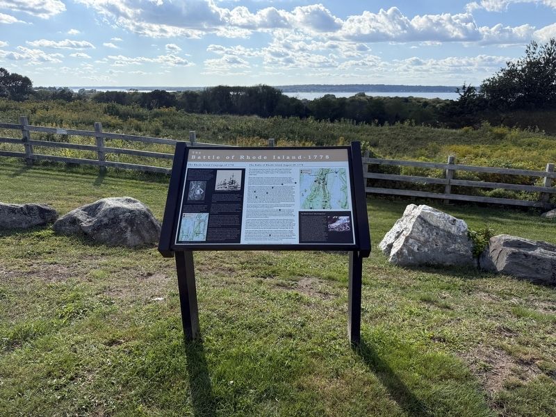
The Rhode Island Campaign of 1778
During the American Revolution, British strategy focused on controlling America’s port cities and blockading the coast. Because of Newport’s significance as a deep-water port and as a center of . . . — — Map (db m312285) HM
The Use of the Land
The scenic landscape that can be seen from this vantage point has had a rich and vibrant history. The Narragansett Indians inhabited this area of Rhode Island for thousands of years before its discovery by European . . . — — Map (db m312283) HM
The earthwork fortifications ahead are original from 1777. The complex was constructed by colonial militiamen as the Tiverton Heights Fort to guard the narrow Sakonnet Strait and prevent and invasion of the Rhode Island mainland by British troops . . . — — Map (db m312286) HM
Why is it called "Sin & Flesh Brook"
The spring after the King Philip's War ended, way back in 1677, a Indian Chief's clerk, Zoeth Howland, a pious Quaker from Dartmouth, was passing through Pocasset (now Tiverton), to attend the meeting of . . . — — Map (db m312354) HM
Capt. Nathaniel Church Estate
ca. 1872
The property was a wedding gift given by George Humphrey to his daughter, Mary, when she married Nathaniel Church, one of the seven Church brothers; the Church family founded a large local . . . — — Map (db m312352) HM
❖ 1st Lawton House destroyed by fire in 1847, rebuilt 1848
❖ 1864 Sold, enlarged & reopened 1865
❖ 1867-1884 Sold 4 times, destroyed by fire in 1884
❖ . . . — — Map (db m312410) HM
Tiverton citizens had a strong concern for the support of the poor. Some were sheltered in the Old Tavern on Main Road just south of the intersection of Souza Road "in a dimly lighted, unfurnished, unpainted attic chamber, containing one small . . . — — Map (db m312346) HM
Aballo, Marianno S. •
Aguiar, Manuel R. •
Albert, Charles •
Albert, Isaac F. •
Amon, Arthur •
Anthony, Irving Walker •
Astin, John Richard •
Astin, Walter Lees •
Beattie, Hamilton •
Beattie, Malcolm Burch •
Beaulieu, . . . — — Map (db m312359) WM
Aballo, Edman R. •
Aballo, Joseph •
Aballo, Norman •
Aballo, R.H.J. •
Aguiar, Anthony •
Aguiar, Dimas P. •
Aguiar, Jesse M. •
Aguiar, John •
Aguiar, John P. Jr. •
Aguiar, Michael F. •
Aguiar, Michael Jr. •
Almas, Frank M. • . . . — — Map (db m312344) WM
30 lots laid out in 1710
Earliest Houses
Chase-Cory House ca.1730
Built by Benjamin Chase, whaler. Andrew Cory purchased in 1816. Cory descendants here until 1962. Currently is Tiverton Historical Society house museum. . . . — — Map (db m312349) HM
The earthen mounds on this site are the original fortifications that defended Tiverton against British forces that occupied Aquidneck Island. With hand tools & human toil colonists dug the breastworks then pulled artillery pieces up the hill to the . . . — — Map (db m48078) HM
Through the unrelenting efforts of Dr. James W. Holt, Jr. Fort Barton was preserved. It was given to the town of Tiverton by the Newport Historical Society in 1968. In 1777 the site was fortified by the colonial army to defend against British . . . — — Map (db m48225) HM
Encamped with Continental Army troops in Tiverton from Aug. 30 to Sept. 2, 1778, in the aftermath of the Battle of Rhode Island. — — Map (db m311535) HM
By the sincerity of his dedication and perseverance Dr. James W. Holt, Jr. motivated by the love for his community and the understanding of his environment, has served to preserve here an unspoiled display of our historical foundation which will . . . — — Map (db m48873) HM
Native people thrived in Narragansett Bay for thousands of years. Giovanni da Verrazzano explored the bay in 1524 and described them as "the most beautiful and the most civilized... we have found," with land that was a "patchwork of cultivated . . . — — Map (db m306718) HM
Over this stone fence you will see
Chace-Cory House, circa seventeen thirty,
Built by Abner or Benjamin Chace, you know,
Some of the whaling men long ago.
Another one was Andrew Cory,
Who, in eighteen sixteen, began another story: . . . — — Map (db m262017) HM
Austin T. Levy's influence on Harrisville began in 1912 when he leased the mill in Harrisville and named it Stillwater Worsted Mill. His mill became unique because of Mr. Levy's beliefs and management style. He devised new methods of operation, . . . — — Map (db m311590) HM
Dedicated to the memory
of the men and women, who
so valiantly served in the
defense of their country
Naldor P. Berard
Born August 10, 1921
Died at Age 22
September 11, 1943
Enlisted in the U.S. Navy July
22, 1942. Was Seaman . . . — — Map (db m191223) WM
Dedicated to the men and women of Burrillville who answered the call for Enduring Freedom, Iraqi Freedom and the Global War on Terrorism — — Map (db m191222) WM
In 1746 Josiah Arnold operated a saw and gristmill on this site utilizing waterpower from the Pascoag River. In 1814 Daniel Sayles erected a building for fulling and dressing woolen cloth. Farmers in the area brought their homespun cloth, woven . . . — — Map (db m312419) HM
The first mill built near this site in 1834 for owner Arnold Hunt, operated on and off until 1892, when it burnt down. The water rights were originally purchased from Moses Taft, another mill owner, supposedly over a turkey dinner. (Hence the . . . — — Map (db m312418) HM
Donated by Alvin Jenks in 1890, the park was built around Dexter's Ledge. In 1676 during King Philip's War, Indian scouts saw the approach of a colonist band from that height. Indians and colonists engaged in Pierce's Fight at a site along the . . . — — Map (db m303634) HM WM
Due to land disputes and broken peace treaties between local natives and early English settlers, King Philip's War took place for 14 months during 1675 and 1676. Captain Michael Pierce's fight with the natives occured on this spot in March of . . . — — Map (db m313313) HM
Near this spot Captain Michael Pierce and his company of
Plymovth Colonists ambvshed and outnvmbered were
almost annihilated by the Indians
March 26, 1676 — — Map (db m303649) HM WM
World's First Sri Chinmoy Peace Blossom
Sri Chinmoy Peace Bridge
uniting
Cumberland - Sri Chinmoy Peace Town
and
Central Falls - Sri Chinmoy Peace City
Dedicated April 24, 1989 by Cumberland Mayor Francis R. Stetkiewicz and Central . . . — — Map (db m251523) HM
In memory of
Private Clarence Surprise
Co. G. 314th Infantry, 79th Division, U.S.A.
Killed at Montfaucon, France
September 29, 1918
In a righteous cause
he won immortal glory — — Map (db m312436) WM
This building served as the education center of Oak Lawn starting in 1838 as a schoolhouse and then served as the Oak Lawn Library since 1895. The library was operated by the Oak Lawn Public Library Association until 1968 when it joined the . . . — — Map (db m312420) HM
The Sprague property included a section of the Pocasset River which provided water power for two small mills. In 1808, after seeing the success of Samuel Slater's cotton mill in Pawtucket, William Sprague converted his grist mill into a small . . . — — Map (db m312435) HM
Department of Defense
United States of America
Army • Marines • Navy
Air Force • Coast Guard
Army Reserve Sgt Gregory A Belanger •
Army National Guard Staff Sgt Joseph Camara •
Army National Guard Specialist Michael Andrade • . . . — — Map (db m251925) WM
In the mid 1800s, this area was known as Spragueville, named after the Sprague family, one of the country's wealthiest textile manufacturers. This 28 room mansion started in 1790 as a farm house and grew as the family gained prominence. It was . . . — — Map (db m312422) HM
In honor and in memory of the citizens of Cranston who served their country during the Revolution 1776-1781 • War of 1812 1812-1815 • Mexican War 1846-1847 • Civil War 1861-1865 • . . . — — Map (db m251922) WM
Dedicated to the memory of the men of the City of Cranston who gave their lives in the Viet Nam War
by the students of
Cranston High School East
May 29, 1969 — — Map (db m251919) WM
In memory of the veterans who made the supreme sacrifice
World War II • Korean Conflict • Vietnam War
Dedicated Memorial Day 1972 — — Map (db m251924) WM
Pawtuxet
Baptist Church
Organized
1805
1806 - 1906
Pawtuxet Baptist Church
Organized Nov. 17, 1806 by 34 members from the First Church, Providence
In 1764-5 Peleg Arnold and Abraham . . . — — Map (db m251151) HM
Dedicated to the firefighters of Volunteer Fire Company #1 of Pawtuxet, RI who faithfully, diligently, and actively served this community from 1891 until 1995. They were summoned to each alarm of fire by the steeple bell of the Pawtuxet Baptist . . . — — Map (db m251153) HM
The Albion Dam on the Blackstone River has been a key feature since 1822. Originally built to harness the river's power for textile production, it now generates hydroelectric power. It is recognized as a contributing resource to the Albion . . . — — Map (db m311584) HM
Arches Everywhere
At the mill complex which once filled this park, arched openings in buildings crossed raceways and defined the [unreadable] of windows and doors. Some of the arches are intact, but many are not. The two in front of you are . . . — — Map (db m251520) HM
pre-1800's
Prehistoric and historic Indian peoples, and English colonists, fished at Valley Falls leaving few traces.
1812 - 1820
Twin brothers Abraham and Isaac Wilkinson bought land and water rights on both sides of the river . . . — — Map (db m313314) HM
This bell was cast by George Holbrook in East Medway MA in 1840, and was installed at 22 Broad St. It remained there until 1977 when it was dismantled by the Knights of Columbus and brought to the Hayden Library and dedicated to the departed . . . — — Map (db m55663) HM
Na honrosa visita de sua excelência o Presidente da Republica Portuguesa Dr. Mario Soares, o Clube J. Lusitana Agredecido 24-5-87
[English translation:]
Commemorating the visit of His Excellency Dr. Mario Soares, . . . — — Map (db m251526) HM
A Cultural Context
The Valley Falls mill was once once of several industrial centers in the community. The mill here ran for over a hundred years until 1834, and [unreadable] Valley Falls the political center of Cumberland. The distinctive . . . — — Map (db m251501) HM
The house of Samuel B. Chase and Elizabeth Buffum Chase, once located across the street, played an important role in the antislavery movement of the 1840s and 1850s. As a secret refuge for fleeing slaves, this home was a stop on the "underground . . . — — Map (db m251489) HM
Hydraulic turbines are water motors that turn at great speed. The metal turbines at this site used the pressure of water (created by the [unreadable] dam) to generate power. They [unreadable], more efficient, and more durable than wooden water . . . — — Map (db m251522) HM
Dedicated by a grateful community in memory of all veterans who have championed the cause of freedom through service in the United States Armed Forces — — Map (db m251491) WM
Dedicated to the Glory of Almighty God in memory of Cumberland men and women who by their unselfish patriotism have advanced the American ideals of liberty and the universal brotherhood of man.
Servant of God well done.
Well . . . — — Map (db m251494) WM
The force of falling water can turn wheels and other devices to power machinery. Capturing that force requires a dam to divert water's natural path, artificial channels or raceways to lead water through a power-creating wheel, and a tailrace . . . — — Map (db m251519) HM
Your Key to the Past
On this Spot
The site of the brick storehouse, mentioned on the sign at the Broad Street park entrance is immediately to your left. There was a small addition to the storehouse right behind you. The bridge in front . . . — — Map (db m251517) HM
The largest ship graveyard in Rhode Island lies submerged under the waters off Bold Point.
The shoreline on which you stand has played a pivotal role in the region's industrial past for centuries and holds a hidden wealth of historical and . . . — — Map (db m303927) HM
1. The area in which John L. Lewis Park is located was purchased in 1641 by Governor Edward Winslow of Plymouth and John Brown from Massasoit, Chief of the Wampanoag Indians. This area was first known as "Old Rehoboth" until being renamed . . . — — Map (db m307616) HM
East Providence - Ribeira Grande
Sister Cities Committee
Established 1982
Recipient of the
Sister Cities International Award
for Professional Assistance
Sister Cities International Conference
Los Angeles, California . . . — — Map (db m222607) HM
Composed of men who in the dark days of the Civil War
from 1861 to 1865 offered their lives that this Union
might be preserved ★ ★ ★ There is a debt this nation
can never pay that is the debt of gratitude to the soldiers . . . — — Map (db m198157) WM
In honor of the men and women of East Providence who served in all wars and in memory of those who made the supreme sacrifice for our country. — — Map (db m222606) WM
This bridge opened for traffic in 1930 and known as the Washington Bridge first opened to traffic on April 12th 1793 and which carried the following inscription on an abutment
Washington Bridge.
Built by John Brown . . . — — Map (db m222506) HM
Erected to the memory of the citizens of East Providence who served in the World War
1917 - 1918
Dedicated July 30, 1927
In Memoriam
Fred A. Almquist •
John D. Austin •
John E. Benson •
Edgar P. Black •
Donald E. Carlton • . . . — — Map (db m251642) WM
Crescent Park
Looff Carousel
has been designated a National Historic Landmark
This site possesses national significance in commemorating the history of the United States of America
1987
National Park Service
United States Department of the . . . — — Map (db m59284) HM
Here ended the Pilgrimage of Elizabeth Tilley Howland who died Wednesday 21-31 Dec. 1687 at home of her daughter Lydia & husband James Brown in Swansea. ~ Elizabeth married Pilgrim John Howland who came with her in the Mayflower Dec. 1620. From . . . — — Map (db m313794) HM
The past and present coexist in a quiet, contemplative setting This picturesque, peaceful landscape on the shores of Bullock Cove, was part of the area inhabited by the Pokanoket Tribe. In 1655, John Browne, a statesman of Rhode Island, . . . — — Map (db m301005) HM
Along the East Bay Bike Path, the Pomham Rocks Lighthouse is perched on a rocky island jutting out approximately 800 feet from the Providence River's eastern shoreline. The lighthouse was constructed in 1871, was in operation until the 1970s, and . . . — — Map (db m251646) HM
Army
Capt. Casey Charles H. •
" Hascall Theo C. •
Lieut. Eddy Guyston S. •
" Harris Ray L ★ •
Serg. Black Edgar P ★ •
" Bolland Leroy H. •
" Chadsey Chas H. •
" Gilmore Harold D. •
" Girard Clifton J. •
" . . . — — Map (db m252295) WM
Here Rev. Samuel Newman and associates, in 1644, found ample place, "Rehoboth," for their plantation.
Near this spot they built their first church at the centre of the "Ring of the Town", destroyed by Indians in 1676. Rebuilt and enlarged . . . — — Map (db m299260) HM WM
Reverend Samuel Newman, the founder of Rehoboth & the 1st Pastor of its first church and author of the 1st full English Concordance of the Holy Scriptures. Was born in Banebury, Eng. May 1602. Graduated at Trinity Coll. Oxford 1620, was Pastor ten . . . — — Map (db m299257) HM
The area of today’s City of East Providence was inhabited by the Pokanoket Tribe, later known as the Wampanoag, for over 10,000 years. In 1621, the Massasoit Ousamequin entered into a mutual protection agreement with the English settlers in . . . — — Map (db m299261) HM
This spring is the site of the first settlement in 1636 by Roger Williams in the State of Rhode Island. Banished from the Massachusetts Bay Colony because of his religious beliefs, he fled into the wilderness and found refuge with his friend . . . — — Map (db m302521) HM
This ancient Landmark holds an enviable record for the number of years it has housed civic, religious and community gatherings.
Second Baptist Church of Foster purchased this for $15.00 in 1795.
Rhode Island General Assembly voted a . . . — — Map (db m297561) HM
This memorial is dedicated in honor of the citizens of Foster who served in the wars of our country and in loving tribute to those who sacrificed their lives in defence of liberty.
Erected by the Welcome Home Committee World . . . — — Map (db m311638) WM
Howard Vanasse •
George Brayton POW •
Reino Tikkanen •
Lester Prior •
John Simula •
Clinton Hopkins •
Clarence Smith •
Henry Randall •
Eleanor Carlson •
Norman Tucker •
Leonard Shippee •
William Harrington • . . . — — Map (db m312478) WM
May 25, 1826 - May 25, 1976
Diverse hands fired upon
Betty
One of America's first elephants at the the north end of the rustic span that arched Chepachet River
Given in observation of the 150th anniversary of the event by Richmond and . . . — — Map (db m243023) HM
This garden reflects the working life of a 19th-century Rhode Island shopkeeper and the family who rented the space above the shop when small plots behind stores and homes were essential for providing food, herbs, medicine, and useful plants for . . . — — Map (db m312311) HM
In honor of all those men and women who have served in the armed forces of the United States of America
Merchant Marines - June 12, 1775 •
United States Army - June 14, 1775 •
United States Marine Corps - November 10, 1775 •
United . . . — — Map (db m312499) HM
Born in Johnston May 23, 1786
Medical diploma August 5, 1807
Surgeon - Wasp-Hornet War of 1812
Prisoner of War by British War of 1812
Assistant Surgeon of U.S. Navy 1812-13
Town Clerk, Town of Johnston 1820-43
Assistant to Gov. . . . — — Map (db m312444) HM
Town of Johnston
Honorable Ralph R. Arusso, Mayor
This area is dedicated to
Johnston residents,br>
who have served in the
United States military
Town Council
Benjamin Zanni, President • . . . — — Map (db m311636) WM
1049 entries matched your criteria. Entries 401 through 500 are listed above. ⊲ Previous 100 — Next 100 ⊳