In 2000, to commemorate a century of service, Canadian Military Engineers embarked on a three-year program of assisting communities along the Trans Canada Trail to construct and restore bridges. Thirty of these bridges are shown here. . . . — — Map (db m113207) HM
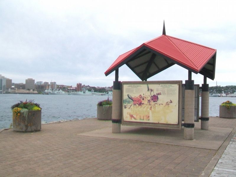
Proudly serving Canada and their fellow citizens at home and abroad.
In a new and awesome land that was to become Canada, adventurous French and British military engineers surveyed the colossal, mapped the incredible and built the . . . — — Map (db m113199) HM
In August 1750, the 504 ton ship Alderney arrived after a month's sail from England with 353 settlers, who made their first landing near the sawmill site. They laid out 184 building lots, 50 feet by 100, and named the settlement after the . . . — — Map (db m113104) HM
This is the starboard propeller of the Canadian coastguard [sic - Coast Guard] Icebreaker, John A. MacDonald [sic - Macdonald]. The propeller was damaged while the John A. MacDonald was assisting the 115,000 ton oil tanker, SS Manhattan, in her . . . — — Map (db m113082) HM
Sullivan’s Pond was a vital feature of the historic Shubenacadie Canal, the traditional water route of Mi’kmaq Indians connecting the harbour at Dartmouth with Minas Pasin and the Bay of Fundy. When the Canal operated, from 1861 to 1870, water . . . — — Map (db m108732) HM
This totem pole, carved by three Kwakiutl Indian carvers from a log of western red cedar, is a gift to the 1969 Canada Games Society on the occasion of the first Canadian Summer Games, held in the twin cities of Halifax and Dartmouth, Nova Scotia. . . . — — Map (db m108731) HM
An avid walker, trail enthusiast, leader, mentor and diligent worker, Vera B. Stone defines the Trans Canada Trail movement in Nova Scotia. As a founding member and a longstanding Chair for the Trans Canada Trail Committee of the Nova Scotia . . . — — Map (db m113189) HM
Wild roses add beauty and colour to roadsides, open woods, prairies, and rocky places all across Canada. They may have pink or white flowers, be with or without thorns, and stand as high as 2.5 metres. Wild roses are considered a weed in many . . . — — Map (db m113194) HM
Lake Micmac was smaller
Lake Micmac was considerably smaller before the Canal was begun. Evidence for this can be found in the cove to the west where the remains of a forest and marsh area can be seen under the surface of the Lake. To the . . . — — Map (db m78081) HM
Man-made Bank
You are now walking on a man made bank which forms one side of the canal cut. This wall of earth and stone was necessary to contain the depth of water needed to float the barges. During the first phase of the canal . . . — — Map (db m78100) HM
Canal Camp
You are looking at a part of the remains of what was known as the “Canal Camp.” The row of stones in this area represent the largest feature found to day at Port Wallace. An archeological investigation was carried out . . . — — Map (db m77987) HM
Lock 2
You are now looking at the upper sill of Lock 2. The chambers of the first five Locks on the Canal are approximately 21 meters long and 5.5 meters wide.
Therefore the boats and barges used on the system had to be able to fit . . . — — Map (db m78083) HM
Cutting the Canal
You are now standing about one third of the way between Lake Micmac to the South (left) and Lake Charles to the North (right). Before canal construction began in 1826 there was no flow of water between these two lakes. The . . . — — Map (db m77986) HM
Benching
As you look down the Cut you will see, on the left or East bank, stone walls separated by narrow, flat terraces. This construction technique was used by the canal workers to prevent the earth from sliding down the bank. It was . . . — — Map (db m78117) HM
Hard Digging!
From this location you can begin to appreciate the enormous task which faced the canal workers. Prior to 1826 this canal cut or trench did not exist and all of the earth and rock had to be removed. Unlike the lower part of the . . . — — Map (db m78105) HM
At the point you are approximately 26 meters above sea level, almost at the height of Lake Charles from which the water flows in two directions - south to the Harbour and north to the Bay of Fundy. To get to this point vessels would have traveled . . . — — Map (db m78147) HM
Vessels entering Lock two, traveling northward, were approximately 19 meters above the level of the Harbour. This lock would raise them another three or four meters enabling them the make their way along the canal to Lock three. This present lock . . . — — Map (db m78148) HM
Navvies
The most concentrated number of features belonging to the Canal Camp are located in this area beneath the trees and along the roadway. You can still make out the remains of several stone foundations. A plan of this area prepared in . . . — — Map (db m77988) HM
A Dwelling for Two Families
Imagine this structure on top of the stone foundation in front of you. This home would be similar to the one at Site No. 9. However this structure is larger and contains two small stone hearths. When excavated in . . . — — Map (db m78104) HM
Dwelling Cabin
This feature represents an example of cultural transfer by emigrants to Canada from their homeland. This dwelling cabin strongly resembles the description of the cabins of the working poor in Northern Scotland and Ireland, as . . . — — Map (db m78101) HM
Location of prominent historical characters at the ground breaking ceremony
General location of the official ground breaking ceremony, July 25th, 1826. Looking south from the walking bridge you are viewing the general location of the . . . — — Map (db m78078) HM
Possibly a Storage Building for Powder
This is the only example of this style of structure found anywhere along the canal. While the Archaeologists are uncertain about its use, it may have been a storage area for black powder used to blast the . . . — — Map (db m78106) HM
From 1826 to 1831, canal labourers constructed two locks and the “deep cut” between Lake Charles and Lake Micmac. During these years, upwards of 250 workers and their families lived here. The locks were rebuilt and operated between 1858 . . . — — Map (db m77956) HM
Highest point of the Canal
Ahead you will see Lake Charles which is the highest body of water in the Canal system. From this lake, water flows south to the Halifax Harbour and north to the Bay of Fundy. You are now approx. 29 meters (95 feet) . . . — — Map (db m78115) HM
Lock 3
When first built this lock was made entirely of granite blocks, as represented by the end walls. Like the other structures of the Canal, this lock fell into disrepair between 1831 and 1854. It was completely rebuilt by Charles Fairbanks . . . — — Map (db m77985) HM
The Blacksmith’s Shop
Excavated by Dr. Davis in 1985, this forge operated during both the first construction period (1820s) and the second (1850s). It was here that workers and masons would have their tools repaired and stone picks . . . — — Map (db m77982) HM
Lock 2
Looking north from the walking bridge you see Lock 2. This lock was the first to be constructed on the Canal. Initially the lock was built totally of granite blocks (British construction method), as seen on the east wall. After the . . . — — Map (db m78077) HM
A water control structure
The man-made holding pond in front of you helped to maintain the level of the canal when the lock was in operation. The water in this holding pond had two purposes. It helped maintain the water level in the dry . . . — — Map (db m78102) HM
[English Text only shown] The Duke of York's Martello Tower was one of many small towers built for coastal defence throughout the British Empire. They were usually round, with stone walls too thick to be penetrated by cannon balls. This . . . — — Map (db m44629) HM
[English text]
York Redoubt was the heart of the defences protecting the outer harbour approaches to Halifax. Begun in 1793, it was enlarged by the Duke of Kent who constructed a Martello tower here in 1798. The redoubt became an essential . . . — — Map (db m44479) HM
In memory of
the more than
100,000 children
sent to Canada
from Great Britain
between 1869
to the mid 1940's
to work as
farm labourers and
domestic servants.
En mémoire des plus
de 100 000 enfants
de la . . . — — Map (db m205390) HM
Through these doors have come immigrants and refugees from every part of the world, often bringing with them little more than hope and dreams of a better life for themselves and their children.
History records that many of these . . . — — Map (db m205629) HM
In honor of Canada’s 150th anniversary. CN restored this 1937 railway passenger car that was donated to the Canadian Museum of Immigration at Pier 21 in 1999.
Special tanks to the Halifax Port Authority and the Alberta Railway . . . — — Map (db m205630) HM
A tribute to all fallen soldiers in Gallipoli, Çanakkale for turning the tragedies of man into friendship among all those nations who never forget the past, but embrace the future for peace.
“Those heroes who shed their blood and lost their . . . — — Map (db m205385) WM
These men died in captivity while serving the United States of America on land and sea during the War of 1812. They lie in unmarked graves here on Deadman's Island.
Followed by a list of 188 men identified by Name, Rank, Ship/Unit, and Date . . . — — Map (db m44062) WM
The year is 1821. You are looking south in the Grand Parade towards Saint Paul's, the oldest Anglican church in Canada. Turn and face north: the fine building you see is not City Hall, but "old" Dalhousie College.
In a long, often acrimonious, . . . — — Map (db m139592) HM
English
Built about 1819 by John Black, successful merchant and Executive Councillor (1813-23), this house is a notable example of the finest Halifax residences of its day - the first important era of stone construction in the town. James . . . — — Map (db m77657) HM
Erected
by the
Commissioners
of the
Public Gardens
in commemoration
of the services
of our
Citizen Soldiers
in the
South African
Campaign
1899~1902 — — Map (db m112796) WM
The corps was formed in Nova Scotia and elsewhere across Canada in 1937, on the instigation of the Canadian Government, to find employment for worthy older veterans.
Its organization was patterned along military lines of the British Corps of . . . — — Map (db m77805) HM
English
These gravestones were all carved by hand, using chisels and wooden mallets. Many of the old slate stones were quarried and carved around Massachusetts Bay, and shipped to Halifax before the American Revolution. By the 1770s local . . . — — Map (db m77782) HM
English:
This building, erected in 1860, provides a rare and early example of a full cast iron facade in Canada. Used in construction since the 1770s, cast iron had become a popular decorative material by the mid-19th century . . . — — Map (db m139596) HM
Dedicated to the original Irish
settlers of 1749 and to the
contributions of the Irish
community to Halifax, to
Nova Scotia and to Canada
Tíolactha do na hÉireannaigh a
bhain fúthu í Halifax sa bhliain
1749 is mar aitheantas da . . . — — Map (db m113130) HM
The history of Kuowage’jk (Citadel Hill and Kjipuktuk (Halifax) does not begin with European settlements. These places form part of the larger Indigenous landscape of Mi’kma’ki, which dates back more than 10,000 years.
The Mi’k’maq, along with . . . — — Map (db m260157) HM
D-Day and the
Battle of Normandy
6 June-21 August 1944
After months of elaborate planning, the largest seaborne invasion in modern history commenced on 6 June 1944 (D-Day) to liberate northwestern Europe from German . . . — — Map (db m139666) HM
This plaque is dedicated to the memory of
Edmund Burke
distinguished scholar, missionary pastor, and prelate, having served for sixteen years, he was elected as Bishop of Sion and first Vicar Apostolic of Nova Scotia on July 4, 1817. He . . . — — Map (db m77747) HM
The Halifax Citadel was once the headquarters for a massive array of coastal defenses that made Halifax one of the most heavily defended ports in North America. Five of those fortifications are now national historic sites and together are known as . . . — — Map (db m259732) HM
Read it Here
Project Bookmark Canada
places stories and poems in the exact Canadian locations where literary scenes are set.
This bookmark was unveiled in December 2017, by the Estate of Hugh MacLennan, McGill University, as part of the . . . — — Map (db m260371) HM
English:
Born in Halifax, Newton had his first art lessons in Boston from his uncle Gilbert Stuart, painter of the George Washington portraits. Leaving for Europe in 1815 he settled in London and entered the Royal Academy Schools . . . — — Map (db m139597) HM
On this site in 1802 was erected the school building which became the forerunner of Saint Mary’s University.
Edmund Burke, newly appointed as Roman Catholic Vicar General in Nova Scotia, had the two-storey structure built in the hope of . . . — — Map (db m77719) HM
English
Built to defend against a land-based attack, the Halifax Citadel was the fourth in a series of forts to occupy this hill, The star-shaped fortress, completed in 1856, was the centerpiece of the extensive system of fortifications . . . — — Map (db m78258) HM
English:
The Halifax City Hall, erected between 1887 and 1890, is the
largest and one of the oldest municipal buildings in Nova Scotia.
Designed by a local architect, Edward Elliot, its elegant facade
features an attractive and . . . — — Map (db m139509) HM
Open for viewing daily, 10:00am to 5:00PM
Come visit the ship, on the waterfront,
behind the Maritime Museum Of The Atlantic
HMCS Sackville is the last of 267 Flower Class Corvettes
built for the Allied Navies during WWII.
Of . . . — — Map (db m112799) HM
English
Major General Ross sailed to North America in the summer of 1814 from the Peninsular War against France to command the British army on the east coast of the United States, opening a second front to relieve the pressure on the . . . — — Map (db m77877) HM
On your left near this spot lie the remains of … / À votre gauche, près d’ici se trouvent les restes de ….
Mr. / M. John Samwell
Midshipman / Aspirant de marine • 1797-1813
Mr. / M. William Stevens
Boatswain / Maître de . . . — — Map (db m77897) HM
This land was set aside as a common burial ground outside the stockade of the new fortified town of Halifax
First grave dug June 21, 1749
Granted to St. Paul’s Church June 17, 1793
Closed to burials August 18, 1844
Welsford-Parker Monument . . . — — Map (db m77743) HM
English
The Old Burying Ground, which contains more than 1,200 head and footstones, constitutes a unique concentration of gravestone art. A rich variety of styles, poignant images and carving skill is reflected in these old stones. The . . . — — Map (db m77784) HM
English
Author of the first Canadian novel of French expression, L’influence du’ livre (1837), written in Saint-Jean-Port-Joli, Philippe-Ignace-Françoise Aubert de Gaspé was born in Quebec City on April 8th, 1814. He worked from 1840 . . . — — Map (db m77825) HM
This plaque is dedicated to the memory of
Pierre Maillard
who served as missionary to the Micmac Indians in this country for over thirty years, who succeeded in reconciling the Micmac to British rule, who celebrated the first mass and opened . . . — — Map (db m77723) HM
English
Province House is an architectural monument and the setting for signifiant events in Canadian political life. Begun in 1811 and opened in 1819 as the seat of government for Nova Scotia, it is one of the finest Palladian-style . . . — — Map (db m77858) HM
Hurricane Juan struck Halifax on September 29, 2003, devastating the Halifax Public Gardens. A volunteer-led foundation was formed to raise funds and restore the Gardens and historic Horticultural Hall.
This fountain and plaza were dedicated on . . . — — Map (db m112821) HM
Erected
by the people of
Nova Scotia
in honor
of those who served
and in memory of
those who fell in the
South African Campaign
1898 - 1902 — — Map (db m77859) WM
English
St. Mary’s holds a central position in the history of Roman Catholicism in Nova Scotia. Begun in 1820, the church demonstrated the enhanced ecclesiastical status of the province, which acquired its own Bishop in 1818, and witnessed . . . — — Map (db m77721) HM
English:
Completed in 1750, St. Paul’s was the first church outside Great Britain to be designated as an Anglican cathedral. Between 1787 and 1864 it served as the cathedral church of the See of Nova Scotia. For 96 years St. . . . — — Map (db m139686) HM
The Acadians on George Island
Georges Island National Historic Site, the small island that lies in Halifax harbor, is a culturally significant site to the Acadian community.
The Acadians are descendants of French colonists who arrived in what is . . . — — Map (db m259737) HM
[English]
The Bailey Bridge was developed in Britain and used to great advantage by the Allied forces’ military engineers in the 1939-1945 World War. These Bailey panels were erected overlooking the Royal . . . — — Map (db m269427) HM
The hands on the north clock face in the City Hall tower, opposite on Duke Street, are permanently fixed at 9:04:35 the exact moment of the wartime Halifax Explosion the morning of 6 December 1917.
The clock face, a replica of the City Hall . . . — — Map (db m139510) HM
This has been the central gathering place of our people since the founding of Halifax in 1749.
Saint Paul’s Church was established by Royal Charter in our founding year, becoming the first church in the city and the oldest Protestant church in . . . — — Map (db m139593) HM
English:
The Halifax Court House was designed in 1858 by the Toronto architectural firm of William Thomas and Sons and since its completion in 1863 has housed both county and provincial courts. The building’s importance is . . . — — Map (db m139600) HM
From where you are standing, you can see Ground Zero for the Halifax Explosion, the largest man-made explosion prior to the first atomic bomb. On December 6, 1917, as the First World War raged around the globe, the Norwegian relief ship Imo . . . — — Map (db m259705) HM
The Jamaican Maroons
The "Maroon Bastion" stood near this location from about 1796 to 1828
The Jamaican Maroons were descendants of enslaved Africans who had escaped to form free communities in the mountainous interior of the . . . — — Map (db m259709) HM
English
In this common burial ground lie many of the first citizens of Halifax, their descendants and men of the British Army and the Royal Navy who were stationed here. First opened in 1749, the year Halifax was founded, it was used until . . . — — Map (db m77783) HM
The property on which this Church stands was acquired by the Society of Methodists in 1793 for use as a burial ground. A church structure was built on part of the site in 1852 but was destroyed by fire in 1868. The present Church building was . . . — — Map (db m307800) HM
Halifax has been the scene of many "firsts" in Canada. These eighteen acres, comprising one of Canada's most attractive Victorian public gardens, derived from an earlier site, part of the original Common, chosen for the Gardens in 1841, the year . . . — — Map (db m112715) HM
The place where you are standing is known as the Saluting Battery. Here the custom of saluting naval ships with cannon fire was carried out by British forces in the 19th century. For much of the 20th century, the famous Noon gun was also . . . — — Map (db m260364) HM
This marker is composed of five plaques on the same mounting. The marker stands on north wall of the Citadel overlooking Halifax Harbor. The markers are presented left to right.
The Halifax Explosion / L’explosion d’Halifax . . . — — Map (db m78257) HM
English This monument was erected in 1860 in memory of Major A.F. Welsford and Captain W.B.C.A. Parker. These two Halifax men both perished during the Crimean War. In September of 1855 they participated in the assault on the Great Redan, part . . . — — Map (db m77744) HM
Studio Notman Studio, 1897
[Historic photo of the fountain unveiling]
—————————————
Erected by the Garden Commissioners
in commemoration of Queen Victoria's . . . — — Map (db m112947) HM
The Halifax Public Gardens is one of the finest surviving examples of Victorian Gardens in North America. It was established in 1874 by the amalgamation of two older gardens, the Nova Scotia Horticultural Society Garden (laid out in 1837) and an . . . — — Map (db m112791) HM
This marker may be conveniently divided into three section; left, center and right. The center sections is presented first.Center sectionEnglish
We are not Americans because of the service men like the sailors and . . . — — Map (db m78073) HM
English:
Born in Halifax and called to the bar in 1840, Henry represented Antigonish in the Nova Scotia Assembly as a Liberal (1841-57), and as a Conservative (1857-67). An ardent advocate of Confederation, he attended the . . . — — Map (db m139598) HM
English:
The buildings on the north end of Granville Street were designed by the firm of William Thomas and Sons after a fire had razed the block in 1859. Erected in the Italianate Style for prosperous merchants, the structures . . . — — Map (db m139599) HM
Women in Canada and Newfoundland significantly contributed to Allied victory. Whereas women were military nurses during the First World War, more than 50,000 were now serving in uniform as
non-combatants in all three armed services . . . — — Map (db m139663) HM
English:
A gifted lawyer, legislator, and judge, this Father of Confederation helped pave the way for Nova Scotia's reluctant entry into the new Dominion. He was a member of this colony's legislature and served as solicitor . . . — — Map (db m140961) HM
English
Before the voyages that brought him world fame as Captain Cook, this British Royal Navy officier complied navigational charts for the coasts of Quebec and Nova Scotia. While based in Halifax from 1758 to 1762, he learned . . . — — Map (db m77953) HM
This marker is composed exclusively pictures and their captions. There is a left side and a right side to the marker. Captions are presented left to right, then top to bottom. Click on the marker image to enlarge it. Left side
• . . . — — Map (db m77955) HM
Charles Morris was Nova Scotia’s Chief Surveyor and one of he first residents of Halifax.
In 1750, on order from the founder of Halifax, Edward Cornwallis, Morris began surveying the entire peninsula, laying out new suburbs and 240 acres of . . . — — Map (db m77647) HM
Dedicated 30 April 2006
Dedicated to the men and women of the
Canadian armed forces who left from
these shores and participated in the
liberation of the Netherlands
during World War II. We remember the over 5700 who paid the . . . — — Map (db m202799) HM WM
France and Canada share a long history. Theirs is a story of enduring friendship.
It began 400 years ago, in Nova Scotia, the birthplace of Acadie, with the arrival of the first French settlers and of Samuel de Champlain at Port-Royal in 1605. . . . — — Map (db m77622) HM
Constructed between 1799 and 1805 under the superintendence
of architect-builder Isaac Hildrith, this is one of the oldest
official residences in Canada. The combination of building
material, craftsmanship, scale and style made it an . . . — — Map (db m289901) HM
English:
In September, 1814, a British military and naval expedition from Halifax, under Lieutenant General Sir John Coape Sherbrooke and Rear Admiral Edward Griffith, occupied the portion of Maine between the Penobscot and St. . . . — — Map (db m140379) HM
National Historic
Civil Engineering Site
Ocean Terminals
1912-1928
A tribute to the civil engineers
and contractors who designed and built these
ocean terminals Canadian Society for
Civil Engineering June 1998
Site historique . . . — — Map (db m139330) HM
English
Celebrating Canada’s Immigrants
In the 1940s and 1950s, Canada opened its doors wide to European immigrants. With haunting wartime memories still fresh in their minds, men, women and children from diverse countries and . . . — — Map (db m77876) HM
169 entries matched your criteria. The first 100 are listed above. The final 69 ⊳