1783 entries match your criteria. The first 100 are listed. ⊳
Historical Markers and War Memorials on the High Plains Region
By Duane Hall, July 15, 2017
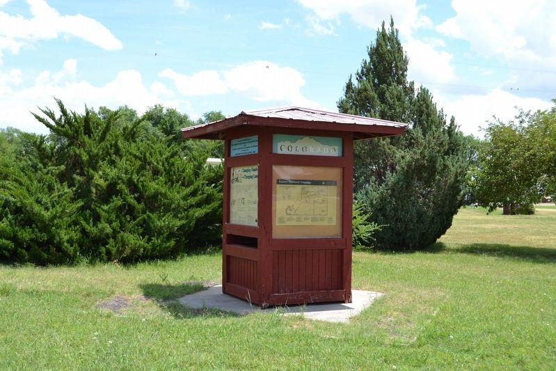
Kiosk Exhibit with Marker
1 ► Colorado, Baca County, Campo — Changing Hands --- Changing Lands —  |
| Near S. Main Street (U.S. 287) at 6th Street, on the right when traveling north. | |||
| 2 ► Colorado, Baca County, Springfield — Baca County Trails — |
| On Main Street (U.S. 287) north of East 8th Avenue, on the right when traveling north. | |||
| 3 ► Colorado, Bent County, Fort Lyon — Pike's First View — |
| Near County Road Ff.5 5 miles east of Colorado State Highway 101 and Bent County Road FF. | |||
| 4 ► Colorado, Bent County, Hasty — Santa Fe Trail — Travelers through Time — |
| Near County Highway HH near County Highway 24. | |||
| 5 ► Colorado, Bent County, Hasty — Santa Fe Trail — |
| On County Highway HH near County Highway 24. | |||
| 6 ► Colorado, Bent County, Las Animas — Boggsville — |
| On Colorado Route 101 0.6 miles south of County Road 10.75, on the right when traveling north. | |||
| 7 ► Colorado, Bent County, Las Animas — From Trail to Town — Santa Fe National Historic Trail — Boggsville Historic Site — |
| Near Colorado Route 101 1 mile south of County Road 10.75. | |||
| 8 ► Colorado, Bent County, Las Animas — Santa Fe Trail — 1822 — 1872 — |
| On U.S. 50 at County Road 13, on the right when traveling west on U.S. 50. | |||
| 9 ► Colorado, Bent County, Las Animas — Welcome to Bent County — |
| Near Carson Avenue (Colorado Route 101) north of 8th Street, on the right when traveling north. | |||
| 10 ► Colorado, Bent County, Las Animas — Welcome to Boggsville — |
| Near Colorado Route 101 1 mile south of County Road 10.75, on the left when traveling south. | |||
| 11 ► Colorado, Bent County, McClave — Fort Bent — |
| Near County Road 35.25 south of 5th Street (County Road JJ), on the right when traveling south. | |||
| 12 ► Colorado, Cheyenne County, Arapahoe — 157th Infantry Memorial Highway — |
| On U.S. 40 0.3 miles east of County Road 60, on the right when traveling west. | |||
| 13 ► Colorado, Cheyenne County, Cheyenne Wells — Bandstand Replica — |
| On South 1st Street East near West 1st Street North, on the right when traveling west. | |||
| 14 ► Colorado, Cheyenne County, Cheyenne Wells — Cheyenne County Centennial Time Capsule — |
| Near South 1st Street East just east of West 1st Street North, on the left when traveling east. | |||
| 15 ► Colorado, Cheyenne County, Cheyenne Wells — Cheyenne County Courthouse — |
| On South 1st Street East just east of West 1st Street North, on the left when traveling east. | |||
| 16 ► Colorado, Cheyenne County, Cheyenne Wells — Cheyenne County Jail — Built in 1894 — |
| On West 2nd Street North at North 1st Street West, on the left when traveling north on West 2nd Street North. | |||
| 17 ► Colorado, Cheyenne County, Cheyenne Wells — Cheyenne County Veterans Memorial — |
| On South 2nd Street West just east of West 5th Street South, on the right when traveling east. | |||
| 18 ► Colorado, Cheyenne County, Cheyenne Wells — Cheyenne County World War I Memorial — |
| On East 1st Street North at E 1st Street N, on the right when traveling west on East 1st Street North. | |||
| 19 ► Colorado, Cheyenne County, Cheyenne Wells — Colorado — Entering the Centennial State — |
| On U.S. 40 just east of West 6th Street South, on the right when traveling east. | |||
| 20 ► Colorado, Cheyenne County, Cheyenne Wells — 207 — Trails West — |
| On U.S. 40 at milepost 463.5, on the left when traveling east. | |||
| 21 ► Colorado, Cheyenne County, Kit Carson — 150 — Kit Carson — |
| On U.S. 287 at milepost 130, on the right when traveling west. | |||
| 22 ► Colorado, Cheyenne County, Kit Carson — Old Cattle Trail — |
| On State Highway 59 south of County Route CC, on the right when traveling south. | |||
| 23 ► Colorado, Cheyenne County, Kit Carson — The Kit Carson Railroad Depot — |
| On Route 287 at milepost 130, on the right when traveling west. | |||
| 24 ► Colorado, Crowley County, Crowley — Crowley — Biggest Little Town — |
| On Broadway at State Route 96, on the right when traveling north on Broadway. | |||
| 25 ► Colorado, Crowley County, Crowley — Crowley Communities / National Sugar Company / Last Days of the Buffalo / Crowley Country — |
| On Colorado Route 96 at Broadway, on the right when traveling west on Colorado Route 96. | |||
| 26 ► Colorado, Elbert County, Elizabeth — Elizabeth Main Street — |
| On East Main Street, on the right when traveling south. | |||
| 27 ► Colorado, Elbert County, Elizabeth — Elizabeth Mercantile — 207 South Main Street — |
| On Main Street at East Broadway Street, on the left when traveling north on Main Street. | |||
| 28 ► Colorado, Elbert County, Elizabeth — First National Bank — 188 South Main Street — |
| On Main Street at East Broadway Street, on the left when traveling south on Main Street. | |||
| 29 ► Colorado, Elbert County, Elizabeth — Historic Section House — |
| On East Main Street, on the right when traveling south. | |||
| 30 ► Colorado, Elbert County, Elizabeth — Olde Hotel Square — |
| On Main Street just south of East Kiowa Avenue (State Highway 86), on the left when traveling south. | |||
| 31 ► Colorado, Elbert County, Kiowa — Elbert County Veterans Memorial — |
| On Comanche Street (State Highway 86) just east of Arapahoe Street, on the left when traveling east. | |||
| 32 ► Colorado, Elbert County, Kiowa — 272 — Kiowa — |
| On Colorado Street (County Route 86), on the right when traveling west. | |||
| 33 ► Colorado, Elbert County, Kiowa — Pioneer Women of Colorado — |
| On Colorado Street (State Highway 86). | |||
| 34 ► Colorado, Elbert County, Kiowa — The Peaceful Valley of Kiowa Creek — |
| On Comanche Steet (State Highway 86) just east of Arapahoe Street, on the left when traveling east. | |||
| 35 ► Colorado, Elbert County, Kiowa — 272 — Trail Under Siege / Rising to the Challenge — |
| On Colorado Street (County Road 86) west of Pawnee Street, on the right when traveling west. | |||
| 36 ► Colorado, Kiowa County, Chivington — A Chief’s Village — Sand Creek Massacre National Historic Site — |
| Near County Highway W east of Chief White Antelope Way. | |||
| 37 ► Colorado, Kiowa County, Chivington — An End to the Slaughter — Sand Creek Massacre National Historic Site — |
| Near County Highway W east of Chief White Antelope Way. | |||
| 38 ► Colorado, Kiowa County, Chivington — Attack and Pursuit — Sand Creek Massacre National Historic Site — |
| Near County Highway W east of Chief White Antelope Way. | |||
| 39 ► Colorado, Kiowa County, Chivington — Chaos, Disorder, and Disgust — Sand Creek Massacre National Historic Site — |
| Near County Highway W east of Chief White Antelope Way. | |||
| 40 ► Colorado, Kiowa County, Chivington — Cheyenne and Arapaho Village at Sand Creek — Sand Creek Massacre National Historic Site — |
| Near County Highway W east of Chief White Antelope Way. | |||
| 41 ► Colorado, Kiowa County, Chivington — Conflict Within and Without — Sand Creek Massacre National Historic Site — |
| Near County Highway W east of Chief White Antelope Way. | |||
| 42 ► Colorado, Kiowa County, Chivington — Conscience and Courage — Sand Creek Massacre National Historic Site — |
| Near County Highway W west of County Road 56. | |||
| 43 ► Colorado, Kiowa County, Chivington — Dawn November 29, 1864 — Sand Creek Massacre National Historic Site — |
| Near County Highway W east of Chief White Antelope Way. | |||
| 44 ► Colorado, Kiowa County, Chivington — Fort Lyon Reservation — Sand Creek Massacre National Historic Site — |
| Near County Highway W east of Chief White Antelope Way. | |||
| 45 ► Colorado, Kiowa County, Chivington — Healing — Sand Creek Massacre National Historic Site |
| Near County Road W 1.3 miles east of County Road 54. Reported permanently removed. | |||
| 46 ► Colorado, Kiowa County, Chivington — Humans and the Prairie — Sand Creek Massacre National Historic Site — National Park Service, U.S. Department of the Interior — |
| Near County Highway W east of Chief White Antelope Way. | |||
| 47 ► Colorado, Kiowa County, Chivington — Incredible Feats of Bravery — Sand Creek Massacre National Historic Site — |
| Near County Highway W east of Chief White Antelope Way. | |||
| 48 ► Colorado, Kiowa County, Chivington — Incriminations and Culpability — Sand Creek Massacre National Historic Site — |
| Near County Highway W east of Chief White Antelope Way. | |||
| 49 ► Colorado, Kiowa County, Chivington — Past, Present, and Future Come Together — Sand Creek Massacre National Historic Site — |
| Near County Highway W east of Chief White Antelope Way. | |||
| 50 ► Colorado, Kiowa County, Chivington — Pleas for Peace — Sand Creek Massacre National Historic Site |
| Near County Road W 1.3 miles east of County Road 54. Reported permanently removed. | |||
| 51 ► Colorado, Kiowa County, Chivington — Remains — Sand Creek Massacre National Historic Site |
| Near County Road W 1.3 miles east of County Road 54. Reported permanently removed. | |||
| 52 ► Colorado, Kiowa County, Chivington — Returned to Sand Creek — Sand Creek Massacre National Historic Site |
| Near County Highway W just east of Chief White Antelope Way. Reported permanently removed. | |||
| 53 ► Colorado, Kiowa County, Chivington — Sacred Memory — Sand Creek Massacre National Historic Site — |
| Near County Highway W east of Chief White Antelope Way. | |||
| 54 ► Colorado, Kiowa County, Chivington — Sand Creek as Camp Site — Sand Creek Massacre National Historic Site — |
| Near County Highway W east of Chief White Antelope Way. | |||
| 55 ► Colorado, Kiowa County, Chivington — Testimony — Sand Creek Massacre National Historic Site |
| Near County Road W 1.3 miles east of County Road 54. Reported permanently removed. | |||
| 56 ► Colorado, Kiowa County, Chivington — The Attack |
| Near County Road W 1.3 miles east of County Road 54. Reported permanently removed. | |||
| 57 ► Colorado, Kiowa County, Chivington — The Big Head Fight — Sand Creek Massacre National Historic Site — |
| Near County Highway W east of Chief White Antelope Way. | |||
| 58 ► Colorado, Kiowa County, Chivington — The Sand Creek Massacre — Sand Creek Massacre National Historic Site |
| Near County Road W 1.3 miles east of County Road 54. Reported permanently removed. | |||
| 59 ► Colorado, Kiowa County, Chivington — Troops Approach the Village — Sand Creek Massacre National Historic Site — |
| Near County Road W east of Chief White Antelope Way. | |||
| 60 ► Colorado, Kiowa County, Chivington — Welcome to the Sand Creek Massacre National Historic Site — Sand Creek Massacre National Historic Site — National Park Service, U.S. Department of the Interior — |
| On Unnamed entrance road north of County Road W, in the median. | |||
| 61 ► Colorado, Kiowa County, Chivington — Why A 33 Star Flag — Sand Creek Massacre National Historic Site — |
| Near County Road W east of Chief White Antelope Way. | |||
| 62 ► Colorado, Kiowa County, Chivington — Why? — Sand Creek Massacre National Historic Site — National Park Service, U.S. Department of the Interior |
| On County Road W 1.3 miles east of County Road 54. Reported permanently removed. | |||
| 63 ► Colorado, Kiowa County, Eads — Eads Roadside Park Exhibit — |
| Near E 15th Street (U.S. 287) 0.1 miles east of Maine Street, on the left when traveling east. | |||
| 64 ► Colorado, Kiowa County, Eads — High Plains Country — |
| Near E 15th Street (U.S. 287) 0.1 miles east of Maine Street, on the left when traveling east. | |||
| 65 ► Colorado, Kiowa County, Eads — Kiowa County Veterans Memorial — |
| Near E 15th Street (U.S. 287) 0.1 miles east of Maine Street, on the left when traveling east. | |||
| 66 ► Colorado, Kiowa County, Eads — Unity Lodge No. 142, A.F. & A.M. — Works Progress Administration — |
| On West 13th Street east of Slater Street, on the left when traveling east. | |||
| 67 ► Colorado, Kit Carson County, Burlington — A Farming Revolution — Burlington Colorado — |
| On Ben Street west of Judy Street, on the left when traveling west. | |||
| 68 ► Colorado, Kit Carson County, Burlington — As the Dust Settled — Burlington Colorado — |
| On Ben Street east of Judy Street, on the right when traveling east. | |||
| 69 ► Colorado, Kit Carson County, Burlington — Burlington County Colorado Veterans Memorial — |
| On Rose Ave, on the right when traveling west. | |||
| 70 ► Colorado, Kit Carson County, Burlington — Farm Equipment - Then and Now — Burlington Colorado — |
| On Ben Street west of Judy Street, on the left when traveling west. | |||
| 71 ► Colorado, Kit Carson County, Burlington — Kit Carson County Carousel — |
| On Colorado Ave. at 15th Street on Colorado Ave.. | |||
| 72 ► Colorado, Kit Carson County, Burlington — Our Community Welcomes You — Burlington Colorado — |
| On Ben Street west of Mike Lounge Drive, on the left when traveling west. | |||
| 73 ► Colorado, Kit Carson County, Burlington — Philadelphia Toboggan Co. Carousel #6 — 1905 — A National Historic Landmark — |
| On North 15th Street at Colorado Avenue, on the left when traveling north on North 15th Street. | |||
| 74 ► Colorado, Kit Carson County, Burlington — The Dust Bowl Years — Burlington Colorado — |
| On Ben Street west of Tony Street, on the left when traveling west. | |||
| 75 ► Colorado, Kit Carson County, Burlington — The Early People — Burlington Colorado — |
| On Ben Street west of Mike Lounge Drive, on the left when traveling west. | |||
| 76 ► Colorado, Kit Carson County, Burlington — The Open Range — Burlington Colorado — |
| On Ben Street, on the left when traveling west. | |||
| 77 ► Colorado, Kit Carson County, Burlington — The Winds of Change — Burlington Colorado — |
| On Ben Street west of Judy Street, on the left when traveling west. | |||
| 78 ► Colorado, Kit Carson County, Burlington — What Lies Beneath — Burlington Colorado — |
| On Ben Street west of Judy Street, on the left when traveling west. | |||
| 79 ► Colorado, Kit Carson County, Burlington — What's In a Name — Burlington Colorado — |
| On Ben Street at Tony Street, on the left when traveling west on Ben Street. | |||
| 80 ► Colorado, Kit Carson County, Flagler — Flagler Day Air Show Tragedy — |
| Near East 2nd Street, on the right when traveling west. | |||
| 81 ► Colorado, Kit Carson County, Flagler — Flagler Hospital 1937-63 — Built in 1909 as Hotel Flagler — |
| On Main Avenue just north of West 3rd Street, on the left when traveling north. | |||
| 82 ► Colorado, Lincoln County, Arriba — 245 — Arriba Country — Colorado — |
| Near County Road 63 at Interstate 70. | |||
| 83 ► Colorado, Lincoln County, Hugo — Hugo Country — |
| Near 4th Street (U.S. 287) west of 7th Avenue, on the right when traveling west. | |||
| 84 ► Colorado, Lincoln County, Hugo — Hugo Municipal Pool — Works Progress Administration — 1938 — |
| On 4th Street (U.S. 287) at 6th Avenue, on the right when traveling north on 4th Street. | |||
| 85 ► Colorado, Lincoln County, Hugo — Lincoln County World War I Memorial — |
| On 4th Street (U.S. 40/287) just west of 4th Avenue, on the left when traveling west. | |||
| 86 ► Colorado, Lincoln County, Hugo — Welcome to Lincoln County — |
| Near 4th Street (U.S. 287) west of 7th Avenue, on the right when traveling west. | |||
| 87 ► Colorado, Lincoln County, Limon — Aeromotor Windmill — |
| Near 1st Street at G Avenue, on the right when traveling east. | |||
| 88 ► Colorado, Lincoln County, Limon — Colorado Centennial Project — 1876-1976 Centennial — |
| Near 1st Street near Civic Center Drive, on the right when traveling east. | |||
| 89 ► Colorado, Lincoln County, Limon — Currie Windmill — |
| Near 1st Street at Civic Center Drive, on the right when traveling east. | |||
| 90 ► Colorado, Lincoln County, Limon — David Bradley Windmill — |
| Near 1st Street at G Avenue, on the right when traveling east. | |||
| 91 ► Colorado, Lincoln County, Limon — Dempster Windmill — |
| Near 1st Street at G Avenue, on the right when traveling east. | |||
| 92 ► Colorado, Lincoln County, Limon — Eclipse Windmill — |
| Near 1st Street near F Avenue, on the right when traveling east. | |||
| 93 ► Colorado, Lincoln County, Limon — Fairbury Windmill — |
| Near 1st Street at G Avenue, on the right when traveling east. | |||
| 94 ► Colorado, Lincoln County, Limon — Limon Railroad Depot — Former Rock Island Line and Union Pacific Station — |
| Near 1st Street near Civic Center Drive, on the right when traveling east. | |||
| 95 ► Colorado, Lincoln County, Limon — Prairie Monument — |
| On 1st Street 0.1 miles south of Main Street (Business Interstate 70), on the right when traveling south. | |||
| 96 ► Colorado, Lincoln County, Limon — Rock Island Snow Plow No. 95580 — |
| Near 1st Street near D Avenue, on the right when traveling east. | |||
| 97 ► Colorado, Logan County, Merino — 2 — Fort Wicked — |
| On Grand Army of the Republic Highway (State Highway 6) at County Road 2.5, on the right when traveling east on Grand Army of the Republic Highway. | |||
| 98 ► Colorado, Logan County, Sterling — 1981 — "Dinkey Engine" — |
| On South Front Street at Factory Street ( Highway 6) on South Front Street. | |||
| 99 ► Colorado, Logan County, Sterling — 34 — Battle of Summit Springs — |
| On Colorado Route 63 north of County Road 16, on the left when traveling north. | |||
| 100 ► Colorado, Logan County, Sterling — I & M Building — |
| On Main Street at South 3rd Street, on the left when traveling west on Main Street. | |||
1783 entries matched your criteria. The first 100 are listed above. Next 100 ⊳