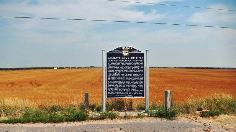
In the spring of 1942 the U.S. Army selected a site one mile south of here for an airfield. The dry climate and open landscape afforded ideal flying conditions. Ample water, cheap land, and Alliance’s new power plant, new hospital, and railroad . . . — — Map (db m178807) HM
By the mid-1880s the Sandhills had become an important cattle-raising region. The extension of the Burlington and Missouri Railroad westward through the Sandhills in 1877-1888 made ranching more profitable by making more accessible eastern markets. . . . — — Map (db m178801) HM
A flat-topped hill to the southeast was named Box Butte by early cowboys and travelers. This area is part of the Box Butte Tableland, semi-arid short grass country that stretches far to the west.
Box Butte has given its name to the creek that . . . — — Map (db m89342) HM
On August 9, 1949, the first successful oil well in western Nebraska came in for 225 barrels of oil per day at a total depth of 4,429 feet. Marathon Oil Co. completed the discovery well, Mary Egging No.1, located four miles east and two miles . . . — — Map (db m223425) HM
On June 1, 1926, George A. Coulter completed one of the first four irrigation wells in Cheyenne County, among the earliest in western Nebraska, on his farm just south of here. He and his son, James, dug the first twenty-two feet by hand. Charles . . . — — Map (db m231142) HM
Potter began as a small Union Pacific Railroad settlement and depot midway between Kimball and Sidney. The station house was built by Union Pacific in 1870 and, as the only building in the settlement, also served as the post office and school. Its . . . — — Map (db m231144) HM
Thar’s gold in them thar hills! The Black Hills Gold Rush 1874: Two scientists attached to the Custer Expedition uncover gold in sacred Sioux land in South Dakota—and the Black Hills Gold Rush is on. During the Allison . . . — — Map (db m257339) HM
Cheyenne County was organized in 1870 from lands ceded by the Cheyenne, Arapaho, and Dakota Sioux Indians. In the panhandle of Nebraska, it is part of the Cheyenne tableland portion of the Great Plains. Some fifteen miles west of Sidney lies the . . . — — Map (db m231054) HM
Sidney Barracks, when established in 1867, was a temporary camp with one permanent structure, a blockhouse located to the north. In 1869 the Fort was relocated at this site and in 1870 the name was officially changed to Fort Sidney. The primary . . . — — Map (db m76864) HM
Eight plaques mounted on a single monument are located at Hickory Square. The plaques are presented left to right.
Early Day Cheyenne County
The history of Nebraska and Cheyenne County correlate to the push westward of the . . . — — Map (db m76866) HM
In memory of the founders, riders, stock tenders, station keepers, superintendents and anyone connected with the day to day operation of the Central Overland California and Pikes Peak Express Co. — — Map (db m255114) HM
A distinct group of prehistoric hunter-gatherers known to archeologists as the Oxbow Complex once occupied the northern High Plains from western Nebraska to southern Canada. About 2500 B.C. a band of Oxbow people interred two of their own near . . . — — Map (db m231081) HM
Known throughout the Old West
as "The Bad Man's Cemetery"
Excavated & relocated in 1922
211 bodies removed
Sidney's original cemetery
www.sidneyboothill.com — — Map (db m252485) HM
Pole Creek Original Station
Apr. 3, 1860 - Nov. 20, 1861.
Reverse
In the fall of 1859 a new
route from the South Platte
to the North Platte River
for the Oregon-California
Trail followed Lodgepole
Creek to here and then . . . — — Map (db m252482) HM
The Purple Heart medal was originated by General George Washington on August 7, 1782 for distinguished valor and is now awarded only to members of the armed forces of the United States who have been wounded in combat against an armed enemy. . . . — — Map (db m231068) HM
In 1867 an Army tent camp was established near here to provide protection for Union Pacific Railroad construction crews. Three years later it became Fort Sidney, the nucleus for the town of Sidney, county seat of Cheyenne County. The rush to the . . . — — Map (db m231061) HM
Gold was discovered in the Black Hills in August, 1874. By the spring of 1876, the Army had stopped enforcing a treaty which reserved the hills for the Sioux Indians. Miners soon began to pour into the gold regions. From 1875 to 1881, the . . . — — Map (db m231079) HM
Sioux Army Depot was established on 23 March 1942 as Sioux Ordnance Depot. It was the only U.S. Army Ammunition Depot in Nebraska during World War II, the Korean War, and the Vietnam War. The depot was initially under the command of the U.S. Army . . . — — Map (db m76863) HM
From about 1846 until 1872, an Indian "trading house" occupied a site near here. Built by James Bordeaux, the trading station was once attacked and set afire by hostile Crow warriors. Fortunately, some friendly Sioux Indians came to the rescue and . . . — — Map (db m4529) HM
Employees of Lancaster P. Lupton built a trading post on the creek near here in 1841 to trade with the Sioux Indians. From 1842 until at least 1845 this post was managed by Louis B. Chartran, first for Sibille and Adams and later for Pratte & . . . — — Map (db m89344) HM
Chadron was selected as the site of the fourth Nebraska State Normal School on January 8, 1910, and located on the grounds of the former Chadron Congregational Academy. Classes began in the summer of 1911, concluding with the dedication of the . . . — — Map (db m234618) HM
Following the 1874 establishment of military posts near the Red Cloud and Spotted Tail agencies for the Oglala and Brule Sioux, the army laid out a forty-two-mile road to transport military and Indian supplies between the agencies and posts.
Oglala . . . — — Map (db m89346) HM
The Pine Ridge Country of northwestern Nebraska is among the greatest historic places of the nineteenth-century American West. It was long the homeland and hunting grounds of the Lakota (Western Sioux). White fur traders began arriving during . . . — — Map (db m89354) HM
Paha Sapa is sacred land of the Lakota that the white man has named Black Hills. We never lived in this place. It is the womb of Mother Earth—the rightful home of birds and animals. We came here only for ceremonies, vision quests and burials. The . . . — — Map (db m173952) HM
America’s longest horse race began here June 13, 1893. The 1,000 mile race ended June 27 in Chicago at Buffalo Bill’s Wild West Show. The race apparently was the idea of Chadron jokester John G. Maher. Seven of nine riders finished, some traveling . . . — — Map (db m51693) HM
Shortly after the townsite of Chadron was selected on August 1, 1885, the Reverend Harmon Bross, a Congregational missionary, conducted the first worship service in the fledgling community. For a time services were held in the open air or in tents. . . . — — Map (db m234613) HM
From about 1837 until 1850, more than a quarter million buffalo robes bought from Indians and 27 tons of fur company trade goods were hauled over the 300 mile long Fort Pierre-Fort Laramie Trail that followed the White River through this area. First . . . — — Map (db m4530) HM
During the 1887 expansion of Fort Robinson six adobe barracks were built on the south side of the parade ground. Later two frame barracks were added. Each building had a dormitory area 170 by 30 feet, a kitchen wing 70 by 30 feet, and housed a . . . — — Map (db m223428) HM
Of the fifteen enlisted men's barracks of
log, adobe, or fired brick, only this structure
remains at Fort Robinson. It housed men of the
8th and 12th Cavalry and the Quartermaster
Remount Service. A similar structure near the
brick officers' . . . — — Map (db m223430) HM
These duplex officers' quarters, of adobe brick construction, were completed in 1887 when Fort Robinson became a cavalry regimental headquarters. This structure has been restored by by the Nebraska State Historical Society, and furnishings . . . — — Map (db m223431) HM
Toadstool’s Trackway Imagine miniature rhinos, pig-like animals,
giant tortoises, and tiny horses traveling the
plains before you. These are just a few of the
animals that came here to hunt, rest, and
drink from the wide
shallow . . . — — Map (db m174506) HM
Where Bison Roam Bison once roamed the Great Plains of North America. During the 19th century their numbers greatly declined, but they have rebounded slowly with more than 200,000 bison living on preserves and ranches. Fort . . . — — Map (db m235882) HM
Black soldiers of the Ninth and Tenth Cavalry regiments (called "buffalo soldiers" by the Plains Indians) garrisoned Fort Robinson for eighteen years and played an important role in northwestern Nebraska's history. Organized in 1866, the . . . — — Map (db m174269) HM
Site of Cavalry Barracks 1874 Cheyenne Outbreak One hundred and forty-nine Northern Cheyenne Indians led by Dull Knife were taken into custody by troops from from Fort Robinson in October 23, 1878. Imprisoned in the log cavalry barracks, . . . — — Map (db m174893) HM
Oglala War-Chief
of the Sioux Nation
killed near this spot September 5, 1877
A great chief of heroic character.
He fought to the last to hold his
native land for the Indian people — — Map (db m174028) HM
Crawford sprang up as a tent city on land owned by homesteader/newspaper correspondent William E. Annin in 1886 when the Fremont, Elkhorn and Missouri Valley Railroad pushed through the Nebraska Panhandle. To Incorporate the town, editor William . . . — — Map (db m44254) HM
Crawford’s first High School building was erected with locally fired brick in 1890 at an approximate cost of $25,000. This bell was installed in the belfry the following year. During the structure’s demolition in 1956, citizens stealthily . . . — — Map (db m235898) HM
Sidney — Black Hills Trail 1875-1881 Freight wagons, stagecoaches and horsemen carried supplies, passengers mail and gold between Sydney Nebraska and the gold-mining towns in the Black Hills of South Dakota. Fort Pierre — Fort Laramie . . . — — Map (db m235932) HM
After escaping from Fort Robinson on January 9, 1879, the Cheyennes climbed the buttes to the south and fled through this area, pursued by Third Cavalrymen. Soldiers and Cheyennes fought sharp engagements west of here on January 11 and 13. The . . . — — Map (db m235873) HM
This flagstaff, 105 feet high, is constructed of metal pipe with a ladder and crow's nest for buglers. It was originally on the other side of the 1905 headquarters near the highway, having replaced an earlier flagstaff blown
down by an 1889 . . . — — Map (db m223432) HM
In March, 1874, the U.S. Government authorized the establishment of a military camp at the Red Cloud Indian Agency on the White River. Home of some 13,000 Indians, many of whom were hostile, the Agency was one of the most troublesome spots on the . . . — — Map (db m173982) HM
On January 20, 1885, Congress granted the Fremont, Elkhorn and Missouri Valley Railroad a right-of-way through the Fort Robinson Military Reservation. Later this line was acquired by the Chicago and North Western. With direct rail access in 1886, . . . — — Map (db m223433) HM
Ft. Robinson Nebraska named in honor of First Lieutenant Levi H. Robinson who made the supreme sacrifice February 9, 1874 in the winning of the west — — Map (db m173980) HM WM
This camp, constructed to house three thousand men, received the first German prisoners of war in June 1943. Most of the soldiers were members of the Afrika Korps. The prisoners were allowed to work on farms and ranches in the area and
received a . . . — — Map (db m223434) WM
In September 1942 the Fort Robinson War Dog Training Center was established. Barracks, classrooms, administrative offices, and other support buildings were located west and north of here. To the east and north was a sprawling kennel area housing . . . — — Map (db m223435) HM
This tablet is dedicated by Capt. Christopher Robinson Chapter D. A. R. of Crawford, Nebraska, in grateful recognition of the many services rendered by Moses P. Kinkaid as Congressman, 1903-1923 which include Congressional Grant of this . . . — — Map (db m235899) HM
These officers quarters with adobe brick
walls are the oldest original buildings at
Fort Robinson. The post surgeon noted they
had dirt floors and complained over delays
in shipping heating stoves. A frame lean-to
at the rear provided kitchen . . . — — Map (db m223436) HM
Consisting of four double sets and one single
occupancy dwelling for the post commander,
these were the last officers' homes constructed
at Fort Robinson. They represent the culmination
of Victorian military architecture, with fancy
fireplaces . . . — — Map (db m223437) HM
The Post Headquarters was constructed in 1905. The Post Commander's office was located here, along with other administrative offices, post office, and the Fort's telephone exchange. An ornate auditorium on the second floor was often used for parties . . . — — Map (db m223439) HM
Red Cloud Agency was established here in 1873 for Chief Red Cloud and his Oglala band, as well as for other northern plains Indians, totaling nearly 13,000. Their earlier agency had been located on the North Platte near Fort Laramie. The agencies . . . — — Map (db m223441) HM
The stone monument at this location is one of Nebraska's original bench marks.
Surveyors use bench marks to determine elevations. This one was placed by the U.S. Coast & Geodetic Survey in 1902. It was part of a larger project in which a . . . — — Map (db m223449) HM
The Chief of Fort Robinson Scouts, Baptiste “Little Bat” Garnier was shot by James Haguewood, bartender, in this building known as Dietrich’s Saloon, December 16, 1900. “Little Bat” died near the center of the street intersection about 3 a.m. and . . . — — Map (db m235888) HM
Just before 10 P. M. on January 9, 1879,
the 130 Cheyennes held in the cavalry barracks
made their desperate bid for freedom. After
disabling the soldier guards, they fled across
this ground to the White River beyond. Under
heavy fire from . . . — — Map (db m223442) HM WM
Explore the badlands and unique geologic formations
of Toadstool Park. A one-mile trail leads you through
the heart of the ancient rocks, fossil
remains, and trackways left by the
mammals who thrived here
34 million years ago.
Exploring . . . — — Map (db m185759) HM
An important thoroughfare between Sidney, Nebraska and the Black Hills during the years 1876-1880. Heavily traveled by stage coaches, freight wagons and prospectors going between the railroad at Sidney, and the gold fields. — — Map (db m158997) HM
Perhaps no spot in Nebraska is so surrounded by historical and geographical landmarks as this one. Numerous landmarks of the period of the Indian Wars are visible from here. The site of a legendary battle between the Sioux and Crow Indians, Crow . . . — — Map (db m135118) HM
On this vast plain between Crow Butte and the White River, a Grand Council was held on September 20th, 1875. By the Treaty of 1868, the Government acknowledged the Black Hills and other lands in Dakota Territory belonged to the Lakota Indians. . . . — — Map (db m235897) HM
In September 1875 a lone cottonwood provided a landmark where the Allison Commission met with thousands of Lakota Sioux in a futile effort to buy the Black Hills. Based on the recollections of elderly Lakotas, Captain Christopher Robinson Chapter, . . . — — Map (db m235900) HM
The history of Big Springs, northeast of here, has been closely associated with the Union Pacific Railroad since 1867, when a station was established at that point. A nearby spring, from which the station derived its name, provided an . . . — — Map (db m68069) HM
The southeast corner of the Nebraska panhandle was organized November 6, 1888 from a part of Cheyenne County. Deuel County has two incorporated towns, Chappell, the County Seat and Big Springs.
Before 1850 Teton Sioux Indians camped on the . . . — — Map (db m119438) HM
Julesburg, Colorado, visible to the southwest, was
established as a road ranche, trading post, and stage
station in 1859. Located near the junction of several
overland routes, Old Julesburg became an important
transportation and military . . . — — Map (db m228355) HM
Organized May 3, 1873, when Perkins was still a part of Keith County. The southwest corner is the southwest corner section eighteen of township twelve, north, range forty-one of the 6th P.M.
Both the north and south Platte Rivers traverse . . . — — Map (db m119439) HM
Organized on November 8, 1887 from a part of Keith County. Consists of generally prairie land with some sand hills. Its northwest corner is the northwest corner of section nineteen, township twelve, north, range forty-one west of the 6th P.M, . . . — — Map (db m119440) HM
The Phelps Hotel was built in 1885 by the Edwin A. Phelps family, who were among the first settlers in the Big Springs area. Also known as the “House of Three Chimneys,” the hotel was the most important nineteenth-century landmark in . . . — — Map (db m51249) HM
The first and greatest robbery of a Union Pacific train took place near here on the night of September 18, 1877. The legendary Sam Bass and five companions, after capturing John Barnhart, station-master, and destroying the telegraph, forced Union . . . — — Map (db m51231) HM
[Pony Express medallion on top]
1860-61
South Platte Station
1.5 mi. directly south
Erected to the intrepid riders and operators 1932 by Deuel Co. — — Map (db m51252) HM
Pioneers traveling west on the Oregon Trail discovered this spring that Plains Indians had frequented for centuries. It provided an oasis for man and beast alike in the "Great American Desert."
In 1867, Union Pacific railroad workers named . . . — — Map (db m258618) HM
Since 1841, Nebraska's Platte River Valley has been the historic highway of westward migration. In this area, the Overland Trail divided into two branches, one which followed the north and the other the south forks of the river. Emigrants . . . — — Map (db m68070) HM
A replica of [the] cottonwood tree known as the Lone Tree Station ½ mile from this point. 18 feet in diameter over 100 years old. Said to be the largest from Omaha to Denver.
Landmark for Pony Express, Org. and Calif. Trails, Emigrants . . . — — Map (db m51250) HM
[Map of the Pony Express route]
From April 1860 until October 1861 the famed Pony Express riders passed along the south side of the Plate River south of Big Springs. Diamond Springs station was to the southeast. Frontz and Julesburg stations were . . . — — Map (db m51247) HM
The Wallace W. and Libby King Waterman sod house, located nine miles north of here on the Day Road, was built about 1886. The original dwelling had three rooms. In 1925 it was enlarged and remodeled by Virgil and Helen Burke Waterman, and the sod . . . — — Map (db m51246) HM
During World War II Nebraska was home to eleven air bases, which filled the sky with planes engaged in training aircrews. On June 7, 1944, fifteen B-24 bombers departed from the Lincoln Army Air Base en route to the west coast. During a thunderstorm . . . — — Map (db m223444) HM WM
Here is the valley of Lodgepole Creek through which passed historic trails, telegraph lines, and railroads. The famed Pony Express followed the valley in 1860-61. "Nine Mile" Pony Express station was located just southeast of present Chappell; "Pole . . . — — Map (db m223445) HM
This marker has text on both sides
Dedicated October 4, 2003
Hughes’ Ranch
Added Station
July 1, 1861 - Nov. 20. 1861
by
Deuel County
Historical Society
James Stretesky
Sterling Monument Company
Pony . . . — — Map (db m79441) HM
1. Cabela's Fishing Lure
Richard Dick Cabela started selling
fishing flies, became Cabela's.
2. Aaron Gunn Pyle
Local farmer and painter
Called "Painter of Nebraska"
3. Pony Express Commemorative Stamp
Rode through from April 3, . . . — — Map (db m274425) HM
1. Chappell Buffalo
Chappell School's mascot until 2005
2. UNL Husker Volleyball
Kim Behrends played from 1997 to 2000
3. Train Engine
Chappell began as a railroad stop.
4. Original Chappell Railroad Depot
5. Heads of Wheat . . . — — Map (db m274422) HM
Ash Hollow was famous on the Oregon Trail. A branch of the trail ran northwestward from the Lower California Crossing of the South Platte River a few miles west of Brule, and descended here into the North Platte Valley. The hollow, named for a . . . — — Map (db m2503) HM
Ash Hollow is a focal point for understanding the geologic history of the Central Great Plains prior to the onset of the Great Ice Age. It is the type locality of the Ash Hollow Formation, named by Henry Engelmann after a visit in 1858–1859. . . . — — Map (db m2505) HM
Here, covered-wagon travelers faced the most difficult terrain since their departure from Missouri. One man said: “I cannot say at what angle we descend, but it is so great that some go so far as to say ‘the road hangs a little past the . . . — — Map (db m87335) HM
The Way West -- The Oregon Trail
For the wagon-traveler, the road from Independence, Missouri, to the Far West was “2,000 miles, one step at a time.” Wagon Brakes The most common wagon brake was the rough-lock. It slowed the . . . — — Map (db m87757) HM
Residents of the district built this stone schoolhouse in the summer of 1903. Rock quarried from the nearby hillsides was hauled in and laid in lime and sand mortar. A nearby rancher donated the quarried lintels above the doors and windows. This . . . — — Map (db m87322) HM
On September 3, 1855, the U.S. Army’s 600-man Sioux Expedition, commanded by Col William S. Harney, attacked and destroyed a Lakota village located three miles north on Blue Creek. The fight became known as the Battle of Blue Water, sometimes the . . . — — Map (db m51218) HM
Travelers reached this point over the trail you see stretching out across the prairie to the southeast. They left the last real settlement at Westport Landing or at Independence, some 600 miles from here. Most of them took about 40 days to reach . . . — — Map (db m87332) HM
In 1854, the Federal Government hired contractors to carry the mail over the old trail to Salt Lake City and onto California. They built a mail station at Ash Hollow. Most of these mail stations became trading posts, carrying a small . . . — — Map (db m87326) HM
This ravine started as a set of wagon ruts cut through the grass and soil by heavy iron-shod wheels. It is but one example of the long interaction between man and the environment in this region. This walk to the top of the hill has . . . — — Map (db m87337) HM
Under a picture of a large covered wagon: The Conestoga was a heavy freight wagon. Very few passed over the Oregon Trail because of the rough terrain. Under a picture of a travelers in a Prairie Schooner: Thousands of . . . — — Map (db m87760) HM
The stones surrounding this marker are the remains of the homestead dwelling of Reverend Dennis B. Clary, a pioneer Methodist Minister, who received final patent for his homestead Mar 22, 1899. Mr. Clary was born September 1st 1822, in Maryland . . . — — Map (db m2501) HM
The Mormon Pioneer Trail
Fleeing heated religious and political hostility and persecution, many members of The Church of Jesus Christ of Latter-day Saints (widely known as Mormons) abruptly fled their homes in Nauvoo, Illinois in February . . . — — Map (db m3705) HM
It has been estimated that at least 20,000 persons died on the overland trail, between 1842 and 1859. This averages ten graves per mile over the 2,000 mile trail. Of the hundreds who died while crossing Nebraska, only seven identifiable graves . . . — — Map (db m231177) HM
Kimball County locals, Art Henrickson and Claude Alden, discovered the Highest Point of Nebraska in October 1951 using a WW1 altimeter. • • • Dedicated to the memory of Hiram Scott, an early Nebraska Territory explorer, who was employed by the . . . — — Map (db m167112) HM
In 1910 the Kimball Irrigation District voted to construct an irrigation system with a reservoir and two canals. The rough topography traversed by the canals required several aqueducts, which used flumes manufactured in Kimball, Nebraska, by . . . — — Map (db m178497) HM
207 entries matched your criteria. The first 100 are listed above. Next 100 ⊳