304 entries match your criteria. Entries 201 through 300 are listed.⊲ Previous 100 — The final 4 ⊳
The Historic National Road Historical Markers
“The Road that Built the Nation.” The first (1811) federally funded road in the U.S. ran from Baltimore, Maryland to Vandalia, Illinois.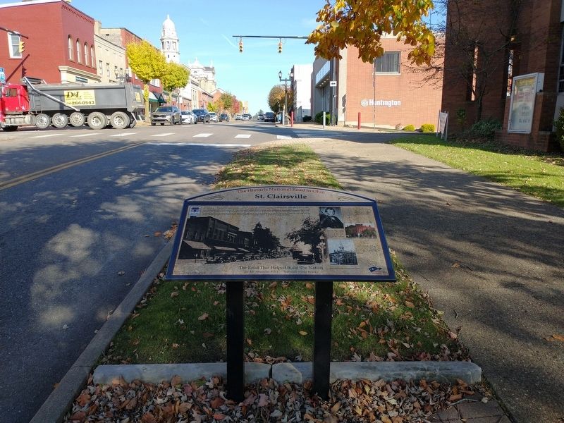
By Craig Doda, October 21, 2022
St. Clairsville Marker
| 201 ► Ohio, Belmont County, Saint Clairsville — St. Clairsville — The Historic National Road in Ohio — |
| 202 ► Ohio, Belmont County, Saint Clairsville — The Historic National Road in Ohio — |
| 203 ► Ohio, Belmont County, Saint Clairsville, Richland Township — 20-7 — Belmont County / Groundbreaking Site of the National Road in Ohio — |
| 204 ► Ohio, Clark County, South Vienna, Hollandia View — Buena Vista Tavern — The Historic National Road in Ohio — Nineteenth and Early Twentieth Century Travel Accommodations — |
| 205 ► Ohio, Clark County, Springfield — Esplanade/Fountain Square — |
| 206 ► Ohio, Clark County, Springfield — Historic National Road — The Road That Helped Build America — |
| 207 ► Ohio, Clark County, Springfield — Madonna of the Trail — |
| 208 ► Ohio, Clark County, Springfield — Mile Markers — The Historic National Road in Ohio — |
| 209 ► Ohio, Clark County, Springfield, Springfield Township — 4-12 — Pennsylvania House / The National Road — |
| 210 ► Ohio, Clark County, Springfield, Springfield Township — The National Road — |
| 211 ► Ohio, Franklin County, Bexley, Bexley Plaza — 58-25 — The National Road / The Interurban Electric Railway — |
| 212 ► Ohio, Franklin County, Columbus, Downtown — Broad Street Bridge — The Historic National Road in Ohio — |
| 213 ► Ohio, Franklin County, Columbus, Downtown — Central High School — The Historic National Road in Ohio — |
| 214 ► Ohio, Franklin County, Columbus, Downtown — The Great Southern Hotel — The Historic National Road in Ohio — |
| 215 ► Ohio, Franklin County, Columbus, Eastmoor — Eastmoor — The Historic National Road in Ohio — |
| 216 ► Ohio, Franklin County, Columbus, Hilltop — Camp Chase — The Historic National Road in Ohio — |
| 217 ► Ohio, Franklin County, Columbus, Hilltop — 43-25 — The National Road — |
| 218 ► Ohio, Franklin County, Columbus, Near East Side — Engine House 11 — The Historic National Road in Ohio — |
| 219 ► Ohio, Franklin County, Columbus, Whitehall — The Underground Railroad — The Historic National Road in Ohio — |
| 220 ► Ohio, Franklin County, Reynoldsburg — Mile Markers — Reynoldsbirg — One of Several Identical Markers — |
| 221 ► Ohio, Franklin County, Reynoldsburg — Reynoldsburg — The Historic National Road in Ohio — The Birthplace of the Tomato — |
| 222 ► Ohio, Franklin County, Whitehall, Lowrie Brothers — Whitehall Tavern — The Historic National Road in Ohio — |
| 223 ► Ohio, Guernsey County, Cambridge — “S” Bridge — |
| 224 ► Ohio, Guernsey County, Cambridge — Cambridge — The Historic National Road in Ohio — |
| 225 ► Ohio, Guernsey County, Cambridge — Peacock Road — The Historic National Road in Ohio — |
| 226 ► Ohio, Guernsey County, Cambridge — Peters Creek Mile Marker — One of Several Identical Markers — |
| 227 ► Ohio, Guernsey County, Cambridge — Peters Creek S-Bridge — The Historic National Road in Ohio — |
| 228 ► Ohio, Guernsey County, Old Washington — Old Washington — Historic District — The Historic National Road in Ohio — |
| 229 ► Ohio, Guernsey County, Salesville — “S” Bridge — Old National Road — Built about 1828 — |
| 230 ► Ohio, Licking County, Etna — Etna — The Historic National Road in Ohio — |
| 231 ► Ohio, Licking County, Hebron — Hebron — The Historic National Road in Ohio — Transportation Crossroad — |
| 232 ► Ohio, Licking County, Hebron — 1-45 — Hebron — |
| 233 ► Ohio, Licking County, Hebron — Hebron Mill — The Historic National Road in Ohio — |
| 234 ► Ohio, Licking County, Hebron — Hebron Milling Company — Historic Site — |
| 235 ► Ohio, Licking County, Kirkersville — Kirkersville — The Impact of the Interurban — The Historic National Road in Ohio — |
| 236 ► Ohio, Licking County, Kirkersville — Mile Markers — Kirkersville — One of Several Identical Markers — |
| 237 ► Ohio, Licking County, Newark — The National Road — |
| 238 ► Ohio, Licking County, Thornville — Eagle’s Nest — |
| 239 ► Ohio, Licking County, Thornville — Eagles Nest — The Historic National Road in Ohio — |
| 240 ► Ohio, Madison County, Lafayette — Red Brick Tavern — The Historic National Road in Ohio — A Presidential Wayside — |
| 241 ► Ohio, Madison County, Lafayette — The Anderson House — The Historic National Road in Ohio — |
| 242 ► Ohio, Madison County, West Jefferson — West Jefferson — The Historic National Road in Ohio — |
| 243 ► Ohio, Miami County, Brandt — 2-55 — The Old National Road — |
| 244 ► Ohio, Miami County, Phoneton — Phoneton — The Historic National Road in Ohio — Communications Center — |
| 245 ► Ohio, Montgomery County, Englewood — Englewood — Founded as Harrisburg- 1841 — The Historic National Road in Ohio — |
| 246 ► Ohio, Montgomery County, Englewood — National Road US 40 — Modern Mile-marker in Englewood, Ohio — |
| 247 ► Ohio, Montgomery County, Vandalia — Tadmor - Taylorsville — The Historic National Road in Ohio — |
| 248 ► Ohio, Montgomery County, Vandalia — The Crossroads of America — Vandalia — The Historic National Road in Ohio — |
| 249 ► Ohio, Montgomery County, Vandalia — 10- 57 — The Village of Tadmor / The National Road — |
| 250 ► Ohio, Muskingum County, New Concord — Findley Settlement — |
| 251 ► Ohio, Muskingum County, New Concord — John Glenn — The Historic National Road in Ohio — |
| 252 ► Ohio, Muskingum County, New Concord — New Concord — The Historic National Road in Ohio — |
| 253 ► Ohio, Muskingum County, New Concord — 2-60 — S-Bridge — |
| 254 ► Ohio, Muskingum County, New Concord — 12-60 — Zane's Trace — |
| 255 ► Ohio, Muskingum County, Norwich — 15-60 — First Traffic Fatality in Ohio / The National Road — |
| 256 ► Ohio, Muskingum County, Norwich — Mile Markers — National Road/Zane Grey Museum — One of Several Identical Markers — |
| 257 ► Ohio, Muskingum County, Norwich — Motels — The Historic National Road in Ohio — |
| 258 ► Ohio, Muskingum County, Norwich — The Historic National Road — in Ohio — |
| 259 ► Ohio, Muskingum County, Norwich — The Ralph Hardesty Stone House — The Historic National Road in Ohio — The Road That Helped Build The Nation — |
| 260 ► Ohio, Muskingum County, Zanesville — Headley Inn — The Historic National Road in Ohio — |
| 261 ► Ohio, Muskingum County, Zanesville — Nelson T. Gant House — The Historic National Road in Ohio — |
| 262 ► Ohio, Muskingum County, Zanesville — Smith House & Farm — |
| 263 ► Ohio, Muskingum County, Zanesville — The History of Zanesville — |
| 264 ► Ohio, Muskingum County, Zanesville — Y-Bridge — The Historic National Road in Ohio — A Unique Landmark — |
| 265 ► Ohio, Muskingum County, Zanesville — 3-60 — Y-Bridge — 1902 — |
| 266 ► Ohio, Muskingum County, Zanesville — 4-60 — Y-Bridge — 1902 — |
| 267 ► Ohio, Muskingum County, Zanesville — 5-60 — Y-Bridge — 1902 — Reported missing |
| 268 ► Ohio, Muskingum County, Zanesville — Zanesville — The Historic National Road in Ohio — |
| 269 ► Ohio, Preble County, Lewisburg — Euphemia — The Historic National Road in Ohio — |
| 270 ► Ohio, Preble County, Lewisburg — Welcome to the National Road — The Historic National Road in Ohio — West Gate — |
| 271 ► Ohio, Preble County, New Paris, Jackson Township — Welcome to the National Road — The Historic National Road in Ohio — |
| 272 ► Pennsylvania, Fayette County, Brownsville — Brownsville - Route 40 Bridge — |
| 273 ► Pennsylvania, Fayette County, Brownsville — Dunlap’s Creek Bridge — |
| 274 ► Pennsylvania, Fayette County, Brownsville — The First Cast Iron Bridge — |
| 275 ► Pennsylvania, Fayette County, Farmington, Wharton Township — Fort Necessity National Battlefield — Information — |
| 276 ► Pennsylvania, Fayette County, Farmington, Wharton Township — Mount Washington Tavern — Fort Necessity National Battlefield — National Park Service, U.S. Department of the Interior — |
| 277 ► Pennsylvania, Fayette County, Farmington, Wharton Township — 2 — National Road — |
| 278 ► Pennsylvania, Fayette County, Farmington, Wharton Township — The National Road — Fort Necessity National Battlefield — National Park Service, U.S. Department of the Interior — |
| 279 ► Pennsylvania, Fayette County, Farmington, Wharton Township — Trail Information — Fort Necessity National Battlefield — National Park Service, U.S. Department of the Interior — |
| 280 ► Pennsylvania, Fayette County, Grindstone — 2 — National Road — |
| 281 ► Pennsylvania, Fayette County, Hopwood — National Road — |
| 282 ► Pennsylvania, Fayette County, Uniontown — Fayette County — |
| 283 ► Pennsylvania, Fayette County, Uniontown — Searight’s Tollhouse — |
| 284 ► Pennsylvania, Fayette County, Uniontown — Thomas Jefferson and Albert Gallatin — |
| 285 ► Pennsylvania, Fayette County, Uniontown — Toll House — |
| 286 ► Pennsylvania, Fayette County, Uniontown — Uniontown — |
| 287 ► Pennsylvania, Somerset County, Addison — Toll House — |
| 288 ► Pennsylvania, Somerset County, Addison, Addison Township — 2 — National Road — |
| 289 ► Pennsylvania, Washington County, Centerville — Centerville — |
| 290 ► Pennsylvania, Washington County, Centerville, West Pike Run Township — 10 — Madonna of the Trail — |
| 291 ► Pennsylvania, Washington County, Claysville — Claysville — Historic National Road — |
| 292 ► Pennsylvania, Washington County, Claysville, Buffalo Township — “S” Bridge — |
| 293 ► Pennsylvania, Washington County, North Bethlehem Township — Century Inn — Reported missing |
| 294 ► Pennsylvania, Washington County, Scenery Hill, North Bethlehem Township — Hill’s Tavern — |
| 295 ► Pennsylvania, Washington County, Washington, Buffalo Township — National Road — |
| 296 ► Pennsylvania, Washington County, Washington, Buffalo Township — Washington — |
| 297 ► Pennsylvania, Washington County, Washington, South Strabane Township — Washington — |
| 298 ► West Virginia, Ohio County, Elm Grove — “Monument Place” — |
| 299 ► West Virginia, Ohio County, Elm Grove — Elm Grove Stone Bridge — |
| 300 ► West Virginia, Ohio County, Elm Grove — Madonna of the Trail — |
304 entries matched your criteria. Entries 201 through 300 are listed above. ⊲ Previous 100 — The final 4 ⊳