In the autumn of 1816 the family of Abraham Lincoln, then 7 years old, migrating to Indiana, rested and recuperated about three weeks in a cabin that stood near here. Local residents gave them food. Lincoln route in Kentucky started near Hodgenville . . . — — Map (db m162245) HM
Founded in 1810 by Fr. Charles Nerinckx, a Catholic missionary from Belgium. It is the oldest parish remaining at one location in the Diocese of Owensboro. Original 3 acres of land donated by Zachariah Mattingly. First log church built in 1810; . . . — — Map (db m160316) HM
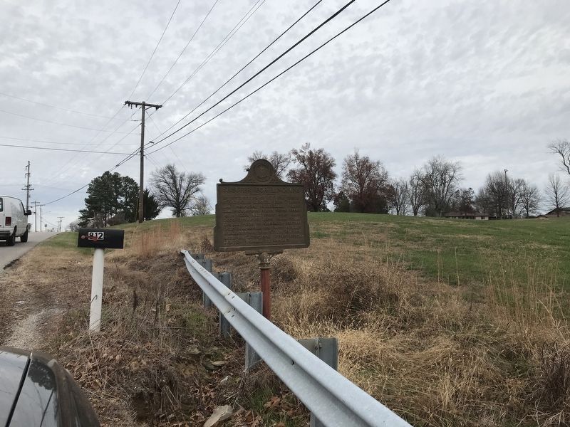
At age of 17, in 1861, Jerome Clarke, called Sue Mundy, joined Confederate Army. He was with Morgan's Raiders from 1862 until Morgan's death in 1864. He then became notorious as a guerrilla. On March 12, 1865 Union soldiers captured him here with . . . — — Map (db m162244) HM
Stood one mile west. It was a stone stack 33 ft. high with a maximum inner diameter of 10 ft. Its fuel was charcoal, and its air blast machinery was driven by a steam engine, blowing preheated air through the stack. Built in 1832, perhaps by John H. . . . — — Map (db m122030) HM
Decades-old graveyard discovered near here. Graves, with unmarked headstones, believed to be those of itinerant railroad workers struck down by cholera epidemic during the construction of the Bardstown-Springfield-Louisville Railroad around 1854, or . . . — — Map (db m171587) HM
Belmont Furnace
Stone stack 500 yds. east, 33 ft. high originally, 10 ft. across inside. Built in 1844, perhaps by John H. Baker, rebuilt in 1853, it burned charcoal fuel, smelted iron ore from Cane Run. The air blast machinery was powered . . . — — Map (db m174393) HM
An explorer and surveyor, he was born in Pennsylvania on March 21, 1757. He came to Kentucky ca. 1781 to survey land for his father. Named a justice of the peace in 1793, he founded Shepherdsville on 50 acres on the north side of the Salt River that . . . — — Map (db m122012) HM
Side A A pioneer of the contemporary crafts movement, Lesch was an internationally exhibited textile teacher and artist, noted for work with fabric and found objects. Wrote influential book, Vegetable Dyeing, in 1970. Named Master Craftsman . . . — — Map (db m122017) HM
An early station on the Wilderness Road between the Falls of the Ohio (Louisville) and
Harrodsburg, Brashear's Station was a haven for pioneer hunters and travelers. It was built at mouth of Floyd's Fork near bank of Salt River, 1779. Founded by . . . — — Map (db m174444) HM
Brooks' Spring
The spring here, first called Stewart's or Phillips' and then Brooks' Spring, was a well-known camping place in the early 1780s on the main route from the Falls of the Ohio & Beargrass Creek to Bullitt's Lick and Harrodsburg. . . . — — Map (db m174479) HM
For Alexander Scott Bullitt, a leader in the political formation of Kentucky. Member conventions, 1788, seeking statehood and, 1792, drafting first Ky. Constitution. President Ky. Senate, 1792-99, and second constitutional convention, 1799. Elected . . . — — Map (db m122013) HM
Destroyed 3 times by CSA. Partially razed on Sept. 7, 1862, by troops under Col. John Hutcheson. During the occupation of Shepherdsville, Sept. 28 Braxton Bragg's troops again destroyed it, but new bridge was up by Oct. 11. After Battle of . . . — — Map (db m136632) HM
July 2, 1863, CSA Gen. J.H. Morgan began raid to prevent USA move to Tenn. and Va. Repulsed at Green River, July 4. Defeated USA force at Lebanon, July 5. Moved through Bardstown, July 6. After night march, crossed here July 7. Rested troops few . . . — — Map (db m71984) HM
Front
Settled ca. 1800 by Rev. War veterans Thos. Carson, John Helm, & Matthew Kuykendall who received land grants for their service. These founders of Butler County served as first county surveyor, presiding justice of . . . — — Map (db m123286) HM
Born Jan. 27, 1867, two miles NE of here. Educated in local schools. B. A. from National Normal Univ., Ohio. He taught school for 6 years. Studied in Germany and earned a Ph.D. from Yale in 1895. Began ministry in Methodist Episcopal South. . . . — — Map (db m123454) HM
First Union soldier killed in west Kentucky while skirmishing on the Big Hill with CSA scouting party Oct. 29, 1861. A stone monument erected, 1894, by Granville Allen, Post 98, G.A.R., marks the place. Member of Co. D, 17th Kentucky Inf., enrolled . . . — — Map (db m123459) HM
Hamilton, a leader of one of most incredible prison escapes of the Civil War, was born in Pa., Jan. 9, 1835. A Woodbury resident before the war, he joined Co. A of the 12th Ky. (Union) Cavalry, Aug. 12, 1862. Captured at Jonesboro, Tn., Aug. 1863; . . . — — Map (db m123457) HM
Born in Chicago, Il., he moved to Butler Co. in 1874 & was educated in public and private schools here. After serving as Butler Co. Circuit Court Clerk (1893-96) he studied law and was admitted to the bar in 1898. He moved to Louisville in 1900 & . . . — — Map (db m123452) HM
Morgantown
The county seat of Butler Co., it was originally called Funkhouser Hill. It was renamed Morgan Town in Dec. 1810 to honor Revolutionary War officer Daniel Morgan and was incorporated in 1813. It began as a settlement of . . . — — Map (db m123448) HM
William S. Taylor (1853-1928)
This Republican governor from Butler Co. was declared winner over William Goebel and inaugurated Dec. 12, 1899. When Democrats contested the election, controversy and extreme bitterness led to Sen. Goebel's . . . — — Map (db m123445) HM
The town of Suffolk, originally called “Bluff,” established here by Logan Co. Court in 1803. Site recognized importance of Green River for future development of valley and State of Kentucky. The court appointed trustees: Reuben . . . — — Map (db m123460) HM
William Stephens, Sr., gunsmith by trade, came to America from England with his two sons, 1832. They traveled overland, then down the Ohio to the Green River, where they bought 150 acres in 1854. The gunshop operated from 1855-61, when Stephens' two . . . — — Map (db m162250) HM
The career of this naval officer spanned Spanish-American War and World Wars I and II. A native of Butler County, he attended public schools and Ogden College in Bowling Green;
graduated from Annapolis, 1899. Assumed command of USS . . . — — Map (db m159198) HM
Capt. Thomas Henry Hines enlisted in the Confederate Army, 1861. With Brig. Gen. John H. Morgan, 1862-63. Captured, July '63, in Ohio with Morgan. Led escape from Federal prison, Nov. '63. Leader of northwest conspiracy '64. Termed most dangerous . . . — — Map (db m123424) HM
Town founded 1835 as a voting precinct. Established between Princeton and Salem stage stops, it was first called Midway; name changed to Fredonia two years later. In 1887, the Ohio Valley Railroad ran one-half mile west of town. Kelsey was . . . — — Map (db m123802) HM
Here on December 1, 1906, began Black Patch War, which lasted to the end of 1908. “Night Riders” fought against non-cooperative farmers and businessmen who opposed the dark tobacco pool. — — Map (db m79151) HM WM
Saline, Eddy, and Varmint traces met at Big Spring (Princeton) and developed into today's roads. First forged by buffalo, later used by Indians and pioneers. A fork of Saline crossed Ohio River at Cave-in-Rock; another at Golconda, Ill. Eddy Trace . . . — — Map (db m124356) HM
For General John Caldwell.
Born Virginia; came Kentucky 1781.
Maj. Gen. in militia; Indian campaigns.
With George Rogers Clark, 1786.
Member Danville Conventions, 1787, 1788, which adopted petition “demanding admission into the . . . — — Map (db m79159) HM
[front side] Gen. Hylan B. Lyon with 800 men invaded Ky., Dec. 1864, to enforce CSA draft law and divert USA from Nashville. In 23 days he burned seven courthouses used by Union forces. See map on reverse side. US troops fled Princeton as . . . — — Map (db m79180) HM
Site of college founded March, 1826, by the Cumberland Presbyterian Church. First president was Rev. F. R. Cossitt. School opened with six students on some 500 acres of land bought for $6,000. A manual-labor school, students required to work 2 hours . . . — — Map (db m123805) HM
Six educational institutions have flourished here since 1860. Local citizens gave $20,000 and Dr. T.L. McNary six acres to establish Princeton College, 1860-80. Youth also served by Princeton Collegiate Inst., 1880-1911; Princeton High, 1911-23; . . . — — Map (db m123800) HM
Congregation organized in 1818 as Methodist Episcopal Church at home of Richard Barnes, a tanner. First meeting house later built beside his home on S. Jefferson St. Became M.E. Church, South, 1845, when national church split over slavery. Renamed . . . — — Map (db m123845) HM
Bishop Asbury named two itinerant Methodist preachers to Kentucky in 1786. One, Rev. Benjamin Ogden, had dedicated himself to religion after the Revolution. He preached in what is now Ky. and Tenn. area. While inspiring countless pioneers, he . . . — — Map (db m123810) HM
First Baptist Church, organized on March 30, 1850, under the leadership of the Rev. James Mansfield and a presbytery from Donaldson, Harmony, and New Bethel Baptist Churches, began with 11 members. The 1st church, built in 1851, stood on Vine . . . — — Map (db m123850) HM
Confederate Gen. Adam R. Johnson with 1700 Partisan Rangers were in area seeking recruits and supplies. Learning of Union troops under Gen. E. H. Hobson camped at Grubb's Cross Roads, Johnson attacked. Aug. 21, 1864. In the skirmish that followed, . . . — — Map (db m158707) HM
Shandy Hall, two-story stone home built on Bluff above Big Spring, built by William Prince on his 200-acre survey made in 1798. Prince, a Rev. War veteran from S.C., began town on waters of Eddy Creek. In 1817, Princetown became county seat of . . . — — Map (db m123817) HM
Shandy Hall, two-story stone home built on Bluff above Big Spring, built by William Prince on his 200-acre survey made in 1798. Prince, a Rev. War veteran from S.C., began town on waters of Eddy Creek. In 1817, Princetown became county seat of . . . — — Map (db m123818) HM
In 1910, Princeton High School was the only high school in the vicinity for blacks. In 1920s name was changed to Dotson High School in honor of John Dotson, a prominent black businessman in Princeton. In 1938, Federal WPA officials approved . . . — — Map (db m166066) HM
Most Caldwell County Confederates enlisted in Gen. Adam Johnson's Co. K, 10th Ky. Partisan Rangers. His purpose was to gather recruits and supplies, to secure state for
CSA. In August, 1864, he attacked a Union regiment here, was blinded . . . — — Map (db m158706) HM
Dr. David Amoss, leader of Night Rider movement, was born in Cobb, Ky. on October 19, 1857. Moved by compassion for his people, this country doctor provided leadership for tobacco farmers in Ky. & Tenn. He led an organized society of dark tobacco . . . — — Map (db m166061) HM
Established by Ky. legislature in 1924 as Western Ky. Sub-experiment Station of the Univ. of Kentucky College of Agriculture. Original 400 acres donated by Caldwell Co.
citizens. S. J. Lowry was supt., 1924-63. First office / service building was . . . — — Map (db m158710) HM
William Prince
1752-1810
Born in Virginia, his family moved to Spartanburg Co., S.C. in 1768. During the Revolutionary War, he served as captain in Col. Benjamin Roebuck’s S.C. Spartan regiment. After completing his military duty, he . . . — — Map (db m123867) HM
Two miles west was District seat of Jackson Purchase area 1818, now being Kentucky's eight and Tennessee's twenty westernmost counties. Settled in 1821 and U.S. Public Land Office opened. Calloway County Seat, 1822-1842. Then it was moved to . . . — — Map (db m169133) HM
This institution of higher learning was established by 1899 under the leadership of Rainey T. Wells, later president of Murray State Teachers College. Land for college was deeded to trustees in 1899. Students came from a wide area and boarded in . . . — — Map (db m169149) HM
Murray native Cleanth Brooks became a major figure in the teaching and study of literature. With fellow Kentuckian Robert Penn Warren, he co-founded the Southern Review and directed attention to close reading of literature -- the "New . . . — — Map (db m169171) HM
For Col. Richard Callaway. Came to Ky. With Daniel Boone, 1776. One of the founders of Boonesboro, he instilled confidence in success among other settlers. In one year, 1777, appointed Col. Of Militia; Justice of the Peace; elected a representative . . . — — Map (db m151224) HM
Shortly after the historic U. S. Supreme Court Brown v. Board of Education, et. al. decision, Murray State College "with all deliberate speed," welcomed Mary Ford Holland of Kuttawa, Ky., as a student in the summer of 1955. Holland's . . . — — Map (db m179582) HM
First public building in Jackson Purchase area. Built in 1823 for $100, it was originally erected at Wadesboro, Calloway county seat, 1822-42, where its first session of court was held, Feb. 13, 1823. Remained in use till new one built in 1831. . . . — — Map (db m179560) HM
Established 1922. Founder, Rainey T. Wells (1875-1958). His home, where the idea of the University was born, 350 feet SE of here. Dr. Wells second president of Murray State.
Gov. Morrow signed bill authorizing two "normal schools” — . . . — — Map (db m169173) HM
Under leadership of H. Boyce Taylor, First Baptist Church, Murray, began in 1900 a new approach to church finance. Taylor, pastor 1897-1931, avidly promoted this unified budget plan: appointed chairman of State Baptist committee, 1913, "to consider . . . — — Map (db m169178) HM
This one - room school building, named for Joseph Spillman Waters (1822-1898), its first teacher, once sat near New Concord. School operated from mid -1800s to 1936. Moved here, it was preserved as a representative of the type of school building . . . — — Map (db m179562) HM
Confederate fort erected in 1861. Federals occupied 1862. Seized by CSA Gen. Forrest in fall 1864. With field cannon his cavalrymen sank 2 Union river transports. Captured another and a gunboat, and commandeered them. Due east, this side of Kentucky . . . — — Map (db m37939) HM
Gerard Furnace Built 2¼ miles east in 1854 by Browder, Kentucky and Co. Inside it was 24ft. high and 10½ ft. across at widest point, burning locally made charcoal fuel. Its air blast machinery was powered by steam. In 34 weeks of 1857, it . . . — — Map (db m37941) HM
Ca. 1793, salt water found here by
Samuel Bryan, a nephew of Daniel
Boone. John Grant, another Boone
nephew, and Charles Morgan helped
him drill well, which supplied salt
to interior of Ky. This territory
was owned by John Grant and named
for . . . — — Map (db m175099) HM
Campbell County formed, 1794, of
parts of Mason, Scott and Harrison
Counties, Ky. by legislative act.
Named for Col. John Campbell, a
Revolutionary War officer, and a
Ky. pioneer and statesman. Boone,
Kenton, parts of Pendleton and
Bracken . . . — — Map (db m175093) HM
Born in Pa. in 1736, she was the
daughter of Squire & Sarah Morgan
Boone and younger sister of Daniel
Boone. Family moved to N.C. when
she was 14. There she met, and in
1755, married William Bryan. With
10 children, they migrated to Ky.
via . . . — — Map (db m175094) HM
Incorporated March 15, 1870, on part of original land grant to Gen. James Taylor, pioneer, for whose farm this city was named. A general in War of 1812, banker, and statesman, whose farm was an underground railroad station.
President of the first . . . — — Map (db m49115) HM
Ft. Thomas Army Post
Established by Congress, 1887. Constructed at cost of $3,500,000 on about 111 acres, jurisdiction of which was ceded to U. S. by Kentucky Legislature, 1888. Post was designated Ft. Thomas, 1890. First commander was Col. . . . — — Map (db m175085) HM
The oldest church congregation in Ft. Thomas. Began in the home of Wm. & Alice Taliaferro in 1830. In 1832, log structure was built for Sunday services & served as first school in the area during the week. 1850-52, frame church building was erected . . . — — Map (db m175082) HM
Site of his home, 1857 to 1881. Attorney-General of U.S., 1866-68. Resigned to become one of counsel for President Andrew Johnson in impeachment trial by U.S. Senate, 1868. Johnson reappointed him, but Senate refused to confirm. Resumed practice of . . . — — Map (db m175081) HM
“Outstanding soldier of the AEF,"
Gen. Pershing. “The first soldier
of America,” Marshal Foch. Given
Congressional Medal of Honor, the
French Croix de Guerre and Legion
of Honor. Alone he destroyed three
machine gun nests, . . . — — Map (db m135046) HM
Brig. Gen. John T. Thompson, USA, inventor of Thompson submachine gun, was born here in 1860. A West Point graduate of 1882, he was early advocate of automatic weapons and improved many small arms. Awarded Distinguished Service Medal as Director of . . . — — Map (db m98032) HM
As chairman of U.S. House Banking
and Currency Committee, Spence was
delegate to 44-nation Bretton Woods
(N. H.) Conference, 1944, to promote
fair commerce. This led to creating
the International Monetary Fund
and Bank, and Spence's . . . — — Map (db m175107) HM
Northern Kentucky's first doctor. Born in Oxfordshire, England on July 10, 1737. Graduate of Royal College of Physicians. Served at Quebec with Gen. James Wolfe. In 1765 settled in Virginia; personal physician to Patrick Henry. Chief Surgeon, 1775, . . . — — Map (db m175075) HM
Underground Railroad station. Mansion built by General Taylor, pioneer, banker, statesman. General in the War of 1812. Original house designed by H.B. Latrobe. Present house build, 1837. — — Map (db m135084) HM
Built three blocks east in 1859 by Swift's Iron and Steel Works. As rebuilt in 1869, it was 65 feet high, with a maximum diameter inside of 16 feet. Its annual capacity was 17,000 tons of iron, using Connellsville coke as fuel. Iron mostly converted . . . — — Map (db m49114) HM
Kentuckians crossed here Aug. 1812 marching to relieve Gen. Hull at Detroit. Took Frenchtown (Monroe) Jan. 18, 1813. Four days later all but 30 were killed or captured. Other Kentuckians gathered here Aug. 31, 1813. Led by Gov. Shelby these men . . . — — Map (db m175074) HM
Northern Kentucky University began as an
extension center of University of
Kentucky, 1948. It became community
college, 1962, and by 1976 was a
state university. It moved here
from Covington in 1972. The 300-acre NKU campus is part of . . . — — Map (db m135013) HM
In 1870, the Newport City Council purchased property for a school for African Americans, and three years later a frame house was constructed. Elizabeth Hudson was appointed first African American teacher at salary of $35 per month. Two major events . . . — — Map (db m135078) HM
For a century and a quarter, a St. Paul's Episcopal Church has stood on this corner. Since 1871, the bell in the towering spire atop this native stone church has rung for services. Here worshipped Gen. James Taylor, War of 1812; Henry Stanbery, who . . . — — Map (db m175076) HM
Said to have been first white woman in Kentucky. Captured by Indians in Virginia, July 1755, and taken to Ohio. Later she escaped a salt-making party at Big Bone Lick and made her way across the Kentucky wilderness back to Virginia. — — Map (db m135043) HM
Site of Beverly Hills Supper Club, popular night spot from 1930s—70s. Burnt May 28, 1977 killing 165.
Third worst nightclub fire in US;
changed building-code enforcement.
First disaster case tried as class
action suit, merging 300 . . . — — Map (db m134541) HM
Albert S. Berry was Newport mayor
prior to serving in Congress, 1893-
1901. Later became circuit judge.
Brent Spence, lawyer & banker prior
to serving in Congress, 1931-1963.
George Baird Hodge elected to CSA
Congress, 1862. Served area . . . — — Map (db m175108) HM
One of youngest Kentuckians to receive the Medal of Honor for service during the Civil War is buried in Evergreen Cemetery. Horsfall, born in Newport, 1847, was a drummer in Company G, First Ky. Infantry (USA). Medal was awarded for saving the life . . . — — Map (db m62013) HM
For John Griffin Carlisle. Born 1835, practiced law in Covington. Kentucky Legislator from 1859-71. Lt. Governor, 1871-75. U.S. Congress, 1877-91. House Speaker, 1883-89. U.S. Senate, 1890-93. Secretary of Treasury, 1893-97, under Pres. Grover . . . — — Map (db m180001) HM
Jan. 1862, Brig. Gen. U.S. Grant sent 5,000 USA troops from Cairo as a demonstration against Columbus, a Confederate stronghold on the Miss. River. Combined forces led by Brig. Gen. J.A. McClernand from Ft. Jefferson at Wickliffe through here to . . . — — Map (db m18487) HM
Grave of one of founders of Port
William (now Carrollton). Craig
laid off town on 613 acres which
he and James Hawkins owned; the
legislature incorporated it in
1794. He erected the first brick
house in county, 1792. Born in
Virginia, 1751, . . . — — Map (db m136133) HM
First settled 1792, incorporated as Port William 1794. Carroll County formed and name of town changed to Carrollton by the Kentucky Legislature, 1838, both honoring "Charles Carroll of Carrollton" of Maryland, bold signer of the Declaration of . . . — — Map (db m22149) HM
Marker Front:
Col. Percival Butler was appointed Ky.'s first adjutant gen. in Gov. Isaac Shelby's first term. Born in Penn., he was with Washington at Valley Forge and Lafayette at Yorktown. Immigrated to Jessamine Co., Ky., then moved to . . . — — Map (db m22097) HM
In 1754 James McBride canoed down the Ohio to the mouth of this river—now Kentucky. Here, as first explorer, he carved his initials and the date on a tree, a landmark for 30 years. Cited for part in defense of Bryan Station and Battle of Blue . . . — — Map (db m136145) HM
Gen. William O. Butler, born Kentucky 1791, died here, 1880. War of 1812: River Raisin, Pensacola, and New Orleans. Gen. Andrew Jackson's staff 1816-17. Cited for heroism in Mexican War 1846-48. Practiced law here. Congressman 1839-43. Defeated as . . . — — Map (db m22131) HM
The Old Kentucky River Toll Bridge first surveyed November 1897 and incorporated Nov. 1898. J.F. Jett, M.I. Barker, John J. Orr, and Martin L. Downs were instrumental in obtaining bridge. Contract was let to Indiana Bridge Company, July 1899; bridge . . . — — Map (db m136142) HM
Blockhouse built here, 1789, by
Gen. Charles Scott for protection
of settlers against Indians who
had massacred and driven off
earlier families. Scott came
from Va., 1785. He was in the
French and Indian Wars. Organized
first company south of . . . — — Map (db m77353) HM
Oldest brick house still standing in county, this was home of Richard and Sarah Masterson. Bricks laid in Flemish bond. House was center of town's activities. Mastersons, leading Methodists, opened their home for services before church erected in . . . — — Map (db m22128) HM
Known as McCool’s Creek Settlement
it was laid off in 1809 on land
of Samuel Sanders, whose father
was here early as 1795. Thirteen
families came from Virginia, 1800.
Traditionally, on visit here about
1816, Henry Clay a member of . . . — — Map (db m136129) HM
Birthplace of poet, humorist,
columnist, raconteur, soldier.
He brought pleasure to thousands
with his dialectal stories and
banjo songs of the Blue Grass, and
his unique fictional character of
“Uncle Rambo.” For 20 years . . . — — Map (db m136132) HM
Home and family cemetery of Lewis
Sanders, 1781-1861. House built
1819, on land wife inherited from
Col. George Nicholas, key drafter
of Kentucky Constitution and the first
state Attorney General. Sanders
organized first Kentucky fair on . . . — — Map (db m136122) HM
Gen. George Rogers Clark used
route through here, circa 1780s,
called Clark’s War Road,
Drennon’s Lick to Ohio River.
First called Rislerville, then
Liberty Station. In 1874, renamed
Sanders, for “Wash” Sanders, local
citizen . . . — — Map (db m136125) HM
Matthew Sellers is among first to experiment with gliding and power flight. Did this research at his home and laboratory, 6 miles south, 1897-1911. Built most advanced wind tunnel of his day, 1903, to study lift and drag of various wing designs; and . . . — — Map (db m145292) HM
Retreating from Cumberland Gap General George W. Morgan’s Union force of 8,000 men camped here Sept. 1862. CSA Morgan’s Raiders harassed USA, 30 miles along here; skirmishing, felling trees across roads and preempting food and supplies. Covering 200 . . . — — Map (db m145350) HM
As Gen. George W. Morgan's Union force, 8,000 when here, retreated from Cumberland Gap, they were harassed from West Liberty by CSA Gen. John H. Morgan's Raiders. Failure of reinforcements to reach here caused Confederates to leave Oct. 1, 1862 and . . . — — Map (db m73803) HM
In their blue and gray uniforms for over forty years, Civil War veterans gathered here annually, around campfires, with song and story, friends and former foes, revived war memories, and always a pilgrimage to graves of their comrades in cemetery of . . . — — Map (db m73788) WM
For Col. William Grayson Carter, state senator, 1834-36. The 88th Ky. county formed, 32nd in size. Carter was created from Greenup and Lawrence. Noted in early years for 5 iron furnaces, its clay products, industry developed in late 1800's. Carter . . . — — Map (db m73789) HM WM
E. K. Railway purchased 25,000
acres of land in Little Sandy
Valley at close of the Civil War.
Tracks laid to this site June 10,
1871. Grayson was location of depot
and repair shops. Stinson Branch
was laid, 1893, with more straight
track . . . — — Map (db m144463) HM
Six miles south, site of famous iron
furnace, erected, 1848, by R. M.
Biggs and others. Operated 37 years,
averaging 15 tons pig iron daily
which was hauled by ox teams to
Ohio River for shipment. Iron
produced here was used for rails,
plows, . . . — — Map (db m144955) HM
Pactolus Furnace Built in 1824 by Joseph McMurtry and David L. Ward, on the site of an earlier bloomer forge. Its stone stack used charcoal fuel, and its air blast machinery was powered from a dam, 5 1/2 ft. high, in Little Sandy River. Capacity . . . — — Map (db m73787) HM
Here the EK had a junction with
the Elizabethtown, Lexington &
Big Sandy Railway that connected with
the Ashland Coal and Iron Railway in
Denton. January 1882 both would
become part of Chesapeake & Ohio
Railway. The EK and C&O shared a
depot . . . — — Map (db m145351) HM
Created from parts of Carter,
Lewis and Elliott Counties with
county seat here by legislative
act signed Feb. 9, 1904, by Gov.
J.C. W Beckham for whom it was
named. C. C. Brooks appointed
County Judge. On April 29, 1904,
the Court of Appeals . . . — — Map (db m145288) HM
“Honest Bill from Olive Hill.”
Home of Gov. William Jason Fields,
34th Governor of Kentucky, 1923-27.
Promoted Kentucky’s first grant of
Federal aid for road construction,
consolidation of schools, teacher-training colleges at . . . — — Map (db m145260) HM
Built in 1848 by A. McCullough and Lampton Brothers. Its stone stack was 36 feet high. 11½ feet across inside at widest point, and burned “stone coal” rather than charcoal. It was served by its own railroad spur. In 1866 it produced . . . — — Map (db m144425) HM
1845 entries matched your criteria. Entries 201 through 300 are listed above. ⊲ Previous 100 — Next 100 ⊳